

Cumberland Gap National Historical Park Travel Guide - Free Web & App
Your ultimate guide to Cumberland Gap National Historical Park. Discover top landmarks, proposed trips, and local tips. Free on the web or via the Evendo companion app.


Cumberland Gap National Historical Park in Kentucky spans three states, with Appalachian trails, historic Wilderness Road, caves and panoramic overlooks.
A Mountain Pass with a Wider Story
Cumberland Gap National Historical Park preserves one of the most consequential natural passages through the Appalachian Mountains. The park centres on Cumberland Gap, a break in the long ridge of Cumberland Mountain where present-day Kentucky, Tennessee and Virginia meet. Although the Kentucky community of Middlesboro lies immediately west of the park, the protected landscape extends across the three-state border region, combining forested ridges, sandstone cliffs, wooded hollows and historic routes.Read more about Cumberland Gap National Historical Park
Landscapes and Historic Routes
The Wilderness Road
When is the best time to visit Cumberland Gap National Historical Park?
Best: May, September–October · 20–26°C| Month | High (°C) | Rainfall (mm) |
|---|---|---|
| January | 8 | 109 |
| February | 10 | 105 |
| March | 16 | 117 |
| April | 20 | 109 |
| May (best) | 25 | 114 |
| June | 29 | 117 |
| July | 31 | 129 |
| August | 31 | 111 |
| September (best) | 26 | 99 |
| October (best) | 20 | 86 |
| November | 14 | 101 |
| December | 9 | 114 |
Getting to and around Cumberland Gap National Historical Park
How to get there
Transportation
Best attractions in Cumberland Gap National Historical Park
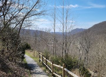
Cumberland Gap itself is the park's defining attraction, a natural passage through Cumberland Mountain that can be understood from nearby trails and viewpoints. Pinnacle Overlook offers one of the clearest elevated perspectives across the Gap, Middlesboro and the surrounding Appalachian valleys. The Wilderness Road Trail follows the historic migration corridor, while the short route to Sand Cave leads to a large sandstone recess associated with the mountain's geology. White Rocks provides another prominent ridge feature and a demanding high-level destination. Underground, Gap Cave reveals the limestone landscape beneath the mountain on guided visits when tours are available. Hensley Settlement, a preserved high-elevation community, introduces visitors to Appalachian farming and domestic life through historic buildings and interpretation. Park roads and footpaths link these experiences unevenly, and the attractions are spread across a substantial, wooded landscape rather than arranged as a single walkable complex.
-
Historical landmark
KY-TN-VA Tri-State Point
Explore the KY-TN-VA Tri-State Point, a unique landmark where Kentucky, Tennessee, and Virginia meet, rich in history and cultural diversity.
-
Visitor center
Cumberland Gap National Historical Park Visitor Center
Explore the Cumberland Gap National Historical Park Visitor Center for a rich blend of history, nature, and adventure in a breathtaking setting.
-
Museum
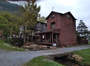
Little Congress Bicycle Museum
Discover the fascinating history of cycling at the Little Congress Bicycle Museum in Cumberland Gap, a charming destination for bike enthusiasts and curious travelers.
-
Tourist attraction
Gap Cave
Discover the enchanting underground world of Gap Cave in Ewing, Virginia, where breathtaking formations await every explorer.


Explore Cumberland Gap National Historical Park on the map
Plan your trip on one map. See where the top attractions, landmarks, restaurants and hotels are, and book hotels and experiences in a few clicks.
Best hotels in Cumberland Gap National Historical Park
Best bars in Cumberland Gap National Historical Park
Evenings around Cumberland Gap are generally quiet rather than nightlife-oriented. The park closes into a dark, wooded landscape after daytime activities, and there is no nightclub district or concentration of late-night venues inside the protected area. Traditional pubs, bars and casual evening restaurants are more likely to be found in Middlesboro, Cumberland Gap or Harrogate, where residents and visitors gather in a relaxed small-town setting. Entertainment may include community events, local music or seasonal programmes, but these should not be assumed to run on any particular date. Many visitors spend the evening at their accommodation, dining locally or preparing for an early trail outing. The surrounding valleys and ridges also offer an opportunity for stargazing where conditions and access allow, provided visitors respect park rules and avoid entering closed areas after dark.
-
American
Cracker Barrel Old Country Store
Experience the warmth of Southern hospitality at Cracker Barrel Old Country Store in Middlesboro, KY, where hearty meals and nostalgic gifts await.
-
Steak
Shades Café & Steakhouse
Discover Shades Café & Steakhouse, where exceptional steaks and a cozy café ambiance meet in the heart of Middlesboro, Kentucky.
-
Fast Food
Sonic Drive-In
Experience the nostalgia of American fast food at Sonic Drive-In in Middlesboro, Kentucky, where flavorful meals and a unique drive-in experience await.
-
Restaurant
Gap Creek Coffee House
Discover the warm ambiance and delicious offerings at Gap Creek Coffee House, your perfect stop in Cumberland Gap, Tennessee.


Best shops in Cumberland Gap National Historical Park
Shopping is concentrated outside the park in Middlesboro and the neighbouring communities of Cumberland Gap and Harrogate rather than at remote overlooks or trailheads. Visitors can find ordinary supplies, outdoor necessities, books and locally oriented gifts in the gateway area, while small independent businesses may offer Appalachian crafts, regional artwork or food products. The park's most meaningful purchases are generally interpretive items connected with the Wilderness Road, Cumberland Gap and local history, obtained through National Park Service outlets when facilities are open. Rural roadside producers and farm shops may sell seasonal goods in the wider region, although they are not a guaranteed feature of every route. There is no extensive designer or specialist retail district; shopping here is practical and locally focused, with the character of the surrounding Appalachian communities more important than commercial scale.
-
National reserve
Cumberland Gap National Historical Park
Discover the scenic wonders and rich history of Cumberland Gap National Historical Park, where nature and heritage intertwine beautifully.
-
Shopping mall
Middlesboro Mall
Explore Middlesboro Mall: A vibrant shopping center in Kentucky with diverse stores, delicious dining, and entertainment for all ages.
-
Cafe
Gap Creek Coffee House
Explore the rustic charm and delightful brews of Gap Creek Coffee House in Cumberland Gap, Tennessee - your cozy retreat for great coffee and pastries.
-
Beauty supply store
Bath & Body Works
Explore Bath & Body Works in Middlesboro, KY for luxurious beauty supplies, captivating fragrances, and thoughtful gifts that elevate your self-care routine.


Get your free copy of our complete guide to Cumberland Gap National Historical Park, delivered straight to you.
Everything on this page, from attractions and restaurants to essentials and local phrases, in one PDF you can read offline, print or share.
Already have an account? Sign in
Your Cumberland Gap National Historical Park guide is ready.
We'll send it to · Not you? Sign out

Getting your guide ready…
We are putting together a fresh copy of the Cumberland Gap National Historical Park guide. This can take up to a minute.
This can take a few moments. If your browser asks, choose Allow so the download can start. You'll find the guide in your Downloads folder.
Nothing happened? Download it again
Sorry, the guide is taking longer than usual. Please try again in a minute, or get it by email instead.
Cumberland Gap National Historical Park essentials
Currency and Payment
Safety
Emergency Situations
Do's and Don'ts
Local Tips
From Eve
Local phrases worth knowing
You don't need to get them perfect. A few words go a long way, and locals appreciate the effort.
Basics
| English | Local | Say it |
|---|---|---|
| Hello | Howdy | [haw-dee] |
| Goodbye | See ya | [see yuh] |
| Yes | Yup | [yuhp] |
| No | Nah | [nah] |
| Please/You're welcome | Please/You're welcome | [pleez/yur wel-cum] |
| Thank you | Thanks | [thanks] |
| Excuse me/Sorry | Pardon me | [par-dun mee] |
| How are you? | How y'all doin'? | [haw y'all doin'] |
| Fine. And you? | Fine. And you? | [fahyn. and yuh?] |
| Do you speak English? | Ya speak English? | [ya speak ing-glish?] |
| I don't understand | I don't cotton to that | [ah dun't kah-tun tuh that] |
Eating & Drinking
| English | Local | Say it |
|---|---|---|
| I'd like to see the menu, please | I'd like to see the menu, please | [ah'd like tuh see the men-yoo, pleez] |
| I don't eat meat | I don't eat meat | [ah dun't eat meet] |
| Cheers! | Cheers! | [cheers] |
| I would like to pay, please | I would like to pay, please | [ah wood like tuh pay, pleez] |
Emergencies
| English | Local | Say it |
|---|---|---|
| Help! | Help! | [help!] |
| Go away! | Git! | [git!] |
| Call the Police! | Call the Sheriff! | [call the sheriff!] |
| Call a doctor! | Call a doc! | [call a doc!] |
| I'm lost | I'm turned around | [ahm turnd around] |
| I'm ill | I'm under the weather | [ahm un-dur the we-ther] |
Shopping
| English | Local | Say it |
|---|---|---|
| I'd like to buy... | I'd like to buy... | [ah'd like tuh bahy...] |
| I'm just looking | I'm just lookin' | [ahm just look-in'] |
| How much is it? | How much is it? | [haw much iz it?] |
| That's too expensive | That's too steep | [that's tooh steep] |
| Can you lower the price? | Kin ya knock the price down? | [kin yuh nok the price down?] |
Time & Numbers
| English | Local | Say it |
|---|---|---|
| What time is it? | What time is it? | [what time iz it?] |
| It's one o'clock | It's one o'clock | [its wun uh-klok] |
| Half past (10) | Half past (10) | [haf past (10)] |
| Morning | Mornin' | [morn-in'] |
| Afternoon | Afternoon | [after-noon] |
| Evening | Evenin' | [even-in'] |
| Yesterday | Yestiddy | [yes-ti-dee] |
| Today | Today | [to-day] |
| Tomorrow | Tomorrer | [tom-or-er] |
| 1 | One | [wun] |
| 2 | Two | [too] |
| 3 | Three | [three] |
| 4 | Four | [fawr] |
| 5 | Five | [fahyv] |
| 6 | Six | [siks] |
| 7 | Seven | [sev-un] |
| 8 | Eight | [ayt] |
| 9 | Nine | [nayn] |
| 10 | Ten | [ten] |
Transport & Directions
| English | Local | Say it |
|---|---|---|
| Where's a/the...? | Where's a/the...? | [wheres uh/the...] |
| What's the address? | What's the address? | [whats the address?] |
| Can you show me (on the map)? | Can you show me (on the map)? | [kin yuh show mee (on the map)?] |
| When's the next (bus)? | When's the next (bus)? | [whens the next (bus)?] |
| A ticket (to ....) | A ticket (to ....) | [uh ticket (to ....)] |
History of Cumberland Gap National Historical Park
A Natural Passage Through the Appalachians
Cumberland Gap is a water gap, formed where erosion cut through Cumberland Mountain and created a relatively accessible route across the Appalachian ridges. The gap was used long before European-American settlement, and its position made it important to Indigenous peoples travelling between the interior Southeast and lands west of the mountains. The surrounding terrain also records a much older geological history, with resistant sandstone and other rock layers shaping the ridges, cliffs and caves visible today.
Indigenous Routes and Early Contact
Native peoples travelled through the Cumberland Gap for generations before the arrival of large-scale European-American migration. The pass formed part of a network of trails connecting valleys on either side of the mountains. During the colonial period, European settlers, traders and explorers increasingly followed these routes, bringing the area into the expanding political and commercial world of the eastern colonies. The history of the Gap therefore begins with movement across an established Indigenous landscape rather than with the opening of an unused wilderness.
Daniel Boone and the Wilderness Road
In 1775, Daniel Boone led a team employed by the Transylvania Company in improving the trail through Cumberland Gap and into Kentucky. The resulting Wilderness Road became one of the principal overland routes into the trans-Appalachian interior. It was difficult, muddy and sometimes dangerous, but its existence enabled large numbers of settlers to cross the mountains with families, livestock and possessions. The route helped connect the eastern seaboard with new settlements in Kentucky and became central to the popular history of American westward migration.
Settlement, Conflict and a Changing Route
Communities developed around the Gap as movement, farming and trade increased, while the wider region experienced the conflicts and political upheavals associated with the American Revolution, early state formation and the Civil War. Cumberland Gap's strategic position made it significant to military forces during the Civil War, when Union and Confederate troops occupied the pass at different times. Later, roads, railways and improved engineering offered travellers alternatives to the difficult mountain crossing, reducing the Gap's former importance as a principal passage.
Preservation as a National Historical Park
Cumberland Gap National Historical Park was established in 1940 to preserve the pass, its associated landscapes and the history of the Wilderness Road. Park management has protected historic sites, maintained trails and interpreted the relationships between geology, Indigenous travel, migration and settlement. The Hensley Settlement, a high-elevation community within the park, illustrates a later period of Appalachian rural life. Modern interpretation presents the Gap not simply as a scenic opening in the mountains, but as a long-used corridor shaped by movement, community and conservation.
Cumberland Gap National Historical Park in Photos
Browse through our photo collection highlighting the charm and character of the destination.
Neighbouring destination travel guides
The closest destinations to Cumberland Gap National Historical Park, if you have time for more than one.
-

-
-
-
-


Swipe for more destinations
Explore more

Explore more of Cumberland Plateau
Explore Kentucky’s Cumberland Plateau for sandstone gorges, forest trails, waterfalls, Appalachian heritage and outdoor adventures across eastern Kentucky.
Explore Cumberland Plateau
Explore more of Kentucky
Discover Kentucky, a land of natural wonders, historic landmarks, and rich cultural heritage. From horse racing to bourbon distilleries, this state has it all.
Explore Kentucky