

Centro Historico (Mexico City) Travel Guide - Free
Explore Centro Historico in Mexico City with Evendo's free guide. Find the best shops, historic streets, restaurants, and gems on web or mobile.


Centro Histórico in Mexico City pairs Aztec foundations, colonial plazas, grand museums, street food, markets and lively evening culture for curious travellers.
In the Centre of the Capital
Centro Histórico is Mexico City’s most layered urban district, stretching around the Zócalo from the monumental core of the former Aztec capital to streets lined with colonial, nineteenth-century and early twentieth-century buildings. The area is not a museum frozen in time: government offices, churches, schools, markets, cafés, street vendors and apartment buildings share the same dense streetscape. Its central squares and pedestrian routes make it one of the most rewarding parts of the city to explore on foot, although the pavements can be uneven and busy.Read more about Centro Historico
Aztec Foundations and Colonial City
Markets, Culture and Street Life
Best attractions in Centro Historico
Centro Histórico’s principal attractions cluster around the Zócalo, where Templo Mayor exposes the ceremonial foundations of Mexico-Tenochtitlan beside the Metropolitan Cathedral and Palacio Nacional. The latter is known for Diego Rivera’s monumental murals, while the cathedral represents centuries of changing colonial and later architectural work. From the square, Calle de Moneda leads through museums and historic façades, and pedestrian Madero connects the centre with the cultural institutions around Alameda Central. Palacio de Bellas Artes combines exhibitions and performance spaces with a celebrated interior, while Museo Nacional de Arte occupies the former Palace of Communications on Tacuba. Museo del Estanquillo presents Carlos Monsiváis’s collection of Mexican popular culture, and the bustling streets around Mercado de San Juan offer a more everyday view of the district than its grand monuments.
-
Plaza
Plaza de la Constitución
Explore the vibrant heart of Mexico City at Plaza de la Constitución, a UNESCO World Heritage site filled with rich history and culture.
1 min walk · 0.1 km from neighbourhood centre
-
Tourist attraction
Palacio de Bellas Artes
Discover the architectural marvel of Palacio de Bellas Artes, a cultural landmark in Mexico City showcasing art, music, and history.
11 min walk · 0.9 km from neighbourhood centre
-
Tourist attraction
Alameda Central
Discover the beauty of Alameda Central, a historic park in the heart of Mexico City, blending nature, culture, and vibrant local life.
15 min walk · 1.2 km from neighbourhood centre
-
Tourist attraction
The House of Tiles
Discover the enchanting beauty and rich history of The House of Tiles, a stunning architectural gem in the heart of Mexico City.
9 min walk · 0.8 km from neighbourhood centre


Best landmarks in Centro Historico
The Zócalo is the district’s defining civic space, bordered by the Metropolitan Cathedral, Palacio Nacional and other buildings representing successive political eras. Templo Mayor and its museum provide the most direct physical link to the Mexica capital, while the Casa de los Azulejos on Avenida Francisco I. Madero is recognised for its blue-and-white tiled façade and long commercial history. Torre Latinoamericana, near Alameda Central, marks the modern skyline and offers a striking contrast to nearby colonial streets. Palacio de Bellas Artes is distinguished by its monumental exterior and richly decorated interior, and Museo Nacional de Arte occupies a grand former government building on Tacuba. Together these structures show how Centro Histórico repeatedly absorbed new architectural and civic meanings without losing its earlier foundations.
-
Park
Alameda Central
Discover the lush landscapes and cultural charm of Alameda Central, Mexico City's historic park, perfect for relaxation and exploration.
15 min walk · 1.2 km from neighbourhood centre
-
Landmark
Mirador Torre Latino
Experience breathtaking views of Mexico City from the iconic Mirador Torre Latino, a must-visit landmark showcasing the city's vibrant beauty and history.
10 min walk · 0.8 km from neighbourhood centre
-
Historical place
The House of Tiles
Explore The House of Tiles, a historical gem in Mexico City renowned for its stunning architecture and exquisite dining experience.
9 min walk · 0.8 km from neighbourhood centre
-
Museum
Templo Mayor Museum
Discover the rich history of the Aztec civilization at Templo Mayor Museum in the heart of Mexico City, a must-visit archaeological site.
3 min walk · 0.3 km from neighbourhood centre


Explore Centro Historico on the map
A handpicked selection of must-see spots in Centro Historico, mapped for you.
Best hotels in Centro Historico
Best restaurants in Centro Historico
Eating in Centro Histórico ranges from long-established Mexican dining rooms and cafés to market counters, bakeries, cantinas and contemporary restaurants in restored buildings. Café de Tacuba is associated with traditional Mexican dishes and a historic setting, while El Cardenal is known for classic cooking rooted in central Mexican traditions. Around the Zócalo and Madero, visitors will find menus designed for the central location, but streets away from the grand squares often reveal more specialised local commerce. Mercado de San Juan is notable for its broad selection of produce and prepared food, with stalls that attract curious diners as well as professional cooks. Other central markets and taquerías provide affordable, informal choices, while restaurants such as Azul Histórico place regional cuisine within an atmospheric colonial courtyard. Menus and opening arrangements change, so independent checks are sensible.
-
Mexican
El Cardenal
Experience authentic Mexican cuisine at El Cardenal in Mexico City's historic center—where tradition meets flavor.
3 min walk · 0.2 km from neighbourhood centre
-
Restaurant
Café De Tacuba
Experience authentic Mexican cuisine at Café De Tacuba in the heart of Mexico City's Historic Center.
7 min walk · 0.6 km from neighbourhood centre
-
Mexican
Azul Historico
Experience the essence of traditional Mexican cuisine at Azul Historico in the heart of Mexico City’s vibrant historic center.
4 min walk · 0.3 km from neighbourhood centre
-
Mexican
El Mayor
Experience authentic Mexican flavors at El Mayor, where traditional cuisine meets vibrant culture in Mexico City's Historic Center.
5 min walk · 0.4 km from neighbourhood centre


Best bars in Centro Historico
Centro Histórico after dark is more varied than a conventional nightclub district: historic cantinas, mezcalerías, rooftop bars, music venues and restaurants occupy streets around the Zócalo, Madero, República de Uruguay and Regina. Salón Tenampa, in the Garibaldi area of the historic centre, is associated with mariachi performance and Mexican popular music, while traditional cantinas preserve a social culture built around conversation, drinks and small dishes. Cultural evenings at Palacio de Bellas Artes and other central venues extend the district’s appeal beyond drinking. Some streets become quieter once offices close, whereas the pedestrian core and established nightlife corridors remain active. Visitors should distinguish venue locations carefully, as nightlife continues into adjoining areas and taxi or ride-hailing arrangements are preferable after late performances.
-
Grill
La Opera
Experience the vibrant flavors of authentic Mexican cuisine and a lively bar atmosphere at La Opera in Mexico City's Historic Center.
9 min walk · 0.7 km from neighbourhood centre
-
Bar
Bar Pata Negra
Experience the vibrant nightlife and authentic flavors of Mexico City at Bar Pata Negra, a top destination for food and drink lovers.
4 min walk · 0.3 km from neighbourhood centre
-
Bar
Terraza Catedral
Experience the vibrant atmosphere and stunning views of Terraza Catedral, a bar and restaurant in the heart of Mexico City, where tradition meets modernity.
4 min walk · 0.3 km from neighbourhood centre
-
Bar
BAR DONCELES
Discover Bar Donceles, a lively bar in the heart of Mexico City offering a unique blend of local culture, delicious cocktails, and vibrant nightlife.
6 min walk · 0.5 km from neighbourhood centre


Best nightclubs in Centro Historico
Centro Histórico after dark is more varied than a conventional nightclub district: historic cantinas, mezcalerías, rooftop bars, music venues and restaurants occupy streets around the Zócalo, Madero, República de Uruguay and Regina. Salón Tenampa, in the Garibaldi area of the historic centre, is associated with mariachi performance and Mexican popular music, while traditional cantinas preserve a social culture built around conversation, drinks and small dishes. Cultural evenings at Palacio de Bellas Artes and other central venues extend the district’s appeal beyond drinking. Some streets become quieter once offices close, whereas the pedestrian core and established nightlife corridors remain active. Visitors should distinguish venue locations carefully, as nightlife continues into adjoining areas and taxi or ride-hailing arrangements are preferable after late performances.
-
Night club
Mr. Duck
Discover the electric nightlife at Mr. Duck, a top-rated night club in Mexico City's historic center, blending cocktails, music, and an unforgettable vibe.
8 min walk · 0.6 km from neighbourhood centre
-
Jazz
Zinco Jazz Club
Discover the vibrant jazz scene at Zinco Jazz Club, an intimate venue bringing you captivating live performances in the heart of Mexico City.
6 min walk · 0.4 km from neighbourhood centre
-
Night club
La Purísima
Experience the vibrant and inclusive nightlife of La Purísima, a premier gay nightclub in the heart of Mexico City, perfect for an unforgettable night out.
10 min walk · 0.8 km from neighbourhood centre
-
Night club
Cultural Roots
Experience the vibrant nightlife and rich culture at Cultural Roots, a must-visit night club in the heart of Mexico City.
5 min walk · 0.4 km from neighbourhood centre


Best shops in Centro Historico
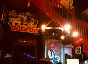
Shopping in Centro Histórico is organised by streets, markets and trading specialities rather than by one enclosed retail quarter. Mercado de la Ciudadela, at the district’s south-western edge, is a major place to browse Mexican crafts, textiles, ceramics and decorative goods from different regions, while Mercado de San Juan is principally a food market rather than a souvenir bazaar. The streets around Correo Mayor and República de Colombia are associated with clothing, fabrics, party goods and wholesale commerce, and independent shops around Madero and the central streets mix books, jewellery, traditional products and contemporary retail. La Lagunilla lies nearby to the north and is often visited for antiques and vintage goods, though it is commonly treated as a separate adjoining area. Compare quality, ask about materials and pack fragile purchases carefully.
-
Department store
El Palacio de Hierro Centro
Discover luxury shopping and culinary delights at El Palacio de Hierro Centro, a premier retail destination in the historic heart of Mexico City.
2 min walk · 0.2 km from neighbourhood centre
-
Shopping mall
The Shops at Downtown
Explore unique shopping and dining experiences at The Shops at Downtown, the heart of Mexico City's vibrant culture and commerce.
4 min walk · 0.3 km from neighbourhood centre
-
Clothing store
Promoda Outlet
Explore the vibrant Promoda Outlet in Mexico City for unbeatable fashion deals and a unique shopping experience in the historic center.
3 min walk · 0.2 km from neighbourhood centre
-
Gift shop
Regalos de Prestigio, S.A. de C.V.
Explore Regalos de Prestigio in Mexico City: Your destination for authentic Mexican crafts and unique souvenirs.
4 min walk · 0.3 km from neighbourhood centre


Centro Historico essentials
Getting There
Getting Around
Safety
Emergency Situations
Do's and Don'ts
Local Tips

From Eve
Local phrases worth knowing
You don't need to get them perfect. A few words go a long way, and locals appreciate the effort.
Basics
| English | Local | Say it |
|---|---|---|
| Hello | Hola | [oh-lah] |
| Goodbye | Adiós | [ah-dee-ohs] |
| Yes | Sí | [see] |
| No | No | [noh] |
| Please/You're welcome | Por favor/De nada | [por fah-vor/deh nah-dah] |
| Thank you | Gracias | [grah-see-ahs] |
| Excuse me/Sorry | Perdón/Lo siento | [pair-dohn/loh see-en-toh] |
| How are you? | ¿Cómo estás? | [koh-moh ehs-tahs] |
| Fine. And you? | Bien. ¿Y tú? | [byehn. ee too] |
| Do you speak English? | ¿Hablas inglés? | [ah-blahs een-glehs] |
| I don't understand | No entiendo | [noh ehn-tee-ehn-doh] |
Eating & Drinking
| English | Local | Say it |
|---|---|---|
| I'd like to see the menu, please | Me gustaría ver el menú, por favor | [meh goo-stah-ree-ah vehr ehl meh-noo, por fah-vor] |
| I don't eat meat | No como carne | [noh koh-moh kahr-neh] |
| Cheers! | ¡Salud! | [sah-lood] |
| I would like to pay, please | Me gustaría pagar, por favor | [meh goo-stah-ree-ah pah-gahr, por fah-vor] |
Emergencies
| English | Local | Say it |
|---|---|---|
| Help! | ¡Ayuda! | [ah-yoo-dah] |
| Go away! | ¡Vete! | [veh-teh] |
| Call the Police! | ¡Llama a la policía! | [yah-mah ah lah poh-lee-see-ah] |
| Call a doctor! | ¡Llama a un médico! | [yah-mah ah oon meh-dee-koh] |
| I'm lost | Estoy perdido/a | [ehs-toy pair-dee-doh/ah] |
| I'm ill | Estoy enfermo/a | [ehs-toy ehn-fehr-moh/ah] |
Shopping
| English | Local | Say it |
|---|---|---|
| I'd like to buy... | Me gustaría comprar... | [meh goo-stah-ree-ah kohm-prahr...] |
| I'm just looking | Sólo estoy viendo | [soh-loh ehs-toy vee-ehn-doh] |
| How much is it? | ¿Cuánto cuesta? | [kwan-toh kwehs-tah] |
| That's too expensive | Eso es demasiado caro | [eh-soh ehs deh-mah-see-ah-doh kah-roh] |
| Can you lower the price? | ¿Puedes bajar el precio? | [pweh-dehs bah-har ehl pree-seh-oh] |
Time & Numbers
| English | Local | Say it |
|---|---|---|
| What time is it? | ¿Qué hora es? | [keh oh-rah ehs] |
| It's one o'clock | Es la una | [ehs lah oo-nah] |
| Half past (10) | Las diez y media | [lahs dyehs ee meh-dee-ah] |
| Morning | Mañana | [mah-nyah-nah] |
| Afternoon | Tarde | [tahr-deh] |
| Evening | Noche | [noh-cheh] |
| Yesterday | Ayer | [ah-yehr] |
| Today | Hoy | [oy] |
| Tomorrow | Mañana | [mah-nyah-nah] |
| 1 | Uno | [oo-noh] |
| 2 | Dos | [dohs] |
| 3 | Tres | [trehs] |
| 4 | Cuatro | [kwah-troh] |
| 5 | Cinco | [seen-koh] |
| 6 | Seis | [says] |
| 7 | Siete | [syeh-teh] |
| 8 | Ocho | [oh-choh] |
| 9 | Nueve | [nweh-veh] |
| 10 | Diez | [dyehs] |
Transport & Directions
| English | Local | Say it |
|---|---|---|
| Where's a/the...? | ¿Dónde está...? | [dohn-deh ehs-tah] |
| What's the address? | ¿Cuál es la dirección? | [kwal ehs lah dee-rehk-syon] |
| Can you show me (on the map)? | ¿Puedes mostrarme (en el mapa)? | [pweh-dehs mohs-trar-meh (ehn ehl mah-pah)] |
| When's the next (bus)? | ¿Cuándo es el próximo (autobús)? | [kwan-doh ehs ehl proh-ksee-moh (ow-toh-boos)] |
| A ticket (to ....) | Un boleto (a ....) | [oon boh-leh-toh (ah)] |
History of Centro Historico
Tenochtitlan and the Lake Basin
Before the Spanish conquest, the area now known as Centro Histórico formed the ceremonial and political heart of Mexico-Tenochtitlan, the Mexica capital established on an island in Lake Texcoco. The precinct included the Templo Mayor and other temples, palaces and markets connected by causeways and waterways. Much of the pre-Hispanic city was dismantled or buried after the conquest, but excavations around the Templo Mayor have revealed foundations, sculpture and offerings that clarify the scale and importance of the original capital. The surviving archaeological zone gives the modern district its deepest historical layer and explains why the surrounding streets contain such a concentrated mixture of political, religious and commercial institutions.
The Spanish Colonial Capital
After the conquest in 1521, Spanish authorities rebuilt the capital over the former Mexica centre, using existing materials and reshaping the urban grid around the Plaza Mayor, now the Zócalo. Churches, convents, administrative buildings and merchant houses gradually filled the district. The Metropolitan Cathedral developed over several centuries, while streets such as Moneda and Tacuba became associated with religious, governmental and commercial life. The colonial centre also reflected the inequalities of New Spain: Indigenous communities, enslaved Africans, Spaniards and mixed-status residents occupied different social and economic positions, even as their labour and commerce sustained the city surrounding the central institutions.
Reform, Commerce and Modernisation
The nineteenth century brought political upheaval and major changes to the central district. The Reform era reduced the power and property holdings of religious institutions, opening some convent lands and buildings to new civic, commercial and residential uses. Under the Porfirian modernisation of the late nineteenth and early twentieth centuries, parts of the centre gained new façades, public improvements and commercial buildings influenced by European architectural fashions. The arrival and expansion of electric transport, together with the growth of printing, wholesale trade and professional offices, connected the historic core more closely to the expanding capital while preserving its role as a place of work and exchange.
Preservation and Contemporary Life
During the twentieth century, population shifts, commercial pressure, pollution and neglected buildings affected the historic centre, even as its monuments remained central to Mexico City’s identity. Archaeological discoveries, including the Templo Mayor excavations begun in the late 1970s, renewed public attention to the district’s pre-Hispanic past. Conservation and regeneration programmes later improved important public spaces and pedestrian routes, although debates about rents, informal commerce, tourism and displacement continue to shape the area. The designation of the Historic Centre and Xochimilco as a UNESCO World Heritage site in 1987 reinforced its international significance, while residents, workers, traders, worshippers and visitors continue to give the district its daily character.
Centro Historico in Photos
Browse through our photo collection highlighting the charm and character of the destination.
Neighbourhoods near Centro Historico
The closest neighbourhoods to Centro Historico, if you have time for more than one stop.
-
-

-
-

-


Swipe for more neighbourhoods
Explore more

Explore more of Mexico City
Mexico City blends Aztec heritage, grand museums, historic barrios, bold cuisine and contemporary culture across Mexico's highland capital, for curious travellers.
Explore Mexico City