

Free Boundary Waters Canoe Area Wilderness Travel Guide & Mobile App
Explore Boundary Waters Canoe Area Wilderness with free travel guides. Discover regional history, expert tips, proposed trips, and audio guides on web or mobile app.


Boundary Waters Canoe Area Wilderness offers canoe routes, boreal forests, wildlife, starry skies and quiet adventure in northern Minnesota.
Read more about Boundary Waters Canoe Area Wilderness
When is the best time to visit Boundary Waters Canoe Area Wilderness?
Best: June–August · 24–27°C| Month | High (°C) | Rainfall (mm) |
|---|---|---|
| January | -7 | 30 |
| February | -4 | 25 |
| March | 3 | 35 |
| April | 12 | 40 |
| May | 19 | 60 |
| June (best) | 24 | 80 |
| July (best) | 27 | 90 |
| August (best) | 25 | 90 |
| September | 20 | 70 |
| October | 12 | 60 |
| November | 3 | 40 |
| December | -5 | 35 |
Getting to and around Boundary Waters Canoe Area Wilderness
How to get there
Transportation
Top city travel guides in Boundary Waters Canoe Area Wilderness
The cities of Boundary Waters Canoe Area Wilderness, and the easiest places to base yourself.

Swipe for more cities
Destinations in Boundary Waters Canoe Area Wilderness
Resorts, valleys and scenic spots worth a trip of their own.
-

-


Swipe for more destinations
Best attractions in Boundary Waters Canoe Area Wilderness
The Boundary Waters’ attractions are primarily natural and experiential rather than built. Canoe routes connect thousands of lakes and waterways, with options ranging from relatively accessible introductory trips to demanding expeditions involving repeated portages. Paddlers come for quiet coves, open-water crossings, fishing, swimming, wildlife observation and exceptionally dark night skies. Designated campsites provide simple fire grates and latrines but no conventional visitor facilities, reinforcing the area’s backcountry character. The forest supports loons, bald eagles, beavers, moose and black bears, although sightings depend on season, habitat and luck. Historic and cultural interest includes Indigenous pictographs on selected rock faces, while waterfalls and rapids such as Basswood Falls provide memorable features on some routes. The surrounding Superior National Forest adds hiking and scenic driving outside the wilderness, particularly near the Gunflint Trail and the approaches from Ely, but those gateway landscapes should not be confused with the Boundary Waters itself. Outfitters, interpretive displays and equipment services in nearby towns can help visitors understand and reach the wilderness, yet the central attraction remains the protected combination of water, forest, silence and self-reliant travel.
-
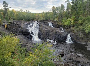
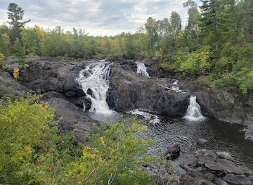
Kawishiwi Falls Trail
Explore the natural beauty of Kawishiwi Falls Trail in Ely, Minnesota – a hiker's paradise with stunning waterfalls and rich wildlife.
-
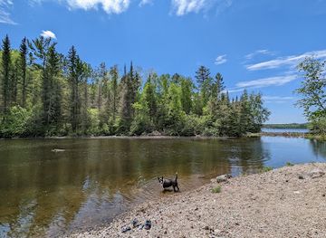
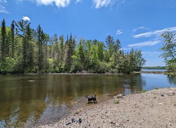
Bass Lake Trail
Discover the breathtaking beauty of Bass Lake Trail in Ely, Minnesota, a perfect hiking destination for nature lovers and adventure seekers.
-
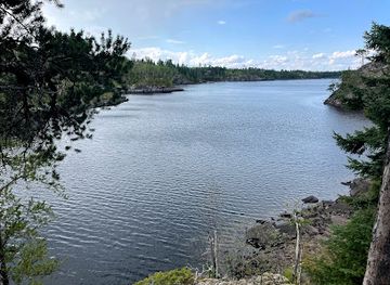
Chik-Wauk Museum and Nature Center
Discover the stunning beauty and rich history of the Chik-Wauk Museum and Nature Center in Grand Marais, Minnesota, a perfect escape for nature lovers and history buffs.
-
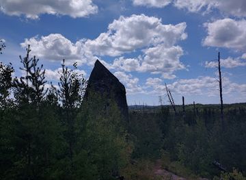
Magnetic Rock
Explore Magnetic Rock: A Unique Hiking Destination on the Scenic Gunflint Trail with Stunning Views and Intriguing Geological Wonders.
Best landmarks in Boundary Waters Canoe Area Wilderness
The Boundary Waters has few conventional monuments, but several natural and cultural features are strongly associated with its identity. Its thousands of interconnected lakes, rocky islands and narrow portages form the defining landmark system, created by glacial erosion and preserved through wilderness protection. Basswood Falls is a notable waterfall and rapids area on the international border zone, while Knife Lake is recognised for its broad water views, islands and canoe-route history. Crooked Lake and nearby waterways contain important Indigenous pictographs on selected rock faces; these fragile images are cultural landmarks that require respectful observation and must never be touched or altered. The international boundary itself runs through part of the canoe country, although visitors should understand border rules before approaching or crossing it. Much of the visual character comes from the contrast between exposed granite shoreline, boreal forest and open water rather than from architecture. The Superior National Forest roads, visitor facilities and gateway towns provide access and context, but landmarks outside the wilderness should be identified as surrounding features rather than presented as part of the protected canoe area.
-
Hiking area
Kawishiwi Falls Trail
Explore Kawishiwi Falls Trail, a scenic hiking area in Ely, Minnesota, perfect for nature lovers and adventure seekers alike.
-
Hiking area
Bass Lake Trail
Discover the natural beauty and tranquility of Bass Lake Trail, a must-visit hiking destination in Minnesota's wilderness.
-
Tourist attraction
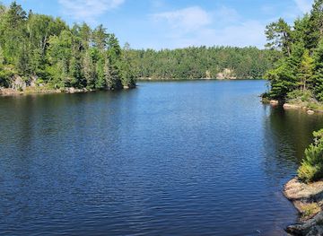
Burntside Lake
Discover the tranquil charm of Burntside Lake, a natural paradise for outdoor lovers in Ely, Minnesota, perfect for fishing, kayaking, and relaxation.
-
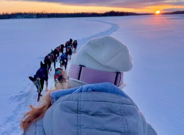
Dogsled ride service
Cast Outdoor Adventures
Experience the thrill of dogsledding at Cast Outdoor Adventures in Ely, Minnesota, where adventure and nature come together beautifully.
Explore Boundary Waters Canoe Area Wilderness on the map
Plan your trip on one map. See where the top cities, national parks and sights are, and book hotels and experiences in a few clicks.
Best hotels in Boundary Waters Canoe Area Wilderness
Best restaurants in Boundary Waters Canoe Area Wilderness
There are no restaurants, cafés or food shops inside the Boundary Waters, so meals must be carried in and prepared by visitors, generally on a camp stove or where permitted at a designated campsite. Gateway communities outside the wilderness, particularly Ely, Grand Marais and settlements along the Gunflint Trail, provide the practical dining scene before or after a trip. Expect cafés, bakeries, restaurants, pubs and provisions shops rather than a concentrated regional cuisine. Menus in northern Minnesota commonly reflect American comfort food, freshwater fish, burgers, sandwiches, soups and locally oriented seasonal cooking, while visitors may also find wild rice products and locally produced beer or baked goods. Food planning is part of the wilderness experience: lightweight, durable ingredients are valuable, and all supplies must be protected from wildlife and packed out responsibly. Ask local outfitters about resupply possibilities, but assume that stores and prepared food are outside the wilderness and may be separated by considerable driving distance.
-
Restaurant
Burntside Lodge
Experience nature's beauty at Burntside Lodge – a serene retreat with cozy accommodations and delicious dining options on Burntside Lake.
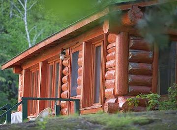
Best bars in Boundary Waters Canoe Area Wilderness
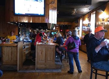
Nightlife inside the Boundary Waters consists of quiet evenings at camp, conversation, wildlife listening and exceptionally dark skies rather than bars or clubs. Visitors should not expect entertainment venues, amplified music or late-night services once they pass the entry point. Social life before and after a trip is centred on the gateway communities of Ely, Grand Marais and the Gunflint Trail, all outside the wilderness, where traditional bars, pubs, restaurants and occasional live-music settings provide relaxed places to eat and meet. Their evening character is practical and seasonal, reflecting canoeists, residents and visitors rather than a major urban club scene. Alcohol should be used cautiously around cold water, campfires and portages, and it must never interfere with navigation, food storage or emergency readiness. Checking current local arrangements is sensible because rural businesses and seasonal services can change.
-
 Resort hotel
Grand Ely Lodge Resort & Event Center
Experience the perfect blend of adventure and tranquility at Grand Ely Lodge, a premier resort hotel in beautiful Ely, Minnesota.
-
Brewpub
Boathouse Brewpub & Restaurant
Experience the best of Ely, Minnesota at Boathouse Brewpub & Restaurant – where local flavors meet craft brews in a picturesque lakeside setting.
-
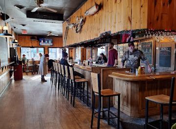
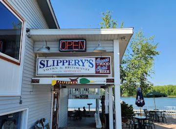
American
Slippery's Bar & Grill
Indulge in delicious American cuisine and local brews at Slippery's Bar & Grill, a must-visit dining gem in Wabasha, Minnesota.
-
Bar
Volstead's Emporium
Experience the charm of a Prohibition-era speakeasy at Volstead's Emporium, featuring craft cocktails and live music in a cozy atmosphere.

Best nightclubs in Boundary Waters Canoe Area Wilderness
-
Resort hotel
Grand Ely Lodge Resort & Event Center
Experience luxury and natural beauty at Grand Ely Lodge Resort & Event Center, a premier destination in Ely, Minnesota for relaxation and adventure.
-
Brewpub
Boathouse Brewpub & Restaurant
Experience the flavors of Ely at Boathouse Brewpub & Restaurant, where craft beer meets delicious cuisine in a cozy atmosphere.
-
American
Gator's Grilled Cheese Emporium
Discover Ely's hidden gem, Gator's Grilled Cheese Emporium, where comfort food meets culinary creativity in every delicious sandwich.
-
Coffee shop
Northern Grounds
Discover the vibrant charm of Northern Grounds, a unique coffee shop and live music venue in Ely, Minnesota, perfect for every traveler.
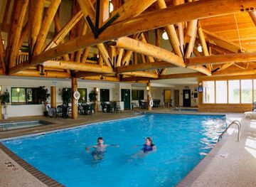
Best shops in Boundary Waters Canoe Area Wilderness
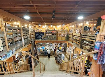
Shopping within the Boundary Waters is limited to practical backcountry preparation: there are no retail streets, markets or souvenir shops inside the wilderness. Visitors usually buy food, fuel where permitted, maps, fishing supplies, clothing and camping equipment in gateway towns before departure. Ely offers a broad concentration of outfitters and outdoor services, while Grand Marais and businesses along the Gunflint Trail serve eastern access routes; these communities are outside the wilderness and differ in their mix of independent shops, galleries, provisions and practical equipment. Appropriate souvenirs include locally made art, books about the Northwoods, maps and responsibly sourced regional food products, but cultural items should be purchased from reputable sellers and never collected from the landscape. Shopping is best treated as part of trip logistics rather than a principal activity, with reservations and equipment arrangements made well in advance during the busiest paddling season.
-
Gift shop
Lake Superior Trading Post
Explore the Lake Superior Trading Post for unique gifts, outdoor gear, and local art in Grand Marais, Minnesota.
-
Camping store
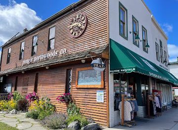
Piragis Northwoods Company
Discover your gateway to adventure at Piragis Northwoods Company, Ely's premier destination for outdoor gear, canoe rentals, and wilderness expertise.
-
Canoe & kayak rental service
Cliff Wold's Outfitting Co.
Discover outdoor adventures at Cliff Wold's Outfitting Co. in Ely, Minnesota - your premier destination for canoe and kayak rentals, camping gear, and more.
-
Canoe & kayak tour agency
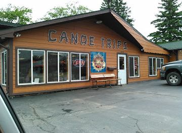
Voyageur North Canoe Outfitters
Experience the adventure of a lifetime at Voyageur North Canoe Outfitters, your premier destination for canoeing in Ely, Minnesota.
Get your free copy of our complete guide to Boundary Waters Canoe Area Wilderness, delivered straight to you.
Everything on this page, from attractions and restaurants to essentials and local phrases, in one PDF you can read offline, print or share.
Already have an account? Sign in
Your Boundary Waters Canoe Area Wilderness guide is ready.
We'll send it to · Not you? Sign out

Getting your guide ready…
We are putting together a fresh copy of the Boundary Waters Canoe Area Wilderness guide. This can take up to a minute.
This can take a few moments. If your browser asks, choose Allow so the download can start. You'll find the guide in your Downloads folder.
Nothing happened? Download it again
Sorry, the guide is taking longer than usual. Please try again in a minute, or get it by email instead.
Boundary Waters Canoe Area Wilderness essentials
Currency and Payment
Safety
Emergency Situations
Do's and Don'ts
Local Tips
From Eve
Local phrases worth knowing
You don't need to get them perfect. A few words go a long way, and locals appreciate the effort.
Basics
| English | Local | Say it |
|---|---|---|
| Hello | Boozhoo | [boo-zhoo] |
| Goodbye | Miigwech | [mee-gwetch] |
| Yes | Aaniin | [ah-nee] |
| No | Kaa | [kah] |
| Please/You're welcome | Nin gozii | [nin goh-zee] |
| Thank you | Miigwech | [mee-gwetch] |
| Excuse me/Sorry | Nin waabandak | [nin wah-bahn-dahk] |
| How are you? | Aaniin ezhi-ayaayan? | [ah-nee-in eh-zhi-ah-yah-n] |
| Fine. And you? | Daga, aaniin ezhi-ayaayan? | [dah-gah, ah-nee-in eh-zhi-ah-yah-n] |
| Do you speak English? | Aaniin gii-izhi-zhichige? | [ah-nee-in gee-izh-ee-zhi-gay] |
| I don't understand | Nin gii-zhichigewin | [nin gee-izh-ee-gay-win] |
Eating & Drinking
| English | Local | Say it |
|---|---|---|
| I'd like to see the menu, please | Nin gii-mikwenh, nin gozii | [nin gee-mik-wen, nin goh-zee] |
| I don't eat meat | Nin gii-ninid, naa gii-zhichigewin | [nin gee-nee-nid, nah gii-izh-ee-gay-win] |
| Cheers! | Boozhoo! | [boo-zhoo] |
| I would like to pay, please | Nin gii-dibik, nin gozii | [nin gee-dee-bik, nin goh-zee] |
Emergencies
| English | Local | Say it |
|---|---|---|
| Help! | Nin gii-zaawag | [nin gee-zah-wahg] |
| Go away! | Gii-inendang! | [gee-ee-nen-dahng] |
| Call the Police! | Nin gii-izhi-kiijigan! | [nin gee-izh-ee-key-jih-gahn] |
| Call a doctor! | Nin gii-izhi-ziigwan! | [nin gee-izh-ee-zee-gwahn] |
| I'm lost | Nin gii-mikwedang | [nin gee-meek-weh-dahng] |
| I'm ill | Nin gii-nimishowin | [nin gee-nee-mih-show-win] |
Shopping
| English | Local | Say it |
|---|---|---|
| I'd like to buy... | Nin gii-bikad, ... | [nin gee-bee-kahd, ...] |
| I'm just looking | Nin gii-kikendaan | [nin gee-kee-ken-dahn] |
| How much is it? | Aaniin gii-nawendi? | [ah-nee-in gee-nah-wen-dee] |
| That's too expensive | Nisidotam, gii-bikad izhi-bakwezhigan | [nee-see-doh-tahm, gee-bee-kahd ee-zhi-bahk-weh-zhih-gahn] |
| Can you lower the price? | Aaniin gii-kikendaan, gii-bikad izhi-nawendi? | [ah-nee-in gee-kee-ken-dahn, gee-bee-kahd ee-zhi-nah-wen-dee] |
Time & Numbers
| English | Local | Say it |
|---|---|---|
| What time is it? | Aaniin gii-nawendi? | [ah-nee-in gee-nah-wen-dee] |
| It's one o'clock | Gii-bizindaw 1 | [gee-bee-zin-dahw 1] |
| Half past (10) | Gii-nawendi 10 bimaadiziwin | [gee-nah-wen-dee 10 bee-mah-dih-zi-win] |
| Morning | Bimaadiziwin | [bee-mah-dih-zi-win] |
| Afternoon | Bineshiinh | [bee-neh-sheehn] |
| Evening | Odaabaan | [oh-dah-bahn] |
| Yesterday | Ningodwaaswi | [neen-goh-dwah-swee] |
| Today | Niizhwaaswi | [nee-zhwah-swee] |
| Tomorrow | Niswi | [nee-swee] |
| 1 | Nii | [nee] |
| 2 | Niizho | [nee-zho] |
| 3 | Niswi | [nee-swee] |
| 4 | Nii-nii | [nee-nee] |
| 5 | Nin | [neen] |
| 6 | Nin-nii | [neen-nee] |
| 7 | Nin-niizho | [neen-nee-zho] |
| 8 | Nin-nii-nii | [neen-nee-nee] |
| 9 | Nin-nii-niswi | [neen-nee-nee-swee] |
| 10 | Nin-nii-niizho | [neen-nee-nee-zho] |
Transport & Directions
| English | Local | Say it |
|---|---|---|
| Where's a/the...? | Aaniin gii-zhichigewin? | [ah-nee-in gee-zhih-chee-gay-win] |
| What's the address? | Aaniin gii-bagijigan? | [ah-nee-in gee-bah-gee-jih-gahn] |
| Can you show me (on the map)? | Aaniin gii-izhi-bagijigan? | [ah-nee-in gee-izh-ee-bah-gee-jih-gahn] |
| When's the next (bus)? | Aaniin gii-nawendi (bus)? | [ah-nee-in gee-nah-wen-dee (bus)] |
| A ticket (to ....) | Nin gii-bikad ticket (to ....) | [nin gee-bee-kahd ticket (to ....)] |
History of Boundary Waters Canoe Area Wilderness
Anishinaabe Homelands and Water Routes
The Boundary Waters lies within the historic and continuing cultural landscape of Anishinaabe peoples, including the Bois Forte Band of Chippewa. Lakes, rivers and portages served as routes for travel, hunting, fishing, gathering and exchange long before the area became a federally managed wilderness. Rock paintings, or pictographs, survive at selected sites and are important cultural records. They should not be treated as curiosities: their locations and meanings belong within a living Indigenous history that continues beyond the boundaries of the protected area.
The Fur Trade and Voyageur Travel
During the late eighteenth and nineteenth centuries, the interconnected waterways formed part of the wider fur-trade network linking the Great Lakes to the interior. Indigenous knowledge was indispensable to this commerce, while French-Canadian voyageurs and later traders travelled by birchbark canoe through lakes and portages. The region’s geography made water transport practical but physically demanding. Although most modern visitors travel for recreation rather than trade, the same passages and portages reveal why the area was historically valued as a transportation landscape.
Logging and the Northern Forest Economy
Nineteenth- and early twentieth-century commercial expansion brought logging, prospecting and related settlement pressures to northern Minnesota. Timber harvesting altered parts of the surrounding forest and helped shape communities that later became gateways for canoe travel. Fire, natural succession and past land use remain part of the forest’s ecological story. The wilderness designation did not erase this history; rather, it placed a large surviving landscape within a different management framework, prioritising ecological processes and primitive recreation over industrial development.
Early Forest Conservation
The federal government established the Superior National Forest in 1909, creating a broad administrative setting for conservation and resource management in northeastern Minnesota. Over time, public debate increasingly focused on protecting the canoe country’s lakes, forests and undeveloped character. The resulting conservation movement reflected tensions familiar across the United States: timber, mining, tourism and local economic interests had to be considered alongside preservation. The Boundary Waters emerged from this long negotiation rather than from a single act of protection.
The Wilderness Act of 1964
The Wilderness Act of 1964 created the National Wilderness Preservation System and established a national definition of wilderness as a place substantially unaffected by modern human control. The canoe country received important protection through this evolving framework, although special arrangements were needed because motorboats and aircraft had already been part of the area’s recreational pattern. The legislation made the preservation of solitude, natural conditions and primitive recreation central goals for the Boundary Waters.
The Boundary Waters Canoe Area Wilderness Act of 1978
The Boundary Waters Canoe Area Wilderness Act of 1978 provided the principal modern legal framework for the area. It strengthened wilderness protection, restricted logging and mechanised use, addressed commercial and recreational practices, and established a system of permits and quotas for overnight visitors. The act also confirmed that the area would be managed within the National Wilderness Preservation System. Present-day canoe routes, portage experiences and limits on development are direct legacies of this major conservation settlement.
Modern Conservation and Mining Debates
In recent decades, proposed mineral exploration and mining near the Boundary Waters have generated sustained debate about water quality, employment, public lands and long-term conservation. Supporters and opponents have differed over whether potential economic benefits can be reconciled with risks to interconnected lakes and rivers. These disputes demonstrate that the wilderness is not an isolated historical relic but part of a living regional economy and national conversation about land stewardship. The protected area itself remains managed for wilderness recreation and ecological preservation.
Boundary Waters Canoe Area Wilderness in Photos
Browse through our photo collection highlighting the charm and character of the destination.
Neighbouring regions of Boundary Waters Canoe Area Wilderness
The closest regions to Boundary Waters Canoe Area Wilderness, if you have time for more than one.
-

-

-

-

-
 Voyageurs National Park
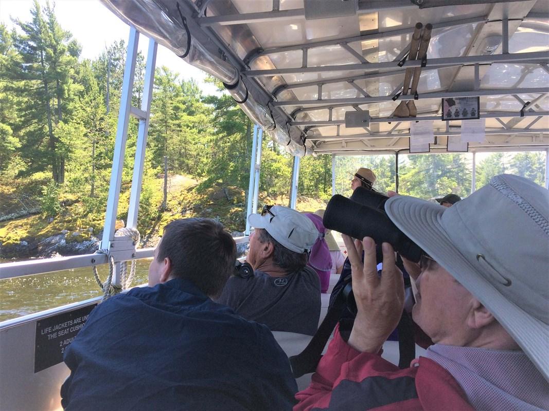
 in Minnesota offers island-studded lakes, boreal wildlife, historic waterways, boating and dark northern skies.
Voyageurs National Park
Voyageurs National Park in Minnesota offers island-studded lakes, boreal wildlife, historic waterways, boating and dark northern skies.


Swipe for more regions
Explore more

Explore more of Minnesota
Discover Minnesota: From the bustling Twin Cities and cultural landmarks to the serene lakes and expansive wilderness, experience the diverse beauty and welcoming spirit of the North Star State.
Explore Minnesota