

Free Dissected Till Plains Travel Guide & Mobile App
Explore Dissected Till Plains with free travel guides. Discover regional history, expert tips, proposed trips, and audio guides on web or mobile app.


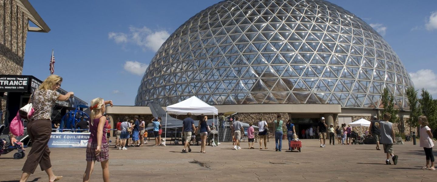


Explore Nebraska’s Dissected Till Plains for rolling farmland, wooded valleys, Missouri River history, Omaha culture and accessible outdoor recreation.
Read more about Dissected Till Plains
When is the best time to visit Dissected Till Plains?
Best: May–June, September · 22–28°C| Month | High (°C) | Rainfall (mm) |
|---|---|---|
| January | 1 | 20 |
| February | 3 | 21 |
| March | 9 | 46 |
| April | 17 | 70 |
| May (best) | 22 | 97 |
| June (best) | 28 | 98 |
| July | 31 | 95 |
| August | 29 | 86 |
| September (best) | 25 | 64 |
| October | 17 | 52 |
| November | 9 | 28 |
| December | 3 | 22 |
Getting to and around Dissected Till Plains
How to get there
Transportation
Top city travel guides in Dissected Till Plains
The cities of Dissected Till Plains, and the easiest places to base yourself.
-

-

-
-

-

-


Swipe for more cities
Destinations in Dissected Till Plains
Resorts, valleys and scenic spots worth a trip of their own.
-

-
-


Swipe for more destinations
Best attractions in Dissected Till Plains
The attractions of Nebraska’s Dissected Till Plains are spread across an urban river centre, wooded reserves, state parks and agricultural communities. Omaha provides the strongest concentration of museums, galleries, gardens, performing arts and family-oriented venues, as well as riverfront trails and historic neighbourhoods. Nearby Bellevue adds access to Fontenelle Forest, where marked paths pass through mature woodland and steep ravines above the Missouri Valley. North-eastern parts of the landscape lead towards Ponca State Park, known for river views, outdoor recreation and interpretive programmes. Fort Atkinson State Historical Park presents a reconstructed early nineteenth-century military post and helps explain the Missouri River frontier. Farther south, Indian Cave State Park combines forested hills, river scenery, trails and archaeological interpretation. Rural attractions are often modest in scale but valuable for understanding the region’s farming history: courthouses, historic main streets, local museums, cemeteries and seasonal produce stands appear between fields and creek valleys. The region is particularly suited to visitors who combine Omaha’s cultural institutions with short hikes, scenic drives, wildlife observation and visits to protected river and woodland landscapes.
-
State park
Eugene T. Mahoney State Park
Discover the beauty of Eugene T. Mahoney State Park, an outdoor paradise in Nebraska offering trails, lakes, and family-friendly activities.
-
Tourist attraction
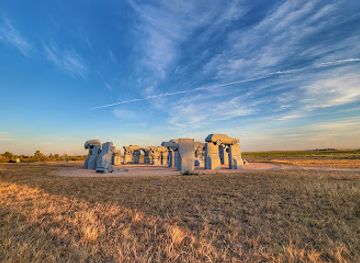
Carhenge
Discover the whimsical Carhenge in Alliance, Nebraska—a creative tribute to Stonehenge made entirely of vintage cars, blending art and history.
-
Historical place
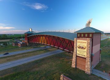
Great Platte River Road Archway Monument
Explore the Great Platte River Road Archway Monument: A historical tribute to America's pioneers, showcasing the journey of westward expansion.
-
Monument
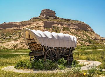
Scotts Bluff National Monument
Experience breathtaking views and rich history at Scotts Bluff National Monument, a top tourist attraction in Nebraska showcasing America's pioneering spirit.
Best landmarks in Dissected Till Plains
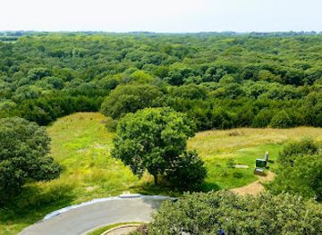
The Missouri River is the region’s defining natural landmark, forming a broad eastern boundary and explaining the location of major settlements, transport routes and historic military sites. In Omaha, the Bob Kerrey Pedestrian Bridge is a prominent contemporary structure spanning the river to Iowa; it is outside Nebraska’s Dissected Till Plains on its eastern landing but is a practical nearby viewpoint rather than a landmark within the Nebraska region itself. Fontenelle Forest near Bellevue is a significant landscape landmark because its mature woodland and sharply cut ravines contrast with the surrounding agricultural uplands. Fort Atkinson State Historical Park preserves the setting and reconstruction of one of the earliest United States military posts west of the Missouri. Omaha’s historic commercial and residential architecture further records the city’s development as a railway and livestock centre. In the rural districts, wooded creek valleys, elevated farm roads and river bluffs are less monumental but express the geological character of the Dissected Till Plains: glacial deposits reshaped by erosion into a varied pattern of ridges, slopes and narrow drainage corridors.
-
Live Music
The Royal Grove
Experience the vibrant nightlife at The Royal Grove, Lincoln's premier live music venue offering unforgettable performances and a lively atmosphere.
-
State park
Arbor Lodge State Historical Park
Experience the beauty and history of Arbor Lodge State Historical Park in Nebraska City, a serene escape for nature lovers and history enthusiasts alike.
-
Park
Fremont Lakes
Explore the natural beauty of Fremont Lakes, a serene park in Nebraska perfect for fishing, picnicking, and enjoying the great outdoors.
-
Campground
Fremont State Recreation Area
Discover the serene landscapes and abundant outdoor activities at Fremont State Recreation Area, Nebraska's premier destination for camping, hiking, and fishing.


Explore Dissected Till Plains on the map
Plan your trip on one map. See where the top cities, national parks and sights are, and book hotels and experiences in a few clicks.
Best hotels in Dissected Till Plains
Best restaurants in Dissected Till Plains
Dining in the Dissected Till Plains reflects Nebraska’s agricultural base and Omaha’s role as a diverse regional city. Beef, pork, grain-based foods, seasonal vegetables and locally produced beer are common reference points, while menus in Omaha range from long-established American cooking to contemporary restaurants influenced by immigrant communities. Steakhouses, independent cafés, bakeries, diners and neighbourhood restaurants are concentrated in the metropolitan area; rural communities are more likely to offer family restaurants, pubs and straightforward American meals. Farmers’ markets and seasonal stands can provide fruit, vegetables, baked goods and other Nebraska-grown products, though availability varies by season. Barbecue and smoked meats are found across the wider Midwest and Great Plains rather than belonging exclusively to this region, so they are best understood as part of the broader food culture. Visitors driving between towns should plan meals ahead, as choices become less frequent outside Omaha and larger settlements.
-
Steak
Round the Bend Steakhouse
Discover exceptional steaks and warm hospitality at Round the Bend Steakhouse in Ashland, Nebraska—a culinary delight for every traveler.
-
Steak
Ole's Big Game Steakhouse & Lounge
Discover Ole's Big Game Steakhouse & Lounge in Paxton - where delicious steaks meet rustic charm in an unforgettable dining adventure.
-
Hamburger
Honest Abe's - Meadowlane
Discover Honest Abe's - Meadowlane in Lincoln for unique burgers made with quality ingredients in a welcoming atmosphere.
-
Restaurant
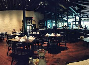
M's Pub
Experience the vibrant flavors of M's Pub in Downtown Omaha – where innovative cuisine meets a lively bar atmosphere.


Best bars in Dissected Till Plains
Evening life is concentrated in Omaha, where historic neighbourhoods, the downtown area and districts around the central city provide pubs, breweries, cocktail bars, live music and late-night entertainment. The city’s cultural calendar also supports theatre, concerts and other evening events, although venues and schedules change frequently. Outside the metropolitan area, nightlife is generally quieter and centres on local bars, restaurants, community events and traditional pubs rather than large clubs. Some towns have breweries or taprooms, but their roles are primarily social and dining-oriented. Visitors exploring rural parks should expect limited late-night services and arrange transport before leaving Omaha or a larger town. Alcohol is not necessary to experience the region’s evening culture; performances, restaurants, riverfront walks and seasonal community activities offer alternatives, subject to current local arrangements.
-
Steak
Round the Bend Steakhouse
Experience the best steaks in Ashland, Nebraska at Round the Bend Steakhouse, where quality meets flavor in a cozy setting.
-
Barbecue
Parker's Smokehouse
Discover the best barbecue in Ashland, Nebraska, at Parker's Smokehouse, where every meal is a smoky delight.
-
Grill
Buck's Bar and Grill
Experience the lively atmosphere and delicious grilled dishes at Buck's Bar and Grill in Waterloo, where local flavors meet vibrant live music.
-
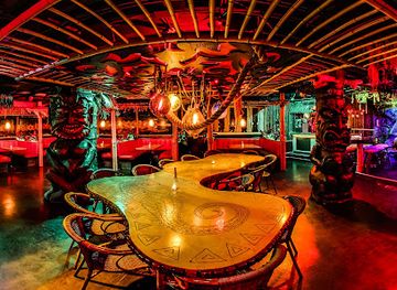
Cocktail bar
Laka Lono Rum Club
Experience tropical vibes and exquisite rum cocktails at Laka Lono Rum Club in Omaha, your go-to cocktail bar for unforgettable nights.


Best nightclubs in Dissected Till Plains
Evening life is concentrated in Omaha, where historic neighbourhoods, the downtown area and districts around the central city provide pubs, breweries, cocktail bars, live music and late-night entertainment. The city’s cultural calendar also supports theatre, concerts and other evening events, although venues and schedules change frequently. Outside the metropolitan area, nightlife is generally quieter and centres on local bars, restaurants, community events and traditional pubs rather than large clubs. Some towns have breweries or taprooms, but their roles are primarily social and dining-oriented. Visitors exploring rural parks should expect limited late-night services and arrange transport before leaving Omaha or a larger town. Alcohol is not necessary to experience the region’s evening culture; performances, restaurants, riverfront walks and seasonal community activities offer alternatives, subject to current local arrangements.
-
Lounge
Steve O's Lounge
Discover Lincoln's vibrant nightlife at Steve O's Lounge, where karaoke and a welcoming atmosphere create unforgettable memories.
-
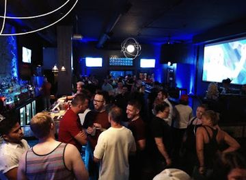
Bar
Bar 415
Experience the pulse of Omaha's nightlife at Bar 415, where underground dance music meets expertly crafted cocktails in a vibrant atmosphere.
-
Bar
Das Haus
Discover the lively ambiance and creative cocktails at Das Haus, Lincoln's premier nightlife destination, perfect for socializing and entertainment.
-
Bar
Independent Club
Experience the lively atmosphere and delicious food at Independent Club in Central City, where every visit feels like a celebration.


Best shops in Dissected Till Plains
Omaha provides the region’s broadest shopping choice, from established high streets and malls to independent boutiques, bookshops, galleries, antique dealers and neighbourhood retail areas. Its farmers’ markets and food shops are useful places to look for Nebraska-produced goods, including seasonal produce, baked items, preserves and locally made drinks, subject to the time of year. Smaller towns in the Dissected Till Plains tend to offer practical main-street shopping rather than extensive specialist retail, with antiques, craft goods, local artwork and community markets appearing on a more limited or seasonal basis. Visitors seeking regional gifts can consider Nebraska food products, prairie-themed artwork, books about the Missouri Valley and handmade goods, but should distinguish genuinely local products from generic western souvenirs. Rural shops and markets may keep shorter hours or accept cash more readily than large urban retailers, so checking arrangements before making a detour is sensible.
-
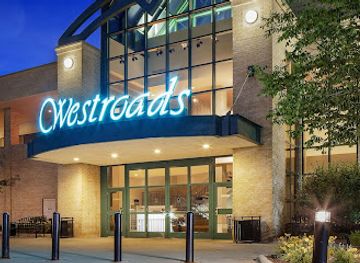
Shopping mall
Westroads Mall
Explore the dynamic Westroads Mall in Omaha, a shopping paradise with diverse stores, dining options, and family-friendly entertainment.
-
Shopping mall
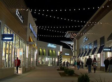
Nebraska Crossing
Discover unbeatable savings and an enjoyable shopping experience at Nebraska Crossing, Nebraska's premier outlet mall.
-
Shopping mall
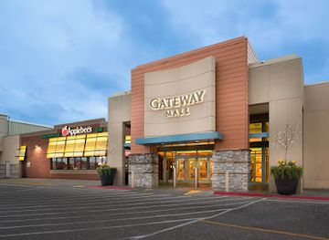
Gateway Mall
Discover Gateway Mall, Lincoln's ultimate shopping destination with diverse stores, delectable dining, and exciting entertainment for all ages.
-
Shopping mall
Village Pointe
Village Pointe: Omaha’s vibrant outdoor shopping mall offering top-notch retail, dining, and entertainment experiences for all visitors.
Get your free copy of our complete guide to Dissected Till Plains, delivered straight to you.
Everything on this page, from attractions and restaurants to essentials and local phrases, in one PDF you can read offline, print or share.
Already have an account? Sign in
Your Dissected Till Plains guide is ready.
We'll send it to · Not you? Sign out

Getting your guide ready…
We are putting together a fresh copy of the Dissected Till Plains guide. This can take up to a minute.
This can take a few moments. If your browser asks, choose Allow so the download can start. You'll find the guide in your Downloads folder.
Nothing happened? Download it again
Sorry, the guide is taking longer than usual. Please try again in a minute, or get it by email instead.
Dissected Till Plains essentials
Currency and Payment
Safety
Emergency Situations
Do's and Don'ts
Local Tips
From Eve
Local phrases worth knowing
You don't need to get them perfect. A few words go a long way, and locals appreciate the effort.
Basics
| English | Local | Say it |
|---|---|---|
| Hello | Howdy | [Ha-dee] |
| Goodbye | See ya | [See yah] |
| Yes | Yep | [Yep] |
| No | Nope | [Nope] |
| Please/You're welcome | Sure thing | [Shur thing] |
| Thank you | Thanks a lot | [Thanks uh lot] |
| Excuse me/Sorry | Pardon me | [Pardon me] |
| How are you? | How's it going? | [How's it goin'?] |
| Fine. And you? | Good. You? | [Good. You?] |
| Do you speak English? | You speakin' English? | [You speakin' English?] |
| I don't understand | I don't get it | [I don't get it] |
Eating & Drinking
| English | Local | Say it |
|---|---|---|
| I'd like to see the menu, please | Can I see the menu? | [Can I see the menu?] |
| I don't eat meat | I'm not eatin' meat | [I'm not eatin' meat] |
| Cheers! | Cheers! | [Cheers!] |
| I would like to pay, please | Can I get the check? | [Can I get the check?] |
Emergencies
| English | Local | Say it |
|---|---|---|
| Help! | Help! | [Help!] |
| Go away! | Leave me alone! | [Leave me alone!] |
| Call the Police! | Call the cops! | [Call the cops!] |
| Call a doctor! | Get a doctor! | [Get a doctor!] |
| I'm lost | I'm lost | [I'm lost] |
| I'm ill | I'm sick | [I'm sick] |
Shopping
| English | Local | Say it |
|---|---|---|
| I'd like to buy... | I wanna buy... | [I wanna buy...] |
| I'm just looking | Just browsing | [Just browsing] |
| How much is it? | How much's this? | [How much's this?] |
| That's too expensive | That's way too pricey | [That's way too pricey] |
| Can you lower the price? | Can you drop the price? | [Can you drop the price?] |
Time & Numbers
| English | Local | Say it |
|---|---|---|
| What time is it? | What time is it? | [What time is it?] |
| It's one o'clock | It's one o'clock | [It's one o'clock] |
| Half past (10) | Half past ten | [Half past ten] |
| Morning | Morning | [Morning] |
| Afternoon | Afternoon | [Afternoon] |
| Evening | Evening | [Evening] |
| Yesterday | Yesterday | [Yesterday] |
| Today | Today | [Today] |
| Tomorrow | Tomorrow | [Tomorrow] |
| 1 | One | [One] |
| 2 | Two | [Two] |
| 3 | Three | [Three] |
| 4 | Four | [Four] |
| 5 | Five | [Five] |
| 6 | Six | [Six] |
| 7 | Seven | [Seven] |
| 8 | Eight | [Eight] |
| 9 | Nine | [Nine] |
| 10 | Ten | [Ten] |
Transport & Directions
| English | Local | Say it |
|---|---|---|
| Where's a/the...? | Where's the...? | [Where's the...?] |
| What's the address? | What's the address? | [What's the address?] |
| Can you show me (on the map)? | Can you point it out? | [Can you point it out?] |
| When's the next (bus)? | When's the next bus? | [When's the next bus?] |
| A ticket (to ....) | A ticket to... | [A ticket to...] |
History of Dissected Till Plains
Indigenous Missouri Valley Homelands
Long before Nebraska became a state, Indigenous peoples used the Missouri Valley, its tributary bottoms and the surrounding uplands for settlement, travel, hunting and trade. The Omaha people have especially strong historical and contemporary connections with north-eastern Nebraska and the lower Missouri Valley, while the Otoe-Missouria also belong to the region’s deeper history. Archaeological evidence records earlier occupation extending back thousands of years. These histories remain important to understanding the landscape beyond the later town, farm and railway narratives.
Exploration and the Missouri River, 1804–1806
The Lewis and Clark Expedition travelled the Missouri River along the eastern edge of present-day Nebraska in 1804 and again during its return journey. Its journals recorded the river environment, Indigenous communities, wildlife and geography encountered by the expedition. The route did not define the whole Dissected Till Plains, but it helped make the Missouri corridor more familiar to the United States government and later travellers. River landings and nearby historical interpretation preserve part of this early nineteenth-century story.
Fort Atkinson and the Early Territorial Frontier
Fort Atkinson, established in 1819 near the Missouri River north of present-day Omaha, was the first United States military post established west of the Missouri. It supported military and commercial activity during an era when the river was a principal route into the interior. The reconstructed site, now Fort Atkinson State Historical Park, illustrates the strategic importance of the region before Nebraska Territory was organised. Its history also belongs to a period of increasing pressure on Indigenous communities and homelands.
Nebraska Territory and Overland Migration
The creation of Nebraska Territory in 1854 accelerated American settlement, town building and the surveying of land across the eastern part of the territory. Trails followed the Missouri River and crossed the interior, carrying migrants, military personnel and traders westward. Communities such as Omaha developed as river ports and supply centres, while roads and ferries connected farms with emerging markets. This transformation brought new institutions and economic opportunities, but it also intensified land dispossession and conflict affecting Indigenous nations.
Railways and the Growth of Omaha
Railway construction in the nineteenth century changed eastern Nebraska’s economic geography. Omaha became a major rail and distribution centre because of its position beside the Missouri River and its links westward across the Great Plains. Railways moved livestock, grain, manufactured goods and people, encouraging the growth of stockyards, warehouses, workshops and neighbourhoods. The city’s historic commercial buildings and transport heritage reflect this period, while rural communities became increasingly tied to distant markets through rail depots and branch lines.
Agriculture, Homesteading and Rural Settlement
Federal land policies, including the Homestead Act, encouraged farming settlement across Nebraska after the Civil War. In the Dissected Till Plains, fertile soils, rolling ground and wooded stream valleys produced a mixed agricultural landscape rather than the treeless uniformity often associated with the Great Plains. Small towns supplied farms with banks, grain facilities, schools and churches. Mechanisation, consolidation and changing markets later reduced the population of some rural districts, but agriculture remains central to the region’s appearance and economy.
Modern Metropolitan and River-Valley Transformation
During the twentieth and twenty-first centuries, Omaha expanded into a major regional centre for business, education, healthcare, culture and logistics. Industrial land along the Missouri River has been reshaped in places for parks, trails and civic uses, while older neighbourhoods have experienced conservation and redevelopment. At the same time, state parks, forest reserves and wildlife areas have protected portions of the region’s valleys and uplands. The present landscape therefore combines working farmland, metropolitan growth and managed natural areas.
Dissected Till Plains in Photos
Browse through our photo collection highlighting the charm and character of the destination.
Neighbouring regions of Dissected Till Plains
The closest regions to Dissected Till Plains, if you have time for more than one.
-

-

-

-

-


Swipe for more regions
Explore more

Explore more of Nebraska
Discover Nebraska: A blend of rich history, diverse landscapes, and unique attractions in the heartland of America.
Explore Nebraska