

Free Northeast New Mexico Travel Guide & Mobile App
Explore Northeast New Mexico with free travel guides. Discover regional history, expert tips, proposed trips, and audio guides on web or mobile app.


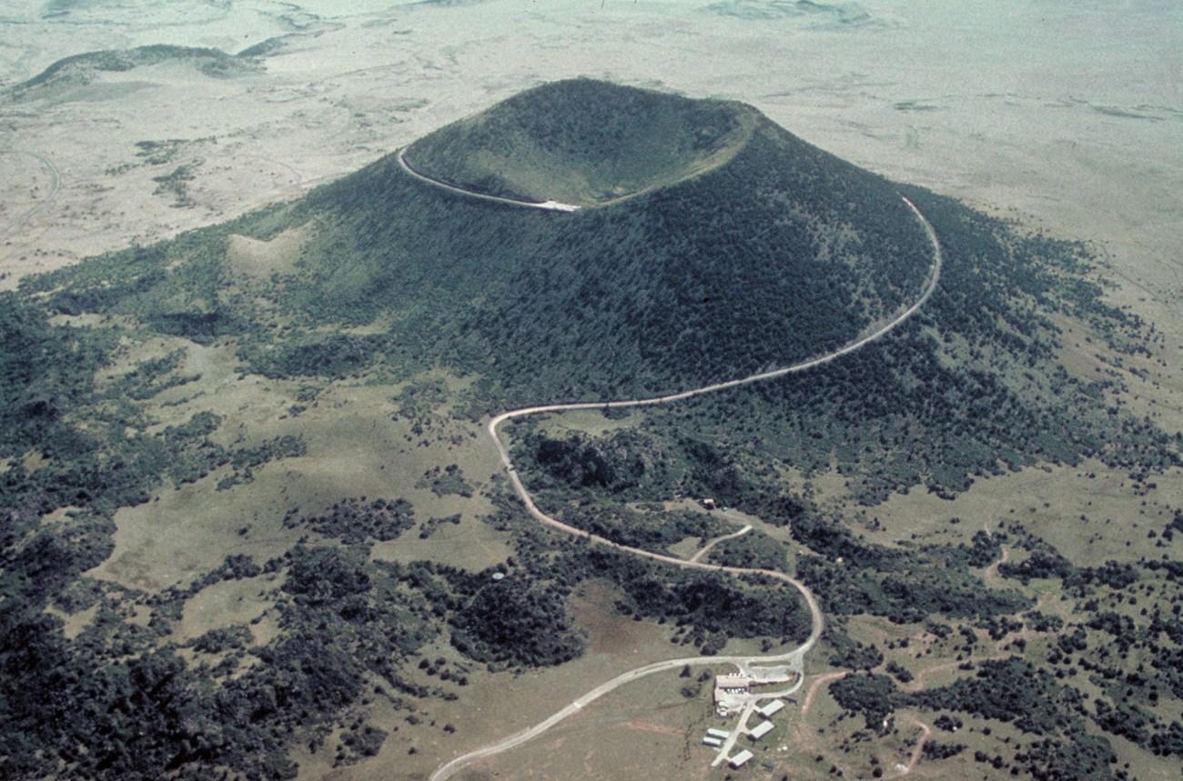


Explore Northeast New Mexico for Santa Fe Trail history, historic Las Vegas, mountain recreation, ranch country and wide-open high-plains landscapes.
Read more about Northeast New Mexico
Getting to and around Northeast New Mexico
How to get there
Transportation
Top city travel guides in Northeast New Mexico
The cities of Northeast New Mexico, and the easiest places to base yourself.
-
-
-

-

-

-


Swipe for more cities
Destinations in Northeast New Mexico
Resorts, valleys and scenic spots worth a trip of their own.
-

-

-

-

-

-


Swipe for more destinations
Best attractions in Northeast New Mexico
Northeast New Mexico's attractions are spread across a large landscape rather than concentrated in one resort or city. Fort Union National Monument is the region's defining historic site, with adobe ruins, reconstructed outlines and trail interpretation revealing the scale of the nineteenth-century military post. Historic Las Vegas offers museums, galleries and one of New Mexico's most substantial collections of Victorian and Territorial buildings. The Santa Fe Trail remains a recurring theme around Springer, Watrous and nearby high plains, while Raton's museums and historic surroundings explore railways, coal and frontier life. In the mountains, Cimarron Canyon, Eagle Nest Lake, the Moreno Valley and the Carson National Forest provide opportunities for hiking, fishing, wildlife watching and scenic drives. Angel Fire and Red River support seasonal mountain recreation, including skiing and summer trail activities. Clayton is a gateway to the eastern plains and the volcanic landscapes and grasslands of the wider region. The attractions are strongest when connected by road: historic towns, ranch country, dark skies, forested passes and open prairie each provide a different understanding of northeastern New Mexico.
-
National park
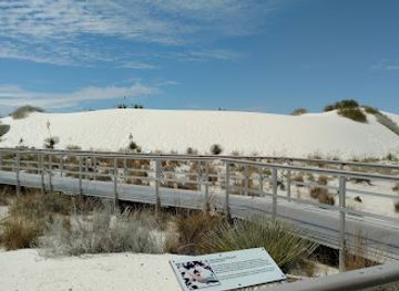
White Sands National Park
Experience the enchanting beauty of White Sands National Park, a unique landscape of shimmering gypsum dunes in New Mexico.
-
 Resort hotel
Sandia Resort & Casino
Discover luxury, entertainment, and breathtaking views at Sandia Resort & Casino in Albuquerque, New Mexico, where excitement meets relaxation.
-
Tourist attraction
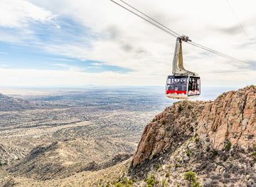
Sandia Peak Tramway
Discover the stunning vistas and exhilarating adventure at Sandia Peak Tramway, a top tourist attraction in Albuquerque, New Mexico.
-
Plaza
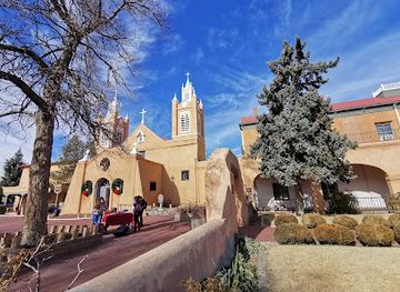
Old Town Plaza
Explore Old Town Plaza in Albuquerque, a cultural hub featuring historic architecture, local shops, and vibrant community events in a charming setting.
Best landmarks in Northeast New Mexico
-
Tourist attraction
Meow Wolf Santa Fe
Experience the wonder of immersive art and storytelling at Meow Wolf Santa Fe, a unique attraction in New Mexico that captivates all ages with its creative magic.
-
Historical landmark
Santa Fe Plaza
Discover the vibrant history and culture of Santa Fe Plaza, a historical landmark that showcases the soul of New Mexico through art, cuisine, and community.
-
Tourist attraction
Sandia Peak Tramway
Explore the breathtaking Sandia Peak Tramway in Albuquerque, New Mexico, where adventure meets stunning natural beauty and unforgettable views.
-
Park
Old Town Plaza
Explore the historical beauty and cultural richness of Old Town Plaza in Albuquerque, a must-visit destination for every traveler.


Explore Northeast New Mexico on the map
Plan your trip on one map. See where the top cities, national parks and sights are, and book hotels and experiences in a few clicks.
Best hotels in Northeast New Mexico
Best restaurants in Northeast New Mexico
Dining in Northeast New Mexico combines northern New Mexican cooking with ranch-country and small-town traditions. Red and green chile are central to many menus, appearing in enchiladas, stews, burritos, carne adovada and breakfast dishes, while blue-corn products, beans, sopapillas and locally influenced variations on American diner food are widely encountered. Las Vegas provides the broadest choice of cafés, family restaurants, bakeries and contemporary dining, while Raton, Springer, Clayton and the mountain communities offer dependable diners, cafés, grills and seasonal restaurants. Rural inns and resort areas often emphasise beef, burgers, trout and hearty plates suited to outdoor travel. Farmers' markets and local shops can be useful for fruit, preserves, baked goods and regional chile products when in season. Menus and opening patterns can be limited in smaller communities, so planning ahead is sensible. Visitors should distinguish New Mexican cuisine from the Tex-Mex traditions found farther east, while recognising that menus vary considerably from one town to another.
-
Mexican
Frontier
Discover Frontier in Albuquerque: A beloved eatery serving delicious Mexican cuisine, breakfast delights, and juicy hamburgers.
-
Seafood
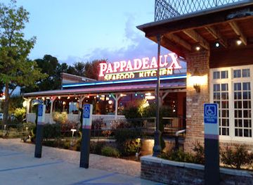
Pappadeaux Seafood Kitchen
Experience authentic Southern-inspired seafood at Pappadeaux Seafood Kitchen in Albuquerque - where fresh flavors meet vibrant hospitality.
-
Southwestern American
El Pinto Restaurant
Experience authentic Southwestern flavors at El Pinto Restaurant in Albuquerque - a culinary delight set against stunning New Mexico scenery.
-
Mexican
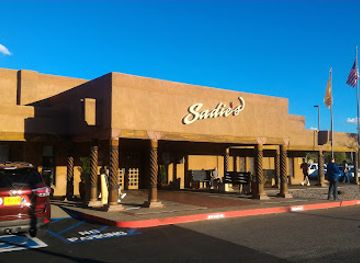
Sadie's of New Mexico
Discover authentic Mexican flavors at Sadie's of New Mexico - where tradition meets taste in Los Ranchos De Albuquerque.


Best bars in Northeast New Mexico
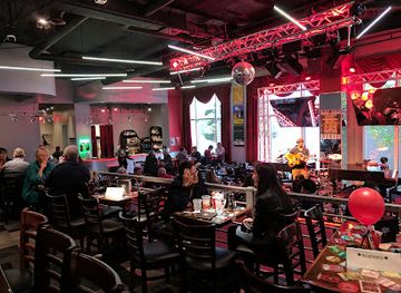
Evening life in Northeast New Mexico is generally centred on historic bars, neighbourhood pubs, restaurants, hotel lounges and live music rather than a large nightclub circuit. Las Vegas has the widest range of places for an evening out, with its historic streets and student population contributing to a more active bar and performance scene than the surrounding towns. Raton and Clayton offer a smaller selection of pubs, lounges and casual venues, while Cimarron, Angel Fire and Red River tend to focus on après-ski settings, resort bars, restaurants and occasional live entertainment. In rural areas, venues may close earlier and distances make driving after drinking especially unwise. Breweries and craft-beverage options exist but are not evenly distributed across the region. Seasonal events and summer tourism can increase evening activity, while winter patterns are strongest in mountain resorts. A quiet night of stargazing, dining or listening to local music is often more characteristic than clubbing.
-
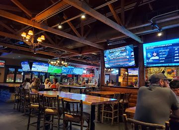
Sports bar
Twin Peaks
Discover Twin Peaks, Albuquerque's ultimate sports bar and American restaurant, where great food meets a vibrant atmosphere for every sports lover.
-
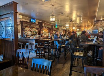
Irish pub
Two Fools Tavern
Discover the vibrant atmosphere and authentic Irish cuisine at Two Fools Tavern, a must-visit pub in Albuquerque's Nob Hill.
-
Grill
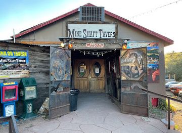
The Mine Shaft Tavern & Cantina
Discover a culinary treasure in Madrid, NM, at The Mine Shaft Tavern & Cantina, where great food meets vibrant live music in a welcoming atmosphere.
-
Bar
Sister
Discover Sister in Albuquerque, a lively bar and restaurant offering delicious food, crafted cocktails, and vibrant live music in a friendly atmosphere.

Best nightclubs in Northeast New Mexico
Evening life in Northeast New Mexico is generally centred on historic bars, neighbourhood pubs, restaurants, hotel lounges and live music rather than a large nightclub circuit. Las Vegas has the widest range of places for an evening out, with its historic streets and student population contributing to a more active bar and performance scene than the surrounding towns. Raton and Clayton offer a smaller selection of pubs, lounges and casual venues, while Cimarron, Angel Fire and Red River tend to focus on après-ski settings, resort bars, restaurants and occasional live entertainment. In rural areas, venues may close earlier and distances make driving after drinking especially unwise. Breweries and craft-beverage options exist but are not evenly distributed across the region. Seasonal events and summer tourism can increase evening activity, while winter patterns are strongest in mountain resorts. A quiet night of stargazing, dining or listening to local music is often more characteristic than clubbing.
-
Bar
Backstage at Revel
Experience the vibrant nightlife of Albuquerque at Backstage at Revel, your ultimate bar destination for great drinks and live music.
-
Night club
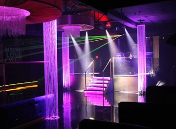
Cake Nightclub
Discover the electrifying nightlife at Cake Nightclub in Albuquerque, where music, dance, and fun come together for an unforgettable experience.
-
Night club
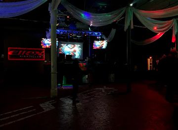
Effex NightClub
Experience the vibrant nightlife at Effex NightClub in Albuquerque, where music, dance, and cocktails create unforgettable nights.
-
Night club
Sidewinders Ranch
Discover the lively atmosphere of Sidewinders Ranch, Albuquerque’s premier gay bar and nightclub, where fun and inclusivity unite for an unforgettable night.

Best shops in Northeast New Mexico
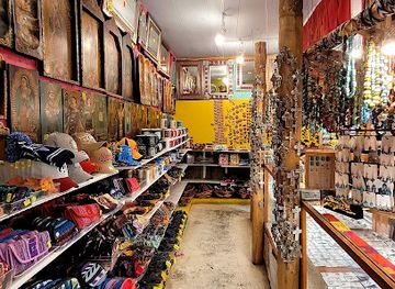
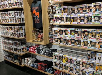
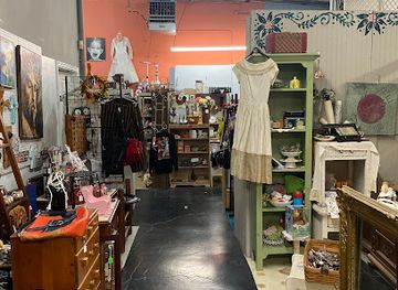
Shopping in Northeast New Mexico is town-centred and practical, with the most varied browsing in Las Vegas, Raton and Clayton. Las Vegas has independent galleries, antique shops, bookshops, vintage goods and locally oriented retailers around its historic districts, while Raton combines everyday services with antiques, art and western-influenced merchandise. Clayton is a useful stop for provisions and regional products when travelling across the eastern plains. Mountain communities such as Angel Fire and Red River focus more on outdoor equipment, resort clothing, souvenirs, galleries and craft goods. Farmers' markets and seasonal roadside sellers may offer chile, preserves, baked goods, honey and other New Mexican produce, although availability changes through the year. Good regional purchases include locally made pottery, woven goods, jewellery, artwork, books on the Santa Fe Trail and food products featuring New Mexican chile. Visitors should favour authorised shops and galleries, particularly when buying Native-made art, and ask about provenance rather than assuming that every southwestern-style item is locally produced.
-
Gift shop
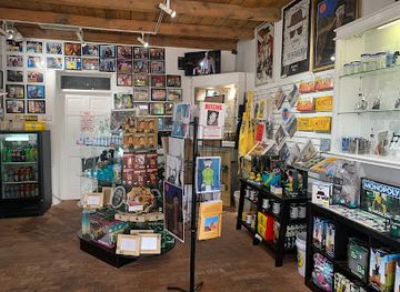
The Breaking Bad Store ABQ
Explore The Breaking Bad Store in Albuquerque - a unique gift shop and museum dedicated to the iconic TV series, featuring exclusive memorabilia and more.
-
Home goods store
Camino 66
Discover authentic southwestern gifts and folk art at Camino 66, a charming home goods store in Albuquerque's historic Old Town.
-
Gift shop
BoxLunch
Explore BoxLunch in Albuquerque for unique gifts and collectibles that celebrate pop culture while making a difference in the community.
-
Antique store
U Neek Findings LLC
Explore U Neek Findings LLC for unique antiques and vintage treasures in Albuquerque, NM—perfect for collectors and casual shoppers alike.
Get your free copy of our complete guide to Northeast New Mexico, delivered straight to you.
Everything on this page, from attractions and restaurants to essentials and local phrases, in one PDF you can read offline, print or share.
Already have an account? Sign in
Your Northeast New Mexico guide is ready.
We'll send it to · Not you? Sign out

Getting your guide ready…
We are putting together a fresh copy of the Northeast New Mexico guide. This can take up to a minute.
This can take a few moments. If your browser asks, choose Allow so the download can start. You'll find the guide in your Downloads folder.
Nothing happened? Download it again
Sorry, the guide is taking longer than usual. Please try again in a minute, or get it by email instead.
Northeast New Mexico essentials
Currency and Payment
Safety
Emergency Situations
Do's and Don'ts
Local Tips
From Eve
Local phrases worth knowing
You don't need to get them perfect. A few words go a long way, and locals appreciate the effort.
Basics
| English | Local | Say it |
|---|---|---|
| Hello | Hola | [OH-lah] |
| Goodbye | Adiós | [ah-DYOS] |
| Yes | Sí | [SEE] |
| No | No | [NO] |
| Please/You're welcome | Por favor/De nada | [por fah-VOR/deh NAH-dah] |
| Thank you | Gracias | [GRAH-syahs] |
| Excuse me/Sorry | Disculpe/Lo siento | [dees-KOOL-peh/loh SYEN-toh] |
| How are you? | ¿Cómo estás? | [KOH-moh es-TAS] |
| Fine. And you? | Bien. ¿Y tú? | [BYEN. ee TOO] |
| Do you speak English? | ¿Hablas inglés? | [AH-blahs een-GLES] |
| I don't understand | No entiendo | [NO en-TYEN-doh] |
Eating & Drinking
| English | Local | Say it |
|---|---|---|
| I'd like to see the menu, please | Me gustaría ver el menú, por favor | [meh goos-tah-REE-ah vehr el meh-NOO, por fah-VOR] |
| I don't eat meat | No como carne | [NO KOH-moh KAR-neh] |
| Cheers! | ¡Salud! | [sah-LOOD] |
| I would like to pay, please | Me gustaría pagar, por favor | [meh goos-tah-REE-ah pah-GAR, por fah-VOR] |
Emergencies
| English | Local | Say it |
|---|---|---|
| Help! | ¡Ayuda! | [ah-YOO-dah] |
| Go away! | ¡Vete! | [VEH-teh] |
| Call the Police! | ¡Llame a la policía! | [YAH-meh ah lah po-lee-SEE-ah] |
| Call a doctor! | ¡Llame a un médico! | [YAH-meh ah oon MEH-dee-koh] |
| I'm lost | Estoy perdido | [es-TOY per-DEE-doh] |
| I'm ill | Estoy enfermo | [es-TOY en-FER-mo] |
Shopping
| English | Local | Say it |
|---|---|---|
| I'd like to buy... | Me gustaría comprar... | [meh goos-tah-REE-ah kom-PRAR] |
| I'm just looking | Solo estoy mirando | [SOH-lo es-TOY mee-RAN-doh] |
| How much is it? | ¿Cuánto cuesta? | [KWAN-toh KWES-tah] |
| That's too expensive | Es demasiado caro | [es deh-mah-SYAH-doh KAH-roh] |
| Can you lower the price? | ¿Puedes bajar el precio? | [PWEH-des bah-HAR el PREH-syo] |
Time & Numbers
| English | Local | Say it |
|---|---|---|
| What time is it? | ¿Qué hora es? | [KEH OH-rah es] |
| It's one o'clock | Es la una | [es lah OO-nah] |
| Half past (10) | Y diez y media | [ee DYESS ee MEH-dyah] |
| Morning | Mañana | [mah-NYAH-nah] |
| Afternoon | Tarde | [TAR-deh] |
| Evening | Noche | [NOH-cheh] |
| Yesterday | Ayer | [ah-YER] |
| Today | Hoy | [OY] |
| Tomorrow | Mañana | [mah-NYAH-nah] |
| 1 | Uno | [OO-no] |
| 2 | Dos | [DOS] |
| 3 | Tres | [TRES] |
| 4 | Cuatro | [KWA-tro] |
| 5 | Cinco | [SEEN-koh] |
| 6 | Seis | [SAYS] |
| 7 | Siete | [SYEH-teh] |
| 8 | Ocho | [OH-choh] |
| 9 | Nueve | [NWEH-beh] |
| 10 | Diez | [DYESS] |
Transport & Directions
| English | Local | Say it |
|---|---|---|
| Where's a/the...? | ¿Dónde está un/una...? | [DON-deh es-TAH oon/OO-nah] |
| What's the address? | ¿Cuál es la dirección? | [KWAL es lah dee-rek-SYON] |
| Can you show me (on the map)? | ¿Puedes mostrarme (en el mapa)? | [PWEH-des mos-TRAR-meh (en el MAH-pah)] |
| When's the next (bus)? | ¿Cuándo es el próximo (autobús)? | [KWAN-doh es el PROK-see-mo (ow-toh-BOOS)] |
| A ticket (to ....) | Un boleto (a ....) | [oon boh-LEH-toh (ah ....)] |
History of Northeast New Mexico
Indigenous Homelands and Ancient Landscapes
Northeast New Mexico lies within a landscape shaped by long Indigenous histories. Apache peoples, including the Jicarilla Apache, have enduring cultural connections with the mountains and plains, while other Native communities travelled, hunted and traded across the wider region. Archaeological evidence across northern New Mexico records earlier settlement and farming traditions, although individual sites must be treated respectfully and not reduced to scenic curiosities. The region's rivers, grasslands, mountain passes and volcanic formations were practical corridors and resources long before the arrival of European powers.
Spanish and Mexican Borderlands
Spanish colonial influence reached the upper Pecos and Mora valleys through settlement, mission activity, ranching and agriculture. Communities developed around water, cultivated valleys and routes linking the Rio Grande settlements with the plains. After Mexican independence in 1821, the area remained part of northern Mexico and participated in regional trade networks. Land-use patterns established in these centuries—including acequia irrigation, village agriculture and pastoralism—continued to influence local communities even as American commercial and military interests expanded westward.
The Santa Fe Trail and Fort Union
The Santa Fe Trail transformed the region during the nineteenth century by connecting Missouri with Santa Fe across the Great Plains and mountain passes. Fort Union, established in 1851 and later expanded, became a major United States military post, supply depot and repair centre near the trail. Its garrison supported military campaigns, protected transport routes and represented federal power in a contested borderland. The ruins at Fort Union National Monument and surviving trail traces near several communities remain among the clearest physical reminders of this era.
The Civil War in New Mexico, 1862
The New Mexico campaign of the American Civil War reached the mountain corridor east of Santa Fe in 1862. The Battle of Glorieta Pass, fought in the wider northeastern New Mexico landscape, halted the Confederate advance towards the territorial capital and forced Confederate troops to withdraw. The campaign affected settlements, supply routes and military installations across the territory. Although the main battlefield sites are not all within the same contemporary tourism subregion, the conflict forms an important part of northeast New Mexico's frontier and transport history.
Land Grants, Ranching and the Maxwell Era
Large land grants and later ranching enterprises reshaped the uplands and valleys during the nineteenth century. The Maxwell Land Grant, one of the largest grants in the region, covered extensive territory around Cimarron and the northern mountains before portions were sold and reorganised. Cattle, sheep, timber and agricultural production became central to the economy, while land ownership generated enduring disputes over access and community rights. The St. James Hotel in Cimarron and historic ranch landscapes help convey this period, though the region's story also includes smaller farmers and Hispano villages.
Railways, Coal and the Growth of Towns
Railway construction in the late nineteenth century shifted commercial power towards towns such as Raton, Las Vegas and Springer. Rail connections accelerated the movement of livestock, coal, timber, passengers and manufactured goods, while depots and hotels stimulated urban growth. Raton's development was closely linked to coal mining and its position near the Colorado border; Las Vegas became a major transport and commercial centre with a distinctive mix of Hispanic, Territorial and Victorian architecture. The railway era left town plans, depots, warehouses and civic buildings that remain visible today.
Twentieth-Century Roads, Tourism and Conservation
Motor travel, improved highways and Route 66 altered the region's relationship with distance during the twentieth century. Communities that had grown around railways adapted to automobile tourism, freight and changing patterns of trade, while ranching remained important across the plains. At the same time, national forests, historic sites and mountain recreation areas gained greater importance as public landscapes. Contemporary Northeast New Mexico therefore combines working ranch country and small-town life with heritage tourism, skiing, hiking, fishing, scenic driving and renewed interest in dark skies and conservation.
Northeast New Mexico in Photos
Browse through our photo collection highlighting the charm and character of the destination.
Neighbouring regions of Northeast New Mexico
The closest regions to Northeast New Mexico, if you have time for more than one.
-

-

-

-

-


Swipe for more regions
Explore more

Explore more of New Mexico
Discover the enchanting blend of rich history, diverse cultures, and stunning landscapes in New Mexico, the Land of Enchantment, where adventure and relaxation await.
Explore New Mexico