

Valles Caldera National Preserve Travel Guide - Free Web & App
Your ultimate guide to Valles Caldera National Preserve. Discover top landmarks, proposed trips, and local tips. Free on the web or via the Evendo companion app.


Valles Caldera National Preserve in New Mexico offers volcanic scenery, elk-filled meadows, hiking, winter trails and high-country landscapes near Los Alamos.
Volcanic Landscapes and High Valleys
Valles Caldera National Preserve occupies a vast volcanic basin in the Jemez Mountains of northern New Mexico. Created by enormous eruptions roughly 1.25 million years ago, the caldera is surrounded by forested volcanic domes and high ridges, with the broad grasslands of Valle Grande forming its most recognisable landscape. Elevations are generally above 2,400 metres, giving the preserve cool summers, snowy winters and fast-changing mountain weather.Read more about Valles Caldera National Preserve
Wildlife and Seasonal Character
Exploring the Preserve
When is the best time to visit Valles Caldera National Preserve?
Best: May–June, September · 19–24°C| Month | High (°C) | Rainfall (mm) |
|---|---|---|
| January | 5 | 35 |
| February | 7 | 30 |
| March | 11 | 35 |
| April | 14 | 25 |
| May (best) | 19 | 25 |
| June (best) | 24 | 35 |
| July | 27 | 70 |
| August | 26 | 80 |
| September (best) | 23 | 50 |
| October | 17 | 35 |
| November | 11 | 30 |
| December | 6 | 35 |
Getting to and around Valles Caldera National Preserve
How to get there
Transportation
Best attractions in Valles Caldera National Preserve
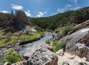
The defining sight of Valles Caldera National Preserve is Valle Grande, a broad mountain meadow occupying part of the ancient volcanic basin and framed by forested ridges and volcanic domes. Redondo Peak rises from the caldera as a prominent resurgent dome, while Cerro Grande and other high slopes offer routes and overlooks shaped by elevation, weather and seasonal access. The East Fork of the Jemez River crosses the preserve, linking grassland and riparian habitat, and the surrounding conifer forests provide opportunities for hiking, wildlife observation and autumn foliage. Elk are a major attraction, particularly in the cooler months, though sightings are never guaranteed. Scenic driving along New Mexico State Route 4 reveals the scale of the volcanic landscape, while permitted trails lead into quieter meadows and uplands. In winter, snow-covered grasslands and forests create opportunities for cross-country skiing or snowshoeing where conditions and current regulations permit.
-
National reserve
Bandelier National Monument
Bandelier National Monument: A breathtaking blend of ancient Puebloan history and stunning New Mexico landscapes awaits your exploration.
-
State park
Fenton Lake State Park
Experience the natural beauty of Fenton Lake State Park, where adventure meets tranquility in the heart of New Mexico's stunning landscapes.
-
Picnic ground
Jemez Falls Picnic Site
Discover the tranquility of Jemez Falls Picnic Site, a beautiful picnic ground nestled in the Jemez Mountains, perfect for relaxation and outdoor fun.
-
National forest
McCauley Warm Springs
Experience relaxation and adventure in the serene embrace of McCauley Warm Springs, a natural wonder in Jemez Springs, New Mexico.


Best landmarks in Valles Caldera National Preserve
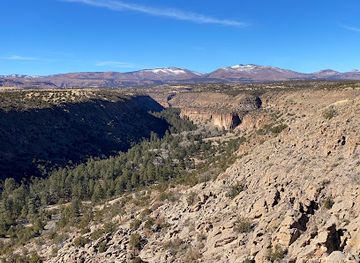
Valles Grande is the preserve's signature natural landmark, an expansive grassland set within the collapsed volcanic structure of the Jemez Mountains. Its enclosing ring of forested volcanic terrain helps visitors understand the scale of the caldera, while Redondo Peak marks the resurgent dome that rose within it after the original collapse. Cerro Grande and the surrounding volcanic domes form additional high points and scenic reference marks, with their appearance changing from summer grassland to autumn colour and winter snow. The East Fork of the Jemez River is an important watercourse and riparian feature, threading through a landscape where meadows, wetlands and forest meet. The preserve's ranch roads, fences and surviving working-landscape features are also significant, expressing the area's more recent history of private ranching and land management rather than monumental architecture.
-
Tourist attraction
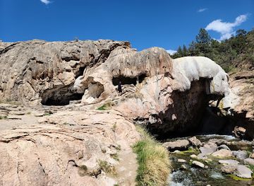
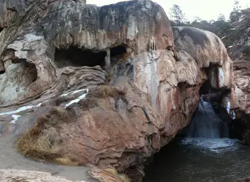
Jemez Soda Dam
Discover the breathtaking beauty of Jemez Soda Dam, a unique natural wonder in the heart of New Mexico's stunning landscapes.
-
Hiking area
Battleship Rock
Explore Battleship Rock in Jemez Springs, NM - A breathtaking hiking area featuring stunning rock formations and serene trails for nature lovers.
-
Visitor center
Valles Caldera Visitor Center
Discover the Valles Caldera Visitor Center, your gateway to the breathtaking landscapes and diverse wildlife of New Mexico's stunning national preserve.
-
Mountain peak
Valles Caldera
Explore Valles Caldera, a breathtaking mountain peak in New Mexico, perfect for hiking, wildlife watching, and enjoying the serene beauty of nature.


Explore Valles Caldera National Preserve on the map
Plan your trip on one map. See where the top attractions, landmarks, restaurants and hotels are, and book hotels and experiences in a few clicks.
Best hotels in Valles Caldera National Preserve
Best restaurants in Valles Caldera National Preserve
Valles Caldera itself has limited dining infrastructure, so visitors generally eat before entering the preserve or return to gateway communities. Los Alamos and White Rock offer the broadest choice of cafés, restaurants and everyday food supplies on the eastern side, while Jemez Springs and other Jemez Valley communities provide smaller-scale options along the western and southern approaches. The regional food culture reflects northern New Mexico's Spanish, Mexican and Pueblo influences, with preparations commonly featuring chile, beans, corn, tortillas and locally used herbs, alongside familiar American café and grill cooking. Visitors may also find regional products through shops, markets or producers in surrounding communities, although opening patterns and seasonal availability vary. Remote outings require self-sufficiency: carry water, food and any picnic supplies needed for the day, and do not rely on finding a meal within the preserve.
-
Grill
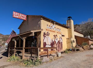
Los Ojos Restaurant & Saloon
Discover authentic New Mexican flavors at Los Ojos Restaurant & Saloon in beautiful Jemez Springs - a must-visit for every traveler.
-
Mediterranean
Pyramid cafe
Discover authentic Mediterranean cuisine at Pyramid Cafe in Los Alamos – where every dish tells a story of flavor and tradition.
-
Pizza
Jemez Mountain Brewhouse
Discover delicious artisan pizzas and local craft brews at Jemez Mountain Brewhouse in scenic Jemez Springs, New Mexico.
-
Takeout Restaurant
Sirphey
Discover Sirphey in Los Alamos - where fusion cuisine meets local charm in an unforgettable takeout experience.


Best bars in Valles Caldera National Preserve
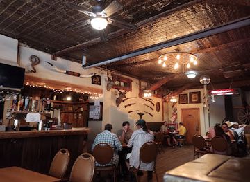
Evening entertainment around Valles Caldera is quiet and community-based rather than centred on nightlife districts or nightclubs. Los Alamos and White Rock have the greatest concentration of restaurants, breweries, bars and occasional cultural programming, while Jemez Springs and the Jemez Valley offer a smaller selection of local hospitality venues and traditional evening gatherings. The preserve itself has no developed nightlife scene, and darkness comes quickly in the high country, making stargazing and the sounds of the meadow more characteristic evening experiences than late-night entertainment. Visitors staying in rural accommodation should expect limited transport after dark and should check current opening arrangements before planning an evening meal. Seasonal events, music and community activities may occur in nearby towns, but they should be treated as locally scheduled rather than guaranteed.
-
Nature preserve
Valles Caldera National Preserve
Explore the breathtaking landscapes and diverse wildlife of Valles Caldera National Preserve in New Mexico's Jemez Mountains.
-
Grill
Los Ojos Restaurant & Saloon
Experience the vibrant spirit of New Mexico at Los Ojos Restaurant & Saloon, where delicious grill dishes meet rustic charm in Jemez Springs.
-
Pub
Pajarito Brewpub and Grill
Experience the unique flavors of Los Alamos at Pajarito Brewpub and Grill, where craft beer meets delicious American cuisine.
-
Tourist attraction
Jemez Soda Dam
Experience the breathtaking beauty of Jemez Soda Dam, a unique natural attraction in New Mexico known for its vibrant mineral springs and stunning rock formations.


Best shops in Valles Caldera National Preserve
Shopping within Valles Caldera is limited, with the preserve primarily offering landscapes and outdoor experiences rather than a retail centre. Visitors should obtain fuel, groceries, maps, outdoor equipment and other necessities in Los Alamos, White Rock, Jemez Springs or another established community before travelling into the caldera. In the surrounding region, independent shops, galleries, markets and local producers may offer New Mexican food products, art, pottery, textiles and other crafts influenced by the area's Spanish, Mexican and Pueblo traditions. Purchases should be made respectfully and with attention to provenance, particularly when buying Indigenous art or cultural goods. There is no extensive shopping district within the preserve, and availability in smaller valley communities can be seasonal or limited, so practical supplies are best arranged before reaching remote access points.
-
Nature preserve
Valles Caldera National Preserve
Discover the stunning beauty and diverse wildlife of Valles Caldera National Preserve, a must-visit nature preserve in New Mexico for outdoor enthusiasts.
-
Grocery store
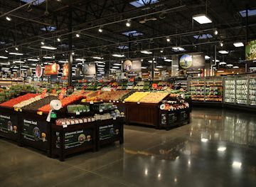
Smith's Marketplace
Explore a vibrant grocery store in Los Alamos offering fresh produce, local delicacies, and a unique shopping experience.
-
Visitor center
Valles Caldera Visitor Center
Explore the breathtaking Valles Caldera Visitor Center, your gateway to stunning landscapes, educational exhibits, and unique local gifts in New Mexico.
-
Shopping mall
Central Shopping Center
Explore the Central Shopping Center in Los Alamos for a unique blend of shopping, dining, and community events.



Get your free copy of our complete guide to Valles Caldera National Preserve, delivered straight to you.
Everything on this page, from attractions and restaurants to essentials and local phrases, in one PDF you can read offline, print or share.
Already have an account? Sign in
Your Valles Caldera National Preserve guide is ready.
We'll send it to · Not you? Sign out

Getting your guide ready…
We are putting together a fresh copy of the Valles Caldera National Preserve guide. This can take up to a minute.
This can take a few moments. If your browser asks, choose Allow so the download can start. You'll find the guide in your Downloads folder.
Nothing happened? Download it again
Sorry, the guide is taking longer than usual. Please try again in a minute, or get it by email instead.
Valles Caldera National Preserve essentials
Currency and Payment
Safety
Emergency Situations
Do's and Don'ts
Local Tips
From Eve
Local phrases worth knowing
You don't need to get them perfect. A few words go a long way, and locals appreciate the effort.
Basics
| English | Local | Say it |
|---|---|---|
| Hello | Hola | [oh-lah] |
| Goodbye | Adiós | [ah-dee-ohs] |
| Yes | Sí | [see] |
| No | No | [noh] |
| Please/You're welcome | Por favor/De nada | [por fah-vor/deh nah-dah] |
| Thank you | Gracias | [grah-see-ahs] |
| Excuse me/Sorry | Perdón/Lo siento | [pair-dohn/loh see-ehn-toh] |
| How are you? | ¿Cómo estás? | [koh-moh ehs-tahs] |
| Fine. And you? | Bien. ¿Y tú? | [byen. ee too] |
| Do you speak English? | ¿Hablas inglés? | [ah-blahs een-glehs] |
| I don't understand | No entiendo | [noh ehn-tee-ehn-doh] |
Eating & Drinking
| English | Local | Say it |
|---|---|---|
| I'd like to see the menu, please | Me gustaría ver el menú, por favor | [meh goo-stah-ree-ah vehr ehl meh-noo, poor fah-vor] |
| I don't eat meat | No como carne | [noh koh-moh kahr-neh] |
| Cheers! | ¡Salud! | [sah-lood] |
| I would like to pay, please | Me gustaría pagar, por favor | [meh goo-stah-ree-ah pah-gahr, poor fah-vor] |
Emergencies
| English | Local | Say it |
|---|---|---|
| Help! | ¡Ayuda! | [ah-yoo-dah] |
| Go away! | ¡Vete! | [veh-teh] |
| Call the Police! | ¡Llama a la Policía! | [yah-mah ah lah poh-lee-see-ah] |
| Call a doctor! | ¡Llama a un doctor! | [yah-mah ah oon dohk-tohr] |
| I'm lost | Estoy perdido | [ehs-toy pair-dee-doh] |
| I'm ill | Estoy enfermo | [ehs-toy ehn-fehr-moh] |
Shopping
| English | Local | Say it |
|---|---|---|
| I'd like to buy... | Me gustaría comprar... | [meh goo-stah-ree-ah kohm-prahr] |
| I'm just looking | Solo estoy mirando | [soh-loh ehs-toy mee-rahn-doh] |
| How much is it? | ¿Cuánto cuesta? | [kwan-toh kwehs-tah] |
| That's too expensive | Esto es demasiado caro | [ehs-toh ehs deh-mah-syah-doh kah-roh] |
| Can you lower the price? | ¿Puedes bajar el precio? | [pweh-dehs bah-hahr ehl pree-syoh] |
Time & Numbers
| English | Local | Say it |
|---|---|---|
| What time is it? | ¿Qué hora es? | [keh oh-rah ehs] |
| It's one o'clock | Es la una en punto | [ehs lah oo-nah ehn poon-toh] |
| Half past (10) | Las diez y media | [lahs dyehs ee meh-dee-ah] |
| Morning | Mañana | [mah-nyah-nah] |
| Afternoon | Tarde | [tahr-deh] |
| Evening | Noche | [noh-cheh] |
| Yesterday | Ayer | [ah-yehr] |
| Today | Hoy | [oy] |
| Tomorrow | Mañana | [mah-nyah-nah] |
| 1 | Uno | [oo-noh] |
| 2 | Dos | [dohs] |
| 3 | Tres | [trehs] |
| 4 | Cuatro | [kwah-troh] |
| 5 | Cinco | [seen-koh] |
| 6 | Seis | [says] |
| 7 | Siete | [see-eh-teh] |
| 8 | Ocho | [oh-choh] |
| 9 | Nueve | [nweh-veh] |
| 10 | Diez | [dyehs] |
Transport & Directions
| English | Local | Say it |
|---|---|---|
| Where's a/the...? | ¿Dónde está...? | [dohn-deh ehs-tah] |
| What's the address? | ¿Cuál es la dirección? | [kwahl ehs lah dee-rehk-syohn] |
| Can you show me (on the map)? | ¿Puedes mostrarme (en el mapa)? | [pweh-dehs mohs-trahr-meh (ehn ehl mah-pah)] |
| When's the next (bus)? | ¿Cuándo es el próximo (autobús)? | [kwan-doh ehs ehl prohk-see-moh (ow-toh-boos)] |
| A ticket (to ....) | Un boleto (a ...) | [oon boh-leh-toh (ah)] |
History of Valles Caldera National Preserve
The Jemez Volcanic Foundation
Valles Caldera was formed by a vast eruption approximately 1.25 million years ago, when the collapse of the volcanic system created a broad caldera in the Jemez Mountains. Later eruptions built volcanic domes around and within the basin, including Redondo Peak, a prominent resurgent dome rising from the caldera floor. The preserve's rounded ridges, open grasslands, forested slopes and volcanic features are therefore products of a long geological sequence rather than a single crater. The Jemez volcanic field remains geologically significant, and its hot springs, lava formations and geothermal activity can be understood as part of the same underlying system.
Indigenous Connections and Early Use
The Jemez Mountains lie within a region with deep Indigenous history, including the ancestral and contemporary traditions of Pueblo communities. Indigenous peoples used the surrounding mountains and valleys for movement, hunting, gathering and other purposes long before the arrival of European colonists. The nearby Jemez Pueblo continues to maintain its cultural identity and community life. Visitors should recognise that archaeological places and culturally important landscapes are not simply recreational resources; sites protected within and around the preserve should not be disturbed, collected from or entered where access is restricted.
Spanish and Mexican Land Tenure
During the Spanish colonial and later Mexican periods, land use in the Jemez region developed through grants, livestock raising, farming and settlement. After the United States acquired New Mexico in the nineteenth century, the legal history of land grants and federal land administration became increasingly important. The Valles Caldera area was ultimately associated with the Baca Location No. 1 land grant, a large tract whose boundaries and ownership history shaped the modern landscape. Ranching, timber use and other extractive activities left a human imprint while the caldera remained a sparsely settled mountain basin.
The Baca Ranch Era
For much of the twentieth century, the land was managed as a private ranch commonly known as the Baca Ranch. Cattle grazing, elk management, forestry and controlled public access formed part of its modern working history. The extraordinary scale of the property and its volcanic scenery attracted conservation interest, particularly as opportunities to protect a major Jemez landscape became more apparent. Historic ranch structures, roads, fences and altered vegetation reflect the interaction between private land management and the preserve's natural systems.
From National Preserve to National Park Service Stewardship
The United States government acquired the Baca Ranch in 2000, creating Valles Caldera National Preserve as a unit of the National Forest System. Management later transferred to the National Park Service in 2015, bringing the preserve into the national park system. Its current history is therefore one of conservation, public access and active stewardship rather than simple preservation without intervention. Managers balance recreation with habitat protection, wildfire planning, watershed care, cultural-resource protection and the continuing realities of a landscape shaped by grazing, roads and changing climate.
Valles Caldera National Preserve in Photos
Browse through our photo collection highlighting the charm and character of the destination.
Cities in Valles Caldera National Preserve
The towns and cities of Valles Caldera National Preserve, and the easiest places to base yourself.

Swipe for more cities
Neighbouring destination travel guides
The closest destinations to Valles Caldera National Preserve, if you have time for more than one.
-

-
-

-

-


Swipe for more destinations
Explore more

Explore more of Jemez Mountains
Explore New Mexico’s Jemez Mountains for volcanic calderas, pine forests, hot springs, Pueblo heritage, hiking and high-country scenery.
Explore Jemez Mountains
Explore more of New Mexico
Discover the enchanting blend of rich history, diverse cultures, and stunning landscapes in New Mexico, the Land of Enchantment, where adventure and relaxation await.
Explore New Mexico