

Padre Island National Seashore Travel Guide - Free Web & App
Your ultimate guide to Padre Island National Seashore. Discover top landmarks, proposed trips, and local tips. Free on the web or via the Evendo companion app.


Padre Island National Seashore, Texas: sea turtles, shorebirds, wild beaches, dunes, camping and quiet Gulf Coast adventure near Corpus Christi.
Barrier Island Wilderness
Padre Island National Seashore protects approximately 70 miles of Padre Island’s Gulf-facing coast in southern Texas, forming one of the longest undeveloped barrier-island shorelines in the world. The park lies south of Corpus Christi and is separated from the mainland by the Laguna Madre, an exceptionally shallow hypersaline lagoon. Together, the Gulf beach, wind-shaped dunes, grasslands, tidal flats and lagoon create a broad coastal landscape that feels markedly different from the developed resort districts farther north on Padre Island.Read more about Padre Island National Seashore
Wildlife and Seasonal Change
Exploring the National Seashore
When is the best time to visit Padre Island National Seashore?
Best: January–March · 20–25°C| Month | High (°C) | Rainfall (mm) |
|---|---|---|
| January (best) | 20 | 41 |
| February (best) | 22 | 46 |
| March (best) | 25 | 51 |
| April | 29 | 56 |
| May | 32 | 61 |
| June | 35 | 66 |
| July | 36 | 71 |
| August | 35 | 76 |
| September | 33 | 81 |
| October | 29 | 86 |
| November | 24 | 92 |
| December | 21 | 97 |
Getting to and around Padre Island National Seashore
How to get there
Transportation
Best attractions in Padre Island National Seashore
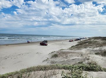
Malaquite Beach and the adjacent visitor centre form the park’s main introduction, combining accessible Gulf shoreline with interpretation about barrier-island ecology and sea-turtle conservation. The beach south of Malaquite extends into a long, lightly developed coastal drive where changing sand and tides create a more remote experience; the distance travelled should always match current conditions and vehicle capability. Bird Island Basin, on the Laguna Madre side, is valued for shallow-water scenery, birdwatching and wind-based watersports when conditions and regulations allow. The lagoon’s tidal flats and grasslands are important feeding areas for migratory birds, while the dunes and foredunes reveal how wind and waves shape the island. Seasonal turtle nesting and hatchling activity can be observed only under conservation guidance. The park’s most rewarding discoveries are often scale-based: a wide horizon, shifting channels, shorebird movement and the contrast between the busy Corpus Christi gateway and the comparatively undeveloped coast within the national seashore.
-
Beach entertainment shop
National seashore
Discover the untouched beauty of Padre Island National Seashore, a Texas coastal gem offering pristine beaches and vibrant wildlife.
Best landmarks in Padre Island National Seashore
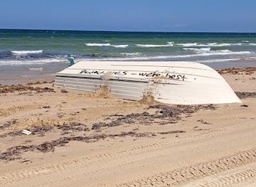
The defining landmark is the undeveloped Gulf shoreline itself, a long meeting point of surf, beach, dunes and open horizon. The foredune ridge and shifting beach demonstrate the island’s continuing response to wind, waves and storms, while the Laguna Madre on the western side is a distinctive shallow lagoon landscape of tidal flats, seagrass and hypersaline water. Malaquite Beach is the best-known developed coastal access point, but its significance lies in how directly it presents the relationship between recreation and protected habitat. Bird Island Basin provides a contrasting lagoon-side setting, associated with wide views across shallow water and coastal grasslands. Sea-turtle nesting beaches are conservation landmarks rather than fixed monuments, and their locations may be protected or temporarily closed. The park’s cultural landmarks are comparatively subtle, found in Indigenous history, maritime traces and the name linked to Padre José Nicolás Ballí.
-
Beach entertainment shop
National seashore
Explore the serene beaches and diverse wildlife of Padre Island National Seashore, a stunning Texas paradise for nature lovers and beach goers.
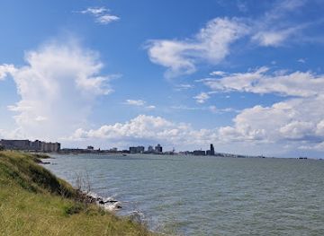
Explore Padre Island National Seashore on the map
Plan your trip on one map. See where the top attractions, landmarks, restaurants and hotels are, and book hotels and experiences in a few clicks.
Best hotels in Padre Island National Seashore
Best shops in Padre Island National Seashore
Shopping within Padre Island National Seashore is limited and should not be confused with the retail areas of nearby Corpus Christi and North Padre Island. Visitors can obtain interpretive material and park-related items at the Malaquite visitor facilities when open, but the seashore is principally a place for landscapes and wildlife rather than commercial browsing. The surrounding gateway areas provide groceries, fuel, beach equipment, fishing supplies, clothing and practical camping provisions. Corpus Christi also offers a wider selection of regional food products, arts and crafts and independently operated shops, while coastal businesses around Padre Island cater to visitors preparing for beach and watersports activities. Buy supplies before travelling into remote sections, and avoid removing shells, plants, archaeological material or other natural objects from the protected area.
-
National reserve
Padre Island National Seashore
Explore the pristine beaches and diverse ecosystems of Padre Island National Seashore, a natural haven along the Texas coast.
-
Beach entertainment shop
National seashore
Discover the natural beauty and adventure of Padre Island National Seashore, Texas' coastal treasure for beach lovers and wildlife enthusiasts.
Get your free copy of our complete guide to Padre Island National Seashore, delivered straight to you.
Everything on this page, from attractions and restaurants to essentials and local phrases, in one PDF you can read offline, print or share.
Already have an account? Sign in
Your Padre Island National Seashore guide is ready.
We'll send it to · Not you? Sign out

Getting your guide ready…
We are putting together a fresh copy of the Padre Island National Seashore guide. This can take up to a minute.
This can take a few moments. If your browser asks, choose Allow so the download can start. You'll find the guide in your Downloads folder.
Nothing happened? Download it again
Sorry, the guide is taking longer than usual. Please try again in a minute, or get it by email instead.
Padre Island National Seashore essentials
Currency and Payment
Safety
Emergency Situations
Do's and Don'ts
Local Tips
From Eve
Local phrases worth knowing
You don't need to get them perfect. A few words go a long way, and locals appreciate the effort.
Basics
| English | Local | Say it |
|---|---|---|
| Hello | Howdy | [haw-dee] |
| Goodbye | See ya | [see yuh] |
| Yes | Yep | [yep] |
| No | Nope | [nohp] |
| Please/You're welcome | Please/No worries | [pleez/noh wur-eez] |
| Thank you | Thanks | [thanks] |
| Excuse me/Sorry | Pardon me/My bad | [par-dun mee/my bad] |
| How are you? | Howdy, how ya doin'? | [haw-dee, how yuh doo-in] |
| Fine. And you? | All good. You? | [awl good. yoo?] |
| Do you speak English? | Ya speak English? | [yah speak ing-glish?] |
| I don't understand | Don't get it | [dohnt get it] |
Eating & Drinking
| English | Local | Say it |
|---|---|---|
| I'd like to see the menu, please | Can I see the menu, please | [kan eye see thee men-yoo, pleez] |
| I don't eat meat | I don't eat meat | [eye dohnt eet meet] |
| Cheers! | Cheers! | [cheers!] |
| I would like to pay, please | Can I pay, please | [kan eye pay, pleez] |
Emergencies
| English | Local | Say it |
|---|---|---|
| Help! | Help! | [help!] |
| Go away! | Get outta here! | [get out-tuh here] |
| Call the Police! | Call the cops! | [call thee cops] |
| Call a doctor! | Get a doc! | [get uh doc] |
| I'm lost | I'm lost | [im lost] |
| I'm ill | I'm not feelin' well | [im not fee-lin well] |
Shopping
| English | Local | Say it |
|---|---|---|
| I'd like to buy... | I wanna buy... | [eye wahn-uh buy] |
| I'm just looking | Just looking | [just look-in] |
| How much is it? | How much does it cost? | [how much duhz it cost] |
| That's too expensive | That's too pricey | [thats too prye-see] |
| Can you lower the price? | Can ya make it cheaper? | [kan yuh make it chee-per] |
Time & Numbers
| English | Local | Say it |
|---|---|---|
| What time is it? | What time is it? | [what time iz it] |
| It's one o'clock | It's one o'clock | [its wun o-clock] |
| Half past (10) | Half past (10) | [haff past (ten)] |
| Morning | Mornin' | [morn-in] |
| Afternoon | Afternoon | [after-noon] |
| Evening | Evenin' | [even-in] |
| Yesterday | Yesterday | [yes-ter-day] |
| Today | Today | [toh-day] |
| Tomorrow | Tomorrow | [toh-mor-row] |
| 1 | One | [wun] |
| 2 | Two | [too] |
| 3 | Three | [three] |
| 4 | Four | [four] |
| 5 | Five | [five] |
| 6 | Six | [six] |
| 7 | Seven | [sev-en] |
| 8 | Eight | [ayt] |
| 9 | Nine | [nine] |
| 10 | Ten | [ten] |
Transport & Directions
| English | Local | Say it |
|---|---|---|
| Where's a/the...? | Where's the...? | [wheres thee] |
| What's the address? | What's the address? | [whats thee ad-dress] |
| Can you show me (on the map)? | Can ya show me (on the map)? | [kan yuh show me (on thee map)] |
| When's the next (bus)? | When's the next (bus)? | [whens thee next (bus)] |
| A ticket (to ....) | A ticket (to ....) | [uh ticket (to)] |
History of Padre Island National Seashore
A Barrier Island Shaped by Sea and Wind
Padre Island is a modern barrier island formed and continually remodelled by waves, currents, wind and storms along the Texas Gulf Coast. Its dunes, beaches, tidal flats and the hypersaline Laguna Madre are part of a shifting coastal system rather than a fixed geological monument. Storms periodically move sand, breach or reshape dunes, and alter access along the shoreline. This constant change helps explain both the island’s ecological variety and the practical need to check current conditions before travelling on its remote beach roads.
Indigenous Coastal Homelands
Before European colonisation, the coast and lagoon supported Indigenous peoples who used the island, bays and nearby mainland for fishing, hunting and gathering. The Karankawa are among the Indigenous communities historically associated with the central and southern Texas coast. Their detailed knowledge of coastal seasons and resources formed part of a long human relationship with an environment that can be difficult to cross and unpredictable in severe weather. Archaeological evidence and historical records provide only an incomplete account of earlier life on the island.
Spanish Missions and Padre Ballí
The island’s name is associated with Padre José Nicolás Ballí, a Roman Catholic priest and landowner active in the lower Texas region during the Spanish and early Mexican periods. Ballí served communities around the Rio Grande and the coastal settlements, and the island became known as Isla de los Misioneros before the name Padre Island prevailed. Spanish and Mexican colonial administration brought new patterns of landholding, livestock keeping and religious influence, although the island itself remained sparsely settled and shaped principally by coastal processes.
Ranching, Fishing and Coastal Use
During the nineteenth and early twentieth centuries, Padre Island was used intermittently for ranching, fishing, hunting and travel along the beach. Its limited freshwater and exposed terrain discouraged dense permanent settlement, while the Laguna Madre supported productive fishing grounds and waterfowl habitat. Shipwrecks and storm losses also form part of the island’s maritime history. Later roads, vehicles and recreational development made more of the coast accessible, increasing pressure on dunes, beaches and nesting wildlife.
National Seashore and Sea-Turtle Conservation
Padre Island National Seashore was established in 1962 to preserve a substantial stretch of the island’s coastal environment and make it available for public enjoyment. As conservation science developed, the park became especially important for protecting Kemp’s ridley sea turtles, the world’s most endangered sea turtle species. Monitoring, nest protection and coordinated releases have become central elements of management, alongside the protection of migratory birds and fragile dune and lagoon habitats. Modern visitors therefore experience a landscape where recreation is closely balanced with active conservation.
Padre Island National Seashore in Photos
Browse through our photo collection highlighting the charm and character of the destination.
Neighbouring destination travel guides
The closest destinations to Padre Island National Seashore, if you have time for more than one.
-

-
-
-

-


Swipe for more destinations
Explore more

Explore more of Rio Grande Valley
Explore the Rio Grande Valley for borderland history, subtropical birdlife, citrus country, South Texas food and Gulf Coast beaches.
Explore Rio Grande Valley
Explore more of Texas
Discover the diverse landscapes, rich history, vibrant cities, and culinary delights of Texas, the Lone Star State, where adventure and culture await at every turn.
Explore Texas