

Free Brownsville Travel Guide & Mobile App
Plan your Brownsville trip with Evendo. Get free guides to top attractions, restaurants, hotels, and bars. Web access or download the mobile app.


Brownsville, Texas blends Rio Grande history, Mexican-American culture, wildlife refuges and Gulf Coast day trips with museums, markets and historic streets.
At the Southern Edge of Texas
Brownsville occupies the southernmost tip of Texas, where the Rio Grande separates the United States from Matamoros, Mexico, and the flat landscape stretches towards the Gulf of Mexico. Its setting gives the city a character distinct from other Texan destinations: Spanish and Mexican influences shape everyday food, festivals, architecture and conversation, while subtropical vegetation and nearby wetlands support an impressive variety of wildlife. The international border is not merely a line on a map but a defining part of Brownsville's history and civic identity.Read more about Brownsville
History in Streets and Battlefields
Culture, Nature and Borderland Life
When is the best time to visit Brownsville?
Best: February–March, November · 23–25°C| Month | High (°C) | Rainfall (mm) |
|---|---|---|
| January | 21 | 30 |
| February (best) | 23 | 30 |
| March (best) | 25 | 30 |
| April | 28 | 30 |
| May | 31 | 40 |
| June | 33 | 51 |
| July | 33 | 50 |
| August | 33 | 50 |
| September | 33 | 80 |
| October | 30 | 70 |
| November (best) | 25 | 40 |
| December | 22 | 30 |
Getting to and around Brownsville
How to get there
Transportation
Best attractions in Brownsville
Brownsville's attractions bring together borderland history, subtropical nature and a strong cultural identity. Historic Downtown offers brick commercial buildings, galleries and museums, while the Historic Brownsville Museum and Brownsville Heritage Museum interpret the city's domestic, military and civic past. The Mitte Cultural District gathers cultural institutions and public gardens around the former Fort Brown area, and the nearby University of Texas Rio Grande Valley campus adds an educational dimension. At Gladys Porter Zoo, paths wind through collections suited to the warm climate, with wildlife and botanical displays appealing to families and nature enthusiasts. Palo Alto Battlefield National Historical Park and Resaca de la Palma Battlefield, both in the Brownsville area, preserve landscapes associated with the opening engagements of the Mexican-American War. Sabal Palm Sanctuary provides a quieter encounter with rare remnants of the lower valley's native habitat, while the city's position near the Gulf makes coastal birding and beach excursions possible beyond the urban area.
-
Tourist attraction
Gladys Porter Zoo
Discover wildlife wonders and conservation efforts at Gladys Porter Zoo in Brownsville, Texas. An educational and fun experience for the whole family.
16 min walk · 1.3 km from city centre
-
Museum
Children's Museum of Brownsville
Explore creativity and learning at the Children's Museum of Brownsville, where interactive exhibits inspire young minds and foster family fun.
5 min drive · 1.6 km from city centre
-
Tourist attraction
Ernesto Gamez Cascade Park
Experience the serenity of Ernesto Gamez Cascade Park in Brownsville, Texas, a perfect blend of nature, recreation, and relaxation for all visitors.
22 min drive · 7.4 km from city centre
-
Tourist attraction
Palo Alto Battlefield National Historical Park
Discover the historical significance of Palo Alto Battlefield National Historical Park in Brownsville, Texas, where the Mexican-American War began.
33 min drive · 13 km from city centre


Best landmarks in Brownsville
Fort Brown is the central historic landmark associated with Brownsville's establishment as a United States settlement after the Mexican-American War, and surviving features help explain the strategic importance of the river frontier. The Stillman House Museum, one of the city's notable historic residences, reflects the domestic and commercial world of nineteenth-century Brownsville, while the Historic Brownsville Museum occupies a former Southern Pacific railway depot and connects the city with the age of rail expansion. Palo Alto Battlefield and Resaca de la Palma Battlefield are protected historic landscapes rather than conventional monuments, preserving the settings of crucial 1846 engagements. In the wider urban landscape, the Rio Grande itself, Fort Brown's grounds and the city's historic brick storefronts express Brownsville's relationship with trade, military movement and neighbouring Matamoros. These places give physical form to a border history shaped by changing nations and communities.
-
Zoo
Gladys Porter Zoo
Explore the captivating wildlife and lush landscapes of Gladys Porter Zoo, a top tourist attraction in Brownsville, Texas, perfect for family adventures.
16 min walk · 1.3 km from city centre
-
Museum
Children's Museum of Brownsville
Explore creativity and learning at the Children's Museum of Brownsville, where interactive exhibits inspire young minds to discover and play.
5 min drive · 1.6 km from city centre
-
Park
Ernesto Gamez Cascade Park
Explore the tranquil beauty of Ernesto Gamez Cascade Park in Brownsville, Texas – a perfect escape for nature lovers and families.
22 min drive · 7.4 km from city centre
-
Historical landmark
Palo Alto Battlefield National Historical Park
Discover the historical significance of Palo Alto Battlefield National Historical Park, an essential site of the Mexican-American War nestled in the heart of Texas.
33 min drive · 13 km from city centre


Explore Brownsville on the map
Plan your Brownsville trip on one map. See where the top attractions, landmarks, restaurants, bars and hotels are, find what's near where you're staying, and book hotels and experiences in a few clicks.
Best hotels in Brownsville
Best restaurants in Brownsville
Brownsville's dining identity is rooted in the lower Rio Grande Valley, where Mexican culinary traditions, Tex-Mex cooking and Gulf Coast ingredients meet. Tacos, enchiladas, tamales, barbacoa and breakfast plates are part of the everyday food culture, while locally familiar dishes often carry techniques and flavours shared across the border with Matamoros. Seafood from the Gulf appears in casual restaurants as well as more contemporary kitchens, and pan dulce, flour tortillas and other Mexican bakery staples are common stops for a quick meal or snack. Independent taquerias, family-run Mexican restaurants, cafés and food counters provide a more useful introduction to local eating than a search for formal fine dining alone. Historic Downtown and neighbourhood commercial strips contain varied options, while markets and seasonal festivals can reveal regional produce, sweets and community cooking traditions. Restaurant practices and menus vary, so asking about house specialities can be worthwhile.
-
Steak
Texas Roadhouse
Experience the best of American cuisine at Texas Roadhouse in Brownsville with hand-cut steaks and vibrant atmosphere.
21 min drive · 6.9 km from city centre
-
Traditional American
Cheddar's Scratch Kitchen
Experience the heart of American comfort food at Cheddar's Scratch Kitchen in Brownsville - where every meal is made from scratch.
17 min drive · 5.8 km from city centre
-
Mexican
Vermillion Restaurant and Watering Hole
Discover the vibrant flavors of Mexican cuisine at Vermillion Restaurant and Watering Hole in Brownsville - where tradition meets taste.
7 min drive · 2.5 km from city centre
-
American
Black Bear Diner Brownsville
Experience the warmth of American dining at Black Bear Diner Brownsville – where hearty meals meet family-friendly vibes.
19 min drive · 6.4 km from city centre


Best bars in Brownsville
Brownsville's evening scene is relatively relaxed, with nightlife concentrated around downtown, university areas and selected commercial districts rather than a single large entertainment quarter. Visitors may find bars serving beer, cocktails and regional conversation, alongside casual venues with live music or patios suited to the warm climate. Cultural programming is also important: performances, exhibitions and festival events in and around the Mitte Cultural District can provide an evening out without centring on alcohol. The city's close relationship with Matamoros contributes to a cross-border social atmosphere, but crossing the international boundary requires the correct documents and attention to current official guidance. Entertainment can be more limited on quieter weeknights than in larger Texas cities, and venues may be dispersed, making a planned taxi, ride service or designated driver sensible when moving between areas after dark.
-
Grill
Cobbleheads
Discover Cobbleheads in Brownsville, a vibrant grill and restaurant offering delicious Texas flavors and a lively atmosphere for every traveler.
15 min drive · 5.1 km from city centre
-
Grill
The Palm Lounge
Discover the vibrant atmosphere and delicious grilled specialties at The Palm Lounge in Brownsville, Texas, a perfect dining spot for all.
5 min walk · 0.4 km from city centre
-
Grill
The Lucky Barrel
Discover the vibrant atmosphere and delicious grilled dishes at The Lucky Barrel, Brownsville's favorite sports bar and grill.
17 min drive · 5.5 km from city centre
-
Bar
The Dive
Experience the vibrant atmosphere of The Dive, a bar and grill in Brownsville, TX, where great pizza meets sports excitement.
21 min drive · 6.9 km from city centre


Best nightclubs in Brownsville
Brownsville's evening scene is relatively relaxed, with nightlife concentrated around downtown, university areas and selected commercial districts rather than a single large entertainment quarter. Visitors may find bars serving beer, cocktails and regional conversation, alongside casual venues with live music or patios suited to the warm climate. Cultural programming is also important: performances, exhibitions and festival events in and around the Mitte Cultural District can provide an evening out without centring on alcohol. The city's close relationship with Matamoros contributes to a cross-border social atmosphere, but crossing the international boundary requires the correct documents and attention to current official guidance. Entertainment can be more limited on quieter weeknights than in larger Texas cities, and venues may be dispersed, making a planned taxi, ride service or designated driver sensible when moving between areas after dark.
-
Lounge
The Kraken Lounge
Experience the vibrant nightlife at The Kraken Lounge in Brownsville, Texas, with creative cocktails and a lively atmosphere.
1 min walk · 0.1 km from city centre
-
Night club
Southwinds Lounge
Discover the vibrant atmosphere of Southwinds Lounge, a premier night club and bar in Brownsville, Texas, perfect for unforgettable nights out.
12 min drive · 3.9 km from city centre
-
Bar
Ibissa Lounge Bar
Experience the vibrant nightlife of Brownsville at Ibissa Lounge Bar, where great music and unique cocktails await you.
21 min drive · 6.9 km from city centre
-
Night club
Mala Suerte
Discover the electrifying nightlife of Mala Suerte in Brownsville, Texas, where music, dance, and fun come together for an unforgettable night out.
12 min drive · 4.1 km from city centre


Best shops in Brownsville
Shopping in Brownsville combines everyday retail with the cross-border character of the lower Rio Grande Valley. Sunrise Mall and surrounding commercial areas provide mainstream shops and services, while Historic Downtown offers independent businesses, galleries and occasional market activity in a setting of older brick buildings. Visitors interested in local products can look for Mexican sweets, pan dulce, regional foodstuffs, woven goods, pottery, leatherwork and festival souvenirs, although selection varies between shops and seasonal events. Flea markets and tiendas can be more useful for browsing practical goods and inexpensive local finds than formal tourist boutiques, while specialist food stores reflect the area's Mexican-American culinary culture. Markets linked to community celebrations, including Charro Days programming, may offer crafts and traditional items, but dates and stalls change. Purchases made across the border involve separate customs and documentation considerations.
-
Shopping mall
Sunrise Mall
Experience shopping, dining, and entertainment all under one roof at Sunrise Mall in Brownsville, Texas – a must-visit for every tourist.
17 min drive · 5.8 km from city centre
-
Shopping mall
Las Tiendas Plaza
Discover Las Tiendas Plaza, the ultimate shopping and dining experience in Brownsville, Texas, perfect for tourists seeking retail therapy and local flavors.
22 min drive · 7.5 km from city centre
-
Clothing store
Ross Dress for Less
Uncover unbeatable deals on clothing, shoes, and home goods at Ross Dress for Less in Brownsville, Texas - the ultimate destination for budget shopping.
3 min walk · 0.2 km from city centre
-
Department store
T.J. Maxx
Explore T.J. Maxx in Brownsville, TX for unbeatable prices on fashion, accessories, and home goods that showcase unique styles.
23 min drive · 7.6 km from city centre


Get your free copy of our complete guide to Brownsville, delivered straight to you.
Everything on this page, from attractions and restaurants to essentials and local phrases, in one PDF you can read offline, print or share.
Already have an account? Sign in
Your Brownsville guide is ready.
We'll send it to · Not you? Sign out

Getting your guide ready…
We are putting together a fresh copy of the Brownsville guide. This can take up to a minute.
This can take a few moments. If your browser asks, choose Allow so the download can start. You'll find the guide in your Downloads folder.
Nothing happened? Download it again
Sorry, the guide is taking longer than usual. Please try again in a minute, or get it by email instead.
Brownsville essentials
Currency and Payment
Safety
Emergency Situations
Do's and Don'ts
Local Tips
From Eve
Local phrases worth knowing
You don't need to get them perfect. A few words go a long way, and locals appreciate the effort.
Basics
| English | Local | Say it |
|---|---|---|
| Hello | Howdy | [haw-dee] |
| Goodbye | Adios | [ah-dee-ohs] |
| Yes | Sí | [see] |
| No | No | [no] |
| Please/You're welcome | Por favor/De nada | [por fah-vor/deh nah-dah] |
| Thank you | Gracias | [grah-see-ahs] |
| Excuse me/Sorry | Disculpe/Lo siento | [dee-skool-peh/loh see-ehn-toh] |
| How are you? | ¿Cómo estás? | [koh-moh ehs-tahs] |
| Fine. And you? | Bien. ¿Y tú? | [byen. ee too] |
| Do you speak English? | ¿Hablas inglés? | [ah-blahs een-glays] |
| I don't understand | No entiendo | [noh ehn-tee-ehn-doh] |
Eating & Drinking
| English | Local | Say it |
|---|---|---|
| I'd like to see the menu, please | Me gustaría ver el menú, por favor | [meh goo-stah-ree-ah vehr ehl meh-noo, por fah-vor] |
| I don't eat meat | No como carne | [noh koh-moh kahr-neh] |
| Cheers! | ¡Salud! | [sah-lood] |
| I would like to pay, please | Me gustaría pagar, por favor | [meh goo-stah-ree-ah pah-gar, por fah-vor] |
Emergencies
| English | Local | Say it |
|---|---|---|
| Help! | ¡Ayuda! | [ah-yoo-dah] |
| Go away! | ¡Vete! | [veh-teh] |
| Call the Police! | ¡Llama a la policía! | [yah-mah ah lah poh-lee-see-ah] |
| Call a doctor! | ¡Llama a un médico! | [yah-mah ah oon meh-dee-koh] |
| I'm lost | Estoy perdido | [ehs-toy pehr-dee-doh] |
| I'm ill | Estoy enfermo | [ehs-toy ehn-fehr-moh] |
Shopping
| English | Local | Say it |
|---|---|---|
| I'd like to buy... | Me gustaría comprar... | [meh goo-stah-ree-ah kohm-prahr...] |
| I'm just looking | Sólo estoy mirando | [soh-loh ehs-toy meer-ahn-doh] |
| How much is it? | ¿Cuánto cuesta? | [kwan-toh kwes-tah] |
| That's too expensive | Eso es demasiado caro | [eh-soh ehs deh-mah-see-ah-doh kah-roh] |
| Can you lower the price? | ¿Puede bajar el precio? | [pweh-deh bah-har ehl pree-syoh] |
Time & Numbers
| English | Local | Say it |
|---|---|---|
| What time is it? | ¿Qué hora es? | [keh oh-rah ehs] |
| It's one o'clock | Es la una en punto | [ehs lah oo-nah ehn poon-toh] |
| Half past (10) | Media hora (10) | [meh-dee-ah oh-rah (deez)] |
| Morning | Mañana | [mah-nyah-nah] |
| Afternoon | Tarde | [tahr-deh] |
| Evening | Noche | [noh-cheh] |
| Yesterday | Ayer | [ah-yehr] |
| Today | Hoy | [oy] |
| Tomorrow | Mañana | [mah-nyah-nah] |
| 1 | Uno | [oo-noh] |
| 2 | Dos | [dohs] |
| 3 | Tres | [trehs] |
| 4 | Cuatro | [kwah-troh] |
| 5 | Cinco | [seen-koh] |
| 6 | Seis | [says] |
| 7 | Siete | [see-eh-teh] |
| 8 | Ocho | [oh-choh] |
| 9 | Nueve | [nweh-veh] |
| 10 | Diez | [dyehs] |
Transport & Directions
| English | Local | Say it |
|---|---|---|
| Where's a/the...? | ¿Dónde está un/el...? | [dohn-deh ehs-tah oon/el] |
| What's the address? | ¿Cuál es la dirección? | [kwal ehs lah dee-rehk-see-ohn] |
| Can you show me (on the map)? | ¿Puedes mostrarme (en el mapa)? | [pweh-dehs mohs-trahr-meh (ehn el mah-pah)] |
| When's the next (bus)? | ¿Cuándo es el próximo (autobús)? | [kwan-doh ehs ehl proh-see-moh (ow-toh-boos)] |
| A ticket (to ....) | Un boleto (a ....) | [oon boh-leh-toh (ah ....)] |
History of Brownsville
Indigenous Valley and Spanish Frontier
Long before the modern city emerged, the lower Rio Grande Valley was inhabited by Indigenous peoples who used its river, resacas and coastal plains for movement and subsistence. Spanish colonial authorities later established missions, ranches and settlements in the broader region, while the river became a shifting frontier between Spanish Texas, independent Mexico and, eventually, the United States. The area's agricultural potential and access to river transport encouraged ranching and trade, but its political identity remained contested through the early nineteenth century. These earlier layers of Indigenous presence, Spanish colonisation and Mexican settlement form the deeper background to Brownsville's later development, even though much of the visible historic city dates from the period after the United States took control of the region.
The Mexican-American War Frontier
Brownsville's immediate origins are closely tied to the Mexican-American War. In May 1846, battles at Palo Alto and Resaca de la Palma, north of the Rio Grande, marked the opening of the conflict in the region. After the war ended with the Treaty of Guadalupe Hidalgo in 1848, the United States established a military presence on the river. Fort Taylor was renamed Fort Brown in honour of Major Jacob Brown, who had died during the fighting, and the settlement that developed around the post became Brownsville. The fort, preserved sites and battlefield landscapes around the city still express how military strategy, shifting borders and the river shaped Brownsville's foundation.
Trade and a Divided Border
During the nineteenth century, Brownsville grew as a commercial and transport centre for the lower Rio Grande Valley. Its economy depended on river traffic, ranching, agriculture and cross-border exchange with Matamoros, whose history remained closely connected to the American town opposite it. The border was repeatedly disrupted by political conflict, including the American Civil War, when Brownsville's position made it strategically important for commerce and military supply. Fort Brown changed hands during the conflict, and the region remained unsettled after the war. The final land battle of the American Civil War took place at Palmito Ranch, east of Brownsville, in May 1865, after Confederate forces had surrendered elsewhere.
Railways, Agriculture and Urban Growth
Rail connections reached Brownsville in the late nineteenth and early twentieth centuries, strengthening its links with the interior of Texas and encouraging larger-scale movement of people, livestock and agricultural produce. Irrigation and farming became increasingly important as the lower valley developed, with citrus, vegetables and other crops joining ranching in the regional economy. Brownsville's commercial core expanded through this period, leaving behind brick storefronts, civic buildings and houses that can still be read in the Historic Downtown area. The city's growth remained inseparable from Matamoros and the Rio Grande: local prosperity depended both on national transport networks and on the everyday movement of goods and communities across the international boundary.
A Modern Borderland City
In the twentieth and twenty-first centuries, Brownsville developed into a bilingual, bicultural city whose identity reflects Mexican-American heritage, cross-border family connections, agriculture, education, logistics and trade. Festivals such as Charro Days Fiesta celebrate the shared cultural world of Brownsville and Matamoros, while conservation work has protected remnants of the valley's subtropical habitat in places such as Sabal Palm Sanctuary. Historic preservation has also expanded, with museums and battlefield parks interpreting military history, domestic life and the city's changing communities. Contemporary Brownsville continues to balance its historic river setting with regional growth, environmental pressures and its role as one of the principal urban centres of the lower Rio Grande Valley.
Brownsville in Photos
Browse through our photo collection highlighting the charm and character of the destination.
Cities near Brownsville
The closest cities to Brownsville, if you have time for more than one stop.
-
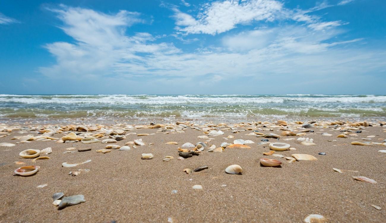 South Padre Island
Discover South Padre Island, Texas: Pristine beaches, thrilling water sports, and vibrant nightlife make it a premier destination for adventure and relaxation.
1 h drive · 40 km from city centre
-

-

-

-


Swipe for more cities
Explore more
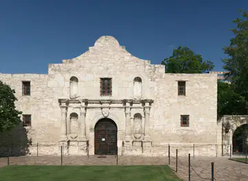
Explore more of Texas
Discover the diverse landscapes, rich history, vibrant cities, and culinary delights of Texas, the Lone Star State, where adventure and culture await at every turn.
Explore Texas