Loch Beg Bridge
An 18th-century stone crossing where Highland engineering meets island heritage and timeless landscape.
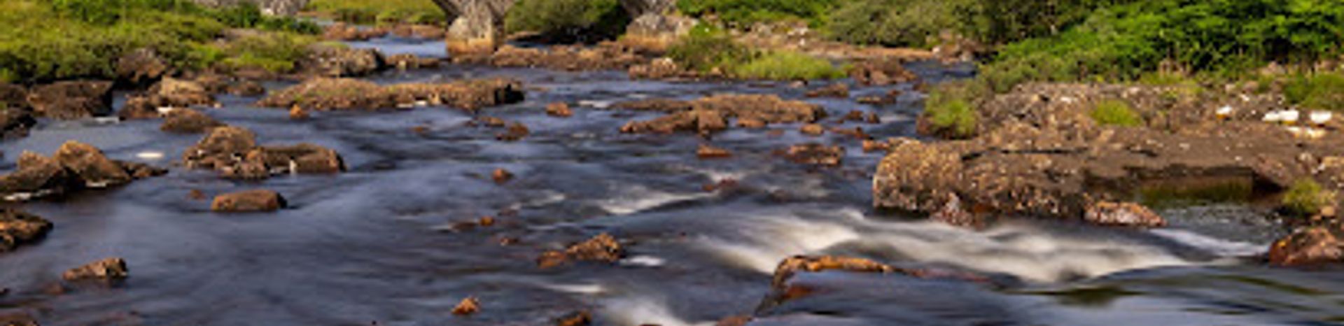
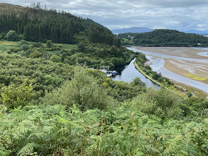
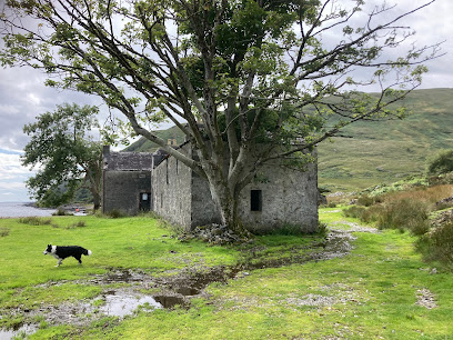
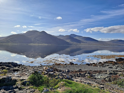
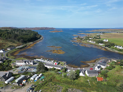
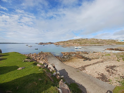
Loch Beg Bridge is an 18th-century stone crossing at Pennyghael on the Isle of Mull, Scotland. This two-arch marvel spans the River Coladoir at the head of Loch Beg and stands as a testament to Scottish Highland engineering and the island's cattle-droving heritage. Today, visitors encounter both the original listed stone structure and a modern concrete bypass, offering a striking contrast between eras of transport infrastructure.
A brief summary to Loch Beg Bridge
- Crossroads, Isle of Mull, Pennyghael, PA70 6HG, GB
- Duration: 0.5 to 2 hours
- Free
-
 Outdoor
- Mobile reception: 3 out of 5
Local tips
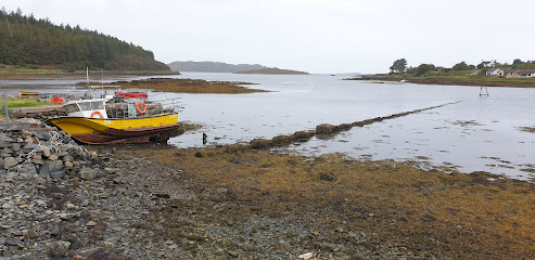
- Visit during clear weather for the best photography. The bridge frames excellent views of Loch Beg and surrounding hills, particularly in golden hour light.
- Allow time to explore both the original stone bridge and the modern bypass. The contrast between the two structures tells the story of Mull's transport evolution.
- The narrow roadway can be challenging for larger vehicles. Drive slowly and with caution, particularly on the winding approaches to the bridge.
- Combine your visit with the scenic drive between Salen and Fionnphort, known locally as the 'slow road,' where the journey itself is as rewarding as the destination.
- Picnic facilities are available nearby. Pack supplies and enjoy a meal while taking in views of Ben More and the surrounding landscape.
For the on-the-go comforts that matter to you
- Picnic Areas
- Seating Areas
- Information Boards
Getting There
-
Car via A849 from Craignure
From Craignure ferry terminal, follow the A849 southwest toward Fionnphort. The journey takes approximately 45–55 minutes covering roughly 35 kilometers. The road winds through moorland and coastal scenery. Loch Beg Bridge is located at Pennyghael, near the head of Loch Beg. The bridge itself has a narrow single-track roadway with passing places; exercise caution, particularly with larger vehicles. No parking fee. Road is open year-round but can be challenging in winter weather.
-
Car via A849 from Tobermory
From Tobermory, take the A848 south toward Salen, then continue on the A849 toward Fionnphort. Total journey time is approximately 60–75 minutes covering roughly 50 kilometers. This route is known locally as the 'slow road' and offers spectacular scenery throughout. Loch Beg Bridge appears as you approach the head of Loch Beg. The narrow roadway requires careful driving. No entrance fee or parking charge. Accessible year-round, though winter conditions may affect road safety.
-
Bus service to nearby stops
Local bus services operate between Craignure, Tobermory, and Fionnphort, with stops near Pennyghael. Journey times vary from 50–90 minutes depending on starting point and service frequency. Services are seasonal and less frequent in winter months. Confirm schedules locally before traveling. The bus stop nearest the bridge requires a short walk to reach the crossing itself.
-
Walking from Pennyghael campsite
Pennyghael campsite is located within walking distance of the bridge. The walk takes approximately 10–15 minutes on relatively level terrain with good ground conditions. A picnic bench is available on the far side of the bridge for rest and views. This option is ideal for those already staying at the campsite or nearby accommodation.
Loch Beg Bridge location weather suitability
-
 Clear Skies
-
 Mild Temperatures
-
 Any Weather
Discover more about Loch Beg Bridge
A Gateway Built on Economic Necessity
Loch Beg Bridge represents far more than a picturesque crossing; it embodies the strategic infrastructure that sustained the Ross of Mull economy for nearly two centuries. Constructed in the 18th century, this stone structure was essential to communities in the parishes of Kilfinichen and Kilvickeon, whose survival depended on reliable access across the River Coladoir. Before the bridge's construction, travelers and livestock drovers faced treacherous fords that Highland storms could render impassable, effectively isolating the southern half of Mull from the rest of the island. The investment in a robust, permanent structure was not a luxury but a primary economic imperative.Engineering Marvel of the Droving Era
The bridge's design reveals the priorities of its time. Its narrow 3.0-meter span—a constraint that puzzled later generations—was deliberately engineered to accommodate livestock herds being driven to market. Droving was a demanding and risky enterprise requiring guaranteed river crossings. A secure, permanent bridge eliminated the delays and potential losses associated with dangerous fords, especially during high water. The narrow gauge is perhaps the most telling feature of the structure, a silent indicator that the dominance of the livestock trade set its design parameters. This sophisticated stone construction solidified the wealth and structure of the 18th-century island economy, making it one of Mull's most historically significant transport achievements.Telford's Shadow and Local Politics
The bridge presents a fascinating historical paradox. Its architectural style and engineering quality closely resemble the work of Thomas Telford, the renowned Scottish civil engineer who was deeply involved in planning road infrastructure on Mull. Yet contemporary accounts confirm that local political issues blocked Telford's official road construction commissions on the island. This means the bridge, which looks and performs like a Telford design, was built in an era when the great engineer's official projects faced obstruction. The structure stands as evidence of how local determination and economic necessity could drive infrastructure development even when grand schemes faltered.Preservation and Modern Bypass
By the second half of the 20th century, the volume and weight of vehicles using the A849 had increased dramatically. The narrow roadway could no longer meet contemporary safety and logistical standards, particularly for larger vehicles navigating the winding bends on either bank. Authorities commissioned a new concrete structure with wider safety verges to bypass the original arch. Fortunately, the historical value of the Old Kinloch Bridge was recognized in time. In 1971, it was formally protected as a Category B Listed Building, ensuring the preservation of this crucial piece of Mull's transport heritage. Today, the site vividly presents two eras of island transport: the modern three-span concrete crossing carrying the main artery, and the original stone bridge standing slightly downstream, bypassed yet preserved.A Photographer's and Naturalist's Haven
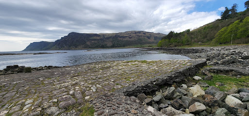
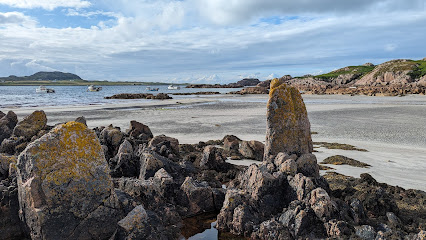
The bridge has become a cherished spot for photographers and nature lovers traveling the scenic route to Fionnphort and the sacred island of Iona. The picturesque crossing at the head of Loch Beg frames views of the surrounding landscape, with lush greenery and loch waters creating a serene backdrop. Many visitors pause here for quiet reflection, capturing images of the arched stone structure set against the Hebridean landscape. The site offers a perfect vantage point for appreciating both the engineering achievement and the natural beauty that characterizes this corner of Mull.Iconic landmarks you can’t miss
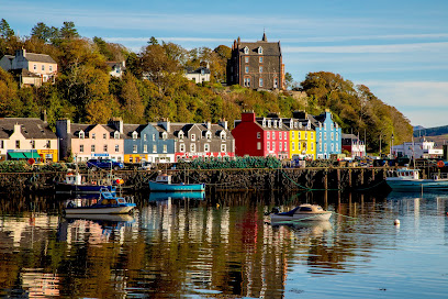
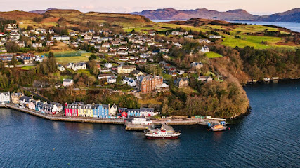
Tobermory Clock Tower
26.4 km
Historic granite clock tower memorializing local heritage, standing proudly by Tobermory’s colourful harbour on the Isle of Mull.
St John's Scottish Episcopal Cathedral : Oban
31.2 km
An unfinished masterpiece where Gothic ambition meets industrial-age engineering in Scotland's most unusual cathedral.
McCaig's Tower & Battery Hill
31.5 km
Explore Oban’s iconic McCaig's Tower, a Colosseum-inspired folly with stunning views and tranquil gardens atop Battery Hill.

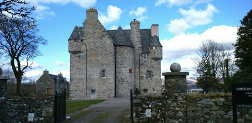
Barcaldine Castle
37.9 km
Experience the haunting beauty and rich history of Barcaldine Castle, a 17th-century Scottish fortress overlooking Loch Creran.
Kilmartin Museum
41.7 km
Discover 12,000 years of history at Kilmartin Museum, where ancient artefacts meet the stunning prehistoric landscape of Kilmartin Glen.
Nether Largie Mid Cairn
41.9 km
Bronze Age burial cairn at the heart of Scotland's most significant prehistoric landscape, carved with rare axehead symbols.
Dunchraigaig Cairn
43.2 km
Explore the ancient Dunchraigaig Cairn, a historical landmark steeped in mystery and surrounded by breathtaking landscapes in Kilmartin Glen.
Tioram Castle
44.8 km
A hauntingly beautiful ruined castle on a tidal island in Loch Moidart, once the seat of Clanranald and the Lords of the Isles.
Knapdale Scottish Beaver Trail
45.2 km
Discover the Knapdale Scottish Beaver Trail, a nature lover's paradise where you can observe beavers in their natural habitat amidst stunning Scottish landscapes.
Wild About Argyll
45.4 km
Explore the stunning landscapes and rich biodiversity of Wild About Argyll, a must-visit destination for nature lovers and adventure seekers in Scotland.
Cairn from Auchoish
49.9 km
Explore the ancient wonders of the Cairn from Auchoish, a historical monument in Lochgilphead, revealing Scotland's rich archaeological heritage.
Ruvaal Lighthouse
51.3 km
Victorian lighthouse guarding the Sound of Islay, designed by the legendary Stevenson engineers in 1859.
Heart of Argyll Tourism Alliance
51.7 km
Explore the Heart of Argyll Tourism Alliance, your essential guide to breathtaking landscapes, rich history, and local culture in Scotland.
Castle Sween
52.9 km
Explore the ancient ruins of Castle Sween, a historical gem in Scotland, offering stunning views and rich stories from centuries past.
Jura
54.1 km
Explore the stunning Isle of Jura, a tranquil Scottish island known for its breathtaking landscapes, abundant wildlife, and exceptional whisky heritage.
Unmissable attractions to see
Stone Head
5.3 km
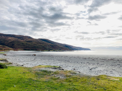
Discover the rugged coastal beauty and ancient mysteries of Stone Head and the Lochbuie Standing Stones on the Isle of Mull.
Isle of Mull
5.6 km
Discover the Isle of Mull’s wild landscapes, rich wildlife, historic castles, and vibrant coastal charm on Scotland’s captivating west coast island.
Glenbyre farm
6.8 km
Experience nature's splendor at Glenbyre Farm on the Isle of Mull, where breathtaking landscapes meet the tranquility of rural life.
Carsaig Pier
7.8 km
Historic 19th-century pier on Mull’s rugged coast, gateway to stunning sea arches and wild coastal trails.
Three Lochs Viewpoint
7.8 km
Breathtaking panoramic views over three serene lochs and Mull’s rugged mountains, a tranquil escape for nature lovers and wildlife watchers.
River Lussa
8.1 km
Discover the tranquil beauty and rugged charm of River Lussa, a serene Highland river winding through the Isle of Mull’s dramatic landscapes.
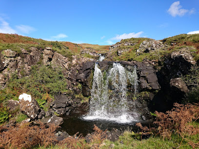
Allt Chreaga Dubha Waterfall
8.1 km
A serene and scenic waterfall nestled in the wild landscapes of the Isle of Mull, perfect for nature lovers and hikers.
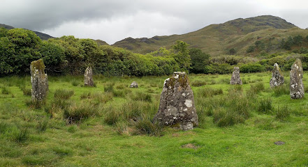
Lochbuie Standing Stones
8.3 km
Discover the Isle of Mull’s only stone circle, a Bronze Age monument aligned with ancient solar events, set beneath the majestic Ben Buie.
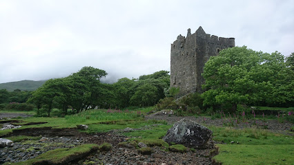
Moy Castle
8.4 km
Explore Moy Castle, a stunning historical gem in Lochbuie, offering rich heritage and breathtaking landscapes perfect for photography and exploration.
Laggan beach
9.3 km
Discover the serene silver sands of Laggan Beach, where stunning wildlife, historic landmarks, and sweeping views of Ben Buie await on the Isle of Mull.
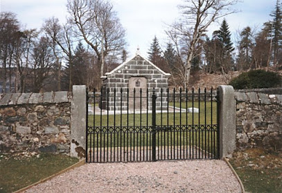
Lochbuie Mausoleum : Isle Of Mull
9.8 km
Historic family mausoleum of the MacLaines of Lochbuie, blending medieval architecture and clan heritage on the tranquil Isle of Mull coast.
Benmore Estate Ltd
9.8 km
Experience luxurious Scottish country living and exclusive outdoor pursuits on the stunning Benmore Estate, Isle of Mull’s premier sporting retreat.
MacQuarie's Mausoleum
10.7 km
A serene Scottish mausoleum honoring Governor Lachlan Macquarie, bridging Scottish heritage and Australian colonial history.
Mackinnon’s Cave
10.9 km
Explore the Isle of Mull’s deepest sea cave, steeped in legend and volcanic geology, where history and myth intertwine along rugged coastal cliffs.
Viewing area
11.9 km
A tranquil viewpoint offering breathtaking panoramas of Loch na Keal and the wild landscapes of the Isle of Mull.
Essential places to dine
The Whitehouse Restaurant
20.4 km
An intimate fine dining haven in Lochaline serving innovative Scottish cuisine with fresh, local, and foraged ingredients in a historic coastal setting.
Ninth Wave Restaurant
24.5 km
Intimate seafood dining in a historic croft on the Isle of Mull, blending local flavors with refined culinary artistry.
The Creel Seafood Bar
25.1 km
Fresh, locally caught seafood served with friendly charm near the ferry to Iona on the scenic Isle of Mull.
Hebridean Lodge
25.6 km
A charming coastal restaurant near Tobermory serving fresh local seafood with stunning island views and warm hospitality.
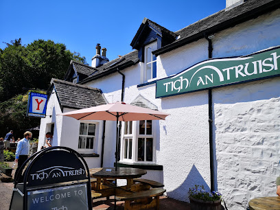
Tigh An Truish
25.6 km
Charming inn and acclaimed restaurant with stunning views of the iconic Clachan Bridge, offering exquisite local cuisine and cozy accommodations.
Macgochans
26.1 km
Waterfront gastropub with stunning bay views, fresh Scottish seafood, and warm Hebridean hospitality.
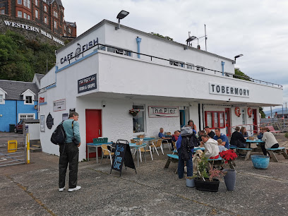
Cafe Fish, Upper Floor, The Pier, Tobermory
26.4 km
Experience Tobermory’s freshest seafood with stunning harbour views at the acclaimed Cafe Fish on the Isle of Mull.
An Cala Ciuin
26.4 km
Traditional Scottish hospitality with harbour views and hearty fare in the heart of Tobermory’s historic Mishnish Hotel.
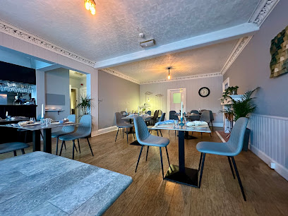
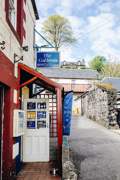
The Galleon Bistro Tobermory
26.4 km
Family-run harbour-side bistro in Tobermory offering fresh local seafood, Scottish classics, and a warm, accessible dining experience on the Isle of Mull.
Spice of Mull
26.4 km
Experience authentic Indian, Bangladeshi, Thai, and Chinese flavors in a cozy Tobermory setting with stunning harbor views.
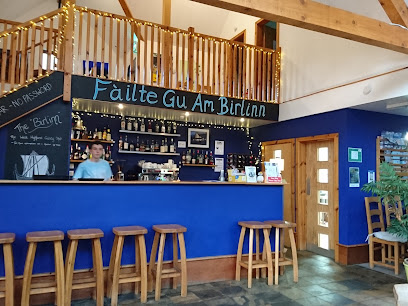
Am Birlinn
27.0 km
Rustic charm meets fresh seafood in a cozy, contemporary setting on the scenic Isle of Mull.
The Barn Bar
30.9 km
A rustic country pub at Cologin offering seasonal Scottish fare, cozy log fires, and lively local music near Oban.
Food From Argyll at the Pier
31.1 km
A vibrant café at Oban’s ferry terminal serving fresh, locally sourced Argyll produce with stunning waterfront views.
EE-USK
31.1 km
Fresh, locally sourced seafood served with panoramic harbor views on Oban’s historic North Pier.
Taste of Argyll Kitchen
31.3 km
Cozy Scottish kitchen in Oban serving fresh, local dishes with a creative touch and warm hospitality.
Markets, malls and hidden boutiques
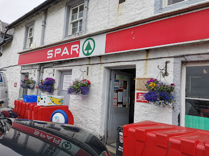
Spar Bunessan
17.7 km
Your friendly local convenience store and post office in Bunessan, Isle of Mull, offering essentials and community connection in a scenic village setting.
Fingal's Cave Gift Shop
17.8 km
Discover unique Hebridean crafts and souvenirs inspired by the legendary Fingal's Cave at this charming Isle of Mull gift shop.
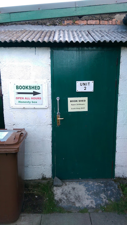
Bookshed
17.8 km
Discover a charming charity bookshop in Bunessan, Isle of Mull, offering diverse second-hand books and supporting local community causes.
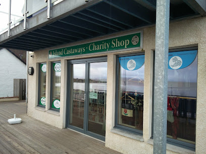
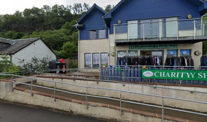
Island Castaways
17.8 km
Discover unique thrift treasures and support local causes at Island Castaways, Mull’s spotless and community-driven charity shop in Craignure.
Craignure SPAR and Post Office
18.9 km
Discover the convenience of Craignure SPAR and Post Office, your one-stop shop for essentials and local delights on the Isle of Mull.
Island Castaways Within An Roth Community Centre
19.0 km
Discover unique preloved treasures and support local causes at Island Castaways, Craignure’s beloved charity shop on the Isle of Mull.
M E S S Charity Shop
19.2 km
Discover unique pre-loved treasures and support local sustainability at M E S S Charity Shop in Craignure’s community hub.
The Ferry Shop
25.0 km
Your essential stop for groceries, island produce, and local services in Fingal on the Isle of Mull.
Fingal Arts & Crafts
25.0 km
A charming craft shop in Fionnphort, showcasing handmade jewellery, textiles, ceramics and art inspired by the wild beauty of the Hebrides and Iona.
Premier
25.6 km
Your friendly local Premier store on Mull’s Main Street, offering groceries, postal services, and community warmth in Dervaig village.

Hasn Candle Company
25.6 km
Discover handcrafted candles inspired by the natural beauty and seasonal scents of the Isle of Mull in Tobermory’s welcoming artisan shop.
Seafare
26.1 km
Tobermory’s trusted chandlery since 1977, offering essential marine safety gear and supplies in the heart of the Isle of Mull’s harbor town.
Trekomory Breeze
26.2 km
Trekomory Breeze offers practical outdoor clothing and accessories in Tobermory, blending local charm with quality gear for every adventurer.
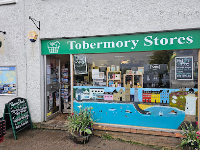
Tobermory Stores
26.3 km
Tobermory Stores offers essential shopping with local charm in the heart of Isle of Mull’s colorful main street.
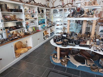
Island Crafts
26.3 km
Discover authentic Isle of Mull artistry and handcrafted treasures in the heart of Tobermory’s vibrant craft scene.
Essential bars & hidden hideouts
Bunessan Inn
17.9 km
Historic Isle of Mull pub and inn offering hearty food, local whiskies, cozy rooms, and stunning loch views in a warm community setting.
Isle of Mull Hotel & Spa
18.8 km
A welcoming coastal retreat on the Isle of Mull, blending scenic views, spa relaxation, and warm Scottish hospitality.
Craignure Inn
19.1 km
A cozy, dog-friendly pub and inn in Craignure offering hearty fare, comfortable rooms, and a warm welcome on the Isle of Mull.
The Oyster Bar
22.9 km
A charming seafood haven in historic Ellenabeich, offering fresh oysters, scenic coastal views, and warm Scottish hospitality.
The Keel Row
24.9 km
Cozy pub and restaurant in Fionnphort offering hearty Scottish dishes, scenic bay views, and a warm, welcoming atmosphere on the Isle of Mull.
Snack Bar
25.1 km
Experience the charm of the Isle of Mull at the Snack Bar, where delightful bites and stunning views create unforgettable memories.
The Tobermory Hotel
26.3 km
Historic boutique hotel with stunning Tobermory Bay views, local cuisine, and warm Highland hospitality on the Isle of Mull’s vibrant waterfront.
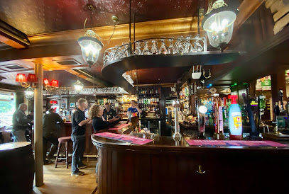
Mishnish
26.4 km
A traditional Scottish hotel and bar in Tobermory, famed for cosy harbour views, live folk music, and warm island hospitality.
Western Isles Hotel
26.5 km
Historic hotel with breathtaking Tobermory Bay views, classic charm, and warm hospitality on the scenic Isle of Mull.
Auld Mull Bar
26.5 km
Experience warm island hospitality and local flavors at Auld Mull Bar, a cozy family-run retreat in Tobermory’s charming harbor village.
Markie Dans
31.2 km
Family-run pub in Oban offering vast single malts, hearty food, live music, and stunning bay views in a welcoming, lively atmosphere.
Cellar Bar
31.2 km
Cozy and traditional Scottish pub on Oban’s waterfront, famed for local whiskies, live music, and warm hospitality.
The Tartan Tavern
31.2 km
Experience authentic Scottish hospitality and traditional charm at The Tartan Tavern, a cozy and lively pub in the heart of Oban.
Lorne Bar
31.4 km
Experience authentic Scottish hospitality, fresh local seafood, and a warm, welcoming atmosphere in the heart of Oban at The Lorne Bar.
Colonsay Pub
38.2 km
Experience authentic island hospitality and local brews at Colonsay Pub, the vibrant social hub of the Isle of Colonsay.
Nightclubs & after hour spots
Jura Brewery
60.8 km
Discover Jura Brewery: A Craft Beer Experience in the Heart of the Isle of Jura, Where Tradition Meets Nature's Bounty.
Roobarb
71.0 km
Experience Fort William’s vibrant nightlife at Roobarb, the welcoming nightclub where music and dancing light up weekend nights.
The Islay Hotel
85.6 km
Experience the charm of The Islay Hotel, where comfort meets local culture on the beautiful Isle of Islay.
Word Up
89.8 km
Experience Greenock's revitalized nightlife at Word Up, a modern nightclub with vibrant energy and a welcoming atmosphere.

Red
90.4 km
Experience Greenock’s vibrant nightlife at Red Nightclub, where intimate vibes meet lively dance floors and affordable fun every weekend.
Great Scotts Bar
94.6 km
Experience the perfect blend of stunning loch views and a vibrant bar atmosphere at Great Scots Bar, your ideal retreat in Loch Lomond.
The Tavern
94.6 km
Discover The Tavern, a charming bar by Loch Lomond, perfect for unwinding with drinks amidst stunning natural beauty.
Gabbro Bar
94.7 km
Experience the cozy charm of Gabbro Bar in Broadford, Isle of Skye, with a delightful selection of drinks in a welcoming atmosphere.
The Lobby Bar
94.7 km
Discover the perfect blend of relaxation and local charm at The Lobby Bar, nestled by the scenic shores of Loch Lomond.
Queen Of The Loch
96.2 km
A charming family and dog-friendly pub and lodge on Loch Lomond’s banks, serving hearty British classics in a warm, scenic setting.
Desire Nightclub
96.4 km
Experience Balloch’s vibrant nightlife at Desire Nightclub, where energetic music and welcoming vibes create unforgettable evenings.
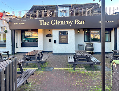
Glenroy Bar
96.5 km
Experience the friendly ambiance and local flavors at Glenroy Bar, your perfect retreat in Balloch, Scotland.
Monkey Island Cafe Bar
96.5 km
Discover the serene beauty and delightful refreshments at Monkey Island Cafe Bar, the perfect riverside retreat in Balloch.
Dog House
96.7 km
Experience the vibrant nightlife at The Dog House, a welcoming pub in Balloch with great drinks and lively entertainment, perfect for tourists.
The King Haakon Bar
99.3 km
Experience authentic Scottish hospitality at The King Haakon Bar on the Isle of Skye, where local ales and hearty meals await in a cozy atmosphere.
For the vibe & atmosphere seeker
- Scenic
- Tranquil
- Unique
- Adventurous
For the design and aesthetic lover
- Historic
- Rustic Designs
For the architecture buff
- Historic
- Landmarks
- Heritage Neighborhoods
For the view chaser and sunset hunter
- Iconic Views
- Panoramas
- Waterfront
For the social media creator & influencer
- Instagrammable
- Photo Spots
- Architectural Shots
For the eco-conscious traveler
- Protected Area
- Low Impact
- Locally Managed
For the kind of experience you’re after
- Cultural Heritage
- Photowalk
- Myth & Legends
- Day Trip
For how adventurous you want the journey to be
- Easy Access
- Requires Hike
Location Audience
- Family Friendly
- Solo Friendly
- Couple Friendly
- Senior Friendly
- Photographer Friendly


