

The Broads Travel Guide - Free Web & App
Your ultimate guide to The Broads. Discover top landmarks, proposed trips, and local tips. Free on the web or via the Evendo companion app.


The Broads, United Kingdom: explore tranquil waterways, reedbeds, villages, wildlife, windmills and boating routes across Norfolk and Suffolk by boat or on foot.
Water, Reedbeds and Open Skies
The Broads form one of the United Kingdom’s most distinctive lowland landscapes, a network of rivers, lakes, marshes and drainage dykes spread across parts of Norfolk and Suffolk. Although the waterways look natural, many of the broads were created by medieval peat extraction; after the peat workings flooded, they became connected to the region’s river system and gradually developed into the wetland landscape seen today. The Broads Authority manages the national park, whose waterways include sections of the rivers Bure, Ant, Thurne, Yare and Waveney.Read more about The Broads
Exploring the National Park
Wildlife, Heritage and Local Life
When is the best time to visit The Broads?
Best: June–August · 19–22°C| Month | High (°C) | Rainfall (mm) |
|---|---|---|
| January | 7 | 50 |
| February | 7 | 45 |
| March | 9 | 41 |
| April | 12 | 36 |
| May | 16 | 31 |
| June (best) | 19 | 25 |
| July (best) | 22 | 20 |
| August (best) | 22 | 26 |
| September | 18 | 31 |
| October | 14 | 36 |
| November | 10 | 41 |
| December | 8 | 45 |
Getting to and around The Broads
How to get there
Transportation
Best attractions in The Broads
The Broads’ attractions are distributed across a broad network of waterways rather than concentrated in one centre. Wroxham and Hoveton provide a lively gateway to the northern rivers and boating country, while the villages of Horning and Ranworth offer access to reed-fringed channels and broad water. Hickling Broad is valued for its extensive wetland scenery and wildlife, and nearby Horsey is known for its windpump and seasonal seal-watching access on the coast beyond the inland waterways. Barton Broad, linked to the River Ant, combines open water with village and marsh landscapes, while the River Thurne leads towards distinctive windmills and the wide horizons around Hickling and Horsey. In the south, Beccles and the River Waveney provide a different character, with riverside walks, boatyards and connections towards Oulton Broad and Lowestoft. Nature reserves, churches, drainage mills, footpaths and quiet lanes make the Broads rewarding to explore at a slower pace.
-
National park
The Broads National Park
Explore England’s enchanting Broads National Park, a vast man-made wetland of serene waterways, rare wildlife, and rich cultural heritage.
-
Shopping Centre
Castle Quarter
Castle Quarter: A vibrant five-level shopping and leisure centre in Norwich with shops, dining, cinema, and entertainment for all ages.
-
Aquarium
SEA LIFE Great Yarmouth
Dive into the vibrant marine world of SEA LIFE Great Yarmouth, where sharks, penguins, and interactive exhibits await on the Norfolk coast.
-
Department store
Jarrolds
Historic family-owned department store in Norwich blending Edwardian charm with modern British retail and local community spirit.


Best landmarks in The Broads
The defining landmarks of the Broads are often practical structures and natural features rather than grand monuments. Horsey Windpump is one of the area’s best-known drainage mills, representing the engineering that helped manage the marshes, while the windmills around Thurne and Halvergate reinforce the distinctive skyline of the lowlands. Hickling Broad, Barton Broad and the open water of Breydon Water are major landscape landmarks, each revealing a different relationship between rivers, reedbeds, grazing marsh and tidal influence. The River Bure, River Ant, River Yare, River Thurne and River Waveney provide the geographical framework of the national park. Riverside churches, drainage structures, boatyards and historic villages add a human dimension, showing how settlement, navigation, agriculture and water management have shaped the region. Together, these features express the Broads’ identity as a working wetland and navigable cultural landscape.
-
Castle
Burgh Castle
One of Britain’s best-preserved Roman forts, standing above the Norfolk Broads with sweeping views over Breydon Water and the surrounding marshes.
-
Historical landmark
Pull's Ferry
A tranquil 15th-century watergate and ferry house on Norwich’s River Wensum, blending rich medieval history with scenic riverside charm.
-
Monument
Nelson's Monument
A towering Doric column in Great Yarmouth honouring Admiral Nelson with panoramic views from its historic viewing platform.
-
Historical landmark
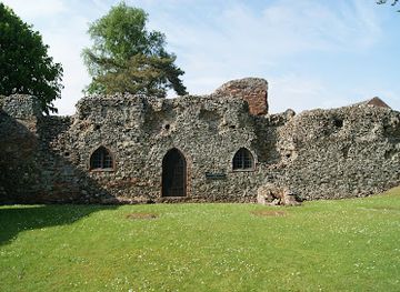
St Olave's Priory
Medieval brick undercroft and Augustinian priory ruins in peaceful Norfolk countryside, free to explore year-round.


Explore The Broads on the map
Plan your trip on one map. See where the top attractions, landmarks, restaurants and hotels are, and book hotels and experiences in a few clicks.
Best hotels in The Broads
Best restaurants in The Broads
Dining in the Broads is closely tied to its villages, boatyards and gateway towns rather than to isolated stretches of marsh. Waterside pubs and traditional inns are especially characteristic, serving familiar British food alongside local ales and seasonal dishes, while cafés in places such as Wroxham, Hoveton, Beccles and Great Yarmouth provide practical stops for walkers, cyclists and boat crews. Norfolk’s wider food identity includes locally grown vegetables, breads, cheeses, meats and seafood from the nearby coast, although menus vary between establishments. Farm shops and village shops can be useful for provisions when staying on a boat or in self-catering accommodation, but they are not evenly distributed across the waterways. In remote areas, plan meals before setting out and distinguish between a village with regular food service and a small settlement with limited facilities.
-
Restaurant
Acle Bridge Inn
Historic riverside pub offering hearty British fare, warm hospitality, and family-friendly charm on the scenic Norfolk Broads.
-
Restaurant
Rising Sun Coltishall
Charming riverside pub and inn in Coltishall serving hearty British fare with warm hospitality and scenic Norfolk Broads views.
-
Restaurant
The Boathouse | Restaurant | Wedding Venue | Pub | Accommodation
Charming waterside restaurant, accommodation, and wedding venue offering fresh local cuisine and stunning views on Ormesby Broad.
-
Restaurant
Kings Arms
A traditional village pub in Ludham offering hearty home-cooked meals, local ales, and a welcoming atmosphere for families and dog lovers alike.


Best bars in The Broads
Evenings in the Broads are generally quiet and sociable rather than centred on nightlife districts. Village pubs and waterside inns in settlements such as Horning, Wroxham, Beccles and surrounding villages provide the most characteristic evening settings, with a mixture of local residents, boat crews and visitors during the boating season. Larger choices are available in Norwich, Great Yarmouth and Lowestoft, which lie around the national park rather than forming part of its rural core and offer a broader selection of pubs, bars, theatres and clubs. On the waterways, the atmosphere often depends on the season, weather and individual venue, so visitors should not assume late opening or regular live entertainment. Quiet evenings may instead involve riverside walks, observing sunset over the marshes or returning to a rural inn or self-catering base.
-
Pub
Acle Bridge Inn
Historic riverside pub on the Norfolk Broads offering hearty home-cooked food, family-friendly spaces, and welcoming hospitality all year round.
-
Pub
Rising Sun Coltishall
Charming riverside pub and inn in Coltishall offering wood-fired pizzas, cozy rooms, and warm Norfolk hospitality.
-
Pub
The William Adams
A vibrant coastal pub honoring Gorleston’s lifesaving hero with great food, real ales, and a welcoming community vibe.
-
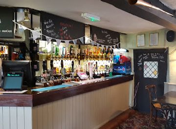
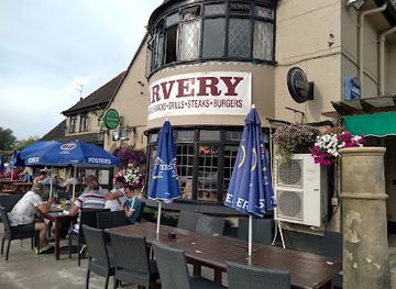
Pub
The Ferry Inn of Horning
A charming riverside pub on the Norfolk Broads offering hearty meals, scenic views, and warm hospitality in Horning.


Best nightclubs in The Broads
Evenings in the Broads are generally quiet and sociable rather than centred on nightlife districts. Village pubs and waterside inns in settlements such as Horning, Wroxham, Beccles and surrounding villages provide the most characteristic evening settings, with a mixture of local residents, boat crews and visitors during the boating season. Larger choices are available in Norwich, Great Yarmouth and Lowestoft, which lie around the national park rather than forming part of its rural core and offer a broader selection of pubs, bars, theatres and clubs. On the waterways, the atmosphere often depends on the season, weather and individual venue, so visitors should not assume late opening or regular live entertainment. Quiet evenings may instead involve riverside walks, observing sunset over the marshes or returning to a rural inn or self-catering base.
-
Nightclub
Popworld - Norwich
Norwich’s vibrant late-night hotspot for pop hits, friendly vibes, and unforgettable party nights on Prince of Wales Road.
-
Night Club
Loft Nightclub
Norwich’s vibrant gay nightclub with over 30 years of inclusive nightlife, music, and community spirit in the heart of the city.
-
Nightclub
Fluke
Experience Norwich’s vibrant nightlife at Fluke, where great music, affordable drinks, and a lively crowd come together for unforgettable nights.
-
Club
The Bermuda Club
A welcoming nightclub and bar in Hemsby offering lively evenings, family-friendly nights, and affordable drinks near Norfolk’s scenic coast.


Best shops in The Broads
Shopping in the Broads is modest and locally focused, with the greatest choice in gateway settlements such as Wroxham, Hoveton, Beccles, Great Yarmouth and Lowestoft. Visitors can find provisions for boating and self-catering stays, outdoor clothing, maps, gifts, books and practical equipment, while village shops and farm shops offer selected local foods where available. The region’s most characteristic purchases are connected with Norfolk and Suffolk food production, independent art, craft and the boating tradition rather than a large-scale retail scene. Some boatyards and visitor businesses stock souvenirs and waterway-related goods, but facilities become sparse away from the main hubs. Markets and seasonal events may provide additional opportunities, although they are not permanent features at every settlement. Plan substantial shopping before heading into remote marshland areas or onto a longer cruising route.
-
Department store
Lathams of Potter Heigham
Norfolk Broads’ largest discount superstore and pet shop with extensive shopping, fishing tackle, garden centre, and artisan café.
-
Shopping Centre
Market Gates Shopping Centre (Great Yarmouth)
A vibrant indoor shopping destination in Great Yarmouth offering diverse shops, eateries, and a secure, accessible environment for all visitors.
-
Department store
Roys of Wroxham Department store
Discover Norfolk’s beloved independent department store blending heritage charm with a vast array of goods and festive magic in Wroxham.
-
Tea room
A Piece Of Cake
Cozy tea room and bakery in Coltishall, serving fresh cakes, hearty breakfasts, and traditional British fare in a charming riverside village setting.


Get your free copy of our complete guide to The Broads, delivered straight to you.
Everything on this page, from attractions and restaurants to essentials and local phrases, in one PDF you can read offline, print or share.
Already have an account? Sign in
Your The Broads guide is ready.
We'll send it to · Not you? Sign out

Getting your guide ready…
We are putting together a fresh copy of the The Broads guide. This can take up to a minute.
This can take a few moments. If your browser asks, choose Allow so the download can start. You'll find the guide in your Downloads folder.
Nothing happened? Download it again
Sorry, the guide is taking longer than usual. Please try again in a minute, or get it by email instead.
The Broads essentials
Currency and Payment
Safety
Emergency Situations
Do's and Don'ts
Local Tips
From Eve
Local phrases worth knowing
You don't need to get them perfect. A few words go a long way, and locals appreciate the effort.
Basics
| English | Local | Say it |
|---|---|---|
| Hello | Hiya | [hɪjə] |
| Goodbye | Ta-ra | [tɑːrɑː] |
| Yes | Yup | [jʌp] |
| No | Nah | [nɑː] |
| Please/You're welcome | Please | [pliːz] |
| Thank you | Cheers | [tʃɪəz] |
| Excuse me/Sorry | Sorry | [sɒri] |
| How are you? | How’s it going? | [haʊz ɪt ˈɡəʊɪŋ] |
| Fine. And you? | Reet. An' you? | [riːt. ənd juː] |
| Do you speak English? | Do ya speak English? | [də jə spiːk ˈɪŋɡlɪʃ] |
| I don't understand | I don’t get it | [aɪ dəʊnt ɡɛt ɪt] |
Eating & Drinking
| English | Local | Say it |
|---|---|---|
| I'd like to see the menu, please | Can I see the menu, please? | [kən aɪ siː ðə ˈmɛnjuː pliːz] |
| I don't eat meat | I don’t eat meat | [aɪ dəʊnt iːt miːt] |
| Cheers! | Cheers! | [tʃɪəz] |
| I would like to pay, please | Can I pay, please? | [kən aɪ peɪ pliːz] |
Emergencies
| English | Local | Say it |
|---|---|---|
| Help! | Help! | [hɛlp] |
| Go away! | Clear off! | [klɪə ɔːf] |
| Call the Police! | Ring the coppers! | [rɪŋ ðə ˈkɒpəz] |
| Call a doctor! | Get a doc! | [ɡɛt ə dɒk] |
| I'm lost | I’m lost | [aɪm lɒst] |
| I'm ill | I’m feeling poorly | [aɪm ˈfiːlɪŋ ˈpʊəli] |
Shopping
| English | Local | Say it |
|---|---|---|
| I'd like to buy... | I’d like to buy... | [aɪd laɪk tə baɪ] |
| I'm just looking | Just looking, ta | [dʒʌst ˈlʊkɪŋ, tɑː] |
| How much is it? | How much's this? | [haʊ mʌtʃz ðɪs] |
| That's too expensive | That’s a bit pricey | [ðæts ə bɪt ˈpraɪsi] |
| Can you lower the price? | Can you knock it down? | [kən jə nɒk ɪt daʊn] |
Time & Numbers
| English | Local | Say it |
|---|---|---|
| What time is it? | What time is it? | [wɒt taɪm ɪz ɪt] |
| It's one o'clock | It's one o'clock | [ɪts wʌn əˈklɒk] |
| Half past (10) | Half past ten | [hɑːf pɑːst tɛn] |
| Morning | Mornin' | [ˈmɔːnɪn] |
| Afternoon | Aft'noon | [æftəˈnuːn] |
| Evening | Eve'nin' | [ˈiːvnɪn] |
| Yesterday | Yest'day | [ˈjɛstdeɪ] |
| Today | Today | [təˈdeɪ] |
| Tomorrow | Tomorrah | [təˈmɒrə] |
| 1 | One | [wʌn] |
| 2 | Two | [tuː] |
| 3 | Three | [θriː] |
| 4 | Four | [fɔː] |
| 5 | Five | [faɪv] |
| 6 | Six | [sɪks] |
| 7 | Seven | [ˈsɛvən] |
| 8 | Eight | [eɪt] |
| 9 | Nine | [naɪn] |
| 10 | Ten | [tɛn] |
Transport & Directions
| English | Local | Say it |
|---|---|---|
| Where's a/the...? | Where's the...? | [wɛrz ðə] |
| What's the address? | What’s the address? | [wɒts ðə əˈdrɛs] |
| Can you show me (on the map)? | Can ya show me on the map? | [kən jə ʃoʊ mi ɒn ðə mæp] |
| When's the next (bus)? | When's the next bus? | [wɛn z ðə nɛkst bʌs] |
| A ticket (to ....) | A ticket to... | [ə ˈtɪkɪt tə] |
History of The Broads
A Landscape Shaped by Peat Cutting
The Broads are largely the legacy of medieval peat extraction. Peat was dug from low-lying ground for fuel, leaving excavated areas that later filled with water as drainage patterns and water levels changed. Over time, these flooded workings became broads and joined the rivers and dykes of the marshes. Their apparently natural appearance therefore conceals a long history of human engineering and resource use. The wetland habitats that developed around them were influenced by grazing, reed cutting, drainage and changing river conditions, creating the open mosaic of water, reedbed, fen and meadow that defines much of the region today.
Medieval Marshes and River Communities
For centuries, communities along the Bure, Yare, Waveney, Ant and Thurne depended on the waterways for transport, fishing, agriculture and the movement of fuel and goods. Churches, drainage mills and settlements grew within a landscape where marshes had to be managed continually. Reed and sedge were harvested for thatching and other practical uses, while grazing livestock helped maintain open grassland. The rivers connected inland villages with the ports of Great Yarmouth and Lowestoft, linking the Broads to wider coastal and commercial networks without turning the area into a densely built region.
Drainage, Windmills and Navigation
Windmills became defining features of the Broads from the eighteenth and nineteenth centuries, serving as drainage pumps that moved water from marshes into the rivers. Some survive as prominent landmarks, including Horsey Windpump and the mills around the Thurne and Halvergate areas. Improvements to drainage and navigation altered the balance between agricultural land and wetland, while wherries and other working boats carried cargo through the waterways. The continuing presence of mills, staithes, boatyards and riverside churches records the practical relationship between local communities and a landscape that was never simply wilderness.
The Rise of Pleasure Boating
The Broads became increasingly associated with leisure during the nineteenth century, as improved rail connections and growing interest in inland boating brought visitors from across Britain. Sailing, rowing and cruising offered a slower alternative to the developing seaside resorts, while boatbuilding and hire services became important local industries. The appeal lay in the combination of navigable water, open scenery and accessible villages rather than in grand urban attractions. Pleasure boating continued to develop during the twentieth century, helping establish the regional tourism economy visible in boatyards, waterside inns and holiday accommodation.
National Park and Conservation Landscape
The Broads received national park status in 1989, and the Broads Authority was established in the same year to manage the waterways and surrounding landscape. Its responsibilities combine navigation, conservation and visitor enjoyment, reflecting the unusual character of a national park shaped by both people and water management. Conservation work supports reedbeds, grazing marshes, wet woodland and open water, while navigation remains central to the area’s identity. Modern management also addresses water quality, erosion, invasive species, flooding and the effects of climate change across a low-lying and carefully maintained environment.
The Broads in Photos
Browse through our photo collection highlighting the charm and character of the destination.
Cities in The Broads
The towns and cities of The Broads, and the easiest places to base yourself.

Swipe for more cities
Neighbouring destination travel guides
The closest destinations to The Broads, if you have time for more than one.
-

-

-

-

-


Swipe for more destinations
Explore more
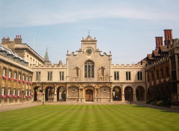
Explore more of East of England
Explore the East of England for university cities, Roman heritage, fenland landscapes, North Sea beaches, coastal food and historic market towns.
Explore East of England
Explore more of United Kingdom
Discover the United Kingdom: A blend of rich history, stunning landscapes, and vibrant cities, offering a unique travel experience for every visitor.
Explore United Kingdom