

Grand Staircase-Escalante National Monument Travel Guide - Free Web & App
Your ultimate guide to Grand Staircase-Escalante National Monument. Discover top landmarks, proposed trips, and local tips. Free on the web or via the Evendo companion app.


Grand Staircase-Escalante National Monument reveals Utah’s slot canyons, desert arches, fossil-rich plateaux, waterfalls and remote scenic drives.
A Monument of Scale and Geological Time
Grand Staircase-Escalante National Monument occupies a vast area of southern Utah between Bryce Canyon, Capitol Reef and Glen Canyon, although those better-known parks lie outside the monument. Managed by the Bureau of Land Management, it encompasses roughly 1.87 million acres of cliffs, plateaux, desert valleys, slot canyons, natural arches and remote wilderness. Its name describes two defining ideas: the Grand Staircase, a sequence of broad geological terraces descending towards the Grand Canyon, and the Escalante Canyons, where tributaries of the Escalante River have cut deeply into sandstone country.Read more about Grand Staircase-Escalante National Monument
Three Distinct Landscapes
Desert Travel and Cultural Heritage
When is the best time to visit Grand Staircase-Escalante National Monument?
Best: May, September–October · 20–28°C| Month | High (°C) | Rainfall (mm) |
|---|---|---|
| January | 8 | 20 |
| February | 10 | 22 |
| March | 15 | 25 |
| April | 20 | 20 |
| May (best) | 26 | 18 |
| June | 31 | 12 |
| July | 34 | 20 |
| August | 33 | 23 |
| September (best) | 28 | 17 |
| October (best) | 20 | 15 |
| November | 13 | 20 |
| December | 8 | 22 |
Getting to and around Grand Staircase-Escalante National Monument
How to get there
Transportation
Best attractions in Grand Staircase-Escalante National Monument
Grand Staircase-Escalante’s attractions are scattered across a huge area rather than gathered into one park circuit. Near the western staircase, Grosvenor Arch is a prominent double arch reached from a remote road, while Willis Creek offers a relatively accessible introduction to layered canyon scenery when conditions permit. In the central area, the Lower Calf Creek Falls trail follows a sandy route through a canyon to a tall waterfall and passes evidence of earlier human use. Around Escalante, the Hole-in-the-Rock Road leads towards trailheads for narrow gulches including Peek-a-Boo and Spooky, as well as the open sandstone landscape of Devil’s Garden. Boulder and the Burr Trail provide access to the eastern plateau and canyon country, while the Escalante River and its tributaries create opportunities for more demanding multi-day exploration. Road conditions, permits, water and weather determine which attractions can be reached safely.
-
National park
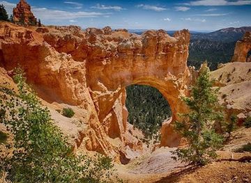
Bryce Canyon National Park
Explore the breathtaking hoodoos and vibrant landscapes of Bryce Canyon National Park, a true natural wonder in Utah's stunning wilderness.
-
Visitor center
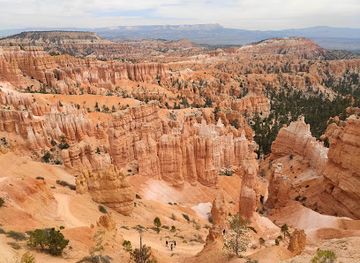
Bryce Canyon National Park Visitor Center
Explore the wonders of Bryce Canyon at the Visitor Center—your gateway to breathtaking landscapes and enriching experiences.
-
National park
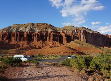
Capitol Reef National Park
Explore the breathtaking landscapes and rich history of Capitol Reef National Park, a stunning escape for nature lovers and adventure seekers in Utah.
-
Tourist attraction
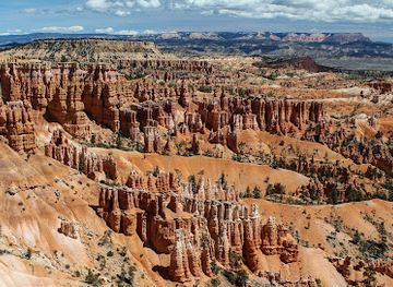
Bryce Canyon National Park Sunset Point
Experience the breathtaking views and unique geological wonders at Sunset Point in Bryce Canyon National Park, a must-visit for every traveler.
Best landmarks in Grand Staircase-Escalante National Monument
The monument’s defining landmark is the Grand Staircase itself, a succession of immense geological terraces and cliffs that descends southward through southern Utah. The Kaiparowits Plateau forms another major physical landmark, a high, remote tableland whose rocks preserve a significant Late Cretaceous fossil record. In the Escalante district, the Escalante River and its tributary canyons create a maze of sandstone corridors, domes and slickrock benches. Grosvenor Arch is one of the area’s best-known natural formations, while Lower Calf Creek Falls provides a contrasting landmark formed by water, resistant rock and a perennial stream. The Hole-in-the-Rock route is both a landscape feature and a historic cultural landmark, recalling the difficult nineteenth-century crossing towards the Colorado River. Archaeological sites and rock art add human depth, but many are deliberately unobtrusive and require careful protection.
-
State park
Escalante Petrified Forest State Park
Explore the magical Escalante Petrified Forest State Park, where ancient trees turned to stone create a stunning natural wonder in Utah.
-
Tourist attraction
Grosvenor Arch
Experience the breathtaking beauty of Grosvenor Arch, a stunning natural wonder in Utah's picturesque desert landscape.
-
Hiking area
Peek-a-boo slot Canyon
Discover the breathtaking beauty of Peek-a-Boo Slot Canyon in Utah – a hidden gem for hiking enthusiasts and nature lovers alike.
-
Natural feature
Devils Garden
Explore the breathtaking beauty of Devils Garden in Utah, where unique rock formations and stunning landscapes await adventurers and nature lovers alike.


Explore Grand Staircase-Escalante National Monument on the map
Plan your trip on one map. See where the top attractions, landmarks, restaurants and hotels are, and book hotels and experiences in a few clicks.
Best hotels in Grand Staircase-Escalante National Monument
Best restaurants in Grand Staircase-Escalante National Monument
Dining is concentrated in the small gateway communities around the monument, particularly Escalante, Boulder, Cannonville, Henrieville, Tropic and Kanab, rather than inside the remote backcountry. Visitors can find a mixture of cafés, independent restaurants, bakeries, grocery stores and traditional rural eateries, with menus shaped by the practical needs of travellers, ranching communities and the wider Utah high-desert region. Local food shopping is important for hiking and driving days: fresh supplies, packed lunches, snacks and abundant water should be obtained before leaving settled areas. Boulder and Escalante are particularly useful bases for meals associated with visits along Highway 12, while Kanab serves the monument’s southern approaches. Dining choices may be seasonal or limited outside the principal communities, and remote trailheads have no dependable food service, so self-catering is often part of a backcountry itinerary.
-
Nature preserve
Grand Staircase-Escalante National Monument
Explore the stunning landscapes and rich biodiversity of Grand Staircase-Escalante National Monument – a must-visit destination for nature lovers.

Best bars in Grand Staircase-Escalante National Monument
Grand Staircase-Escalante is not a nightlife destination, and there are no concentrated club districts within the monument. Evening life is centred on the quiet hospitality of gateway communities such as Escalante, Boulder, Tropic and Kanab, where visitors may find restaurants, cafés, small bars or traditional pub-like settings depending on local licensing and opening arrangements. The atmosphere is generally suited to conversation, a meal and preparation for the following day rather than late-night entertainment. In smaller settlements, options can be limited and may vary by season. Away from town, the defining evening experience is the dark, open desert environment, although visitors should camp and use public lands only in accordance with current Bureau of Land Management rules and any applicable permit requirements.
-
Restaurant
Escalante Outfitters
Discover Escalante Outfitters, your ultimate stop for food, gear, and local insights in the heart of Utah's stunning landscapes.
-
American
Hell's Backbone Grill & Farm
Discover the perfect blend of farm-fresh flavors and stunning views at Hell's Backbone Grill & Farm in Boulder, Utah.
-
Coffee shop
Kiva Koffeehouse
Discover the enchanting Kiva Koffeehouse in Escalante, Utah, where exceptional coffee meets breathtaking views in a serene atmosphere.
-
American
Circle D Restaurant
Experience the best of American cuisine at Circle D Restaurant in Escalante, where local flavors meet warm hospitality for an unforgettable dining experience.


Best shops in Grand Staircase-Escalante National Monument
Shopping within Grand Staircase-Escalante is limited and practical, with most opportunities found in gateway settlements rather than on the monument’s roads. Escalante, Boulder, Tropic, Kanab and nearby communities provide groceries, fuel, outdoor supplies, maps and equipment useful for desert travel, while small shops and galleries may offer local art, books, photography, crafts or regional gifts. Farm stands and food producers occur on a seasonal or local basis rather than as a continuous market network, so availability should not be assumed. Visitors seeking distinctive souvenirs should favour responsibly produced work from established local businesses and avoid buying fossils, archaeological objects or natural materials whose removal may be illegal or damaging. The most useful purchases are often supplies for self-sufficient exploration, especially water, food and navigation essentials before travelling beyond the settled corridors.
-
Nature preserve
Grand Staircase-Escalante National Monument
Discover the breathtaking landscapes and rich biodiversity of Grand Staircase-Escalante National Monument, a hidden gem in Utah's wilderness.
-
General store
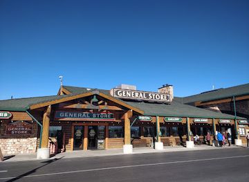
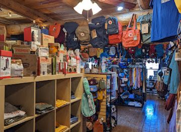
Ruby’s Inn General Store
Experience the best of Bryce Canyon City at Ruby’s Inn General Store, offering camping supplies, unique souvenirs, and local crafts for every traveler.
-
Restaurant
Escalante Outfitters
Experience the perfect blend of dining, lodging, and outdoor adventure at Escalante Outfitters in the heart of Utah's stunning landscapes.
-
State park
Escalante Petrified Forest State Park
Explore the unique geological marvels and ancient beauty of Escalante Petrified Forest State Park in Utah, a perfect destination for nature enthusiasts and history lovers.


Get your free copy of our complete guide to Grand Staircase-Escalante National Monument, delivered straight to you.
Everything on this page, from attractions and restaurants to essentials and local phrases, in one PDF you can read offline, print or share.
Already have an account? Sign in
Your Grand Staircase-Escalante National Monument guide is ready.
We'll send it to · Not you? Sign out

Getting your guide ready…
We are putting together a fresh copy of the Grand Staircase-Escalante National Monument guide. This can take up to a minute.
This can take a few moments. If your browser asks, choose Allow so the download can start. You'll find the guide in your Downloads folder.
Nothing happened? Download it again
Sorry, the guide is taking longer than usual. Please try again in a minute, or get it by email instead.
Grand Staircase-Escalante National Monument essentials
Currency and Payment
Safety
Emergency Situations
Do's and Don'ts
Local Tips
From Eve
Local phrases worth knowing
You don't need to get them perfect. A few words go a long way, and locals appreciate the effort.
Basics
| English | Local | Say it |
|---|---|---|
| Hello | Shiyo | [shee-yo] |
| Goodbye | Wanishi | [wah-nee-shee] |
| Yes | Heh | [heh] |
| No | Tah | [tah] |
| Please/You're welcome | Aho | [ah-ho] |
| Thank you | Nah-tah | [nah-tah] |
| Excuse me/Sorry | S'oki | [soh-kee] |
| How are you? | K'adokoh | [ka-doh-koh] |
| Fine. And you? | Naat'áanii. Yaa | [nah-tah-nee. yah] |
| Do you speak English? | Haa ałk'idaago tsiní? | [hah ahl-kee-dah-go tsee-nee?] |
| I don't understand | Díí anííníshní | [dee ah-nee-nee-shnee] |
Eating & Drinking
| English | Local | Say it |
|---|---|---|
| I'd like to see the menu, please | Menu na'alkáágo yisdzoh | [meh-noo nah-ahl-kah-goh yis-dzoh] |
| I don't eat meat | Naada'ííłt'éego bínaa'álí | [nah-dah-ee-lteh-eh-go bee-nah-ah-lee] |
| Cheers! | Ahe'he' | [ah-hay-hay] |
| I would like to pay, please | Baa hózhǫ́ | [bah hoh-zhon] |
Emergencies
| English | Local | Say it |
|---|---|---|
| Help! | Yaa | [yah] |
| Go away! | Dooleeł | [doh-lee-ehl] |
| Call the Police! | Naayéé' neełni | [nah-yay-eh neh-lee] |
| Call a doctor! | Binaa'áłtso | [bee-nah-ah-ltsoh] |
| I'm lost | Naaltsoos biyiinaa | [nah-ahl-tsohs bee-yee-nah] |
| I'm ill | Hóchxo'oo' | [hohch-shoh-oh] |
Shopping
| English | Local | Say it |
|---|---|---|
| I'd like to buy... | Doo bik'ehgo | [doh bee-kay-hgoh] |
| I'm just looking | T'áá ákót'éego | [taa ah-koh-tay-eh-go] |
| How much is it? | T'áá dóó | [taa doh] |
| That's too expensive | Baa dóó naashá | [bah doh nah-shah] |
| Can you lower the price? | T'áá háádíní dóó naashá | [taa haa-dee-nee doh nah-shah] |
Time & Numbers
| English | Local | Say it |
|---|---|---|
| What time is it? | T'áá háájií keehé | [taa haa-jee kah-hay] |
| It's one o'clock | T'áá at'éé' | [taa ah-tay-eh] |
| Half past (10) | Neezłí | [nee-zhlee] |
| Morning | Taayáásh | [tah-yah-sh] |
| Afternoon | Hai | [high] |
| Evening | Yííh | [yeeh] |
| Yesterday | Yik'ehgo | [yee-kay-hgoh] |
| Today | Jiik'ehgo | [jee-kay-hgoh] |
| Tomorrow | Áadoo | [ah-doh] |
| 1 | Bee | [bee] |
| 2 | Naaki | [nah-ah-kee] |
| 3 | Táá | [taa] |
| 4 | Dįį | [dee] |
| 5 | Ashdla' | [ash-dlah] |
| 6 | Hastiin | [hah-steehn] |
| 7 | Tseebíí | [tseh-bee] |
| 8 | Tsinii | [tsi-nee] |
| 9 | Baa | [bah] |
| 10 | Táh | [tah] |
Transport & Directions
| English | Local | Say it |
|---|---|---|
| Where's a/the...? | Haa'aah | [hah-ah-ah] |
| What's the address? | Bik'ehgo yee dah | [bee-kay-hgoh yee dah] |
| Can you show me (on the map)? | Dił hólǫ́ | [deel hoh-lohn] |
| When's the next (bus)? | Haa hólǫ́ | [hah hoh-lohn] |
| A ticket (to ....) | Hózhó bidaa | [hoh-zhon bee-dah] |
History of Grand Staircase-Escalante National Monument
A Landscape Built in Layers
The monument’s geological story extends across hundreds of millions of years, as ancient seas, rivers, dunes and floodplains deposited successive layers of sediment across what is now southern Utah. Uplift and erosion later exposed these formations as the terraces, cliffs, domes and canyons associated with the Grand Staircase. The Escalante Canyons were carved as water exploited weaknesses in the sandstone and shale, while the Kaiparowits Plateau preserves a high, dissected landscape. These geological processes are not a human historical period, but they explain why the monument contains such sharply contrasting terrain within one extensive protected area.
Ancestral Puebloan and Fremont Presence
People have lived in and travelled through the plateau and canyon country for thousands of years. Archaeological evidence across the wider region records Ancestral Puebloan communities, while Fremont cultural materials are also associated with parts of central and southern Utah. Rock art, habitation sites, tools, granaries and other traces demonstrate adaptation to a landscape where water is unevenly distributed and movement follows canyon corridors, springs and elevated benches. Many archaeological places are fragile and may be difficult to recognise; their protection depends on leaving artefacts and structures undisturbed and following current land-management guidance.
The Hole-in-the-Rock Expedition
In 1879 and 1880, Mormon settlers associated with the San Juan Mission undertook the difficult Hole-in-the-Rock journey across the country east of Escalante. The expedition created a route down to the Colorado River through rugged terrain that earlier travellers had regarded as exceptionally difficult, using labour and engineering to move wagons through steep country. The route’s name survives in the Hole-in-the-Rock Road, now a remote scenic and recreational corridor rather than a conventional through-road. Its history illustrates both the practical challenge of crossing the plateau and the enduring importance of routes through the Escalante landscape.
Settlement, Ranching and Scientific Discovery
Permanent Euro-American settlement developed around small agricultural and ranching communities including Escalante and Boulder, where farming depended on limited water and the seasonal character of the high desert. Roads, stock routes and later tourism connected these settlements with the surrounding plateaux and canyons. The Kaiparowits Plateau subsequently gained scientific importance for its exceptionally rich Late Cretaceous fossil record, including discoveries of dinosaurs and other ancient organisms. Palaeontological research continues to shape understanding of North America’s prehistoric ecosystems, while fieldwork is conducted under permits and within rules intended to protect scientifically important deposits.
National Monument Designation and Stewardship
Grand Staircase-Escalante National Monument was established by presidential proclamation in 1996 under the Antiquities Act. The designation recognised the area’s geological formations, archaeological resources, palaeontological deposits, ecological communities and largely undeveloped character. Its boundaries were reduced in 2017 and restored to their earlier extent in 2021. Today the Bureau of Land Management administers the monument, balancing recreation, grazing, scientific research, cultural-resource protection and conservation across a landscape where roads and visitor facilities remain limited. Management conditions, road access and permit requirements can change, making current official information important for detailed trips.
Grand Staircase-Escalante National Monument in Photos
Browse through our photo collection highlighting the charm and character of the destination.
Cities in Grand Staircase-Escalante National Monument
The towns and cities of Grand Staircase-Escalante National Monument, and the easiest places to base yourself.
-
-

-

-


Swipe for more cities
Neighbouring destination travel guides
The closest destinations to Grand Staircase-Escalante National Monument, if you have time for more than one.
-

-

-

-

-


Swipe for more destinations
Explore more

Explore more of Colorado Plateau
Explore Utah’s Colorado Plateau for red-rock national parks, canyon country, ancient archaeology, scenic drives and high-desert adventure.
Explore Colorado Plateau
Explore more of Utah
Explore Utah's stunning national parks, rich cultural heritage, and year-round outdoor adventures. Discover why this diverse state is a top destination for travelers.
Explore Utah