

Blue Ridge Parkway Travel Guide - Free Web & App
Your ultimate guide to Blue Ridge Parkway. Discover top landmarks, proposed trips, and local tips. Free on the web or via the Evendo companion app.


Blue Ridge Parkway in Virginia links mountain overlooks, historic farms, forest trails and gateway towns, revealing Appalachian landscapes and heritage.
Ridges, Valleys and Long Views
Blue Ridge Parkway in Virginia follows the crest and eastern slopes of the Blue Ridge Mountains for roughly 216 miles between its northern beginning near Waynesboro and the North Carolina state line. It is not a town or a single compact park, but a linear national parkway linking overlooks, forested ridges, historic sites and recreation areas. The road's character changes gradually: the northern section approaches the Shenandoah Valley and Shenandoah National Park, while farther south the route passes through the valleys and highlands associated with Roanoke, the Peaks of Otter, Floyd and the Blue Ridge plateau.Read more about Blue Ridge Parkway
Historic Landscapes and Mountain Culture
Exploring the Virginia Section
When is the best time to visit Blue Ridge Parkway?
Best: June, August–September · 24–28°C| Month | High (°C) | Rainfall (mm) |
|---|---|---|
| January | 4 | 80 |
| February | 5 | 80 |
| March | 11 | 95 |
| April | 16 | 95 |
| May | 21 | 105 |
| June (best) | 26 | 100 |
| July | 28 | 105 |
| August (best) | 28 | 100 |
| September (best) | 24 | 95 |
| October | 18 | 90 |
| November | 11 | 85 |
| December | 5 | 85 |
Getting to and around Blue Ridge Parkway
How to get there
Transportation
Best attractions in Blue Ridge Parkway
The Virginia Parkway's attractions unfold in a chain of distinct sections. Near the northern end, Humpback Rocks combines a demanding rocky viewpoint with the Humpback Rocks Visitor Center and a reconstructed mountain farm illustrating 19th-century life. The James River area marks the route's crossing of Virginia's principal river and provides a different landscape from the high ridges. Around the Peaks of Otter, Abbott Lake, Sharp Top Mountain, Flat Top Mountain and Johnson Farm create the state's most concentrated group of scenic, walking and historic experiences on the Parkway. Farther south, Rocky Knob Recreation Area offers forest trails and highland scenery near Floyd, while Mabry Mill presents one of the route's most recognisable historic landscapes. Groundhog Mountain and the road towards the Virginia–North Carolina line add open ridge views and pastoral surroundings. Nearby towns such as Roanoke, Bedford, Floyd and Galax provide museums, music, food and cultural attractions beyond the Parkway's protected corridor.
-
Visitor center
Craggy Gardens Visitor Center
Explore the beauty of North Carolina at Craggy Gardens Visitor Center, your portal to stunning views and hiking adventures along the Blue Ridge Parkway.
-
Tourist attraction
Blue Ridge National Heritage Area
Explore the stunning Blue Ridge National Heritage Area, a perfect blend of nature, culture, and adventure in North Carolina's picturesque mountains.


Explore Blue Ridge Parkway on the map
Plan your trip on one map. See where the top attractions, landmarks, restaurants and hotels are, and book hotels and experiences in a few clicks.
Best hotels in Blue Ridge Parkway
Get your free copy of our complete guide to Blue Ridge Parkway, delivered straight to you.
Everything on this page, from attractions and restaurants to essentials and local phrases, in one PDF you can read offline, print or share.
Already have an account? Sign in
Your Blue Ridge Parkway guide is ready.
We'll send it to · Not you? Sign out

Getting your guide ready…
We are putting together a fresh copy of the Blue Ridge Parkway guide. This can take up to a minute.
This can take a few moments. If your browser asks, choose Allow so the download can start. You'll find the guide in your Downloads folder.
Nothing happened? Download it again
Sorry, the guide is taking longer than usual. Please try again in a minute, or get it by email instead.
Blue Ridge Parkway essentials
Currency and Payment
Safety
Emergency Situations
Do's and Don'ts
Local Tips
From Eve
Local phrases worth knowing
You don't need to get them perfect. A few words go a long way, and locals appreciate the effort.
Basics
| English | Local | Say it |
|---|---|---|
| Hello | Howdy | [haw-dee] |
| Goodbye | See ya | [see yah] |
| Yes | Yup | [yuhp] |
| No | Nah | [nuh] |
| Please/You're welcome | Please/You're welcome | [pleez/yur wel-kum] |
| Thank you | Thank ya | [thank yah] |
| Excuse me/Sorry | Pardon me | [par-dn me] |
| How are you? | How ya doin'? | [haw yuh doo-in'] |
| Fine. And you? | Fine. And you? | [fahyn. n' yuh?] |
| Do you speak English? | Ya speak English? | [yah speek ing-glish?] |
| I don't understand | I don't git it | [ah dun git it] |
Eating & Drinking
| English | Local | Say it |
|---|---|---|
| I'd like to see the menu, please | I'd like to see the menu, please | [ahd lahk t' see thuh menu, pleez] |
| I don't eat meat | I don't eat meat | [ah dun eat meet] |
| Cheers! | Cheers! | [cheers!] |
| I would like to pay, please | I would like to pay, please | [ah wood lahk t' pay, pleez] |
Emergencies
| English | Local | Say it |
|---|---|---|
| Help! | Help! | [help!] |
| Go away! | Git outta here! | [git out-uh here!] |
| Call the Police! | Call the Sheriff! | [kahl thuh sher-iff!] |
| Call a doctor! | Call a doc! | [kahl uh dahk!] |
| I'm lost | I'm plumb lost | [ahm pluhm lost] |
| I'm ill | I'm feelin' poorly | [ahm feel-in' poor-lee] |
Shopping
| English | Local | Say it |
|---|---|---|
| I'd like to buy... | I'd like t' buy... | [ahd lahk t' bahy...] |
| I'm just looking | I'm just lookin' | [ahm juhst look-in'] |
| How much is it? | How much fer that? | [haw much f'r that?] |
| That's too expensive | That's too pricey | [that's too prahy-see] |
| Can you lower the price? | Can ya knock the price down? | [kan yah nahk thuh price doun?] |
Time & Numbers
| English | Local | Say it |
|---|---|---|
| What time is it? | What time ya got? | [what time yah gaht?] |
| It's one o'clock | It's one | [its wun] |
| Half past (10) | Half past (10) | [haff past (10)] |
| Morning | Mornin' | [morn-in'] |
| Afternoon | Afternoon | [after-noon] |
| Evening | Evenin' | [ee-ven-in'] |
| Yesterday | Yest'day | [yes-t'day] |
| Today | Today | [t'day] |
| Tomorrow | Tomorrah | [tom-or-rah] |
| 1 | One | [wun] |
| 2 | Two | [too] |
| 3 | Three | [three] |
| 4 | Four | [four] |
| 5 | Five | [five] |
| 6 | Six | [six] |
| 7 | Seven | [seven] |
| 8 | Eight | [eight] |
| 9 | Nine | [nine] |
| 10 | Ten | [ten] |
Transport & Directions
| English | Local | Say it |
|---|---|---|
| Where's a/the...? | Where's the...? | [wheres thuh...?] |
| What's the address? | What's the address? | [whats thuh address?] |
| Can you show me (on the map)? | Can ya show me where on the map? | [kan yah show me whair on thuh map?] |
| When's the next (bus)? | When's the next (bus)? | [whens thuh next (bus)?] |
| A ticket (to ....) | A ticket (to ....) | [uh ticket (tuh ....)] |
History of Blue Ridge Parkway
An Ancient Mountain Foundation
The Blue Ridge is part of the Appalachian mountain system, built from exceptionally old rocks and reshaped over immense geological periods by uplift, weathering and erosion. The Parkway follows a high landscape of ridges, coves and valleys rather than a single sharp mountain chain. Its repeated views across forested slopes and agricultural lowlands reflect this long geological history. Features such as the rocky escarpment at Humpback Rocks and the elevated basins around the Peaks of Otter are best understood as products of ancient mountain formation and continuing erosion, not as monuments created by human activity.
Indigenous Homelands and Early Settlement
The Blue Ridge was inhabited and travelled by Indigenous peoples long before the creation of the Parkway. In Virginia, the broader region is associated with the Monacan and other Indigenous communities whose histories continue in the central Blue Ridge and adjoining Piedmont and Shenandoah Valley. European settlement expanded through valleys and mountain gaps during the 18th and 19th centuries, bringing farms, mills, churches and dispersed homesteads. Much of the highland economy depended on mixed farming, timber and local exchange, with small communities connected by rough roads and established mountain routes.
Farms, Mills and Mountain Communities
During the 19th and early 20th centuries, families in the Blue Ridge combined crop cultivation, livestock keeping, woodland use and craft production. Water-powered mills processed grain and supported local trade, while blacksmiths, sawyers and other specialists served scattered settlements. The Humpback Rocks farm and Mabry Mill interpret different aspects of this working landscape. Historic places along the Parkway should not be viewed as isolated curiosities: they represent a wider pattern of self-sufficient or semi-subsistence communities whose lives were closely tied to slope, soil, streams and seasonal weather.
Conception and Construction of the Parkway
The Blue Ridge Parkway was conceived during the New Deal era as a scenic road linking Shenandoah National Park with Great Smoky Mountains National Park. Construction began in the 1930s and proceeded in stages, with the route requiring extensive grading, bridge building and landscape design across difficult mountain terrain. The Virginia section was developed over several decades rather than completed all at once. Its alignment was intended to reveal scenery while avoiding many settled valleys, and roadside features such as overlooks, picnic areas and trails were planned as part of a unified visitor experience.
Conservation and Public Memory
As the Parkway developed, portions of the surrounding landscape were acquired or protected to maintain its scenic character and provide public recreation. Historic structures were preserved or reconstructed to explain regional life, while forests and habitats became part of the National Park Service's management responsibilities. The Parkway also helped bring wider attention to Appalachian music, craft and rural history, though the communities represented by these traditions extend well beyond the road itself. Today, conservation work must balance visitor access, historic interpretation, road engineering, fire and forest management, and the protection of wildlife and waterways.
Blue Ridge Parkway in Photos
Browse through our photo collection highlighting the charm and character of the destination.
Neighbouring destination travel guides
The closest destinations to Blue Ridge Parkway, if you have time for more than one.
-

-

-
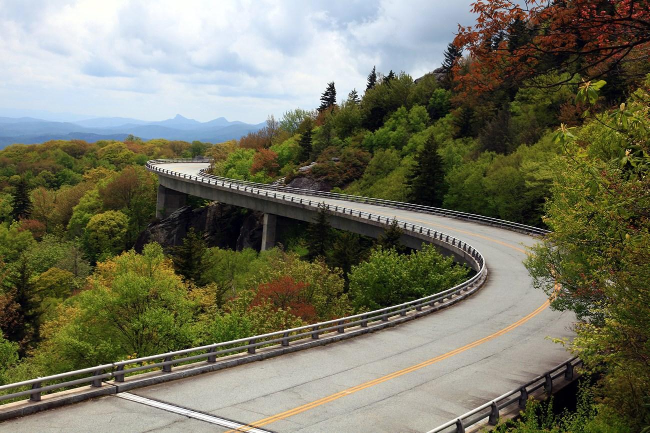 Blue Ridge Mountains
, North Carolina, offer scenic parkway drives, Appalachian trails, waterfalls, high peaks, Cherokee culture and mountain towns.
-

-


Swipe for more destinations
Explore more

Explore more of Virginia
Discover Virginia: A blend of historic landmarks, natural beauty, and vibrant culture perfect for history buffs, nature lovers, and culture seekers.
Explore Virginia