

Mount Baker-Snoqualmie National Forest Travel Guide - Free Web & App
Your ultimate guide to Mount Baker-Snoqualmie National Forest. Discover top landmarks, proposed trips, and local tips. Free on the web or via the Evendo companion app.


Mount Baker-Snoqualmie National Forest in Washington offers alpine scenery, old-growth forests, volcano views, hiking, skiing and wild mountain valleys.
Volcanic Peaks and Deep Forests
Mount Baker-Snoqualmie National Forest stretches along the western side of Washington’s Cascade Range, from the Canadian border south towards Mount Rainier National Park. It is a vast public landscape of volcanic summits, glaciated valleys, dense conifer forest, rushing rivers and high-country meadows. Mount Baker dominates the northern skyline, while the forest also contains extensive wilderness around Glacier Peak and rugged terrain near Snoqualmie Pass. The national forest is separate from North Cascades National Park and Mount Rainier National Park, although all three protected landscapes meet or sit close to one another in the wider Cascades.Read more about Mount Baker-Snoqualmie National Forest
Valleys, Passes and Gateway Communities
Outdoor Life and Protected Landscapes
When is the best time to visit Mount Baker-Snoqualmie National Forest?
Best: July–September · 20–23°C| Month | High (°C) | Rainfall (mm) |
|---|---|---|
| January | 4 | 250 |
| February | 5 | 190 |
| March | 8 | 180 |
| April | 11 | 120 |
| May | 15 | 80 |
| June | 19 | 60 |
| July (best) | 23 | 30 |
| August (best) | 23 | 30 |
| September (best) | 20 | 60 |
| October | 14 | 120 |
| November | 9 | 200 |
| December | 4 | 250 |
Getting to and around Mount Baker-Snoqualmie National Forest
How to get there
Transportation
Best attractions in Mount Baker-Snoqualmie National Forest
Mount Baker and the Heather Meadows–Artist Point area are among the forest’s best-known high-country destinations, offering alpine scenery and views towards volcanic peaks when roads and weather permit. Baker Lake provides a contrasting low-elevation setting for boating, fishing and lakeside recreation, subject to local rules and conditions. In the southern forest, Snoqualmie Pass and the I-90 corridor lead to walks such as Franklin Falls and Denny Creek, while Gold Creek Pond offers an accessible mountain-lake setting near the pass. Darrington and the Mountain Loop Highway open access to the Sauk and Stillaguamish valleys, though sections of the route may be seasonally closed or affected by road conditions. The Glacier Peak Wilderness is a major attraction for experienced backpackers, with extensive trail networks and remote terrain rather than conventional visitor facilities. The forest’s rivers, old-growth stands, waterfalls, subalpine meadows and wildlife habitats provide the main visual and recreational focus across its many dispersed districts.
-
Mount Rainier National Park
Explore the breathtaking landscapes and diverse wildlife of Mount Rainier National Park, a must-visit natural wonder in Washington State.
-
National forest
Mt. Baker-Snoqualmie National Forest
Explore the breathtaking landscapes of Mt. Baker-Snoqualmie National Forest, a paradise for outdoor enthusiasts and nature lovers in Washington State.
-
Lake Sammamish State Park
Explore the wonders of Lake Sammamish State Park, a beautiful state park in Issaquah, Washington, offering swimming, hiking, and stunning natural scenery.
-
Diablo Lake Vista Point
A legendary North Cascades roadside viewpoint where glacial flour paints Diablo Lake an electric turquoise beneath rugged peaks and deep evergreen forests.


Best landmarks in Mount Baker-Snoqualmie National Forest
Mount Baker is the forest’s defining natural landmark, a snow-covered stratovolcano whose glaciers and broad summit massif dominate views from northern valleys and high routes. Glacier Peak, another major Cascade volcano, rises within the wider wilderness landscape and is best understood through demanding backcountry approaches rather than roadside viewpoints. The forest also contains important river landmarks, including the Nooksack, Sauk, Stillaguamish and Skykomish systems, whose valleys connect mountain habitats with communities below. At Snoqualmie Pass, steep forested slopes, alpine terrain and historic transport routes illustrate the importance of a crossing through the Cascades. Heather Meadows and Artist Point form a celebrated subalpine landscape near Mount Baker, while the Glacier Peak Wilderness represents a landmark of conservation as much as geography. Historic mining traces around the Monte Cristo area and older logging landscapes add evidence of human use, although abandoned workings and structures should not be entered.
-
National forest
Mt. Baker-Snoqualmie National Forest
Experience the breathtaking landscapes and diverse wildlife of Mt. Baker-Snoqualmie National Forest, a true gem of Washington's outdoor adventure.
-
Hiking area
Artist Point
Discover the breathtaking beauty of Artist Point in Mt. Baker-Snoqualmie National Forest, a top hiking area with stunning vistas and vibrant wildflowers.
-
Hiking area
Snow Lake Trailhead
Experience the breathtaking beauty of Snow Lake Trailhead in the Cascade Mountains, a perfect hiking destination for nature lovers and adventure seekers.
-
Tourist attraction
Big Four Ice Caves
Explore the breathtaking Big Four Ice Caves in Granite Falls, Washington, where nature's icy sculptures meet towering mountains and scenic hiking trails.


Explore Mount Baker-Snoqualmie National Forest on the map
Plan your trip on one map. See where the top attractions, landmarks, restaurants and hotels are, and book hotels and experiences in a few clicks.
Best hotels in Mount Baker-Snoqualmie National Forest
Best restaurants in Mount Baker-Snoqualmie National Forest
Dining opportunities are concentrated in gateway communities rather than within the forest itself. Bellingham offers the broadest range of restaurants for visitors using the northern approaches, while smaller communities such as Glacier, Maple Falls, Sedro-Woolley, Concrete and Darrington provide more limited choices of cafés, diners, bakeries, taverns and general stores, depending on the area and season. North Bend, Snoqualmie and towns along the I-90 corridor are practical for southern trailheads, while Skykomish serves parts of the Stevens Pass route. Regional food reflects the Pacific Northwest, with salmon, berries, apples, locally produced beer, coffee and ingredients from the fertile valleys west of the Cascades appearing on menus and in farm shops. In remote recreation areas, visitors should not expect restaurants or reliable food supplies, so a packed lunch and sufficient water are essential for many day trips.
-
National forest
Mt. Baker-Snoqualmie National Forest
Discover the breathtaking beauty of Mt. Baker-Snoqualmie National Forest – your ultimate outdoor adventure awaits in Washington's stunning landscapes.
-
New American
North Bend Bar & Grill
Experience exceptional New American cuisine at North Bend Bar & Grill in Washington's scenic North Bend—perfect for breakfast, brunch, or dinner.
-
Indian
Aahaar an Indian Eatery
Experience authentic Indian flavors at Aahaar an Indian Eatery in Snoqualmie – where every dish tells a story.
-
Mexican
Caadxi Oaxaca
Experience the flavors of Mexico at Caadxi Oaxaca - where tradition meets taste in Snoqualmie.


Best bars in Mount Baker-Snoqualmie National Forest
The forest itself has little conventional nightlife, and evenings are generally shaped by campgrounds, lodges, ski-area accommodation and the quiet atmosphere of mountain communities. Traditional pubs, taverns and casual bars can be found in gateway towns such as Darrington, Concrete, Sedro-Woolley, North Bend, Snoqualmie and Skykomish, while Bellingham provides the most developed evening scene for visitors approaching Mount Baker from the west. Mount Baker Ski Area and Stevens Pass may offer a livelier seasonal atmosphere connected with skiing, but entertainment and operating patterns vary. In smaller settlements, evening options are more likely to involve a local meal, conversation, live community events or an early night before a trail outing than nightclubs or late venues. Remote cabins and campsites should be treated as self-contained bases rather than nightlife destinations.
-
Woods
Mt. Baker-Snoqualmie National Forest
Experience the stunning landscapes and diverse wildlife of Mt. Baker-Snoqualmie National Forest, a perfect destination for outdoor adventure enthusiasts.
-
Brewery
Snoqualmie Falls Brewery
Discover the charm of Snoqualmie Falls Brewery, where craft beer meets delicious American cuisine in a stunning natural setting.
-
Pub
Mt Si Tavern
Discover the lively charm of Mt Si Tavern in North Bend, where great barbecue and a welcoming atmosphere await every visitor.
-
Brewery
No Boat Brewing Company
Experience the best of craft brewing at No Boat Brewing Company in Snoqualmie, Washington, where quality meets community and innovation.


Best nightclubs in Mount Baker-Snoqualmie National Forest
The forest itself has little conventional nightlife, and evenings are generally shaped by campgrounds, lodges, ski-area accommodation and the quiet atmosphere of mountain communities. Traditional pubs, taverns and casual bars can be found in gateway towns such as Darrington, Concrete, Sedro-Woolley, North Bend, Snoqualmie and Skykomish, while Bellingham provides the most developed evening scene for visitors approaching Mount Baker from the west. Mount Baker Ski Area and Stevens Pass may offer a livelier seasonal atmosphere connected with skiing, but entertainment and operating patterns vary. In smaller settlements, evening options are more likely to involve a local meal, conversation, live community events or an early night before a trail outing than nightclubs or late venues. Remote cabins and campsites should be treated as self-contained bases rather than nightlife destinations.
-
National forest
Mt. Baker-Snoqualmie National Forest
Discover the breathtaking beauty and endless outdoor adventures at Mt. Baker-Snoqualmie National Forest in Washington State.
-
Cigar shop
Lit Cigar Lounge
Discover the ultimate cigar experience at Lit Cigar Lounge in Snoqualmie, where relaxation and premium selections await every enthusiast.
-
Night club
Armani Night Club
Discover the electrifying atmosphere of Armani Night Club, where vibrant music and stylish vibes create unforgettable nightlife experiences in Federal Way.


Best shops in Mount Baker-Snoqualmie National Forest
Shopping is limited inside the national forest and is chiefly practical: fuel, groceries, maps, outdoor equipment and basic supplies are found in gateway towns rather than at remote trailheads. Bellingham provides the widest range of independent shops and specialist outdoor retailers for the Mount Baker approach, while Sedro-Woolley, Concrete, Darrington, North Bend and Skykomish offer smaller selections of provisions and locally made goods. Farm stands, markets and food producers in the Skagit and Nooksack valleys may sell seasonal fruit, preserves, honey and other regional products, although availability varies. Visitors may also find Pacific Northwest crafts, artwork and souvenirs that draw on mountain, forest and Indigenous themes, but these should be purchased from identified artists and legitimate businesses rather than removed from the landscape. In remote districts, do shopping before departure and do not rely on a recreation site for supplies.
-
National forest
Mt. Baker-Snoqualmie National Forest
Experience the breathtaking beauty of Mt. Baker-Snoqualmie National Forest, a paradise for outdoor enthusiasts and nature lovers in Washington State.
-
Grocery store
Safeway
Explore the variety and convenience at Safeway in Cle Elum - your ultimate grocery shopping experience with fresh produce and local specialties.
-
Grocery store
QFC
Explore QFC in Maple Valley for fresh groceries, delicious bakery treats, and a wide variety of gourmet options, all in one convenient location.
-
Cafe
Laconia Market & Cafe
Laconia Market & Cafe: A cozy retreat in Snoqualmie Pass offering fresh food, great coffee, and a delightful atmosphere for all travelers.


Get your free copy of our complete guide to Mount Baker-Snoqualmie National Forest, delivered straight to you.
Everything on this page, from attractions and restaurants to essentials and local phrases, in one PDF you can read offline, print or share.
Already have an account? Sign in
Your Mount Baker-Snoqualmie National Forest guide is ready.
We'll send it to · Not you? Sign out

Getting your guide ready…
We are putting together a fresh copy of the Mount Baker-Snoqualmie National Forest guide. This can take up to a minute.
This can take a few moments. If your browser asks, choose Allow so the download can start. You'll find the guide in your Downloads folder.
Nothing happened? Download it again
Sorry, the guide is taking longer than usual. Please try again in a minute, or get it by email instead.
Mount Baker-Snoqualmie National Forest essentials
Currency and Payment
Safety
Emergency Situations
Do's and Don'ts
Local Tips
From Eve
Local phrases worth knowing
You don't need to get them perfect. A few words go a long way, and locals appreciate the effort.
Basics
| English | Local | Say it |
|---|---|---|
| Hello | Yá'át'ééh | [yah-ah-tay] |
| Goodbye | Ha'át'íísh | [ha-aht-ee-sh] |
| Yes | Ahe' | [ah-hay] |
| No | T'a' | [tah] |
| Please/You're welcome | Ahe'hee' | [ah-hay-hee] |
| Thank you | Yá'át'ééh Kaa'íínií | [yah-ah-tay ka-ee-nee] |
| Excuse me/Sorry | Lóó'óósh | [loh-ohsh] |
| How are you? | Éí'íí'náhéí | [ay-ee-nah-hay] |
| Fine. And you? | Dóó'óó' łeh | [doh-oh leh] |
| Do you speak English? | Diné bizaad yizhí | [dee-nay bee-zaad yee-zhee] |
| I don't understand | T'áá Diníít'iní | [tahah dee-nee-ee-tee-nee] |
Eating & Drinking
| English | Local | Say it |
|---|---|---|
| I'd like to see the menu, please | Nihooliigaan saad bee haz'á | [nee-ho-lee-gahn saad bee haz-ah] |
| I don't eat meat | Aa naashjé'ii yéí náhásdlíí' | [ah nash-jay-ee yay nah-hahst-lee] |
| Cheers! | Bíízhnii | [bee-zhnee] |
| I would like to pay, please | T'áá shil toozí | [tahah sheel too-zee] |
Emergencies
| English | Local | Say it |
|---|---|---|
| Help! | Neezht'é | [nee-zh-tay] |
| Go away! | Doolzé | [dool-zay] |
| Call the Police! | Naaltsoos biih yíłt'é | [nah-ahl-tsoos bee-yih yee-uhl-tay] |
| Call a doctor! | Bilasáana yíłt'é | [bee-lah-sah-nah yee-uhl-tay] |
| I'm lost | Aaa, t'áá ahe'ózin | [ah-ah tahah ah-hay-oh-zeen] |
| I'm ill | T'áá nááhadím | [tahah nah-hah-deem] |
Shopping
| English | Local | Say it |
|---|---|---|
| I'd like to buy... | Nihooliigaan t'áá hólí | [nee-ho-lee-gahn tah-hoh-lee] |
| I'm just looking | T'áá shil ní | [tahah sheel nee] |
| How much is it? | T'áá áná | [tahah ah-nah] |
| That's too expensive | Bilasáana | [bee-lah-sah-nah] |
| Can you lower the price? | T'áá háyoo níłchí | [tahah hah-yoh neel-chee] |
Time & Numbers
| English | Local | Say it |
|---|---|---|
| What time is it? | Bááh nínaaz | [bah-ah nee-nahz] |
| It's one o'clock | Níłchí'í nínaaz | [neel-chee-ee nee-nahz] |
| Half past (10) | Neeshjizhí yiská | [nee-shjee-zhee yis-kah] |
| Morning | Aak'ei | [ahk-ay] |
| Afternoon | T'ááwé | [tah-hah-way] |
| Evening | Tł'iish | [tlee-sh] |
| Yesterday | Shádi | [shah-dee] |
| Today | Yázhí | [yah-zhee] |
| Tomorrow | T'ááłá | [tah-hah-lah] |
| 1 | Ndaa | [en-dah] |
| 2 | Naaki | [nah-ah-kee] |
| 3 | Tááwó | [tah-hah-woh] |
| 4 | Doolchí | [dool-chee] |
| 5 | Adoo' | [ah-doh] |
| 6 | Tl'izh | [tlee-zh] |
| 7 | T'ááłá | [tah-hah-lah] |
| 8 | T'ááłá | [tah-hah-lah] |
| 9 | T'ááłá | [tah-hah-lah] |
| 10 | T'ááłá | [tah-hah-lah] |
Transport & Directions
| English | Local | Say it |
|---|---|---|
| Where's a/the...? | Hót'íísh | [ho-tee-sh] |
| What's the address? | Bééshné | [bay-shnay] |
| Can you show me (on the map)? | Ghaa'ájí | [ghah-ah-jee] |
| When's the next (bus)? | T'áá shil yilwo | [tahah sheel yil-woh] |
| A ticket (to ....) | Bilasána | [bee-lah-sah-nah] |
History of Mount Baker-Snoqualmie National Forest
A Landscape Shaped by Ice and Fire
The forest occupies a geologically active section of the Cascade Range, where volcanic rock, uplift, erosion and repeated glaciation have produced steep valleys, broad river corridors and high peaks. Mount Baker is an active stratovolcano and Glacier Peak is another prominent volcanic centre within the wider forest landscape. Ice has carved valleys and left cirques, lakes and unstable high-country terrain, while rivers such as the Nooksack, Stillaguamish and Skykomish continue to transport sediment through the mountains. This geological history is not a single human-era event, but it explains the dramatic contrasts between lowland rainforest, subalpine meadows and glaciated summits.
Indigenous Homelands and River Routes
Long before the creation of the national forest, the Cascades were used and understood by Indigenous peoples including the Nooksack, Sauk-Suiattle, Stillaguamish and other Coast Salish communities. River valleys, mountain passes and seasonal high-country areas supported travel, fishing, hunting and the gathering of plants and materials. Place names and cultural connections remain important across the region, although colonial mapping and later federal land administration often obscured Indigenous relationships with the landscape. The 1855 Point Elliott Treaty and other treaty arrangements shaped subsequent land rights and settlement, while tribal nations continue to maintain cultural, political and environmental interests in the watersheds surrounding the forest.
Mining, Timber and Mountain Settlement
During the nineteenth and early twentieth centuries, mineral exploration, mining, logging and transport reshaped many forest valleys. Gold and other mineral prospects drew attention to areas near the Monte Cristo district and the upper Stillaguamish country, while timber extraction expanded around rivers and emerging settlements. Roads, railways and logging camps opened terrain that had previously been reached mainly by foot, boat or established Indigenous routes. Towns such as Darrington, Concrete and communities in the Nooksack valley developed in relation to forestry, mining, farming and transport. Some routes and industrial traces remain visible, although many former workings are remote, altered or unsafe to enter.
Forest Reserves and Public Land
Federal forest administration expanded in the Cascades after the creation of forest reserves in the late nineteenth century. Mount Baker National Forest and Snoqualmie National Forest were established in the early twentieth century, reflecting a growing national policy of managing watersheds, timber and public lands. The Civilian Conservation Corps later built or improved roads, trails, bridges and recreation facilities in the region during the 1930s. These infrastructure projects helped make mountain scenery more accessible, but they also reinforced the contrast between developed recreation corridors and remote country managed primarily for conservation and wilderness values.
Wilderness, Recreation and Conservation
Twentieth-century recreation brought hiking, climbing, skiing, fishing and scenic driving to the Cascades, while public debate increasingly focused on old-growth forests, wildlife habitat and the protection of roadless mountain country. The Glacier Peak Wilderness was designated in 1964, later becoming one of the central protected landscapes within the national forest. In 1974, Mount Baker and Snoqualmie national forests were administratively combined. Today, the forest is managed for a mixture of recreation, habitat, watershed protection, wilderness, scenery and sustainable use, with conditions shaped by wildfire, climate change, snowpack variation and long-standing relationships between communities and public land.
Mount Baker-Snoqualmie National Forest in Photos
Browse through our photo collection highlighting the charm and character of the destination.
Cities in Mount Baker-Snoqualmie National Forest
The towns and cities of Mount Baker-Snoqualmie National Forest, and the easiest places to base yourself.
-

-

-

-

-

-


Swipe for more cities
Neighbouring destination travel guides
The closest destinations to Mount Baker-Snoqualmie National Forest, if you have time for more than one.
-

-

-
-

-
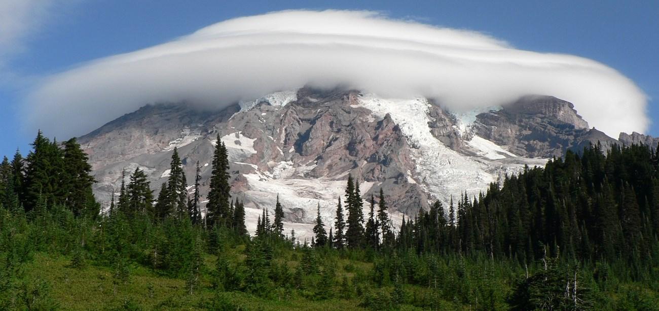 Mount Rainier National Park
 in Washington offers glacier-clad peaks, wildflower meadows, old-growth forests, scenic drives, hiking and heritage.


Swipe for more destinations
Explore more

Explore more of Northern Cascades
Explore Northern Cascades, Washington, for glacier-clad peaks, alpine lakes, forest trails, scenic drives and the dry valleys east of the crest.
Explore Northern Cascades
Explore more of Washington
Explore Washington State: From the vibrant streets of Seattle to the tranquil beauty of the Olympic Peninsula, discover the diverse landscapes, culture, and adventures awaiting you.
Explore Washington