

Coopers Rock State Forest Travel Guide - Free Web & App
Your ultimate guide to Coopers Rock State Forest. Discover top landmarks, proposed trips, and local tips. Free on the web or via the Evendo companion app.


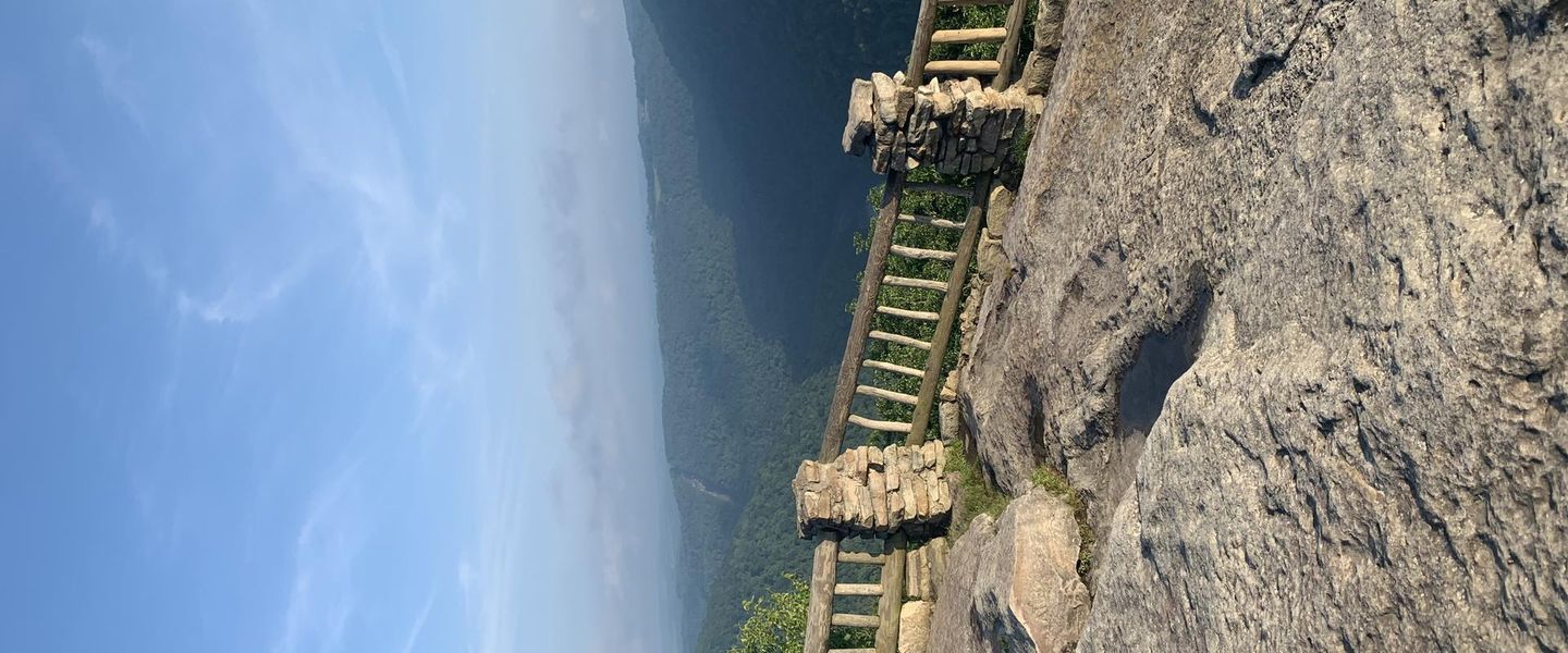


Coopers Rock State Forest, West Virginia, offers Cheat River Gorge overlooks, sandstone trails, forest hikes, camping, climbing and four-season scenery.
Forest, Gorge and High Ridges
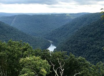
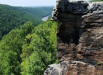
Coopers Rock State Forest occupies more than 12,000 acres in northern West Virginia, close to Morgantown and the Pennsylvania border. Its defining landscape is the deeply cut Cheat River Gorge, where Allegheny Plateau forest rises above sandstone cliffs, wooded ravines and a broad, winding river corridor. The principal overlook, reached from the forest's developed area, looks across a vast sweep of ridges and gorge country, while smaller viewpoints and rocky outcrops reveal a more intimate landscape of hemlock shade, rhododendron thickets and weathered sandstone.Read more about Coopers Rock State Forest
Trails and Outdoor Character
A Gateway to Northern West Virginia
When is the best time to visit Coopers Rock State Forest?
Best: June, August–September · 22–27°C| Month | High (°C) | Rainfall (mm) |
|---|---|---|
| January | 3 | 83 |
| February | 4 | 76 |
| March | 10 | 91 |
| April | 16 | 97 |
| May | 20 | 112 |
| June (best) | 25 | 109 |
| July | 28 | 114 |
| August (best) | 27 | 102 |
| September (best) | 22 | 97 |
| October | 16 | 81 |
| November | 9 | 89 |
| December | 4 | 86 |
Getting to and around Coopers Rock State Forest
How to get there
Transportation
Best attractions in Coopers Rock State Forest
The forest's principal attraction is the Coopers Rock overlook, where a broad view opens across the Cheat River Gorge and the folded, wooded ridges of northern West Virginia. Nearby trails lead through mature woodland and rocky terrain, while Raven Rock offers another recognised viewpoint above the gorge. Rock City is known for weathered sandstone formations that give the forest a more enclosed, geological character than the open overlooks. The Cheat River itself shapes the destination, running through a deep valley used for scenery, fishing and selected water-based recreation rather than continuous lakeside tourism. The forest's recreation areas also include picnic settings, campsites and the Coopers Rock Discovery Center, where visitors can gain context about the landscape and its management. Longer routes link quieter sections of the forest, and designated climbing areas attract experienced climbers. Outside the forest boundary, Morgantown provides museums, restaurants and cultural facilities, but it is a gateway city rather than an attraction within Coopers Rock State Forest.
-
Botanical garden
West Virginia Botanic Garden
Explore the breathtaking beauty of the West Virginia Botanic Garden, a tranquil oasis showcasing diverse plant collections and stunning landscapes.
-
Vista point
Coopers Rock
Explore the breathtaking vistas and outdoor adventures at Coopers Rock State Forest in West Virginia, a nature lover's paradise.
-
Campground
McCollum Campground
Experience the beauty of McCollum Campground in West Virginia – a perfect blend of adventure, tranquility, and nature's wonders.
-
Park
Hemlock Trail
Explore Hemlock Trail in Bruceton Mills, WV: a natural paradise perfect for hiking, picnicking, and immersing yourself in the beauty of West Virginia's landscapes.

Explore Coopers Rock State Forest on the map
Plan your trip on one map. See where the top attractions, landmarks, restaurants and hotels are, and book hotels and experiences in a few clicks.
Best hotels in Coopers Rock State Forest
Best restaurants in Coopers Rock State Forest
Coopers Rock State Forest is primarily a day-out and outdoor recreation destination, not a dining district, and visitors should not expect a concentration of restaurants among the trails and overlooks. Picnic areas provide the most straightforward way to eat inside the forest, so carrying provisions is useful for longer walks or camping trips. The closest small-town facilities are around Bruceton Mills, while Morgantown has the widest selection of cafés, independent restaurants, takeaway outlets and supermarkets within practical driving distance. Dining in the wider region reflects Appalachian and West Virginian traditions alongside familiar American food, with country-style breakfasts, burgers, sandwiches and locally sourced ingredients appearing more often than a narrowly defined forest cuisine. Farm stands and rural shops may be seasonal or limited, so supplies are best arranged before entering the forest, particularly for early starts, evenings or visits to remote trailheads.
-
Restaurant
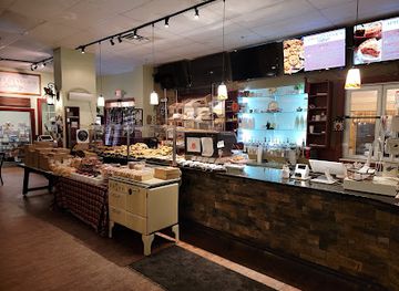
Apple Annie's
Experience the best of American cuisine at Apple Annie's in Morgantown - where family-friendly dining meets delightful bakery treats.
-
Restaurant
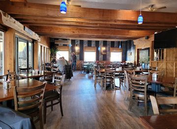
Lake House Restaurant
Experience exquisite local cuisine with breathtaking lake views at Lake House Restaurant in Morgantown, WV – perfect for all food lovers.
-
American
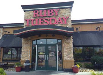
Ruby Tuesday
Experience the best of American cuisine at Ruby Tuesday in Morgantown – where fresh ingredients meet friendly service.
-
American
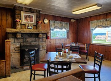
Ruby & Ketchy's Restaurant
Discover the heartwarming flavors of classic American cuisine at Ruby & Ketchy's Restaurant in Morgantown.
Best bars in Coopers Rock State Forest
Evening entertainment is limited within Coopers Rock State Forest, where the night-time atmosphere is shaped by campsites, quiet woodland and dark gorge horizons rather than bars or clubs. Visitors staying overnight should follow current camping and quiet-hour rules and should not assume that facilities operate as a late-night social venue. Bruceton Mills offers a small-town setting with limited hospitality, while Morgantown is the nearest developed evening destination, with the area's broader choice of pubs, bars, casual restaurants, live entertainment and university-influenced cultural activity. These options are outside the forest and require a drive, making them less convenient for campers. Seasonal community events in nearby towns may add local character, but schedules and venues vary, so they should be checked locally rather than presumed to be operating during every visit.
-
Bar
Tropics
Discover the vibrant tropical flavors of Hawaii at Tropics, Morgantown's premier bar and restaurant offering a unique dining experience.
-
Restaurant
Dockside Grille
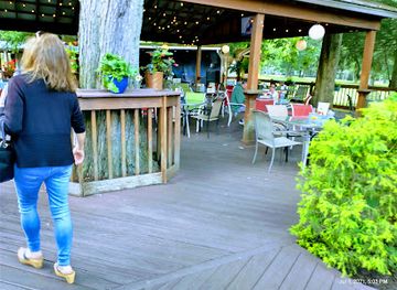
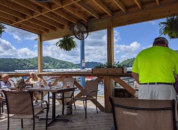
Experience delicious American cuisine at Dockside Grille, a scenic sports bar in Morgantown offering a delightful outdoor dining experience.
-
Bar
Purple Cow Lounge
Experience the vibrant nightlife of Morgantown at Purple Cow Lounge, where delightful drinks and a fun atmosphere await.
-
Sports bar
Legends Sports Bar
Experience the excitement of sports and delicious food at Legends Sports Bar in Morgantown, a must-visit for any sports enthusiast.
Best shops in Coopers Rock State Forest
Shopping inside Coopers Rock State Forest is limited and centred on visitor necessities, interpretation and outdoor use rather than permanent retail streets. Travellers should bring food, fuel, medication and specialist equipment from Morgantown or another gateway before heading into the forest. Bruceton Mills provides a smaller range of local services, while Morgantown has supermarkets, outdoor retailers, bookshops, independent businesses and craft-oriented outlets. In the wider region, West Virginian food products, Appalachian arts and crafts, locally made goods and outdoor equipment can be more meaningful purchases than generic souvenirs, although selection and opening arrangements vary. Forest interpretation and visitor facilities may offer materials connected with the area, but visitors should not assume that a permanent gift shop or broad range of merchandise is available at every recreation site. Rural roadside stands and seasonal producers may appear beyond the forest, particularly during the growing season.
-
Craft store
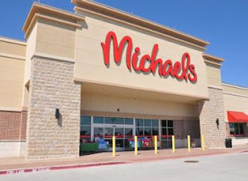
Michaels
Discover endless creativity at Michaels in Morgantown, WV—your go-to craft store for art supplies, home goods, and seasonal decorations.
-
Gift shop
Books-A-Million
Explore the enchanting world of Books-A-Million in Morgantown, a perfect retreat for book lovers and gift seekers alike.
-
Gift shop
Coopers Rock Gift Shop
Discover distinctive souvenirs and local crafts at Coopers Rock Gift Shop, a charming destination in Masontown, West Virginia.
-
Woods
Coopers Rock State Forest
Explore Coopers Rock State Forest: A natural haven in West Virginia with stunning views, diverse trails, and abundant wildlife waiting for your discovery.

Get your free copy of our complete guide to Coopers Rock State Forest, delivered straight to you.
Everything on this page, from attractions and restaurants to essentials and local phrases, in one PDF you can read offline, print or share.
Already have an account? Sign in
Your Coopers Rock State Forest guide is ready.
We'll send it to · Not you? Sign out

Getting your guide ready…
We are putting together a fresh copy of the Coopers Rock State Forest guide. This can take up to a minute.
This can take a few moments. If your browser asks, choose Allow so the download can start. You'll find the guide in your Downloads folder.
Nothing happened? Download it again
Sorry, the guide is taking longer than usual. Please try again in a minute, or get it by email instead.
Coopers Rock State Forest essentials
Currency and Payment
Safety
Emergency Situations
Do's and Don'ts
Local Tips
From Eve
Local phrases worth knowing
You don't need to get them perfect. A few words go a long way, and locals appreciate the effort.
Basics
| English | Local | Say it |
|---|---|---|
| Hello | Howdy | [haʊ.di] |
| Goodbye | See ya | [siː jə] |
| Yes | Yup | [jʌp] |
| No | Nah | [nɑː] |
| Please/You're welcome | Please/No problem | [pliːz/nəʊ ˈprɑbləm] |
| Thank you | Thanks | [θæŋks] |
| Excuse me/Sorry | Pardon/My bad | [ˈpɑːrdn/maɪ bæd] |
| How are you? | How ya doin'? | [haʊ jə ˈduɪn] |
| Fine. And you? | Fine. And you? | [faɪn. ænd jə] |
| Do you speak English? | Ya speak English? | [jə spiːk ˈɪŋɡlɪʃ] |
| I don't understand | I ain't gettin' it | [aɪ ˈeɪnt ˈɡɛtɪn ɪt] |
Eating & Drinking
| English | Local | Say it |
|---|---|---|
| I'd like to see the menu, please | Show me the grub list, please | [ʃoʊ miː ðə ɡrʌb lɪst pliːz] |
| I don't eat meat | I ain't eatin' meat | [aɪ ˈeɪnt ˈiːtɪn mit] |
| Cheers! | Bottoms up! | [ˈbɒtəmz ʌp] |
| I would like to pay, please | I reckon I'll pay now, please | [aɪ ˈrɛkən aɪl peɪ naʊ pliːz] |
Emergencies
| English | Local | Say it |
|---|---|---|
| Help! | Somebody help! | [ˈsʌmbɒdi hɛlp] |
| Go away! | Git outta here! | [ɡɪt ˈaʊtə hɪər] |
| Call the Police! | Ring up the Law! | [rɪŋ ʌp ðə lɔː] |
| Call a doctor! | Get me a doc! | [ɡɛt miː ə dɒk] |
| I'm lost | I'm turned around | [aɪm tɜːnd əˈraʊnd] |
| I'm ill | I'm feelin' poorly | [aɪm ˈfilɪn ˈpʊrli] |
Shopping
| English | Local | Say it |
|---|---|---|
| I'd like to buy... | I reckon I'll buy... | [aɪ ˈrɛkən aɪl baɪ] |
| I'm just looking | Just browsin' | [dʒʌst ˈbraʊzɪn] |
| How much is it? | How much fer it? | [haʊ mʌtʃ fər ɪt] |
| That's too expensive | That's too steep | [ðæts tuː stiːp] |
| Can you lower the price? | Kin ya cut the cost? | [kɪn jə kʌt ðə kɒst] |
Time & Numbers
| English | Local | Say it |
|---|---|---|
| What time is it? | What's the time? | [wɒts ðə taɪm] |
| It's one o'clock | It's one on the dot | [ɪts wʌn ɒn ðə dɒt] |
| Half past (10) | Half past (10) | [hɑːf pæst (10)] |
| Morning | Mornin' | [ˈmɔːrnɪn] |
| Afternoon | Afternoon | [ˌæftəˈnuːn] |
| Evening | Evenin' | [ˈiːvnɪn] |
| Yesterday | Yest'day | [ˈjɛst.deɪ] |
| Today | Today | [təˈdeɪ] |
| Tomorrow | Tomorrer | [ˈtəˈmɒrər] |
| 1 | One | [wʌn] |
| 2 | Two | [tuː] |
| 3 | Three | [θriː] |
| 4 | Four | [fɔːr] |
| 5 | Five | [faɪv] |
| 6 | Six | [sɪks] |
| 7 | Seven | [ˈsɛvən] |
| 8 | Eight | [eɪt] |
| 9 | Nine | [naɪn] |
| 10 | Ten | [tɛn] |
Transport & Directions
| English | Local | Say it |
|---|---|---|
| Where's a/the...? | Where's the...? | [ˈwerz ðə] |
| What's the address? | What's the addy? | [wɒts ðə ˈædi] |
| Can you show me (on the map)? | Can ya point it out (on the map)? | [kæn jə pɔɪnt ɪt aʊt (ɒn ðə mæp)] |
| When's the next (bus)? | When's the next (bus)? | [wɛnz ðə nɛkst (bʌs)] |
| A ticket (to ....) | A pass (to ....) | [ə pæs (tʊ ....)] |
History of Coopers Rock State Forest
An Ancient Plateau Landscape
Coopers Rock stands on the Allegheny Plateau, a dissected upland whose streams have cut deeply into layers of sandstone and other sedimentary rock. The Cheat River Gorge is the central expression of that long geological process, with erosion producing steep slopes, exposed ledges and distinctive formations such as those around Rock City. The forest's present character is also the result of natural succession and changing land use: hardwood ridges, hemlock-lined ravines and rhododendron-filled hollows occupy terrain that has been shaped by water, weather and human activity over very different timescales.
Settlement and the Cooper Legend
The name Coopers Rock is associated with a local legend about a cooper, or barrel maker, who supposedly hid in the forest after becoming involved in a dispute with the law. The story has become part of the area's identity, although details vary in local retellings and should not be treated as a fully documented biography. More broadly, the surrounding Cheat River region developed through rural settlement, timber use, small-scale industry and transport links across the uplands, while the difficult gorge terrain limited dense development within what is now the forest.
Timber, Industry and the Cheat Valley
Like much of West Virginia's upland country, the Cheat River watershed was affected by logging and the industries that depended on forest resources. Timber extraction altered the composition and appearance of the land, while the river corridor served as a natural route through a rugged region. Historic remains and place names around the forest provide reminders of earlier working landscapes, even though the modern visitor experience is primarily recreational. The gorge's steep slopes, exposed rock and limited buildable ground helped preserve a relatively expansive woodland setting.
A State Forest for Recreation
Coopers Rock became a state forest managed for public recreation, forest stewardship and protection of its scenic and ecological character. Roads, picnic grounds, campsites, overlooks and a marked trail network made the Cheat River rim more accessible without turning it into an urbanised resort. Over time, hiking, climbing, mountain biking, fishing and nature observation became established parts of the visitor experience. Current management balances public access with protection of forest habitats, cliffs, waterways and the character of a large working landscape near Morgantown.
Coopers Rock State Forest in Photos
Browse through our photo collection highlighting the charm and character of the destination.
Neighbouring destination travel guides
The closest destinations to Coopers Rock State Forest, if you have time for more than one.
-

-

-

-

-


Swipe for more destinations
Explore more
Explore more of Mountaineer Country
Mountaineer Country pairs West Virginia university towns and Appalachian heritage with forested mountains, waterfalls, lakes, trails and local food.
Explore Mountaineer Country
Explore more of West Virginia
Discover West Virginia's natural beauty, historic charm, and outdoor adventures in the heart of the Appalachian Mountains.
Explore West Virginia