

Free Litchfield Hills Travel Guide & Mobile App
Explore Litchfield Hills with free travel guides. Discover regional history, expert tips, proposed trips, and audio guides on web or mobile app.


Explore Litchfield Hills for New England villages, Appalachian Trail walks, lakes, historic houses, farm-to-table dining and wooded landscapes.
Read more about Litchfield Hills
When is the best time to visit Litchfield Hills?
Best: June, August–September · 23–27°C| Month | High (°C) | Rainfall (mm) |
|---|---|---|
| January | 2 | 89 |
| February | 3 | 76 |
| March | 9 | 96 |
| April | 16 | 101 |
| May | 21 | 106 |
| June (best) | 26 | 101 |
| July | 28 | 110 |
| August (best) | 27 | 109 |
| September (best) | 23 | 96 |
| October | 17 | 106 |
| November | 11 | 101 |
| December | 4 | 96 |
Getting to and around Litchfield Hills
How to get there
Transportation
Top city travel guides in Litchfield Hills
The cities of Litchfield Hills, and the easiest places to base yourself.
-

-

-
-

-
-


Swipe for more cities
Destinations in Litchfield Hills
Resorts, valleys and scenic spots worth a trip of their own.
-

-

-
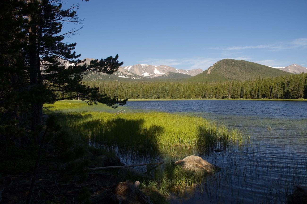 Bear Mountain State Park
 in New York combines Hudson Highlands trails, river views, Perkins Memorial Tower, wildlife exhibits, boating and historic scenery.
-

-

-


Swipe for more destinations
Best attractions in Litchfield Hills
The Litchfield Hills offer a varied combination of outdoor recreation, historic interpretation and small-town cultural attractions. Walkers can follow sections of the Appalachian Trail through the western hills, while state parks such as Kent Falls, Macedonia Brook and Mount Tom provide waterfalls, forest paths, streams, lakes and picnic areas. White Memorial Conservation Center in Litchfield adds natural-history displays, wetlands and an extensive trail network, and the Housatonic River is popular for fishing, canoeing and kayaking where suitable access is available. Winter visitors can ski and snowboard at Mohawk Mountain Ski Area near Cornwall. Historic attractions include the Litchfield Law School, Tapping Reeve House and other preserved buildings around Litchfield’s green, together with local museums and industrial heritage sites. Torrington’s Warner Theatre provides a regional performing-arts focus, while galleries, studios, antiques shops and cultural organisations are particularly prominent in Kent, Washington, Woodbury and neighbouring villages. Farms, orchards, vineyards and conservation properties add a seasonal dimension, with autumn foliage, summer lake activities and spring streams each revealing a different aspect of the landscape.
-
East Rock Park
Discover panoramic views, scenic trails, and historical landmarks at New Haven's iconic East Rock Park, a natural escape for all seasons.
-
Kent Falls State Park
Discover the beauty of Kent Falls State Park: cascading waterfalls, scenic trails, and a peaceful escape in the Litchfield Hills of Connecticut.
-
White Memorial Conservation Center
Explore 4,000 acres of natural beauty at White Memorial Conservation Center in Litchfield, CT. Trails, museum, and year-round programs await!
-
Mt Tom State Park
Explore the breathtaking landscapes and diverse trails of Mt Tom State Park, a premier destination for outdoor adventure in Connecticut.


Best landmarks in Litchfield Hills
Litchfield’s town green, framed by historic civic and religious buildings, is one of the region’s most recognisable architectural landscapes and expresses the importance the settlement acquired as a colonial county centre. The Tapping Reeve House and Law School preserve the memory of the early American legal education that made the town nationally influential. In Salisbury, the remains and landscapes associated with iron production recall the industrial use of local ore, forests and waterpower. Kent Falls, within Kent Falls State Park, is a prominent natural landmark where a series of cascades drops through a wooded ravine. The Housatonic River forms a major geographical landmark through the western hills, linking villages, forests and former industrial sites. Lake Waramaug and Mount Tom provide contrasting water and upland landscapes, while the Appalachian Trail marks the region’s connection to the long-distance footpath extending across the eastern United States. Washington’s historic village areas and the stone-walled rural roads around Litchfield, Salisbury and Cornwall are less monumental, but together they convey the visual character of the hills.
-
Historical place museum
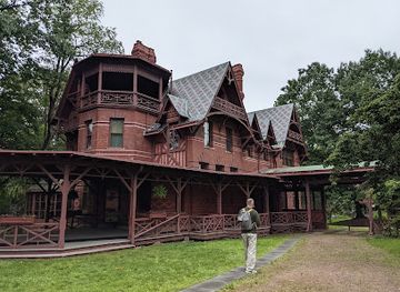
The Mark Twain House & Museum
Explore the rich history of Mark Twain at his magnificent home, where literary genius came to life in Hartford, Connecticut.
-
Historical landmark
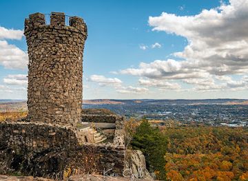
Castle Craig
Experience the breathtaking views and historical charm of Castle Craig in Meriden, Connecticut, a perfect blend of nature and history.
-
Nature preserve
White Memorial Conservation Center
Discover the beauty and biodiversity of the White Memorial Conservation Center, a nature preserve and museum in the heart of Connecticut's Litchfield Hills.
-
State park
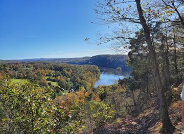
Lovers Leap State Park
Discover the beauty and romance of Lovers Leap State Park in New Milford, Connecticut, where stunning views and outdoor adventures await.

Explore Litchfield Hills on the map
Plan your trip on one map. See where the top cities, national parks and sights are, and book hotels and experiences in a few clicks.
Best hotels in Litchfield Hills
Best restaurants in Litchfield Hills
Dining in the Litchfield Hills reflects New England’s agricultural setting and the region’s mix of villages, farms and country retreats. Restaurants range from historic inns, village pubs and family-run cafés to contemporary kitchens that use local vegetables, orchard fruit, dairy produce and seasonal meats. Farmers’ markets and farm shops are useful for regional cheeses, baked goods, preserves, maple products and fresh produce, while orchards and roadside stands become especially prominent in late summer and autumn. Woodbury, Litchfield, Kent, Washington and Torrington offer the broadest concentration of cafés and restaurants, though rural inns and farm-based businesses are scattered across the wider hills. Craft breweries, cider producers and Connecticut wineries provide local drinks, and some establishments build tasting visits into a countryside itinerary. Menus change with the season, and reservations are prudent on autumn weekends or during summer events. Visitors should not expect one single dish to define the area; its culinary identity lies more in farm produce, traditional American cooking and contemporary interpretations of the wider New England pantry.
-
Family-friendly
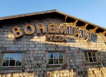
Bohemian Pizza and Tacos
Experience a unique blend of gourmet pizzas and flavorful tacos at Bohemian Pizza and Tacos in Litchfield, CT.
-
American
@ the Corner
Experience delightful American cuisine at @ the Corner in Litchfield—where fresh ingredients meet creative flavors in a cozy setting.
-
New American
Arethusa al tavolo
Experience exquisite New American cuisine at Arethusa al Tavolo in Bantam, CT – where local flavors meet culinary artistry.
-
Italian
DaCapo of Litchfield
Discover DaCapo of Litchfield: A Culinary Journey Through Authentic Italian Flavors in Connecticut's Scenic Town.


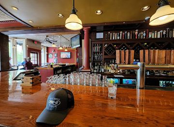
Best bars in Litchfield Hills
Evening life in the Litchfield Hills is centred on traditional pubs, restaurant bars, historic inns, breweries and occasional live-music or theatre events rather than a large nightclub scene. Litchfield, Kent, Washington and Torrington provide the most dependable range of places for a drink or late meal, while smaller villages may have only one or two evening options. Torrington’s Warner Theatre can bring concerts, comedy and stage productions to the area, creating a cultural alternative to bar-hopping. Breweries and cider or wine-tasting venues contribute to the region’s contemporary drinks culture, but their arrangements and hours vary by season. In rural districts, evenings are generally quieter, and visitors staying outside the main towns should plan transport in advance rather than rely on late public services. As elsewhere in Connecticut, alcohol service is subject to state law, identification may be requested, and drinking and driving should be avoided.
-
The White Horse
Experience the charm of American and British cuisine at The White Horse in New Preston, a delightful pub with a welcoming atmosphere and diverse menu.
-
Bohemian Pizza and Tacos
Discover a fusion of flavors at Bohemian Pizza and Tacos in Litchfield, where fresh ingredients meet culinary creativity in every bite.
-
@ the Corner
Experience the charm of Litchfield with delicious American cuisine and a cozy ambiance at @ the Corner, your perfect dining destination.
-
DaCapo of Litchfield
Explore authentic Italian cuisine at DaCapo of Litchfield, where exceptional service and delicious flavors create an unforgettable dining experience.

Best nightclubs in Litchfield Hills
-
Ski resort
Mohawk Mountain Ski Area
Experience the thrill of winter sports at Mohawk Mountain Ski Area, a family-friendly ski resort in beautiful Cornwall, Connecticut, perfect for all ages.
-
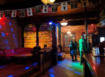
Night club
The Lady
Discover Hartford's nightlife at The Lady, a trendy night club featuring an arcade, live music, and a vibrant atmosphere for a memorable evening.
-
Pub
Molly Darcy’s Irish Pub & Restaurant
Discover the vibrant atmosphere of Molly Darcy's Irish Pub & Restaurant, where authentic Irish cuisine meets live music and great company.
-
Restaurant
Roma Restaurant
Experience authentic Italian cuisine at Roma Restaurant, where delicious pizzas and a lively atmosphere await in New Britain, Connecticut.


Best shops in Litchfield Hills
Shopping in the Litchfield Hills is strongest in historic town centres and along rural roads rather than in large retail districts. Woodbury is particularly associated with antiques and decorative arts, with dealers spread across the town rather than gathered in one single enclosed centre. Kent, Litchfield and Washington offer independent bookshops, galleries, antiques dealers, clothing shops, homeware and locally made work, while Torrington provides a broader everyday retail base. Farm shops, orchards, roadside stands and farmers’ markets are good places to find maple products, cider, preserves, baked goods, cheese and seasonal produce. Craft shopping may include pottery, woodwork, textiles, jewellery and artwork from local studios, although opening arrangements can be seasonal. Visitors should distinguish between goods genuinely made in the region and generic souvenirs sold alongside them. Many smaller businesses keep individual hours, so a little advance checking is worthwhile, especially outside summer and autumn weekends.
-
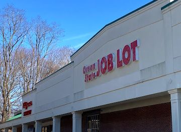
Discount store
Ocean State Job Lot
Discover unbeatable deals and unique finds at Ocean State Job Lot, your one-stop discount store in Litchfield, Connecticut.
-
Grocery store
Stop & Shop
Explore Litchfield's Stop & Shop for a delightful grocery experience, featuring local flavors, fresh produce, and convenient shopping.
-
Shopping mall
Litchfield Crossings
Explore Litchfield Crossings: A vibrant shopping mall in New Milford, Connecticut, perfect for retail therapy and delightful dining experiences.
-
Gift shop
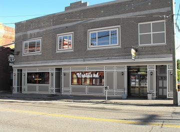
Wasteland Gift Shop
Explore the eclectic Wasteland Gift Shop in Torrington, CT, for unique gifts, clothing, and collectibles that reflect local culture and creativity.

Get your free copy of our complete guide to Litchfield Hills, delivered straight to you.
Everything on this page, from attractions and restaurants to essentials and local phrases, in one PDF you can read offline, print or share.
Already have an account? Sign in
Your Litchfield Hills guide is ready.
We'll send it to · Not you? Sign out

Getting your guide ready…
We are putting together a fresh copy of the Litchfield Hills guide. This can take up to a minute.
This can take a few moments. If your browser asks, choose Allow so the download can start. You'll find the guide in your Downloads folder.
Nothing happened? Download it again
Sorry, the guide is taking longer than usual. Please try again in a minute, or get it by email instead.
Litchfield Hills essentials
Currency and Payment
Safety
Emergency Situations
Do's and Don'ts
Local Tips
From Eve
Local phrases worth knowing
You don't need to get them perfect. A few words go a long way, and locals appreciate the effort.
Basics
| English | Local | Say it |
|---|---|---|
| Hello | Hi there | [Hai thair] |
| Goodbye | Take care | [Teik keir] |
| Yes | Yup | [Yup] |
| No | Nope | [Nope] |
| Please/You're welcome | Sure thing | [Shur thing] |
| Thank you | Thanks a lot | [Thainks a lot] |
| Excuse me/Sorry | Pardon me | [Pardon mee] |
| How are you? | How ya doin'? | [How ya doin'?] |
| Fine. And you? | Good. And you? | [Good. And you?] |
| Do you speak English? | You speakin' English? | [Yoo speekin' English?] |
| I don't understand | I ain't gettin' it | [I ain't gettin' it] |
Eating & Drinking
| English | Local | Say it |
|---|---|---|
| I'd like to see the menu, please | Can I see the menu, please? | [Can I see the menu, pleez?] |
| I don't eat meat | I don't do meat | [I don't do meat] |
| Cheers! | Cheers! | [Cheers!] |
| I would like to pay, please | Can I get the check, please? | [Can I get the chek, pleez?] |
Emergencies
| English | Local | Say it |
|---|---|---|
| Help! | Help! | [Help!] |
| Go away! | Leave me alone! | [Leev mee alone!] |
| Call the Police! | Call the cops! | [Call the cops!] |
| Call a doctor! | Get a doctor! | [Get a doctor!] |
| I'm lost | I’m lost | [I'm lost] |
| I'm ill | I’m sick | [I'm sick] |
Shopping
| English | Local | Say it |
|---|---|---|
| I'd like to buy... | I wanna buy... | [I wanna buy...] |
| I'm just looking | Just browsing | [Just browsing] |
| How much is it? | What’s the price? | [What's the price?] |
| That's too expensive | That’s a bit pricey | [That’s a bit pricy] |
| Can you lower the price? | Can you drop the price? | [Can you drop the price?] |
Time & Numbers
| English | Local | Say it |
|---|---|---|
| What time is it? | What time's it? | [What time's it?] |
| It's one o'clock | It's one o'clock | [It's one o'clock] |
| Half past (10) | Half past ten | [Half past ten] |
| Morning | Morning | [Morning] |
| Afternoon | Afternoon | [Afternoon] |
| Evening | Evening | [Evening] |
| Yesterday | Yesterday | [Yesterday] |
| Today | Today | [Today] |
| Tomorrow | Tomorrow | [Tomorrow] |
| 1 | One | [Wun] |
| 2 | Two | [Too] |
| 3 | Three | [Three] |
| 4 | Four | [For] |
| 5 | Five | [Fiv] |
| 6 | Six | [Six] |
| 7 | Seven | [Sev-en] |
| 8 | Eight | [Ait] |
| 9 | Nine | [Nin] |
| 10 | Ten | [Ten] |
Transport & Directions
| English | Local | Say it |
|---|---|---|
| Where's a/the...? | Where’s a...? | [Where's a...?] |
| What's the address? | What's the address? | [What's the address?] |
| Can you show me (on the map)? | Can you point it out? | [Can you point it out?] |
| When's the next (bus)? | When’s the next bus? | [When's the next bus?] |
| A ticket (to ....) | A ticket to ... | [A tiket to ...] |
History of Litchfield Hills
Indigenous Homelands and Native Trade Routes
Before European settlement, the hills and river valleys were used by Indigenous communities whose seasonal movements, hunting grounds and trade routes followed the Housatonic and other waterways. The region is associated with peoples including the Weantinock and other Native communities of western Connecticut, within a wider network linking the Hudson Valley, inland New England and Long Island Sound. Place names and archaeological evidence preserve only part of this earlier history. European colonisation brought land transactions, conflict, disease and major disruption to Indigenous life, while later towns were built along routes that often followed older paths through the uplands.
Colonial Settlement and the Litchfield Green
English settlement expanded into north-western Connecticut during the eighteenth century, creating farmsteads, meetinghouses, mills and village centres. Litchfield became an important county seat after its founding in the 1720s, and its central green developed as a civic and commercial focus. Other settlements grew around rivers, fertile valleys and transport routes, including Kent, Woodbury, Salisbury and Washington. Surviving houses, churches, cemeteries and town greens reflect the prosperous Federal and early Republican eras, although the landscape also depended on the labour of enslaved people and other groups whose contributions were often omitted from older accounts.
Revolutionary Connecticut and the Early Republic
Residents of the Litchfield Hills participated in Connecticut’s political and military life during the American Revolution, while local farms and workshops supported the war effort. The region produced influential public figures, including Oliver Wolcott, a Litchfield resident who signed the Declaration of Independence and later served as governor of Connecticut. After independence, Litchfield became a notable centre of legal education through the Litchfield Law School, founded by Tapping Reeve in 1784. Its students carried legal and political influence across the young United States, helping give the town an importance beyond its rural setting.
Iron, Mills and Water-Powered Industry
The region’s forests, streams and mineral resources supported ironworking and other small industries from the colonial period into the nineteenth century. Salisbury became particularly associated with iron production, including blast furnaces that used local ore, charcoal and waterpower. Smaller furnaces, forges, sawmills and gristmills operated elsewhere along the valleys. These industries altered forests and waterways and connected the hills to wider markets. Later, many sites declined as technology, transport and competition changed, but furnace remains, mill buildings, ponds and industrial archaeology still reveal the working landscape behind the region’s pastoral appearance.
Turnpikes, Railways and the Rise of Market Towns
Improved roads and nineteenth-century railways connected the hills with Hartford, New York, the Hudson Valley and other commercial centres. Rail access strengthened towns such as Torrington and Winsted, although Winsted lies just east of the commonly defined Litchfield Hills area, and supported manufacturing, timber, agriculture and the movement of visitors. Torrington developed a substantial industrial economy, particularly in metalworking and precision manufacturing. Railways also changed the region’s relationship with the outside world by making summer travel and country tourism more practical, even as some branch lines later closed and roads became the dominant means of transport.
Agriculture, Craft and Country Tourism
During the late nineteenth and twentieth centuries, changes in farming and industry encouraged a new economy based on dairying, orchards, small-scale agriculture, crafts and seasonal tourism. Country estates and summer residences appeared around lakes and villages, while artists, writers and craftspeople were drawn by the landscape and relative proximity to New York and Hartford. Antiques, historic preservation and local food later became important parts of the visitor economy. This transition did not erase the region’s working communities, but it did create the mixture of farms, cultural institutions, second homes and service businesses visible today.
Conservation and the Modern Hills
Twentieth-century conservation efforts protected large areas of woodland, wetlands, rivers and upland habitat from development. White Memorial Conservation Center, established through the work of Alain and May White, became a major centre for environmental education and land stewardship in Litchfield. State parks, forests, land trusts and protected watersheds now shape access to places such as Macedonia Brook, Mount Tom and the Housatonic valley. Contemporary Litchfield Hills culture combines historic preservation with outdoor recreation, farming, theatre, galleries and independent businesses, while ongoing conservation debates address housing, working land, traffic and the pressures of seasonal visitation.
Litchfield Hills in Photos
Browse through our photo collection highlighting the charm and character of the destination.
Neighbouring regions of Litchfield Hills
The closest regions to Litchfield Hills, if you have time for more than one.
-

-

-

-

-


Swipe for more regions
Explore more

Explore more of Connecticut
Discover Connecticut: A blend of charming coastal towns, rich history, and scenic landscapes, perfect for nature lovers, history buffs, and cultural enthusiasts.
Explore Connecticut