From Eve
Know before you go
Hi, I'm Eve. Here are a few practical things to know before exploring Kultippen Hasle.
Local know-how to help you travel smarter and make the most of every moment.
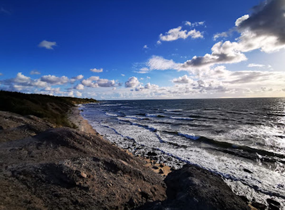
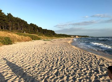
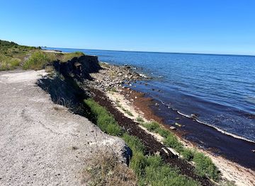
A stark, moonlike coal tip above a soft Baltic beach, where Bornholm’s industrial past meets wild forest and wide, west-coast horizons.
Kultippen, just south of Hasle on Bornholm’s west coast, is a striking man‑made moonscape where coal‑mining waste once slid into the Baltic Sea. Today the dark slag slopes, scattered old mine trolleys and rough terraces form a dramatic contrast to the surrounding green forest and pale sandy beach below. It is a free, open‑air landscape for short hikes, sea views and atmospheric sunsets, offering an unusual mix of industrial heritage and wild coastal nature.
Opening times, essentials, and a few local tips gathered into one calmer, easier-to-scan planning section.
Hi, I'm Eve. Here are a few practical things to know before exploring Kultippen Hasle.
Local know-how to help you travel smarter and make the most of every moment.
Car from Rønne
From Rønne, driving to Kultippen near Hasle typically takes around 15–20 minutes. You follow the main coastal road north towards Hasle and then continue south of the town to the small access road leading to the Glasværksvej parking area, a simple gravel lot close to the forest edge. Parking is free, but spaces are limited in peak summer and the last stretch is narrow, so larger vehicles should drive slowly and be prepared to reverse if meeting oncoming traffic.
Local bus plus short walk
Regional buses between Rønne and Hasle usually run several times a day and the journey takes roughly 20–25 minutes. Tickets are generally in the range of 25–40 DKK one way, depending on route and purchase method. From central Hasle you can walk through the coastal forest towards the south; expect around 25–35 minutes on mostly easy forest paths with some gentle slopes. Surfaces are natural and can be muddy after rain, so this option is better for reasonably mobile visitors.
Bicycle along the west coast
Cycling from Rønne to Kultippen takes about 35–50 minutes for most riders, using the signed coastal cycle route that links Rønne with Hasle and continues through forest and along quieter roads. The route includes short hills but no extreme gradients. There is no specific bike parking, so you simply leave your bicycle at the edge of the forest near the main path. This is a pleasant, low-cost option in spring, summer and early autumn; in strong winds or heavy rain it can feel exposed along the coast.
Catch the right light and the right mood, whether you want a bright city moment or a more cinematic evening visit.


Use Tower Bridge as your starting point for nearby food, family ideas, nightlife, and more local discoveries.
A quick look at seasonal patterns and peak visiting hours.

Explore expert travel guides, compare and book tours, experiences, hotels, and more—all from the palm of your hand. Download now for seamless trip planning wherever your wanderlust takes you.

Explore Bornholm: Denmark's Baltic gem, offering stunning nature, rich history, and vibrant local culture. Perfect for nature lovers, history buffs, and food enthusiasts.
Tell me more about Bornholm