From Eve
Know before you go
Hi, I'm Eve. Here are a few practical things to know before exploring Dovns Klint.
Local know-how to help you travel smarter and make the most of every moment.

Wind-shaped cliffs, big Baltic skies and quiet pebble shores at the southernmost tip of Langeland, where Ice Age geology meets tranquil Danish coastal life.
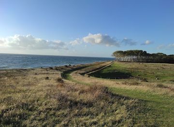
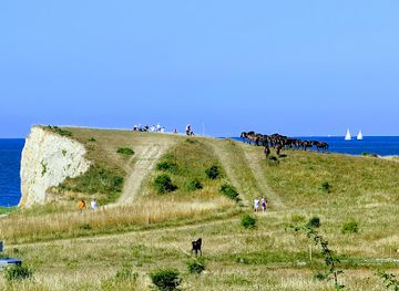
Dovns Klint marks the dramatic southern tip of Langeland, a low white cliff line where the Baltic Sea meets the Langeland Belt. Here, wind-sculpted grasslands drop towards pebble beaches, Ice Age “hat hills” frame sweeping sea views, and coastal paths invite unrushed walks along the edge of Denmark. It is a peaceful, open landscape where migrating birds, wild ponies in nearby grazing areas, and anglers all share the same salt-tinged horizon, especially striking in clear spring and summer light.
Opening times, essentials, and a few local tips gathered into one calmer, easier-to-scan planning section.
Hi, I'm Eve. Here are a few practical things to know before exploring Dovns Klint.
Local know-how to help you travel smarter and make the most of every moment.
Car from Rudkøbing (Langeland)
From Rudkøbing town on Langeland, driving to Dovns Klint typically takes 35–45 minutes, following the main island road south through open countryside towards Bagenkop and continuing along Gulstavvej to the coastal parking area. The route is on paved public roads that are generally well maintained but narrow in the final stretch, so slower speeds are sensible. Parking at the end of the road is free, with a short, gently sloping walk across grassland to reach the cliff edge.
Car via ferry from Svendborg (Funen)
If you are coming from mainland Funen, allow around 1.5–2 hours in total, including the ferry crossing from Svendborg to Rudkøbing and the onward drive down Langeland. Standard passenger cars on the ferry usually cost in the range of 150–300 DKK one way depending on season and ticket type, while foot passengers and cyclists pay notably less. Ferries run several times daily but schedules vary, so checking departure times is important, especially outside summer.
Bike from Bagenkop
From the harbour town of Bagenkop, cycling to Dovns Klint typically takes 20–30 minutes each way at an easy pace, using lightly trafficked rural roads and signposted local routes. The terrain is mostly flat to gently rolling, exposed to wind from the sea, which can make the ride feel more strenuous in strong headwinds. There is no dedicated bike parking infrastructure at the coast, but bicycles can be left near the main parking area; bring a good lock and lights if returning around dusk.
Hiking from Bagenkop
For those on foot in Bagenkop, the coastal hike to Dovns Klint usually takes 1.5–2.5 hours one way, depending on the exact route and pace. Paths combine grassy tracks, field edges and sections along the beach, which can be uneven, stony and muddy after rain. The route is best attempted in sturdy footwear and is not ideal for strollers or wheelchairs. There is no cost to access the area, but weather can change quickly, so carrying water, layers and a basic windproof is recommended.
Catch the right light and the right mood, whether you want a bright city moment or a more cinematic evening visit.


Use Tower Bridge as your starting point for nearby food, family ideas, nightlife, and more local discoveries.
A quick look at seasonal patterns and peak visiting hours.

Explore expert travel guides, compare and book tours, experiences, hotels, and more—all from the palm of your hand. Download now for seamless trip planning wherever your wanderlust takes you.
Discover Langeland: Denmark's idyllic island retreat with scenic landscapes, rich history, and vibrant culture. Perfect for nature lovers, history buffs, and festival goers.
Tell me more about Langeland