Sydligste Punkt på Langeland – Dovns Klint
Wind‑sculpted cliffs, pebble shores and wide Baltic horizons at the southernmost point of Langeland, where Ice Age hills meet open sea and endless sky.
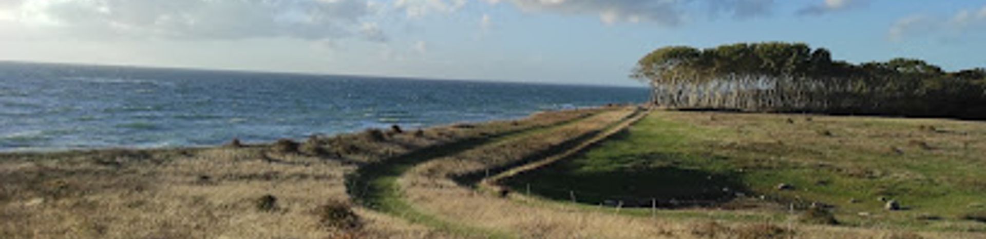
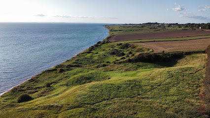
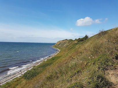
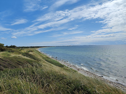
At Dovns Klint, the southernmost point of Langeland, raw Baltic winds meet steep Ice Age cliffs, rounded shingle beaches and wide sea horizons. This is a place of open skies, migrating birds and restless waves, where glacial “hat hills” drop sharply to the water and pebble banks crunch underfoot. Anglers, hikers, divers and birdwatchers all share this elemental corner of Denmark, drawn by its geology, wildlife and sweeping coastal views.
A brief summary to Sydligste Punkt på Langeland
- Gulstavvej 24, Bagenkop, 5935, DK
- Visit website
- Duration: 1 to 3 hours
- Free
-
 Outdoor
- Mobile reception: 4 out of 5
- Monday 12 am-12 am
- Tuesday 12 am-12 am
- Wednesday 12 am-12 am
- Thursday 12 am-12 am
- Friday 12 am-12 am
- Saturday 12 am-12 am
- Sunday 12 am-12 am
Local tips
- Wear sturdy shoes: the access paths are easy, but the beach is all rounded pebbles and can feel unstable underfoot, especially in wet or windy weather.
- Bring windproof layers year‑round; the exposed headland often feels several degrees cooler than inland, even on seemingly calm, sunny days.
- If you are here for birdwatching, plan around spring and autumn migration and pack binoculars; the wide sea views make distant species easier to spot.
- Anglers and divers should carry out all tackle and lines; the pebble beach and shallow seabed easily trap hooks and lead, posing risks to wildlife.
- Time your visit for early morning or late evening in clear weather to enjoy dramatic light over the Baltic and long shadows across the hat‑hill landscape.
For the on-the-go comforts that matter to you
- Restrooms
- Seating Areas
- Trash Bins
- Information Boards
Getting There
-
Car from Rudkøbing (Langeland town)
From Rudkøbing, drive south across Langeland following the main road toward Bagenkop; the journey typically takes 35–45 minutes depending on traffic. About a kilometre before Bagenkop you turn inland toward Gulstav and continue until the public coastal car park near Dovns Klint, from where it is a short walk on level ground to the cliff edge. Access and parking are free, but spaces can feel limited on bright weekends and during school holidays.
-
Bus and short walk from Bagenkop
Regional buses connect Rudkøbing with Bagenkop in about 45–55 minutes, running a few times per day. From Bagenkop you can continue by local bus or taxi toward Gulstav, or walk the final stretch on quiet rural roads and signposted paths in around 45–60 minutes, depending on your pace. Bus fares on Langeland are typically in the range of 20–40 DKK per adult each way; services are less frequent in evenings and on weekends, so check current timetables in advance.
-
Cycling from Bagenkop
From Bagenkop harbour area, the ride to the Dovns Klint car park follows gently undulating minor roads through open farmland and characteristic hat‑hill scenery, usually taking 15–25 minutes by bicycle. The route is on paved surfaces with light traffic but can feel exposed in strong winds. There is no dedicated bike parking infrastructure at the cliff, yet cycles can be locked at the edge of the parking area while you continue on foot.
Sydligste Punkt på Langeland location weather suitability
-
 Clear Skies
-
 Windy Conditions
-
 Mild Temperatures
-
 Cold Weather
-
 Any Weather
Discover more about Sydligste Punkt på Langeland
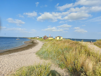
Where Langeland Ends and the Sea Begins
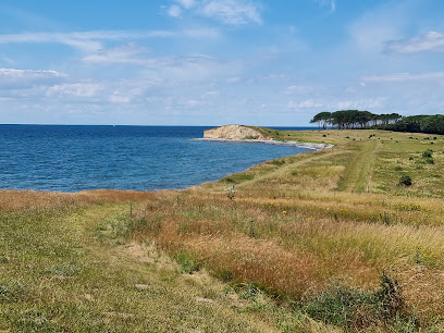
Dovns Klint marks the very tip of Langeland, a narrow tongue of land thrust into the meeting point between the Langeland Belt and the Baltic Sea. Standing here you are surrounded by water on three sides, with uninterrupted views across roughly 35 kilometres of open sea toward northern Germany. The horizon feels unusually wide, the sky dominant, the wind almost a constant companion. Below the grassed cliff tops the beach is made of rounded pebbles and stones rather than soft sand. The surf rolls in over banks of flint and granite boulders, polishing them smooth and filling the air with a steady, rattling hiss as each wave retreats. This stony shore is not ideal for casual bathing, but it creates a powerful sense of being on a true outer coast.Ice Age Landscapes and the Famous Hat Hills
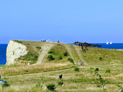
The cliffs around Dovns Klint are a showcase of Langeland’s Ice Age story. Along the four‑kilometre stretch between Bagenkop and the southern tip, the coastline cuts through a chain of dome‑shaped “hat hills”, exposing layers of moraine clay laid down 19–17,000 years ago. In places the sea has sliced these hills in half, revealing their internal structure in natural cross‑sections. Between the elevated ridges lie flatter moraine surfaces and shallow depressions, some of which later became bogs and wetlands such as nearby Gulstav Mose. Walking along the cliff‑top paths or down at beach level, you can see how erosion continues to sculpt the coastline, slowly eating into the glacial deposits while building up storm beaches and sea‑walls of rounded pebbles further along the bay.Wild Seabirds, Coastal Flora and Big Skies
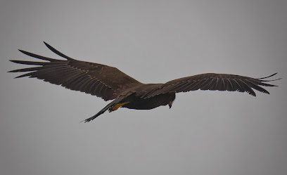
The open position of Dovns Klint makes it an excellent place for birdlife. During migration seasons sea ducks, geese and raptors follow the coastline, using the island as a waypoint. Offshore, cormorants and gulls ride the wind, while closer in you may spot waders picking among the stones for food. With patience and binoculars, the changing bird traffic becomes a show of its own. On land, the salty air and exposure to strong winds favour tough coastal plants. Grasses cling to the cliff edges, while low, hardy vegetation dots the slope. In summer, splashes of wildflowers appear in sheltered patches, contrasting with the muted greys and blues of stone and sea. The combination of open sea, shifting cloud and constantly changing light keeps the landscape visually dynamic in every season.Footpaths, Pebble Shores and Quiet Shelters
A network of waymarked trails runs along the southern coastline, linking Dovns Klint with Gulstav Klint, Gulstav Mose and the countryside around Bagenkop. These routes follow easy tracks and field edges, with only short, steeper sections where paths drop to beach level. The moderate gradients and open views make the area suitable for most walkers with basic fitness and sensible footwear. Down on the shore, walking on the pebble beach is slower and more strenuous but rewarding. The sound of the sea is stronger here, and the cliffs rise above you in a series of small headlands and bays. Simple coastal shelters in the wider area offer basic overnight possibilities for those who want to experience the quiet of the night, listening to waves and wind with almost no artificial light.Anglers, Divers and Life Beneath the Waves
Although the beach is not a classic swimming spot, Dovns Klint is well known among anglers and divers. The stony seabed and varying depths create good conditions for flatfish and other coastal species, and local fishing lines are a common sight during spring and summer. Just offshore, a varied underwater landscape of gravel, chalk deposits and eel‑grass belts provides habitat for crabs, shrimps and pipefish. Scuba divers use the headland as a shore‑entry site, exploring depths of around five to seven metres. Currents are usually weak and run parallel to the coast, but visibility and conditions vary with the weather. From the clifftop you can look down over the water and imagine this hidden world of marine life moving among rocks and seaweed, just out of sight beneath the surface.Atmosphere of Solitude at Denmark’s Edge
Despite its accessibility, the southern tip of Langeland retains a feeling of remoteness. There are no large buildings by the cliff edge, only a simple parking area set back from the coast and a few basic facilities. Once you walk away from the cars, the only sounds are wind, surf, birds and your own footsteps on grass or stone. That sense of being at the “end of the land” is what defines Dovns Klint. It is a place to slow your pace, watch the sea in all its moods and feel the elemental forces that shaped this narrow island. Whether you come for geology, birdlife, coastal walks or simply the wide northern light, this southern headland offers an uncomplicated but memorable encounter with Denmark’s maritime landscape.Iconic landmarks you can’t miss
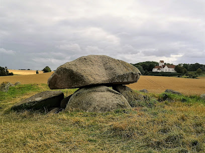
Langdyssen "Kong Humbles Grav"
12.9 km
A 55‑metre Stone Age long dolmen in the fields north of Humble, where legend, prehistoric engineering and soft Langeland landscapes meet in quiet simplicity.
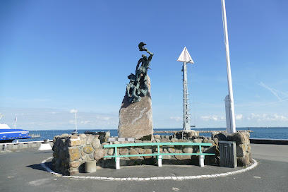
Monument for Danske Sømænd
18.5 km
A modest harbourfront memorial in Marstal that quietly honours generations of Danish sailors who left this island port and never returned from the sea.
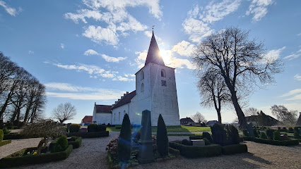
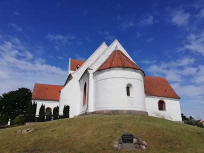
Rise Kirke
23.9 km
A quietly beautiful 12th‑century countryside church on Ærø, where whitewashed walls, historic graves and open fields tell the island’s rural and seafaring story.
Andelen Guesthouse
25.7 km
Discover the charm of Ærøskøbing at Andelen Guesthouse, your cozy retreat in the heart of Denmark's picturesque island.
På Torvet
25.8 km
Experience the unique charm of På Torvet in Ærøskøbing, where historic beauty meets modern comfort in the heart of Denmark.
Danish Island Weddings
25.9 km
Experience the magic of weddings on the enchanting Danish island of Ærø, where love meets scenic beauty and unforgettable memories are made.
Ærø Turist & Erhverv
26.0 km
Explore the beautiful island of Ærø with expert insights and resources from Ærø Turist & Erhverv, your local tourist information center.
Ærøfærgerne
26.0 km
Experience the scenic ferry ride to Ærø Island via Ærøfærgerne, where Danish charm meets breathtaking coastal views.
Hotel Ærøhus
26.1 km
Historic hotel in the heart of Ærøskøbing known for its authentic Danish charm, lush gardens, and local island cuisine—a perfect base for exploring Ærø.
Hattesens Konfektfabrik Aps
26.1 km
Discover the sweet artistry of traditional Danish liquorice at Hattesens Konfektfabrik Aps in scenic Ærøskøbing.
Forladt skorsten
29.6 km
A haunting brick ruin marking Ærø's vanished industrial era, standing silent on the island's edge.
Bregninge Kirke
31.2 km
Medieval island church on a gentle Ærø hillside, where whitewashed stone, quiet fields and seafaring stories meet in a calm, contemplative setting.
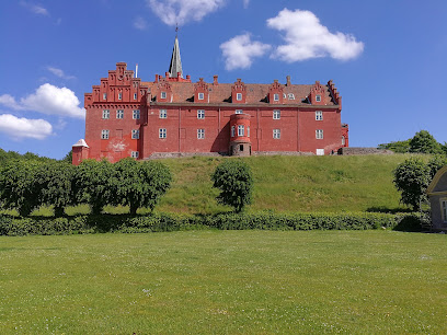
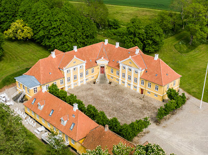
Tranekær Castle
32.8 km
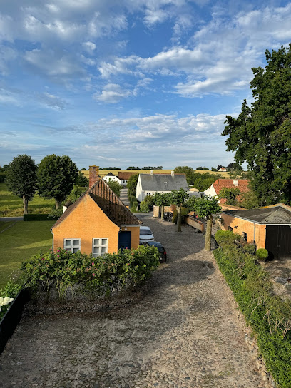
A red-plastered island fortress turned noble family home, Tranekær Castle crowns a hat-shaped hill on Langeland, blending medieval power, romance and working estate life.
Søbygård
34.3 km
Discover Søbygaard: Ærø's historic manor offering cultural exhibitions, concerts, and family-friendly activities in a picturesque setting.
Ærø Museum
34.3 km
Explore Ærø Museum: A captivating journey through the unique history and culture of Ærø Island, Denmark.
Unmissable attractions to see
Dovns Klint
0.1 km
Wind-shaped cliffs, big Baltic skies and quiet pebble shores at the southernmost tip of Langeland, where Ice Age geology meets tranquil Danish coastal life.
Vilde heste
0.3 km
A free‑roaming herd of hardy Exmoor ponies shaping a wild coastal landscape of grassland, marsh and cliffs at the southern tip of Langeland.
Hulbjerg | Burial site from the Peasant Stone Age
1.6 km
Crawl into a 5000‑year‑old Stone Age tomb on windswept Langeland and stand inside one of Denmark’s best‑preserved passage graves, where early surgery left its mark.
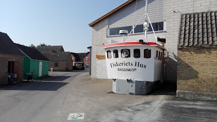
Fiskeriets Hus
3.4 km
Intimate harbor-side museum where Bagenkop’s fishing past comes alive through artifacts, stories, and an immersive ship simulator on southern Langeland.
Bagenkop Kunsthal
3.6 km
Harbor-front contemporary art in a former rescue station, where changing exhibitions and coastal light meet at the southern tip of Langeland.
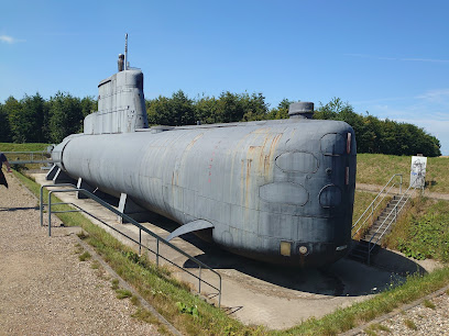
Langelandsfort
3.7 km
A former coastal stronghold on Langeland’s southern tip where bunkers, ships and Cold War stories meet sea air, open skies and hands-on family exploration.
Broløkke
5.5 km
Historic Langeland manor reborn as a stylish countryside retreat with on-site dining, brewery, spa comforts, and spacious grounds for romantic stays and events.
Langdysse i Ormstrup
7.7 km
Experience Langeland’s ancient past inside Hulbjerg, a stunning Neolithic passage grave where Stone Age architecture, rituals, and landscape come vividly to life.
Tryggelev Nor bird sanctuary
8.1 km
Denmark's premier wetland sanctuary for vulnerable breeding birds and migratory raptors.
Tryggelev Kirke
9.1 km
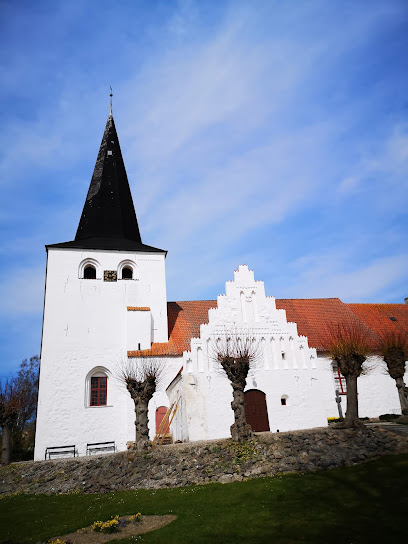
A humble 12th‑century village church on South Langeland, with a rare medieval stone barn and a tranquil churchyard steeped in rural Danish history.
Ristinge Klint
13.0 km
Dramatic ice‑age cliffs, sweeping Baltic views and simple coastal trails make Ristinge Klint a quietly spectacular corner of southern Langeland.
Naturdestination Skovsgaard
14.2 km
Organic estate, wild-grazing herds and slow island living come together at this Langeland nature destination of trails, learning spaces and cosy stays.
Lindelse Kirke
16.1 km
Experience Hulbjerg Passage Grave on Langeland, a Neolithic burial monument where prehistoric engineering and ancient stories come together amid stunning natural views.
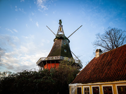
Lindelse Mølle
16.5 km
Historic hilltop windmill and former mill farm on Langeland, blending rural views, traditional architecture and emerging community life in a compact village setting.
Badehusene i Marstal
17.4 km
A slender sand spit lined with vividly painted wooden bathing huts, Badehusene i Marstal capture Ærø’s gentle island spirit, maritime heritage and slow seaside living.
Essential places to dine
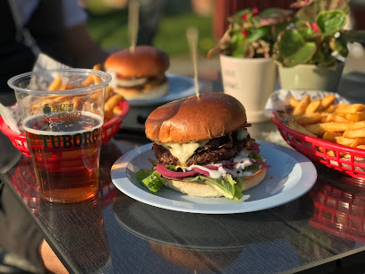
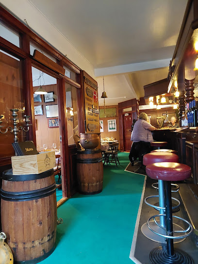
Spisestedet Havnen,Langeland, Bagenkop
3.5 km
Relaxed harbour-side brasserie in Bagenkop serving hearty Danish comfort food and fresh local fish just a few steps from the boats on Langeland’s southern tip.

Humble Pizza & Grill
11.6 km
Casual pizzeria, grill and café in the village of Humble, serving hearty pizzas, burgers and Bosnian-style grills for easy dine-in or takeaway on Langeland.
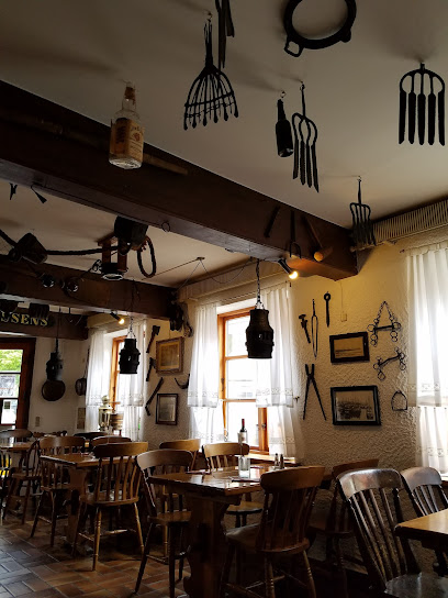
Humble Kro Hotel
11.6 km
Traditional Danish roadside inn in the village of Humble, serving classic kro food with simple, budget‑friendly rooms close to Langeland’s beaches and countryside.

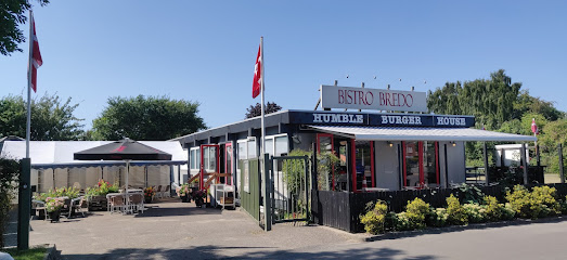
Bistro Bredo
11.8 km
Casual roadside bistro in Humble on Langeland, serving American-inspired homemade burgers and classic sides in a relaxed, family-friendly village setting.
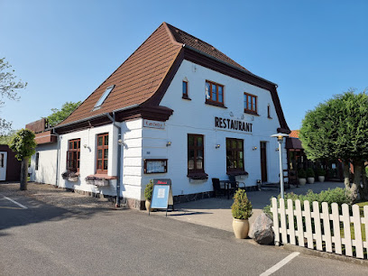
Restaurant Kædeby Cafeen
13.3 km
Hearty Danish classics in a former station house on south Langeland, where generous portions, cosy surroundings and a family-friendly feel anchor any island stay.
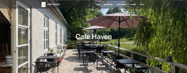
Café Haven
14.2 km
Danish brasserie with outdoor seating and local charm in central Rudkøbing.
Landevejskroen Lindelse (tidl. Lindelse Kro)
15.8 km
Classic Danish roadside inn on Langeland serving hearty kromad, hosting village gatherings and offering simple rooms in a warm, traditional kro setting.
Pizzeria Siciliana v/ Marcello Antonio
17.9 km
Harbor-close, no-nonsense pizzeria in Marstal serving crisp, generous Italian-style pies and takeaway boxes ideal for salty-haired sailors and island wanderers.

Sønderrendens Perle/Burger House Marstal
18.1 km
Casual harbourfront burger joint in Marstal serving hearty comfort food and ice cream just steps from the water, ideal for an easy seaside meal on Ærø.
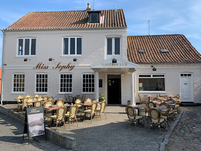
Miss Sophy Gastroclub
18.2 km
Relaxed island bistro and wine bar in central Marstal, serving seasonal comfort dishes, creative burgers and cocktails in an intimate, hygge-filled setting.
Femmasteren Hotel & Vandrerhjem
18.2 km
Character-packed hotel and hostel in central Marstal, blending Ærø’s seafaring history, cozy communal living, and easy access to harbor-side attractions.
Prinsebroen
18.4 km
Harbour-side smokehouse and café in Marstal, serving Ærø’s signature smoked fish and open sandwiches with wide sea views and an easy-going island atmosphere.
Webers café og restaurant
18.4 km
A warmly lit former sailors’ pub in Marstal, serving compact Danish–French bistro dishes, local Ærø beers and well-chosen wines in a cosy brown-café setting.
Den Gamle Vingaard
18.4 km
Mediterranean-Nordic cuisine in a historic maritime setting with a tranquil garden courtyard.
MARSTANG café
18.5 km
Island café where sourdough bread bowls and natural wine capture Ærø's seasonal soul
Markets, malls and hidden boutiques
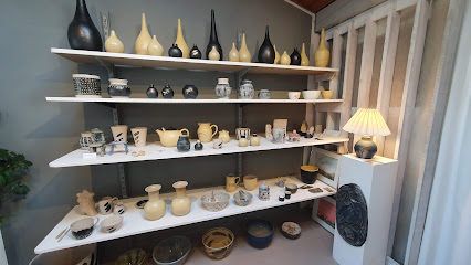
Ulla - Keramik
3.2 km
Handcrafted Danish ceramics with playful surprises, shaped by five decades of island inspiration.
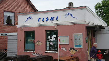
Fiski
3.4 km
Fresh-caught Danish seafood and artisanal delicacies in a harbor town gem.
Den Gamle Fiskehytte
3.5 km
Polar explorer's gallery celebrating Arctic adventures, artisan crafts, and sustainable luxury by the sea.
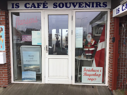
Den Gamle Told
3.5 km
Cosy harbourside coffee and souvenirs in Bagenkop’s old customs-house setting, a relaxed stop for ice cream, drinks and a breather by the southern Langeland sea.
Humble Loppehaller
13.3 km
Langeland's most eclectic indoor flea market, where vintage treasures and Danish nostalgia await discovery.
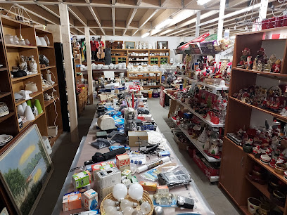
Kræmmerne i Kædeby
13.3 km
Eccentric island flea-market on Langeland, where farm buildings brim with kitsch, curios and second-hand treasures in a relaxed rural setting.
Antikhjørnet
18.5 km
Curated vintage treasures and 4,000 Christmas ornaments in a charming Ærø antique shop.
Ærøpigen
18.6 km
Cozy island shop in central Marstal, blending woolly comforts, local delicacies and everyday essentials in a snug Kirkestræde setting on Ærø.
Chr. H v/Hanne Kromann
18.6 km
Locally anchored clothing shop in Marstal’s old town, offering classic Scandinavian styles for men and women with a subtle, maritime Ærø touch.
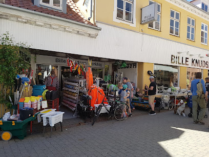
Bille Knudsen Isenkram
18.6 km
A densely stocked island hardware and homeware store in Marstal’s pedestrian street, supplying sailors, locals and holidaymakers with practical Danish everyday goods.
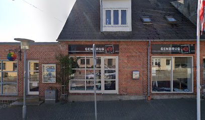
DCA Op Shop
18.6 km
Small island thrift shop in Marstal where second-hand treasures, community spirit and global charity work come together in a cozy, slow-paced setting.
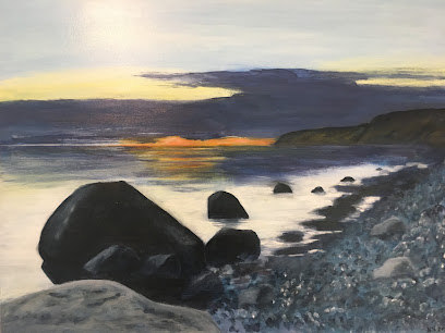
Galleri Strandesen
22.8 km
Intimate island gallery in Ærøskøbing where sea light, harbour life and quiet streets are transformed into contemporary paintings you can linger over—and take home.
Pigekammeret v/Birgitte Nygaard Jensen
23.8 km
A cosy Rudkøbing boutique where Scandinavian-style gifts, home comforts and gourmet treats come together in one lovingly curated island shop.
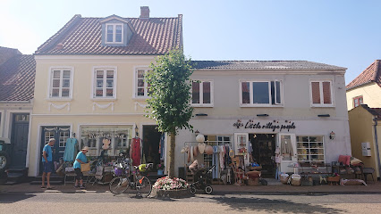
Littlevillagepeople.dk
23.8 km
A small, carefully curated design shop in Rudkøbing, blending children’s wear, toys, interiors, ceramics and yarn into one cozy slice of Scandinavian everyday style.

Ostehuset Rudkøbing
23.8 km
Artisanal cheese and wine shop celebrating Danish heritage and international flavors in historic Rudkøbing.
Essential bars & hidden hideouts
Bar & Café MF Egeskov
18.3 km
Cozy harborfront bar and café on Marstal’s working quay, blending maritime atmosphere, dockside views, and relaxed drinks in the spirit of Ærø’s seafaring life.
Foley's Pub
18.5 km
Marstal's maritime pub where live music, local brews, and seafaring tales create authentic island nightlife.
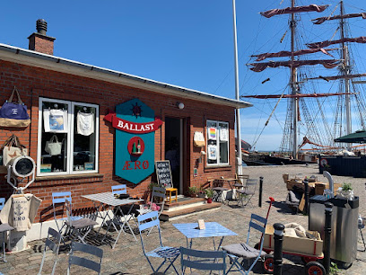
BALLAST BAR BUTIK
18.5 km
Cozy harborfront cocktail bar and woolly boutique in Marstal’s old ferry waiting room, blending inventive drinks, Nordic knitwear and intimate island atmosphere.
Skipperkroen
18.5 km
Cosy skipper’s bar in central Marstal, serving inexpensive drinks and simple fare in a relaxed, maritime small‑town atmosphere close to the harbour.
Marstal cafe Den Glade Gris
18.8 km
Cozy island bar in Marstal where locals and visitors share beers, stories and a relaxed slice of Ærø everyday life.
Langelands Jazzklub
23.6 km
Tiny island jazz hub in Rudkøbing, blending close-up concerts, seasonal outdoor gigs and decades of Danish jazz heritage in a warm, community-run setting.
Basicbigband
23.6 km
Local big band headquarters in a quiet Rudkøbing neighbourhood, where brass, reeds and rhythm bring Langeland’s intimate jazz scene to life on select evenings.
Paa Drejet Beach Bar
23.7 km
Laid-back beach bar and grill by Drejet Beach on Langeland, pairing sea air, sand and simple comfort food in the heart of Spodsbjerg’s holiday‑home area.
Dybendal
23.9 km
Easygoing local bar on Rudkøbing’s main square, blending billiards, darts and drinks with small‑town atmosphere and summer concerts on the cobbled Torvet.
Kasket karl
23.9 km
A classic Rudkøbing bodega where locals gather for cold beer, warm conversation, and an authentic slice of island everyday life from morning to late evening.
Sukker
23.9 km
Intimate wine bar where Danish heritage meets Nordic sophistication in historic Rudkøbing.
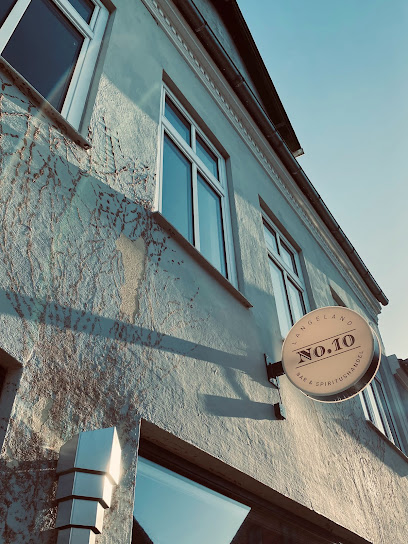
No. 10
24.0 km
Cozy, adults‑only lounge bar in a former butcher’s shop, serving Champagne, craft beer and cocktails with island hygge and a colourful courtyard in central Rudkøbing.
Havnekiosken v/Ole Damgaard Hansen
24.0 km
A tiny historic kiosk-bar on Rudkøbing’s harbor front, serving simple drinks and snacks with big maritime views and the easy rhythm of island harbor life.
Havnekiosken 6kanten
24.0 km
Quirky octagonal harbour kiosk turned cosy café-bar, serving simple Danish fare and cold beer with front-row views of Rudkøbing’s boats and Langelandsbroen.
Arrebo
26.1 km
Island pub where locals and visitors gather for live music, cold drinks, and authentic Ærø atmosphere.
Nightclubs & after hour spots
Ommel
21.3 km
A small, sociable island nightspot near Marstal where locals and travelers share quiet drinks, simple music and the easygoing charm of Ærø after dark.
CLUB ZANZI
30.7 km
High‑energy waterfront nightclub bringing big‑city beats, flashing lights and late‑night dancing to the heart of coastal Nakskov.
Crazy Daisy Svendborg
37.9 km
Compact, high-energy weekend nightclub in central Svendborg, serving mainstream beats, drinks and a sociable dance floor until the early hours.
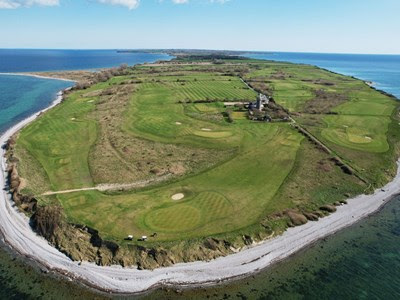
Ærø Golf Klub
41.5 km
Distinctive links course on Ærø’s northwest cape, blending historic lighthouse views, Nordic coastlines, and a classic Danish golfing challenge.
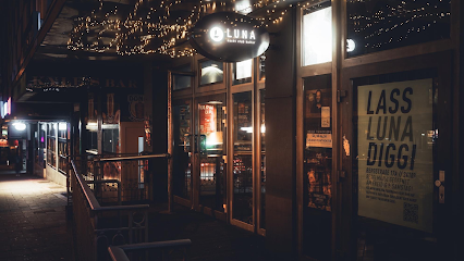
Luna Club
56.8 km
Experience the vibrant nightlife at Luna Club in Kiel, where electrifying music, exquisite cocktails, and unforgettable events await you.
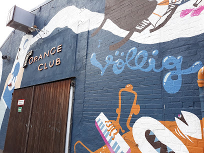
Orange Club
56.9 km
Discover the vibrant nightlife of Kiel at Orange Club, where the music is pumping and the dance floor is waiting.
Rathausbunker Kiel
57.4 km
Experience the underground nightlife of Kiel at Rathausbunker, where music and energy collide for unforgettable nights.
Ben Briggs
57.6 km
Discover the heart of Kiel's nightlife at Ben Briggs, a lively disco club and bar where you can dance the night away in an electrifying atmosphere.
Anna Club & Discostadl
58.0 km
Discover the vibrant nightlife of Kiel at Anna Club & Discostadl, a premier disco club where rhythm and excitement meet.
Old Danish Pub
61.6 km
Central Sønderborg institution blending classic Danish pub ambiance, affordable drinks, and lively atmosphere—perfect for experiencing Southern Denmark’s warmth and social life.

Kaizen ApS
61.6 km
Compact disco-style nightclub in central Sønderborg, pulsing with late-night beats, colourful lights and a straightforward bar for an unpretentious night out.
New Orleans Jazz I Sønderborg
61.9 km
Authentic New Orleans jazz experience in the heart of Sønderborg.
Muzirkus
65.2 km
Nyborg's independent music sanctuary where local bands rehearse, collaborate, and perform since 1974.
KJ's bodel
66.0 km
Laid‑back local nightspot on Nyborg’s main square, mixing simple drinks, sociable bar chatter and a compact dance floor in an unpretentious setting.
Dance All Over
68.1 km
Sønderborg’s sociable dance hub, where fitness, swing and party-ready moves come together in energetic, community-driven classes across the city.
For the vibe & atmosphere seeker
- Tranquil
- Scenic
- Unique
- Relaxing
- Adventurous
For the design and aesthetic lover
- Minimalist Designs
- Rustic Designs
For the architecture buff
- Viewpoints
- Parks & Gardens
- Heritage Neighborhoods
For the view chaser and sunset hunter
- Iconic Views
- Panoramas
- Sunrise Spots
- Sunset Spots
For the social media creator & influencer
- Photo Spots
- Selfie Spots
- Instagrammable
- Architectural Shots
- Reel-Friendly
For the eco-conscious traveler
- Low Impact
- Public-Transport Accessible
- Leave-No-Trace Critical
- Wildlife Habitat
- Locally Managed
For the kind of experience you’re after
- Photowalk
- Adventure Photo Shoot
- Nature Escape
- Roadtrip Stop
- Day Trip
- Mindfulness
For how adventurous you want the journey to be
- Easy Access
Location Audience
- Family Friendly
- Senior Friendly
- Child Friendly
- Teen Friendly
- Solo Friendly
- Couple Friendly
- Solo Female Friendly
- Vegetarian Friendly
- Vegan Friendly


