

Mount Kenya Travel Guide - Free Web & App
Your ultimate guide to Mount Kenya. Discover top landmarks, proposed trips, and local tips. Free on the web or via the Evendo companion app.


Mount Kenya, Kenya’s highland landmark, combines glaciers, Afro-alpine scenery, wildlife, trekking and technical climbing with gateways near Nanyuki and Chogoria.
Mountain and Landscape
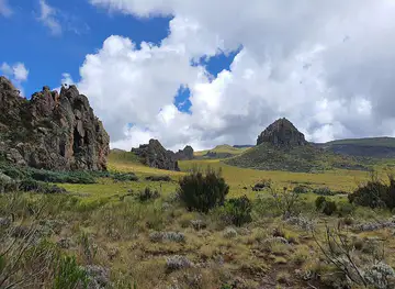
Mount Kenya rises from central Kenya’s agricultural highlands to a jagged summit of volcanic rock, with Batian reaching 5,199 metres, Nelion 5,188 metres and Point Lenana 4,985 metres. The mountain lies within Mount Kenya National Park and the surrounding forest reserve, a protected landscape of bamboo, montane forest, moorland and Afro-alpine vegetation. Its upper slopes are marked by weathered lava formations, deep valleys, tarns and the remaining Lewis and Tyndall glaciers, whose extent has diminished over time.Read more about Mount Kenya
Routes and Gateways
Wildlife and Cultural Meaning
When is the best time to visit Mount Kenya?
Best: November–January · 16°C| Month | High (°C) | Rainfall (mm) |
|---|---|---|
| January (best) | 16 | 40 |
| February | 16 | 59 |
| March | 17 | 89 |
| April | 17 | 124 |
| May | 16 | 144 |
| June | 15 | 130 |
| July | 15 | 113 |
| August | 15 | 104 |
| September | 16 | 89 |
| October | 16 | 70 |
| November (best) | 16 | 51 |
| December (best) | 16 | 35 |
Getting to and around Mount Kenya
How to get there
Transportation
Best attractions in Mount Kenya
Mount Kenya’s principal attraction is the mountain itself, from the forested lower slopes to the volcanic summit massif of Batian, Nelion and Point Lenana. The Naro Moru route is known for its approach through forest and moorland, while the Sirimon route crosses drier northern landscapes and the Chogoria route is valued for views towards the eastern side of the massif. Along the upper mountain, visitors encounter the Mackinder Valley, alpine tarns, giant heathers, tussock grassland and the remaining Lewis and Tyndall glaciers. Lower elevations support montane forest and bamboo habitats where elephants, buffalo, monkeys and highland birds may occur. Nanyuki offers the most developed gateway setting, whereas Naro Moru and Chogoria provide more direct links with particular trail systems. The experience is shaped as much by changing vegetation and altitude as by the final summit viewpoint.
-
Tourist attraction
Lewa Wildlife Conservancy
Explore the enchanting Lewa Wildlife Conservancy, a haven for wildlife and nature enthusiasts, nestled in the heart of Kenya's breathtaking landscapes.
-
Tourist attraction
Mount Kenya Naro Moru Park Gate
Explore the breathtaking landscapes and diverse wildlife at Mount Kenya Naro Moru Park Gate, the gateway to Africa's second-highest peak.
-
Tourist attraction
Meru Museum
Explore the rich heritage and cultural treasures of the Meru region at the Meru Museum, a must-visit destination for every traveler.
-
Park
Mt Kenya National Park Gate
Explore the breathtaking landscapes and rich biodiversity of Mt Kenya National Park, a UNESCO World Heritage site and a paradise for nature lovers.


Best landmarks in Mount Kenya
The defining landmarks of Mount Kenya are the twin summit towers of Batian and Nelion, formed from the eroded volcanic core, and Point Lenana, the highest summit normally reached by trekkers. The Mackinder Valley provides one of the best-known high-altitude landscapes, framed by ridges, cliffs, tarns and Afro-alpine vegetation, while the Lewis and Tyndall glaciers are significant reminders of the mountain’s colder past and changing climate. Lower down, the continuous transition from forest and bamboo to moorland gives the protected area much of its ecological importance. The mountain is also a cultural landmark for Kikuyu, Embu and Meru communities, whose traditions connect it with spiritual belief and the sources of surrounding rivers. Nanyuki, Naro Moru and Chogoria function as gateways rather than landmarks within the high massif itself.
-
National park
Mount Kenya National Park
Discover the breathtaking beauty of Mount Kenya National Park, where stunning landscapes and rich wildlife await every adventurer.
-
 Hotel
Fairmont Mount Kenya Safari Club
Discover the luxury of Fairmont Mount Kenya Safari Club, where breathtaking views and exceptional service create an unforgettable escape.
-
Hotel
Serena Mountain Lodge
Discover the serene beauty of Serena Mountain Lodge, a luxurious retreat nestled in the heart of Mount Kenya's breathtaking landscapes.
-
National park
Mount Kenya Naro Moru Park Gate
Explore the breathtaking landscapes and rich biodiversity of Mount Kenya Naro Moru Park Gate, a premier destination for nature lovers and adventure seekers.


Explore Mount Kenya on the map
Plan your trip on one map. See where the top attractions, landmarks, restaurants and hotels are, and book hotels and experiences in a few clicks.
Best hotels in Mount Kenya
Best restaurants in Mount Kenya
Dining around Mount Kenya is concentrated in gateway settlements rather than on the high mountain. Nanyuki has the broadest choice of restaurants, cafés, hotels and informal eateries, with menus reflecting Kenyan staples such as nyama choma, grilled meat, ugali, chapati, beans, sukuma wiki and locally grown vegetables alongside international food for trekkers and safari travellers. Naro Moru and Chogoria offer more limited choices, generally associated with small hotels, guesthouses and local eateries, so visitors beginning an early ascent should arrange meals and packed provisions beforehand. Farms and highland agriculture around the mountain contribute fresh produce, dairy and tea to the regional food economy. On multi-day treks, meals are normally organised by a guide or trekking crew and prepared at camps rather than purchased along the route.
-
Restaurant
Fairmont Mount Kenya Safari Club
Discover unparalleled luxury amidst breathtaking landscapes at Fairmont Mount Kenya Safari Club – your gateway to adventure and relaxation.
-
Restaurant
Trout Tree Restaurant
Experience delightful cuisine at Trout Tree Restaurant in Nanyuki - where nature meets exceptional dining.
-
Restaurant
Barney's Bar and Restaurant
Experience exquisite dining at Barney's Bar and Restaurant with stunning views of Mt. Kenya in Nanyuki, Laikipia.
-
Grill
Gawanaz Grill Makutano
Discover Gawanaz Grill Makutano: A Culinary Haven Offering Delicious Grilled Delights Amidst Stunning Views in Nanyuki.


Best bars in Mount Kenya
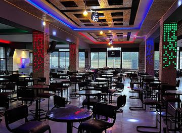
Mount Kenya is not a nightlife destination, and evenings are usually quiet once visitors leave the gateway towns for the mountain. Nanyuki has the region’s most developed evening social scene, with hotel bars, restaurants and informal drinking places where residents, guides, farmers, conservation workers and travellers meet; the precise choice and opening arrangements vary. Naro Moru and Chogoria are smaller settlements with a more limited selection of local bars and hotel lounges rather than dedicated club districts. On the mountain, darkness, cold and early trekking starts make camp routines the norm, with conversation and shared meals replacing organised entertainment. Visitors should avoid loud behaviour near rural homes, respect local customs and confirm transport before drinking, as distances between settlements and accommodation can be substantial.
-
Bar
Makuti Bar
Discover the lively atmosphere of Makuti Bar in Timau, where local drinks and warm hospitality create unforgettable nights out.
-
Bar
Cheers Pub
Experience the vibrant nightlife at Cheers Pub, a local favorite in Timau, known for its welcoming atmosphere and diverse drink selection.
-
Grill
Pub Kimberly & Restraunt
Discover the flavors of Kenya at Pub Kimberly & Restaurant, a grill lover's paradise on the Meru-Nairobi Highway in Nkubu.
-
Bar
Club Buffalo
Discover the lively spirit of Nyeri at Club Buffalo, a bar filled with local culture, great drinks, and unforgettable experiences for tourists.


Best nightclubs in Mount Kenya
Mount Kenya is not a nightlife destination, and evenings are usually quiet once visitors leave the gateway towns for the mountain. Nanyuki has the region’s most developed evening social scene, with hotel bars, restaurants and informal drinking places where residents, guides, farmers, conservation workers and travellers meet; the precise choice and opening arrangements vary. Naro Moru and Chogoria are smaller settlements with a more limited selection of local bars and hotel lounges rather than dedicated club districts. On the mountain, darkness, cold and early trekking starts make camp routines the norm, with conversation and shared meals replacing organised entertainment. Visitors should avoid loud behaviour near rural homes, respect local customs and confirm transport before drinking, as distances between settlements and accommodation can be substantial.
-
Club
Moran Lounge Nanyuki
Discover the vibrant nightlife at Moran Lounge Nanyuki, where lively music and a welcoming atmosphere create unforgettable experiences.
-
Grill
Pryme Lounge Ke
Discover the vibrant nightlife and delicious grill cuisine at Pryme Lounge Ke in Nanyuki, the ultimate destination for fun and flavor.
-
Lounge
Karismatic Nanyuki Lounge
Experience the perfect blend of relaxation and culinary delight at Karismatic Nanyuki Lounge, your go-to spot in the heart of Nanyuki.
-
Night club
Checkers Club
Discover Nanyuki’s nightlife at Checkers Club, where vibrant music and energetic dance floors create unforgettable memories.



Best shops in Mount Kenya
Shopping opportunities are concentrated in Nanyuki and, to a smaller extent, Naro Moru and Chogoria. Nanyuki is the most practical place to buy trekking supplies, basic clothing, food, toiletries and locally made gifts before approaching the mountain. Visitors may find Kenyan crafts, beadwork, woven goods, woodcarving and regional produce through shops, small markets and informal vendors, although stock and trading days vary. Farm and food products from the central highlands may include fresh fruit, vegetables, dairy and tea. Small settlements have fewer retail services, so specialist equipment, cash and substantial provisions should be obtained in a larger town. When purchasing crafts, ask about materials and provenance, avoid products made from protected wildlife or prohibited natural materials, and bargain courteously only where this is customary.
-
National park
Mount Kenya National Park
Discover the breathtaking landscapes and rich biodiversity of Mount Kenya National Park, a UNESCO World Heritage site in the heart of Kenya.
-
Shopping mall
Mt Kenya Peaks View
Discover the breathtaking beauty of Mt. Kenya Peaks View, a paradise for nature lovers and adventure seekers alike.
-
Store
Mountain View Curio Shop
Explore the Mountain View Curio Shop for authentic Kenyan crafts and unique souvenirs that capture the spirit of your travels.
-
Agricultural service
Agri-Biotech Farm International
Explore sustainable farming practices and biotechnology at Agri-Biotech Farm International in the stunning Mt. Kenya region.


Get your free copy of our complete guide to Mount Kenya, delivered straight to you.
Everything on this page, from attractions and restaurants to essentials and local phrases, in one PDF you can read offline, print or share.
Already have an account? Sign in
Your Mount Kenya guide is ready.
We'll send it to · Not you? Sign out

Getting your guide ready…
We are putting together a fresh copy of the Mount Kenya guide. This can take up to a minute.
This can take a few moments. If your browser asks, choose Allow so the download can start. You'll find the guide in your Downloads folder.
Nothing happened? Download it again
Sorry, the guide is taking longer than usual. Please try again in a minute, or get it by email instead.
Mount Kenya essentials
Currency and Payment
Safety
Emergency Situations
Do's and Don'ts
Local Tips
From Eve
Local phrases worth knowing
You don't need to get them perfect. A few words go a long way, and locals appreciate the effort.
Basics
| English | Local | Say it |
|---|---|---|
| Hello | Muraho | [moo-rah-hoh] |
| Goodbye | Kwaheri | [kwa-heh-ree] |
| Yes | Ee | [eh] |
| No | Hapana | [hah-pah-nah] |
| Please/You're welcome | Tafadhali | [tah-fah-dah-lee] |
| Thank you | Asante | [ah-sahn-teh] |
| Excuse me/Sorry | Samahani | [sah-mah-hah-nee] |
| How are you? | Uko sawa? | [oo-koh sah-wah] |
| Fine. And you? | Sawa. Na wewe? | [sah-wah. nah weh-weh] |
| Do you speak English? | Unasema Kiingereza? | [oo-nah-seh-mah keen-geh-reh-zah] |
| I don't understand | Siwelewi | [see-weh-leh-wee] |
Eating & Drinking
| English | Local | Say it |
|---|---|---|
| I'd like to see the menu, please | Nataka kuona menyu, tafadhali | [nah-tah-kah kwoh-nah meh-nyoo, tah-fah-dah-lee] |
| I don't eat meat | Sili nyama | [see-lee nyah-mah] |
| Cheers! | Mambo! | [mahm-boh] |
| I would like to pay, please | Ningependa kulipa, tafadhali | [nee-geh-pehn-dah koo-lee-pah, tah-fah-dah-lee] |
Emergencies
| English | Local | Say it |
|---|---|---|
| Help! | Msaada! | [msah-ah-dah] |
| Go away! | Ondoka! | [ohn-doh-kah] |
| Call the Police! | Piga polisi! | [pee-gah poh-lee-see] |
| Call a doctor! | Piga daktari! | [pee-gah dahk-tah-ree] |
| I'm lost | Nimepotea | [nee-meh-poh-teh-ah] |
| I'm ill | Ninaumwa | [nee-nah-oom-wah] |
Shopping
| English | Local | Say it |
|---|---|---|
| I'd like to buy... | Ningependa kununua... | [nee-geh-pehn-dah koo-noo-noo-ah] |
| I'm just looking | Ninaangalia tu | [nee-nah-ang-ah-lee-ah too] |
| How much is it? | Bei ni ngapi? | [beh-ee nee ngah-pee] |
| That's too expensive | Hiyo ni ghali sana | [hee-yoh nee gah-lee sah-nah] |
| Can you lower the price? | Unaweza kushusha bei? | [oo-nah-weh-zah koo-shoo-shah beh-ee] |
Time & Numbers
| English | Local | Say it |
|---|---|---|
| What time is it? | Saa ngapi? | [sah-ah ngah-pee] |
| It's one o'clock | Ni saa moja | [nee sah-ah moh-jah] |
| Half past (10) | Nusu saa kumi | [noo-soo sah-ah koo-mee] |
| Morning | Asubuhi | [ah-soo-boo-hee] |
| Afternoon | Mchana | [meh-chah-nah] |
| Evening | Jioni | [joh-ee-nee] |
| Yesterday | Jana | [jah-nah] |
| Today | Leo | [leh-oh] |
| Tomorrow | Kesho | [keh-shoh] |
| 1 | Moja | [moh-jah] |
| 2 | Mbili | [mm-bee-lee] |
| 3 | Tatu | [tah-too] |
| 4 | Nne | [nn-neh] |
| 5 | Tano | [tah-noh] |
| 6 | Sita | [see-tah] |
| 7 | Saba | [sah-bah] |
| 8 | Nane | [nah-neh] |
| 9 | Tisa | [tee-sah] |
| 10 | Kumi | [koo-mee] |
Transport & Directions
| English | Local | Say it |
|---|---|---|
| Where's a/the...? | Iko wapi...? | [ee-koh wah-pee] |
| What's the address? | Anuani ni ipi? | [ah-noo-ah-nee nee ee-pee] |
| Can you show me (on the map)? | Unaweza kunionyesha (kwenye ramani)? | [oo-nah-weh-zah koo-nee-oh-nyeh-shah kweh-neh rah-mah-nee] |
| When's the next (bus)? | Basi la pili ni saa ngapi? | [bah-see lah pee-lee nee sah-ah ngah-pee] |
| A ticket (to ....) | Tiketi (kwenda ...) | [tee-keh-tee kwehn-dah] |
History of Mount Kenya
A Volcanic Mountain Formed
Mount Kenya is the eroded remnant of a large stratovolcano that developed during the geological past, probably linked to the East African Rift system. Long-term erosion, glacial action and weathering carved the original volcanic mass into the present array of peaks, ridges, valleys and cirques. The summit massif is dominated by Batian and Nelion, while Point Lenana provides the principal trekking objective. Glaciers and permanent ice once occupied a more extensive area, but the mountain’s ice cover has retreated markedly, making its high-altitude landscape a visible record of environmental change.
Sacred Mountain and Living Landscapes
Mount Kenya has shaped the beliefs and cultural landscapes of peoples living around its lower slopes. In Kikuyu tradition, the mountain is associated with Ngai and is traditionally regarded as a place of spiritual importance; Embu and Meru communities also maintain longstanding cultural relationships with the massif. Forests, rivers and cultivated foothills have supported settlement and agriculture for generations. These connections remain important when visitors travel through villages and farmland towards the protected mountain, where the natural landscape cannot be separated entirely from the communities surrounding it.
The First Recorded Summit Era
European exploration of Mount Kenya intensified during the late nineteenth century. The first recorded ascent of the highest summit, Batian, was achieved in 1899 by the British geologist and explorer Halford Mackinder with guides and porters. Subsequent expeditions examined the mountain’s geology, glaciers and routes, while climbing gradually developed around the twin summit towers and surrounding ridges. These early accounts also helped place the mountain within the scientific and colonial mapping of East Africa, although local communities had long known and named the mountain and its approaches.
Protection and Mount Kenya National Park
Mount Kenya Forest Reserve was established in 1932, reflecting growing concern about the protection of the mountain’s forests and water catchments. Mount Kenya National Park followed in 1949, placing the upper mountain under formal conservation management while the forest belt remained closely connected to the reserve system. The protected area conserves an unusual sequence of habitats, from lower forest to high Afro-alpine vegetation, and supports water supplies and ecosystems far beyond the summit zone.
World Heritage and Modern Conservation
Mount Kenya National Park and the natural forest surrounding it were inscribed together as a UNESCO World Heritage Site in 1997. Conservation has since involved managing tourism, protecting forests, safeguarding wildlife and addressing pressures such as illegal resource use, fire and climate-related change. Trekking and climbing now provide an important visitor connection with the mountain, but access remains shaped by permits, guides, weather and environmental management. The retreat of the remaining glaciers has also increased attention on the mountain’s changing climate and water resources.
Mount Kenya in Photos
Browse through our photo collection highlighting the charm and character of the destination.
Neighbouring destination travel guides
The closest destinations to Mount Kenya, if you have time for more than one.
-

-
-

-

-


Swipe for more destinations
Explore more

Explore more of Mount Kenya Region
Explore Kenya's Mount Kenya Region for high-altitude trekking, forest trails, wildlife conservancies, coffee farms and richly cultivated highlands.
Explore Mount Kenya Region
Explore more of Kenya
Discover Kenya: A land of breathtaking safaris, rich cultural heritage, and stunning coastlines that promise adventure and relaxation all in one.
Explore Kenya