

Gunflint Trail Travel Guide - Free Web & App
Your ultimate guide to Gunflint Trail. Discover top landmarks, proposed trips, and local tips. Free on the web or via the Evendo companion app.


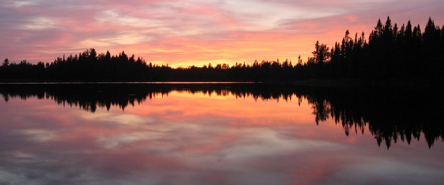


Gunflint Trail, Minnesota offers boreal forests, remote lakes, canoe routes, wildlife, hiking and Boundary Waters access near Grand Marais.
A Forest Road into the North Woods
Gunflint Trail is a 57-mile scenic route running north-west from Grand Marais on Minnesota's North Shore into a landscape of boreal forest, exposed granite, wetlands and dark, interconnected lakes. The road follows the high ground of the Gunflint Ridge, passing through a dispersed rural community of lodges, cabins, campgrounds and private homes before reaching the edge of the Boundary Waters Canoe Area Wilderness. It is not a single village or compact park, but a long, wooded corridor where distances between facilities are considerable.Read more about Gunflint Trail
Lakes, Wildlife and Wilderness Access
A Living Regional Culture
When is the best time to visit Gunflint Trail?
Best: June–August · 23–25°C| Month | High (°C) | Rainfall (mm) |
|---|---|---|
| January | -5 | 28 |
| February | -4 | 26 |
| March | 2 | 34 |
| April | 10 | 47 |
| May | 18 | 65 |
| June (best) | 23 | 81 |
| July (best) | 25 | 86 |
| August (best) | 24 | 79 |
| September | 18 | 68 |
| October | 11 | 53 |
| November | 4 | 39 |
| December | -3 | 33 |
Getting to and around Gunflint Trail
How to get there
Transportation
Best attractions in Gunflint Trail
Gunflint Trail's attractions are primarily landscapes and access points rather than a dense collection of built sights. Chik-Wauk Museum and Nature Center, near the end of the trail, interprets the area's Ojibwe, logging, mining, guiding and tourism history alongside its natural environment. The Magnetic Rock Trail leads through boreal forest and exposed rock towards a distinctive glacial erratic, while the surrounding Gunflint Ridge provides access to shorter walks and longer routes. Lakes including Gunflint, Loon, Magnetic, Flour, East Bearskin and Seagull support canoeing, fishing and lakeside recreation where permitted. Several Boundary Waters Canoe Area Wilderness entry points along or near the corridor open into a much larger network of lakes and portages, including routes towards the Seagull and Granite River areas. The Kekekabic Trail offers a more demanding long-distance experience for properly prepared hikers, while the route itself is a scenic journey through forest, wetlands and recovering burn areas.
-
 Resort hotel
Gunflint Lodge & Outfitters
Discover the beauty of Minnesota at Gunflint Lodge & Outfitters, your ultimate destination for adventure, relaxation, and outdoor fun.
-
Historical landmark
Grand Marais Lighthouse
Explore the Grand Marais Lighthouse, a historic gem on Lake Superior, offering breathtaking views and a glimpse into Minnesota's maritime heritage.
-
Tourist attraction
Chik-Wauk Museum and Nature Center
Explore the rich history and stunning nature at Chik-Wauk Museum and Nature Center, a must-visit destination in Grand Marais, Minnesota.
-
Tourist attraction
Harbor Park
Discover the serene beauty of Harbor Park in Grand Marais, Minnesota, where stunning waterfront views and charming local shops await every traveler.

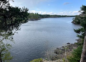

Best landmarks in Gunflint Trail
The Gunflint Ridge is the defining physical landmark of the corridor, forming a high, forested route between Lake Superior's North Shore and the interior canoe country. Gunflint Lake and the chain of neighbouring lakes express the region's glacially shaped geography, while Magnetic Rock is a prominent glacial erratic and one of the area's best-known named natural features. The Boundary Waters Canoe Area Wilderness is the destination's most significant protected landscape, recognised for its interconnected lakes, portages and absence of motorised travel in its core areas. Chik-Wauk Museum and Nature Center is the principal cultural landmark on the trail, preserving and interpreting local human and environmental history. The route's recovering wildfire areas are also important landscape markers, showing how fire can transform boreal forest and influence the appearance of the surrounding country.
-
Tourist attraction
End Of The Gunflint Trail
Explore the breathtaking beauty of the End of the Gunflint Trail in Grand Marais, Minnesota, where nature's wonders await every visitor.

Explore Gunflint Trail on the map
Plan your trip on one map. See where the top attractions, landmarks, restaurants and hotels are, and book hotels and experiences in a few clicks.
Best hotels in Gunflint Trail
Best restaurants in Gunflint Trail
Dining on Gunflint Trail is closely tied to its lodges, resorts and outdoor visitor culture rather than to a conventional restaurant district. Some accommodation businesses provide meals or dining facilities, and the Gunflint Trail's Trail Center has long been associated with food, supplies and meeting other travellers. Options can be seasonal and widely spaced, so visitors staying in cabins or camping often plan provisions in Grand Marais before driving inland. Grand Marais, outside the Gunflint Trail itself, has the area's broadest choice of restaurants, cafés, bakeries and food shops, with menus influenced by Lake Superior, northern produce and the town's fishing and tourism traditions. Lodge dining and self-catering are particularly practical for visitors based far along the route, while canoeists should carry food suitable for their permits and wilderness itinerary rather than expecting regular resupply.
-
Restaurant
Gun Flint Tavern
Experience the best of local flavors at Gun Flint Tavern in Grand Marais—where great food meets a vibrant atmosphere.
-
Resort hotel
Gunflint Lodge & Outfitters
Discover adventure and relaxation at Gunflint Lodge & Outfitters—your gateway to Minnesota's breathtaking wilderness.
-
Restaurant
Trail Center At Poplar Lake
Discover rustic dining and cozy lodging at Trail Center At Poplar Lake amidst Minnesota's breathtaking wilderness.
-
Grill
Poplar Haus Restaurant, Bar & Cabins
Experience the best of North Woods dining at Poplar Haus Restaurant & Cabins—where rustic charm meets exquisite grill cuisine.


Best bars in Gunflint Trail
Gunflint Trail has no conventional nightlife district and very little reason to expect nightclubs or late-night entertainment. Evenings are generally quiet and centred on lodge hospitality, seasonal dining rooms, fireside gatherings, conversation and the dark-sky qualities of a remote northern forest. A few resort or lodge venues may offer a social setting for guests, but opening arrangements vary and should be confirmed directly. Grand Marais, at the southern gateway and outside the trail corridor, provides a broader selection of pubs, brewery-style hospitality, restaurants and occasional live cultural events, although it remains a small town rather than a major nightlife centre. Visitors should plan evening transport carefully, as the distance between Grand Marais and accommodation along the trail makes spontaneous late-night travel inconvenient.
-
Cafe
Angry Trout Cafe
Experience the best of Grand Marais dining at Angry Trout Cafe, a local gem known for fresh seafood and delicious breakfasts with stunning views.
-
American
My Sister's Place
Discover the heart of American dining at My Sister's Place, a charming restaurant in Grand Marais serving eclectic dishes in a cozy atmosphere.
-
Bar
Gun Flint Tavern
Immerse yourself in local flavors and brews at Gun Flint Tavern, a vibrant gathering place in Grand Marais, Minnesota.
-
Pizza
Sven & Ole's
Discover the best pizza in Grand Marais at Sven & Ole's, a local favorite with a cozy atmosphere and delicious flavors.


Best shops in Gunflint Trail
Shopping on Gunflint Trail is limited and practical, with opportunities concentrated at lodges, resorts, outfitters and small service points rather than in a continuous retail centre. Visitors may find provisions, maps, outdoor essentials, souvenirs and locally themed gifts along the corridor, but should not depend on the trail for a full shopping trip. Grand Marais, outside the destination at its southern gateway, is the principal place for groceries, fuel, canoe-country supplies, books, artwork and independent shops. Its creative economy reflects the North Shore through regional food products, photography, paintings, pottery, textiles and other work by local artists. Visitors seeking specialist equipment or a broad choice of supplies should plan purchases before travelling inland, particularly for remote cabins, winter journeys or Boundary Waters expeditions.
-
Gift shop
Lake Superior Trading Post
Explore Lake Superior Trading Post, your ultimate destination for unique gifts, outdoor gear, and local treasures in Grand Marais, Minnesota.
-
Grocery store
Cook County Co-op
Discover the flavors of Grand Marais at the Cook County Co-op, offering fresh groceries, organic products, and delicious deli meals.
-
Canoe & kayak rental service
Voyageur Canoe Outfitters
Discover the beauty of Minnesota's wilderness with canoe and kayak rentals, camping gear, and cozy accommodations at Voyageur Canoe Outfitters.
-
Sporting goods store
Stone Harbor Wilderness Supply
Your ultimate outdoor adventure starts at Stone Harbor Wilderness Supply, where quality gear meets expert advice in Grand Marais, Minnesota.


Get your free copy of our complete guide to Gunflint Trail, delivered straight to you.
Everything on this page, from attractions and restaurants to essentials and local phrases, in one PDF you can read offline, print or share.
Already have an account? Sign in
Your Gunflint Trail guide is ready.
We'll send it to · Not you? Sign out

Getting your guide ready…
We are putting together a fresh copy of the Gunflint Trail guide. This can take up to a minute.
This can take a few moments. If your browser asks, choose Allow so the download can start. You'll find the guide in your Downloads folder.
Nothing happened? Download it again
Sorry, the guide is taking longer than usual. Please try again in a minute, or get it by email instead.
Gunflint Trail essentials
Currency and Payment
Safety
Emergency Situations
Do's and Don'ts
Local Tips
From Eve
Local phrases worth knowing
You don't need to get them perfect. A few words go a long way, and locals appreciate the effort.
Basics
| English | Local | Say it |
|---|---|---|
| Hello | Boozhoo | [Boo-zhoo] |
| Goodbye | Miigwech | [Mee-gwetch] |
| Yes | Eya | [Aye-ya] |
| No | Aaniin | [Ah-nee] |
| Please/You're welcome | Baamaapii | [Bah-mah-pee] |
| Thank you | Miigwech | [Mee-gwetch] |
| Excuse me/Sorry | Miigwech | [Mee-gwetch] |
| How are you? | Aaniin ezhi-ayaayan | [Ah-nee e-zhee-a-ya-yaan] |
| Fine. And you? | Miigwech. Ayaayan? | [Mee-gwetch. A-ya-yaan?] |
| Do you speak English? | Aaniin ezhi-ayaayan gaa-izhiwebziwin? | [Ah-nee e-zhee-a-ya-yaan ga-ee-zhee-weh-bzi-win?] |
| I don't understand | Aaniin ezhi-nendam | [Ah-nee e-zhee-nen-dam] |
Eating & Drinking
| English | Local | Say it |
|---|---|---|
| I'd like to see the menu, please | Miinawaa menu onji | [Mee-na-waa menu on-jee] |
| I don't eat meat | Gii-ayaad menomen | [Gee-ah-yaad me-no-men] |
| Cheers! | Boozhoo! | [Boo-zhoo] |
| I would like to pay, please | Miinawaa dibishkoo onji | [Mee-na-waa dee-bish-koo on-jee] |
Emergencies
| English | Local | Say it |
|---|---|---|
| Help! | Gaa-waab | [Gaa-waab] |
| Go away! | Gaa wiin | [Gaa ween] |
| Call the Police! | Gaa-aanishinaabe-aadizookaan | [Gaa-ah-nee-she-nah-bay-aa-dee-zoh-kaan] |
| Call a doctor! | Gaa-inendam | [Gaa-ee-nen-dam] |
| I'm lost | Niwiid gii-zaagidi | [Nee-weed gee-zah-gi-dee] |
| I'm ill | Niwiid gii-bakade | [Nee-weed gee-bah-kah-day] |
Shopping
| English | Local | Say it |
|---|---|---|
| I'd like to buy... | Miinawaa gii-bakade | [Mee-na-waa gee-bah-kah-day] |
| I'm just looking | Niwiid gii-ninendam | [Nee-weed gee-ni-nen-dam] |
| How much is it? | Gii-ayaa gaa-piichi | [Gee-ah-yaa gaa-pee-chee] |
| That's too expensive | Waaseya gii-ayaa | [Wah-seh-yah gee-ah-yaa] |
| Can you lower the price? | Gii-ayaa gii-bekade | [Gee-ah-yaa gee-bay-kah-day] |
Time & Numbers
| English | Local | Say it |
|---|---|---|
| What time is it? | Maajii wiin | [Mah-zhee ween] |
| It's one o'clock | Wiin gaa-onji | [Ween gaa-on-jee] |
| Half past (10) | Makak gaa-wiijiiwan | [Mah-kahk gaa-wee-zhee-wan] |
| Morning | Waaban | [Wah-bahn] |
| Afternoon | Niizhwaaswi | [Nee-zhwah-swee] |
| Evening | Biidaaban | [Bee-dah-bahn] |
| Yesterday | Niizhwaaswi | [Nee-zhwah-swee] |
| Today | Biidaaban | [Bee-dah-bahn] |
| Tomorrow | Waaban | [Wah-bahn] |
| 1 | Bakade | [Bah-kah-day] |
| 2 | Niizh | [Neezh] |
| 3 | Niswed | [Nis-wed] |
| 4 | Niiwin | [Nee-win] |
| 5 | Naanan | [Naa-nan] |
| 6 | Niizhwaaswi | [Nee-zhwah-swee] |
| 7 | Niizhwaaswi | [Nee-zhwah-swee] |
| 8 | Niizhwaaswi | [Nee-zhwah-swee] |
| 9 | Niizhwaaswi | [Nee-zhwah-swee] |
| 10 | Niizhwaaswi | [Nee-zhwah-swee] |
Transport & Directions
| English | Local | Say it |
|---|---|---|
| Where's a/the...? | Eya gaa | [Aye-ya gaa] |
| What's the address? | Eya gaa-endaayaan | [Aye-ya gaa-en-daa-yaan] |
| Can you show me (on the map)? | Gii-aya gaa-jaagishiimin? | [Gee-ah-yaa gaa-jaa-gish-ee-meen] |
| When's the next (bus)? | Eya gaa-biwaasi | [Aye-ya gaa-bee-waa-see] |
| A ticket (to ....) | Gaa-biwaasi miinawaa | [Gaa-bee-waa-see mee-na-waa] |
History of Gunflint Trail
Ojibwe Homeland and Trade Routes
The Gunflint Trail lies within the traditional homeland of the Ojibwe, whose communities travelled the lakes and rivers of what is now northern Minnesota by canoe and maintained detailed knowledge of the forest, seasons and waterways. The region formed part of a wider network connecting the interior to Lake Superior. Place names such as Gunflint and Seagull reflect later English usage, while the continuing presence and cultural authority of Ojibwe people remain central to understanding the area's history. The lakes were not empty wilderness before tourism; they were travelled, used and understood landscapes shaped by generations of Indigenous stewardship.
Mining, Timber and the Gunflint Road
The name Gunflint is associated with the iron-bearing ridge and the mining activity that developed around the nearby Iron Range and Gunflint Lake area. Small-scale prospecting and mineral exploration formed part of the region's nineteenth- and early twentieth-century economy, although the district never became a major industrial centre. Logging also altered the forest, with timber harvested from accessible areas and moved through a landscape whose lakes and rough roads made transport difficult. The road that became the Gunflint Trail gradually developed as a route into this remote country, linking outlying settlements and working landscapes with the North Shore.
Guiding and Early Tourism
As roads improved during the twentieth century, the Gunflint country began to attract visitors seeking fishing, canoeing, hunting and a retreat from settled areas farther south. Rustic camps and resorts grew around the lakes, often relying on local guides and canoe routes rather than extensive infrastructure. The tradition of guiding remains important to the area's identity, while cabins and lodges continue to place visitors close to the water and forest. Tourism did not replace earlier land uses entirely; it developed alongside small-scale settlement, seasonal work and the practical services needed to maintain a long rural route.
Wilderness Protection and Conservation
The establishment of the Boundary Waters Canoe Area and its later management as part of the National Wilderness Preservation System placed the Gunflint region within one of the most important protected canoe landscapes in the United States. Wilderness designation limited motorised access in the core area and preserved a large network of lakes, portages and forest. The Gunflint Trail remains a gateway rather than a road through the wilderness: visitors reach designated entry points and then continue under wilderness regulations. Conservation work also aims to protect water quality, forest habitat and the character of the wider Superior National Forest.
Fire, Forest Recovery and the Present Landscape
Large wildfires have periodically reshaped the Gunflint country, including the 2006 Cavity Lake and Ham Lake fires, which affected extensive areas near the trail and Boundary Waters. Fire is a disruptive force for homes, roads and tourism, but it is also a natural process in boreal and northern forest ecosystems, creating changing patterns of young growth and mature woodland. Today the corridor combines private cabins and resorts with managed forest, protected wilderness and recovering burn areas. Its modern identity depends on balancing access, tourism and community life with the long-term protection of a fire-prone northern landscape.
Gunflint Trail in Photos
Browse through our photo collection highlighting the charm and character of the destination.
Cities in Gunflint Trail
The towns and cities of Gunflint Trail, and the easiest places to base yourself.
-

-

-

-
-
-


Swipe for more cities
Neighbouring destination travel guides
The closest destinations to Gunflint Trail, if you have time for more than one.
-

-

-

-

-


Swipe for more destinations
Explore more

Explore more of Lake Superior's North Shore
Explore Minnesota’s Lake Superior North Shore for lighthouses, waterfalls, Ojibwe heritage, forest trails, scenic drives and rugged coastal landscapes.
Explore Lake Superior's North Shore
Explore more of Minnesota
Discover Minnesota: From the bustling Twin Cities and cultural landmarks to the serene lakes and expansive wilderness, experience the diverse beauty and welcoming spirit of the North Star State.
Explore Minnesota