

Superior National Forest Travel Guide - Free Web & App
Your ultimate guide to Superior National Forest. Discover top landmarks, proposed trips, and local tips. Free on the web or via the Evendo companion app.


Superior National Forest in Minnesota offers canoe routes, boreal lakes, wildlife, hiking, camping and access to the Boundary Waters wilderness.
A Forest of Water and Granite
Superior National Forest occupies more than three million acres in north-eastern Minnesota, stretching from the wooded uplands west of Lake Superior towards the Canadian border. Its character is defined by boreal forest, exposed granite, muskeg, rushing rivers and an extraordinary concentration of lakes, many connected by portage routes. The forest is not a single park with one entrance or visitor centre, but a broad public landscape containing roads, dispersed recreation areas, developed campgrounds and remote backcountry.Read more about Superior National Forest
From Gateway Towns to Remote Country
Wildlife, Seasons and Northwoods Culture
When is the best time to visit Superior National Forest?
Best: June–August · 22–25°C| Month | High (°C) | Rainfall (mm) |
|---|---|---|
| January | -8 | 31 |
| February | -6 | 28 |
| March | 1 | 31 |
| April | 10 | 42 |
| May | 18 | 66 |
| June (best) | 22 | 92 |
| July (best) | 25 | 93 |
| August (best) | 23 | 91 |
| September | 17 | 82 |
| October | 11 | 60 |
| November | 3 | 40 |
| December | -5 | 32 |
Getting to and around Superior National Forest
How to get there
Transportation
Best attractions in Superior National Forest
Superior National Forest's principal attractions are its water corridors and the distinct landscapes reached from different gateway towns. The Boundary Waters Canoe Area Wilderness offers a vast network of lakes, rivers and portages for permitted canoe journeys, with entry points near Ely, the Gunflint Trail and other approaches. Around Grand Marais, the Gunflint Trail leads through boreal forest and lake country towards remote campsites, paddling routes and hiking opportunities. The western forest around Ely, Cook and the Vermilion country contains additional lakes, trails and winter recreation areas, while the Laurentian Divide provides an important watershed setting. Developed sites such as the Superior Hiking Trail, which traverses parts of the wider North Shore region, and forest roads provide access to viewpoints, shorelines and woodland walks. Visitors may also explore historic logging and mining landscapes near gateway communities, but attractions and facilities are dispersed rather than arranged as a single visitor circuit.
-
History museum
Split Rock Lighthouse
Explore the historic Split Rock Lighthouse, a stunning symbol of Minnesota's maritime heritage with breathtaking views of Lake Superior.
-
Aquarium
Great Lakes Aquarium
Discover the aquatic wonders at the Great Lakes Aquarium in Duluth, MN, where education meets fun in a captivating underwater experience.
-
Bridge
Aerial Lift Bridge
Explore the Aerial Lift Bridge, an iconic landmark in Duluth, Minnesota, blending stunning views with rich maritime history.
-
Tourist attraction
Enger Park
Discover the natural beauty and breathtaking views at Enger Park, a tranquil oasis in Duluth, Minnesota, perfect for relaxation and outdoor adventures.


Best landmarks in Superior National Forest
The Boundary Waters Canoe Area Wilderness is the defining cultural and natural landmark within Superior National Forest, recognised for its linked lakes, rocky shores, portages and unusually undeveloped character. The forest's exposed granite bedrock, boreal woodland and wetland complexes form a landscape shaped by glaciation rather than monumental architecture. The Laurentian Divide is another important geographical feature, separating waters that flow towards Lake Superior from those draining towards Hudson Bay. Along the eastern approaches, Lake Superior provides a powerful regional reference point, although much of its shoreline lies outside the forest boundary. Historic mining and logging sites around Ely, Virginia and other gateway communities help explain the region's economic development, while Ojibwe connections to the waterways add cultural significance that cannot be reduced to scenery alone.
-
Historical place
Father Baraga's Cross Historical Marker
Explore Father Baraga's Cross Historical Marker in Schroeder, MN, a serene park honoring the missionary's legacy amidst stunning natural beauty.
-
State park
Finland State Forest
Explore the stunning Finland State Forest in Minnesota, a serene escape for nature lovers, hikers, and wildlife enthusiasts seeking tranquility.


Explore Superior National Forest on the map
Plan your trip on one map. See where the top attractions, landmarks, restaurants and hotels are, and book hotels and experiences in a few clicks.
Best hotels in Superior National Forest
Best restaurants in Superior National Forest
Dining is concentrated in the communities bordering Superior National Forest rather than deep inside its remote interior. Ely, Grand Marais, Cook, Virginia, Two Harbors and smaller settlements along the North Shore provide cafés, diners, restaurants, bakeries, groceries and traditional taverns, with the widest choice in the larger gateway towns. Menus commonly reflect northern Minnesota ingredients and habits, including freshwater fish, wild rice, berries, game where legally sourced, locally made baked goods and hearty food suited to outdoor travel. Along the Gunflint Trail and near dispersed forest areas, visitors should expect fewer options and plan provisions rather than assume that a restaurant will be nearby. Farm shops, small food producers and seasonal roadside sellers may appear in the wider region, while camp cooking remains an important part of canoe and camping trips.
-
Breakfast
Rustic Inn Cafe
Experience delightful breakfasts and homemade pies at Rustic Inn Cafe in Two Harbors, MN – a must-visit culinary destination on the North Shore.
-
Grill
Black Woods Bar & Grill
Discover Black Woods Bar & Grill: A delightful dining experience with local flavors in Two Harbors, MN.
-
Restaurant
New Scenic Café
Experience exquisite dining at New Scenic Café with locally sourced ingredients and stunning views of Lake Superior.
-
Grill
BoomTown Woodfire Bar & Grill | Eveleth, MN
Discover delicious grilled cuisine at BoomTown Woodfire Bar & Grill in Eveleth, MN - where flavor meets community spirit.


Best bars in Superior National Forest
Evening entertainment is generally quiet and community-based. Gateway towns such as Ely and Grand Marais have local pubs, taverns, breweries or live-music programming at some venues, while smaller settlements offer a limited selection of bars and restaurants where residents and visitors gather. The Gunflint Trail and remote forest areas do not function as nightlife destinations; evenings are more likely to centre on a lodge, campsite, cabin or dark-sky landscape. Seasonal festivals, community performances and cultural events may add variety, but schedules change and should be checked locally. Visitors staying in the forest should plan transport before drinking, as distances are long, roads can be dark and mobile coverage is not dependable in remote areas.
-
Grill
Black Woods Bar & Grill
Experience the heart of Minnesota dining at Black Woods Bar & Grill, where delicious meals and a warm atmosphere await in Two Harbors.
-
Grill
BoomTown Woodfire Bar & Grill | Eveleth, MN
Experience the hearty flavors and warm hospitality at BoomTown Woodfire Bar & Grill, a culinary gem in Eveleth, MN.
-
Grill
Sawmill Saloon & Restaurant
Savor hearty meals in a rustic atmosphere at Sawmill Saloon & Restaurant, a must-visit grill in Virginia, MN.
-
Grill
Trestle Inn Restaurant & Saloon
Discover the rustic charm of Trestle Inn Restaurant & Saloon in Finland, MN, where delicious grilled dishes meet a warm, welcoming atmosphere.


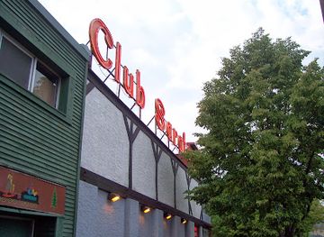
Best nightclubs in Superior National Forest
Evening entertainment is generally quiet and community-based. Gateway towns such as Ely and Grand Marais have local pubs, taverns, breweries or live-music programming at some venues, while smaller settlements offer a limited selection of bars and restaurants where residents and visitors gather. The Gunflint Trail and remote forest areas do not function as nightlife destinations; evenings are more likely to centre on a lodge, campsite, cabin or dark-sky landscape. Seasonal festivals, community performances and cultural events may add variety, but schedules change and should be checked locally. Visitors staying in the forest should plan transport before drinking, as distances are long, roads can be dark and mobile coverage is not dependable in remote areas.
-
Night club
The Flame Nightclub Duluth
Discover the electrifying nightlife at The Flame Nightclub Duluth, where music and dancing create unforgettable memories in a vibrant atmosphere.
-
Gay bar
Flame Nightclub
Discover the vibrant nightlife at Flame Nightclub in Superior, Wisconsin - your go-to destination for fun, acceptance, and unforgettable memories.
-
Adult entertainment club
Club Saratoga
Discover the vibrant nightlife at Club Saratoga, Duluth's premier adult entertainment venue, featuring captivating performances and a lively atmosphere.
-
Gay night club
Main Club
Discover the electrifying energy of Main Club, a premier gay night club in Superior, featuring live music, great drinks, and an inclusive atmosphere.



Best shops in Superior National Forest
Shopping within Superior National Forest is limited, with most provisions and locally made goods found in gateway communities rather than at remote recreation sites. Ely, Grand Marais, Cook, Virginia and North Shore settlements offer grocery shops, outdoor equipment suppliers, outfitters, galleries, bookshops and independent retailers serving canoeing, camping, fishing and winter activities. Visitors may encounter regional products such as wild rice, maple goods, berry preserves, smoked fish, locally made art, pottery, woodwork and textiles, although availability varies by season and location. Shops associated with canoe travel are particularly important around Boundary Waters access towns, where visitors can obtain maps, equipment and food for permitted trips. Remote campgrounds and trailheads generally have no retail facilities, so fuel, food, medication and specialist equipment should be purchased before travelling into the forest.
-
Gift shop
Great! Lakes Candy Kitchen
Discover the sweetest experience in Knife River at Great Lakes Candy Kitchen, where handcrafted chocolates and nostalgic treats await every visitor.
-
Gift shop
Lake Superior Trading Post
Explore Lake Superior Trading Post: Your one-stop shop for gifts, outdoor gear, and local treasures in Grand Marais, Minnesota.
-
Gift shop
Burlington Station
Explore Burlington Station: Your go-to gift shop and cozy coffee retreat in Two Harbors, Minnesota, offering unique treasures and delicious treats.
-
Outdoor sports store
Spirit of the Wilderness
Explore the great outdoors with top-notch gear and expert advice at Spirit of the Wilderness in Ely, Minnesota.


Get your free copy of our complete guide to Superior National Forest, delivered straight to you.
Everything on this page, from attractions and restaurants to essentials and local phrases, in one PDF you can read offline, print or share.
Already have an account? Sign in
Your Superior National Forest guide is ready.
We'll send it to · Not you? Sign out

Getting your guide ready…
We are putting together a fresh copy of the Superior National Forest guide. This can take up to a minute.
This can take a few moments. If your browser asks, choose Allow so the download can start. You'll find the guide in your Downloads folder.
Nothing happened? Download it again
Sorry, the guide is taking longer than usual. Please try again in a minute, or get it by email instead.
Superior National Forest essentials
Currency and Payment
Safety
Emergency Situations
Do's and Don'ts
Local Tips
From Eve
Local phrases worth knowing
You don't need to get them perfect. A few words go a long way, and locals appreciate the effort.
Basics
| English | Local | Say it |
|---|---|---|
| Hello | Boozhoo | [Boh-zhoo] |
| Goodbye | Miigwech | [Mee-gwetch] |
| Yes | Ea | [Ay-ah] |
| No | Aaniin | [Ah-nee-in] |
| Please/You're welcome | Boozhoo | [Boh-zhoo] |
| Thank you | Miigwech | [Mee-gwetch] |
| Excuse me/Sorry | Miigwech | [Mee-gwetch] |
| How are you? | Aaniin ezhi-giizhigad? | [Ah-nee-in eh-zhee-gee-zhee-gad?] |
| Fine. And you? | Maamawi. Giin ezhi-giizhigad? | [Mah-mah-wee. Geen eh-zhee-gee-zhee-gad?] |
| Do you speak English? | Gego wa'aw | [Geh-goh wah-ahw] |
| I don't understand | Aaniin ezhi-giizhigad? | [Ah-nee-in eh-zhee-gee-zhee-gad?] |
Eating & Drinking
| English | Local | Say it |
|---|---|---|
| I'd like to see the menu, please | Giga-waabamin menoo, miigwech | [Gee-gah-wah-bah-min meh-noh, mee-gwetch] |
| I don't eat meat | Gaawiin miijim | [Gah-wee-in mee-jeem] |
| Cheers! | Boozhoo! | [Boh-zhoo!] |
| I would like to pay, please | Giga-waabamin dibishkoo, miigwech | [Gee-gah-wah-bah-min dee-bish-koo, mee-gwetch] |
Emergencies
| English | Local | Say it |
|---|---|---|
| Help! | Aaniin! | [Ah-nee-in!] |
| Go away! | Biboon! | [Bee-boon!] |
| Call the Police! | Waabandaan mashi wiiyaashtanong | [Wah-bahn-dahn mah-shee wee-yah-sh-tah-nong] |
| Call a doctor! | Waabandaan gaa-anaami'idiwin | [Wah-bahn-dahn gah-ah-nah-mee-ee-dee-win] |
| I'm lost | Niin endaso | [Neen en-dah-soh] |
| I'm ill | Niin enji-gikendan | [Neen en-jee-gee-ken-dahn] |
Shopping
| English | Local | Say it |
|---|---|---|
| I'd like to buy... | Giga-waabamin | [Gee-gah-wah-bah-min] |
| I'm just looking | Niizhwaaswi | [Nee-zhwah-swee] |
| How much is it? | Zaagichigaazowin? | [Zah-gee-chee-gah-zoh-win?] |
| That's too expensive | Maajii wii-giiwenh | [Mah-jee wee-gee-wenh] |
| Can you lower the price? | Gaawiin gashkitoon? | [Gah-wee-in gahsh-kee-toon?] |
Time & Numbers
| English | Local | Say it |
|---|---|---|
| What time is it? | Aaniin giiji-ni'ishtam? | [Ah-nee-in gee-jee-nee-ish-tam?] |
| It's one o'clock | Bezhig giizhig | [Beh-zheeg gee-zheeg] |
| Half past (10) | Niiwin dash | [Nee-win dash] |
| Morning | Binaakwe | [Bee-nah-kweh] |
| Afternoon | Aabitoose | [Ah-bee-toh-say] |
| Evening | Zhigaag | [Zhee-gahg] |
| Yesterday | Gikendaasong | [Gee-ken-dah-song] |
| Today | Biindaakonig | [Bee-nah-dah-koh-nig] |
| Tomorrow | Waabanong | [Wah-bah-nong] |
| 1 | Ningoding | [Neen-goh-ding] |
| 2 | Ningozis | [Neen-goh-zis] |
| 3 | Niswi | [Nee-swee] |
| 4 | Niiwin | [Nee-win] |
| 5 | Naanan | [Nah-nahn] |
| 6 | Niizh | [Neezh] |
| 7 | Zhagag | [Zha-gahg] |
| 8 | Shawan | [Shah-wahn] |
| 9 | Niizhwaaswi | [Nee-zhwah-swee] |
| 10 | Midaaswi | [Mee-dah-swee] |
Transport & Directions
| English | Local | Say it |
|---|---|---|
| Where's a/the...? | Aaniin endaa... | [Ah-nee-in en-dah...] |
| What's the address? | Aaniin endaa a'aw? | [Ah-nee-in en-dah ah-ahw?] |
| Can you show me (on the map)? | Gaawiin gashkitoon? | [Gah-wee-in gahsh-kee-toon?] |
| When's the next (bus)? | Aaniin endaa... | [Ah-nee-in en-dah...] |
| A ticket (to ....) | Ningoshimaagan | [Neen-goh-she-mah-gahn] |
History of Superior National Forest
Glacial Formation and the Lake Country
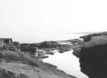
The landscape of Superior National Forest was shaped primarily by repeated continental glaciation, which scoured bedrock, deepened valleys and left the irregular pattern of lakes, wetlands and exposed rock seen today. Retreating ice deposited glacial sediments and created the interconnected waterways that later supported Indigenous travel and, eventually, canoe-based recreation. The forest's thin soils and cool climate favour spruce, fir, pine, birch and aspen, while the varied terrain produces bogs, rocky shorelines and productive wildlife habitat.
Ojibwe Homelands and Early Travel
The forest lies within the homeland of the Ojibwe, whose communities developed extensive knowledge of its waterways, plants, animals and seasonal cycles. Rivers and lakes served as routes for travel, trade and harvesting long before modern roads existed. Treaties made during the nineteenth century profoundly altered Indigenous control of the region, while Ojibwe cultural presence continues in north-eastern Minnesota. Visitors encounter a landscape whose meaning is not limited to recreation or scenic value, but is connected to living communities and enduring relationships with the land.
Timber, Mining and Settlement
During the late nineteenth and early twentieth centuries, commercial logging expanded across northern Minnesota, supplying timber to growing towns and industries. Railways and roads opened access to remote areas, while iron mining became especially important around the Vermilion Range and communities such as Ely and Virginia. Logging altered forest patterns and left a lasting cultural legacy in local settlements, although much of the region has since regenerated. Mining remains visible in the broader area's industrial heritage, even where individual sites fall outside the national forest.
Creation of the National Forest
Superior National Forest was established in 1909, reflecting a growing federal effort to manage public lands, forests and watersheds rather than leaving them solely to unrestricted commercial exploitation. Forest management has changed repeatedly since then, balancing timber production with wildlife habitat, recreation, fire management and water protection. The Boundary Waters Canoe Area became part of the national wilderness system in 1964, giving its lakes and portage routes a more restrictive management framework within the wider national forest.
Wilderness and Modern Conservation
The forest's modern history has been shaped by the effort to protect a large, interconnected water-and-forest ecosystem while accommodating carefully managed recreation. The Boundary Waters receives particular attention because of its undeveloped canoe routes, limited motor access and international setting beside Quetico Provincial Park in Ontario. Fire, invasive species, climate change, forestry and visitor pressure remain important management concerns. Contemporary conservation therefore combines wilderness protection with active stewardship across campgrounds, roads, watersheds, wildlife habitat and working forest.
Superior National Forest in Photos
Browse through our photo collection highlighting the charm and character of the destination.
Cities in Superior National Forest
The towns and cities of Superior National Forest, and the easiest places to base yourself.
-

-
-


Swipe for more cities
Neighbouring destination travel guides
The closest destinations to Superior National Forest, if you have time for more than one.
-

-

-

-

-


Swipe for more destinations
Explore more

Explore more of Boundary Waters Canoe Area Wilderness
Boundary Waters Canoe Area Wilderness offers canoe routes, boreal forests, wildlife, starry skies and quiet adventure in northern Minnesota.
Explore Boundary Waters Canoe Area Wilderness
Explore more of Minnesota
Discover Minnesota: From the bustling Twin Cities and cultural landmarks to the serene lakes and expansive wilderness, experience the diverse beauty and welcoming spirit of the North Star State.
Explore Minnesota