

Carson National Forest Travel Guide - Free Web & App
Your ultimate guide to Carson National Forest. Discover top landmarks, proposed trips, and local tips. Free on the web or via the Evendo companion app.


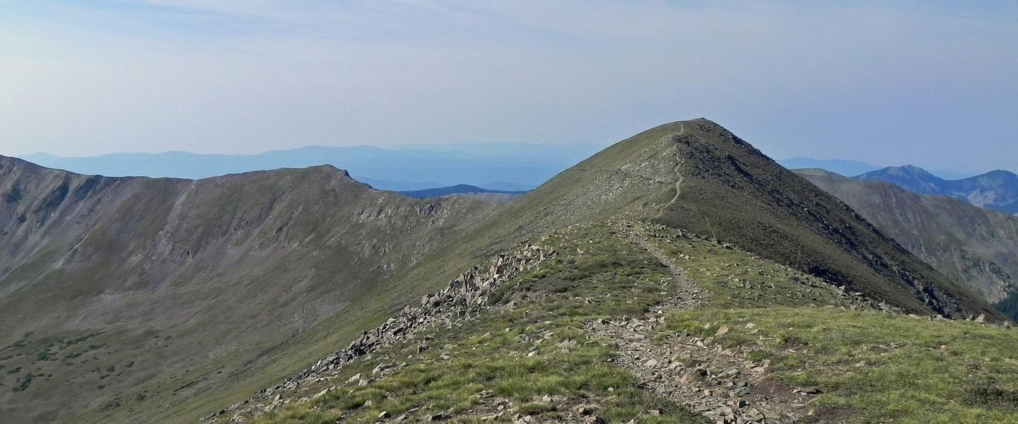


Carson National Forest in New Mexico offers alpine peaks, aspen valleys, wilderness trails, scenic drives, wildlife and outdoor adventure near Taos.
Mountain Landscapes and Wild Country
Carson National Forest occupies more than 1.5 million acres across northern New Mexico, stretching from the high Sangre de Cristo Mountains near Taos and Red River to the forests and valleys around Chama. Its terrain rises from piñon-juniper foothills into spruce, fir, aspen and subalpine country, with alpine lakes, deep canyons, open meadows and broad ridgelines shaping a landscape of striking variety. Wheeler Peak, at 13,161 feet, is the highest point in New Mexico and the centrepiece of the Taos mountain country. The forest also contains or borders several designated wilderness areas, including the Columbine-Hondo Wilderness and Latir Peak Wilderness.Read more about Carson National Forest
Gateway Communities and Regional Character
Outdoor Recreation and Seasonal Change
When is the best time to visit Carson National Forest?
Best: June–August · 25–27°C| Month | High (°C) | Rainfall (mm) |
|---|---|---|
| January | 6 | 30 |
| February | 8 | 30 |
| March | 12 | 40 |
| April | 16 | 40 |
| May | 20 | 50 |
| June (best) | 25 | 60 |
| July (best) | 27 | 70 |
| August (best) | 26 | 70 |
| September | 22 | 60 |
| October | 17 | 50 |
| November | 10 | 40 |
| December | 6 | 30 |
Getting to and around Carson National Forest
How to get there
Transportation
Best attractions in Carson National Forest
Carson National Forest's attractions are dispersed across a broad mountain landscape rather than concentrated at one visitor centre. Around Taos and Taos Ski Valley, trails lead into the Wheeler Peak country, with alpine scenery, high lakes and access to the Columbine-Hondo Wilderness. The Valle Vidal, east of Questa, is a broad open mountain basin valued for meadows, forest edges and wildlife observation, while the Enchanted Circle route links several communities around the high peaks. Red River provides access to trails, fishing waters and seasonal mountain recreation, and the forests near Chama contain lakes, campgrounds and routes through the northern ranges. The Brazos Cliffs near the Chama area form one of the region's recognisable scenic features. Visitors should distinguish Carson National Forest attractions from nearby places such as Taos Pueblo and the Rio Grande Gorge, which are important regional excursions but are not all within the forest's boundaries.
-
Cultural landmark
Taos Pueblo
Explore Taos Pueblo, a UNESCO World Heritage Site, and immerse yourself in the rich cultural heritage of the Taos Native American tribe.
-
Monument
Río Grande del Norte National Monument
Discover the stunning landscapes and rich history of Río Grande del Norte National Monument, a top destination for outdoor adventure and cultural exploration.
-
Kit Carson Park
Explore the beauty and history of Kit Carson Park in Taos, a serene escape with lush landscapes and cultural significance.
-
 Ranch
Ghost Ranch
Experience the natural beauty, rich history, and artistic legacy at Ghost Ranch in Abiquiu, New Mexico, an unforgettable destination for every traveler.


Best landmarks in Carson National Forest
Wheeler Peak is Carson National Forest's defining natural landmark and the highest summit in New Mexico, rising above the Sangre de Cristo Mountains near Taos Ski Valley. The surrounding high country contains alpine terrain, glacially shaped valleys and designated wilderness, while the Columbine-Hondo and Latir mountain landscapes preserve extensive areas with limited road access. The Valle Vidal is a landmark landscape in its own right: open grasslands framed by forested ridges and used by elk and other wildlife. Near Chama, the Brazos Cliffs create a prominent wall of rock above the surrounding valleys. Historic significance is also present in the forest's relationship with Taos, Hispanic agricultural villages and Pueblo communities, although major cultural landmarks such as Taos Pueblo lie outside the national forest and require separate access arrangements.
-
Monument
Río Grande del Norte National Monument
Explore the breathtaking landscapes and rich history of Río Grande del Norte National Monument, a natural wonder in New Mexico perfect for outdoor adventures.
-
State park
Cimarron Canyon State Park
Explore the breathtaking landscapes and outdoor adventures at Cimarron Canyon State Park, a must-visit destination in New Mexico.
-
Park
Kit Carson Park
Discover the beauty and history of Kit Carson Park in Taos, New Mexico, where nature meets heritage in a serene setting.
-
Historical landmark
Puye Cliff Dwellings
Explore the ancient cliff dwellings of the Puebloan people at Puye Cliff Dwellings, a stunning cultural and historical landmark in New Mexico.


Explore Carson National Forest on the map
Plan your trip on one map. See where the top attractions, landmarks, restaurants and hotels are, and book hotels and experiences in a few clicks.
Best hotels in Carson National Forest
Best restaurants in Carson National Forest
Dining within Carson National Forest is limited because the area is primarily public woodland, wilderness and high-country terrain, so visitors generally eat in gateway communities rather than at remote trailheads. Taos has the broadest choice, with restaurants, cafés, bakeries and food shops reflecting northern New Mexico's blend of Pueblo, Hispanic and wider Southwestern traditions; red or green chile, beans, corn, locally influenced stews and enchiladas are characteristic regional flavours. Restaurants and casual food outlets are also found in Red River, Questa, Angel Fire and Chama, although the selection is smaller and distances between services can be substantial. Village stores, supermarkets, farm shops and provisions in larger settlements are useful for picnics and self-catering. Campers should plan supplies before entering the forest and should follow all food-storage and fire regulations.
-
Southwestern American
Rancho de Chimayó
Experience authentic Southwestern cuisine at Rancho de Chimayó - where tradition meets flavor in every dish.
-
Southwestern American
Michael's Kitchen Restaurant & Bakery
Experience authentic Southwestern American cuisine at Michael's Kitchen Restaurant & Bakery in Taos – where every meal is a celebration of local flavors.
-
Mexican
La Cueva Cafe
Experience authentic Mexican cuisine at La Cueva Cafe in Taos - where every meal is a celebration of flavor and culture.
-
Hamburger
The Burger Stand @ Taos Ale House
Experience delicious burgers and local craft beers at The Burger Stand @ Taos Ale House – a top destination for food lovers in Taos.


Best bars in Carson National Forest
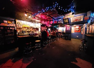
Carson National Forest does not have a central nightlife district, and evening entertainment is concentrated in the surrounding gateway communities. Taos offers the widest range of bars, restaurants and occasional live music, with a more developed arts and hospitality scene than the smaller mountain settlements. Red River, Angel Fire, Questa and Chama have quieter evening options, including local bars, restaurants and seasonal hospitality venues, but availability can vary with the time of year. In the forest itself, the usual evening experience is the subdued atmosphere of a campground, cabin or rural base rather than a nightclub scene. Visitors staying in remote areas should not rely on finding late-night food, fuel or entertainment after leaving town, particularly on mountain roads and during winter.
-
Hamburger
The Burger Stand @ Taos Ale House
Experience the best of Taos with delicious burgers, local beers, and a warm atmosphere at The Burger Stand @ Taos Ale House.
-
Bar
The Alley Cantina
Experience the vibrant flavors of American and Mexican cuisine at The Alley Cantina in Taos, NM, complete with live music and a family-friendly atmosphere.
-
Grill
The Gorge Bar and Grill
Discover the flavors of Taos at The Gorge Bar and Grill, where local cuisine meets a welcoming atmosphere in the heart of New Mexico.
-
Brewery
Taos Mesa Brewing Taos Tap Room
Discover the flavors of Taos at Taos Mesa Brewing Taos Tap Room, where craft beer meets delicious Italian cuisine in a vibrant atmosphere.


Best nightclubs in Carson National Forest
Carson National Forest does not have a central nightlife district, and evening entertainment is concentrated in the surrounding gateway communities. Taos offers the widest range of bars, restaurants and occasional live music, with a more developed arts and hospitality scene than the smaller mountain settlements. Red River, Angel Fire, Questa and Chama have quieter evening options, including local bars, restaurants and seasonal hospitality venues, but availability can vary with the time of year. In the forest itself, the usual evening experience is the subdued atmosphere of a campground, cabin or rural base rather than a nightclub scene. Visitors staying in remote areas should not rely on finding late-night food, fuel or entertainment after leaving town, particularly on mountain roads and during winter.
-
Bar
The Matador
Experience the vibrant nightlife of Santa Fe at The Matador, where locals and tourists gather for eclectic drinks and a lively atmosphere.
-
Lounge
La Fiesta Lounge
Discover the essence of Santa Fe at La Fiesta Lounge, where vibrant drinks and local entertainment create an unforgettable experience.
-
Bar
Motherlode Saloon
Discover the lively atmosphere of Motherlode Saloon, Red River's top bar for delicious drinks and unforgettable karaoke nights.
-
Bar
Los Caminos Bar
Experience the vibrant local culture and unwind with delicious drinks at Los Caminos Bar in Abiquiu, New Mexico.


Get your free copy of our complete guide to Carson National Forest, delivered straight to you.
Everything on this page, from attractions and restaurants to essentials and local phrases, in one PDF you can read offline, print or share.
Already have an account? Sign in
Your Carson National Forest guide is ready.
We'll send it to · Not you? Sign out

Getting your guide ready…
We are putting together a fresh copy of the Carson National Forest guide. This can take up to a minute.
This can take a few moments. If your browser asks, choose Allow so the download can start. You'll find the guide in your Downloads folder.
Nothing happened? Download it again
Sorry, the guide is taking longer than usual. Please try again in a minute, or get it by email instead.
Carson National Forest essentials
Currency and Payment
Safety
Emergency Situations
Do's and Don'ts
Local Tips
From Eve
Local phrases worth knowing
You don't need to get them perfect. A few words go a long way, and locals appreciate the effort.
Basics
| English | Local | Say it |
|---|---|---|
| Hello | Howdy | [hah-dee] |
| Goodbye | Adios | [ah-dee-ohs] |
| Yes | Si | [see] |
| No | No | [noh] |
| Please/You're welcome | Por favor | [por fah-vor] |
| Thank you | Gracias | [grah-see-ahs] |
| Excuse me/Sorry | Disculpe | [dees-kool-peh] |
| How are you? | Como estas? | [ko-moh ehs-tahs] |
| Fine. And you? | Bien. Y tu? | [bee-en. ee too] |
| Do you speak English? | Hablas ingles? | [ah-blahs een-glays] |
| I don't understand | No entiendo | [noh ehn-tee-ehn-doh] |
Eating & Drinking
| English | Local | Say it |
|---|---|---|
| I'd like to see the menu, please | Me gustaría ver el menú, por favor | [meh goo-stah-ree-ah behr ehl meh-noo, por fah-vor] |
| I don't eat meat | No como carne | [noh koh-moh kahr-neh] |
| Cheers! | Salud! | [sah-loohd] |
| I would like to pay, please | Me gustaría pagar, por favor | [meh goo-stah-ree-ah pah-gahr, por fah-vor] |
Emergencies
| English | Local | Say it |
|---|---|---|
| Help! | Ayuda! | [ah-yoo-dah] |
| Go away! | Vete! | [veh-teh] |
| Call the Police! | Llama a la policía! | [yah-mah ah lah poh-lee-see-ah] |
| Call a doctor! | Llama a un doctor! | [yah-mah ah oon dohk-tohr] |
| I'm lost | Estoy perdido | [ehs-toy pehr-dee-doh] |
| I'm ill | Estoy enfermo | [ehs-toy ehn-fehr-moh] |
Shopping
| English | Local | Say it |
|---|---|---|
| I'd like to buy... | Quisiera comprar... | [kee-see-eh-rah kohm-prahr] |
| I'm just looking | Solo estoy mirando | [soh-loh ehs-toy mee-rahn-doh] |
| How much is it? | Cuánto cuesta? | [kwan-toh kweh-stah] |
| That's too expensive | Esto es demasiado caro | [ehs-toh ehs deh-mah-syah-doh kah-roh] |
| Can you lower the price? | Puede bajar el precio? | [pweh-deh bah-hahr ehl preh-syoh] |
Time & Numbers
| English | Local | Say it |
|---|---|---|
| What time is it? | Qué hora es? | [keh oh-rah ehs] |
| It's one o'clock | Es la una | [ehs lah oo-nah] |
| Half past (10) | Media (10) | [meh-dee-ah (diez)] |
| Morning | Mañana | [mah-nyah-nah] |
| Afternoon | Tarde | [tahr-deh] |
| Evening | Noche | [noh-cheh] |
| Yesterday | Ayer | [ah-yehr] |
| Today | Hoy | [oy] |
| Tomorrow | Mañana | [mah-nyah-nah] |
| 1 | Uno | [oo-noh] |
| 2 | Dos | [dohs] |
| 3 | Tres | [trehs] |
| 4 | Cuatro | [kwah-troh] |
| 5 | Cinco | [seen-koh] |
| 6 | Seis | [sehs] |
| 7 | Siete | [syeh-teh] |
| 8 | Ocho | [oh-choh] |
| 9 | Nueve | [nweh-veh] |
| 10 | Diez | [diez] |
Transport & Directions
| English | Local | Say it |
|---|---|---|
| Where's a/the...? | Dónde está el/la...? | [dohn-deh ehs-tah ehl/lah] |
| What's the address? | Cuál es la dirección? | [kwal ehs lah dee-rehk-syon] |
| Can you show me (on the map)? | Puedes mostrarme (en el mapa)? | [pweh-dehs mohs-trar-meh (ehn ehl mah-pah)] |
| When's the next (bus)? | Cuándo es el próximo (autobús)? | [kwan-doh ehs ehl proh-ksee-moh (ow-toh-boos)] |
| A ticket (to ....) | Un boleto (a ....) | [oon boh-leh-toh (ah)] |
History of Carson National Forest
Mountain Landscapes and First Communities
The mountains and valleys of northern New Mexico have a much longer history than the national forest designation. Pueblo communities have maintained enduring cultural relationships with the region, while Indigenous hunting, travel and land-use traditions predate later colonial settlement. Spanish colonisation introduced new settlements, grazing practices and acequia irrigation systems into the valleys around Taos, Questa, Trampas and Chama. Hispanic villages developed distinctive agricultural landscapes in which communal water management, field patterns and adobe architecture remain important features of regional identity.
Colonial, Mexican and United States Rule
Northern New Mexico passed through Spanish, Mexican and United States administration, and its land history reflects changing systems of ownership and access. The Treaty of Guadalupe Hidalgo brought the region into the United States in 1848. Later surveys, grants, private holdings and federal land policies affected communities whose livelihoods depended on farming, grazing, hunting and woodland resources. The name Carson is associated with frontiersman and army scout Kit Carson, who lived in Taos during the nineteenth century, although the forest's history encompasses many communities and traditions beyond that individual.
Forest Reserves and Resource Use
Federal forest administration expanded in the early twentieth century as the United States sought to manage watersheds, timber and public lands. The area's reserve system developed into what is now Carson National Forest, named for Kit Carson. Logging, grazing, mining in parts of the surrounding mountain country and road construction shaped local economies and altered access to remote valleys. At the same time, forests remained essential to water supply, wildlife habitat and recreation. The division between public forest, private land and community land continues to influence travel routes and land management.
Conservation and Recreation
During the twentieth century, national forest management increasingly balanced timber and grazing with watershed protection, wildlife conservation, wilderness and outdoor recreation. Wilderness designations in the Sangre de Cristo and adjacent mountain ranges helped protect areas where roads and commercial development remain limited. Skiing developed around Taos Ski Valley and other high-country communities, while fishing, camping, hiking and scenic travel broadened the forest's visitor identity. Today, Carson National Forest is managed as a working public landscape whose uses include recreation, habitat protection, cultural stewardship, grazing, forestry and the protection of sensitive mountain environments.
Carson National Forest in Photos
Browse through our photo collection highlighting the charm and character of the destination.
Cities in Carson National Forest
The towns and cities of Carson National Forest, and the easiest places to base yourself.
-
-

-


Swipe for more cities
Neighbouring destination travel guides
The closest destinations to Carson National Forest, if you have time for more than one.
-

-

-

-

-


Swipe for more destinations
Explore more

Explore more of Enchanted Circle
Explore New Mexico's Enchanted Circle for alpine scenery, Taos culture, mountain towns, outdoor adventure and high-country scenic drives.
Explore Enchanted Circle
Explore more of New Mexico
Discover the enchanting blend of rich history, diverse cultures, and stunning landscapes in New Mexico, the Land of Enchantment, where adventure and relaxation await.
Explore New Mexico