

Free Bryce Canyon National Park Travel Guide & Mobile App
Explore Bryce Canyon National Park with free travel guides. Discover regional history, expert tips, proposed trips, and audio guides on web or mobile app.


Bryce Canyon National Park pairs Utah’s high-elevation forests with radiant hoodoos, dramatic amphitheatre views, dark skies and memorable trails.
Read more about Bryce Canyon National Park
Getting to and around Bryce Canyon National Park
How to get there
Transportation
Top city travel guides in Bryce Canyon National Park
The cities of Bryce Canyon National Park, and the easiest places to base yourself.

Swipe for more cities
Destinations in Bryce Canyon National Park
Resorts, valleys and scenic spots worth a trip of their own.

Swipe for more destinations
Best attractions in Bryce Canyon National Park
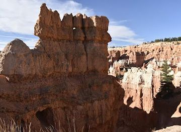
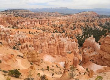
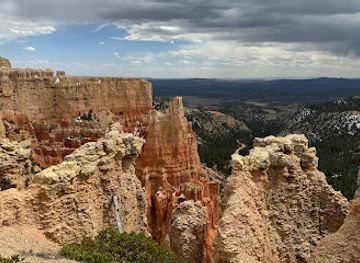
Bryce Canyon National Park’s attractions centre on the relationship between its high plateau, sculpted amphitheatres and accessible trails. The Bryce Amphitheatre area brings together Sunrise Point, Sunset Point, Inspiration Point and Bryce Point, each revealing a different arrangement of hoodoos and eroded walls. The Queen’s Garden Trail and Navajo Loop provide the classic descent into the formations, while the Peekaboo Loop offers a longer and more strenuous route. Along the park road, visitors encounter forested viewpoints, bristlecone pines, open meadows and changing perspectives towards Rainbow Point and Yovimpa Point. The Rim Trail is suitable for linking several overlooks, though snow, ice and exposure affect conditions seasonally. Ranger interpretation at the visitor centre and scheduled programmes explain the park’s geology, ecology, Indigenous heritage and night sky. Wildlife watching may include mule deer, marmots, birds of prey and smaller forest species, but sightings are never guaranteed. Winter adds opportunities for snowshoeing and cross-country travel when conditions permit, while summer and early autumn favour hiking and scenic driving. The historic lodge and nearby campground provide a sense of the park’s early tourism tradition, although services remain limited compared with a town.
-
Bryce Canyon National Park Visitor Center
Explore the breathtaking landscapes of Bryce Canyon National Park at the Visitor Center, your gateway to adventure and discovery.
-
Grand Staircase-Escalante National Monument
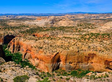
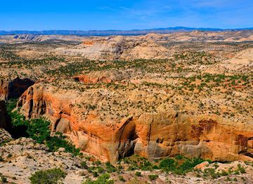
Explore the vast beauty of Grand Staircase-Escalante National Monument, a treasure trove of stunning landscapes and rich geological history in Utah.
-
Bryce Canyon National Park Sunset Point
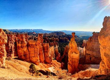
Discover the breathtaking landscapes of Bryce Canyon National Park at Sunset Point, where vibrant colors and unique rock formations create unforgettable views.
-
Bryce Canyon National Park Sunrise Point
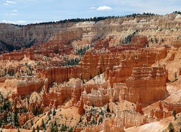
Experience the awe-inspiring Sunrise Point at Bryce Canyon National Park, where breathtaking views and unique geological formations await every visitor.
Best landmarks in Bryce Canyon National Park
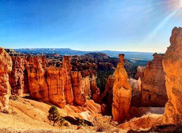
The hoodoo-filled Bryce Amphitheatre is the park’s defining natural landmark, a vast eroded basin best understood from the sequence of Bryce Point, Inspiration Point, Sunset Point and Sunrise Point. Thor’s Hammer, a prominent hoodoo visible from trails in the amphitheatre, has become one of the landscape’s most recognisable formations. Beyond the central viewpoints, the Pink Cliffs of the Paunsaugunt Plateau continue towards Rainbow Point, where broad views reveal the park’s high-elevation setting and the layered geology of the surrounding region. Yovimpa Point is associated with views across the Grand Staircase, a sequence of elevated geological benches extending through southern Utah. The hoodoos are not static monuments: frost, water and gravity continue to modify their shapes. Among the natural features, the ancient bristlecone pines near the southern high points provide a contrasting landmark, showing how life adapts to exposed, cold conditions. Bryce Canyon Lodge, built in the 1920s near the rim, is the park’s most significant historic structure and an important expression of early National Park Service rustic architecture.
-
Visitor center
Bryce Canyon National Park Visitor Center
Explore Bryce Canyon National Park Visitor Center: Your gateway to breathtaking landscapes, unique geological formations, and unforgettable outdoor adventures.
-
Nature preserve
Grand Staircase-Escalante National Monument
Explore the breathtaking landscapes and geological wonders of Grand Staircase-Escalante National Monument, a true gem in Utah's natural beauty.
-
Scenic spot
Bryce Canyon National Park Sunset Point
Discover the breathtaking beauty of Bryce Canyon National Park Sunset Point, where stunning vistas and unique rock formations await.
-
 Monument
Cedar Breaks National Monument
Experience the breathtaking beauty of Cedar Breaks National Monument, a stunning natural amphitheater featuring vibrant rock formations and rich alpine ecosystems.
Explore Bryce Canyon National Park on the map
Plan your trip on one map. See where the top cities, national parks and sights are, and book hotels and experiences in a few clicks.
Best hotels in Bryce Canyon National Park
Best restaurants in Bryce Canyon National Park
Dining inside Bryce Canyon National Park is limited and seasonal, with the historic Bryce Canyon Lodge providing the principal full-service heritage setting and other visitor services offering simpler provisions when operating. The food culture is therefore less about a distinct park cuisine than about practical meals for hikers, lodge dining and supplies gathered in the nearby gateway community of Bryce Canyon City, outside the park boundary. Visitors will find familiar American café, grill and diner-style choices in the surrounding area, along with packed-lunch provisions useful for long days on the trails. Utah specialities may appear on regional menus, but the park should not be treated as a major culinary destination. Breakfast before an early walk, plenty of water and food that travels well are often more important than elaborate dining plans. Services can be reduced outside the main visitor season, so check current arrangements and avoid assuming that every facility will be open late.
-
Hotel
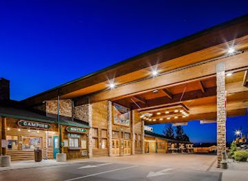
Best Western Plus Ruby's Inn
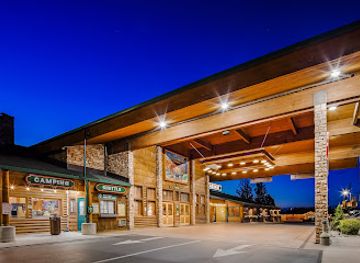
Discover unparalleled comfort and convenience at Best Western Plus Ruby's Inn near Bryce Canyon National Park.
-
Steak
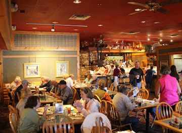
Ruby's Inn Cowboy's Buffet & Steak Room
Discover hearty meals at Ruby's Inn Cowboy's Buffet & Steak Room near Bryce Canyon National Park—where Western flavors meet warm hospitality.
-
American
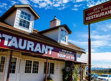
Bryce Canyon Pines Restaurant
Experience authentic American cuisine at Bryce Canyon Pines Restaurant, your perfect dining spot near breathtaking natural wonders.
-
Lodge
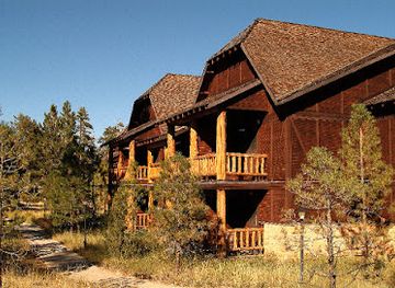
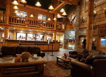
The Lodge at Bryce Canyon
Discover comfort amidst breathtaking landscapes at The Lodge at Bryce Canyon – your gateway to adventure in Utah's stunning national park.

Best bars in Bryce Canyon National Park
Bryce Canyon National Park has no conventional nightclub district and evenings are shaped by quiet accommodation, lodge dining, ranger programmes and dark-sky viewing rather than late entertainment. The historic lodge provides the park’s most established social setting, while restaurants and lodging businesses in Bryce Canyon City, immediately outside the entrance, offer the area’s principal evening facilities. Alcohol availability and licensing vary by establishment, and visitors should not assume that rural services remain open late. The most distinctive night-time activity is astronomy: on clear evenings, the absence of urban light makes the Milky Way and numerous stars visible, although moonlight, cloud and weather affect conditions. Ranger-led astronomy programmes may be offered seasonally and should be checked in advance. After dark, carry a suitable light, watch for uneven ground and respect quiet hours around campsites and accommodation.
-
Hotel
Best Western Plus Ruby's Inn
Experience the natural beauty of Bryce Canyon from the comfort of Best Western Plus Ruby's Inn, your ideal home base for adventure.
-
Steak
Ruby's Inn Cowboy's Buffet & Steak Room
Discover the heart of cowboy cuisine at Ruby's Inn Cowboy's Buffet & Steak Room, where delicious steaks and a warm atmosphere await in Bryce Canyon.
-
Scenic spot
Bryce Canyon National Park Sunset Point
Experience the breathtaking beauty of Bryce Canyon National Park's Sunset Point, where stunning sunsets meet unique geological formations.
-
American
Bryce Canyon Pines Restaurant
Explore Bryce Canyon's natural beauty while enjoying delicious American cuisine at Bryce Canyon Pines Restaurant, a favorite among travelers.
Best nightclubs in Bryce Canyon National Park
-
Hotel
Best Western Plus Ruby's Inn
Discover comfort and adventure at Best Western Plus Ruby's Inn, your perfect base for exploring Bryce Canyon National Park's stunning natural beauty.
-
Steak
Ruby's Inn Cowboy's Buffet & Steak Room
Experience the bounty of the Wild West at Ruby's Inn Cowboy's Buffet & Steak Room, where hearty meals meet the stunning backdrop of Bryce Canyon.
-
American
Bryce Canyon Pines Restaurant
Experience mouthwatering American cuisine at Bryce Canyon Pines Restaurant, the perfect dining stop near the stunning Bryce Canyon National Park.
-
Hotel
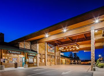
Best Western Plus Bryce Canyon Grand Hotel
Experience comfort and adventure at the Best Western Plus Bryce Canyon Grand Hotel, your gateway to breathtaking landscapes and outdoor fun.


Best shops in Bryce Canyon National Park
Shopping within Bryce Canyon National Park is concentrated at the visitor centre and historic lodge, where visitors may find interpretive books, maps, educational material, postcards and park-related gifts. These outlets are primarily useful for understanding the landscape and supporting park visits rather than for extensive retail browsing. More general supplies, souvenirs, outdoor equipment and food are available in Bryce Canyon City outside the park, though the range is limited compared with a major town. Regional purchases may include books on Utah geology and Indigenous history, artwork inspired by the Colorado Plateau, practical hiking items and locally themed crafts. Visitors should distinguish authentic regional work from generic western souvenirs and avoid buying anything made from protected natural materials or removed rock. Because facilities and stock can vary by season, it is sensible to obtain specialist equipment and substantial supplies before travelling to the park.
-
Hotel
Best Western Plus Ruby's Inn
Experience comfort and adventure at Best Western Plus Ruby's Inn, your gateway to the breathtaking landscapes of Bryce Canyon.
-
General store
Ruby’s Inn General Store
Explore Bryce Canyon with ease by stocking up at Ruby's Inn General Store, your essential shopping destination for outdoor adventures.
-
Scenic spot
Natural Bridge
Experience the stunning beauty of Natural Bridge in Bryce Canyon National Park, a must-visit geological wonder in Utah's captivating landscape.
-
Gift shop
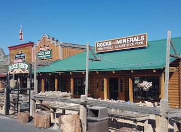
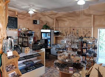
The Rock Stop
Explore The Rock Stop in Orderville, Utah – a unique gift shop and coffee haven featuring local art, souvenirs, and geological wonders.


Get your free copy of our complete guide to Bryce Canyon National Park, delivered straight to you.
Everything on this page, from attractions and restaurants to essentials and local phrases, in one PDF you can read offline, print or share.
Already have an account? Sign in
Your Bryce Canyon National Park guide is ready.
We'll send it to · Not you? Sign out

Getting your guide ready…
We are putting together a fresh copy of the Bryce Canyon National Park guide. This can take up to a minute.
This can take a few moments. If your browser asks, choose Allow so the download can start. You'll find the guide in your Downloads folder.
Nothing happened? Download it again
Sorry, the guide is taking longer than usual. Please try again in a minute, or get it by email instead.
Bryce Canyon National Park essentials
Currency and Payment
Safety
Emergency Situations
Do's and Don'ts
Local Tips
From Eve
Local phrases worth knowing
You don't need to get them perfect. A few words go a long way, and locals appreciate the effort.
Basics
| English | Local | Say it |
|---|---|---|
| Hello | Howdy | [Ha-dee] |
| Goodbye | See ya | [See ya] |
| Yes | Yep | [Yep] |
| No | Nope | [Nope] |
| Please/You're welcome | Please | [Please] |
| Thank you | Thanks | [Thanks] |
| Excuse me/Sorry | Pardon me | [Par-don me] |
| How are you? | How's it going? | [How's it go-ing?] |
| Fine. And you? | Good. You? | [Good. You?] |
| Do you speak English? | Can you talk English? | [Can you talk Eng-lish?] |
| I don't understand | I ain't got it | [I ain't got it] |
Eating & Drinking
| English | Local | Say it |
|---|---|---|
| I'd like to see the menu, please | Can I see the menu? | [Can I see the men-u?] |
| I don't eat meat | I’m vegetarian | [I'm vege-tar-i-an] |
| Cheers! | Cheers! | [Cheers!] |
| I would like to pay, please | Can I get the bill? | [Can I get the bill?] |
Emergencies
| English | Local | Say it |
|---|---|---|
| Help! | Help! | [Help!] |
| Go away! | Leave me alone! | [Leave me a-lone!] |
| Call the Police! | Get the cops! | [Get the cops!] |
| Call a doctor! | Need a doctor! | [Need a doc-tor!] |
| I'm lost | I'm turned around | [I'm turned a-round] |
| I'm ill | I feel sick | [I feel sick] |
Shopping
| English | Local | Say it |
|---|---|---|
| I'd like to buy... | I want to buy... | [I want to buy...] |
| I'm just looking | Just browsing | [Just brows-ing] |
| How much is it? | What’s the price? | [What's the price?] |
| That's too expensive | That's pricey | [That's price-y] |
| Can you lower the price? | Can you make it cheaper? | [Can you make it cheap-er?] |
Time & Numbers
| English | Local | Say it |
|---|---|---|
| What time is it? | What time ya got? | [What time ya got?] |
| It's one o'clock | It's one o'clock | [It's one o'clock] |
| Half past (10) | Half past ten | [Half past ten] |
| Morning | Morning | [Morn-ing] |
| Afternoon | Afternoon | [Af-ter-noon] |
| Evening | Evening | [Eve-ning] |
| Yesterday | Yesterday | [Yes-ter-day] |
| Today | Today | [To-day] |
| Tomorrow | Tomorrow | [To-mor-row] |
| 1 | One | [One] |
| 2 | Two | [Two] |
| 3 | Three | [Three] |
| 4 | Four | [Four] |
| 5 | Five | [Five] |
| 6 | Six | [Six] |
| 7 | Seven | [Seven] |
| 8 | Eight | [Eight] |
| 9 | Nine | [Nine] |
| 10 | Ten | [Ten] |
Transport & Directions
| English | Local | Say it |
|---|---|---|
| Where's a/the...? | Where's the...? | [Where's the...?] |
| What's the address? | What's the address? | [What's the ad-dress?] |
| Can you show me (on the map)? | Can you point it out? | [Can you point it out?] |
| When's the next (bus)? | When's the next bus? | [When's the next bus?] |
| A ticket (to ....) | One ticket to... | [One tick-et to...] |
History of Bryce Canyon National Park
Ancestral Peoples and Southern Paiute Heritage
The Bryce Canyon region has been used and understood by Indigenous peoples for centuries. Archaeological evidence records the wider presence of Ancestral Puebloan and Fremont communities in southern Utah, while Southern Paiute people maintained enduring cultural relationships with the plateau, its water sources, plants and wildlife. The landscape was not an empty wilderness before government designation. Its formations, high-country environment and seasonal resources formed part of a broader cultural geography extending across what is now southern Utah and northern Arizona.
Geological Formation of the Hoodoos
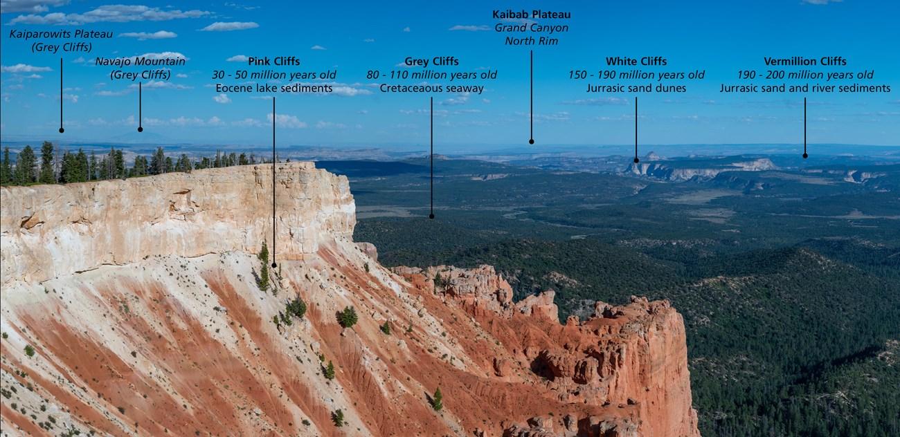
Bryce’s distinctive formations are made mainly from the Claron Formation, deposited in a large ancient lake basin roughly 50 to 60 million years ago. Uplift raised the region and exposed the soft rock to frost wedging and rain erosion. Water entered cracks, froze and expanded, gradually separating fins into columns and sculpting the hoodoos seen today. The amphitheatres continue to change: freeze-thaw cycles, rather than a single dramatic geological event, remain the principal force shaping the park’s walls and pinnacles.
Exploration and Settlement in the Nineteenth Century
Euro-American mapping and exploration increased in southern Utah during the nineteenth century, followed by Mormon settlement in nearby valleys and uplands. Ebenezer Bryce, a Mormon homesteader and rancher who lived in the area in the 1870s, became associated with the amphitheatre that now bears his name. Local settlers used the plateau for timber, grazing and access to seasonal resources, while roads and trails gradually connected the high country with communities beyond it.
From Forest Reserve to National Monument
As visitors and conservationists drew attention to the unusual formations, federal protection gradually replaced local extraction as the dominant land-use priority. Bryce Canyon became part of the broader federal conservation system as a national monument in 1923. Early tourism relied on rough roads, horseback travel and modest accommodation, but the landscape’s visual appeal soon made it one of southern Utah’s most important scenic destinations.
National Park Status and Early Tourism
Bryce Canyon National Park was established in 1928, confirming the national importance of its amphitheatres, hoodoos and high-elevation ecosystems. The Union Pacific Railroad and associated tourism development helped bring more visitors to southern Utah, while road improvements made the park increasingly accessible by car. Bryce Canyon Lodge, built in the 1920s near the amphitheatre, remains an important example of the rustic National Park Service architectural tradition.
Conservation, Interpretation and Dark-Sky Stewardship
Twentieth-century park management increasingly focused on protecting fragile formations, forests, wildlife and night skies while accommodating visitors. The Civilian Conservation Corps contributed to early infrastructure in the region, including trails and park facilities. Today, interpretation places geology alongside Indigenous heritage, settlement history and ecological change. Bryce Canyon’s exceptionally dark skies have also become an important conservation and educational resource, supporting astronomy programmes and a broader effort to limit unnecessary artificial light.
Bryce Canyon National Park in Photos
Browse through our photo collection highlighting the charm and character of the destination.
Neighbouring regions of Bryce Canyon National Park
The closest regions to Bryce Canyon National Park, if you have time for more than one.
-

-

-
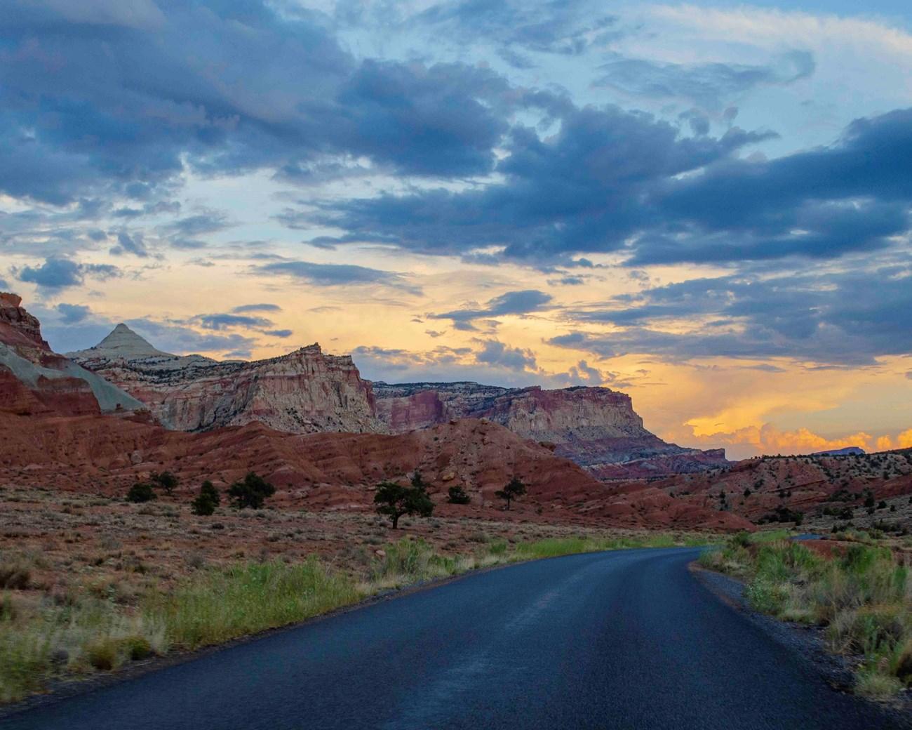 Capitol Reef National Park
Explore Capitol Reef National Park in Utah for folded red-rock geology, historic Fruita orchards, scenic drives, canyons and remote desert trails.
Capitol Reef National Park
Explore Capitol Reef National Park in Utah for folded red-rock geology, historic Fruita orchards, scenic drives, canyons and remote desert trails.
-
 Escalante Desert
Explore Utah's Escalante Desert for sandstone canyons, river trails, dark skies, scenic drives and the wide-open landscapes of Grand Staircase country.
Escalante Desert
Explore Utah's Escalante Desert for sandstone canyons, river trails, dark skies, scenic drives and the wide-open landscapes of Grand Staircase country.
-
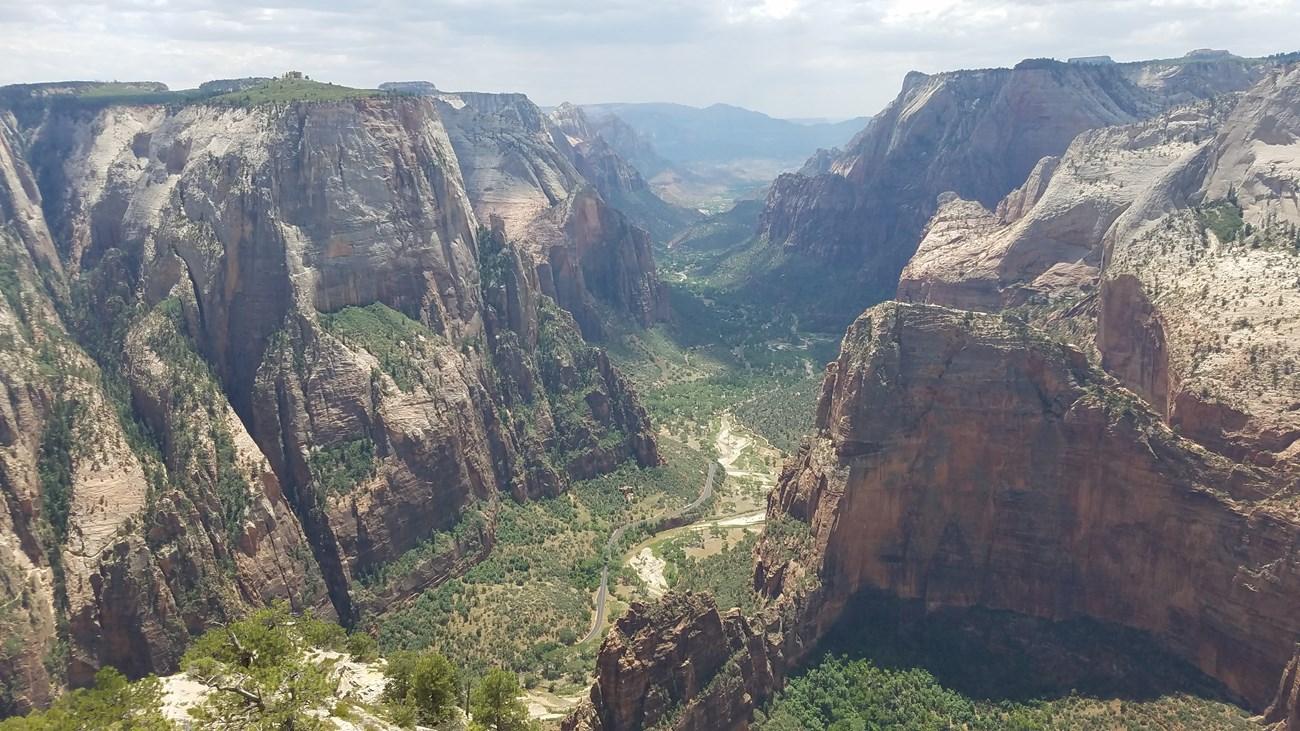 Dixie
Explore Dixie Utah for red-rock canyons, desert trails, St George heritage, high plateaux and access to Zion’s dramatic landscapes.
Dixie
Explore Dixie Utah for red-rock canyons, desert trails, St George heritage, high plateaux and access to Zion’s dramatic landscapes.


Swipe for more regions
Explore more

Explore more of Utah
Explore Utah's stunning national parks, rich cultural heritage, and year-round outdoor adventures. Discover why this diverse state is a top destination for travelers.
Explore Utah