

Whidbey Island Travel Guide - Free Web & App
Your ultimate guide to Whidbey Island. Discover top landmarks, proposed trips, and local tips. Free on the web or via the Evendo companion app.


Whidbey Island, Washington blends Puget Sound beaches, Deception Pass, historic Coupeville, coastal forts, farms and scenic outdoor adventures.
Island Landscapes
Whidbey Island stretches through the sheltered waters of Puget Sound, forming a long, varied island between the Olympic Peninsula and the mainland of Washington State. Its eastern shore looks across Saratoga Passage towards Camano Island, while the western side faces Admiralty Inlet and the Olympic Mountains. Forested bluffs, tidal beaches, working farmland, quiet coves and open prairie give the island a more layered character than its modest distances might suggest. At the north, Deception Pass State Park combines steep wooded slopes, saltwater channels and the celebrated bridge linking Whidbey with Fidalgo Island.Read more about Whidbey Island
Communities and Heritage
Outdoor Character
When is the best time to visit Whidbey Island?
Best: June–August · 20–22°C| Month | High (°C) | Rainfall (mm) |
|---|---|---|
| January | 9 | 92 |
| February | 10 | 74 |
| March | 11 | 80 |
| April | 14 | 56 |
| May | 18 | 40 |
| June (best) | 20 | 30 |
| July (best) | 22 | 16 |
| August (best) | 22 | 18 |
| September | 19 | 28 |
| October | 15 | 60 |
| November | 10 | 76 |
| December | 9 | 96 |
Getting to and around Whidbey Island
How to get there
Transportation
Best attractions in Whidbey Island
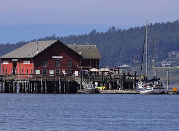
Whidbey Island's attractions range from the tidal drama of Deception Pass State Park in the north to the historic waterfront of Coupeville on Penn Cove. The park offers wooded trails, beaches, viewpoints and views of the bridge and narrow channels, while nearby Oak Harbor provides the island's largest concentration of everyday services. In central Whidbey, Ebey's Landing National Historical Reserve combines coastal bluffs, prairie, farmland and the settlement of Coupeville in a landscape shaped by Indigenous history and nineteenth-century colonisation. Fort Casey Historical State Park preserves coastal batteries and Admiralty Head Lighthouse beside Admiralty Inlet, and Fort Ebey State Park adds forest, shoreline and military remains on the west coast. Langley offers galleries, independent shops and views across Saratoga Passage, while beaches, farms and smaller communities around Freeland and Clinton give the southern island a quieter, more rural character.
-
Outlet mall
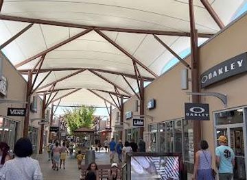
Seattle Premium Outlets
Discover unbeatable savings and a diverse shopping experience at Seattle Premium Outlets in Tulalip, Washington, just north of Seattle.
-
Tourist attraction
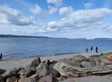
Mukilteo Beach
Experience the beauty and tranquility of Mukilteo Beach, a must-visit destination in Washington for nature lovers and beach enthusiasts alike.
-
Seafood restaurant
Front Street Grill
Discover the taste of the Pacific Northwest at Front Street Grill, Coupeville's premier seafood restaurant with stunning waterfront views.
-
Nike Factory Store - Tulalip
Discover unbeatable deals on high-quality athletic apparel and footwear at the Nike Factory Store in Tulalip, a shopper's paradise for sportswear enthusiasts.

Explore Whidbey Island on the map
Plan your trip on one map. See where the top attractions, landmarks, restaurants and hotels are, and book hotels and experiences in a few clicks.
Best hotels in Whidbey Island
Best restaurants in Whidbey Island
Whidbey Island's food culture is shaped by its marine setting, fertile farmland and small-scale producers. Penn Cove is associated with shellfish farming, while local menus may draw on Pacific Northwest seafood, oysters, clams, salmon, berries, apples and seasonal vegetables. Coupeville, Oak Harbor, Langley, Freeland and Clinton contain the island's main concentration of cafés, restaurants, bakeries, pubs and provisions, with options ranging from informal meals to more considered regional cooking. Farm stands, markets and independent producers are useful for picnic supplies and seasonal ingredients, although availability changes through the year. In rural areas, dining is more dispersed and visitors should not assume that a park or beach has food nearby. The island's agricultural landscape also supports wineries, cider and other locally produced drinks, best approached as part of the wider farming economy rather than as a dense tasting district.
-
Pacific Northwestern
Prima Bistro
Experience exquisite Pacific Northwestern flavors fused with French culinary artistry at Prima Bistro in Langley.
-
American
Savory, a restaurant
Experience the best of American cuisine at Savory in Langley - where local ingredients meet culinary artistry for an unforgettable meal.
Best bars in Whidbey Island
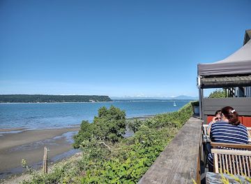
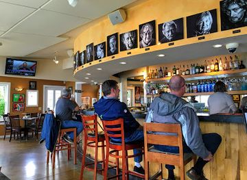
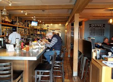
Whidbey Island is not a nightclub destination, and evenings are generally quiet once visitors leave the main towns. Traditional pubs, taverns, wine bars and restaurant bars in places such as Oak Harbor, Coupeville, Langley and Freeland provide the principal opportunities for an evening drink, conversation or occasional local entertainment. Langley's arts-oriented community can bring cultural events and performances, while seasonal festivals and community gatherings may add life to town centres, though programmes vary. Around Clinton and the southern ferry gateway, evening choices are limited and often linked to accommodation or dining. In rural parts of the island, the after-dark experience is more likely to be a dark shoreline, a farm stay or a quiet inn than organised nightlife; visitors should check current local listings rather than expect late-opening venues.
-
Pizza
Village Pizzeria
Discover the authentic taste of gourmet pizza at Village Pizzeria in Langley, a delightful spot for food lovers in Washington.
-
Seafood
Saltwater Fish House & Oyster Bar
Experience the best of Pacific Northwest seafood at Saltwater Fish House & Oyster Bar in Langley, WA, where fresh flavors meet stunning waterfront views.
-
Island
Whidbey Island
Experience the breathtaking beauty and vibrant culture of Whidbey Island, a Pacific Northwest gem with stunning landscapes and outdoor adventures.
-
Sports bar
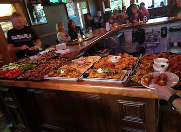
The Lodge Sports Grille
Experience the ultimate sports bar atmosphere at The Lodge Sports Grille, featuring delicious food, refreshing drinks, and all your favorite games.
Best nightclubs in Whidbey Island
Whidbey Island is not a nightclub destination, and evenings are generally quiet once visitors leave the main towns. Traditional pubs, taverns, wine bars and restaurant bars in places such as Oak Harbor, Coupeville, Langley and Freeland provide the principal opportunities for an evening drink, conversation or occasional local entertainment. Langley's arts-oriented community can bring cultural events and performances, while seasonal festivals and community gatherings may add life to town centres, though programmes vary. Around Clinton and the southern ferry gateway, evening choices are limited and often linked to accommodation or dining. In rural parts of the island, the after-dark experience is more likely to be a dark shoreline, a farm stay or a quiet inn than organised nightlife; visitors should check current local listings rather than expect late-opening venues.
-
Club
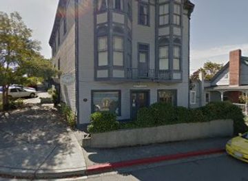
Coupeville Lions Club
Discover the vibrant community spirit at the Coupeville Lions Club, where local culture, fun events, and unforgettable experiences await in the heart of Coupeville.
Best shops in Whidbey Island
Shopping on Whidbey Island is concentrated in its towns rather than in a single commercial district. Langley is known for independent galleries, bookshops, studios and small specialist retailers, while Coupeville offers heritage-town shops and places to browse regional food, art and craft goods. Oak Harbor has the broadest range of practical retail and services, and Freeland and Clinton provide smaller selections useful for visitors staying nearby. Farm stands, seasonal markets and local producers offer fruit, vegetables, preserves, baked goods, wine, cider and other island products when operating. Galleries and craft businesses reflect the island's coastal scenery and creative community, although opening patterns can be seasonal. Remote parks and beaches have little retail provision, so visitors should obtain groceries, walking supplies and picnic food in a town before heading into rural areas.
-
Gift shop
THE STAR STORE
Explore The Star Store in Langley, WA, for unique gifts, local delicacies, children's clothing, and charming finds for all ages.
-
Cafe
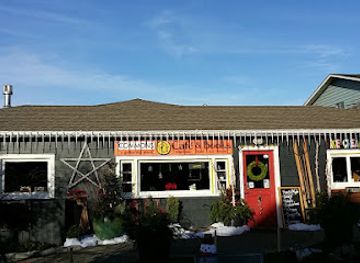
The Commons Cafe & Books
Discover the perfect blend of coffee and books at The Commons Cafe & Books in Langley, where every sip and page turn is a delightful escape.
-
Craft store
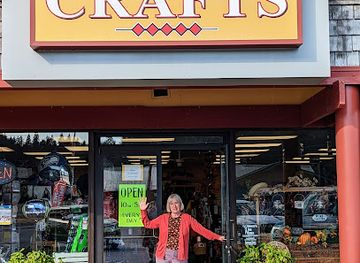
Casey's Crafts
Discover endless creative possibilities at Casey's Crafts, your go-to craft store in Langley, WA, with supplies for all your artistic needs.
-
Rug store
Music for the Eyes
Explore a unique collection of handcrafted rugs at Music for the Eyes in Langley, Washington, where art and style meet in an inviting atmosphere.

Get your free copy of our complete guide to Whidbey Island, delivered straight to you.
Everything on this page, from attractions and restaurants to essentials and local phrases, in one PDF you can read offline, print or share.
Already have an account? Sign in
Your Whidbey Island guide is ready.
We'll send it to · Not you? Sign out

Getting your guide ready…
We are putting together a fresh copy of the Whidbey Island guide. This can take up to a minute.
This can take a few moments. If your browser asks, choose Allow so the download can start. You'll find the guide in your Downloads folder.
Nothing happened? Download it again
Sorry, the guide is taking longer than usual. Please try again in a minute, or get it by email instead.
Whidbey Island essentials
Currency and Payment
Safety
Emergency Situations
Do's and Don'ts
Local Tips
From Eve
Local phrases worth knowing
You don't need to get them perfect. A few words go a long way, and locals appreciate the effort.
Basics
| English | Local | Say it |
|---|---|---|
| Hello | Hi | [haɪ] |
| Goodbye | Bye | [baɪ] |
| Yes | Yeah | [jɛ] |
| No | Nah | [nɑ] |
| Please/You're welcome | Please/Welcome | [pliz/ˈwɛlkəm] |
| Thank you | Thanks | [θæŋks] |
| Excuse me/Sorry | Excuse me/Sorry | [ɪkˈskjuz mi/ˈsɔri] |
| How are you? | How are you? | [haʊ ɑr ju] |
| Fine. And you? | Good. And you? | [ɡʊd ænd ju] |
| Do you speak English? | Do you speak English? | [du ju spik ˈɪŋɡlɪʃ] |
| I don't understand | I don't get it | [aɪ doʊnt ɡɛt ɪt] |
Eating & Drinking
| English | Local | Say it |
|---|---|---|
| I'd like to see the menu, please | Can I see the menu, please | [kæn aɪ si ðə ˈmɛnju pliz] |
| I don't eat meat | I don't eat meat | [aɪ doʊnt it mit] |
| Cheers! | Cheers! | [ʧɪrz] |
| I would like to pay, please | I want to pay, please | [aɪ wʊd laɪk tə peɪ pliz] |
Emergencies
| English | Local | Say it |
|---|---|---|
| Help! | Help! | [hɛlp] |
| Go away! | Go away! | [ɡoʊ əˈweɪ] |
| Call the Police! | Call the Cops! | [kɔl ðə kɒps] |
| Call a doctor! | Call a doc! | [kɔl ə ˈdɑk] |
| I'm lost | I'm lost | [aɪm lɒst] |
| I'm ill | I'm sick | [aɪm sɪk] |
Shopping
| English | Local | Say it |
|---|---|---|
| I'd like to buy... | I want to buy... | [aɪ wɑnt tə baɪ] |
| I'm just looking | I'm just looking | [aɪm ʤʌst ˈlʊkɪŋ] |
| How much is it? | How much does it cost? | [haʊ mʌʧ dəz ɪt kɒst] |
| That's too expensive | That's too pricey | [ðæts tuː ˈpraɪsi] |
| Can you lower the price? | Can you drop the price? | [kæn ju drɒp ðə praɪs] |
Time & Numbers
| English | Local | Say it |
|---|---|---|
| What time is it? | What time is it? | [wʌt taɪm ɪz ɪt] |
| It's one o'clock | It's one | [ɪts wʌn] |
| Half past (10) | Half after (10) | [hæf ˈæftər (10)] |
| Morning | Morning | [ˈmɔrnɪŋ] |
| Afternoon | Afternoon | [ˌæftərˈnun] |
| Evening | Evening | [ˈivnɪŋ] |
| Yesterday | Yesterday | [ˈjɛstərˌdeɪ] |
| Today | Today | [təˈdeɪ] |
| Tomorrow | Tomorrow | [təˈmɔroʊ] |
| 1 | One | [wʌn] |
| 2 | Two | [tu] |
| 3 | Three | [θri] |
| 4 | Four | [fɔr] |
| 5 | Five | [faɪv] |
| 6 | Six | [sɪks] |
| 7 | Seven | [ˈsɛvən] |
| 8 | Eight | [eɪt] |
| 9 | Nine | [naɪn] |
| 10 | Ten | [tɛn] |
Transport & Directions
| English | Local | Say it |
|---|---|---|
| Where's a/the...? | Where is the...? | [wɛr ɪz ðə] |
| What's the address? | What's the address? | [wʌts ðə ˈædrəs] |
| Can you show me (on the map)? | Can you show me (on the map)? | [kæn ju ʃoʊ mi (ɒn ðə mæp)] |
| When's the next (bus)? | When is the next (bus)? | [wɛn ɪz ðə nɛkst (bʌs)] |
| A ticket (to ....) | A ticket (to ....) | [eɪ ˈtɪkɪt (tə ....)] |
History of Whidbey Island
Coast Salish Homelands
Whidbey Island lies within the traditional homelands of Coast Salish peoples, including communities associated with the Lower Skagit, Swinomish and other neighbouring peoples. The island's shorelines, prairies, forests and marine waters supported travel, fishing, shellfish gathering, hunting and plant use long before European exploration. Penn Cove and other waterways were part of a wider network of canoe routes and cultural connections across the Salish Sea. Contemporary place names, tribal communities and cultural work continue to reflect this enduring Indigenous presence, which should be understood as living history rather than solely as a pre-colonial chapter.
European Exploration and Naming
Spanish and British maritime expeditions charted parts of the Pacific Northwest coast in the eighteenth century, but the island's modern English name derives from the survey voyage of George Vancouver in 1792. Vancouver named Whidbey Island after Joseph Whidbey, one of the officers who helped investigate the intricate waterways around Puget Sound. These surveys introduced European names to a landscape that already had established Indigenous geographies and systems of movement. The island's position between Admiralty Inlet, Saratoga Passage and Deception Pass made it important to later marine travel and regional mapping.
Settlement and Coupeville
American settlement expanded in the nineteenth century, bringing farming, timber cutting, maritime trade and new transportation links. Coupeville, established on Penn Cove, became an important local centre, and its waterfront retains buildings and streets associated with the island's nineteenth-century development. The fertile central prairie and sheltered coastal waters supported agriculture and shellfish production, while small communities formed along roads and landing places. Ebey's Landing National Historical Reserve, created in 1978, preserves this continuing cultural landscape rather than isolating a single monument from the working farms, town and shore that surround it.
Coastal Defence and Admiralty Head
Whidbey Island's position beside the entrance to Puget Sound led to its inclusion in the late nineteenth- and early twentieth-century coastal-defence system known as the Triangle of Fire, together with Fort Worden and Fort Flagler on the Olympic Peninsula. Fort Casey, near Admiralty Head, was built as an artillery post, while Admiralty Head Lighthouse guided shipping through the adjacent waters. Fort Ebey, farther north on the west coast, was developed during the Second World War as part of changing coastal defence arrangements. Their surviving batteries, structures and landscapes connect the island to the military history of Puget Sound.
Naval Aviation and Modern Island Life
Oak Harbor grew substantially after the establishment of Naval Air Station Whidbey Island in 1942, which brought a major military presence to the northern part of the island. The base remains an important influence on the local economy and community, while agriculture, tourism, maritime activity and small-scale enterprise continue elsewhere. Twentieth-century road improvements and ferry services made Whidbey more accessible, but its dispersed settlements and rural landscapes have remained distinctive. Modern conservation efforts, including the historical reserve and state parks, seek to balance public enjoyment, ecological protection, farming and the island's continuing communities.
Whidbey Island in Photos
Browse through our photo collection highlighting the charm and character of the destination.
Cities in Whidbey Island
The towns and cities of Whidbey Island, and the easiest places to base yourself.
-
-


Swipe for more cities
Neighbouring destination travel guides
The closest destinations to Whidbey Island, if you have time for more than one.
-

-

-

-

-


Swipe for more destinations
Explore more
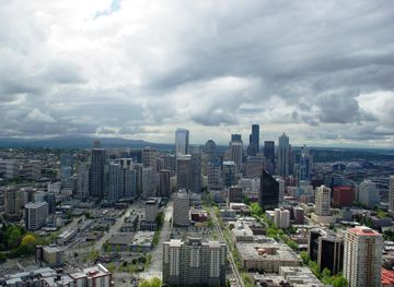
Explore more of Puget Sound
Explore Puget Sound for ferry journeys, Coast Salish heritage, island landscapes, Pacific Northwest food and distinctive waterfront cities.
Explore Puget Sound
Explore more of Washington
Explore Washington State: From the vibrant streets of Seattle to the tranquil beauty of the Olympic Peninsula, discover the diverse landscapes, culture, and adventures awaiting you.
Explore Washington