

Free Big Sur Travel Guide & Mobile App
Plan your Big Sur trip with Evendo. Get free guides to top attractions, restaurants, hotels, and bars. Web access or download the mobile app.


Big Sur, California combines dramatic Pacific cliffs, redwood forests, scenic Highway 1 drives, historic trails and quiet coastal escapes.
Coast, Forest and Open Road
Big Sur is not an incorporated city but a sparsely settled coastal region stretching along California’s Central Coast, where the Santa Lucia Mountains meet the Pacific Ocean. Its name is commonly linked to the Spanish el sur, meaning “the south”, a reference to the area south of Monterey. Highway 1 threads through the landscape, passing high bluffs, eucalyptus groves, plunging ravines and beaches often reached by short trails rather than conventional streets. The journey is as important as the destinations: viewpoints reveal a restless ocean on one side and steep, forested mountains on the other.Read more about Big Sur
Redwoods and Coastal Parks
A Landscape of Writers and Artists
When is the best time to visit Big Sur?
Best: July–September · 19°C| Month | High (°C) | Rainfall (mm) |
|---|---|---|
| January | 14 | 150 |
| February | 15 | 130 |
| March | 16 | 110 |
| April | 16 | 70 |
| May | 17 | 40 |
| June | 18 | 20 |
| July (best) | 19 | 10 |
| August (best) | 19 | 10 |
| September (best) | 19 | 20 |
| October | 18 | 40 |
| November | 16 | 90 |
| December | 15 | 130 |
Getting to and around Big Sur
How to get there
Transportation
Best attractions in Big Sur
Big Sur’s principal attractions are landscapes made accessible by short walks, viewpoints and winding drives. Bixby Creek Bridge, north of the main Big Sur settlement, frames one of the coast’s most recognisable combinations of concrete engineering, cliffs and open ocean. In Julia Pfeiffer Burns State Park, the viewpoint for McWay Falls overlooks a slender waterfall dropping onto a cove, while the park’s trails reveal redwoods and rugged coastal vegetation. Pfeiffer Big Sur State Park offers shaded walks through the Big Sur River valley, and Andrew Molera State Park combines meadows, woodland and a broad coastal setting. Garrapata State Park is valued for open bluffs, beaches and spring vegetation, although access and parking can vary. The Point Sur Lighthouse, a historic light station on a volcanic rock overlooking the Pacific, provides a different kind of visit through authorised access. Throughout the region, scenic pull-ins and carefully chosen trails are attractions in their own right.
-
State park
Julia Pfeiffer Burns State Park
Explore the breathtaking landscapes of Julia Pfeiffer Burns State Park, featuring iconic waterfalls, towering redwoods, and stunning coastal views.
38 min drive · 18 km from city centre
-
State park
Garrapata State Park
Discover Garrapata State Park: Big Sur's hidden gem with dramatic coastlines, redwood canyons, and unforgettable hiking trails.
42 min drive · 22 km from city centre
-
Bridge
Rocky Creek Bridge
Experience the beauty of Big Sur at Rocky Creek Bridge, a historic landmark offering stunning coastal views and a glimpse of California's natural wonders.
33 min drive · 13 km from city centre
-
Bridge
Rocky Creek Bridge
Explore the stunning Rocky Creek Bridge, a breathtaking architectural marvel on California's scenic Highway One, surrounded by natural beauty and coastal views.
33 min drive · 13 km from city centre


Best landmarks in Big Sur
Big Sur’s landmarks express the meeting of engineering, settlement, conservation and dramatic geology. Bixby Creek Bridge, completed as part of the original coastal highway, is a celebrated example of the infrastructure that opened this previously difficult coastline to road travel. The Point Sur Lighthouse stands on a striking offshore-looking volcanic rock and marks a hazardous stretch of Pacific navigation; its associated light-station buildings reflect the working history of the coast. McWay Falls is a natural landmark rather than a built monument, recognised for its rare beachside cascade within Julia Pfeiffer Burns State Park. The Henry Miller Memorial Library preserves the memory of the writer’s Big Sur years and the area’s literary culture. Pfeiffer Big Sur State Park, meanwhile, represents the preservation of the river valley and redwood landscape that has become central to the region’s public identity.
-
State park
Julia Pfeiffer Burns State Park
Explore the stunning coastal beauty of Julia Pfeiffer Burns State Park, where majestic waterfalls and breathtaking views create unforgettable memories.
38 min drive · 18 km from city centre
-
State park
Garrapata State Park
Explore the stunning landscapes and diverse wildlife of Garrapata State Park, a must-visit destination along California's breathtaking Big Sur coastline.
42 min drive · 22 km from city centre
-
Bridge
Rocky Creek Bridge
Experience the breathtaking beauty and iconic architecture of Rocky Creek Bridge on California's stunning Pacific Coast Highway.
33 min drive · 13 km from city centre
-
Public beach
Pfeiffer Beach
Discover the enchanting beauty of Pfeiffer Beach, where stunning rock formations meet unique purple sand along the breathtaking Big Sur coastline.
16 min drive · 5.4 km from city centre


Explore Big Sur on the map
Plan your Big Sur trip on one map. See where the top attractions, landmarks, restaurants, bars and hotels are, find what's near where you're staying, and book hotels and experiences in a few clicks.
Best hotels in Big Sur
Best restaurants in Big Sur
Big Sur’s dining scene is small, spread out and closely tied to the landscape rather than organised around a conventional town centre. Restaurants and cafés serve travellers along Highway 1, with menus often combining Californian produce, seafood, salads, baked goods and regional wines. Nepenthe is known for its dramatic elevated setting above the Pacific, while Big Sur Bakery has long been associated with wood-fired cooking and baked treats; current opening arrangements should be checked before travelling. The Big Sur River Inn and other established lodgings may provide food and drink alongside accommodation. Picnic supplies are useful because distances between services are considerable, and options can be affected by weather, road closures or seasonal changes. There is no large food market district, so the region’s culinary character is found in independent restaurants, roadside cafés and provisions enjoyed outdoors among redwoods or coastal viewpoints.
-
American
Nepenthe
Experience breathtaking views and exquisite American cuisine at Nepenthe in Big Sur - a true culinary gem overlooking the Pacific Ocean.
25 min drive · 8.4 km from city centre
-
Restaurant
Big Sur River Inn
Discover tranquility at Big Sur River Inn - where rustic charm meets breathtaking nature along California's iconic coast.
5 min drive · 1.6 km from city centre
-
American
Big Sur Bakery
Discover delicious American cuisine at Big Sur Bakery—your perfect pitstop along California's scenic coast.
20 min drive · 6.6 km from city centre
-
Seafood
Rocky Point Restaurant
Cliffside seafood haven with endless ocean vistas on Big Sur's Highway 1, blending coastal cuisine and dramatic Pacific panoramas in Monterey's wild embrace.
36 min drive · 16 km from city centre


Best bars in Big Sur
Big Sur has no conventional club district and a limited nightlife scene, with evenings generally centred on food, conversation, live performance and the landscape after dark. Nepenthe and other established hospitality venues may offer a drink with coastal views, while restaurants and inns provide the principal social settings. The Henry Miller Memorial Library has hosted literary, musical and artistic events, although its programme and access vary. Occasional performances and cultural gatherings at local venues add interest without creating a busy late-night circuit. Darkness arrives quickly beyond the small settlements, roads are winding and wildlife may cross the highway, so driving after drinking is particularly unsafe. Visitors seeking extensive bars, theatres or nightclubs are better served by Monterey, Carmel or larger towns beyond Big Sur.
-
American
Nepenthe
Experience exquisite American dining at Nepenthe, where stunning ocean views and delicious cuisine create unforgettable moments in Big Sur.
25 min drive · 8.4 km from city centre
-
Restaurant
Big Sur River Inn
Experience the rustic charm and natural beauty of Big Sur at Big Sur River Inn, a perfect retreat for food lovers and nature enthusiasts alike.
5 min drive · 1.6 km from city centre
-
American
Restaurant at Big Sur River Inn
Experience delicious American cuisine in a beautiful setting at the Restaurant at Big Sur River Inn, where culinary delight meets nature's charm.
5 min drive · 1.7 km from city centre
-
Restaurant
COAST Big Sur
Experience the best of California's coastline dining at COAST Big Sur, where exquisite cuisine meets breathtaking ocean views.
32 min drive · 12 km from city centre


Best nightclubs in Big Sur
Big Sur has no conventional club district and a limited nightlife scene, with evenings generally centred on food, conversation, live performance and the landscape after dark. Nepenthe and other established hospitality venues may offer a drink with coastal views, while restaurants and inns provide the principal social settings. The Henry Miller Memorial Library has hosted literary, musical and artistic events, although its programme and access vary. Occasional performances and cultural gatherings at local venues add interest without creating a busy late-night circuit. Darkness arrives quickly beyond the small settlements, roads are winding and wildlife may cross the highway, so driving after drinking is particularly unsafe. Visitors seeking extensive bars, theatres or nightclubs are better served by Monterey, Carmel or larger towns beyond Big Sur.
-
Pub
Big Sur Taphouse
Experience the charm of Big Sur at Big Sur Taphouse, where delicious food meets breathtaking ocean views in a cozy pub atmosphere.
19 min drive · 6.5 km from city centre
-
Bar
Big Sur Roadhouse
Savor the best of Californian cuisine at Big Sur Roadhouse, a delightful restaurant nestled in the stunning landscapes of Big Sur.
8 min drive · 2.5 km from city centre
-
Grill
Fernwood Tavern
Experience the flavors of Big Sur at Fernwood Tavern, where delicious grill fare meets stunning natural beauty in a cozy, inviting setting.
9 min drive · 3.1 km from city centre
-
Lounge
Sunset Lounge
Experience the elegance of Sunset Lounge in Carmel-By-The-Sea, where stunning views meet exquisite dining and vibrant ambiance.
47 min drive · 27 km from city centre


Best shops in Big Sur
Shopping in Big Sur is modest and locally oriented, with opportunities concentrated in small galleries, gift shops, bookshops and businesses attached to inns or cafés along Highway 1. The Henry Miller Memorial Library is associated with books, literary material and cultural events, while local galleries may present paintings, photography, ceramics and crafts inspired by the coast and redwood forests. Visitors may also find Big Sur-themed books, postcards, artwork, clothing and regional food products rather than the department stores or brand districts of larger California cities. There is no single central market, and retail hours and stock can change with the season or road access. Purchases that reflect the region’s artistic culture, such as locally made pottery, prints or writing connected with Big Sur, are generally more characteristic than generic souvenirs.
-
Restaurant
COAST Big Sur
Experience the best of Big Sur at COAST, where culinary delights meet artistic expression in a stunning coastal setting.
32 min drive · 12 km from city centre
-
Gift shop
Big Sur Deli
Discover the flavors of Big Sur at Big Sur Deli, where delicious deli bites meet the captivating beauty of California's coastline.
19 min drive · 6.5 km from city centre
-
Gift shop
Phoenix Shop
Explore the enchanting Phoenix Shop in Big Sur - your destination for unique gifts, local art, and memorable souvenirs.
25 min drive · 8.4 km from city centre
-
Grocery store
Big Sur River Inn General Store
Discover the essence of Big Sur at the Big Sur River Inn General Store, your one-stop shop for essentials and local treasures amidst stunning natural beauty.
5 min drive · 1.7 km from city centre


Get your free copy of our complete guide to Big Sur, delivered straight to you.
Everything on this page, from attractions and restaurants to essentials and local phrases, in one PDF you can read offline, print or share.
Already have an account? Sign in
Your Big Sur guide is ready.
We'll send it to · Not you? Sign out

Getting your guide ready…
We are putting together a fresh copy of the Big Sur guide. This can take up to a minute.
This can take a few moments. If your browser asks, choose Allow so the download can start. You'll find the guide in your Downloads folder.
Nothing happened? Download it again
Sorry, the guide is taking longer than usual. Please try again in a minute, or get it by email instead.
Big Sur essentials
Currency and Payment
Safety
Emergency Situations
Do's and Don'ts
Local Tips
From Eve
Local phrases worth knowing
You don't need to get them perfect. A few words go a long way, and locals appreciate the effort.
Basics
| English | Local | Say it |
|---|---|---|
| Hello | Howdy | [haw-dee] |
| Goodbye | So long | [so long] |
| Yes | Yup | [yup] |
| No | Nope | [nope] |
| Please/You're welcome | Sure thing | [shore thing] |
| Thank you | Thanks a bunch | [thanks uh bun-ch] |
| Excuse me/Sorry | Pardon me | [par-dun me] |
| How are you? | Howdy, how ya doin'? | [haw-dee, how ya doin'] |
| Fine. And you? | Just peachy. How 'bout you? | [just pee-chee. how 'bout you?] |
| Do you speak English? | Can ya talk English? | [can ya talk English?] |
| I don't understand | I'm lost | [I'm lost] |
Eating & Drinking
| English | Local | Say it |
|---|---|---|
| I'd like to see the menu, please | Can I check out the grub, please? | [can I check out the grub, please?] |
| I don't eat meat | I don't do meat | [I don't do meat] |
| Cheers! | Bottoms up! | [bottoms up!] |
| I would like to pay, please | Can I settle the tab, please? | [can I settle the tab, please?] |
Emergencies
| English | Local | Say it |
|---|---|---|
| Help! | SOS! | [S-O-S!] |
| Go away! | Beat it! | [beat it!] |
| Call the Police! | Ring the cops! | [ring the cops!] |
| Call a doctor! | Get me a doc! | [get me uh doc!] |
| I'm lost | I'm turned around | [I'm turned around] |
| I'm ill | I'm under the weather | [I'm under the weather] |
Shopping
| English | Local | Say it |
|---|---|---|
| I'd like to buy... | I'm lookin' to purchase... | [I'm lookin' to purchase...] |
| I'm just looking | Just browsin' | [just brow-zin'] |
| How much is it? | What's the damage? | [what's the dam-ij] |
| That's too expensive | That's a bit steep | [that's uh bit steep] |
| Can you lower the price? | Can ya cut me a deal? | [can ya cut me uh deal?] |
Time & Numbers
| English | Local | Say it |
|---|---|---|
| What time is it? | What's the hour? | [what's the our?] |
| It's one o'clock | It's one | [it's one] |
| Half past (10) | Ten thirty | [ten thur-tee] |
| Morning | Mornin' | [morn-in'] |
| Afternoon | Afternoon | [after-noon] |
| Evening | Evenin' | [even-in'] |
| Yesterday | Yest'day | [yest-day] |
| Today | Today | [to-day] |
| Tomorrow | Tomorra | [tom-or-ra] |
| 1 | One | [wun] |
| 2 | Two | [too] |
| 3 | Three | [three] |
| 4 | Four | [four] |
| 5 | Five | [five] |
| 6 | Six | [six] |
| 7 | Seven | [seven] |
| 8 | Eight | [ate] |
| 9 | Nine | [nine] |
| 10 | Ten | [ten] |
Transport & Directions
| English | Local | Say it |
|---|---|---|
| Where's a/the...? | Where's the... | [where's the...] |
| What's the address? | What's the addy? | [what's the addy?] |
| Can you show me (on the map)? | Can ya point it out (on the map)? | [can ya point it out (on the map)?] |
| When's the next (bus)? | When's the next ride? | [when's the next ride?] |
| A ticket (to ....) | A pass (to ....) | [uh pass (to ....)] |
History of Big Sur
Esselen Homelands
The Big Sur coast lies within the ancestral homeland of the Esselen people, whose communities used the forests, rivers, grasslands and shore of the Santa Lucia Mountains for thousands of years. Neighbouring Ohlone-speaking peoples also maintained connections with parts of the wider Central Coast. Indigenous life was profoundly disrupted during the Spanish colonial period, when missions, disease and forced labour altered established communities. Their history remains central to understanding Big Sur as a cultural landscape rather than an untouched wilderness.
Spanish and Mexican Land Grants
Spanish exploration along the California coast began in the eighteenth century, but Big Sur’s steep terrain and limited natural harbours discouraged dense colonial settlement. Under Mexican rule, much of the region formed part of large land grants, including Rancho San Jose y Sur Chiquito. Ranching and small-scale agriculture later developed in the valleys, while the coast remained difficult to reach from Monterey and communities farther south. The absence of an easily navigable coastal route helped preserve Big Sur’s relative isolation.
Pioneers and Homesteads
During the nineteenth century, families established homesteads in the Big Sur River valley and other comparatively accessible pockets of land. The Pfeiffer family became especially associated with the region, and their former property eventually contributed to the creation of Pfeiffer Big Sur State Park. Travel was generally by rough trails, horseback or boat, and supplies were limited. These conditions shaped a self-reliant rural culture that survived into the early twentieth century, alongside cattle grazing, logging and small farms.
Highway 1 Reaches Big Sur
The modern period began with construction of the coastal road that became Highway 1. Work started during the 1920s and, after major engineering challenges involving bridges, tunnels and unstable slopes, the route opened through Big Sur in 1937. The road connected isolated settlements with Monterey and the wider state, bringing visitors, goods and new economic opportunities. It also exposed the coastline to automobile tourism, creating the scenic travel culture that still defines many people’s first encounter with Big Sur.
Writers, Artists and Counterculture
Big Sur became associated with artists and writers during the mid-twentieth century. Henry Miller lived in the region from 1944, and his work helped give the landscape an international literary profile. The area also attracted painters, musicians and members of the wider counterculture, while the Esalen Institute, founded in 1962 at Big Sur Hot Springs, became known for human-potential workshops and alternative education. These communities added a creative and philosophical dimension to the region’s established traditions of ranching and conservation.
Conservation and a Changing Coast
State parks, protected public land and private conservation efforts have played a major role in maintaining Big Sur’s forests, marine views and undeveloped character. Parks such as Pfeiffer Big Sur, Julia Pfeiffer Burns, Andrew Molera and Garrapata preserve different parts of the landscape, from redwood valleys to open coastal terraces. At the same time, wildfire, erosion, landslides and increasingly severe storms repeatedly affect roads and habitats. Big Sur’s present identity is therefore shaped by both conservation and the continuing difficulty of living beside a powerful, unstable coast.
Big Sur in Photos
Browse through our photo collection highlighting the charm and character of the destination.
Cities near Big Sur
The closest cities to Big Sur, if you have time for more than one stop.
-

-

-

-
-


Swipe for more cities
Explore more
Explore more of California
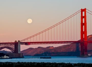
Discover California: A land of diverse landscapes, iconic cities, and endless adventures, from sun-soaked beaches to towering redwoods and vibrant cultural experiences.
Explore California