Background

Skjoldnæs Lighthouse

Granite tower on Ærø’s far northwestern tip, Skjoldnæs Lighthouse blends big‑sky sea views, Ice Age geology and quiet legend into one wild, windwashed headland.

4.5

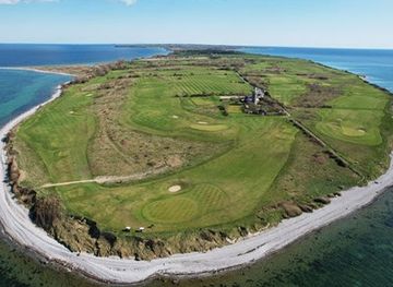
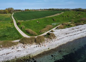
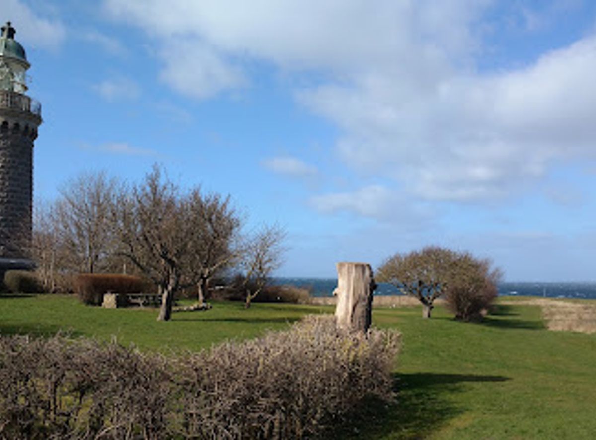
Standing sentinel at the northwestern tip of Ærø, Skjoldnæs Lighthouse is a handsome granite tower surrounded by sea on three sides and framed by a seaside golf course. Built in 1881 from finely cut Bornholm granite, the 22 m lighthouse offers sweeping views over the South Funen Archipelago and, on clear days, all the way to Germany and surrounding islands. Open around the clock for a modest fee, it is as much a place for quiet coastal walks and geology-rich shorelines as for sunset photos and stargazing from the lantern gallery.

A brief summary to Skjoldnaes Lighthouse

  • Skjolnæs Fyr, Skjoldnæsvej, Søby, 5985, DK
  • Duration: 1 to 3 hours
  • Free
  • Environment icon Outdoor
  • Mobile reception: 4 out of 5

Local tips

  • Bring a windproof layer; even on warm days the exposed headland and gallery can feel much cooler than inland Ærø.
  • Carry coins or a payment card for the modest entrance fee to climb the tower, and check the local tourist site for current prices.
  • Plan extra time to explore the beach, the angular foreland known as Næbbet and the small hollow of Dronningens Hule nearby.
  • For photographs, aim for late afternoon or sunset when the granite glows warmly and the low light sculpts the surrounding coastline.
  • Watch your footing on the internal stairs and the exterior gallery, which can be narrow and occasionally slippery in wet or icy weather.
widget icon

Getting There

  • Local bus from Ærøskøbing or Søby

    From Ærøskøbing or Søby you can use the island bus network towards the northern part of Ærø, with journey times typically 15–35 minutes depending on route and season. Services are limited in the evening and on weekends, and may require a short walk at the end across level rural roads. Fares are usually low, often under 40–50 DKK per adult for a single trip.

  • Car or rental car on Ærø

    Drivers coming from Ærøskøbing or Marstal can follow the main island roads north to the Skjoldnæs peninsula in around 25–40 minutes. The roads are paved and straightforward, though narrow in places, and there is simple parking close to the lighthouse and golf course. Expect to pay normal island fuel and ferry costs, but no separate parking fee at the site in typical conditions.

  • Bicycle across the island

    Skjoldnæs is popular with cyclists exploring Ærø. From Ærøskøbing it usually takes 45–70 minutes by bike, depending on fitness and wind, on lightly trafficked country roads with gentle hills. There is no charge to bring your own bike, though rental from local shops typically costs about 100–200 DKK per day. Surfaces are mostly paved, but expect some exposure to wind on the peninsula.

Skjoldnaes Lighthouse location weather suitability

  • Weather icon Clear Skies
  • Weather icon Mild Temperatures
  • Weather icon Windy Conditions
  • Weather icon Hot Weather
  • Weather icon Cold Weather
  • Weather icon Any Weather

Unlock the Best of Skjoldnaes Lighthouse

Buy tickets

    No tickets available

Book tours with entry

    No tours available

Book tours without entry

    No tours available

Discover more about Skjoldnaes Lighthouse

An island sentinel on Ærø’s wild northwest tip

Skjoldnæs Lighthouse crowns the narrow peninsula that forms the northwestern tip of Ærø, surrounded by water on three sides and buffeted by Baltic winds. Here the landscape feels wonderfully exposed: low fields, a fringe of rough coastal grass and the steady pulse of waves against the shore. The tower itself rises cleanly from this setting, a reference point for sailors and a natural full stop to the island’s long ridge. From the base of the lighthouse, the sea seems close in every direction. To the east lie views toward the South Funen Archipelago, while to the west the horizon dissolves into open water. The sense of being at the very edge of Ærø is strong, making this one of the island’s most atmospheric places to simply stand, look and breathe in the salt air.

Granite craftsmanship and a working coastal light

The lighthouse was completed in 1881, built by Swedish stonemasons who shaped fine Bornholm granite into a round tower with a subtle taper and precise joints. The structure stands about 22 m high, with its lantern set roughly 32 m above sea level, giving the light a far-reaching range over nearby shipping routes. Its flash pattern, a single pulse roughly every half minute, remains a familiar signal in local waters. Up close, you can trace the careful stonework in the stairwell and exterior courses, and feel the cool, slightly rough texture of the granite blocks. Iron details, small windows set deep into thick walls and the compact lantern room all speak of practical 19th‑century engineering, built to withstand decades of storms without drama or ornament.

Climbing to one of Denmark’s wide island views

Inside, a narrow, spiralling stair leads you towards the lantern. With each step the slit windows frame a little more sea and sky until you emerge onto the gallery that encircles the light. In clear weather, the panorama stretches over the Baltic Sea, the Little Belt waters and the islands of Als, Lyø, Bjørnø and Avernakø, with the low shapes of the “Funen Alps” in the distance. From this height, the 4.5 km Skjoldnæs peninsula reveals its shape: a tongue of land 600–800 m wide, patched with fields and edged by pale beaches, salt marsh and stony foreshore. To one side you look down over the greens and fairways of Ærø Golf Club, laid out as a classic seaside links, to the other you watch freighters and ferries sliding across the archipelago.

Dead‑ice hills, angular forelands and a restless coast

Beyond its maritime role, Skjoldnæs is also a textbook of Ice Age geology. The peninsula sits along an old ice‑margin line from the retreat of the so‑called Lillebælt glacier some 17,500 years ago. As the ice pulled back, blocks of dead ice were left behind and slowly melted, creating the knobbly dead‑ice topography visible in the low hills and depressions inland. Down on the coast, eroding cliffs reveal older layers of soft freshwater clay and mussel‑rich marine deposits from the last interglacial period. On the northeast shore, opposing currents have built a sharply angled foreland, a triangular fan of salt marsh and shingle that locals know simply as “the Beak”. Drainage ditches and borrow pits hint at former gravel and flint extraction, when stone from this shore helped build distant canals and fed porcelain mills.

Legends, starlight and quiet coastal wandering

Just inland from the beach path is the hollow known as Dronningens Hule, the Queen’s Cavern. A local legend tells of a young queen whose ship foundered offshore in an autumn storm; her body, cast up on the Skjoldnæs shore, was laid to rest in this sheltered dip in the landscape, giving the place its poignant name. Whether you treat it as folklore or history, it adds a gentle note of storytelling to a walk between lighthouse and sea. Today, the former keeper’s house serves as the clubhouse of Ærø Golf Club, and the area around the tower is freely accessible, with a small fee for climbing to the top. After dark, the site becomes an excellent stargazing spot thanks to low light pollution and wide horizons. By day, visitors wander the shore, study information about the geology, watch seabirds over the salt marshes and linger on the benches around the tower, letting the slow rhythm of the island sink in.

Busiest months of the year

Busiest hours of the day

Popular Experiences near Skjoldnaes Lighthouse

Popular Hotels near Skjoldnaes Lighthouse

Select Currency