

Free Marsamxett Harbour Travel Guide & Mobile App
Explore Marsamxett Harbour with free travel guides. Discover regional history, expert tips, proposed trips, and audio guides on web or mobile app.


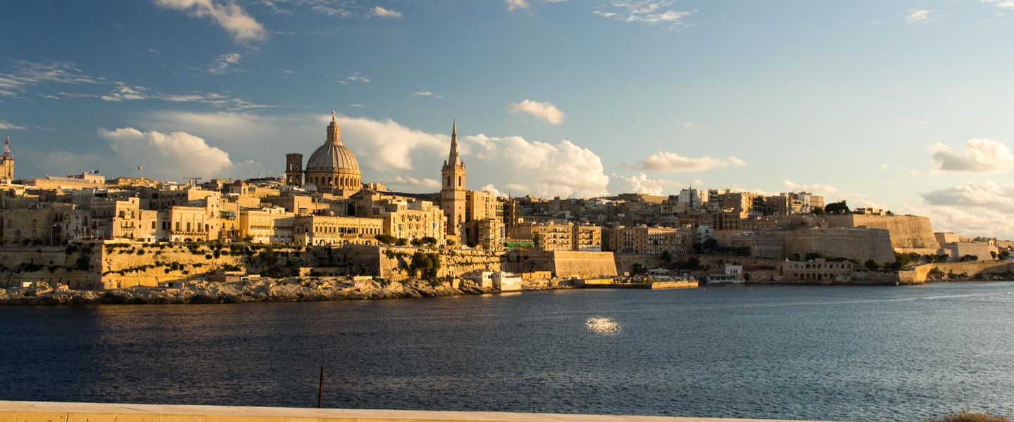


Explore Marsamxett Harbour in Malta for waterfront walks, Valletta views, historic Manoel Island, marinas, swimming and lively urban dining.
Read more about Marsamxett Harbour
When is the best time to visit Marsamxett Harbour?
Best: May–June, October · 23–29°C| Month | High (°C) | Rainfall (mm) |
|---|---|---|
| January | 16 | 80 |
| February | 16 | 70 |
| March | 17 | 60 |
| April | 19 | 40 |
| May (best) | 23 | 20 |
| June (best) | 29 | 10 |
| July | 31 | 5 |
| August | 32 | 10 |
| September | 30 | 40 |
| October (best) | 26 | 60 |
| November | 21 | 70 |
| December | 17 | 80 |
Getting to and around Marsamxett Harbour
How to get there
Transportation
Top city travel guides in Marsamxett Harbour
The cities of Marsamxett Harbour, and the easiest places to base yourself.
-

-

-

-

-

-


Swipe for more cities
Destinations in Marsamxett Harbour
Resorts, valleys and scenic spots worth a trip of their own.

Swipe for more destinations
Best attractions in Marsamxett Harbour
Marsamxett Harbour’s attractions are concentrated around water, views and the layered urban shoreline rather than a single enclosed visitor complex. The Sliema promenade is the main public stage, combining open harbour panoramas, rocky swimming platforms, cafés and long stretches suitable for walking. Gżira leads towards Manoel Island and the entrance to Lazzaretto Creek, where Fort Manoel and the island’s historic military landscape provide the strongest heritage focus, subject to current access arrangements. At the head of the harbour, Msida and Ta’ Xbiex offer marinas, yacht-watching and a less resort-oriented waterfront atmosphere. Harbour ferries and boat trips provide a different perspective on Valletta’s bastions, although Valletta itself lies across the water and is outside Marsamxett Harbour. The area also works well for informal outdoor recreation: swimming from designated rocky platforms, photography, sunset walks and observing maritime traffic. There are no extensive sandy beaches on the harbour shoreline, and visitors seeking open countryside or major archaeological complexes need to travel elsewhere in Malta. The attraction landscape is therefore urban, maritime and historically strategic, with the pleasure of moving between neighbourhoods and viewpoints as important as any individual site.
-
Tourist attraction
City Gate
Explore the stunning City Gate in Valletta, a blend of modern architecture and historical significance that welcomes you to Malta's capital.
-
Tourist attraction
Fort St. Angelo
Discover Fort St. Angelo, a historical fortress in Birgu, Malta, offering stunning views and a deep dive into the island's storied past.
-
Historical landmark
St. George’s Square
Discover the charm of St. George’s Square in Valletta, Malta - a historic landmark perfect for soaking in culture and vibrant city life.
-
Archaeological museum
National Museum of Archaeology
Explore Malta's ancient heritage at the National Museum of Archaeology, a premier destination for history lovers in the heart of Valletta.


Best landmarks in Marsamxett Harbour
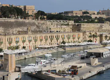
Fort Manoel is Marsamxett Harbour’s defining historic landmark. Built in the eighteenth century on Manoel Island by the Order of St John, its formal bastions, central church and strategic position at the entrance to Lazzaretto Creek demonstrate how carefully the harbour was defended. Access to the interior can vary, but the fort remains an important element of the harbour panorama. Across the water, Valletta’s fortified skyline is a major visual landmark, although the city is outside Marsamxett Harbour and should not be confused with the harbour’s own settlements. The Sliema waterfront is significant as a modern urban landmark in its own right, with a long limestone promenade, rocky bathing platforms and continuous views towards the capital. At the inner end, the marinas of Msida and Ta’ Xbiex express the harbour’s contemporary maritime role, while the creeks and quays preserve the geometry of a protected natural inlet. Together, these places show the transition from an Order of St John defensive harbour to a working and residential waterfront shaped by leisure, transport and sailing.
-
Historical landmark
Mdina Gate
Explore the enchanting Mdina Gate, an ancient entrance to Malta's historic city, rich in culture and architectural beauty.
-
Park
Upper Barrakka
Experience the beauty and tranquility of Upper Barrakka Gardens, a historical park offering stunning views of Valletta's Grand Harbour and rich Maltese heritage.
-
Fountain
Triton Fountain
Discover the Triton Fountain in Floriana, Malta - a stunning modernist masterpiece surrounded by vibrant gardens and rich history.
-
Cathedral
St. John's Co-Cathedral
Explore the magnificent St. John's Co-Cathedral in Valletta, Malta – a breathtaking example of Baroque architecture filled with stunning art and rich history.


Explore Marsamxett Harbour on the map
Plan your trip on one map. See where the top cities, national parks and sights are, and book hotels and experiences in a few clicks.
Best hotels in Marsamxett Harbour
Best restaurants in Marsamxett Harbour
Dining around Marsamxett Harbour reflects Malta’s cosmopolitan urban waterfront. Sliema and Gżira have the broadest choice, ranging from cafés and bakeries to casual restaurants serving Maltese, Mediterranean, Italian, Asian and other international cuisines. Traditional Maltese dishes worth seeking include pastizzi, savoury pastries filled with ricotta or peas; ftira, a ring-shaped bread used in local snacks; imqarrun il-forn, a baked pasta dish; and rabbit, a long-established Maltese speciality. Menus may also feature fresh fish, octopus, shellfish and lampuki when seasonally available, although seafood is not exclusive to Marsamxett. Msida and Ta’ Xbiex provide waterside dining near the marinas, while inland streets often offer better value than the most prominent views. Local wine, Kinnie, a bittersweet Maltese soft drink, and Maltese beer are widely available. Farmers’ markets and specialist food shops elsewhere on the island can supplement the harbour’s restaurant scene, which is more varied and international than strictly traditional.
-
Maltese
Ta' Kris
Experience authentic Maltese cuisine at Ta' Kris in Sliema – where tradition meets flavor in every dish.
-
Italian
Mamma Mia Restaurant
Experience authentic Italian cuisine at Mamma Mia Restaurant on Ta' Xbiex Seafront with stunning views and delightful flavors.
-
Italian
Zero Sei Trattoria Romana
Experience authentic Italian cuisine with a Maltese twist at Zero Sei Trattoria Romana in Valletta.
-
Restaurant
The Brew Grill & Brewery
Savor mouthwatering grilled dishes and refreshing craft beers at The Brew Grill & Brewery in beautiful Sliema.


Best bars in Marsamxett Harbour
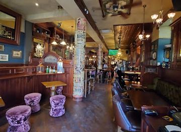
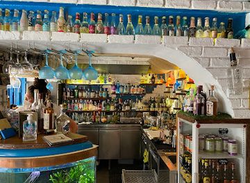
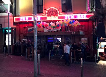
Evenings around Marsamxett Harbour are mainly built around cafés, wine bars, restaurants, hotel lounges and informal waterfront drinking rather than a concentrated nightclub district. Sliema and nearby Gżira have the greatest choice, with social streets where visitors can move between casual bars, late-opening eateries and venues offering harbour views. Msida and Ta’ Xbiex are generally quieter and more associated with marina life, dining and relaxed evenings. Live music and seasonal events may appear in particular venues, but programmes and opening arrangements change, so current listings should be checked locally. Travellers seeking Malta’s most intensive club scene usually continue towards Paceville, outside Marsamxett Harbour, rather than expecting a major nightlife centre along the entire inlet. A sunset walk followed by dinner is often more representative of the harbour’s evening character than a late-night club visit, and residential areas call for consideration regarding noise.
-
Bar
The Pub
Experience the lively atmosphere of The Pub in Valletta, where local charm meets international sports excitement and delicious food.
-
Bar
The Queen Victoria City Pub, Valletta
Discover the vibrant atmosphere of The Queen Victoria City Pub in Valletta, a perfect blend of local charm and lively nightlife.
-
Cocktail bar
Cafe Society
Discover the lively spirit of Valletta at Cafe Society, a premier cocktail bar offering innovative drinks and a vibrant social atmosphere.
-
Tapas Bar
Yard 32 Gin & Tapas Bar
Experience the vibrant flavors of Yard 32 Gin & Tapas Bar in Valletta, where exquisite tapas and an extensive gin selection await you.


Best nightclubs in Marsamxett Harbour
Evenings around Marsamxett Harbour are mainly built around cafés, wine bars, restaurants, hotel lounges and informal waterfront drinking rather than a concentrated nightclub district. Sliema and nearby Gżira have the greatest choice, with social streets where visitors can move between casual bars, late-opening eateries and venues offering harbour views. Msida and Ta’ Xbiex are generally quieter and more associated with marina life, dining and relaxed evenings. Live music and seasonal events may appear in particular venues, but programmes and opening arrangements change, so current listings should be checked locally. Travellers seeking Malta’s most intensive club scene usually continue towards Paceville, outside Marsamxett Harbour, rather than expecting a major nightlife centre along the entire inlet. A sunset walk followed by dinner is often more representative of the harbour’s evening character than a late-night club visit, and residential areas call for consideration regarding noise.
-
Night club
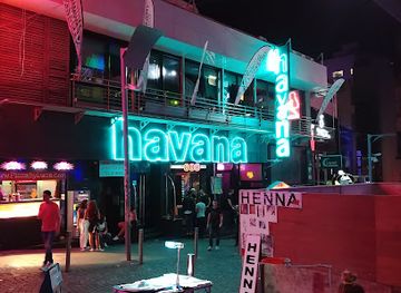
Havana Club Malta
Discover the electrifying nightlife of Havana Club Malta, a top destination for dance enthusiasts and party lovers in St Julian's.
-
Night club
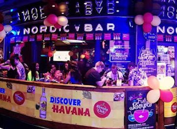
The Nordic Bar
Dive into the heart of Malta's nightlife at The Nordic Bar, a lively night club in St Julian's known for great music, friendly service, and an unforgettable experience.
-
Night club
Footloose
Experience the vibrant nightlife of Malta at Footloose Night Club in St Julian's, where music, dancing, and affordable drinks await you.
-
Night club
TwentyTwo
Discover the vibrant nightlife of St Julian's at TwentyTwo, a premier night club with exquisite cocktails and electrifying dance music.

Best shops in Marsamxett Harbour
Shopping in Marsamxett Harbour is concentrated in Sliema and Gżira, where busy high streets, shopping centres, supermarkets, pharmacies and independent businesses serve both residents and visitors. Sliema offers the widest selection of mainstream fashion, beauty, electronics and cafés, while Gżira has a more mixed local and international retail character. Small shops and specialist outlets can be useful for Maltese food products, wine, confectionery, books, souvenirs and practical beach items. The harbour is not principally a craft-producing district, so visitors seeking traditional lace, filigree jewellery, pottery or specialist artisanal goods may find a broader choice in other Maltese towns and dedicated cultural shops. Local products to consider include honey, sea salt, olive oil, wine, liqueurs and packaged versions of Maltese pastries, provided they are suitable for travel. Markets and temporary stalls change location and schedule, so check current local information before making a special journey. Shopping is best combined with a waterfront walk rather than treated as the area’s sole attraction.
-
Shopping mall
The Point Shopping Mall
Experience shopping, dining, and entertainment at The Point Shopping Mall, the ultimate destination in Sliema, Malta.
-
Gift shop
Souvenirs That Don't Suck - Sliema
Discover unique Maltese gifts at Souvenirs That Don't Suck in Sliema, where every souvenir tells a story and captures the island's charm.
-
Gift shop
il-lokal
Explore the charm of Malta at il-lokal, a gift shop offering unique handmade treasures by local artisans in the heart of Valletta.
-
Gift shop
The Capital Souvenir Shop
Discover unique souvenirs and convenient luggage storage at The Capital Souvenir Shop, a treasured stop in the heart of Valletta.


Get your free copy of our complete guide to Marsamxett Harbour, delivered straight to you.
Everything on this page, from attractions and restaurants to essentials and local phrases, in one PDF you can read offline, print or share.
Already have an account? Sign in
Your Marsamxett Harbour guide is ready.
We'll send it to · Not you? Sign out

Getting your guide ready…
We are putting together a fresh copy of the Marsamxett Harbour guide. This can take up to a minute.
This can take a few moments. If your browser asks, choose Allow so the download can start. You'll find the guide in your Downloads folder.
Nothing happened? Download it again
Sorry, the guide is taking longer than usual. Please try again in a minute, or get it by email instead.
Marsamxett Harbour essentials
Currency and Payment
Safety
Emergency Situations
Do's and Don'ts
Local Tips
From Eve
Local phrases worth knowing
You don't need to get them perfect. A few words go a long way, and locals appreciate the effort.
Basics
| English | Local | Say it |
|---|---|---|
| Hello | Hello | [həˈloʊ] |
| Goodbye | Goodbye | [ɡʊdˈbaɪ] |
| Yes | Yes | [jɛs] |
| No | No | [noʊ] |
| Please/You're welcome | Please | [pliz] |
| Thank you | Thank you | [θæŋk ju] |
| Excuse me/Sorry | Excuse me | [ɪkˈskjus mi] |
| How are you? | How are you? | [haʊ ɑr ju] |
| Fine. And you? | Fine. And you? | [faɪn. ənd ju] |
| Do you speak English? | Do you speak English? | [du ju spiːk ˈɪŋɡlɪʃ] |
| I don't understand | I don't understand | [aɪ doʊnt ˌʌndərˈstænd] |
Eating & Drinking
| English | Local | Say it |
|---|---|---|
| I'd like to see the menu, please | I'd like to see the menu, please | [aɪd laɪk tə si ðə ˈmɛnju, pliz] |
| I don't eat meat | I don't eat meat | [aɪ doʊnt it mit] |
| Cheers! | Cheers! | [tʃɪrz] |
| I would like to pay, please | I would like to pay, please | [aɪ wʊd laɪk tə peɪ, pliz] |
Emergencies
| English | Local | Say it |
|---|---|---|
| Help! | Help! | [hɛlp] |
| Go away! | Go away! | [ɡoʊ əˈweɪ] |
| Call the Police! | Call the Police! | [kɔl ðə pəˈlis] |
| Call a doctor! | Call a doctor! | [kɔl ə ˈdɑktər] |
| I'm lost | I'm lost | [aɪm lɔst] |
| I'm ill | I'm ill | [aɪm ɪl] |
Shopping
| English | Local | Say it |
|---|---|---|
| I'd like to buy... | I'd like to buy... | [aɪd laɪk tə baɪ...] |
| I'm just looking | I'm just looking | [aɪm dʒʌst ˈlʊkɪŋ] |
| How much is it? | How much is it? | [haʊ mʌtʃ ɪz ɪt] |
| That's too expensive | That's too expensive | [ðæts tu ɪkˈspɛnsɪv] |
| Can you lower the price? | Can you lower the price? | [kæn ju ˈloʊər ðə praɪs] |
Time & Numbers
| English | Local | Say it |
|---|---|---|
| What time is it? | What time is it? | [wʌt taɪm ɪz ɪt] |
| It's one o'clock | It's one o'clock | [ɪts wʌn əˈklɑk] |
| Half past (10) | Half past (10) | [hæf pæst (10)] |
| Morning | Morning | [ˈmɔrnɪŋ] |
| Afternoon | Afternoon | [ˌæftərˈnun] |
| Evening | Evening | [ˈivnɪŋ] |
| Yesterday | Yesterday | [ˈjɛstərdeɪ] |
| Today | Today | [təˈdeɪ] |
| Tomorrow | Tomorrow | [təˈmɔroʊ] |
| 1 | 1 | [wʌn] |
| 2 | 2 | [tu] |
| 3 | 3 | [θri] |
| 4 | 4 | [fɔr] |
| 5 | 5 | [faɪv] |
| 6 | 6 | [sɪks] |
| 7 | 7 | [sɛvən] |
| 8 | 8 | [eɪt] |
| 9 | 9 | [naɪn] |
| 10 | 10 | [tɛn] |
Transport & Directions
| English | Local | Say it |
|---|---|---|
| Where's a/the...? | Where's a/the...? | [wɛrz ə/ðə...?] |
| What's the address? | What's the address? | [wʌts ði əˈdrɛs] |
| Can you show me (on the map)? | Can you show me (on the map)? | [kæn ju ʃoʊ mi (ɑn ðə mæp)?] |
| When's the next (bus)? | When's the next (bus)? | [wɛnʤ ðə nɛkst (bʌs)?] |
| A ticket (to ....) | A ticket (to ....) | [ə ˈtɪkɪt (tə ....)] |
History of Marsamxett Harbour
A Natural Harbour in Malta’s Maritime Setting
Marsamxett Harbour forms part of Malta’s deeply indented north-eastern coastline, whose sheltered creeks encouraged anchorage, fishing and maritime movement long before the modern urban shoreline developed. Malta’s position between Sicily and North Africa made its harbours strategically important across successive periods of Mediterranean history. Archaeological evidence from the wider harbour landscape reflects Malta’s long settlement history, although the most visible historic character of Marsamxett today comes from the fortified and naval development of the early modern period.
The Order of St John and the Fortification of the Harbour
After the Order of St John established its base in Malta in the sixteenth century, the harbours around the Grand Harbour and Marsamxett became the centre of a fortified maritime capital. The Order developed defensive positions, quays, hospitals and naval facilities around the water. Valletta was built on the peninsula separating the two harbours after the Great Siege of 1565, while the surrounding creeks remained essential to the movement and protection of ships. Marsamxett’s later fortifications belong to this wider transformation of Malta into a major military stronghold.
Fort Manoel and Eighteenth-Century Defence
Fort Manoel was constructed in the eighteenth century on Manoel Island, then known as the island of Bishop’s Rock. Named after Grand Master António Manoel de Vilhena, the fort guarded the entrance to Marsamxett and complemented the larger defensive system around Valletta. Its geometric design, parade ground and artillery positions illustrate the Order’s continuing investment in harbour defence. The fort’s location allowed it to control movement through the inlet while also protecting the quarantine and naval facilities established nearby.
The French Occupation and the British Naval Era
French forces occupied Malta in 1798, ending the rule of the Order of St John, but their control was challenged by a Maltese uprising supported by British and Portuguese forces. British rule followed in the early nineteenth century, and Malta’s harbours became a key base for imperial shipping and naval operations. Marsamxett acquired stronger associations with quarantine, naval repair, transport and military logistics. The waterfront infrastructure and dense urban growth around Sliema, Gżira and Msida were shaped substantially by this British maritime role.
The Harbour During the Second World War
Malta’s harbours were strategically vital during the Second World War because the island lay on the sea route between Europe and North Africa. The wider harbour area, including Marsamxett, experienced military activity, air raids, shipping movements and disruption to civilian life. Defensive structures, service buildings and harbour installations formed part of a larger network supporting Malta’s resistance and supply system. The war left a lasting mark on the island’s built environment and reinforced the importance of its harbours in modern Maltese history.
From Naval Waterfront to Urban Harbour
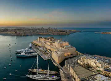
After the decline of the British military presence and Malta’s independence in 1964, Marsamxett gradually shifted from a primarily strategic harbour towards a mixed urban, commercial and recreational waterfront. Sliema expanded as a residential, retail and visitor centre, while Gżira, Msida and Ta’ Xbiex developed dense neighbourhoods, marinas and service businesses. Manoel Island’s former military and quarantine uses became part of an ongoing conservation and redevelopment story. Today the harbour combines working maritime functions with swimming, tourism, dining and everyday urban life.
Marsamxett Harbour in Photos
Browse through our photo collection highlighting the charm and character of the destination.
Neighbouring regions of Marsamxett Harbour
The closest regions to Marsamxett Harbour, if you have time for more than one.
-

-

-
-
-
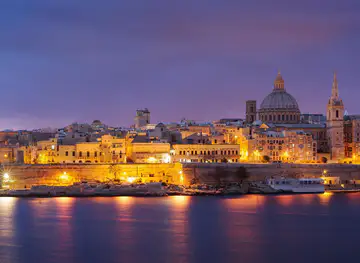


Swipe for more regions
Explore more
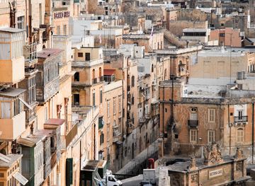
Explore more of Malta
Discover Malta's crystal-clear waters, rich history, and vibrant culture. From ancient temples to modern nightlife, this Mediterranean gem offers something for everyone.
Explore Malta