

Free South Central Montana Travel Guide & Mobile App
Explore South Central Montana with free travel guides. Discover regional history, expert tips, proposed trips, and audio guides on web or mobile app.


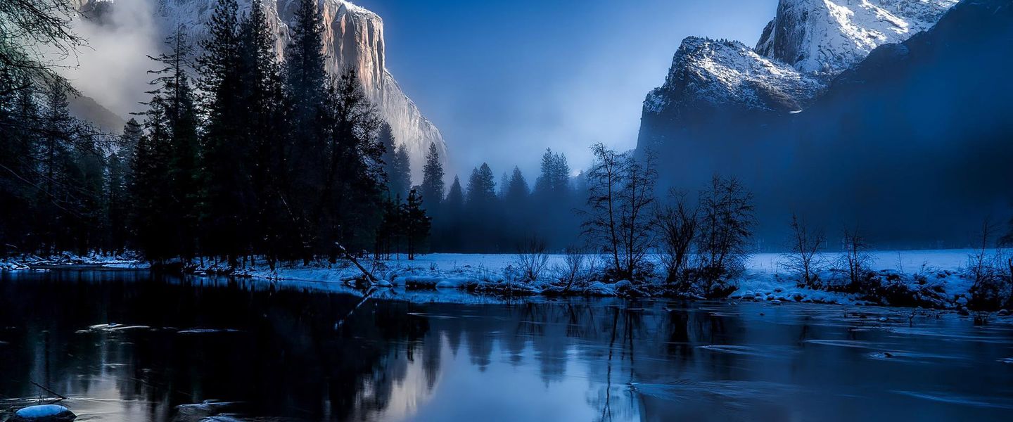


Explore South Central Montana for Yellowstone River landscapes, Billings culture, ranch towns, mountain roads, Indigenous history and outdoor adventure.
Read more about South Central Montana
When is the best time to visit South Central Montana?
Best: June–August · 24–28°C| Month | High (°C) | Rainfall (mm) |
|---|---|---|
| January | 2 | 20 |
| February | 3 | 18 |
| March | 9 | 26 |
| April | 14 | 38 |
| May | 19 | 53 |
| June (best) | 24 | 57 |
| July (best) | 28 | 34 |
| August (best) | 26 | 33 |
| September | 20 | 38 |
| October | 14 | 28 |
| November | 4 | 26 |
| December | 2 | 21 |
Getting to and around South Central Montana
How to get there
Transportation
Top city travel guides in South Central Montana
The cities of South Central Montana, and the easiest places to base yourself.
-

-

-

-

-

-


Swipe for more cities
Destinations in South Central Montana
Resorts, valleys and scenic spots worth a trip of their own.
-

-

-

-

-

-


Swipe for more destinations
Best attractions in South Central Montana
South Central Montana offers an unusually broad mixture of urban culture, Indigenous history, working landscapes and mountain recreation. Billings provides museums, galleries, performing arts and the Yellowstone River’s sandstone rims, while the nearby Western Heritage Center and Yellowstone County Museum explain the region’s settlement, transport and ranching stories. Little Bighorn Battlefield National Monument, on the Crow Reservation, is a major historical destination whose interpretation centres the 1876 battle and its wider consequences. South of Billings, Red Lodge is a base for hiking, skiing and access to the Beartooth Highway, subject to seasonal conditions. Livingston and Paradise Valley lead towards fishing, wildlife watching and the northern Yellowstone gateway, while Big Timber offers access to quieter river and foothill landscapes. The region’s public lands support hiking, camping, climbing, hunting and angling, although access rules vary between national forest, state, tribal and private land. Scenic driving is a major attraction, but distances are substantial and high mountain routes can close outside summer.
-
State park
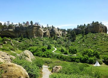
Pictograph Cave State Park
Discover the ancient rock art and natural beauty at Pictograph Cave State Park, a captivating state park in Montana perfect for history and nature enthusiasts.
-
State park
Lake Elmo State Park
Experience the serene beauty and outdoor adventures at Lake Elmo State Park in Billings, Montana, perfect for families and nature lovers.
-
Tourist attraction
Museum of the Beartooths
Explore the Museum of the Beartooths in Columbus, Montana, a unique destination showcasing local history, culture, and art in the heart of the Beartooth Mountains.

Best landmarks in South Central Montana
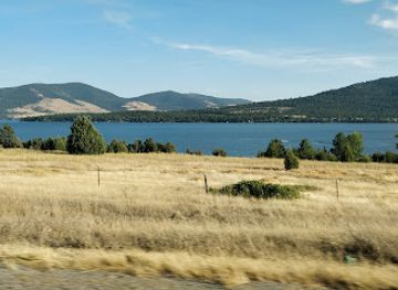
The sandstone rims and cliffs above Billings are among South Central Montana’s most recognisable natural features, revealing the Yellowstone River’s role in shaping the city’s setting. The historic centre of Billings and its surviving railway-era buildings represent the city’s emergence as a commercial and transport hub. At Little Bighorn Battlefield, memorials, markers and the ridge and river landscape make the terrain itself central to understanding the 1876 battle; the site also includes the distinctive Indian Memorial. Livingston’s historic railway architecture recalls its importance as a Northern Pacific division point and gateway towards Yellowstone, while Red Lodge’s townscape reflects its former mining and ranching economy beneath the Beartooth Mountains. Farther west, the Absaroka and Crazy Mountain horizons define long views across the Yellowstone Valley. The Beartooth Highway is both an engineering landmark and a high-altitude landscape experience, climbing from Red Lodge towards alpine plateaux; its seasonal opening and weather should always be confirmed before travel.
-
Park
Phipps Park
Discover the tranquil beauty of Phipps Park in Billings, Montana—your perfect escape into nature and outdoor recreation.

Explore South Central Montana on the map
Plan your trip on one map. See where the top cities, national parks and sights are, and book hotels and experiences in a few clicks.
Best hotels in South Central Montana
Best restaurants in South Central Montana
Dining in South Central Montana reflects both Billings’ role as a regional city and the agricultural landscapes around it. Billings has the widest choice, from cafés, breweries and contemporary American restaurants to steakhouses, international food and bakeries. In Livingston and Red Lodge, independent restaurants, coffee shops, bars and seasonal establishments serve visitors heading towards the mountains, while Big Timber and smaller communities tend towards cafés, diners, pubs and family-run places. Montana beef is prominent, and menus may also feature trout, game, local grains and produce from the Yellowstone Valley, though availability varies by season. Farmers’ markets and food shops are useful for picnic supplies on long scenic drives. Regional dining is best understood through its connection to ranching, river valleys and outdoor travel rather than through a single distinctive dish; reservations are sensible during summer and event weekends, especially in small mountain towns.
-
Steak
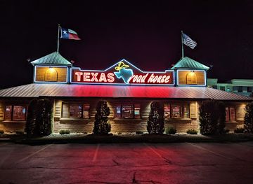
Texas Roadhouse
Experience the best of American cuisine at Texas Roadhouse in Billings – where delicious steaks meet lively hospitality.
-
Hamburger
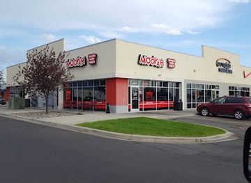
MOOYAH Burgers, Fries & Shakes
Discover delicious gourmet burgers and shakes at MOOYAH in Billings - perfect for families and fast food lovers alike!
-
American
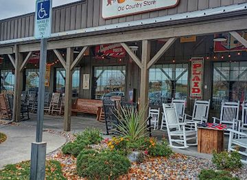
Cracker Barrel Old Country Store
Enjoy traditional Southern cuisine and unique gifts at Cracker Barrel Old Country Store in Billings - where every meal feels like home.
-
Pancake
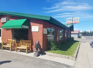
Running Bear Pancake House
Savor delicious pancakes and breakfast specialties at Running Bear Pancake House in West Yellowstone – your perfect start before exploring nature's wonders!
Best bars in South Central Montana
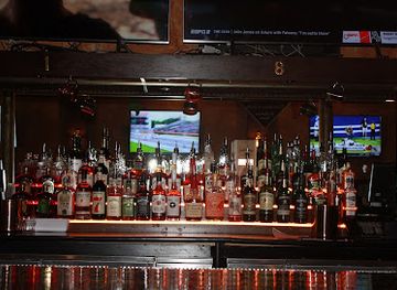
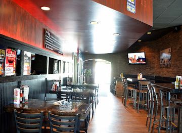
Nightlife is concentrated in Billings, where breweries, cocktail bars, live-music venues, restaurants and cultural events provide the region’s broadest evening choice. Historic downtown areas and the urban districts around them are the main places to look for bars and music, although venues and schedules change. Livingston and Red Lodge have a smaller, more localised scene built around pubs, restaurants, breweries and occasional live performances, with activity often reflecting the summer and winter recreation seasons. Big Timber and other rural communities generally favour traditional bars, gathering places and early-evening dining rather than nightclubs. In many parts of the region, the evening is more likely to involve a meal, a concert, a gallery event or a quiet drink after a day outdoors than a late-night club. Check current arrangements locally, particularly outside Billings.
-
Brewpub
Montana Brewing Company
Discover the craft of brewing at Montana Brewing Company, where delicious American cuisine meets handcrafted beers in a vibrant setting.
-
Pub
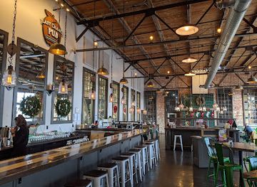
Last Chance | Pub & Cider Mill
Experience the best of Billings with delicious food and craft ciders at Last Chance | Pub & Cider Mill, a local favorite in Montana.
-
American
The Vig | Alehouse & Casino
Experience the lively atmosphere of The Vig | Alehouse & Casino, where American cuisine meets thrilling gaming in Billings, Montana.
-
Bar
406 Kitchen & Taproom
Experience the best of local flavors and craft beverages at 406 Kitchen & Taproom, a vibrant bar and restaurant in Billings, Montana.

Best nightclubs in South Central Montana
Nightlife is concentrated in Billings, where breweries, cocktail bars, live-music venues, restaurants and cultural events provide the region’s broadest evening choice. Historic downtown areas and the urban districts around them are the main places to look for bars and music, although venues and schedules change. Livingston and Red Lodge have a smaller, more localised scene built around pubs, restaurants, breweries and occasional live performances, with activity often reflecting the summer and winter recreation seasons. Big Timber and other rural communities generally favour traditional bars, gathering places and early-evening dining rather than nightclubs. In many parts of the region, the evening is more likely to involve a meal, a concert, a gallery event or a quiet drink after a day outdoors than a late-night club. Check current arrangements locally, particularly outside Billings.
-
Cocktail bar
Red Door Lounge
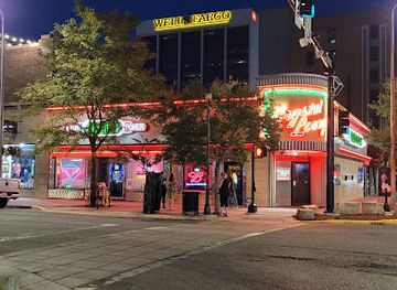
Discover the lively Red Door Lounge in Billings, Montana, offering a unique blend of cocktails and American cuisine in a fun atmosphere.
-
Casino
Crystal Lounge Casino
Discover the lively Crystal Lounge Casino in Billings, Montana, where gaming excitement meets karaoke fun in a quirky, vibrant atmosphere.
-
Casino
Stars 'n' Stripes Lounge And Casino
Discover the excitement of gaming and nightlife at Stars 'n' Stripes Lounge And Casino in Billings, Montana, where fun awaits every visitor.
-
Dance hall
Daisy Dukes Saloon and Dance Hall
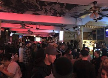
Daisy Dukes Saloon and Dance Hall: A lively dance hall and bar in Billings, MT, where live music, dancing, and unforgettable nights await.


Best shops in South Central Montana
Billings is the region’s principal shopping centre, combining conventional retail with downtown independent businesses, booksellers, galleries, outdoor shops, antiques and stores serving the surrounding ranching communities. The city is also a practical place to buy supplies before travelling into remote valleys or mountain country. Livingston’s compact historic districts are known for galleries, antiques, Western-themed goods, books, homewares and locally made art, while Red Lodge offers outdoor equipment, crafts, gifts and small-town businesses aimed at mountain travellers. Big Timber has a more modest selection of independent shops and services linked to its agricultural community. Farmers’ markets, when operating seasonally, are useful for local produce, baked goods and regional products, but dates and locations vary. Visitors should distinguish authentic local work from generic Western souvenirs and ask about artists, materials and tribal affiliation when purchasing Indigenous art or crafts.
-
Shopping mall
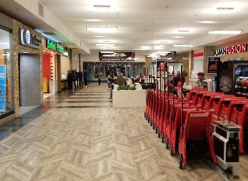
Rimrock Mall
Discover shopping bliss at Rimrock Mall, Billings' top destination for retail therapy, dining delights, and family fun.
-
Gift shop
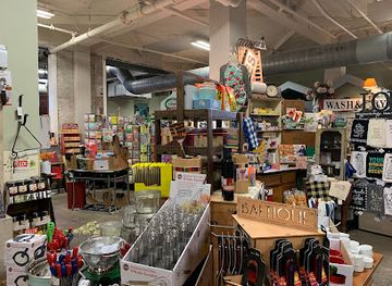
Liberty & Vine Country Store
Explore Liberty & Vine Country Store: A delightful blend of gifts, antiques, and gourmet treats in the heart of Billings, Montana.
-
Gift shop
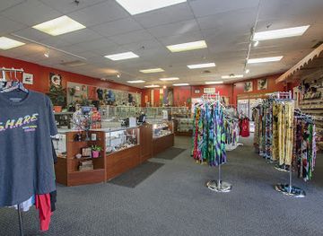
Discontent Lifestyle Stores
Discover the eclectic charm of Discontent Lifestyle Stores in Billings, where unique gifts and local artistry come together for an unforgettable shopping experience.
-
Gift shop
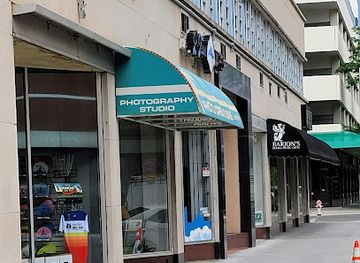
Barjon's Books
Discover unique books and metaphysical supplies at Barjon's Books, a charming gift shop in the heart of Billings, Montana.
Get your free copy of our complete guide to South Central Montana, delivered straight to you.
Everything on this page, from attractions and restaurants to essentials and local phrases, in one PDF you can read offline, print or share.
Already have an account? Sign in
Your South Central Montana guide is ready.
We'll send it to · Not you? Sign out

Getting your guide ready…
We are putting together a fresh copy of the South Central Montana guide. This can take up to a minute.
This can take a few moments. If your browser asks, choose Allow so the download can start. You'll find the guide in your Downloads folder.
Nothing happened? Download it again
Sorry, the guide is taking longer than usual. Please try again in a minute, or get it by email instead.
South Central Montana essentials
Currency and Payment
Safety
Emergency Situations
Do's and Don'ts
Local Tips
From Eve
Local phrases worth knowing
You don't need to get them perfect. A few words go a long way, and locals appreciate the effort.
Basics
| English | Local | Say it |
|---|---|---|
| Hello | Howdy | [Hau-dee] |
| Goodbye | See ya | [See yah] |
| Yes | Yup | [Yup] |
| No | Nope | [Nope] |
| Please/You're welcome | Please/You bet | [Pleez/You bet] |
| Thank you | Thanks | [Thanks] |
| Excuse me/Sorry | Excuse me/Sorry | [Excuse me/Sorry] |
| How are you? | How’s it going? | [How's it goin'?] |
| Fine. And you? | Good. And you? | [Good. An' you?] |
| Do you speak English? | You speak English? | [You speak English?] |
| I don't understand | I don’t get it | [I don't get it] |
Eating & Drinking
| English | Local | Say it |
|---|---|---|
| I'd like to see the menu, please | Can I see the menu, please? | [Can I see the menu, pleez?] |
| I don't eat meat | I’m a vegetarian | [I'm a vege-tarian] |
| Cheers! | Cheers! | [Cheers!] |
| I would like to pay, please | Can I get the check, please? | [Can I get the check, pleez?] |
Emergencies
| English | Local | Say it |
|---|---|---|
| Help! | Help! | [Help!] |
| Go away! | Leave me alone! | [Leave me alone!] |
| Call the Police! | Call the cops! | [Call the cops!] |
| Call a doctor! | Get a doctor! | [Get a doctor!] |
| I'm lost | I’m lost | [I'm lost] |
| I'm ill | I’m not feeling well | [I'm not feelin' well] |
Shopping
| English | Local | Say it |
|---|---|---|
| I'd like to buy... | I want to buy... | [I want to buy...] |
| I'm just looking | Just browsing | [Just browsing] |
| How much is it? | What’s the price? | [What's the price?] |
| That's too expensive | That’s a bit high | [That's a bit high] |
| Can you lower the price? | Can you drop the price? | [Can you drop the price?] |
Time & Numbers
| English | Local | Say it |
|---|---|---|
| What time is it? | What time is it? | [What time is it?] |
| It's one o'clock | It's one o'clock | [It's one o'clock] |
| Half past (10) | Half past ten | [Half past ten] |
| Morning | Morning | [Morning] |
| Afternoon | Afternoon | [Afternoon] |
| Evening | Evening | [Evening] |
| Yesterday | Yesterday | [Yesterday] |
| Today | Today | [Today] |
| Tomorrow | Tomorrow | [Tomorrow] |
| 1 | One | [One] |
| 2 | Two | [Two] |
| 3 | Three | [Three] |
| 4 | Four | [Four] |
| 5 | Five | [Five] |
| 6 | Six | [Six] |
| 7 | Seven | [Seven] |
| 8 | Eight | [Eight] |
| 9 | Nine | [Nine] |
| 10 | Ten | [Ten] |
Transport & Directions
| English | Local | Say it |
|---|---|---|
| Where's a/the...? | Where's the...? | [Where's the...?] |
| What's the address? | What’s the address? | [What's the address?] |
| Can you show me (on the map)? | Can you point it out on the map? | [Can you point it out on the map?] |
| When's the next (bus)? | When's the next bus? | [When's the next bus?] |
| A ticket (to ....) | A ticket to ... | [A ticket to ...] |
History of South Central Montana
Apsáalooke homeland and Northern Plains cultures
The Yellowstone River basin and surrounding plains are part of the historical homeland of the Apsáalooke, commonly known in English as the Crow. Their political, cultural and economic connections extend across what is now south-central Montana and neighbouring parts of Wyoming. Hunting, horse culture, trade, kinship networks and relationships with the landscape shaped life long before the arrival of United States military posts and settlers. The Crow Reservation remains an important living centre of Apsáalooke sovereignty and community, so the region’s Indigenous history is not confined to museums or battle narratives.
Exploration and the Yellowstone River
The Yellowstone River became known to United States explorers and traders during the early nineteenth century, although Indigenous peoples had long travelled and managed the valley. The Lewis and Clark Expedition’s return journey in 1806 passed through the wider Yellowstone country, helping to place the river within the expanding geographical imagination of the United States. Later fur traders, military expeditions and emigrant routes followed or crossed the same river corridors. Their arrival brought new commercial and political pressures, while the river remained a crucial route, water source and ecological spine.
Bozeman Trail and the conflicts of the 1860s
The Bozeman Trail crossed the Northern Plains towards the Montana goldfields and passed through country used by the Apsáalooke, Lakota and Northern Cheyenne. The United States established forts to protect the route, provoking conflict and resistance. The Fort Laramie Treaty of 1868 closed the trail and removed the forts, acknowledging a large area as Crow territory while also reflecting the unstable treaty politics of the period. The episode illustrates how transport corridors, mineral wealth and federal expansion altered the Yellowstone region before the arrival of the railway.
The Battle of the Little Bighorn, 1876
On 25 and 26 June 1876, Lieutenant Colonel George A. Custer’s United States Army command was defeated by a much larger coalition of Lakota, Northern Cheyenne and Arapaho warriors near the Little Bighorn River. The battlefield lies on the Crow Reservation in the wider south-central Montana travel area. Today, Little Bighorn Battlefield National Monument interprets the encounter, the preceding campaign and its consequences. The site is historically significant not simply as a military defeat, but as part of the larger struggle over Indigenous sovereignty, land and federal expansion.
Railways, settlement and the rise of Livingston and Billings
Railway construction transformed south-central Montana in the late nineteenth century. Livingston developed as a major Northern Pacific Railway division point and a gateway towards Yellowstone National Park, while Billings grew as a commercial and transport centre beside the Yellowstone River. Rail connections encouraged immigration, cattle shipping, agriculture, retail and construction, creating the town grids, depots and warehouses still visible today. The railway also tied local economies to distant markets and helped establish the contrasting urban and rural identities that continue to shape the region.
Ranching, irrigation and the working landscape
Cattle and sheep ranching became central to the economy of the Yellowstone Valley, foothills and surrounding plains. Irrigation projects enabled more reliable hay and crop production in a semi-arid climate, while railways provided routes to market. Ranching was never a single uniform tradition: large operations, family farms, Indigenous lands and town-based businesses developed in different ways. Fences, stockyards, hay meadows, shelterbelts and broad grazing allotments remain part of the visual character of the region, even as tourism, services and energy industries have diversified the economy.
Energy, industry and contemporary change
Billings and the wider Yellowstone corridor developed important refining, transport, construction and energy-related industries during the twentieth century. Coal, oil and gas activity in the broader region supported rail freight and urban growth, while public lands and mountain landscapes attracted recreation and conservation interests. Modern South Central Montana therefore combines an industrial city, working agricultural communities, tribal lands and tourism economies. Current debates about land use, water, energy and access reflect the region’s long history of balancing commercial development with cultural and environmental values.
South Central Montana in Photos
Browse through our photo collection highlighting the charm and character of the destination.
Neighbouring regions of South Central Montana
The closest regions to South Central Montana, if you have time for more than one.
-

-

-

-
-


Swipe for more regions
Explore more
Explore more of Montana
Discover Montana: A Treasure State of majestic landscapes, outdoor adventures, and rich cultural heritage. Explore Glacier and Yellowstone, charming towns, and historic sites.
Explore Montana