

Choquequirao Trek Travel Guide - Free Web & App
Your ultimate guide to Choquequirao Trek. Discover top landmarks, proposed trips, and local tips. Free on the web or via the Evendo companion app.


Choquequirao Trek in Peru crosses deep Apurímac valleys to an Inca citadel, with demanding hiking, Andean scenery, camping and remote mountain villages.
Across the Apurímac Wilderness
The Choquequirao Trek is one of Peru’s most demanding archaeological journeys, reaching the Inca complex of Choquequirao through the deeply cut Apurímac valley. The best-known approach begins near Cachora, in the Apurímac region, descending from high Andean terrain to the Apurímac River before climbing through dry valleys and cloud-forest slopes towards the ruins. The route is defined by sharp changes in altitude, exposed mountain paths and a remarkable sense of remoteness rather than by a continuous network of visitor facilities.Read more about Choquequirao Trek
The Citadel and Its Setting
Planning the Journey
When is the best time to visit Choquequirao Trek?
Best: February–March, June · 17–20°C| Month | High (°C) | Rainfall (mm) |
|---|---|---|
| January | 20 | 80 |
| February (best) | 20 | 70 |
| March (best) | 20 | 60 |
| April | 18 | 50 |
| May | 17 | 40 |
| June (best) | 17 | 30 |
| July | 16 | 30 |
| August | 17 | 40 |
| September | 17 | 50 |
| October | 18 | 60 |
| November | 19 | 70 |
| December | 20 | 80 |
Getting to and around Choquequirao Trek
How to get there
Transportation
Best attractions in Choquequirao Trek
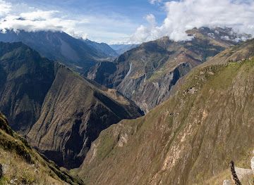
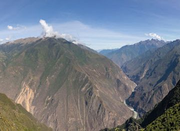
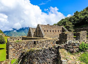
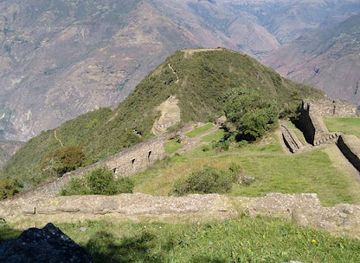
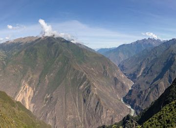
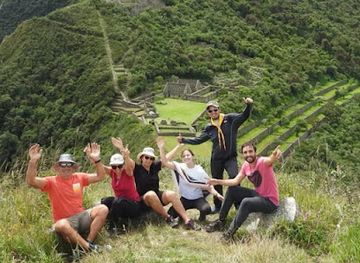
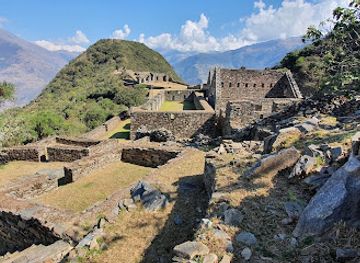
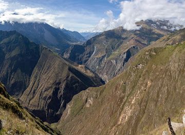
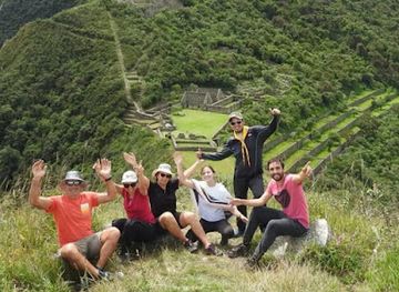
The principal attraction is the Choquequirao archaeological complex, spread across a steep ridge above the Apurímac River and reached by a demanding trail from Capuliyoc. Its plazas, ritual spaces, residential buildings, agricultural terraces and stone waterworks reveal how the Inca adapted construction to severe mountain terrain. The sector of figurative terraces, often called the llamas terraces because of its pale stone designs, is among the site’s most distinctive features. The approach itself passes through contrasting landscapes: dry slopes and cactus near the river, greener valleys around Marampata and cooler highland country near Cachora. Lookouts towards the Apurímac gorge and surrounding Vilcabamba mountains provide some of the route’s most memorable scenery, although visibility depends on weather. Smaller settlements and camps along the trail offer glimpses of contemporary rural life, while longer itineraries lead into more isolated valleys rather than to a dense circuit of formal attractions.
-
Tourist attraction
Choquequirao Trail
Discover the scenic beauty and rich history along the Choquequirao Trail, an unforgettable hiking adventure in the Peruvian Andes.
-
Farmstay
CAÑON DEL APURIMAC
Experience the majestic beauty and rich culture of Cañon del Apurimac, a captivating destination for nature lovers and adventure seekers in Peru.
-
Tourist attraction
Abra Choquequirao
Uncover the mysteries of Abra Choquequirao, a hidden Inca gem in the Andes, where history and breathtaking views meet in perfect harmony.
Best landmarks in Choquequirao Trek
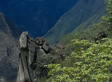
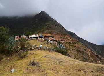
Choquequirao itself is the defining landmark: an extensive Inca complex occupying a high ridge above the Apurímac gorge, with finely built masonry, terraces, plazas and carefully engineered water channels. Its llama figures formed from light-coloured stone are an especially notable feature within the agricultural sectors. The Apurímac River is another essential landmark of the journey, not as a conventional riverside attraction but as the powerful geographical divide that gives the approach its dramatic descent and ascent. The surrounding ridges and high valleys belong to the broader Vilcabamba mountain landscape, where dry valleys meet greener Andean slopes. Capuliyoc and Marampata function as route landmarks and viewpoints rather than monumental sites, marking the transition from road access to the archaeological trail and the final approach to the ruins.
-
Archaeological site
Choquequirao Archaeological Park
Explore the majestic Choquequirao Archaeological Park, a hidden gem of Inca history in the heart of the Andes, offering breathtaking views and rich cultural heritage.
-
Hiking area
Choquequirao Trail
Explore the stunning Choquequirao Trail in Peru, a breathtaking hiking area leading to the ancient Incan ruins and showcasing stunning Andean landscapes.
-
Tourist attraction
Abra Choquequirao
Discover the enchanting ruins of Abra Choquequirao, an Inca treasure nestled in the Amazonian Andes, offering breathtaking views and rich history.
-
Travel agency
Choquequirao Trekking
Discover the breathtaking landscapes and rich history of Choquequirao with expert-guided treks that connect you to Peru's ancient heritage.
Explore Choquequirao Trek on the map
Plan your trip on one map. See where the top attractions, landmarks, restaurants and hotels are, and book hotels and experiences in a few clicks.
Best hotels in Choquequirao Trek
Best restaurants in Choquequirao Trek
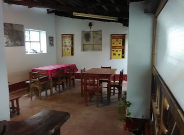
Dining on the Choquequirao Trek is practical and closely tied to the route’s small settlements rather than to a developed restaurant scene. Cachora and nearby gateway communities provide the most dependable opportunity to organise meals and provisions before departure. Basic food, drinks and simple cooked meals may be available around Chikiska, Marampata and other overnight points, but services are modest, seasonal and subject to local arrangements. Trekkers commonly rely on food carried by an organised expedition or prepared by a cook, with staples such as rice, potatoes, pasta, soups, eggs and regional produce forming the basis of camp meals. In Cusco, visitors can explore a much wider Peruvian food culture before or after the trek, including Andean potatoes, maize, quinoa, trout and alpaca, but these should not be assumed to be available along the remote trail. Carry snacks and clarify meal arrangements in advance.
-
Traditional American
LA TERRAZA DE CHOQUEQUIRAO
Discover authentic Traditional American cuisine at La Terraza de Choquequirao while enjoying breathtaking views in scenic Cachora, Peru.
Best shops in Choquequirao Trek
Shopping opportunities on the Choquequirao Trek are very limited and concentrated in gateway settlements rather than at the archaeological site. Cachora and nearby villages may provide basic provisions, drinks, batteries and trekking necessities, although selection can be much smaller than in Cusco. Small local businesses along the route may sell refreshments or simple supplies, but they should not be treated as permanent shops with predictable stock. Visitors wishing to buy Peruvian textiles, ceramics, food products or developed craftwork will find a far wider choice in Cusco and other established regional towns before travelling to the trailhead. In rural communities, purchases from local households can support livelihoods, but ask permission before photographing stalls or people and avoid removing stones, plants or archaeological fragments from the landscape.
-
Archaeological site
Choquequirao Archaeological Park
Explore Choquequirao Archaeological Park, a stunning Incan site nestled in the Andes, offering breathtaking views and rich history for all adventure seekers.
-
Store
Choquequirao Trail Shops
Discover unique local crafts and essential gear at Choquequirao Trail Shops, your gateway to the stunning Choquequirao trek in Cachora, Peru.
-
Hiking area
Choquequirao Trail
Discover the breathtaking Choquequirao Trail in Peru, a stunning hike leading to the ancient Inca ruins surrounded by magnificent Andean landscapes.
-
Travel agency
Choquequirao Trekking
Experience the breathtaking Choquequirao Trekking in Peru, a majestic journey through stunning landscapes to an ancient Incan citadel.
Get your free copy of our complete guide to Choquequirao Trek, delivered straight to you.
Everything on this page, from attractions and restaurants to essentials and local phrases, in one PDF you can read offline, print or share.
Already have an account? Sign in
Your Choquequirao Trek guide is ready.
We'll send it to · Not you? Sign out

Getting your guide ready…
We are putting together a fresh copy of the Choquequirao Trek guide. This can take up to a minute.
This can take a few moments. If your browser asks, choose Allow so the download can start. You'll find the guide in your Downloads folder.
Nothing happened? Download it again
Sorry, the guide is taking longer than usual. Please try again in a minute, or get it by email instead.
Choquequirao Trek essentials
Currency and Payment
Safety
Emergency Situations
Do's and Don'ts
Local Tips
From Eve
Local phrases worth knowing
You don't need to get them perfect. A few words go a long way, and locals appreciate the effort.
Basics
| English | Local | Say it |
|---|---|---|
| Hello | Kausay | [Kow-sigh] |
| Goodbye | Allinllachu | [A-yin-ya-chu] |
| Yes | Arí | [Ah-ree] |
| No | Manan | [Ma-nan] |
| Please/You're welcome | Sulpayki | [Sool-pai-kee] |
| Thank you | Sulpay | [Sool-pie] |
| Excuse me/Sorry | Piedade | [Pee-eh-dah-deh] |
| How are you? | Ima kachkanki? | [Ee-ma kach-kan-kee] |
| Fine. And you? | Allin. Suti? | [A-yin. Soo-tee] |
| Do you speak English? | Inglis simikunanki? | [Ing-lees see-mee-koo-nan-kee] |
| I don't understand | Manammi yachaychu | [Ma-nam-mee yah-chai-chu] |
Eating & Drinking
| English | Local | Say it |
|---|---|---|
| I'd like to see the menu, please | Menuyta qawaykuychi, sulpayki | [Men-oo-ee-ta ka-wai-kooi-chee, sool-pie-kee] |
| I don't eat meat | Karnirqa mikhuy | [Kar-nee-rka meek-way] |
| Cheers! | Kanpai! | [Kan-pie] |
| I would like to pay, please | Harqunkichi, sulpayki | [Har-koon-kee-chee, sool-pai-kee] |
Emergencies
| English | Local | Say it |
|---|---|---|
| Help! | Yanapanachiy! | [Yah-na-pa-na-chee] |
| Go away! | Llaqta | [Yak-ta] |
| Call the Police! | Puliñata llamanki! | [Poo-lee-nyaa-ta yam-an-kee] |
| Call a doctor! | Yachachiq llamanki! | [Yah-cha-cheek yam-an-kee] |
| I'm lost | Uqayku | [Oo-kai-koo] |
| I'm ill | Manan kani | [Ma-nan ka-nee] |
Shopping
| English | Local | Say it |
|---|---|---|
| I'd like to buy... | Imarunakuy... | [Ee-ma-roo-na-kooi] |
| I'm just looking | Rikurikuchkan | [Ree-koo-ree-kooch-kan] |
| How much is it? | Ima suyayki? | [Ee-ma soo-yai-kee] |
| That's too expensive | Kaykunapura | [Kai-koo-na-poo-ra] |
| Can you lower the price? | Suyayta kichayki? | [Soo-yai-ta kee-chai-kee] |
Time & Numbers
| English | Local | Say it |
|---|---|---|
| What time is it? | Maypi ñawin? | [My-pee nyaa-ween] |
| It's one o'clock | Jujuy | [Hoo-hooi] |
| Half past (10) | Iskay y media | [Iss-kai ee me-dee-a] |
| Morning | Punchaw | [Poon-chow] |
| Afternoon | Inti chaski | [In-tee chas-kee] |
| Evening | Tuta | [Too-ta] |
| Yesterday | Qayna | [Kai-na] |
| Today | Kuyay | [Koo-yai] |
| Tomorrow | Kachun | [Kach-oon] |
| 1 | Huk | [Hoo-k] |
| 2 | Iskay | [Iss-kai] |
| 3 | Kinsa | [Keen-sa] |
| 4 | Tawa | [Ta-wa] |
| 5 | Pichqa | [Peech-ka] |
| 6 | Soqta | [Sok-ta] |
| 7 | Qanchis | [Kan-chees] |
| 8 | Pusaq | [Poo-sak] |
| 9 | Isqun | [Iss-koon] |
| 10 | Chunka | [Choon-ka] |
Transport & Directions
| English | Local | Say it |
|---|---|---|
| Where's a/the...? | Maypi... | [My-pee] |
| What's the address? | Maypi sutiyki? | [My-pee soo-tee-kee] |
| Can you show me (on the map)? | Mapawan rikunanki? | [Map-a-wan ree-koo-nan-kee] |
| When's the next (bus)? | Qamri... | [Kam-ree] |
| A ticket (to ....) | Tikiti (....manta) | [Tee-kee-tee (manta)] |
History of Choquequirao Trek
An Andean Mountain Environment
The Choquequirao route crosses a dramatic sequence of Andean environments shaped by altitude, erosion and the deep incision of the Apurímac River. The trail descends from the highlands around Cachora into a hot, dry river valley before climbing towards moister upper slopes. These sharp ecological transitions influenced where people could cultivate crops, graze animals and establish settlements. The modern trek therefore follows a landscape whose historical importance lies not only in its monuments but also in the difficult relationship between highland communities, steep terrain and the river system that separates the major mountain ridges.
The Inca Construction of Choquequirao
Choquequirao was built and occupied during the late Inca period, probably in the fifteenth or early sixteenth century. Its name is commonly translated from Quechua as the Cradle of Gold, although interpretations of the name and the complex’s precise role remain subjects of scholarly discussion. The site contains plazas, ceremonial spaces, terraces, residences, water features and agricultural works arranged across a steep ridge. Its architecture demonstrates the Inca ability to integrate finely cut stonework and extensive terracing into difficult mountain terrain, while its position above the Apurímac gave it strategic and symbolic importance within the wider Vilcabamba region.
A Frontier of the Vilcabamba Region
Choquequirao is often discussed alongside the Vilcabamba region, where Inca resistance to Spanish rule continued after the capture of Cusco. Its relationship with the last independent Inca state is important but not entirely settled, and the complex should not be presented as a definitively identified refuge or capital. The surrounding mountains formed a difficult frontier between highland routes and the western Amazonian slopes. In the centuries after the Spanish conquest, the site became separated from the main centres of colonial administration, while nearby communities continued to use the broader landscape for agriculture, grazing and movement.
Colonial Records and Rediscovery
Choquequirao was not entirely unknown during the colonial period, although it remained remote from the principal routes used by Spanish and later Peruvian authorities. A reference by the priest Juan Arias Díaz in 1710 is commonly associated with the site’s early written documentation. Nineteenth-century travellers and explorers brought further attention to the ruins, but dense vegetation, difficult access and the absence of a road kept them largely beyond ordinary tourism. Hiram Bingham visited Choquequirao in 1910, helping to increase international interest in the complex and its relationship to the wider archaeological landscape of southern Peru.
Archaeology and Modern Conservation
Systematic archaeological work and restoration expanded during the twentieth century, particularly from the 1970s onwards, revealing terraces, plazas, waterworks and buildings beneath vegetation and accumulated soil. Conservation has had to balance visitor access with the fragility of stonework, steep terrain and the continuing effects of rain and vegetation growth. The modern trek developed gradually rather than through a single tourism project, and the area remains less accessible than Machu Picchu. Today, Choquequirao’s heritage is managed within a remote mountain setting where archaeological research, conservation, local livelihoods and carefully controlled tourism remain closely connected.
Choquequirao Trek in Photos
Browse through our photo collection highlighting the charm and character of the destination.
Neighbouring destination travel guides
The closest destinations to Choquequirao Trek, if you have time for more than one.
-

-

-

-

-


Swipe for more destinations
Explore more

Explore more of Apurímac
Discover Apurímac: Peru's hidden gem with stunning landscapes, rich cultural heritage, and thrilling adventures, perfect for nature enthusiasts and history buffs alike.
Explore Apurímac
Explore more of Peru
Discover the wonders of Peru: ancient ruins, stunning landscapes, and a vibrant culture that will captivate your heart and soul.
Explore Peru