

Free Narragansett Travel Guide & Mobile App
Plan your Narragansett trip with Evendo. Get free guides to top attractions, restaurants, hotels, and bars. Web access or download the mobile app.


Narragansett, Rhode Island, pairs Atlantic beaches and Point Judith with coastal history, seafood, surfing, scenic walks and South County seaside culture.
Beaches, Surf and Salt Air
Narragansett occupies a broad stretch of Rhode Island’s southern coast, where sandy beaches, rocky headlands and the open Atlantic define the town’s character. Its best-known shoreline is Narragansett Town Beach, a long, accessible crescent beside the historic Pier, while Scarborough State Beaches offer wider sands and strong surf farther north. At Point Judith, the coast becomes more rugged, with working harbour activity, tidal inlets and views towards Block Island Sound.Read more about Narragansett
A Seaside Town with a Layered Past
Exploring the Coast
When is the best time to visit Narragansett?
Best: June–July, September · 23–28°C| Month | High (°C) | Rainfall (mm) |
|---|---|---|
| January | 3 | 94 |
| February | 3 | 86 |
| March | 9 | 105 |
| April | 14 | 107 |
| May | 19 | 107 |
| June (best) | 24 | 94 |
| July (best) | 28 | 91 |
| August | 27 | 102 |
| September (best) | 23 | 100 |
| October | 18 | 108 |
| November | 11 | 107 |
| December | 5 | 105 |
Getting to and around Narragansett
How to get there
Transportation
Best attractions in Narragansett
Narragansett’s principal attractions follow its Atlantic shoreline. Narragansett Town Beach is the town’s central swimming and surfing beach, set beside the Pier and the stone Narragansett Towers, the surviving entrance to a nineteenth-century resort casino. At Point Judith, visitors can see the Point Judith Lighthouse from the surrounding coastal area and observe the working harbour, while nearby Roger W. Wheeler State Beach and Scarborough State Beaches offer broad sands and open-water scenery. The South County Museum presents regional history through historic buildings, collections and demonstrations connected with farming and maritime life. For a quieter change of pace, the Narrow River and its marsh-fringed edges provide opportunities for walking, kayaking and wildlife observation, subject to local access and conditions. Ocean Road ties many of these experiences together with views across coves, headlands and summer estates.
-
Tourist attraction
Narragansett Town Beach
Discover the beauty of Narragansett Town Beach, a perfect destination for relaxation, family fun, and stunning coastal views in Rhode Island.
15 min drive · 4.9 km from city centre
-
Tourist attraction
Black Point Trailhead
Experience the breathtaking coastal views and diverse wildlife at Black Point Trailhead in Narragansett, a top hiking destination in Rhode Island.
5 min drive · 1.6 km from city centre
-
Tourist attraction
Fishermen's Memorial State Park and Campground
Discover the tranquility and natural beauty of Fishermen's Memorial State Park and Campground, a perfect retreat for outdoor enthusiasts in Rhode Island.
6 min drive · 1.9 km from city centre
-
Historical landmark
The Towers
Discover the enchanting beauty and rich history of The Towers, a stunning landmark in Narragansett, RI, perfect for events and picturesque views.
13 min drive · 4.5 km from city centre


Best landmarks in Narragansett
The Narragansett Towers are the town’s most recognisable architectural landmark, representing the stone entrance of the Narragansett Casino, a grand resort complex built in the late nineteenth century and lost to fire in 1900. Point Judith Lighthouse, completed in 1857, marks a hazardous Atlantic approach and remains an important symbol of the town’s maritime identity, even though the lighthouse grounds are not generally an open sightseeing complex. Narragansett Town Hall, built in the early twentieth century, reflects the civic confidence of the resort era, while the Narragansett Pier Historic District preserves the relationship between streets, seasonal buildings and the shoreline. St. Peter’s by-the-Sea Episcopal Church adds a distinctive religious and architectural presence near the coast, and the Point Judith Fishermen’s Memorial commemorates those lost at sea.
-
Seafood
George's of Galilee
Discover the ultimate seafood dining experience at George's of Galilee, where fresh flavors meet stunning ocean views in beautiful Rhode Island.
10 min drive · 3.3 km from city centre
-
Seafood
The Coast Guard House Restaurant
Experience fine dining with breathtaking ocean views at The Coast Guard House Restaurant, a culinary gem in Narragansett, Rhode Island.
13 min drive · 4.5 km from city centre
-
Public beach
Scarborough State Beach
Discover the beauty of Scarborough State Beach, a serene escape in Rhode Island with golden sands and inviting waves for the perfect beach day.
14 min walk · 1.1 km from city centre
-
Public beach
Narragansett Town Beach
Experience the charm and beauty of Narragansett Town Beach, a premier public beach in Rhode Island perfect for relaxation and seaside fun.
15 min drive · 4.9 km from city centre


Explore Narragansett on the map
Plan your Narragansett trip on one map. See where the top attractions, landmarks, restaurants, bars and hotels are, find what's near where you're staying, and book hotels and experiences in a few clicks.
Best hotels in Narragansett
Best restaurants in Narragansett
Narragansett’s dining scene is shaped by its waterfront setting and South County traditions, with seafood a central presence on menus around the Pier and Point Judith. Local specialities commonly include oysters, clams, lobster, fried seafood and New England-style chowder, alongside grilled fish and simple preparations that reflect the nearby fishing industry. Harbour-side and casual seasonal establishments sit alongside cafés, pizza restaurants, ice-cream shops and more polished dining rooms, giving the town a broad summer range without losing its coastal focus. Point Judith’s working waterfront lends particular character to meals involving locally landed catch, while markets and food counters provide practical choices for beach days. Rhode Island’s distinctive coffee-milk tradition and regional bakery culture also appear in everyday eating, especially at informal cafés and breakfast spots.
-
Seafood
George's of Galilee
Experience fresh seafood delights at George's of Galilee in Narragansett – where coastal charm meets culinary excellence.
10 min drive · 3.3 km from city centre
-
Seafood
The Coast Guard House Restaurant
Experience exquisite seafood dining with breathtaking ocean views at The Coast Guard House Restaurant in Narragansett.
13 min drive · 4.5 km from city centre
-
Restaurant
Iggy's Doughboys & Chowder House
Experience authentic Rhode Island seafood at Iggy's Doughboys & Chowder House – where coastal flavors meet casual dining.
8 min drive · 2.5 km from city centre
-
Seafood
Monahan's Clam Shack
Discover fresh seafood delights at Monahan's Clam Shack in Narragansett - a must-visit for every seafood lover.
11 min drive · 3.7 km from city centre


Best bars in Narragansett
Narragansett’s evening life is centred more on relaxed coastal dining, seasonal bars and live entertainment than on a large nightclub scene. The Pier area provides the greatest concentration of places to meet after the beach, with outdoor seating, seafood restaurants and bars that become busier during the summer months. Point Judith offers a quieter harbour atmosphere, while cafés and casual venues around the town provide low-key evenings rather than late-night clubbing. Live music and seasonal events may add energy to the waterfront, although programming changes and should be checked locally. Visitors should arrange transport carefully after drinking because the town is spread out, public transport is limited at night and coastal roads can be dark outside the main commercial areas.
-
Oyster Bar
Matunuck Oyster Bar
Experience the freshest oysters and seafood in a stunning coastal setting at Matunuck Oyster Bar, a must-visit for every food lover in Rhode Island.
11 min drive · 3.8 km from city centre
-
Seafood
George's of Galilee
Discover the best seafood dining experience in Galilee, Rhode Island, at George's of Galilee, where fresh catches meet stunning ocean views.
10 min drive · 3.3 km from city centre
-
Seafood
The Coast Guard House Restaurant
Discover the culinary delights of The Coast Guard House Restaurant, where fresh seafood meets breathtaking ocean views in Narragansett, Rhode Island.
13 min drive · 4.5 km from city centre
-
Seafood
Monahan's Clam Shack
Experience the best of Rhode Island seafood at Monahan's Clam Shack, where fresh flavors and ocean views come together for an unforgettable meal.
11 min drive · 3.7 km from city centre


Best nightclubs in Narragansett
Narragansett’s evening life is centred more on relaxed coastal dining, seasonal bars and live entertainment than on a large nightclub scene. The Pier area provides the greatest concentration of places to meet after the beach, with outdoor seating, seafood restaurants and bars that become busier during the summer months. Point Judith offers a quieter harbour atmosphere, while cafés and casual venues around the town provide low-key evenings rather than late-night clubbing. Live music and seasonal events may add energy to the waterfront, although programming changes and should be checked locally. Visitors should arrange transport carefully after drinking because the town is spread out, public transport is limited at night and coastal roads can be dark outside the main commercial areas.
-
Bar
Ocean Mist
Experience the vibrant atmosphere of Ocean Mist, a seaside bar in South Kingstown, offering live music, delicious food, and stunning ocean views.
17 min drive · 5.8 km from city centre
-
Restaurant
Spain of Narragansett
Experience authentic Spanish cuisine and vibrant atmosphere at Spain of Narragansett, a must-visit dining destination for tourists.
6 min drive · 2.1 km from city centre
-
Italian
PJ's Pub
Discover the flavors of Italy and the Mediterranean at PJ's Pub, a family-friendly restaurant in scenic Narragansett, Rhode Island.
12 min drive · 3.9 km from city centre
-
Bar
Bon Vue Inn
Discover Bon Vue Inn: A lively bar in Narragansett, RI, where great drinks, live music, and coastal charm come together for an unforgettable experience.
8 min drive · 2.5 km from city centre


Best shops in Narragansett
Shopping in Narragansett is concentrated around the Pier and the commercial areas along Route 1 rather than a large enclosed retail district. Small boutiques, surf-oriented shops, beachwear retailers, galleries and independent stores cater to summer visitors, while food shops offer Rhode Island seafood, locally made products, sweets and practical provisions for the shore. The Pier area is the most walkable place to browse between beach visits, with a seasonal atmosphere that changes outside the main summer period. Visitors looking for distinctive purchases should consider regional food products, nautical goods, local art and coastal-themed crafts rather than mass-produced souvenirs. Larger retail choices are available in nearby South County communities, but they form part of the wider region rather than Narragansett’s compact seaside shopping identity.
-
Seafood
Aunt Carrie's Restaurant, Ice Cream and Gift Shoppe
Discover Aunt Carrie's in Narragansett, RI – a seafood haven featuring fresh dishes, homemade ice cream, and a charming gift shop for memorable souvenirs.
8 min drive · 2.5 km from city centre
-
Shopping mall
Salt Pond Shopping Center
Explore the Salt Pond Shopping Center in Narragansett for a unique blend of local shops, dining, and coastal charm.
11 min drive · 3.7 km from city centre
-
Shopping mall
The Wakefield Mall
Explore the diverse shopping, dining, and entertainment experiences at Wakefield Mall in Rhode Island, a perfect destination for every visitor.
16 min drive · 5.3 km from city centre
-
Grocery store
Stop & Shop
Explore the best of local and fresh produce at Stop & Shop in Narragansett, your go-to grocery store for culinary delights.
11 min drive · 3.6 km from city centre


Get your free copy of our complete guide to Narragansett, delivered straight to you.
Everything on this page, from attractions and restaurants to essentials and local phrases, in one PDF you can read offline, print or share.
Already have an account? Sign in
Your Narragansett guide is ready.
We'll send it to · Not you? Sign out

Getting your guide ready…
We are putting together a fresh copy of the Narragansett guide. This can take up to a minute.
This can take a few moments. If your browser asks, choose Allow so the download can start. You'll find the guide in your Downloads folder.
Nothing happened? Download it again
Sorry, the guide is taking longer than usual. Please try again in a minute, or get it by email instead.
Narragansett essentials
Currency and Payment
Safety
Emergency Situations
Do's and Don'ts
Local Tips
From Eve
Local phrases worth knowing
You don't need to get them perfect. A few words go a long way, and locals appreciate the effort.
Basics
| English | Local | Say it |
|---|---|---|
| Hello | Weyo | [way-oh] |
| Goodbye | Chachimay | [cha-chi-may] |
| Yes | Eh | [eh] |
| No | Nah | [nah] |
| Please/You're welcome | Kwai | [kwai] |
| Thank you | N'sutay | [en-soo-tay] |
| Excuse me/Sorry | Kwunomae | [koo-no-may] |
| How are you? | Nigotawon? | [nee-go-ta-won] |
| Fine. And you? | N'sutay. Aw n'sutay ne? | [en-soo-tay. aw en-soo-tay nay] |
| Do you speak English? | Ni English nutuwon? | [nee English noo-ta-won] |
| I don't understand | Ni wunniwon | [nee wun-nee-won] |
Eating & Drinking
| English | Local | Say it |
|---|---|---|
| I'd like to see the menu, please | Ni kiuskun menu, kwai | [nee kee-us-kun meh-noo, kwai] |
| I don't eat meat | Ni neyakun nekes | [nee nay-ah-kun nek-es] |
| Cheers! | Chachimay! | [cha-chi-may] |
| I would like to pay, please | Ni kiuskun pay, kwai | [nee kee-us-kun pay, kwai] |
Emergencies
| English | Local | Say it |
|---|---|---|
| Help! | Nigotow | [nee-go-toe] |
| Go away! | Naway | [na-way] |
| Call the Police! | Kwai Nigotokun Ponop | [kwai nee-go-toe-kun poe-nope] |
| Call a doctor! | Kwai Nigotokun Doktawun | [kwai nee-go-toe-kun dock-ta-wun] |
| I'm lost | Nigotawon wonk | [nee-go-ta-won wonk] |
| I'm ill | Nigotawon kuspap | [nee-go-ta-won kus-pap] |
Shopping
| English | Local | Say it |
|---|---|---|
| I'd like to buy... | Ni kiuskun woh... | [nee kee-us-kun woh] |
| I'm just looking | Ni kwunomae woh | [nee koo-no-may woh] |
| How much is it? | Kwai kusku? | [kwai kus-koo] |
| That's too expensive | N'sutay kusku | [en-soo-tay kus-koo] |
| Can you lower the price? | Ni kwunomae kusku | [nee koo-no-may kus-koo] |
Time & Numbers
| English | Local | Say it |
|---|---|---|
| What time is it? | Nigotawon woh hok? | [nee-go-ta-won woh hok] |
| It's one o'clock | Wun woh | [wun woh] |
| Half past (10) | Nupusqutun | [noo-pus-koo-tun] |
| Morning | Sukok | [soo-kok] |
| Afternoon | Pisup | [pee-sup] |
| Evening | N'sutay | [en-soo-tay] |
| Yesterday | Wun woh | [wun woh] |
| Today | Wun woh | [wun woh] |
| Tomorrow | Wun woh | [wun woh] |
| 1 | Wun | [wun] |
| 2 | Nip | [nip] |
| 3 | Nes | [nes] |
| 4 | Yef | [yef] |
| 5 | Pip | [pip] |
| 6 | Wunnekwet | [wun-nek-wet] |
| 7 | Nipnekwet | [nip-nek-wet] |
| 8 | Nesnekwet | [nes-nek-wet] |
| 9 | Yefnekwet | [yef-nek-wet] |
| 10 | Pipnekwet | [pip-nek-wet] |
Transport & Directions
| English | Local | Say it |
|---|---|---|
| Where's a/the...? | Nigotawon woh... | [nee-go-ta-won woh] |
| What's the address? | Nigotawon woh hok... | [nee-go-ta-won woh hok] |
| Can you show me (on the map)? | Ni kwunomae woh (on the map)? | [nee koo-no-may woh (on the map)] |
| When's the next (bus)? | Nigotawon woh hok next (bus)? | [nee-go-ta-won woh hok next (bus)] |
| A ticket (to ....) | Nuny | [noon-y] |
History of Narragansett
Indigenous Coast and Colonial Settlement
The Narragansett area lies within the ancestral homeland of the Narragansett people, whose communities used the southern Rhode Island coast, salt marshes and waterways for fishing, shellfishing and agriculture. English colonisation expanded in the seventeenth century, bringing land disputes, new farms and changing patterns of trade. The region was incorporated as the Town of Narragansett in 1901, after having been governed for generations within the wider political history of South Kingstown and colonial Rhode Island. Coastal geography shaped the settlement from the beginning: Point Judith, the Narrow River and the ocean beaches supported maritime activity, while inland areas remained associated with farms and summer estates.
Farming, Fishing and Point Judith
For much of the eighteenth and nineteenth centuries, Narragansett combined agricultural settlement with coastal fishing and maritime work. Point Judith became strategically important as a headland and harbour entrance, although its exposed waters were also hazardous to shipping. The population lived in scattered farms and small coastal communities rather than a single dense centre. Fishing, boatbuilding and the harvesting of marine resources connected Narragansett to other Rhode Island ports, while roads and improved coastal links gradually made the shore more accessible to visitors. The working landscape that survives around Point Judith reflects this earlier economy, even as tourism later became the town’s most visible industry.
The Rise of the Summer Resort
Rail connections and improved transport during the nineteenth century helped transform Narragansett into a summer resort for visitors from Providence and other parts of New England. Hotels, boarding houses and seasonal residences grew around Narragansett Pier, where bathing, promenading and social events became central attractions. The Narragansett Casino, opened in the 1880s, symbolised the resort’s ambition; its main building was destroyed by fire in 1900, leaving the stone Towers as its best-known remnant. The resort era established the pattern of seasonal coastal tourism that still influences the town’s economy, architecture and public life.
Lighthouses, War and Maritime Change
Point Judith’s navigational importance led to successive lighthouse structures, with the present Point Judith Light completed in 1857. The tower and adjacent waters became part of a larger system of coastal navigation and defence, particularly as maritime traffic increased around Narragansett Bay and Block Island Sound. During the twentieth century, the area’s military and naval associations expanded, while fishing remained a practical foundation of the Point Judith waterfront. Storms, erosion and changing shoreline conditions repeatedly tested coastal infrastructure, reinforcing the relationship between Narragansett’s prosperity and the risks of its Atlantic setting.
Preservation and a Modern Coastal Identity
Twentieth-century Narragansett developed as both a year-round community and a major Rhode Island beach destination. Automobile travel widened access to the shore, while public beaches and recreational facilities brought a broader range of visitors than the earlier hotel era. Preservation efforts have kept attention on surviving elements of the resort past, including the Narragansett Towers, historic churches and older civic buildings. Museums and local heritage organisations interpret farming, domestic life, fishing and tourism, while contemporary Narragansett continues to balance residential growth, seasonal pressure and the protection of beaches, dunes, wetlands and working waterfronts.
Narragansett in Photos
Browse through our photo collection highlighting the charm and character of the destination.
Cities near Narragansett
The closest cities to Narragansett, if you have time for more than one stop.
-

-

-

-
-


Swipe for more cities
Explore more
Explore more of Rhode Island
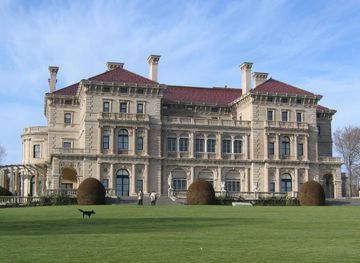
Discover Rhode Island: Explore historic mansions, vibrant cities, serene islands, and culinary delights in the smallest state with a big heart.
Explore Rhode Island