

Uinta-Wasatch-Cache National Forest Travel Guide - Free Web & App
Your ultimate guide to Uinta-Wasatch-Cache National Forest. Discover top landmarks, proposed trips, and local tips. Free on the web or via the Evendo companion app.


Explore Uinta-Wasatch-Cache National Forest in Utah for alpine lakes, canyons, wilderness trails, scenic drives, wildlife and mountain recreation.
Mountain Landscapes and Forested Valleys
Uinta-Wasatch-Cache National Forest stretches across a remarkably varied band of northern and central Utah, from the Wasatch Mountains east of Salt Lake City and Ogden to the high Uinta Mountains and the valleys of northern Utah. Its boundaries encompass alpine basins, conifer forests, deep limestone canyons, sagebrush foothills, high-elevation lakes and broad mountain passes, making it a substantial landscape rather than a single, self-contained attraction. The forest is divided into several ranger districts, each with its own character and access points.Read more about Uinta-Wasatch-Cache National Forest
Gateway Communities and Scenic Routes
Outdoor Recreation and Conservation
When is the best time to visit Uinta-Wasatch-Cache National Forest?
Best: June–August · 22–27°C| Month | High (°C) | Rainfall (mm) |
|---|---|---|
| January | 1 | 40 |
| February | 2 | 35 |
| March | 7 | 40 |
| April | 11 | 45 |
| May | 17 | 40 |
| June (best) | 22 | 35 |
| July (best) | 27 | 30 |
| August (best) | 26 | 35 |
| September | 21 | 40 |
| October | 14 | 45 |
| November | 6 | 40 |
| December | 1 | 45 |
Getting to and around Uinta-Wasatch-Cache National Forest
How to get there
Transportation
Best attractions in Uinta-Wasatch-Cache National Forest
The forest’s attractions are spread across several distinct mountain areas. The Mirror Lake Scenic Byway leads from Kamas into the Uinta Mountains, where Mirror Lake and the surrounding High Uintas provide access to alpine scenery, fishing and hiking subject to seasonal conditions. In the Wasatch, the Alpine Loop Scenic Byway connects American Fork Canyon and Provo Canyon with views towards Mount Timpanogos and access to trailheads, while Logan Canyon combines limestone cliffs, woodland and routes towards the Bear River Range. Ogden Canyon and surrounding valleys offer further entry into the northern Wasatch. The High Uintas Wilderness is the setting for demanding backpacking and high-country exploration, whereas developed campgrounds, picnic areas and winter recreation sites provide easier access closer to population centres. Wildlife may include mule deer, moose, elk, black bears and mountain goats, but sightings are never guaranteed and should not be pursued.
-
Sports complex
Utah Olympic Park
Explore Utah Olympic Park, where Olympic spirit meets thrilling adventures in the stunning landscapes of Park City.
-
State park
Deer Creek State Park
Experience the breathtaking landscapes and recreational activities at Deer Creek State Park, a premier outdoor destination in Utah.
-
Tourist attraction
Bean Life Science Museum
Explore the breathtaking diversity of life at the Bean Life Science Museum in Provo, Utah, a captivating destination for science enthusiasts and families.
-
Tourist attraction
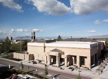
Brigham Young University Museum of Art (MOA)
Discover the artistic treasures at Brigham Young University Museum of Art, where creativity meets culture in a captivating setting.



Best landmarks in Uinta-Wasatch-Cache National Forest
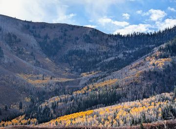
The forest’s defining landmarks are primarily natural. The Uinta Mountains form a broad high-elevation range containing Mirror Lake, numerous alpine lakes and the High Uintas Wilderness, while Mount Timpanogos dominates views from the central Wasatch and is protected within the Mount Timpanogos Wilderness. Logan Canyon is recognised for its great limestone walls, wooded slopes and winding route through the northern mountains; American Fork Canyon and Provo Canyon provide similarly dramatic corridors near the Wasatch Front. The Mirror Lake and Alpine Loop scenic roads are important access landmarks as well as journeys through the landscape. Historic mining traces, old roads, reservoirs and remnants of mountain resource use occur in parts of the forest, but their condition and accessibility vary. The forest’s watersheds are also significant landmarks in practical terms, supplying streams and reservoirs relied upon by communities along the rapidly developing valleys below.
-
Woods
Wasatch National Forest
Discover the stunning beauty of Wasatch National Forest, a paradise for outdoor enthusiasts and nature lovers in Utah, offering adventures year-round.
-
Federal government office
Uinta-Wasatch-Cache National Forests Headquarters
Discover the gateway to Utah's majestic Uinta-Wasatch-Cache National Forests, a haven for outdoor enthusiasts and nature lovers.
-
Woods
Wasatch-Cache National Forest
Experience the breathtaking beauty and diverse recreational opportunities of Wasatch-Cache National Forest in Utah, your ultimate outdoor adventure destination.
-
National forest
Uinta National Forest
Discover the breathtaking landscapes and diverse wildlife of Uinta National Forest in Utah, a paradise for outdoor enthusiasts and nature lovers.


Explore Uinta-Wasatch-Cache National Forest on the map
Plan your trip on one map. See where the top attractions, landmarks, restaurants and hotels are, and book hotels and experiences in a few clicks.
Best hotels in Uinta-Wasatch-Cache National Forest
Best restaurants in Uinta-Wasatch-Cache National Forest
There are few dining facilities deep inside the national forest, so most meals are taken in gateway communities before or after excursions. Logan offers the broadest choice in the northern part of the region, while Ogden, Salt Lake City, Provo, Heber City, Kamas and Vernal serve different forest approaches with cafés, restaurants, supermarkets and traditional Utah eateries. Rural communities provide diners, bakeries, cafés and casual restaurants rather than a concentrated destination dining scene. Local food reflects the wider Intermountain West, with beef, lamb, trout, seasonal produce, baked goods and substantial café cooking commonly encountered across the region. Farm shops and small producers appear in some valleys, but opening patterns vary. Visitors heading to remote trailheads should buy provisions in town and carry food rather than expecting a meal service at a campground, scenic viewpoint or wilderness boundary.
-
American
The Copper Onion
Experience the vibrant flavors of New American cuisine at The Copper Onion in Salt Lake City—a family-friendly destination serving locally sourced delights.
-
Mexican
Blue Iguana Salt Lake City
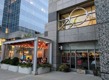
Experience vibrant flavors and authentic Mexican dishes at Blue Iguana in Salt Lake City - a culinary gem in downtown!
-
Brewery
Wasatch Brew Pub
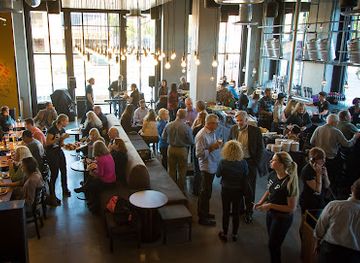
Discover craft beers and delicious cuisine at Wasatch Brew Pub in Salt Lake City - where every meal is paired with local flavor.
-
Steak
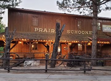
Prairie Schooner Steak House
Experience the rich flavors of expertly grilled steaks at Prairie Schooner Steak House - Ogden's premier dining destination for meat lovers.
Best bars in Uinta-Wasatch-Cache National Forest
Evening entertainment is concentrated in the towns surrounding the forest rather than within its mountain boundaries. Ogden, Logan, Salt Lake City and Provo have the region’s broadest selection of pubs, bars, breweries, live music and cultural venues, while Heber City, Kamas and Vernal offer a quieter range of restaurants, casual drinking places and community-oriented evening hospitality. Smaller gateway settlements may have a traditional bar or café, but they are not nightlife centres and services can be limited outside busy periods. In the forest itself, evenings are shaped by darkness, quiet campsites, mountain weather and stargazing rather than organised entertainment. Visitors should not rely on late-night services near trailheads and should arrange fuel, food and accommodation in the nearest suitable community before travelling into remote areas.
-
Breakfast
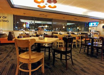
Village Inn
Discover the heartwarming flavors of Village Inn, where family-friendly dining meets delicious breakfast and homemade pies in Provo, Utah.
-
Steak
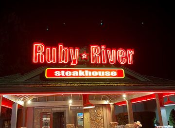
Ruby River Steakhouse
Indulge in expertly crafted steaks and American cuisine at Ruby River Steakhouse, a Provo favorite for family dining and events.
-
Mexican
Joe Bandido's
Experience the vibrant taste of authentic Mexican cuisine at Joe Bandido's in Springville, Utah, where every meal is a celebration of flavor.
-
Live music bar
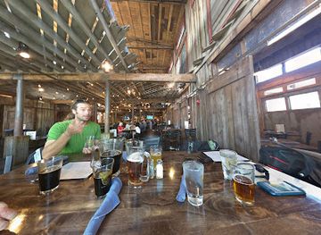
Strap Tank Brewery
Discover Strap Tank Brewery in Springville, where craft brews meet delicious American cuisine and live music creates an unforgettable atmosphere.

Best nightclubs in Uinta-Wasatch-Cache National Forest
Evening entertainment is concentrated in the towns surrounding the forest rather than within its mountain boundaries. Ogden, Logan, Salt Lake City and Provo have the region’s broadest selection of pubs, bars, breweries, live music and cultural venues, while Heber City, Kamas and Vernal offer a quieter range of restaurants, casual drinking places and community-oriented evening hospitality. Smaller gateway settlements may have a traditional bar or café, but they are not nightlife centres and services can be limited outside busy periods. In the forest itself, evenings are shaped by darkness, quiet campsites, mountain weather and stargazing rather than organised entertainment. Visitors should not rely on late-night services near trailheads and should arrange fuel, food and accommodation in the nearest suitable community before travelling into remote areas.
-
National forest
Uinta-Wasatch-Cache National Forest
Explore the vast wilderness and stunning landscapes of Uinta-Wasatch-Cache National Forest, a premier destination for nature lovers and adventurers alike.
Best shops in Uinta-Wasatch-Cache National Forest
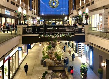
Shopping is limited within the forest itself and is concentrated in gateway towns. Logan, Ogden, Salt Lake City and Provo provide the widest range of outdoor retailers, groceries, equipment and locally made goods, while Kamas, Heber City and Vernal are practical places to obtain provisions and basic supplies for particular mountain approaches. Visitors may find regional food products, farm-shop goods, handmade items, art and western-influenced crafts in surrounding communities, although the forest does not have a single signature shopping district or permanent market defining the destination. Outdoor equipment is especially relevant because visitors may need maps, fuel, layers, camping supplies or winter gear before reaching remote roads and trailheads. Smaller mountain settlements have limited stock and may not be suitable for last-minute specialist purchases, so supplies should be planned around the chosen district.
-
Shopping mall
City Creek Center
Experience premier shopping and dining at City Creek Center, the heart of Salt Lake City’s vibrant retail scene with stunning views and unique events.
-
Shopping mall
The Gateway
Discover a shopping and cultural paradise at The Gateway in Salt Lake City, where retail meets entertainment and art in a stunning downtown setting.
-
Shopping mall
Trolley Square
Experience the blend of history and modern shopping at Trolley Square, Salt Lake City's premier shopping destination.
-
Men's clothing store
Missionary Mall
Explore stylish men's clothing and expert tailoring at Missionary Mall in Orem, Utah, your destination for fashion and quality.


Get your free copy of our complete guide to Uinta-Wasatch-Cache National Forest, delivered straight to you.
Everything on this page, from attractions and restaurants to essentials and local phrases, in one PDF you can read offline, print or share.
Already have an account? Sign in
Your Uinta-Wasatch-Cache National Forest guide is ready.
We'll send it to · Not you? Sign out

Getting your guide ready…
We are putting together a fresh copy of the Uinta-Wasatch-Cache National Forest guide. This can take up to a minute.
This can take a few moments. If your browser asks, choose Allow so the download can start. You'll find the guide in your Downloads folder.
Nothing happened? Download it again
Sorry, the guide is taking longer than usual. Please try again in a minute, or get it by email instead.
Uinta-Wasatch-Cache National Forest essentials
Currency and Payment
Safety
Emergency Situations
Do's and Don'ts
Local Tips
From Eve
Local phrases worth knowing
You don't need to get them perfect. A few words go a long way, and locals appreciate the effort.
Basics
| English | Local | Say it |
|---|---|---|
| Hello | Howdy | [haw-dee] |
| Goodbye | See ya | [see yuh] |
| Yes | Yup | [yuhp] |
| No | Nope | [nohp] |
| Please/You're welcome | Please | [pleez] |
| Thank you | Thanks | [thanks] |
| Excuse me/Sorry | Pardon | [par-dun] |
| How are you? | Howdy | [haw-dee] |
| Fine. And you? | Fine. You? | [fahyn. yuh] |
| Do you speak English? | Speak English? | [speek ing-glish] |
| I don't understand | Huh? | [huh] |
Eating & Drinking
| English | Local | Say it |
|---|---|---|
| I'd like to see the menu, please | Menu, please | [men-yoo, pleez] |
| I don't eat meat | No meat | [noh meet] |
| Cheers! | Cheers! | [cheers] |
| I would like to pay, please | Pay, please | [pay, pleez] |
Emergencies
| English | Local | Say it |
|---|---|---|
| Help! | Help! | [help] |
| Go away! | Go away! | [go away] |
| Call the Police! | Police! | [puh-lees] |
| Call a doctor! | Doctor! | [dok-ter] |
| I'm lost | Lost | [lost] |
| I'm ill | Sick | [sik] |
Shopping
| English | Local | Say it |
|---|---|---|
| I'd like to buy... | Buy... | [byoo] |
| I'm just looking | Just looking | [just look-ing] |
| How much is it? | Price? | [prahys] |
| That's too expensive | Too much | [too much] |
| Can you lower the price? | Lower price? | [loh-wur prahys] |
Time & Numbers
| English | Local | Say it |
|---|---|---|
| What time is it? | Time? | [tahym] |
| It's one o'clock | One o'clock | [wuhn oh-klok] |
| Half past (10) | Half past | [haf past] |
| Morning | Morning | [mawr-ning] |
| Afternoon | Afternoon | [af-ter-noon] |
| Evening | Evening | [eev-ning] |
| Yesterday | Yesterday | [yest-er-day] |
| Today | Today | [tuh-day] |
| Tomorrow | Tomorrow | [tuh-mawr-oh] |
| 1 | One | [wuhn] |
| 2 | Two | [too] |
| 3 | Three | [three] |
| 4 | Four | [fawr] |
| 5 | Five | [fahyv] |
| 6 | Six | [siks] |
| 7 | Seven | [sev-uhn] |
| 8 | Eight | [eyt] |
| 9 | Nine | [nahyn] |
| 10 | Ten | [ten] |
Transport & Directions
| English | Local | Say it |
|---|---|---|
| Where's a/the...? | Where...? | [wair] |
| What's the address? | Address? | [uh-dres] |
| Can you show me (on the map)? | Show on map? | [shoh on map] |
| When's the next (bus)? | Next (bus)? | [nekst bus] |
| A ticket (to ....) | Ticket (to...) | [tik-it to] |
History of Uinta-Wasatch-Cache National Forest
A High-Mountain Geological Foundation
The forest occupies a landscape created by long geological processes rather than a single mountain-building event. The Uinta Mountains contain some of the oldest exposed rocks in Utah, while the Wasatch Range reflects uplift along the Wasatch fault system and subsequent erosion. Glaciation and freeze-thaw processes shaped many of the high basins, cirques, lakes and valleys visible today, particularly in the Uintas. Lower canyons and foothills reveal different combinations of sedimentary rock, woodland and sagebrush, giving the forest its pronounced ecological range.
Indigenous Homelands and Seasonal Use
The mountains and valleys now managed as national forest formed part of the homelands and seasonal travel territories of Indigenous peoples, including Ute, Shoshone, Goshute and Paiute communities in the wider region. Mountain waters, game, plants and sheltered valleys supported movement and resource gathering long before the creation of modern administrative boundaries. Place names, archaeological evidence and continuing tribal connections provide reminders that the forest is not an untouched wilderness separated from human history, but a cultural landscape with an Indigenous past and present.
Settlement, Trails and Resource Use
After the arrival of Euro-American settlement in Utah during the nineteenth century, the mountains became important for grazing, hunting, water resources, timber and mineral extraction. Communities along the Wasatch Front, Cache Valley and Uinta Basin used nearby canyons and uplands for summer pasture, transport and recreation. Mining occurred in parts of the Wasatch and Uinta regions, while mills and logging contributed to the growth of surrounding settlements. These activities altered forests and watersheds, and in some places surviving roads, structures and landscape patterns reflect the resource history of the mountains.
Forest Reserves and Public Land Management
Federal forest reserves were established in Utah during the conservation reforms of the late nineteenth and early twentieth centuries, helping bring timber, watersheds and mountain lands under more systematic public management. The Wasatch, Cache and Uinta forests developed through changing administrative arrangements and were later managed together as Uinta-Wasatch-Cache National Forest. Management has balanced recreation, grazing, habitat protection, watershed conservation, timber interests and mineral rights, with wildfire and drought becoming increasingly important considerations.
Wilderness, Recreation and a Changing Climate
Twentieth-century road building, ski development, reservoirs and improved access brought the mountains within reach of growing populations along Utah’s urban corridor. At the same time, wilderness designations protected extensive areas from motorised development, including the High Uintas Wilderness and Mount Timpanogos Wilderness. Today the forest combines busy recreation corridors with remote backcountry, while managers address wildfire, beetle impacts, water demand, habitat conservation and pressure from expanding visitation. Seasonal closures and changing conditions remain part of the modern history of this working public landscape.
Uinta-Wasatch-Cache National Forest in Photos
Browse through our photo collection highlighting the charm and character of the destination.
Cities in Uinta-Wasatch-Cache National Forest
The towns and cities of Uinta-Wasatch-Cache National Forest, and the easiest places to base yourself.
-

-

-
-

-

-


Swipe for more cities
Neighbouring destination travel guides
The closest destinations to Uinta-Wasatch-Cache National Forest, if you have time for more than one.
-

-

-
-

-


Swipe for more destinations
Explore more
Explore more of Wasatch Front
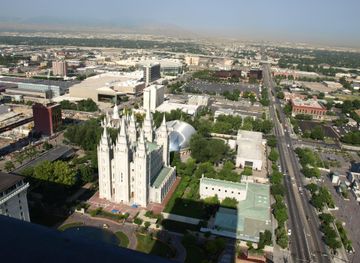
Explore Utah’s Wasatch Front for mountain trails, Great Salt Lake scenery, historic cities, museums, local food and easy urban-to-outdoor journeys.
Explore Wasatch Front
Explore more of Utah
Explore Utah's stunning national parks, rich cultural heritage, and year-round outdoor adventures. Discover why this diverse state is a top destination for travelers.
Explore Utah