

Mount Baker Travel Guide - Free Web & App
Your ultimate guide to Mount Baker. Discover top landmarks, proposed trips, and local tips. Free on the web or via the Evendo companion app.


Mount Baker, Washington, offers alpine views, glaciers, volcanic history, hiking, skiing and access to North Cascades landscapes near the Canadian border.
Volcanic Landscapes and Wilderness
Mount Baker rises in north-western Washington near the Canadian border, its snow-covered summit dominating a broad landscape of glaciers, old-growth forest, alpine meadows and deeply cut river valleys. At 3,286 metres, it is one of the most heavily glaciated volcanoes in the contiguous United States. The mountain and much of its surrounding backcountry lie within the Mount Baker Wilderness and Mount Baker-Snoqualmie National Forest, where roads give way to footpaths, climbing routes and remote natural terrain.Read more about Mount Baker
Gateway Communities and Seasonal Exploration
History and Mountain Culture
When is the best time to visit Mount Baker?
Best: June–August · 15–18°C| Month | High (°C) | Rainfall (mm) |
|---|---|---|
| January | 0 | 200 |
| February | 2 | 150 |
| March | 4 | 130 |
| April | 7 | 120 |
| May | 11 | 100 |
| June (best) | 15 | 90 |
| July (best) | 18 | 70 |
| August (best) | 17 | 70 |
| September | 15 | 90 |
| October | 11 | 130 |
| November | 6 | 170 |
| December | 2 | 190 |
Getting to and around Mount Baker
How to get there
Transportation
Best attractions in Mount Baker
The Mount Baker Highway is the principal sightseeing route, climbing from the Nooksack Valley through dense forest towards the ski area and the high country of Heather Meadows and Artist Point. Heather Meadows provides access to alpine scenery and walking routes in summer, while Artist Point is known for wide views towards Mount Baker, Mount Shuksan and surrounding North Cascades peaks when the road is open. The Mount Baker Ski Area is the main developed winter attraction, offering downhill skiing and snowboarding in a high mountain setting. Lower along the corridor, Nooksack Falls is a notable waterfall reached from a short access route, and the communities of Glacier, Maple Falls and Kendall provide the character of the gateway region rather than attractions within the wilderness itself. Beyond these accessible places, the Mount Baker Wilderness contains extensive hiking, backpacking and mountaineering terrain, including glacier approaches that require appropriate experience and equipment.
-
Tourist attraction
Mt. Baker Ski Area
Experience the thrill of winter sports and breathtaking views at Mt. Baker Ski Area, a top ski resort in Washington's North Cascades.
-
Ranch
Black Mountain Ranch
Explore the natural beauty and outdoor adventures at Black Mountain Ranch, a scenic escape in Deming, Washington, perfect for families and nature lovers.
-
Visitor center
Heather Meadows Visitor Center
Explore the stunning vistas and outdoor adventures at Heather Meadows Visitor Center, your gateway to the beauty of Washington's Mount Baker-Snoqualmie National Forest.
-
Campground
Panorama Point Campground
Experience the breathtaking beauty of nature at Panorama Point Campground, your serene getaway in Washington's Skagit County.


Best landmarks in Mount Baker
The defining landmark is Mount Baker itself, a glaciated Cascade volcano whose broad snowfields and ice-clad summit dominate views from the surrounding valleys. Nearby Mount Shuksan, visible from parts of the high country, is another prominent North Cascades peak and a major visual reference for the region. Artist Point and Heather Meadows are celebrated viewpoints and alpine landscapes at the end of the Mount Baker Highway when seasonal access permits. Nooksack Falls provides a lower-elevation natural landmark, where the Nooksack River drops through a forested gorge. The Mount Baker Ski Area is the principal developed landmark of the upper corridor, while the Mount Baker Wilderness represents the larger protected mountain landscape surrounding these accessible sites. Together, the volcano, glaciers, waterfalls, forests and high passes define a destination where natural features carry greater landmark significance than architecture.
-
Hiking area
Artist Point
Discover the breathtaking landscapes of Artist Point, a premier hiking destination in the North Cascades, ideal for nature lovers and adventure seekers.
-
Hiking area
Mt Baker National Recreation Area
Discover the breathtaking beauty and diverse activities of Mt. Baker National Recreation Area, a paradise for hikers, campers, and nature lovers in Washington State.
-
Park
Mount Baker Wilderness
Discover the untouched beauty and thrilling adventures of Mount Baker Wilderness, a paradise for nature lovers and outdoor enthusiasts in Washington State.


Explore Mount Baker on the map
Plan your trip on one map. See where the top attractions, landmarks, restaurants and hotels are, and book hotels and experiences in a few clicks.
Best hotels in Mount Baker
Best restaurants in Mount Baker
Dining around Mount Baker is concentrated in the gateway communities and recreation corridor rather than at the summit or within the wilderness. Glacier and Maple Falls provide the closest local choices for meals, refreshments and provisions, while Bellingham has the widest range of restaurants and food shops before the journey east. Visitors should expect a rural selection shaped by Pacific North-west ingredients and outdoor travel, including café food, hearty breakfasts, burgers, baked goods and casual meals rather than a dense restaurant district. Along the highway, opening patterns can be seasonal and facilities are dispersed, so self-catering supplies are sensible for longer outings or stays in cabins. Farm shops and local producers may appear in the wider Nooksack Valley, but availability varies. Food brought into the forest or backcountry should be stored and disposed of responsibly, with no assumption that remote trailheads have catering or potable water.
-
Pizza
Chair 9 Woodstone Pizza & Sports Bar
Experience delightful pizza and a vibrant bar atmosphere at Chair 9 Woodstone Pizza & Sports Bar in Glacier, WA—perfect for unwinding after outdoor adventures.
-
American
Heather Meadows Cafe
Experience delicious American cuisine with breathtaking views at Heather Meadows Cafe in Mt. Baker.
-
Restaurant
Mt. Baker Ski Area - Raven Hut Mid Mountain Day Lodge
Discover comfort and great food at Raven Hut Mid Mountain Day Lodge in Mt. Baker Ski Area - your perfect alpine escape.


Best bars in Mount Baker
Mount Baker is not a nightlife destination, and evening entertainment is limited to the small communities along the highway. Glacier and Maple Falls have a rural, early-evening atmosphere centred on local hospitality rather than nightclubs or a dedicated bar district, while visitors staying in cabins or vacation rentals often spend evenings cooking, reading or watching the weather over the mountain. Bellingham, outside the immediate mountain area, offers the region’s broader choice of pubs, breweries, bars, live music and cultural venues. In the Mount Baker corridor, darkness, distance and changing road conditions make late travel impractical, particularly in winter. Evening events and live performances should be checked locally rather than assumed, as services and seasonal patterns can change.
-
Hiking area
Artist Point
Experience breathtaking views and unparalleled hiking adventures at Artist Point, a stunning location in Washington's scenic landscape.
-
Pizza
Chair 9 Woodstone Pizza & Sports Bar
Discover the perfect blend of great pizza and a lively sports bar atmosphere at Chair 9 in Glacier, WA. Ideal for families and adventurers!
-
Grill
The Lonestar
Discover The Lonestar in Concrete, WA - the perfect grill and breakfast restaurant for delicious meals in a warm and inviting atmosphere.
-
Restaurant
Wake 'N Bakery
Experience the warmth of community and delicious flavors at Wake 'N Bakery, where freshly baked goods and hearty meals await in Deming, Washington.


Best nightclubs in Mount Baker
Mount Baker is not a nightlife destination, and evening entertainment is limited to the small communities along the highway. Glacier and Maple Falls have a rural, early-evening atmosphere centred on local hospitality rather than nightclubs or a dedicated bar district, while visitors staying in cabins or vacation rentals often spend evenings cooking, reading or watching the weather over the mountain. Bellingham, outside the immediate mountain area, offers the region’s broader choice of pubs, breweries, bars, live music and cultural venues. In the Mount Baker corridor, darkness, distance and changing road conditions make late travel impractical, particularly in winter. Evening events and live performances should be checked locally rather than assumed, as services and seasonal patterns can change.
-
Club
Mt Baker Rim Community Club
Discover the lively atmosphere at Mt Baker Rim Community Club, where entertainment meets the breathtaking beauty of Washington's landscapes.

Best shops in Mount Baker
Shopping in the Mount Baker area is modest and practical, with supplies concentrated in Bellingham and smaller provisions available in communities such as Maple Falls, Kendall and Glacier. Rural shops may stock food, drinks, basic travel necessities and outdoor essentials, but visitors should assemble specialist equipment and substantial provisions before heading up the highway. The area’s most characteristic purchases are likely to come from regional food producers, small independent businesses and outdoor retailers in the wider Nooksack Valley rather than from a dedicated shopping district at the mountain. Bellingham offers the broadest selection of gifts, clothing, camping equipment and local products. Craft and artisan goods may be found through individual businesses or seasonal events, but permanent markets and extensive retail facilities should not be expected near the wilderness or ski area.
-
Ski resort
Mt. Baker Ski Area
Discover the thrill of skiing at Mt. Baker Ski Area, renowned for its epic snowfall and breathtaking views in the heart of the North Cascades.
-
Hiking area
Artist Point
Explore the breathtaking views and diverse trails of Artist Point, a premier hiking destination in the North Cascades of Washington.
-
Bakery
5b's Bakery & Eatery
Experience the warmth and flavor of 5b's Bakery & Eatery in Concrete, WA, where delicious pastries and hearty breakfasts await in a cozy atmosphere.
-
Mountain peak
Mt Baker
Discover the stunning beauty and adventure of Mt. Baker, a premier mountain peak in Washington renowned for outdoor activities and breathtaking landscapes.


Get your free copy of our complete guide to Mount Baker, delivered straight to you.
Everything on this page, from attractions and restaurants to essentials and local phrases, in one PDF you can read offline, print or share.
Already have an account? Sign in
Your Mount Baker guide is ready.
We'll send it to · Not you? Sign out

Getting your guide ready…
We are putting together a fresh copy of the Mount Baker guide. This can take up to a minute.
This can take a few moments. If your browser asks, choose Allow so the download can start. You'll find the guide in your Downloads folder.
Nothing happened? Download it again
Sorry, the guide is taking longer than usual. Please try again in a minute, or get it by email instead.
Mount Baker essentials
Currency and Payment
Safety
Emergency Situations
Do's and Don'ts
Local Tips
From Eve
Local phrases worth knowing
You don't need to get them perfect. A few words go a long way, and locals appreciate the effort.
Basics
| English | Local | Say it |
|---|---|---|
| Hello | Hi | [haɪ] |
| Goodbye | See ya | [si jə] |
| Yes | Yep | [jɛp] |
| No | Nope | [noʊp] |
| Please/You're welcome | Please/You're welcome | [pliːz/jʊr ˈwɛlkəm] |
| Thank you | Thanks | [θæŋks] |
| Excuse me/Sorry | Excuse me/Sorry | [ɪkˈskjuz mi/ˈsɔri] |
| How are you? | How's it going? | [haʊz ɪt ˈɡoʊɪŋ] |
| Fine. And you? | Good. You? | [ɡʊd ju] |
| Do you speak English? | Do you speak English? | [du jʊ spiːk ˈɪŋɡlɪʃ] |
| I don't understand | I don't get it | [aɪ doʊnt ɡɛt ɪt] |
Eating & Drinking
| English | Local | Say it |
|---|---|---|
| I'd like to see the menu, please | Can I see the menu? | [kæn aɪ siː ðə ˈmɛnjuː] |
| I don't eat meat | I'm vegetarian | [aɪm ˌvɛdʒəˈtɛriən] |
| Cheers! | Cheers! | [ʧɪrz] |
| I would like to pay, please | I'll pay now | [aɪl peɪ naʊ] |
Emergencies
| English | Local | Say it |
|---|---|---|
| Help! | Help! | [hɛlp] |
| Go away! | Get lost! | [ɡɛt lɔst] |
| Call the Police! | Call the cops! | [kɔl ðə kɑps] |
| Call a doctor! | Get a doc! | [ɡɛt ə dɑk] |
| I'm lost | I'm lost | [aɪm lɔst] |
| I'm ill | I'm sick | [aɪm sɪk] |
Shopping
| English | Local | Say it |
|---|---|---|
| I'd like to buy... | I wanna buy... | [aɪ ˈwɑnə baɪ] |
| I'm just looking | Just browsing | [ʤʌst ˈbraʊzɪŋ] |
| How much is it? | How much? | [haʊ mʌʧ] |
| That's too expensive | That's pricey | [ðæts ˈpraɪsi] |
| Can you lower the price? | Can you do a deal? | [kæn jʊ duː ə dil] |
Time & Numbers
| English | Local | Say it |
|---|---|---|
| What time is it? | What's the time? | [wɑts ðə taɪm] |
| It's one o'clock | It's one | [ɪts wʌn] |
| Half past (10) | Half past ten | [hɑf pæst tɛn] |
| Morning | Morning | [ˈmɔrnɪŋ] |
| Afternoon | Afternoon | [ˌæftərˈnun] |
| Evening | Evening | [ˈivnɪŋ] |
| Yesterday | Yesterday | [ˈjɛstərˌdeɪ] |
| Today | Today | [təˈdeɪ] |
| Tomorrow | Tomorrow | [təˈmɑroʊ] |
| 1 | One | [wʌn] |
| 2 | Two | [tu] |
| 3 | Three | [θri] |
| 4 | Four | [fɔr] |
| 5 | Five | [faɪv] |
| 6 | Six | [sɪks] |
| 7 | Seven | [ˈsɛvən] |
| 8 | Eight | [eɪt] |
| 9 | Nine | [naɪn] |
| 10 | Ten | [tɛn] |
Transport & Directions
| English | Local | Say it |
|---|---|---|
| Where's a/the...? | Where's the...? | [wɛrz ðə] |
| What's the address? | What's the address? | [wɑts ðə ˈædrɛs] |
| Can you show me (on the map)? | Can you show me (on the map)? | [kæn jʊ ʃoʊ mi (ɒn ðə mæp)] |
| When's the next (bus)? | When's the next (bus)? | [wɛnz ðə nɛkst (bʌs)] |
| A ticket (to ....) | A ticket (to ....) | [ə ˈtɪkɪt (tu)] |
History of Mount Baker
A Volcano Shaped by Ice
Mount Baker is a stratovolcano built through successive volcanic activity, although the visible character of the mountain is now strongly defined by ice. Glaciers descend from its upper slopes into valleys that have been widened and deepened by glacial erosion. The mountain remains part of the Cascade volcanic chain, but the area’s modern visitor identity is associated more with snowfields, glacier travel and alpine scenery than with visible eruptions. Its extensive ice cover also makes Mount Baker an important setting for observing the effects of changing climate and retreating glaciers.
Indigenous Homelands and Names
The mountain stands within the traditional homelands and cultural landscapes of Coast Salish peoples, including Nooksack and other neighbouring communities. Indigenous relationships with the rivers, forests, plants and high country long predate the arrival of European and American explorers. The name Mount Baker reflects a later colonial naming tradition, while Indigenous names and knowledge continue to express different understandings of the mountain and its significance. Visitors should recognise that the landscape is not simply wilderness without human history.
Exploration and Early Industries
European and American exploration of the northern Cascades increased during the nineteenth century, followed by settlement and resource development in the foothills. Forestry, mining and transport shaped communities along routes that later became gateways to recreation. The valleys around the Nooksack River supported working landscapes, while the steep upper country remained difficult to access. These industries left a historical imprint on the region even though much of the high mountain area is now managed primarily for conservation and public recreation.
Mountaineering and Winter Recreation
Mount Baker became increasingly known to climbers and outdoor travellers as routes into the high Cascades improved. The establishment of protected public lands helped retain large areas of forest and alpine terrain, while the Mount Baker Ski Area later developed at the end of the Mount Baker Highway. Winter sports, summer hiking and mountaineering now coexist with wilderness management. Recreation remains dependent on weather, snowpack, road access and the technical nature of the mountain environment rather than on a dense network of urban facilities.
Mount Baker in Photos
Browse through our photo collection highlighting the charm and character of the destination.
Neighbouring destination travel guides
The closest destinations to Mount Baker, if you have time for more than one.
-
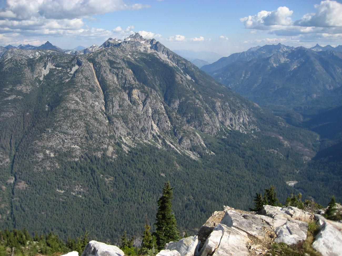 North Cascades National Park
 in Washington offers glaciers, alpine lakes, jagged peaks, wilderness trails and scenic drives through the American mountains.
-

-

-

-


Swipe for more destinations
Explore more
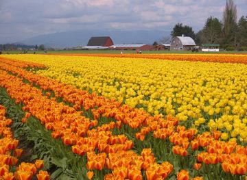
Explore more of The Skagit Valley
Explore Washington's Skagit Valley for tulip fields, river towns, wildlife refuges, farm produce and Salish Sea landscapes.
Explore The Skagit Valley
Explore more of Washington
Explore Washington State: From the vibrant streets of Seattle to the tranquil beauty of the Olympic Peninsula, discover the diverse landscapes, culture, and adventures awaiting you.
Explore Washington