When is the best time to go to Greenbrier River Trail?
Weather at a glance
Use the monthly temperature and precipitation trends to compare typical conditions across the year before planning city walks, museum days, and riverside exploring.

Discover the Greenbrier River Trail in West Virginia: 78 miles of stunning scenery, rich history, and outdoor adventure in the heart of the Appalachian Mountains.
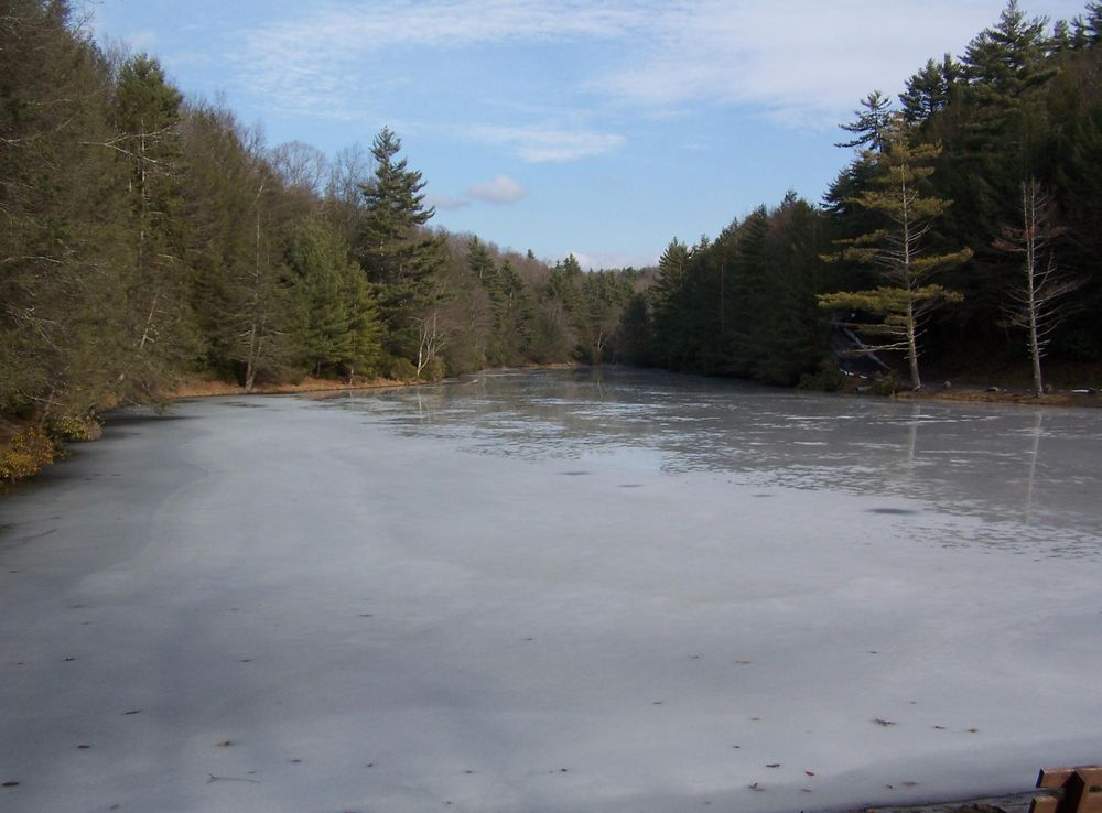
The Greenbrier River Trail in West Virginia is a must-visit for nature enthusiasts and adventure seekers alike. Spanning 78 miles, this former railroad turned rail-trail offers a picturesque journey through the heart of the Appalachian Mountains. The trail follows the meandering Greenbrier River, providing stunning views of the water, lush forests, and the occasional wildlife sighting. The trail is open year-round and is ideal for activities such as hiking, biking, and horseback riding. Each season brings its own unique charm, from the vibrant fall foliage to the blooming wildflowers in spring. With numerous access points, the trail is easily customizable for short day trips or extended multi-day excursions. The small towns along the trail offer quaint lodging and dining options, making it a perfect blend of adventure and comfort. For those seeking a bit of history, the trail features several historical markers and remnants of the old railroad. The Cass Scenic Railroad State Park, located near the trail, offers an opportunity to ride a historic steam train and learn about the region's rich railroading past. Whether you are a seasoned outdoor enthusiast or a family looking for a scenic getaway, the Greenbrier River Trail promises an unforgettable experience.
Jump straight into the city guide by the kind of discovery you want first.
Weather at a glance
Use the monthly temperature and precipitation trends to compare typical conditions across the year before planning city walks, museum days, and riverside exploring.

Explore expert travel guides, compare and book tours, experiences, hotels, and more—all from the palm of your hand. Download now for seamless trip planning wherever your wanderlust takes you.
Core city planning details in the same structured guide format used across the Country/Region page language.
Greenbrier River Trail is located in the eastern part of West Virginia, United States. The nearest major city is Lewisburg, which has a regional airport, Greenbrier Valley Airport (LWB). For international travelers, the closest major airports are Roanoke-Blacksburg Regional Airport (ROA) in Roanoke, Virginia, and Yeager Airport (CRW) in Charleston, West Virginia. From these airports, you can rent a car and drive to the trail. The drive from Roanoke takes approximately 2 hours, while the drive from Charleston takes about 2.5 hours.
The best way to explore the Greenbrier River Trail and its surrounding areas is by car. Car rentals are available at nearby airports and in larger towns such as Lewisburg. The trail itself is ideal for cycling, walking, and horseback riding. There are several outfitters along the trail where you can rent bicycles and other equipment. Public transportation options are limited in this rural area, so having your own vehicle is highly recommended.
The official currency in the United States is the US Dollar (USD). Credit and debit cards are widely accepted in most establishments, including hotels, restaurants, and shops along the Greenbrier River Trail. However, it is advisable to carry some cash, especially in smaller towns and for transactions at local vendors and markets. ATMs are available in larger towns like Lewisburg and Marlinton.
The Greenbrier River Trail is generally a safe destination for tourists. However, it is always important to take standard safety precautions. Keep an eye on your belongings, especially in crowded areas, and avoid walking alone at night. There are no specific high-crime areas targeting tourists, but it is always best to stay vigilant and aware of your surroundings. Additionally, be mindful of wildlife and ensure you follow trail safety guidelines.
In case of emergency, dial 911 for immediate assistance. There are medical facilities in nearby towns such as Lewisburg and Marlinton. It is recommended to have travel insurance that covers medical emergencies. For minor health issues, there are pharmacies in these towns where you can purchase over-the-counter medications. Additionally, inform someone of your planned route and expected return time when venturing into more remote areas of the trail.
Fashion: Do wear comfortable, weather-appropriate clothing and sturdy footwear for hiking or biking. Layering is recommended due to variable weather conditions. Avoid wearing overly revealing clothing. Religion: There are no specific religious customs to be aware of along the trail, but always show respect at any historical or cultural sites. Public Transport: Public transport is limited, so plan to use a car or bicycle for most of your travel. Greetings: A friendly greeting such as 'hello' or a nod is common. Locals are generally welcoming and helpful. Eating & Drinking: Do try local eateries and sample regional cuisine. Don’t litter; always carry your trash and dispose of it properly.
To experience the Greenbrier River Trail like a local, consider staying in a bed and breakfast or a local inn. Engage with locals at farmers' markets and small-town shops. Participate in local events and festivals, which are often listed in community calendars. Don’t miss the opportunity to paddle the Greenbrier River in a kayak or canoe, as it offers a unique perspective of the scenic surroundings. For a special treat, visit the Jefferson National Forest, which offers additional trails and natural beauty.
Follow the city from Roman Londinium to its modern global identity through landmark moments that still shape the visitor experience.
The Greenbrier River Trail began its life as a railroad corridor, constructed in the early 1900s by the Chesapeake and Ohio Railway. This rail line was crucial for transporting timber and coal from the rugged Appalachian Mountains to larger markets. Over the years, the railroad served as a vital economic artery for the communities along the Greenbrier River, facilitating commerce and communication in an otherwise remote region.
By the mid-20th century, the importance of the railroad began to wane due to the rise of highway transportation and the decline in coal production. The Chesapeake and Ohio Railway ultimately abandoned the line in the 1970s, leaving behind a stretch of unused railway. In 1980, recognizing the potential for recreational use, the state of West Virginia acquired the corridor and transformed it into a rail-trail for bikers, hikers, and equestrians, officially opening the Greenbrier River Trail in 1985.
The creation of the Greenbrier River Trail was largely facilitated by the Pocahontas Land Corporation, which donated significant portions of the abandoned rail corridor to the state. This act of philanthropy was instrumental in the establishment of one of West Virginia's most cherished recreational trails, preserving the natural beauty of the Greenbrier River Valley for future generations.
The Greenbrier River Trail features numerous engineering marvels from its days as a railway, including 35 bridges and two tunnels. The Droop Mountain Tunnel, stretching 511 feet, is a notable landmark, exemplifying early 20th-century engineering prowess. These structures not only add to the trail's scenic allure but also serve as historical artifacts, reminding visitors of the trail's industrial past.
Before the arrival of European settlers and the advent of the railroad, the Greenbrier River Valley was home to various Indigenous tribes, including the Shawnee. The river and its surrounding lands were rich in resources and held significant cultural importance. Artifacts and remnants of these early inhabitants can still be found along the trail, offering a glimpse into the region's ancient history.
The Greenbrier River Valley played a strategic role during the American Civil War. Both Union and Confederate forces recognized the importance of the region's transportation routes and natural resources. Skirmishes and troop movements occurred around the area, leaving behind a legacy of battle sites and historical markers that can be explored along the trail.
Today, the Greenbrier River Trail is not only a hub for outdoor recreation but also a venue for various cultural festivals and events. The annual Great Greenbrier River Race, for example, attracts participants from across the country, celebrating the community spirit and natural beauty of the region. These events highlight the trail's role in fostering local culture and heritage.
Browse practical local phrases by situation. Each group opens only when needed, keeping the guide tidy while preserving the full phrase set.
A quick visual tour through classic views, riverside landmarks, royal streets, and skyline moments.


Continue exploring nearby destinations and classic US city breaks after Greenbrier River Trail.


