

Ice Age Trail Travel Guide - Free Web & App
Your ultimate guide to Ice Age Trail. Discover top landmarks, proposed trips, and local tips. Free on the web or via the Evendo companion app.


Ice Age Trail in Wisconsin follows glacial ridges, kettles, forests and prairies, linking state parks, small towns and long-distance hiking adventures.
A Trail Shaped by Ice
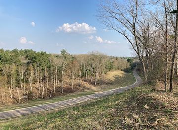
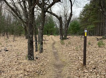
The Ice Age Trail is a long-distance footpath extending for roughly 1,200 miles across Wisconsin, following landscapes formed or reshaped by the last continental glaciation. Designated a National Scenic Trail, it runs between Interstate State Park near St Croix Falls on the Minnesota border and Potawatomi State Park near Sturgeon Bay, although its route is divided into many sections rather than experienced as one continuous walk by most visitors. The trail crosses wooded moraines, open prairies, kettle ponds, wetlands, drumlins, eskers and rolling farm country, revealing the variety of Wisconsin’s glacial terrain.Read more about Ice Age Trail
Communities and Conservation
Walking Through Wisconsin
When is the best time to visit Ice Age Trail?
Best: June–August · 25–27°C| Month | High (°C) | Rainfall (mm) |
|---|---|---|
| January | -4 | 30 |
| February | -1 | 25 |
| March | 6 | 35 |
| April | 13 | 50 |
| May | 21 | 60 |
| June (best) | 26 | 70 |
| July (best) | 27 | 80 |
| August (best) | 25 | 70 |
| September | 21 | 60 |
| October | 14 | 50 |
| November | 6 | 40 |
| December | -1 | 30 |
Getting to and around Ice Age Trail
How to get there
Transportation
Best attractions in Ice Age Trail
The Ice Age Trail’s principal attractions are the landscapes it links rather than a single visitor complex. Devil’s Lake State Park is one of the best-known sections, with quartzite bluffs, wooded slopes and glacial scenery around the lake, while the Kettle Moraine region contains kettle depressions, moraines and forested hiking country. In the west, the route approaches Interstate State Park and the St Croix River landscape; in the east, it reaches Potawatomi State Park near Sturgeon Bay and the Door County peninsula. Central and northern sections pass through prairies, wetlands, working farmland, county forests and quiet glacial ridges. The Ice Age National Scientific Reserve sites, including preserved examples of moraines, kettles and other landforms, add geological context. Small towns and rural communities along the route provide access points, local history and practical services, but the distance between them makes detailed section planning essential.
-
Tourist attraction
Ledge View Nature Center
Explore Ledge View Nature Center: A tranquil escape in Wisconsin with scenic trails, wildlife encounters, and educational experiences for all ages.
-
Hiking area
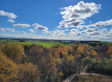
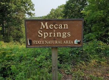
Ice Age Trail-Mecan River Segment north
Explore the stunning landscapes of the Ice Age Trail-Mecan River Segment, a hiker's paradise in Wisconsin that reveals the beauty of nature shaped by glaciers.
Best landmarks in Ice Age Trail
The Ice Age Trail’s defining landmarks are glacial landforms preserved across Wisconsin. The quartzite bluffs and lake basin at Devil’s Lake are among its most recognisable scenes, while the Kettle Moraine landscape is marked by ridges, kettle holes and other deposits left by retreating ice. The trail also crosses drumlin country, eskers, wetlands and broad outwash areas, each revealing a different phase of glacial movement. Interstate State Park at the western end adds the steep St Croix River gorge and exposed rock scenery, while Potawatomi State Park marks the eastern terminus in Door County. Individual trail segments pass historic farms, rural roads, forests and communities whose character reflects settlement and land use, but the route’s principal significance lies in how these natural and human landmarks are connected into one geological narrative.
-
Nature preserve
Observatory Hill State Natural Area
Explore breathtaking landscapes and diverse ecosystems at Observatory Hill State Natural Area, a nature preserve perfect for outdoor enthusiasts in Wisconsin.
-
Hiking area
Ice Age Trail-Mecan River Segment north
Discover the stunning Ice Age Trail - Mecan River Segment, a captivating hiking destination in Wisconsin with breathtaking landscapes and diverse wildlife.
-
Hiking area
Ice Age Trail Parking - Waupaca River Segment
Discover the breathtaking landscapes of the Ice Age Trail Parking - Waupaca River Segment, where nature and history intertwine in a scenic hiking paradise.
-
Hiking area
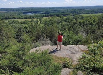
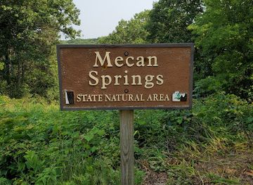
Ice Age Trail-Wedde Creek Segment south
Discover the enchanting Ice Age Trail-Wedde Creek Segment in Coloma, Wisconsin—a hiker's paradise showcasing glacial landscapes and stunning natural beauty.
Explore Ice Age Trail on the map
Plan your trip on one map. See where the top attractions, landmarks, restaurants and hotels are, and book hotels and experiences in a few clicks.
Best hotels in Ice Age Trail
Best nightclubs in Ice Age Trail
Evening entertainment along the Ice Age Trail is generally low-key and community-based rather than concentrated in nightlife districts. Village taverns, traditional supper-club bars, breweries and casual restaurants in gateway towns provide places for a meal or drink after walking, while larger nearby centres such as Madison, Green Bay and the Twin Cities offer a broader choice of music, theatre and late-evening venues outside the trail itself. In smaller communities, opening patterns and entertainment options can be limited, particularly away from the main towns or outside the summer season. Some state parks and rural areas are quiet after dark, with visitors spending the evening at accommodation or campsites where permitted. Check local arrangements in advance and plan transport responsibly after drinking.
-
Night club
The ReMixx, Your NightLife Destination
Unleash your energy at The ReMixx, Neenah's premier night club offering a vibrant atmosphere, great music, and an unforgettable nightlife experience.

Get your free copy of our complete guide to Ice Age Trail, delivered straight to you.
Everything on this page, from attractions and restaurants to essentials and local phrases, in one PDF you can read offline, print or share.
Already have an account? Sign in
Your Ice Age Trail guide is ready.
We'll send it to · Not you? Sign out

Getting your guide ready…
We are putting together a fresh copy of the Ice Age Trail guide. This can take up to a minute.
This can take a few moments. If your browser asks, choose Allow so the download can start. You'll find the guide in your Downloads folder.
Nothing happened? Download it again
Sorry, the guide is taking longer than usual. Please try again in a minute, or get it by email instead.
Ice Age Trail essentials
Currency and Payment
Safety
Emergency Situations
Do's and Don'ts
Local Tips
From Eve
Local phrases worth knowing
You don't need to get them perfect. A few words go a long way, and locals appreciate the effort.
Basics
| English | Local | Say it |
|---|---|---|
| Hello | Howdy | [haw-dee] |
| Goodbye | See ya | [see yah] |
| Yes | Yah | [yah] |
| No | Nah | [nah] |
| Please/You're welcome | Please/No problem | [pleez/no prob-lem] |
| Thank you | Thanks a bunch | [thanks uh buhnch] |
| Excuse me/Sorry | Pardon me/My bad | [par-dn me/my bad] |
| How are you? | How's it goin'? | [hows it go-in] |
| Fine. And you? | Good. How 'bout you? | [good. how bout yoo] |
| Do you speak English? | Kin ya talk English? | [kin yuh talk ing-lish] |
| I don't understand | I'm lost | [im lost] |
Eating & Drinking
| English | Local | Say it |
|---|---|---|
| I'd like to see the menu, please | Lemme see the grub list, please | [lem-me see the gruhb list, please] |
| I don't eat meat | I'm veggie | [im veh-jee] |
| Cheers! | Bottoms up! | [bot-ums up] |
| I would like to pay, please | Check, please | [chek, please] |
Emergencies
| English | Local | Say it |
|---|---|---|
| Help! | SOS! | [ess-oh-ess] |
| Go away! | Scram! | [skram] |
| Call the Police! | Ring the cops! | [ring the cops] |
| Call a doctor! | Get a doc! | [get a doc] |
| I'm lost | I'm off the map | [im off the map] |
| I'm ill | I'm under the weather | [im un-der the weath-ur] |
Shopping
| English | Local | Say it |
|---|---|---|
| I'd like to buy... | I wanna get... | [i wanna get] |
| I'm just looking | Jus' browsin' | [jus brows-in] |
| How much is it? | How 'spensive? | [how spen-siv] |
| That's too expensive | Too pricy | [too prye-see] |
| Can you lower the price? | Can ya knock it down? | [can yuh nok it down] |
Time & Numbers
| English | Local | Say it |
|---|---|---|
| What time is it? | What's the time? | [whats the time] |
| It's one o'clock | It's one | [its one] |
| Half past (10) | Ten-thirty | [ten-thur-tee] |
| Morning | Mornin' | [morn-in] |
| Afternoon | Afternoon | [after-noon] |
| Evening | Evenin' | [even-in] |
| Yesterday | Yest'day | [yes-tuh-day] |
| Today | Today | [to-day] |
| Tomorrow | Tomorrer | [to-mor-ur] |
| 1 | One | [wun] |
| 2 | Two | [too] |
| 3 | Three | [three] |
| 4 | Four | [for] |
| 5 | Five | [fahyv] |
| 6 | Six | [siks] |
| 7 | Seven | [sev-un] |
| 8 | Eight | [ate] |
| 9 | Nine | [nine] |
| 10 | Ten | [ten] |
Transport & Directions
| English | Local | Say it |
|---|---|---|
| Where's a/the...? | Where's the...? | [wheres the] |
| What's the address? | Where's the addy? | [wheres the add-ee] |
| Can you show me (on the map)? | Show me | [show me] |
| When's the next (bus)? | When's the next bus? | [whens the next bus] |
| A ticket (to ....) | A ticket | [a ticket] |
History of Ice Age Trail
The Glacial Foundation
The Ice Age Trail follows landforms created or modified during the Wisconsin Glaciation, the most recent major advance of the Laurentide Ice Sheet across the region. As ice moved, paused and melted, it left moraines, eskers, drumlins, kettles and outwash plains, while areas beyond the furthest advance retained older landscapes. The trail’s route was conceived to reveal this geological story on foot, linking some of the clearest surviving expressions of glacial topography in Wisconsin. Its name refers to the Ice Age National Scientific Reserve, a collection of protected sites established to preserve nationally significant glacial features.
Indigenous Homelands and Early Settlement
The landscapes crossed by the trail are Indigenous homelands with long histories of seasonal movement, hunting, fishing, cultivation and cultural connection. Menominee, Ho-Chunk, Ojibwe, Potawatomi and other Native nations have enduring relationships with Wisconsin’s forests, wetlands, rivers and prairies. European American settlement later brought farms, roads, mills and altered drainage patterns, while many communities developed around transport routes and local industries. The present trail passes through a lived-in landscape rather than an untouched wilderness, and responsible visitors should recognise both its Indigenous history and continuing Native presence.
Farms, Forests and Changing Land Use
During the nineteenth and twentieth centuries, much of the region was transformed by agriculture, logging, settlement and expanding transport networks. Forest clearance created fields and pasture in southern Wisconsin, while timber harvesting shaped the northern sections. Abandoned farms, regenerating woodland, remnant prairie and managed wetlands now form part of the trail’s varied scenery. In places, conservation has restored or protected habitats that had become fragmented, allowing the route to function not only as a recreational corridor but also as a thread connecting public forests, parks and natural areas.
From Concept to National Scenic Trail
The idea for a continuous footpath tracing Wisconsin’s glacial features emerged in the mid-twentieth century through the work of conservationists and public agencies. Congress established the Ice Age National Scenic Trail in 1980, recognising it as part of the National Trails System. The route remains a work in progress: some sections are complete and permanently protected, while others rely on connecting roads or evolving alignments. The Ice Age Trail Alliance, volunteers, landowners and government agencies have played an important role in acquiring easements, improving route continuity and caring for the trail.
A Living Conservation Landscape
Today the Ice Age Trail represents both geological interpretation and active landscape stewardship. Its route crosses state parks, county forests, wildlife areas, private holdings and working countryside, so protection depends on cooperation between public bodies, local communities and landowners. Maintenance includes waymarking, erosion control, habitat care and adapting sections to changing access conditions. The trail’s modern history is therefore not simply the story of a completed path, but of an evolving effort to preserve Wisconsin’s glacial landforms while allowing low-impact recreation and continued community use.
Ice Age Trail in Photos
Browse through our photo collection highlighting the charm and character of the destination.
Cities in Ice Age Trail
The towns and cities of Ice Age Trail, and the easiest places to base yourself.
-

-


Swipe for more cities
Neighbouring destination travel guides
The closest destinations to Ice Age Trail, if you have time for more than one.
-

-

-

-
-


Swipe for more destinations
Explore more
Explore more of Central Sands
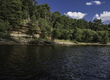
Explore Central Sands, Wisconsin, for cranberry country, pine forests, river towns, wildlife areas, trails and relaxed outdoor travel.
Explore Central Sands
Explore more of Wisconsin
Discover Wisconsin: A Midwestern gem offering stunning natural landscapes, rich cultural experiences, and a taste of America's finest dairy products.
Explore Wisconsin