

Westend (Frankfurt) Travel Guide - Free
Explore Westend in Frankfurt with Evendo's free guide. Find the best shops, historic streets, restaurants, and gems on web or mobile.


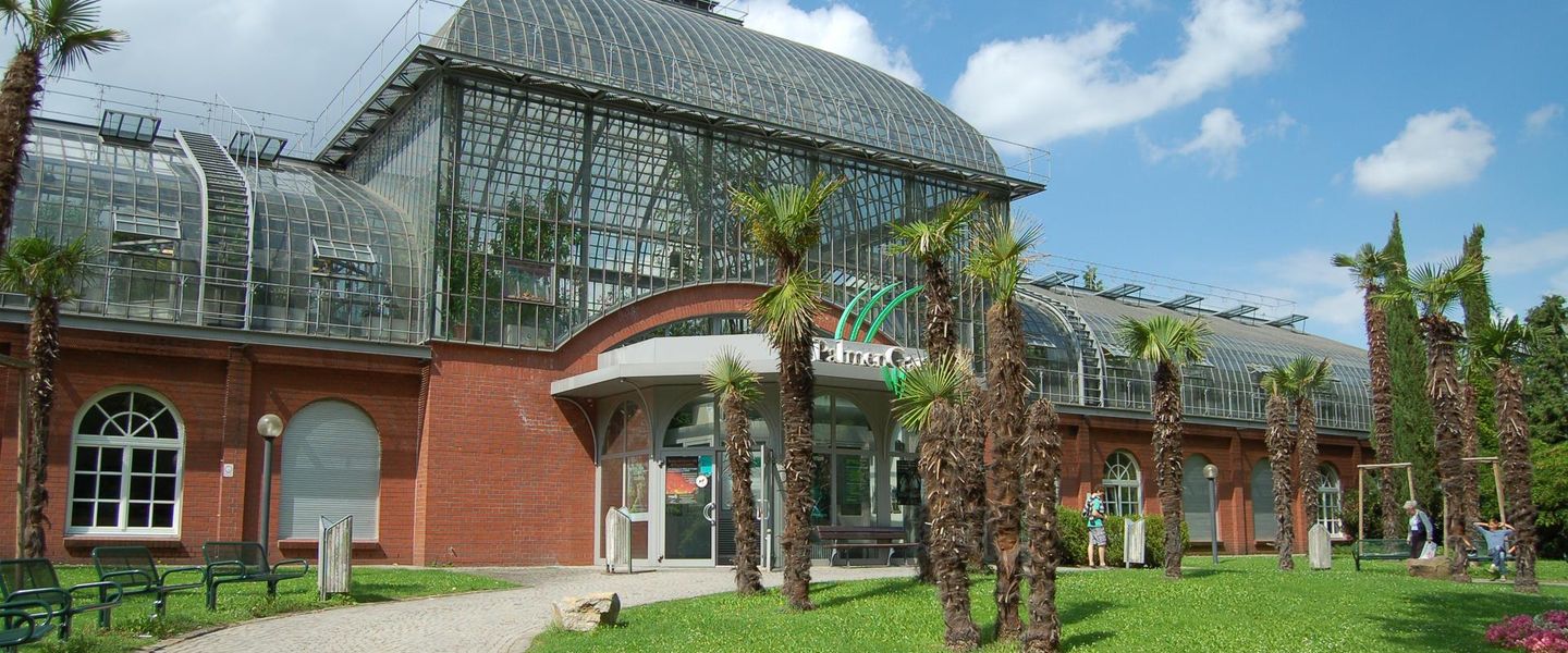


Westend Frankfurt blends leafy villa streets, Palmengarten, Senckenberg Museum, Jewish heritage, Goethe University and easy access to the Messe.
A Leafy Western Quarter
Westend occupies a broad stretch immediately west of Frankfurt's Innenstadt, extending from the business district towards Bockenheim and the Messe. It is commonly understood as two contrasting areas: Westend-Süd, with grand late-nineteenth-century villas, offices and elegant apartment buildings, and the quieter, greener Westend-Nord, where residential streets meet the Palmengarten and Grüneburgpark. The district is prosperous without being uniformly formal; cafés, university life, embassies and long-established local businesses give its streets a more varied rhythm than its reputation for affluence might suggest.Read more about Westend
Architecture and Green Space
Culture, Memory and University Life
Explore Westend on the map
A handpicked selection of must-see spots in Westend, mapped for you.
Best hotels in Westend
Westend essentials
Getting There
Getting Around
Safety
Emergency Situations
Do's and Don'ts
Local Tips

From Eve
Local phrases worth knowing
You don't need to get them perfect. A few words go a long way, and locals appreciate the effort.
Basics
| English | Local | Say it |
|---|---|---|
| Hello | Hallo | [hah-loh] |
| Goodbye | Auf Wiedersehen | [owf vee-der-zay-en] |
| Yes | Ja | [yah] |
| No | Nein | [nine] |
| Please/You're welcome | Bitte | [bih-tuh] |
| Thank you | Danke | [dahn-kuh] |
| Excuse me/Sorry | Entschuldigung | [ent-shool-dee-goong] |
| How are you? | Wie geht es dir? | [vee gayt es deer] |
| Fine. And you? | Gut. Und dir? | [goot oont deer] |
| Do you speak English? | Sprechen Sie Englisch? | [shpreh-khen zee eng-lish] |
| I don't understand | Ich verstehe nicht | [ikh fer-shtay-uh nikht] |
Eating & Drinking
| English | Local | Say it |
|---|---|---|
| I'd like to see the menu, please | Ich würde gerne die Speisekarte sehen, bitte | [ikh vur-deh gehr-neh dee shpy-zuh-kahr-teh zay-en, bih-tuh] |
| I don't eat meat | Ich esse kein Fleisch | [ikh ess-uh kine flysh] |
| Cheers! | Prost! | [prohst] |
| I would like to pay, please | Ich möchte bitte bezahlen | [ikh mehrkhte bih-tuh beh-tsah-len] |
Emergencies
| English | Local | Say it |
|---|---|---|
| Help! | Hilfe! | [hil-feh] |
| Go away! | Geh weg! | [geh vehg] |
| Call the Police! | Rufen Sie die Polizei! | [roo-fen zee dee poh-lee-tsey] |
| Call a doctor! | Rufen Sie einen Arzt! | [roo-fen zee iyn-en artsht] |
| I'm lost | Ich habe mich verirrt | [ikh hah-buh meesh fer-eert] |
| I'm ill | Ich bin krank | [ikh been krahngk] |
Shopping
| English | Local | Say it |
|---|---|---|
| I'd like to buy... | Ich würde gerne kaufen... | [ikh vur-deh gehr-neh kow-fen] |
| I'm just looking | Ich schaue nur | [ikh shou-eh noor] |
| How much is it? | Wie viel kostet es? | [vee feel koh-stet es] |
| That's too expensive | Das ist zu teuer | [dahs ist tsoy toy-er] |
| Can you lower the price? | Können Sie den Preis senken? | [kern-en zee den prees zayn-ken] |
Time & Numbers
| English | Local | Say it |
|---|---|---|
| What time is it? | Wie spät ist es? | [vee shpet ist es] |
| It's one o'clock | Es ist ein Uhr | [es ist iyn oor] |
| Half past (10) | Halb (zehn) vor | [hahlp (tsayn) for] |
| Morning | Morgen | [mor-gen] |
| Afternoon | Nachmittag | [nahk-mit-tahk] |
| Evening | Abend | [ah-bend] |
| Yesterday | Gestern | [geh-stern] |
| Today | Heute | [hoy-teh] |
| Tomorrow | Morgen | [mor-gen] |
| 1 | Eins | [ines] |
| 2 | Zwei | [tsvai] |
| 3 | Drei | [dry] |
| 4 | Vier | [feer] |
| 5 | Fünf | [foonf] |
| 6 | Sechs | [zeks] |
| 7 | Sieben | [zee-ben] |
| 8 | Acht | [ahkt] |
| 9 | Neun | [noyn] |
| 10 | Zehn | [tsayn] |
Transport & Directions
| English | Local | Say it |
|---|---|---|
| Where's a/the...? | Wo ist ein/der...? | [voh ist iyn/dehr] |
| What's the address? | Was ist die Adresse? | [vahs ist dee ah-dreh-suh] |
| Can you show me (on the map)? | Können Sie mir zeigen (auf der Karte)? | [kern-en zee meer tsay-gen (ouf dehr kar-teh)] |
| When's the next (bus)? | Wann kommt der nächste (Bus)? | [vahn kohmt dehr nekhs-teh (boos)] |
| A ticket (to ....) | Eine Fahrkarte (nach ....) | [iyn-uh fahr-kar-teh (nahkh ....)] |
History of Westend
From Fields to Western Expansion
Before Frankfurt's nineteenth-century expansion, much of the area west of the old city consisted of gardens, agricultural land and open ground beyond the former fortifications. The removal of the city walls and the growth of Frankfurt after the Napoleonic period made outward development possible. Streets were gradually laid out west of the old centre, and the district became part of the city's new residential belt. Its name reflects this position on Frankfurt's western side rather than an ancient settlement of its own. The transformation accelerated as the city gained population, wealth and improved transport connections during the nineteenth century.
The Gründerzeit Residential Quarter
During the late nineteenth and early twentieth centuries, Westend developed into one of Frankfurt's preferred residential districts for affluent families and professionals. Apartment blocks, detached villas and representative streets replaced much of the former open land, with landscaped gardens helping to distinguish the area from denser commercial quarters. The Palmengarten, opened in 1871, became a major public horticultural institution and helped establish Westend's enduring association with cultivated greenery. The Senckenberg Natural History Museum, founded in the district in the nineteenth century, added a scientific and educational presence that still shapes Westend's cultural identity.
Jewish Life and the Westend Synagogue
Westend became an important location for Frankfurt's Jewish community as the city expanded westward. The Westend Synagogue, built between 1908 and 1910 on Freiherr-vom-Stein-Strasse, served a growing congregation and represented the established presence of Jewish life in the district. Under National Socialism, Frankfurt's Jewish community was persecuted, dispossessed and deported, while the synagogue suffered damage during the war years but survived. Its continued use after restoration makes it one of the neighbourhood's most significant sites of religious and historical memory, linking present-day Westend with a community that was violently disrupted.
Modern Institutions and Urban Change
Westend's twentieth-century identity was shaped by large institutions as well as housing. The former IG Farben building, completed in 1931 to designs by Hans Poelzig, became the central building of Goethe University's Campus Westend after the university moved there in the early twenty-first century. Its changing function reflects wider shifts in Frankfurt from industrial and corporate power towards education, services and international business. The southern part of the district also developed close ties to the Messe and the expanding office landscape. Today, protected historic buildings, university life, high-rise development and expensive residential property exist side by side, producing a layered and continually changing urban quarter.
Westend in Photos
Browse through our photo collection highlighting the charm and character of the destination.
Neighbourhoods near Westend
The closest neighbourhoods to Westend, if you have time for more than one stop.
-

-

-


Swipe for more neighbourhoods
Explore more

Explore more of Frankfurt
Frankfurt blends a reconstructed medieval centre, world-class museums, Main River walks, skyline views, markets and lively neighbourhood culture in Germany.
Explore Frankfurt