

Seaport District (Boston) Travel Guide - Free
Explore Seaport District in Boston with Evendo's free guide. Find the best shops, historic streets, restaurants, and gems on web or mobile.


Seaport District in Boston pairs harbour walks with the ICA, contemporary architecture, public art, seafood restaurants and waterfront events in a revitalised historic port.
Harbourfront Setting
Boston’s Seaport District occupies the broad waterfront south of the Fort Point Channel, where former wharves and industrial land have been transformed into a dense district of offices, apartments, hotels, restaurants, galleries and public spaces. Its character is more contemporary than that of Boston’s historic core: glass towers rise beside converted brick warehouses, while the harbour opens out beyond promenades, piers and landscaped parks. The area is commonly associated with the South Boston Waterfront, although local boundaries overlap with Fort Point and the wider South Boston waterfront.Read more about Seaport District
Art, Architecture and Public Space
Food and Waterfront Life
Best attractions in Seaport District
The Institute of Contemporary Art/Boston is the Seaport’s principal cultural attraction, presenting modern and contemporary exhibitions in a dramatic building directly facing the harbour, with views from its public areas and waterfront surroundings. The Boston Children’s Museum, on Fort Point Channel, offers hands-on exhibits and family-oriented activities in a converted industrial building, while the Boston Tea Party Ships & Museum presents an immersive interpretation of the 1773 protest through reconstructed vessels and historical displays nearby. For open-air sightseeing, the HarborWay connects promenades, landscaped parks and piers around Fan Pier, Seaport Common and the channel. Visitors can also explore the district’s public art, converted brick warehouses and changing skyline from the waterfront paths. The Boston Convention and Exhibition Center is primarily an events venue, but its scale and surrounding public realm help explain the modern Seaport’s commercial identity.
-
Aquarium
New England Aquarium
Explore the vibrant marine life at the New England Aquarium in Boston, a captivating destination for families and ocean enthusiasts alike.
5 min drive · 1.6 km from neighbourhood centre
-
Children's museum
Boston Children's Museum
Explore, learn, and play at the Boston Children's Museum, where imagination and curiosity come to life through interactive exhibits and engaging activities.
14 min walk · 1.1 km from neighbourhood centre
-
Park
Christopher Columbus Waterfront Park
Experience the beauty and history of Boston at Christopher Columbus Waterfront Park, a serene escape along the harbor with stunning views and lush landscapes.
6 min drive · 1.9 km from neighbourhood centre
-
Art museum
Institute of Contemporary Art
Discover the Institute of Contemporary Art in Boston: a premier destination for modern art lovers, featuring dynamic exhibitions and stunning waterfront views.
10 min walk · 0.8 km from neighbourhood centre


Best landmarks in Seaport District
The Institute of Contemporary Art/Boston is the Seaport’s defining architectural landmark, its angular, cantilevered form projecting towards the harbour and making a deliberate connection between art and public waterfront space. The Boston Convention and Exhibition Center, one of the district’s largest structures, represents the area’s transformation into a major business and events quarter. On Fort Point Channel, the Boston Children’s Museum occupies a former industrial building whose waterside location recalls the area’s working-port past, while the Boston Tea Party Ships & Museum marks the channel with a reconstructed historical vessel and museum complex. Fan Pier’s public spaces, preserved brick warehouses and the broad channel crossings are less monumental but equally important to local identity, showing how maritime infrastructure, industrial remnants and new construction coexist across the district.
-
Historical landmark
Boston Massacre Site
Discover the Boston Massacre Site, a pivotal historical landmark that tells the story of America's fight for independence in the heart of Boston.
6 min drive · 2.1 km from neighbourhood centre
-
Park
Fan Pier Park
Explore the lush landscapes and scenic waterfront views at Fan Pier Park, a serene escape in the heart of Boston's vibrant waterfront.
14 min walk · 1.1 km from neighbourhood centre
-
Promenade
Boston Harborwalk
Discover the Boston Harborwalk, a scenic promenade blending history, art, and breathtaking waterfront views in the heart of Boston.
5 min drive · 1.7 km from neighbourhood centre


Explore Seaport District on the map
A handpicked selection of must-see spots in Seaport District, mapped for you.
Best hotels in Seaport District
Best restaurants in Seaport District
The Seaport’s dining scene reflects its redevelopment as a large mixed-use waterfront district, with seafood restaurants, contemporary American cooking, cafés, breweries, hotel dining rooms and polished venues concentrated around Congress Street, Seaport Boulevard, Fan Pier and the channel. Menus often draw on New England’s coastal setting, but the area is not limited to traditional seafood: international influences, shared-plate restaurants and casual options serve office workers, museum visitors, convention delegates and evening crowds. The Boston Public Market is not in the Seaport, so visitors should not confuse its food hall with the district’s own dining offer; within the neighbourhood, food halls and restaurant clusters provide the more relevant informal choices. Outdoor seating is common in warmer months, and the waterfront setting shapes the experience, although individual venues vary considerably in style and price.
-
Seafood
Ocean Prime
Discover Ocean Prime: A premier seafood and steakhouse offering fine dining experiences with stunning waterfront views in Boston.
8 min walk · 0.7 km from neighbourhood centre
-
Mediterranean
Committee
Discover the essence of Mediterranean cuisine at Committee, where Greek flavors meet contemporary dining in South Boston.
12 min walk · 1.0 km from neighbourhood centre
-
American
75 on Liberty Wharf
Experience exquisite American cuisine at 75 on Liberty Wharf in Boston's vibrant waterfront district - where great taste meets stunning views.
3 min walk · 0.2 km from neighbourhood centre
-
Italian
Strega Italiano Seaport
Experience authentic Italian cuisine at Strega Italiano Seaport while enjoying stunning waterfront views in South Boston.
11 min walk · 0.9 km from neighbourhood centre


Best bars in Seaport District
After dark, the Seaport is better known for restaurants, hotel bars, breweries, lounges and large-format entertainment venues than for a traditional pub or underground club scene. Congress Street, Seaport Boulevard and the streets around Fan Pier gather much of the evening activity, with a mix of cocktail bars, waterfront terraces and venues suited to after-work drinks or convention gatherings. The district can become lively around concerts, exhibitions, sporting broadcasts and major events at the Boston Convention and Exhibition Center, while quieter stretches of the HarborWay empty earlier. Nightlife is generally polished and commercial rather than bohemian, and the neighbourhood lacks the dense late-night concentration associated with some parts of downtown Boston. Visitors should check individual venues for current admission policies and programme details rather than assuming that a particular evening will bring live entertainment.
-
Bar
City Tap House Boston
Experience the vibrant atmosphere and delightful flavors at City Tap House Boston, a premier bar and restaurant on the South Boston Waterfront.
11 min walk · 0.9 km from neighbourhood centre
-
Lounge
Lucky's Lounge
Discover Lucky's Lounge in Boston, a lively American restaurant and lounge offering delicious cuisine, craft cocktails, and vibrant nightlife.
12 min walk · 1.0 km from neighbourhood centre
-
Bar
Rooftop at The Envoy
Experience stunning views and exquisite drinks at The Rooftop at The Envoy, Boston's premier bar destination for unforgettable moments.
14 min walk · 1.1 km from neighbourhood centre
-
Bar
Scorpion Boston
Experience the electrifying nightlife at Scorpion Boston, where vibrant music, creative cocktails, and a lively atmosphere await every night.
13 min walk · 1.0 km from neighbourhood centre


Best nightclubs in Seaport District
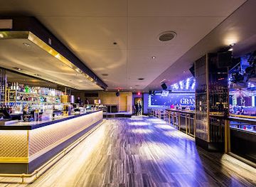
After dark, the Seaport is better known for restaurants, hotel bars, breweries, lounges and large-format entertainment venues than for a traditional pub or underground club scene. Congress Street, Seaport Boulevard and the streets around Fan Pier gather much of the evening activity, with a mix of cocktail bars, waterfront terraces and venues suited to after-work drinks or convention gatherings. The district can become lively around concerts, exhibitions, sporting broadcasts and major events at the Boston Convention and Exhibition Center, while quieter stretches of the HarborWay empty earlier. Nightlife is generally polished and commercial rather than bohemian, and the neighbourhood lacks the dense late-night concentration associated with some parts of downtown Boston. Visitors should check individual venues for current admission policies and programme details rather than assuming that a particular evening will bring live entertainment.
-
Night club
Scorpion Boston
Discover the electrifying nightlife at Scorpion Boston, a premier night club in the South Boston Waterfront with vibrant music and stylish ambiance.
13 min walk · 1.0 km from neighbourhood centre
-
Night club
The Grand Boston
Discover Boston's nightlife at The Grand, where electrifying music meets an upscale atmosphere in the vibrant South Boston Waterfront.
13 min walk · 1.0 km from neighbourhood centre
-
Night club
Down Nightclub Boston
Experience Boston's vibrant nightlife at Down Nightclub, where live music, exquisite cocktails, and electrifying dance floors await.
5 min drive · 1.6 km from neighbourhood centre


Best shops in Seaport District
Shopping in the Seaport is concentrated in contemporary mixed-use developments rather than traditional market streets. The area offers fashion, design, beauty, gifts, fitness-related retail and convenience shopping around Seaport Boulevard, Congress Street, Fan Pier and the newer commercial buildings, alongside cafés and food-led businesses. The retail character is closely tied to offices, hotels, apartments, museums and convention traffic, so the district feels more like a modern urban quarter than an independent specialist-shopping destination. Visitors interested in Boston’s older bookshops, antiques or market traditions will find a broader range elsewhere in the city; the Seaport’s appeal lies instead in its architecture, public art and design-conscious commercial spaces. The brick warehouses near Fort Point Channel provide a visual link with the area’s industrial past, even where their current uses are offices, restaurants or galleries rather than shops.
-
Clothing store
L.L.Bean
Explore the great outdoors with L.L.Bean in Boston's Seaport district, your go-to destination for high-quality outdoor gear and apparel.
13 min walk · 1.0 km from neighbourhood centre
-
Gift shop
Best of Boston
Discover the best souvenirs and local treasures at Boston's charming gift shop in the heart of the city.
6 min drive · 2.0 km from neighbourhood centre
-
Clothing store
Everlane
Discover stylish and sustainable fashion at Everlane in Boston's vibrant Seaport District, where quality meets transparency and ethics.
9 min walk · 0.7 km from neighbourhood centre
-
Clothing store
Filson
Discover Filson in Boston: A premier clothing store offering high-quality apparel and outdoor gear for the stylish adventurer.
13 min walk · 1.1 km from neighbourhood centre


Seaport District essentials
Getting There
Getting Around
Safety
Emergency Situations
Do's and Don'ts
Local Tips

From Eve
Local phrases worth knowing
You don't need to get them perfect. A few words go a long way, and locals appreciate the effort.
Basics
| English | Local | Say it |
|---|---|---|
| Hello | Hey there | [Hey th-air] |
| Goodbye | See ya | [See y-ah] |
| Yes | Yeah | [Y-ah] |
| No | Nah | [N-ah] |
| Please/You're welcome | Please/thank ya | [P-lease/th-ank ya] |
| Thank you | Thanks a lot | [Thanks a lot] |
| Excuse me/Sorry | Pardon me | [P-ahrd-un me] |
| How are you? | How's it goin'? | [H-ow's it goin'?] |
| Fine. And you? | Good. How 'bout you? | [Good. How 'bout you?] |
| Do you speak English? | Ya speak English? | [Ya speak English?] |
| I don't understand | I don't get ya | [I don't get ya] |
Eating & Drinking
| English | Local | Say it |
|---|---|---|
| I'd like to see the menu, please | Can I check out the menu? | [Can I check out the menu?] |
| I don't eat meat | I don't do meat | [I don't do meat] |
| Cheers! | Cheers! | [Cheers!] |
| I would like to pay, please | Can I settle up, please | [Can I settle up, please] |
Emergencies
| English | Local | Say it |
|---|---|---|
| Help! | I need help! | [I need help!] |
| Go away! | Get lost! | [Get lost!] |
| Call the Police! | Ring the cops! | [Ring the cops!] |
| Call a doctor! | Get a doc! | [Get a doc!] |
| I'm lost | I'm all turned around | [I'm all turned around] |
| I'm ill | I'm feelin' sick | [I'm feelin' sick] |
Shopping
| English | Local | Say it |
|---|---|---|
| I'd like to buy... | I'm lookin' to grab... | [I'm lookin' to grab...] |
| I'm just looking | Just browsin' | [Just browsin'] |
| How much is it? | What's the damage? | [What's the damage?] |
| That's too expensive | That's a rip-off | [That's a rip-off] |
| Can you lower the price? | Can ya cut me a deal? | [Can ya cut me a deal?] |
Time & Numbers
| English | Local | Say it |
|---|---|---|
| What time is it? | What's the time? | [What's the time?] |
| It's one o'clock | It's one | [It's one] |
| Half past (10) | Half past ten | [Half past ten] |
| Morning | Mornin' | [Mornin'] |
| Afternoon | Afternoon | [Afternoon] |
| Evening | Evenin' | [Evenin'] |
| Yesterday | Yest'day | [Yest'day] |
| Today | Today | [Today] |
| Tomorrow | Tomorrah | [Tomorrah] |
| 1 | One | [One] |
| 2 | Two | [Two] |
| 3 | Three | [Three] |
| 4 | Four | [Four] |
| 5 | Five | [Five] |
| 6 | Six | [Six] |
| 7 | Seven | [Seven] |
| 8 | Eight | [Eight] |
| 9 | Nine | [Nine] |
| 10 | Ten | [Ten] |
Transport & Directions
| English | Local | Say it |
|---|---|---|
| Where's a/the...? | Where's the...? | [Where's the...?] |
| What's the address? | What's the street? | [What's the street?] |
| Can you show me (on the map)? | Can you point it out (on the map)? | [Can you point it out (on the map)?] |
| When's the next (bus)? | When's the next (bus)? | [When's the next (bus)?] |
| A ticket (to ....) | A ticket (to ....) | [A ticket (to ....)] |
History of Seaport District
Wharves and Working Waterfront
The Seaport developed on Boston’s expanded waterfront as wharves, piers, warehouses and maritime businesses grew around the South Boston waterfront and Fort Point Channel. Its low-lying shoreline was shaped by land reclamation and successive harbour improvements rather than by the colonial street pattern found on Boston’s older peninsula. The area supported shipping, storage, fish handling and related commercial activity, tying it to the port economy while remaining physically distinct from the historic centre. Brick industrial buildings and utilitarian waterfront structures became the architectural traces of this working landscape, many of them later adapted for offices, restaurants and cultural uses.
Industrial Decline and Urban Renewal
During the twentieth century, changes in shipping, industry and road transport reduced the importance of the traditional wharves and left substantial portions of the South Boston Waterfront underused. The area’s large parcels and proximity to downtown eventually made it a focus for planning and redevelopment. The Central Artery/Tunnel project, completed in stages from the 1990s into the 2000s, improved connections beneath and around the waterfront, while the Silver Line created a direct transit link with South Station and Logan Airport. These infrastructure changes helped make large-scale commercial and residential development practical.
The Cultural Waterfront Emerges
A new cultural identity took shape as institutions arrived on or near the former industrial waterfront. The Institute of Contemporary Art/Boston opened its current Seaport building in 2006, establishing a major contemporary-art presence and reconnecting the district with the harbour. The Boston Children’s Museum moved to its Fort Point Channel building in 1979, while the Boston Tea Party Ships & Museum later added a history-focused attraction nearby. Together, these institutions helped turn an area once associated mainly with logistics and warehouses into a destination for art, family visits and public waterfront activity.
A New Mixed-Use District
Since the early twenty-first century, the Seaport has undergone extensive redevelopment, with towers, hotels, apartments, offices, restaurants, convention facilities and landscaped public spaces replacing or reworking much of the former industrial landscape. Projects around Fan Pier, Seaport Boulevard and the Boston Convention and Exhibition Center created the recognisable modern district, while older brick buildings near Fort Point retained links to the area’s industrial past. The transformation brought employment and public access to parts of the waterfront, but also changed land values, building scale and the social character of the South Boston waterfront. Today, the district’s identity is defined by the meeting of maritime infrastructure, contemporary architecture and commercial urban development.
Seaport District in Photos
Browse through our photo collection highlighting the charm and character of the destination.
Neighbourhoods near Seaport District
The closest neighbourhoods to Seaport District, if you have time for more than one stop.
-

-

-

-

-


Swipe for more neighbourhoods
Explore more

Explore more of Boston
Boston blends Revolutionary history, harbour walks, world-class museums, brownstone streets and lively neighbourhoods into a richly rewarding American city break.
Explore Boston