

Sleeping Bear Dunes National Lakeshore Travel Guide - Free Web & App
Your ultimate guide to Sleeping Bear Dunes National Lakeshore. Discover top landmarks, proposed trips, and local tips. Free on the web or via the Evendo companion app.


Sleeping Bear Dunes National Lakeshore in Michigan combines Lake Michigan beaches, towering dunes, island landscapes, historic villages and scenic hiking.
Landscapes of Sand, Forest and Water
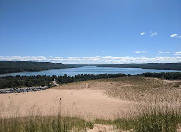
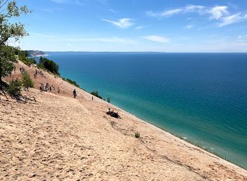
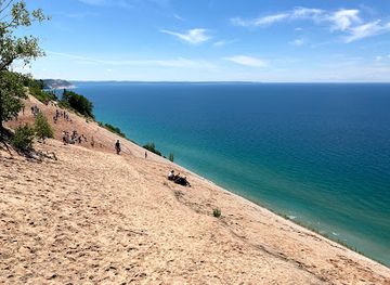
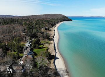
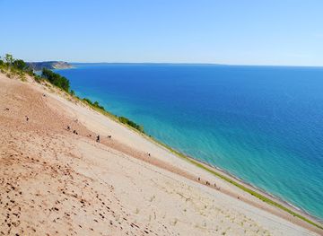
Sleeping Bear Dunes National Lakeshore follows a remarkably varied stretch of north-western Michigan’s Lake Michigan shoreline, encompassing mainland beaches, immense forested dunes, inland lakes, river mouths and the North and South Manitou Islands. Its great dunes were shaped from glacial deposits and continually remodelled by wind, water and vegetation. From the crest of the Dune Climb, the shore can appear almost oceanic, while quieter inland roads reveal wetlands, hardwood forest and small lakes separated from Lake Michigan by ridges of sand.Read more about Sleeping Bear Dunes National Lakeshore
Villages, Farms and Maritime History
Exploring the Lakeshore
When is the best time to visit Sleeping Bear Dunes National Lakeshore?
Best: June–August · 23–26°C| Month | High (°C) | Rainfall (mm) |
|---|---|---|
| January | -1 | 60 |
| February | -1 | 55 |
| March | 4 | 65 |
| April | 12 | 75 |
| May | 19 | 80 |
| June (best) | 23 | 85 |
| July (best) | 26 | 90 |
| August (best) | 25 | 90 |
| September | 21 | 85 |
| October | 15 | 75 |
| November | 7 | 70 |
| December | 3 | 65 |
Getting to and around Sleeping Bear Dunes National Lakeshore
How to get there
Transportation
Best attractions in Sleeping Bear Dunes National Lakeshore
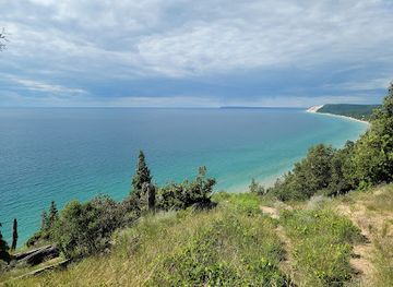
Sleeping Bear Dunes National Lakeshore’s principal attractions are spread across a mainland shoreline and the North and South Manitou Islands. The Dune Climb provides a strenuous introduction to the scale of the sandy landscape, while Empire Bluff Trail and Pyramid Point offer elevated views over Lake Michigan, subject to trail and weather conditions. Pierce Stocking Scenic Drive leads through wooded dune country to established overlooks, and Esch Road Beach gives access to a more open lakeshore setting. Glen Haven combines a beach settlement with preserved maritime and community buildings, while the Port Oneida Rural Historic District reveals a network of farms, fields and lanes. Inland waters such as Glen Lake and Platte Lake lie close to the national lakeshore and help explain the region’s varied geography, although not every nearby shoreline is part of the park. The Manitou Islands add forests, beaches, historic remains and a more isolated sense of place reached by boat.
-
Tourist attraction
Dune Climb
Discover the breathtaking Dune Climb in Michigan's Sleeping Bear Dunes, where adventure meets stunning natural beauty and panoramic lake views.
-
Tourist attraction
Sleeping Bear Dunes Overlook
Experience breathtaking views and natural beauty at Sleeping Bear Dunes Overlook, where stunning landscapes await every visitor.
-
Tourist attraction
Historic Fishtown
Discover the allure of Historic Fishtown, where charming fish shanties meet stunning Lake Michigan views and a rich maritime heritage.
-
Tourist attraction
Clinch Park
Explore the natural beauty and recreational offerings of Clinch Park, a premier tourist attraction in Traverse City, Michigan, perfect for families and beach lovers.
Best landmarks in Sleeping Bear Dunes National Lakeshore
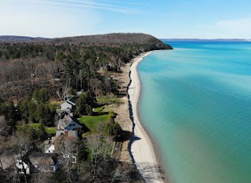
The most recognisable natural landmark is the long wall of Lake Michigan dunes, whose high ridges, sandy slopes and forested summits define the lakeshore’s character. The Dune Climb is a familiar access point to this terrain, while the Empire Bluff and Pyramid Point areas demonstrate how dunes rise above beaches and inland landscapes. The Manitou Islands are important landmarks in their own right, combining offshore scenery with evidence of historic settlement and maritime use. Glen Haven’s preserved buildings and former maritime setting represent the human history of the mainland shore, and the Port Oneida Rural Historic District is significant for its concentration of farm landscapes rather than a single grand structure. Together, these natural and cultural features show how glacial landforms, Lake Michigan navigation, agriculture and conservation remain inseparable parts of the destination’s identity.
-
Tourist attraction
Sleeping Bear Dunes Overlook
Experience the breathtaking views and natural beauty of Sleeping Bear Dunes Overlook, a stunning gem along Michigan's Lake Michigan shoreline.
-
Historical place
Historic Fishtown
Discover the rich heritage and stunning beauty of Historic Fishtown, a must-visit destination for tourists exploring Michigan's scenic lakeside charm.
-
Hiking area
Empire Bluff Trail
Explore the breathtaking Empire Bluff Trail for stunning lake views and an unforgettable hiking experience in Sleeping Bear Dunes National Lakeshore.
-
Visitor center
Philip A. Hart Visitor Center
Explore the wonders of Sleeping Bear Dunes at the Philip A. Hart Visitor Center, your essential starting point for adventure and discovery in this stunning national lakeshore.
Explore Sleeping Bear Dunes National Lakeshore on the map
Plan your trip on one map. See where the top attractions, landmarks, restaurants and hotels are, and book hotels and experiences in a few clicks.
Best hotels in Sleeping Bear Dunes National Lakeshore
Best restaurants in Sleeping Bear Dunes National Lakeshore
Dining within Sleeping Bear Dunes National Lakeshore is limited, with no large restaurant district inside the protected area, so visitors generally eat in gateway communities such as Empire and Glen Arbor or in nearby villages beyond the boundary. These places provide the area’s principal concentration of cafés, bakeries, casual restaurants, general stores and seasonal food outlets. Regional menus commonly draw on northern Michigan produce, cherries, apples, berries, freshwater fish and locally made baked goods, while farm shops and roadside stands may offer a direct connection to surrounding agriculture when operating. Leland and other nearby communities provide additional choices farther north, but should be treated as separate regional destinations rather than park settlements. Picnicking and self-catering are practical options for beach and trail days, especially when exploring remote sites or planning an island excursion where food services are limited or absent.
-
Steak
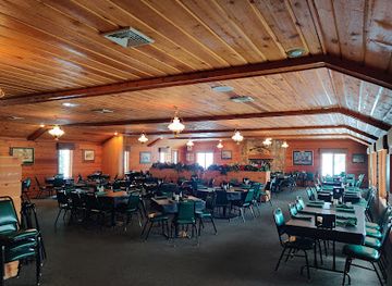
Boone's Long Lake Inn
Discover Boone's Long Lake Inn: A Culinary Gem in Traverse City Offering Exquisite Steaks and Fresh Seafood with Scenic Lakeside Views.
-
Grill
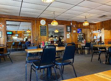
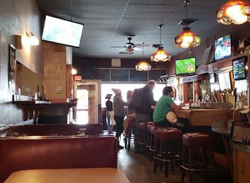
Joe's Friendly Tavern
Experience the best of grill cuisine at Joe's Friendly Tavern in Empire – where hearty meals meet friendly service in a cozy atmosphere.
-
Restaurant
Trattoria Stella
Experience authentic Italian cuisine at Trattoria Stella in Traverse City - where every meal is a celebration of flavor and tradition.
-
Restaurant
Oaky's Tavern
Discover the heart of American cuisine at Oaky's Tavern in Grawn, MI—home of delicious burgers, wings, and an unforgettable dining experience.
Best bars in Sleeping Bear Dunes National Lakeshore
Evening entertainment around Sleeping Bear Dunes is modest and community-focused rather than club-oriented. Empire and Glen Arbor have the area’s most relevant concentration of pubs, restaurants and seasonal hospitality venues, while nearby villages may offer traditional bars where residents and visitors gather for food, conversation and local atmosphere. Live music and cultural events can occur seasonally, but availability changes and should not be assumed outside the main visitor period. Inside the national lakeshore, evenings are primarily shaped by quiet beaches, dark skies, camp-based activities where permitted and the sounds of the lake rather than by nightlife infrastructure. Visitors seeking a broader choice of bars or performances may need to travel to larger regional centres such as Traverse City, outside the destination.
-
Tourist attraction
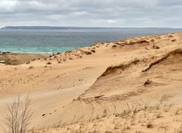
Sleeping Bear Dunes National Lakeshore
Experience the awe-inspiring beauty of Sleeping Bear Dunes National Lakeshore, where towering sand dunes meet the serene waters of Lake Michigan.
-
Grill
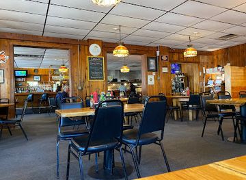
Joe's Friendly Tavern
Discover the delightful flavors and inviting atmosphere of Joe's Friendly Tavern, a must-visit grill and restaurant in beautiful Empire, Michigan.
-
Restaurant
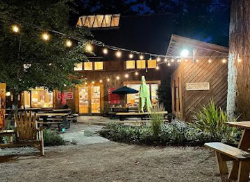
Cherry Public House | Glen Arbor
Experience the best of local cuisine and craft brews at Cherry Public House, a must-visit restaurant and brewery in Glen Arbor, Michigan.
-
Swimming lake
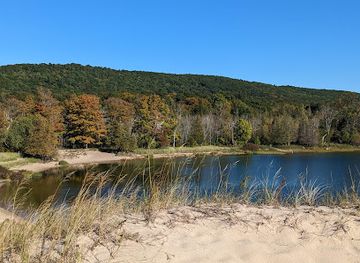
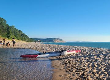
North Bar Lake
Explore North Bar Lake in Empire, MI - a serene swimming lake surrounded by stunning dunes and natural beauty, perfect for relaxation and adventure.
Best nightclubs in Sleeping Bear Dunes National Lakeshore
Evening entertainment around Sleeping Bear Dunes is modest and community-focused rather than club-oriented. Empire and Glen Arbor have the area’s most relevant concentration of pubs, restaurants and seasonal hospitality venues, while nearby villages may offer traditional bars where residents and visitors gather for food, conversation and local atmosphere. Live music and cultural events can occur seasonally, but availability changes and should not be assumed outside the main visitor period. Inside the national lakeshore, evenings are primarily shaped by quiet beaches, dark skies, camp-based activities where permitted and the sounds of the lake rather than by nightlife infrastructure. Visitors seeking a broader choice of bars or performances may need to travel to larger regional centres such as Traverse City, outside the destination.
-
Lounge
U And I Lounge
Discover the vibrant nightlife at U And I Lounge in Traverse City, where great drinks and a welcoming atmosphere await every visitor.
-
Grill
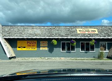
Empire Village Inn
Experience the taste of Michigan at Empire Village Inn, your perfect retreat for grilled delights and local brews in the heart of Empire.
-
Restaurant
Cherry Public House | Glen Arbor
Discover the taste of Glen Arbor at Cherry Public House - where local brews meet delicious cuisine in a charming atmosphere.
-
Swimming lake
North Bar Lake
Discover the tranquil beauty of North Bar Lake, a perfect swimming destination nestled behind Sleeping Bear Dunes in Michigan's breathtaking natural landscape.
Best shops in Sleeping Bear Dunes National Lakeshore
Shopping opportunities are concentrated outside the national lakeshore in gateway communities such as Empire and Glen Arbor, where independent shops, galleries, food outlets and seasonal businesses serve visitors. Regional purchases may include northern Michigan cherries and other farm produce, preserves, baked goods, locally made art, books, outdoor equipment and craft items, although the selection varies by settlement and season. The Port Oneida and Glen Haven areas are historic landscapes rather than shopping districts, so visitors should not expect extensive retail facilities inside the park. Leland and Traverse City provide wider choices farther from the lakeshore, but they are separate places and require additional travel. For extended hikes, island trips or visits to remote beaches, obtain food, water and other essentials before leaving the main service communities.
-
Grocery store
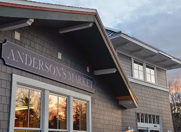
Anderson's Glen Arbor Market
Discover Anderson's Glen Arbor Market, your go-to grocery store for fresh produce, local beers, gourmet deli items, and delicious pizza takeout in Glen Arbor, MI.
-
Gift shop
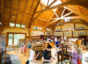
Cherry Republic | Glen Arbor
Discover the best of Michigan’s cherry delights at Cherry Republic in Glen Arbor, where gourmet treats and local beverages await.
-
Chocolate shop
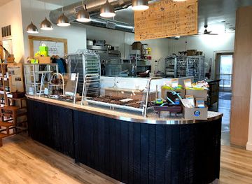
Grocer's Daughter Chocolate Shop
Discover the taste of artisanal chocolates at Grocer's Daughter Chocolate Shop in Empire, Michigan, where every bite is a celebration of quality and flavor.
-
Gift shop
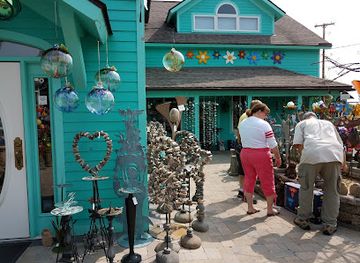
Bayside Gallery
Discover Bayside Gallery in Suttons Bay - a vibrant gift shop and art gallery showcasing local talent and unique home goods.
Get your free copy of our complete guide to Sleeping Bear Dunes National Lakeshore, delivered straight to you.
Everything on this page, from attractions and restaurants to essentials and local phrases, in one PDF you can read offline, print or share.
Already have an account? Sign in
Your Sleeping Bear Dunes National Lakeshore guide is ready.
We'll send it to · Not you? Sign out

Getting your guide ready…
We are putting together a fresh copy of the Sleeping Bear Dunes National Lakeshore guide. This can take up to a minute.
This can take a few moments. If your browser asks, choose Allow so the download can start. You'll find the guide in your Downloads folder.
Nothing happened? Download it again
Sorry, the guide is taking longer than usual. Please try again in a minute, or get it by email instead.
Sleeping Bear Dunes National Lakeshore essentials
Currency and Payment
Safety
Emergency Situations
Do's and Don'ts
Local Tips
From Eve
Local phrases worth knowing
You don't need to get them perfect. A few words go a long way, and locals appreciate the effort.
Basics
| English | Local | Say it |
|---|---|---|
| Hello | Ahnii | [Ah-nee] |
| Goodbye | Miigwech | [Mee-gwetch] |
| Yes | Eya | [Ay-ya] |
| No | Aaniin | [Ah-nee] |
| Please/You're welcome | Bozhoo | [Bo-joo] |
| Thank you | Miigwech | [Mee-gwetch] |
| Excuse me/Sorry | Miigwech | [Mee-gwetch] |
| How are you? | Boozhoo | [Bo-joo] |
| Fine. And you? | Boozhoo. Aaniin? | [Bo-joo. Ah-nee?] |
| Do you speak English? | Anishinaabemowin endizhinikaaz? | [Ah-ni-she-naa-be-mo-win en-dee-jee-ni-kaz?] |
| I don't understand | Aaniin ezhi-ayaad | [Ah-nee ah-zhi-ah-yad] |
Eating & Drinking
| English | Local | Say it |
|---|---|---|
| I'd like to see the menu, please | Menu nindaanis | [Meh-noo nin-dah-nees] |
| I don't eat meat | Niizh | [Neezh] |
| Cheers! | Baamaapii | [Bah-mah-pee] |
| I would like to pay, please | Nibaaj | [Nee-baaj] |
Emergencies
| English | Local | Say it |
|---|---|---|
| Help! | Asemaa | [Ah-seh-mah] |
| Go away! | Waaban | [Wah-bahn] |
| Call the Police! | Ozhibii'an | [Oh-zhee-bee-an] |
| Call a doctor! | Mashkiki | [Mah-shkee-kee] |
| I'm lost | Niin giinawaa | [Neen gee-nwaa] |
| I'm ill | Niish | [Neesh] |
Shopping
| English | Local | Say it |
|---|---|---|
| I'd like to buy... | Gaa gidin | [Gah gee-deen] |
| I'm just looking | Nindaanis | [Nin-dah-nees] |
| How much is it? | Giinwaa | [Gee-nwaa] |
| That's too expensive | Maajii | [Mah-jee] |
| Can you lower the price? | Giinwaa wii madwaa | [Gee-nwaa wee mah-dwaa] |
Time & Numbers
| English | Local | Say it |
|---|---|---|
| What time is it? | Giinwaa ji-ayaamagad? | [Gee-nwaa jee-ah-yaa-mah-gahd] |
| It's one o'clock | Bekaadizi | [Beh-kah-dee-zee] |
| Half past (10) | Midaaswi | [Mee-dah-swee] |
| Morning | Waaban | [Wah-bahn] |
| Afternoon | Nibi | [Nee-bee] |
| Evening | Bakade | [Bah-kah-day] |
| Yesterday | Niiwin | [Nee-win] |
| Today | Biindaakonigewin | [Bee-nah-dah-koh-ni-geh-win] |
| Tomorrow | Biindigay | [Been-dee-gay] |
| 1 | Beka | [Beh-kah] |
| 2 | Ningodwaaswi | [Neen-goh-dwah-swee] |
| 3 | Niswi | [Nee-swee] |
| 4 | Niiwin | [Nee-win] |
| 5 | Naanan | [Nah-nan] |
| 6 | Niizh | [Neezh] |
| 7 | Niwii | [Nee-wee] |
| 8 | Ningodwaaswi | [Neen-goh-dwah-swee] |
| 9 | Zhaangaswi | [Zhaan-gah-swee] |
| 10 | Midaaswi | [Mee-dah-swee] |
Transport & Directions
| English | Local | Say it |
|---|---|---|
| Where's a/the...? | Ningaani | [Neen-gah-nee] |
| What's the address? | Waaseyaa | [Wah-seh-yah] |
| Can you show me (on the map)? | Nibwaakaawin | [Nee-bwah-kah-win] |
| When's the next (bus)? | Giinwaa nanaandagwaa? | [Gee-nwaa nah-nahn-dah-gwaa] |
| A ticket (to ....) | Niginaa | [Nee-gee-nah] |
History of Sleeping Bear Dunes National Lakeshore
Glacial Foundations
The physical setting of Sleeping Bear Dunes was shaped during the Ice Age, when continental glaciers moved across the Great Lakes region, excavating basins and leaving behind extensive deposits of sand, gravel and other glacial material. As the ice retreated, Lake Michigan developed within the glacial basin and waves and wind began reorganising sediment along its shore. The dunes are therefore dynamic landforms rather than fixed hills: wind moves sand inland, vegetation stabilises some slopes, and storms alter beaches and bluffs. This geological inheritance explains the lakeshore’s striking mixture of high dunes, low wetlands, inland lakes and exposed shoreline.
Indigenous Homelands
The lakeshore lies within the traditional homelands of Anishinaabeg peoples, including Odawa, Ojibwe and Potawatomi communities connected to the wider Great Lakes region. Indigenous people used the waterways, forests, wetlands and shorelines for travel, fishing, hunting and gathering long before the arrival of European settlers. Place names and oral traditions remain important to the area’s identity, including the Sleeping Bear story associated with the dunes and Lake Michigan. Visitors should understand the national lakeshore as a lived cultural landscape rather than an empty wilderness preceding modern settlement.
Maritime Routes and Settlement
Lake Michigan became a major route for regional transport as Euro-American settlement expanded in the nineteenth century. Communities developed around timber, farming, fishing and the movement of goods by schooner and steamer, although the lake’s storms, shoals and changing shoreline made navigation hazardous. The Manitou Islands were important stopping points in these maritime networks, while mainland settlements such as Glen Haven supported shipping and local industries. Lighthouses, lifesaving facilities and other navigational and maritime structures reflected the growing need to protect vessels and crews on the lake.
Logging and Farm Country
During the nineteenth and early twentieth centuries, logging cleared large areas of the region’s forests, and farms developed in the more workable soils between the dunes and inland waters. The Port Oneida area preserves an especially clear record of this agricultural period, with fields, barns, houses and lanes forming a historic rural landscape rather than a single monumental site. Glen Haven also retains evidence of a small lakeside community whose economy combined maritime work, farming and local industry. Forest regeneration and changing land use later altered the appearance of much of the area.
Protection as a National Lakeshore
Growing concern about development along the Great Lakes shoreline led to the creation of Sleeping Bear Dunes National Lakeshore in 1970. The designation protected an extensive combination of dunes, beaches, forests, inland lakes, islands and historic properties for public enjoyment and long-term conservation. Management has since had to balance recreation with fragile dune vegetation, wildlife habitat, historic preservation and the continuing movement of sand and water. The lakeshore’s modern identity consequently combines outdoor access with stewardship of both natural processes and the cultural landscapes left by earlier communities.
Sleeping Bear Dunes National Lakeshore in Photos
Browse through our photo collection highlighting the charm and character of the destination.
Cities in Sleeping Bear Dunes National Lakeshore
The towns and cities of Sleeping Bear Dunes National Lakeshore, and the easiest places to base yourself.

Swipe for more cities
Neighbouring destination travel guides
The closest destinations to Sleeping Bear Dunes National Lakeshore, if you have time for more than one.
-

-

-

-

-


Swipe for more destinations
Explore more

Explore more of Northern Michigan
Northern Michigan pairs Great Lakes shorelines, island heritage, forest trails, mining history, seasonal produce and outdoor adventures across the state’s north.
Explore Northern Michigan
Explore more of Michigan
Explore Michigan's stunning Great Lakes, vibrant cities, and untouched natural beauty. Discover the state's rich cultural heritage and endless outdoor adventures.
Explore Michigan