

Grayson Highlands State Park Travel Guide - Free Web & App
Your ultimate guide to Grayson Highlands State Park. Discover top landmarks, proposed trips, and local tips. Free on the web or via the Evendo companion app.


Grayson Highlands State Park, Virginia, pairs Appalachian balds, free-roaming ponies, Mount Rogers trails and wide mountain views for hiking, camping and nature.
Mountain Landscapes
Grayson Highlands State Park occupies Virginia’s elevated southwest, near the small communities of Mouth of Wilson and Troutdale and close to the North Carolina border. Its open, grass-covered ridges, locally known as balds, give the park a character unlike the more heavily forested Appalachian landscapes elsewhere in the state. Weathered rock outcrops, spruce-fir woodland, heath-covered slopes and broad views across the Blue Ridge create a setting shaped as much by exposure and elevation as by the surrounding mountains. Mount Rogers, Virginia’s highest summit, rises nearby within the Mount Rogers National Recreation Area, and the Appalachian Trail crosses the high country between the park and the summit area.Read more about Grayson Highlands State Park
Ponies, Wildlife and Walking
A Rural Mountain Base
When is the best time to visit Grayson Highlands State Park?
Best: June–August · 24–26°C| Month | High (°C) | Rainfall (mm) |
|---|---|---|
| January | 4 | 100 |
| February | 6 | 90 |
| March | 8 | 110 |
| April | 14 | 100 |
| May | 20 | 110 |
| June (best) | 24 | 110 |
| July (best) | 26 | 120 |
| August (best) | 25 | 120 |
| September | 22 | 110 |
| October | 15 | 100 |
| November | 10 | 100 |
| December | 5 | 100 |
Getting to and around Grayson Highlands State Park
How to get there
Transportation
Best attractions in Grayson Highlands State Park
Grayson Highlands State Park’s central attractions are its open Appalachian balds, high-elevation trails and panoramas across southwest Virginia. Wilburn Ridge is the area most closely associated with the free-roaming ponies, while the route towards Rhododendron Gap reveals broad ridgelines, rock outcrops and changing views. The Appalachian Trail crosses the high country and provides a longer-distance walking option, linking the park landscape with the Mount Rogers National Recreation Area. Mount Rogers, Virginia’s highest summit, is reached from the wider protected highland network rather than being a developed attraction within the park itself. Shorter walks, picnic areas and camping facilities make the park accessible to visitors who are not attempting a full mountain journey, while longer routes reward careful planning and suitable weather gear. In the surrounding countryside, small communities such as Mouth of Wilson and Troutdale provide rural context, local services and access points for exploring the wider mountain landscape.
-
Campground
Thomas Knob Shelter
Experience the natural beauty and tranquility of Thomas Knob Shelter along the Appalachian Trail, a perfect campground for hiking and relaxation in Virginia.
-
Campground
Little Pinnacle
Discover the serene beauty of Little Pinnacle in Grayson Highlands State Park, Virginia, a perfect retreat for nature lovers and outdoor adventurers.
-
Park
Picnic Area Overlook @ Grayson Highlands State Park
Experience breathtaking mountain views and serene picnicking at the Picnic Area Overlook in Grayson Highlands State Park, Virginia's natural gem.
-
Ridge
Wilburn Ridge
Experience the breathtaking beauty of Wilburn Ridge in Virginia, a premier destination for nature lovers and outdoor enthusiasts.


Best landmarks in Grayson Highlands State Park
The defining natural landmark is the chain of open balds and rocky ridges around Wilburn Ridge, whose exposed grassland character sets Grayson Highlands apart from the forested mountains nearby. Rhododendron Gap forms another prominent high-country feature and a recognised point along the Appalachian Trail. Mount Rogers, rising to 5,729 feet, is Virginia’s highest summit and stands within the adjoining Mount Rogers National Recreation Area; its significance belongs to the wider protected landscape reached from the park. The Appalachian Trail is also a cultural landmark, linking the area to one of the United States’ best-known long-distance footpaths. The free-roaming ponies have become an emblem of the highlands, although they are living animals rather than a constructed monument. Together, these ridges, trails, upland habitats and grazing landscapes express the region’s geographical and cultural identity.
-
Hiking area
Appalachian Trail, Grayson Highlands
Discover the breathtaking beauty of the Appalachian Trail at Grayson Highlands, where stunning vistas and wild ponies await every hiker.
-
Park
Picnic Area Overlook @ Grayson Highlands State Park
Experience the breathtaking views and serene atmosphere of the Picnic Area Overlook at Grayson Highlands State Park, a must-visit destination for nature lovers.


Explore Grayson Highlands State Park on the map
Plan your trip on one map. See where the top attractions, landmarks, restaurants and hotels are, and book hotels and experiences in a few clicks.
Best hotels in Grayson Highlands State Park
Best restaurants in Grayson Highlands State Park
Dining within Grayson Highlands State Park is limited compared with an urban or resort destination, so visitors generally bring provisions or eat in nearby communities. Mouth of Wilson, Troutdale, Independence and other settlements along the approach roads provide the most practical options for casual meals, groceries and locally familiar Appalachian hospitality, although availability varies by location and season. Regional cooking reflects the mountain setting, with home-style breakfasts, biscuits, country ham, fried chicken, seasonal produce and baked goods found across southwest Virginia rather than concentrated in one formal dining district. Farm shops and roadside produce stands may appear in the wider countryside, particularly during the growing season, while traditional diners and small-town eateries offer a useful contrast to meals prepared at a campsite or cabin. Supplies should be purchased before heading into the high country, where trailheads and ridge areas do not form a restaurant centre.
-
State park
Grayson Highlands State Park
Explore Grayson Highlands State Park: A breathtaking escape into Virginia's natural beauty with wild ponies, scenic hikes, and serene camping.
-
General store
Grayson Highlands General Store & Inn
Discover rustic charm at Grayson Highlands General Store & Inn, your gateway to adventure in Virginia's breathtaking mountain landscapes.


Best bars in Grayson Highlands State Park
Grayson Highlands is a quiet rural park rather than a nightlife destination, and there are no established nightclubs or entertainment districts on the high ridges. Evenings are generally centred on campsites, cabins and the simple pleasure of watching weather and darkness settle over the mountains, with visitors expected to observe park rules concerning quiet hours, fires and outdoor conduct. Traditional pubs, restaurants and community venues in surrounding towns may offer a drink or occasional local music, but entertainment is dispersed and should not be assumed to operate every night. The wider region has strong Appalachian musical traditions, including old-time and bluegrass influences, and seasonal community events may provide cultural entertainment when they are scheduled. Visitors seeking a broader bar scene will need to travel beyond the park towards larger regional centres, rather than treating nearby rural settlements as a concentrated nightlife base.
-
General store
Grayson Highlands General Store & Inn
Experience the beauty of Virginia's Highlands at Grayson Highlands General Store & Inn, your ideal stop for local goods and cozy stays.
-
Campground
Grayson Highlands Campground
Discover the beauty of Virginia's wilderness at Grayson Highlands Campground with stunning views, unique wildlife, and endless hiking opportunities.
-
Hiking area
Appalachian Trail, Grayson Highlands
Explore the breathtaking Appalachian Trail at Grayson Highlands, Virginia, where stunning landscapes and unique wildlife await every adventurer.
-
Cabin rental agency
Highland Hideaways
Discover the serene beauty of Highland Hideaways, Virginia's premier cabin rental agency, perfect for nature lovers and adventure seekers alike.


Best shops in Grayson Highlands State Park
Shopping at Grayson Highlands is practical and local rather than extensive. The park itself is not a retail centre, so visitors should obtain food, fuel, walking supplies and other essentials in surrounding communities before heading into the high country. Small-town shops, farm stands and independent businesses around Mouth of Wilson, Troutdale, Independence and the wider region may carry locally produced foods, preserves, baked goods, crafts and Appalachian-themed gifts, though stock and opening patterns vary. The area’s cultural identity is also reflected in regional music, woodwork, textiles, pottery and handmade goods sold through craft businesses, community events and visitor-oriented outlets across southwest Virginia. Outdoor equipment is more likely to be found in larger nearby towns than at the park entrance. Buying from genuine local producers can provide a more meaningful connection to the farming, craft and musical traditions of the mountain communities surrounding the protected landscape.
-
State park
Grayson Highlands State Park
Experience the breathtaking beauty of Grayson Highlands State Park, where wild ponies roam and adventure awaits among Virginia's stunning landscapes.
-
General store
Grayson Highlands General Store & Inn
Experience the perfect blend of local charm and natural beauty at Grayson Highlands General Store & Inn, a cozy stop in Virginia's scenic landscape.
-
Campground
Grayson Highlands Campground
Experience the natural splendor of Grayson Highlands Campground, where adventure meets tranquility in the stunning Appalachian Mountains.
-
Hiking area
Appalachian Trail, Grayson Highlands
Experience the breathtaking trails and wild ponies of Grayson Highlands, a gem of the Appalachian Trail, perfect for hikers and nature lovers.


Get your free copy of our complete guide to Grayson Highlands State Park, delivered straight to you.
Everything on this page, from attractions and restaurants to essentials and local phrases, in one PDF you can read offline, print or share.
Already have an account? Sign in
Your Grayson Highlands State Park guide is ready.
We'll send it to · Not you? Sign out

Getting your guide ready…
We are putting together a fresh copy of the Grayson Highlands State Park guide. This can take up to a minute.
This can take a few moments. If your browser asks, choose Allow so the download can start. You'll find the guide in your Downloads folder.
Nothing happened? Download it again
Sorry, the guide is taking longer than usual. Please try again in a minute, or get it by email instead.
Grayson Highlands State Park essentials
Currency and Payment
Safety
Emergency Situations
Do's and Don'ts
Local Tips
From Eve
Local phrases worth knowing
You don't need to get them perfect. A few words go a long way, and locals appreciate the effort.
Basics
| English | Local | Say it |
|---|---|---|
| Hello | Howdy | [hah-dee] |
| Goodbye | See ya | [see yah] |
| Yes | Yep | [yep] |
| No | Nah | [nah] |
| Please/You're welcome | Please/Thank ya kindly | [pleez/thank yah kine-lee] |
| Thank you | Much obliged | [much o-blah-jed] |
| Excuse me/Sorry | Pardon me/My bad | [par-dun me/my bad] |
| How are you? | How y'all doin'? | [how y'all doin'] |
| Fine. And you? | Jest fine. How 'bout you? | [jest fine. how 'bout yah] |
| Do you speak English? | Y'all speak English? | [y'all speak ing-glish] |
| I don't understand | I reckon I don't get ya | [I reckon I don't get yah] |
Eating & Drinking
| English | Local | Say it |
|---|---|---|
| I'd like to see the menu, please | Can I reckon the menu, please | [can I reckon the menu, please] |
| I don't eat meat | I don't fancy no meat | [I don't fancy no meat] |
| Cheers! | Bottoms up! | [bottoms up] |
| I would like to pay, please | Can I settle up, please | [can I settle up, please] |
Emergencies
| English | Local | Say it |
|---|---|---|
| Help! | Send help! | [send help] |
| Go away! | Shoo! | [shoo] |
| Call the Police! | Fetch the Sheriff! | [fetch the sheriff] |
| Call a doctor! | Send the doc! | [send the doc] |
| I'm lost | I'm turned around | [I'm turned around] |
| I'm ill | I'm feelin' poorly | [I'm feelin' poorly] |
Shopping
| English | Local | Say it |
|---|---|---|
| I'd like to buy... | I reckon I'd buy... | [I reckon I'd buy...] |
| I'm just looking | I'm jest browsin' | [I'm jest brow-sin'] |
| How much is it? | What's the reckonin'? | [what's the reckon-in'] |
| That's too expensive | That's a mite pricey | [that's a mite pricey] |
| Can you lower the price? | Kin ya drop the reckonin'? | [kin yah drop the reckon-in'] |
Time & Numbers
| English | Local | Say it |
|---|---|---|
| What time is it? | What's the time o' day? | [what's the time o' day] |
| It's one o'clock | It's one on the dot | [It's one on the dot] |
| Half past (10) | Half past ten | [Half past ten] |
| Morning | Mornin' | [Mornin'] |
| Afternoon | Afternoon | [Afternoon] |
| Evening | Evenin' | [Evenin'] |
| Yesterday | Yest'day | [Yest'day] |
| Today | Today | [Today] |
| Tomorrow | Tomorrah | [Tomorrah] |
| 1 | One | [One] |
| 2 | Two | [Two] |
| 3 | Three | [Three] |
| 4 | Four | [Four] |
| 5 | Five | [Five] |
| 6 | Six | [Six] |
| 7 | Seven | [Seven] |
| 8 | Eight | [Eight] |
| 9 | Nine | [Nine] |
| 10 | Ten | [Ten] |
Transport & Directions
| English | Local | Say it |
|---|---|---|
| Where's a/the...? | Where's the...? | [Where's the...?] |
| What's the address? | What's the reckon? | [What's the reckon?] |
| Can you show me (on the map)? | Kin ya show me (on the map)? | [Kin ya show me (on the map)?] |
| When's the next (bus)? | When's the next (bus)? | [When's the next (bus)?] |
| A ticket (to ....) | A ticket (to ....) | [A ticket (to ....)] |
History of Grayson Highlands State Park
Ancient Appalachian Uplands
The high country around Grayson Highlands forms part of the ancient Appalachian Mountain system, whose rocks and ridges have been repeatedly uplifted, eroded and reshaped over immense geological periods. The open summits and rounded ridgelines are not alpine peaks in the European sense, but elevated Appalachian grasslands and shrublands maintained by exposure, soils, weather and land use. Their unusual appearance distinguishes the area from the predominantly wooded mountains of southwest Virginia and helps explain the importance of the balds as both ecological and cultural landscapes.
Indigenous and Mountain Landscapes
Before European settlement, the wider southern Appalachian region was inhabited and travelled by Indigenous peoples, including communities associated with the Cherokee world to the south and west. The high ridges formed part of a broader landscape of seasonal movement, hunting and exchange rather than an isolated wilderness without human history. Later European-American settlement developed mainly in valleys and lower uplands, where farms, roads and small communities grew around the difficult terrain. Place names and surviving rural patterns reflect the layered history of the mountain region.
Settlement, Grazing and Forestry
For generations, local families used the mountain country for farming, grazing and gathering forest resources. Livestock grazing helped preserve portions of the open highland character, while timber production and small-scale agriculture shaped the surrounding valleys. The region remained comparatively remote, with communities linked by mountain roads rather than large industrial centres. This relationship between people and upland pasture is important to understanding why the balds are cultural landscapes as well as natural ones, and why modern management continues to balance recreation, habitat and traditional land-use influences.
A State Park and Protected High Country
Grayson Highlands State Park was established in 1965 as Virginia developed a system of public parks intended to protect notable landscapes and provide outdoor recreation. The adjoining Mount Rogers National Recreation Area later placed the highest mountain country in a wider federal conservation setting. The Appalachian Trail added a long-distance walking connection through the region, while conservation work has focused on trails, fragile high-elevation vegetation, visitor management and the distinctive pony herds. Today the park represents both public access to Appalachian scenery and the continuing stewardship of a sensitive mountain environment.
Grayson Highlands State Park in Photos
Browse through our photo collection highlighting the charm and character of the destination.
Neighbouring destination travel guides
The closest destinations to Grayson Highlands State Park, if you have time for more than one.
-

-

-

-
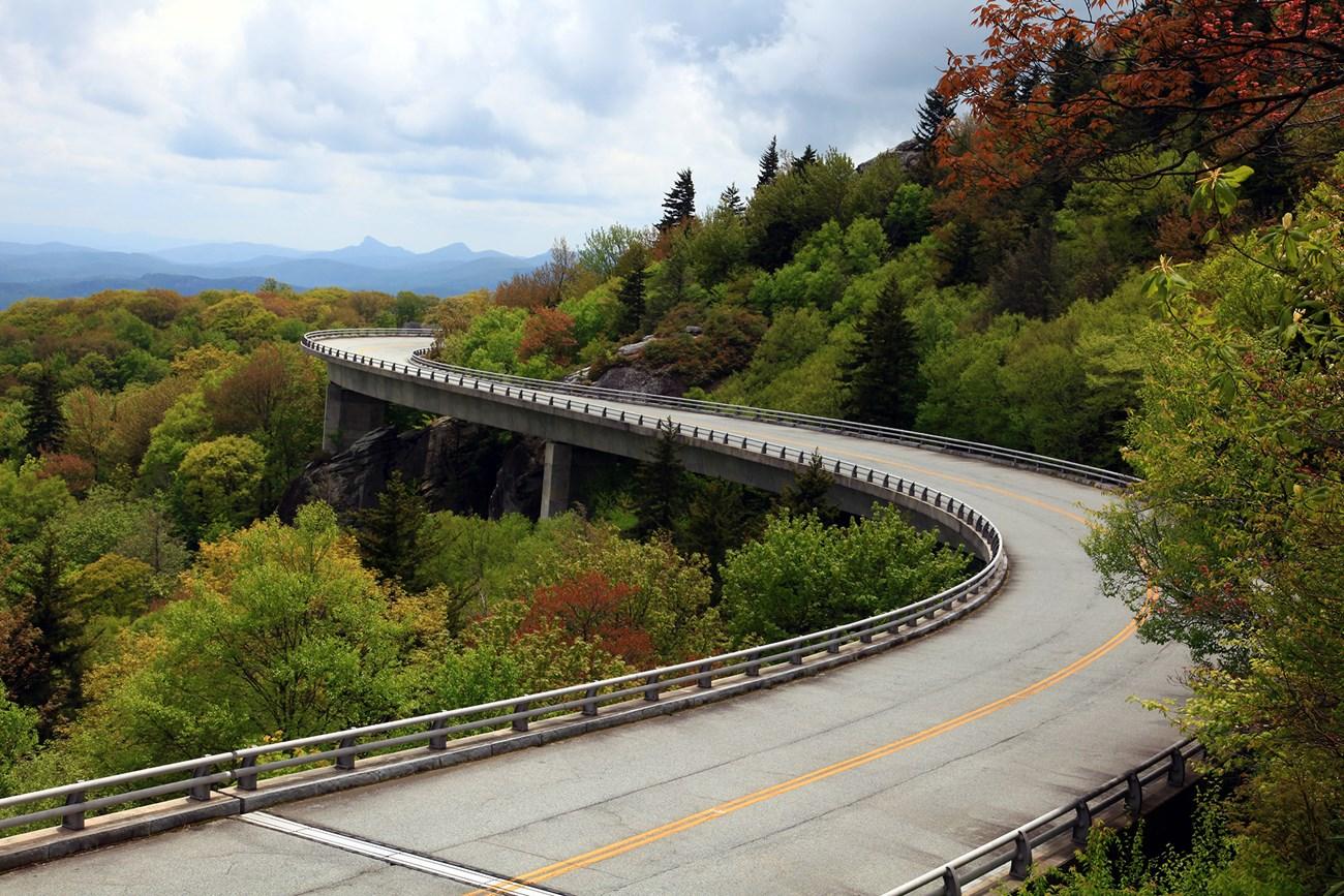 Blue Ridge Mountains
, North Carolina, offer scenic parkway drives, Appalachian trails, waterfalls, high peaks, Cherokee culture and mountain towns.
-


Swipe for more destinations
Explore more
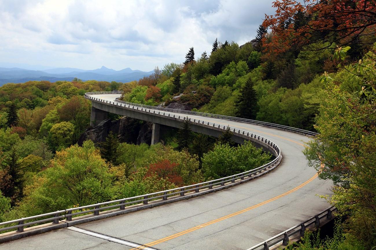
Explore more of Southwest Virginia
Southwest Virginia combines Appalachian mountain scenery, country music heritage, historic trails, rivers and small-town culture across the Commonwealth's western highlands.
Explore Southwest Virginia
Explore more of Virginia
Discover Virginia: A blend of historic landmarks, natural beauty, and vibrant culture perfect for history buffs, nature lovers, and culture seekers.
Explore Virginia