

Geghama Mountains Travel Guide - Free Web & App
Your ultimate guide to Geghama Mountains. Discover top landmarks, proposed trips, and local tips. Free on the web or via the Evendo companion app.


Geghama Mountains, Armenia: hike volcanic peaks, crater lakes and ancient petroglyphs between Yerevan, Garni and Lake Sevan across Armenia’s highlands.
Volcanic Landscapes Between Yerevan and Lake Sevan
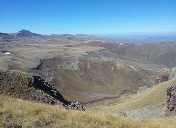
The Geghama Mountains form a broad volcanic upland in central Armenia, rising between the Ararat plain and Lake Sevan. Their slopes are reached from several directions, including the Garni and Geghard area to the west, highland tracks near Sevaberd to the north, and rural approaches from the Lake Sevan basin. There is no single defined town or visitor centre at the heart of the range; instead, the landscape unfolds through open grasslands, dark volcanic ridges, deeply eroded valleys and isolated summits. The highest point is Mount Azhdahak, rising to approximately 3,597 metres, while Mount Spitakasar and other volcanic peaks give the range its distinctive skyline.Read more about Geghama Mountains
Crater Lakes, Ancient Marks and Seasonal Pastures
Exploring a Remote Mountain Region
When is the best time to visit Geghama Mountains?
Best: June, August–September · 24–29°C| Month | High (°C) | Rainfall (mm) |
|---|---|---|
| January | 2 | 22 |
| February | 3 | 20 |
| March | 8 | 17 |
| April | 15 | 15 |
| May | 20 | 12 |
| June (best) | 26 | 9 |
| July | 31 | 7 |
| August (best) | 29 | 7 |
| September (best) | 24 | 10 |
| October | 16 | 14 |
| November | 8 | 17 |
| December | 3 | 20 |
Getting to and around Geghama Mountains
How to get there
Transportation
Best landmarks in Geghama Mountains
Mount Azhdahak is the defining natural landmark of the Geghama Mountains, combining a high volcanic summit with a visible crater and expansive views across central Armenia. The range’s other volcanic cones, lava-covered slopes and crater depressions create a geological landscape more characteristic of an ancient volcanic field than a built resort. Lake Akna is a notable high-altitude water feature, while the petroglyph fields are important cultural landmarks because they preserve images made by prehistoric communities moving through the uplands. On the western approaches, Garni Temple and the Monastery of Geghard are major historic landmarks associated with the surrounding gorges and routes, though they are not located on the remote summits. The proximity of these monuments to the volcanic highlands connects Armenia’s classical and medieval heritage with a much older pastoral and archaeological landscape.
Explore Geghama Mountains on the map
Plan your trip on one map. See where the top attractions, landmarks, restaurants and hotels are, and book hotels and experiences in a few clicks.
Best hotels in Geghama Mountains
Get your free copy of our complete guide to Geghama Mountains, delivered straight to you.
Everything on this page, from attractions and restaurants to essentials and local phrases, in one PDF you can read offline, print or share.
Already have an account? Sign in
Your Geghama Mountains guide is ready.
We'll send it to · Not you? Sign out

Getting your guide ready…
We are putting together a fresh copy of the Geghama Mountains guide. This can take up to a minute.
This can take a few moments. If your browser asks, choose Allow so the download can start. You'll find the guide in your Downloads folder.
Nothing happened? Download it again
Sorry, the guide is taking longer than usual. Please try again in a minute, or get it by email instead.
Geghama Mountains essentials
Currency and Payment
Safety
Emergency Situations
Do's and Don'ts
Local Tips
From Eve
Local phrases worth knowing
You don't need to get them perfect. A few words go a long way, and locals appreciate the effort.
Basics
| English | Local | Say it |
|---|---|---|
| Hello | Բարև | [Barev] |
| Goodbye | Ցտեսություն | [Tsdesutun] |
| Yes | Այո | [Ayo] |
| No | Ոչ | [Voç] |
| Please/You're welcome | Խնդրեք | [Khndrekh] |
| Thank you | Շնորհակալ եմ | [Shnorhakal em] |
| Excuse me/Sorry | Ներքեք ինձ | [Nerkhek indz] |
| How are you? | Ինչպե՞ս եք | [Inchpes ek] |
| Fine. And you? | Լավ եմ. Անդե՞ Դու | [Lav em. Ande? Du] |
| Do you speak English? | Դուք խոսում եք անգլերեն | [Duk khosum ek angleren] |
| I don't understand | Ես չեմ հասկանա | [Yes chem haskanə] |
Eating & Drinking
| English | Local | Say it |
|---|---|---|
| I'd like to see the menu, please | Խնդրում եմ մենյունը տեսնել | [Khndrum em menyunə tsnel] |
| I don't eat meat | Ես միս չուտում | [Yes mis chutum] |
| Cheers! | Կարմիր! | [Karmir] |
| I would like to pay, please | Խնդրում եմ վճարել | [Khndrum em vcharəl] |
Emergencies
| English | Local | Say it |
|---|---|---|
| Help! | Օրհնեք! | [Orhnək] |
| Go away! | Հետ գնալ | [Het gnal] |
| Call the Police! | Զինվորական կանչեք | [Zinvorakan kanchək] |
| Call a doctor! | Բժշկի կանչեք | [Bzhski kanchək] |
| I'm lost | Ես կորցրել եմ | [Yes kortsrel em] |
| I'm ill | Ես հիվանաժել եմ | [Yes hivanazhel em] |
Shopping
| English | Local | Say it |
|---|---|---|
| I'd like to buy... | Խնդրում եմ գնել | [Khndrum em gnel] |
| I'm just looking | Ուզում եմ տեսնել | [Uzum em tsnəl] |
| How much is it? | Քանի է դամաս | [Kani e damas] |
| That's too expensive | Այն շատ թանկ է | [Ayn shat tank e] |
| Can you lower the price? | Կարող եք գներածել | [Karogh ek gnəratsel] |
Time & Numbers
| English | Local | Say it |
|---|---|---|
| What time is it? | Տեղեկություն կի՞ս | [Teghekutun kis] |
| It's one o'clock | Երկուս է | [Erkus e] |
| Half past (10) | Կես է | [Kes e] |
| Morning | Առավոտ | [Aravot] |
| Afternoon | Կեսգիշ | [Kesgish] |
| Evening | Երեկ | [Erek] |
| Yesterday | Երեկո | [Ereko] |
| Today | Այսօր | [Aysor] |
| Tomorrow | Վաղը | [Vage] |
| 1 | Ամենամեկ | [Amenamek] |
| 2 | Երկու | [Erku] |
| 3 | Երեք | [Erek] |
| 4 | Չորս | [Chors] |
| 5 | Հինգ | [Hing] |
| 6 | Վեց | [Vets] |
| 7 | Յոթ | [Yot] |
| 8 | Ութ | [Ut] |
| 9 | Ինը | [Ine] |
| 10 | Տաս | [Tas] |
Transport & Directions
| English | Local | Say it |
|---|---|---|
| Where's a/the...? | Որտեղ է ...? | [Vortegh e...?] |
| What's the address? | Հասցեն ի՞նչ է | [Hascen inch e] |
| Can you show me (on the map)? | Կարող եք ցուցադրել (քարտեզի վրա) | [Karogh ek tsutsadrel (kartezhi vra)] |
| When's the next (bus)? | Երբ է հաջողվում հաջողվել | [Yerp e hajoghvum hajoghvel] |
| A ticket (to ....) | Բիլետ (մի տեղ) | [Bilet (mi tegh)] |
History of Geghama Mountains
A Volcanic Highland Formation
The Geghama Mountains are a volcanic range formed through successive eruptions and lava-producing episodes within Armenia’s highland landscape. Their broad plateaux, cones, lava fields and crater depressions differ from the sharply folded appearance of many older mountain systems. Erosion, seasonal snow and long-term weathering have shaped the dark ridges and open valleys visible today. Volcanic features are especially apparent around Mount Azhdahak, whose summit contains a prominent crater, and around other high peaks such as Spitakasar. This geological foundation has influenced later human use: the uplands provide summer pasture and water in an otherwise exposed environment, while their steep approaches have kept many areas lightly developed.
Prehistoric Movement Through the Range
Rock carvings scattered across parts of the Geghama uplands provide evidence of prehistoric activity in the mountains. The petroglyphs depict subjects including animals, human figures, hunting scenes and symbolic marks, although individual interpretations and dates vary. Their presence indicates that the high plateaux were not isolated from human life, but formed part of wider routes between lower settlements, grazing grounds and water sources. The carvings are best understood within Armenia’s broader prehistoric landscape, where pastoral movement and seasonal occupation connected mountain environments with the valleys below. Their survival also reflects the limited intensity of later construction across much of the range.
Pastoral Traditions and Seasonal Grazing
For centuries, the Geghama Mountains have formed part of a pastoral landscape in which livestock are moved towards high summer pastures. The short growing season produces open grassland rather than continuous woodland, and temporary shepherding camps have traditionally followed the availability of water and grazing. This seasonal pattern helped preserve the range’s spacious character while linking it economically and culturally with nearby villages. Modern visitors may encounter livestock, shepherds and rough tracks used for rural access. Such encounters are part of a living landscape rather than staged heritage, and travellers should keep distance from animals, avoid obstructing vehicles and respect working pasture.
Garni, Geghard and the Western Approaches
The western side of the mountains lies close to some of Armenia’s most important historic places, including the Temple of Garni and the Monastery of Geghard. These monuments are not interchangeable with the high Geghama range itself, but their position on the approaches helps explain the region’s long historical importance. River valleys, upland routes and passes connected the Ararat plain with interior highlands and the Lake Sevan basin. Garni preserves a rare surviving classical temple in Armenia, while Geghard represents a medieval monastic tradition deeply associated with the surrounding gorge. Both provide cultural context for excursions into the mountains.
Modern Exploration and Conservation
During the modern period, the Geghama Mountains became increasingly visible to mountaineers, trekkers, geologists and nature travellers rather than mass tourism. Parts of the western and southern mountain landscape relate to the Khosrov Forest State Reserve, whose protected territory is separate from the range as a whole; access rules therefore depend on the precise route and locality. Remote roads, fragile vegetation, archaeological remains and seasonal grazing continue to shape responsible travel. Contemporary interest focuses on low-impact hiking, geological observation, prehistoric rock art and highland scenery, with local guides often providing the most practical link between settlements and the remote interior.
Geghama Mountains in Photos
Browse through our photo collection highlighting the charm and character of the destination.
Neighbouring destination travel guides
The closest destinations to Geghama Mountains, if you have time for more than one.
-

-

-

-

-


Swipe for more destinations
Explore more
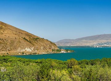
Explore more of Gegharkunik
Explore Gegharkunik in Armenia for Lake Sevan, medieval monasteries, khachkars, mountain scenery and highland Armenian food traditions.
Explore Gegharkunik
Explore more of Armenia
Explore Armenia's ancient wonders, vibrant cities, and breathtaking landscapes. From historic monasteries to delicious cuisine, there's something for every traveler.
Explore Armenia