

West End (Brisbane) Travel Guide - Free
Explore West End in Brisbane with Evendo's free guide. Find the best shops, historic streets, restaurants, and gems on web or mobile.


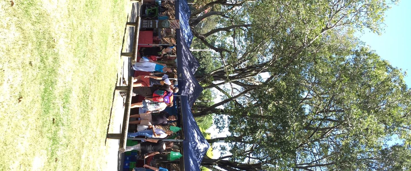


West End Brisbane combines Kurilpa history, multicultural dining, Boundary Street cafés, riverside walks, Davies Park markets and live local culture.
A Riverside Neighbourhood with Many Layers
West End occupies the western end of the Brisbane peninsula south of the Brisbane River, a walkable inner-city neighbourhood known locally as Kurilpa. Its streets combine Queenslander houses, apartment buildings, small businesses and leafy riverside reserves, while Boundary Street provides the main commercial spine. The area sits close to South Brisbane and the cultural institutions of the Queensland Cultural Centre, but retains a distinct identity shaped by long-established residents, newer arrivals and a broad mix of cafés, restaurants, community organisations and independent shops.Read more about West End
Everyday Life on Boundary Street
River Walks, Markets and Public Space
Best landmarks in West End
West End's most meaningful landmarks are closely tied to its river setting, civic history and everyday commercial life. Davies Park is both a substantial open space and a social landmark, recognised across Brisbane for its markets and broad riverside lawns. Orleigh Park marks the neighbourhood's relationship with the Brisbane River and forms part of a valued public walkway along the water. West End State School represents the suburb's nineteenth-century institutional development, while the surviving Queenslander houses and older shopfronts around Boundary Street and Vulture Street preserve traces of its earlier residential and trading patterns. The West End ferry terminal at Montague Road is a practical transport structure with symbolic importance, linking the neighbourhood to Brisbane's river-based public transport network. Together these places show how West End grew through schools, homes, local commerce, public recreation and connections across the river.
-
Historical landmark
Whynot Hill
Discover the rich history and stunning views of Whynot Hill, a historical landmark that offers a peaceful escape in Brisbane's vibrant West End.
4 min walk · 0.3 km from neighbourhood centre

Explore West End on the map
A handpicked selection of must-see spots in West End, mapped for you.
Best hotels in West End
Best restaurants in West End
West End has one of Brisbane's most varied inner-suburban dining scenes, concentrated particularly along Boundary Street and extending along Vulture Street and Montague Road. Vietnamese, Greek, Middle Eastern, South Asian and contemporary Australian influences appear in restaurants, bakeries, takeaway counters and grocers, reflecting the communities that have shaped the suburb since the post-war period. Casual eating is central to the local rhythm, with coffee shops, breakfast venues, vegetarian options and international meals sitting alongside long-established delicatessens and specialist food stores. The Saturday markets at Davies Park add prepared food, seasonal produce and locally made products, although the offer changes from stall to stall. Outdoor tables and relaxed evening dining give Boundary Street much of its social energy, while the surrounding side streets provide smaller cafés and neighbourhood venues away from the main traffic.
-
Restaurant
Covent Garden - Gin Bar & Restaurant
Explore exquisite cuisine and an unparalleled gin selection at Covent Garden - Gin Bar & Restaurant in vibrant West End, Queensland.
4 min walk · 0.3 km from neighbourhood centre

Best bars in West End
West End's nightlife is centred on relaxed bars, pubs, small music venues and restaurants rather than a large concentration of nightclubs. Boundary Street is the main evening corridor, where drinking and dining venues create a sociable atmosphere without entirely displacing the area's residential character. The neighbourhood has long been associated with live music and informal cultural activity, although programmes and venues change over time, so current event information is essential. Vulture Street and Montague Road provide additional options, including places suited to a quiet drink or a casual meal after dark. Weekends can be busy around popular venues and events, while streets away from the commercial centre become noticeably quieter. Visitors should remember that many bars sit close to homes and keep conversations and departures considerate late at night.
-
Bar
Covent Garden - Gin Bar & Restaurant
Experience the perfect blend of craft gin and modern Australian cuisine at Covent Garden, West End's premier gin bar and restaurant.
4 min walk · 0.3 km from neighbourhood centre
-
Bar
The Bearded Lady
Experience the vibrant culture of Brisbane at The Bearded Lady, a beloved bar and live music venue in West End.
4 min walk · 0.3 km from neighbourhood centre
-
Bar
The End Bar
Unwind at The End Bar in West End, Queensland—where great drinks meet a vibrant atmosphere in the heart of the city.
3 min walk · 0.2 km from neighbourhood centre
-
Cocktail bar
Jungle Tiki Bar, West End, Brisbane
Experience a slice of paradise at Jungle Tiki Bar, West End's tropical cocktail haven perfect for relaxation and socializing.
3 min walk · 0.3 km from neighbourhood centre


Best nightclubs in West End
West End's nightlife is centred on relaxed bars, pubs, small music venues and restaurants rather than a large concentration of nightclubs. Boundary Street is the main evening corridor, where drinking and dining venues create a sociable atmosphere without entirely displacing the area's residential character. The neighbourhood has long been associated with live music and informal cultural activity, although programmes and venues change over time, so current event information is essential. Vulture Street and Montague Road provide additional options, including places suited to a quiet drink or a casual meal after dark. Weekends can be busy around popular venues and events, while streets away from the commercial centre become noticeably quieter. Visitors should remember that many bars sit close to homes and keep conversations and departures considerate late at night.
-
Bar
The Bearded Lady
Discover The Bearded Lady, a quirky bar and live music venue in West End, perfect for drinks, entertainment, and a vibrant atmosphere.
4 min walk · 0.3 km from neighbourhood centre
-
Cocktail bar
Jungle Tiki Bar, West End, Brisbane
Experience a tropical oasis at Jungle Tiki Bar in West End, Brisbane, offering creative cocktails and lively entertainment in a vibrant atmosphere.
3 min walk · 0.3 km from neighbourhood centre


Best shops in West End
Shopping in West End is local, independent and closely connected with food culture. Boundary Street contains the largest concentration of everyday retail, including cafés, bakeries, restaurants, small grocers, bookshops and specialist stores, while Vulture Street and Montague Road add further businesses. The neighbourhood is particularly useful for browsing international ingredients and prepared foods associated with its Greek, Vietnamese, Middle Eastern and broader Asian influences. Davies Park becomes a major retail setting during the Saturday markets, when stalls sell seasonal produce, baked goods, crafts, plants and products from local makers. This is not a conventional chain-shopping district, and stock and stallholders vary, but that changing mix is part of the appeal. The quieter residential blocks are more notable for architecture and gardens than for retail, making Boundary Street the natural starting point for independent shopping.
-
Vintage clothing store
Neo-Generalist
Explore Neo-Generalist, a vintage clothing store in West End, Queensland, where unique fashion pieces and sustainable shopping collide.
3 min walk · 0.2 km from neighbourhood centre
-
Shop
Open House
Explore Open House in West End for unique gifts and local artisan treasures that capture the essence of Queensland culture.
2 min walk · 0.2 km from neighbourhood centre
-
Vintage clothing store
Brik Market
Explore Brik Market, West End's vintage clothing store where unique fashion pieces and local culture come together for an unforgettable shopping experience.
3 min walk · 0.2 km from neighbourhood centre
-
Vintage clothing store
The Love Bubble Collective.
Explore The Love Bubble Collective, a vintage clothing store in West End, Queensland, where every piece tells a story and fashion meets sustainability.
3 min walk · 0.2 km from neighbourhood centre


West End essentials
Getting There
Getting Around
Safety
Emergency Situations
Do's and Don'ts
Local Tips

From Eve
Local phrases worth knowing
You don't need to get them perfect. A few words go a long way, and locals appreciate the effort.
Basics
| English | Local | Say it |
|---|---|---|
| Hello | G'day | [g'day] |
| Goodbye | See ya | [see ya] |
| Yes | Yeah | [yeah] |
| No | Nah | [nah] |
| Please/You're welcome | Please/Ta | [please/ta] |
| Thank you | Cheers | [cheers] |
| Excuse me/Sorry | Sorry | [sorry] |
| How are you? | How ya goin'? | [how ya goin'] |
| Fine. And you? | Good. You? | [good. you?] |
| Do you speak English? | You speak English? | [you speak english?] |
| I don't understand | I don't get it | [i don't get it] |
Eating & Drinking
| English | Local | Say it |
|---|---|---|
| I'd like to see the menu, please | Menu, thanks | [menu, thanks] |
| I don't eat meat | No meat for me | [no meat for me] |
| Cheers! | Cheers! | [cheers!] |
| I would like to pay, please | Bill, thanks | [bill, thanks] |
Emergencies
| English | Local | Say it |
|---|---|---|
| Help! | Help! | [help!] |
| Go away! | Bugger off! | [bugger off!] |
| Call the Police! | Call the cops! | [call the cops!] |
| Call a doctor! | Get a doctor! | [get a doctor!] |
| I'm lost | I'm lost | [i'm lost] |
| I'm ill | I'm sick | [i'm sick] |
Shopping
| English | Local | Say it |
|---|---|---|
| I'd like to buy... | I want to buy... | [i want to buy...] |
| I'm just looking | Just looking | [just looking] |
| How much is it? | How much? | [how much?] |
| That's too expensive | Too pricey | [too pricey] |
| Can you lower the price? | Can you do it cheaper? | [can you do it cheaper?] |
Time & Numbers
| English | Local | Say it |
|---|---|---|
| What time is it? | What's the time? | [what's the time?] |
| It's one o'clock | It's one | [it's one] |
| Half past (10) | Half ten | [half ten] |
| Morning | Morning | [morning] |
| Afternoon | Arvo | [arvo] |
| Evening | Evening | [evening] |
| Yesterday | Yesterday | [yesterday] |
| Today | Today | [today] |
| Tomorrow | Tomorrow | [tomorrow] |
| 1 | One | [one] |
| 2 | Two | [two] |
| 3 | Three | [three] |
| 4 | Four | [four] |
| 5 | Five | [five] |
| 6 | Six | [six] |
| 7 | Seven | [seven] |
| 8 | Eight | [eight] |
| 9 | Nine | [nine] |
| 10 | Ten | [ten] |
Transport & Directions
| English | Local | Say it |
|---|---|---|
| Where's a/the...? | Where's the...? | [where's the...?] |
| What's the address? | What's the address? | [what's the address?] |
| Can you show me (on the map)? | Show me (on the map) | [show me (on the map)] |
| When's the next (bus)? | When's the next (bus)? | [when's the next (bus)?] |
| A ticket (to ....) | A ticket (to ....) | [a ticket (to ....)] |
History of West End
Kurilpa Before European Settlement
West End lies on the traditional lands of the Turrbal and Jagera peoples, and Kurilpa is a local Aboriginal name associated with the area around the Brisbane River. The river flats, creeks and higher ground supported movement, food gathering and cultural life long before the arrival of European settlers. The continuing use of the name Kurilpa in local parks and public projects reflects an effort to acknowledge this earlier history, although the neighbourhood's Indigenous story extends well beyond the visible plaques and place names found today.
A Suburb at Brisbane's Western Edge
European settlement expanded into the area during the nineteenth century as Brisbane grew south and west from its early town centre. The name West End was adopted in reference to London's West End, although the Brisbane district developed as a residential suburb rather than an equivalent entertainment quarter. Streets were laid out across the peninsula, timber houses appeared on elevated ground and small commercial premises served a growing population. West End State School, established in the nineteenth century, remains a reminder of the suburb's early civic development.
Trams, Houses and Inner-Suburban Growth
Tram connections helped turn West End into a well-linked inner suburb, tying its residential streets to Brisbane's central business district and adjoining South Brisbane. The network encouraged denser development along routes such as Boundary Street and Vulture Street, while Queenslander houses and small corner shops shaped the quieter blocks behind them. Brisbane's trams were progressively replaced by buses, and the West End tram service ended in 1969. Even after that change, the neighbourhood's compact street pattern and proximity to the river continued to support local shopping and walking.
Migration, Markets and Changing Urban Life
The decades after the Second World War brought new migrant communities and businesses to West End, adding Greek, Vietnamese and other cultural influences to an already changing inner suburb. Restaurants, grocers, cafés and community organisations helped give Boundary Street its diverse character. Davies Park became an important open space and later a setting for regular markets, connecting food production, local enterprise and neighbourhood social life. More recently, apartment construction, rising housing demand and nearby cultural development have altered parts of West End, while debates about density and heritage continue to shape its identity.
West End in Photos
Browse through our photo collection highlighting the charm and character of the destination.
Neighbourhoods near West End
The closest neighbourhoods to West End, if you have time for more than one stop.
-

-

-
-


Swipe for more neighbourhoods
Explore more
Explore more of Brisbane
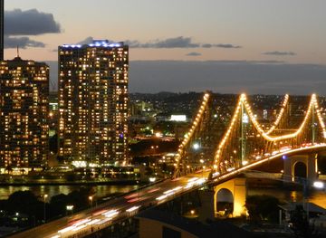
Brisbane blends subtropical river scenery, Queensland heritage, major galleries, lively neighbourhoods and easy access to coastal and hinterland escapes across Queensland, Australia.
Explore Brisbane