

Mesa Verde National Park Travel Guide - Free Web & App
Your ultimate guide to Mesa Verde National Park. Discover top landmarks, proposed trips, and local tips. Free on the web or via the Evendo companion app.


Mesa Verde National Park in Colorado reveals Ancestral Pueblo cliff dwellings, canyon landscapes, archaeological sites and high-desert wildlife.
High Country and Archaeological Heritage
Mesa Verde National Park occupies a broad, forested plateau in south-western Colorado, where the land drops into deep canyons cut through pale sandstone. Its name, meaning “green table”, reflects the elevated mesa landscape, although the park’s defining sights are the remarkable cliff dwellings built beneath overhanging rock alcoves. More than 600 cliff dwellings and thousands of other archaeological sites record the achievements of Ancestral Pueblo communities who lived here for centuries.Read more about Mesa Verde National Park
Exploring the Mesas
Landscape, Wildlife and Gateway Towns
When is the best time to visit Mesa Verde National Park?
Best: June, August–September · 23–27°C| Month | High (°C) | Rainfall (mm) |
|---|---|---|
| January | 3 | 28 |
| February | 5 | 26 |
| March | 9 | 27 |
| April | 14 | 25 |
| May | 19 | 31 |
| June (best) | 24 | 23 |
| July | 28 | 35 |
| August (best) | 27 | 35 |
| September (best) | 23 | 31 |
| October | 16 | 27 |
| November | 8 | 28 |
| December | 4 | 31 |
Getting to and around Mesa Verde National Park
How to get there
Transportation
Best attractions in Mesa Verde National Park
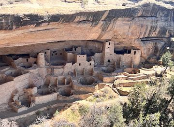
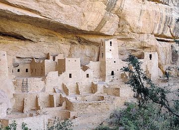
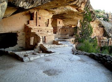
Mesa Verde’s principal attractions are its archaeological settlements and the landscapes that contain them. On Chapin Mesa, Cliff Palace is the largest known cliff dwelling in North America, while Balcony House and Spruce Tree House provide different perspectives on Ancestral Pueblo architecture and community life; access to some sites is controlled through ranger-guided tours or current park arrangements. The Mesa Top Loop Road links overlooks and archaeological locations, including the remains of mesa-top villages and views into deep canyons. Wetherill Mesa, when accessible, offers Long House and a quieter network of archaeological sites and trails. The Chapin Mesa Archaeological Museum adds cultural and historical context, while overlooks across the park open towards the Four Corners landscape. Beyond the ruins, visitors encounter piñon-juniper woodland, ponderosa pine, canyon rims and wildlife habitats that explain why farming, movement and settlement developed in such a distinctive setting.
-
Visitor center
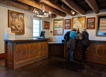
Mesa Verde Visitor & Research Center
Discover Ancestral Puebloan history and plan your Mesa Verde adventure at the park's central visitor hub.
-
Tourist attraction
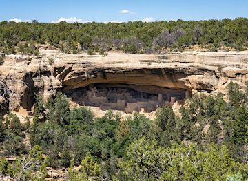
Cliff Palace
Explore the ancient Cliff Palace, the largest cliff dwelling in North America, and step back in time to experience Ancestral Puebloan life in Mesa Verde.
-
Tourist attraction
Balcony House
Explore Balcony House in Mesa Verde: A thrilling adventure into Ancestral Puebloan history and architecture.
-
Tourist attraction
Chapin Mesa Archeological Museum
Discover the ancient world of the Ancestral Pueblo people at Mesa Verde's Chapin Mesa Archeological Museum.
Best landmarks in Mesa Verde National Park
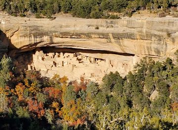
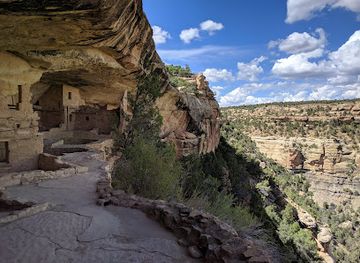
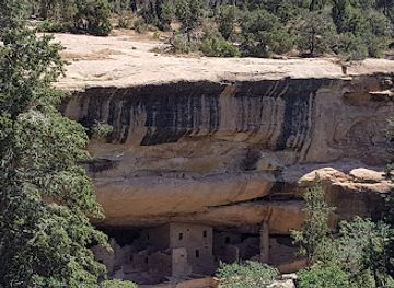
Mesa Verde’s defining landmarks are the sandstone alcoves and cliff dwellings suspended beneath the edges of its high plateau. Cliff Palace is the park’s most famous architectural landmark, with clustered rooms and kivas built into a broad natural recess, while Balcony House and Long House demonstrate different relationships between masonry, rock shelter and canyon terrain. Spruce and Navajo canyons help explain the park’s topography, their steep walls separating mesa-top settlements from the lower landscape. Far View sites preserve evidence of earlier communities on the open mesa, contrasting with the later cliff settlements. The Chapin Mesa Archaeological Museum is an important interpretive landmark, while the park’s overlooks provide wide views across forested mesas and the Four Corners region. Together, these features express the close connection between geology, architecture, agriculture and ancestral Pueblo cultural history.
-
Historical landmark
Cliff Palace
Unveil the mysteries of Cliff Palace, the largest cliff dwelling in North America, and explore the rich heritage of the Ancestral Puebloans in stunning Mesa Verde.
-
Historical landmark
Balcony House
Discover the ancient cliff dwelling of Balcony House in Mesa Verde National Park, a significant historical landmark revealing the lives of the Puebloan people.
-
Historical landmark
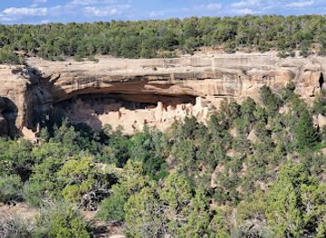
Step House
Discover the ancient cliff dwellings of Step House in Mesa Verde National Park, a must-visit historical landmark showcasing Puebloan heritage.
-
Archaeological site
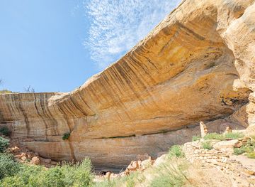
Sun Temple
Explore the Sun Temple at Mesa Verde, a stunning archaeological site revealing the ancient legacy of the Ancestral Puebloans amidst breathtaking landscapes.
Explore Mesa Verde National Park on the map
Plan your trip on one map. See where the top attractions, landmarks, restaurants and hotels are, and book hotels and experiences in a few clicks.
Best hotels in Mesa Verde National Park
Best restaurants in Mesa Verde National Park
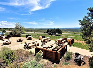
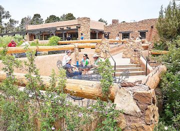
Dining inside Mesa Verde National Park is limited and may be seasonal, so most visitors plan meals around the park’s established concessions, accommodation areas or packed provisions rather than expecting a broad restaurant scene. Cortez is the principal nearby dining centre, with the greatest range of restaurants, cafés and food shops, while Mancos and Durango provide additional choices outside the park. Regional menus across south-western Colorado may include Mexican-influenced cooking, green chile, locally produced meats, baked goods and ingredients associated with the wider Four Corners region, although offerings vary by establishment. Farm shops and independent food businesses around the gateway towns can be useful for picnic supplies. Carry water and food for longer drives and walks, particularly when exploring away from the main visitor facilities or travelling outside peak operating periods.
-
American
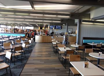
Far View Terrace Café / Gift Shop / Mesa Mocha
Experience delicious American cuisine with stunning views at Far View Terrace Café in Mesa Verde National Park.
-
American
Spruce Tree Terrace Café
Discover the flavors of America at Spruce Tree Terrace Café in Mesa Verde National Park – where delicious food meets stunning natural beauty.
Best bars in Mesa Verde National Park
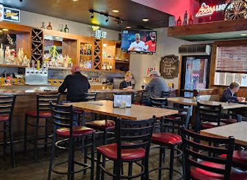
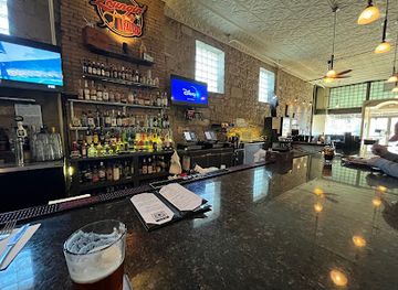
Mesa Verde National Park has no substantial nightlife district, and evenings are generally quiet once visitors leave the archaeological areas and scenic roads. The park’s accommodation and campground areas may provide a sociable setting, but services and opening patterns vary, so they should not be treated as a late-night entertainment centre. Cortez offers the nearest concentration of restaurants, bars and casual evening venues, while Mancos has a smaller community-oriented scene and Durango provides a broader choice of pubs, breweries, live performances and evening dining outside the destination. In the park itself, the most characteristic after-dark experience is a clear, dark sky rather than club entertainment, although visitors should follow current rules and respect quiet hours around campsites and accommodation.
-
Bar
J Fargo's Family Dining & Micro Brewery
Experience the best of traditional American cuisine and craft brews at J Fargo's Family Dining & Micro Brewery in Cortez, Colorado.
-
Restaurant
Loungin' Lizard
Experience the vibrant atmosphere and unique flavors of Loungin' Lizard, a top dining destination in Cortez, Colorado.
-
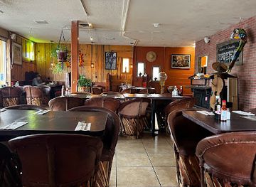
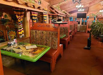
Mexican
Chavolo's Mexican Restaurant
Experience the vibrant flavors of Mexico at Chavolo's Mexican Restaurant in Mancos, Colorado - a must-visit dining destination for tourists.
-
Mexican
Fiesta Mexicana Restaurant Cortez
Experience authentic Mexican flavors at Fiesta Mexicana Restaurant in Cortez, where every meal is a celebration of culture and community.
Best shops in Mesa Verde National Park
Shopping within Mesa Verde National Park is modest and centred on official park outlets, books, maps, educational material and carefully selected gifts connected with the archaeological heritage of the area. Visitors should not expect a conventional shopping district inside the park. The nearest broader retail opportunities are in Cortez, where shops and galleries serve as useful places to look for regional artwork, Native American-inspired and Indigenous-produced goods, books about Pueblo history, outdoor equipment and food supplies; Mancos and Durango provide further choices outside the park. Purchases should be made with cultural awareness, particularly when buying Indigenous art or archaeological-looking objects: avoid anything presented as an artefact unless its legal and ethical provenance is clear. Local food products and practical supplies are generally easier to find in the gateway towns than within the park.
-
Historical landmark
Cliff Palace
Explore Cliff Palace, an exquisite archaeological site in Mesa Verde National Park, revealing the rich history of the Ancestral Puebloans amidst breathtaking landscapes.
-
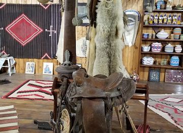
Gift shop
Notah Dineh Trading Co
Discover authentic Native American art and crafts at Notah Dineh Trading Co, a unique gift shop, art gallery, and museum in Cortez, Colorado.
-
Museum
Chapin Mesa Archeological Museum
Discover the ancient Pueblo culture at Chapin Mesa Archeological Museum in Mesa Verde National Park, where history comes alive through artifacts and exhibits.
-
American
Far View Terrace Café / Gift Shop / Mesa Mocha
Experience the perfect blend of American cuisine and breathtaking views at Far View Terrace Café in Mesa Verde National Park.
Get your free copy of our complete guide to Mesa Verde National Park, delivered straight to you.
Everything on this page, from attractions and restaurants to essentials and local phrases, in one PDF you can read offline, print or share.
Already have an account? Sign in
Your Mesa Verde National Park guide is ready.
We'll send it to · Not you? Sign out

Getting your guide ready…
We are putting together a fresh copy of the Mesa Verde National Park guide. This can take up to a minute.
This can take a few moments. If your browser asks, choose Allow so the download can start. You'll find the guide in your Downloads folder.
Nothing happened? Download it again
Sorry, the guide is taking longer than usual. Please try again in a minute, or get it by email instead.
Mesa Verde National Park essentials
Currency and Payment
Safety
Emergency Situations
Do's and Don'ts
Local Tips
From Eve
Local phrases worth knowing
You don't need to get them perfect. A few words go a long way, and locals appreciate the effort.
Basics
| English | Local | Say it |
|---|---|---|
| Hello | Yá'át'ééh | [yah-ah-tay] |
| Goodbye | Hágoónee' | [hah-goo-neh] |
| Yes | Aoo' | [ah-oh] |
| No | Doo' | [doh] |
| Please/You're welcome | Ahe'hee' | [ah-hay-hee] |
| Thank you | Ahéhee' | [ah-hay-hee] |
| Excuse me/Sorry | T'áá hwó' ají t'éego | [taa-hwo-ah-jee-tay-go] |
| How are you? | Yá'át'ééh? | [yah-ah-tay?] |
| Fine. And you? | Bááh. Ak'é'é? | [bah-ah-ah-kay] |
| Do you speak English? | Shí éí Dóó Nitsaa? | [shee-ee-doh-neet-sah] |
| I don't understand | T'áá hwó' ají t'éego | [taa-hwo-ah-jee-tay-go] |
Eating & Drinking
| English | Local | Say it |
|---|---|---|
| I'd like to see the menu, please | Naat'áanii nizhónígo bííníl | [naa-taa-ni-nee-nee-zhoh-nee-go-bee-nee] |
| I don't eat meat | Nihí bikéyah dahsidilį́į́' | [nee-hee-bee-kay-yah-dah-si-dee-lee-lee] |
| Cheers! | Aayóó anííníshní | [ah-yoh-oh-ah-neen-ish-nee] |
| I would like to pay, please | Naat'áanii be'éhózinígíí | [naa-taa-ni-beh-hoh-zee-neeh-gee] |
Emergencies
| English | Local | Say it |
|---|---|---|
| Help! | Áyóó | [ah-yoh-oh] |
| Go away! | Yá'át'ééh | [yah-ah-tay] |
| Call the Police! | Básh ch'inígíí | [bah-sh-chi-nee-gee] |
| Call a doctor! | Básh níłchí | [bah-sh-neel-chee] |
| I'm lost | T'áá hwó' nishłį́ | [taa-hwo-neesh-lee] |
| I'm ill | T'áá hwó' nííł | [taa-hwo-neel] |
Shopping
| English | Local | Say it |
|---|---|---|
| I'd like to buy... | Naat'áanii níłchí | [naa-taa-ni-neel-chee] |
| I'm just looking | T'áá hwó' nihiki | [taa-hwo-nee-hee-kee] |
| How much is it? | Shik'éí da? | [shee-kay-deh] |
| That's too expensive | Hajííł nídeeshchíí' | [hah-jee-lee-nee-day-shchee] |
| Can you lower the price? | Awe' níłchí yee ánilyé | [ah-way-neel-chee-yay-ah-nee-lyay] |
Time & Numbers
| English | Local | Say it |
|---|---|---|
| What time is it? | T'áá hwó' nízin? | [taa-hwo-neezin] |
| It's one o'clock | Háádéí nááhóóhai | [hah-deh-ee-naa-hoh-hai] |
| Half past (10) | Ashdla' názhóní | [ash-dlah-naa-zhoh-nee] |
| Morning | Nízhóní | [nee-zhoh-nee] |
| Afternoon | Niwólí | [nee-woh-lee] |
| Evening | T'áá hwó' | [taa-hwo] |
| Yesterday | Kesté | [kes-tay] |
| Today | Jóhonaa'éí | [joh-ho-naa-ay] |
| Tomorrow | T'áá hwó' | [taa-hwo] |
| 1 | Táá' | [taa] |
| 2 | Naaki | [nah-kee] |
| 3 | Tááłá' | [taa-laa] |
| 4 | Diyinii | [dee-yee-nee] |
| 5 | Ashdla' | [ash-dlah] |
| 6 | Hastą́ą́ | [has-taa] |
| 7 | Tseebíí | [tsee-bee] |
| 8 | Tł'ízí | [tlee-zee] |
| 9 | Ndaa' | [ndaa] |
| 10 | Ndaa | [ndaa] |
Transport & Directions
| English | Local | Say it |
|---|---|---|
| Where's a/the...? | Háálá' háyoo? | [haa-laa-haa-yoh] |
| What's the address? | Áłtsé hashkéé? | [aal-tsay-hash-kee] |
| Can you show me (on the map)? | Dííjool nitsaa? | [dee-johl-neet-sah] |
| When's the next (bus)? | T'áá hwó' haash yoo? | [taa-hwo-haash-yoh] |
| A ticket (to ....) | Béésh bee ná'á | [bay-sh-bee-naa-aa] |
History of Mesa Verde National Park
A Plateau Shaped by Water and Time
Mesa Verde’s physical setting began as layers of sediment deposited in ancient environments and later uplifted into the high plateau seen today. Erosion by water gradually cut canyons into the mesa, while the softer layers beneath resistant sandstone created alcoves suitable for shelter. This geological structure explains the contrast between open mesa tops, steep canyon walls and the natural recesses where Ancestral Pueblo communities built many of their most recognisable settlements. The landscape also influenced farming, travel and access to water, making geology an essential part of the park’s human story.
The First Farming Communities
People reached the Mesa Verde region long before the construction of the famous cliff dwellings. By about 550 CE, Ancestral Pueblo communities were living in the area and cultivating crops, including maize, while supplementing agriculture with wild plants and hunted animals. Earlier dwellings were often built on mesa tops and developed from pit-house traditions into more substantial masonry settlements. The term Ancestral Pueblo is generally preferred today to the older word “Anasazi”, which is not a name used by contemporary Pueblo peoples for their ancestors.
Masonry Villages and Cliff Dwellings
Between roughly the sixth and thirteenth centuries, communities in Mesa Verde developed increasingly complex architecture, including plazas, ceremonial spaces known as kivas and multi-room masonry structures. During the late 1100s and 1200s, many people constructed or occupied settlements beneath the mesa’s sandstone overhangs. Cliff Palace, Balcony House and Long House demonstrate sophisticated building skills, careful use of limited space and close relationships between architecture, farming and community life. These places were not isolated mountain retreats but part of a wider cultural landscape extending across the Four Corners.
Migration from Mesa Verde
By the late 1200s, Ancestral Pueblo communities had largely left the Mesa Verde area. Archaeologists associate this movement with a combination of pressures that could include prolonged drought, environmental change, resource difficulties and social factors rather than a single confirmed cause. Descendant Pueblo communities in New Mexico and Arizona maintain cultural connections with the wider region. The departure did not represent the disappearance of the people, but a migration that formed part of the long history of Pueblo communities across the south-western United States.
Archaeology, Protection and Recognition
Euro-American interest in Mesa Verde increased during the late nineteenth century, when explorers and researchers documented its cliff dwellings. Concern about looting and damage helped lead to the creation of Mesa Verde National Park by President Theodore Roosevelt in 1906, making it the first national park established principally to protect archaeological remains. Excavation, stabilisation and interpretation have continued under changing archaeological standards, with growing recognition of Indigenous perspectives. UNESCO inscribed Mesa Verde on the World Heritage List in 1978, acknowledging the exceptional cultural importance of its archaeological landscape.
Mesa Verde National Park in Photos
Browse through our photo collection highlighting the charm and character of the destination.
Neighbouring destination travel guides
The closest destinations to Mesa Verde National Park, if you have time for more than one.
-

-

-
-

-


Swipe for more destinations
Explore more

Explore more of Southwest Colorado
Southwest Colorado combines San Juan mountain towns, Mesa Verde archaeology, scenic drives, outdoor adventure and Four Corners cultural heritage.
Explore Southwest Colorado
Explore more of Colorado
Discover Colorado: A stunning blend of rugged mountains, vibrant cities, and rich history, offering endless adventures and unforgettable experiences.
Explore Colorado