Roneklint Fyr Lighthouse & Snorkelling Spot
Small historic lighthouse at the mouth of Præstø Fjord, with shallow child‑friendly beaches, rich snorkelling waters and tranquil coastal scenery.
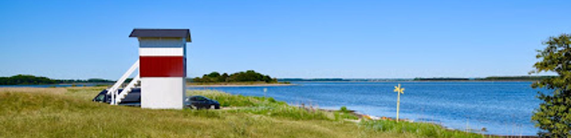
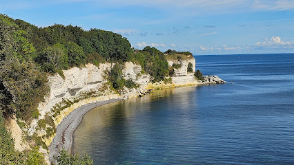
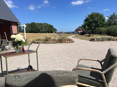
Roneklint Fyr is a small historic lighthouse on the edge of Præstø Fjord in South Zealand, framed by shallow beaches, big skies and tranquil coastal scenery. Once a navigation aid in Faxe Bay, it now anchors a low-key recreation area with a child-friendly beach, rich snorkelling waters and views towards the islet Maderne. Simple, uncommercial and atmospheric, it is ideal for quiet walks, sea breezes, picnics and easy access to the water, with a small exhibition in the old lighthouse.
A brief summary to Roneklint Fyr
- Batterivej 8, Præstø, 4720, DK
- Duration: 0.5 to 3 hours
- Free
-
 Outdoor
- Mobile reception: 4 out of 5
- Monday 12 am-12 am
- Tuesday 12 am-12 am
- Wednesday 12 am-12 am
- Thursday 12 am-12 am
- Friday 12 am-12 am
- Saturday 12 am-12 am
- Sunday 12 am-12 am
Local tips
- Bring water shoes or sturdy sandals; the beach mixes sand and small stones, and the shallow seabed can be pebbly and slippery in places.
- Pack snorkel gear on calm days to explore sand reefs, seaweed beds and small fish in the shallow waters near the lighthouse and channel.
- Dress in layers and a windproof jacket outside high summer; the exposed coastline can feel significantly cooler than inland.
- If you plan longer time by the water, bring snacks and drinks, as there are no major food outlets directly at the lighthouse.
- Keep an eye on currents closer to the marked channel and ensure weaker swimmers stay within the very shallow, sheltered area by the beach.
For the on-the-go comforts that matter to you
- Seating Areas
- Trash Bins
- Information Boards
Getting There
-
Car from Præstø town
From central Præstø, driving to Roneklint Fyr typically takes about 10–15 minutes via local roads through the countryside. The route is straightforward and paved throughout. There is a small informal parking area near the lighthouse and beach, but spaces are limited in peak summer and may fill on sunny weekends. There is no parking fee at the lighthouse itself; fuel costs are the only expense for this option.
-
Bicycle from Præstø town
Cycling from Præstø to Roneklint Fyr usually takes around 25–40 minutes, depending on pace. The distance is moderate and the terrain mostly flat, using a mix of smaller country roads and local lanes that are suitable for riders with basic road confidence. There is no dedicated bike parking infrastructure at the lighthouse, but bicycles can be securely locked to fences or placed off the main path. This option is free aside from any bike rental cost you may incur in town.
-
Regional bus plus short walk
Regional buses in the Vordingborg municipality connect Præstø with nearby villages, and some services stop within a few kilometres of Roneklint. Typical travel time on the bus segment is about 10–20 minutes, followed by a walk of roughly 20–30 minutes along quiet local roads to reach the lighthouse. Single bus tickets on local routes generally cost in the range of 20–40 DKK per adult, depending on zones and operator. Service frequency can be lower in evenings and weekends, so checking the timetable in advance is important.
Roneklint Fyr location weather suitability
-
 Clear Skies
-
 Windy Conditions
-
 Mild Temperatures
-
 Hot Weather
-
 Cold Weather
-
 Any Weather
Discover more about Roneklint Fyr
A modest lighthouse at the edge of fjord and bay
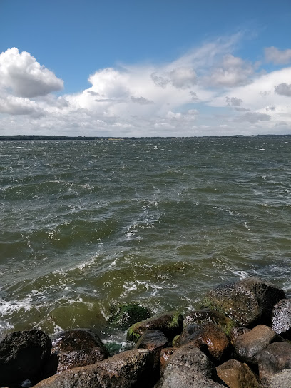
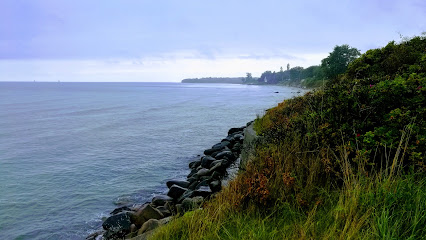
Roneklint Fyr stands at the mouth of Præstø Fjord where the calm, shallow waters meet the more open Faxe Bay, a compact white lighthouse in a gently sloping coastal landscape. It once served coastal sailors navigating the narrow channel between the mainland and the little islet of Maderne, signalling safe passage in an area known for shifting shoals and sandbanks. Today the light still feels like a quiet sentinel, more a landmark for walkers, paddlers and snorkellers than for ships. Around the building, low grass, scattered bushes and a simple track give the place an unpolished, authentic feel. There are no grand facilities or heavy infrastructure here; instead the attraction lies in the openness of the seascape, the curve of the coastline and the sense that this is still a working piece of maritime heritage folded into everyday nature.Coastal nature and views across Faxe Bay
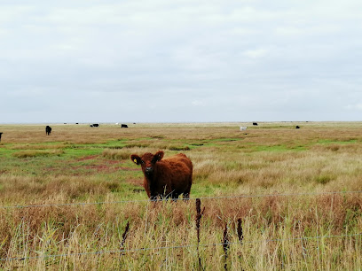
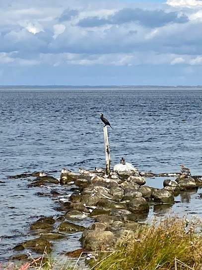
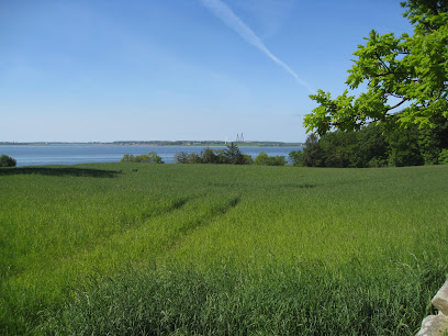
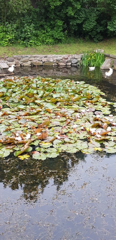
Standing by the lighthouse you look out over broad, shallow waters where the colour of the sea changes with the light and wind. At low tide you can often see sandbars emerging and darker patches of eelgrass swaying under the surface. Across the water lie the flat outlines of Maderne and the wooded fringe of Hejreskov, giving a layered horizon that changes as you move along the shore. Birdlife is a constant presence. Waders probe the wet sand, gulls circle lazily, and in the cooler months you may spot flocks of ducks or swans resting on the fjord. The relatively undeveloped shoreline helps preserve a feeling of space and calm; even on breezy days there is an underlying softness in the soundscape of waves, reeds and distant bird calls.Family‑friendly beaches and snorkelling waters
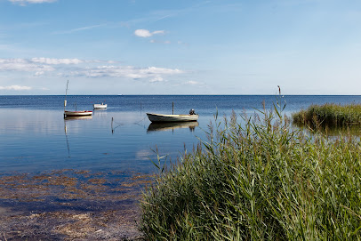
Immediately by the lighthouse you find a small beach, a mix of sand and rounded stones. The seabed shelves very gradually here, creating a notably shallow, protected zone that suits children and hesitant swimmers. You can wade out a long way before the water reaches your waist, which also makes it easier to explore with a mask and snorkel. Beneath the surface, the coast is known for its biodiversity, with sand reefs, stones, patches of seaweed and small fish darting between them. On calm days, snorkellers can follow the transition from beach to deeper channel, spotting crabs, flatfish and, with luck, eels. The lack of heavy boat traffic close to shore keeps the atmosphere relaxed, though currents increase near the marked channel and require sensible care.A simple stop for kayaks and coastal wanderers
Roneklint Fyr is one of those low-key spots that suits an unhurried visit. Paddlers often use the nearby beach as a starting point, taking advantage of the sheltered fjord to explore coves and shallows by sea kayak or stand-up paddleboard. The flat terrain and open views also make it a pleasant place for short coastal walks, pausing to watch light play across the water. The lighthouse itself sometimes hosts a small exhibition that illustrates the area’s maritime role and natural environment. Even when the door is closed, the building and its setting tell their own story of Danish coastal life: functional, modest and closely tied to the rhythms of the sea and weather.Quiet moments in changing Scandinavian light
What lingers most after a visit is the interplay of light, water and sky. Early and late in the day the low sun can turn the sandbars golden and the sea metallic blue, while clouds sweep over the flat landscape in broad strokes. On still summer evenings the fjord can look glassy and reflective; in winter, sharp winds and grey skies highlight the rawness of the coast. Whether you come for a quick look at the lighthouse, a family paddle in the shallows or a longer snorkelling session, Roneklint Fyr offers an accessible slice of South Zealand’s coastline. It is not a place of spectacle but of gentle detail: ripples in the sand, seaweed on stones, the glow of the lighthouse against a wide northern sky.Iconic landmarks you can’t miss
Rose Stege Restaurant
19.3 km
Discover the authentic tastes of Denmark at Rose Stege Restaurant, where delicious pizzas and local dishes await in a cozy atmosphere.
Restaurant pizzeria Delfino
19.3 km
Experience authentic Italian cuisine in the heart of Stege at Restaurant Pizzeria Delfino, where fresh ingredients and a warm atmosphere create a memorable dining experience for all.
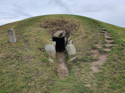
Kong Asgers Høj
19.4 km
Denmark's largest passage grave—a 5,000-year-old Neolithic monument of monumental stone and timeless mystery.
Genforeningssten i Næstelsø
19.8 km
Experience the vibrant history and charm of Copenhagen's iconic Nyhavn waterfront.

Cosy Farmhouse on Møn
22.7 km
Experience tranquility at Cosy Farmhouse on Møn: Discover rural charm, stunning landscapes, and authentic Danish hospitality on this idyllic island escape, a UNESCO Biosphere Reserve.
Pension Elmehøj
23.0 km
Experience Møn's charm at Pension Elmehøj: Affordable comfort near Stege, close to Møns Klint, Elmelunde Church, and the Camønoen hiking trail, perfect for families and budget travelers.

Næstved Station
25.4 km
Explore the evolution of Danish and international design at Copenhagen's historic Designmuseum Danmark.

Visit Sydsjælland & Møn
25.5 km
Discover the stunning landscapes and rich culture of Sydsjælland & Møn, a unique Danish destination for nature lovers and history enthusiasts alike.
Hans-Jørgen Færks Plads
25.6 km
Medieval market town square where Danish history, culture, and modern commerce converge in southern Zealand.
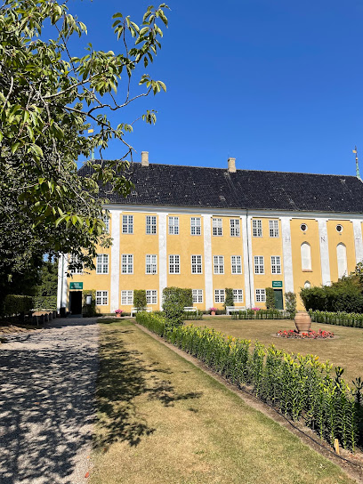
Gavnø Slot og Park
26.3 km
Experience the charm of Copenhagen’s iconic Nyhavn harbor—vivid houses, historic ships, vibrant restaurants, and the city’s lively waterfront spirit.

Gavnø castle
26.5 km
Discover Gavnø Castle: A majestic Rococo castle on the Island of Flowers, offering a unique blend of history, art, and nature in a picturesque Danish setting.
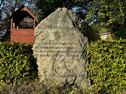
Genforeningssten i Herlufsholm
26.5 km
Diskret granitmindesmærke ved Herlufsholm, hvor lokal erindring om Danmarks genforening i 1920 står midt i nutidens trafik og hverdagsliv.
Councilman Garden / Herlufsholm Forest
26.7 km
Colorful 17th-century harbor in the heart of Copenhagen, famous for its historic ships, pastel houses, vibrant quay cafés, and rich maritime heritage.

Stevns Lighthouse
27.3 km
Historic stone lighthouse perched atop Stevns Klint, blending Baltic seascapes, Cold War echoes and sweeping UNESCO-listed cliff-top views.
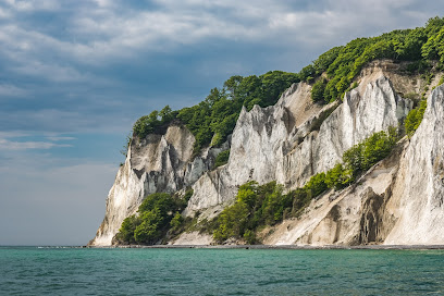
Høje Møn
27.9 km
Denmark's tallest white chalk cliffs rise 128 meters above the Baltic, crowned by legendary tales and ancient forests.
Unmissable attractions to see
Bønsvig Strand
4.3 km
A serene coastal hamlet offering pristine beaches, natural landscapes, and peaceful retreat on southern Zealand.
Oremandsgaard Gods & Destilleri
7.8 km
Denmark's pioneering estate distillery where five generations of organic farming meet award-winning handcrafted spirits.
Nyord
10.7 km
Tiny island, big skies: salt meadows, bird sanctuaries and a storybook village under some of Northern Europe’s darkest, starriest nights.
Nyord Enge, fuglereservat
11.1 km
Windy salt meadows, wide horizons and rich birdlife make Nyord Enge a standout coastal wetland and an international stopover for migratory ducks, geese and waders.
Ulvshale
12.2 km
A quietly beautiful peninsula on Møn where broad sandy beach, low dunes and coastal forest create a soft, light-filled escape by the Baltic Sea.
Ulvshale Naturcenter
12.7 km
Simple but superbly placed, Ulvshale Naturcenter is your springboard into Møn’s wild mix of flint forest, grazing meadows, rich birdlife and big coastal skies.
Kalvehave Labyrintpark
13.0 km
Navigate mind-bending mazes and brain-teasing games across 20,000 square meters of outdoor puzzle paradise.
Geomuseum Faxe
13.8 km
Stand on the brink of a vast white quarry, handle fossils from a 63‑million‑year‑old coral sea, and see how geology and industry shaped this corner of Denmark.
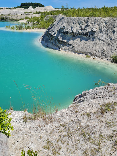
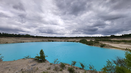
Den blå sø
14.8 km
A vivid turquoise lake framed by towering white chalk walls, Den Blå Sø transforms Faxe Limestone Quarry into one of Denmark’s most surreal and photogenic landscapes.
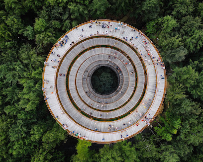
Skovtårnet (Forest Tower)
16.5 km
A striking hourglass tower rising above the Gisselfeld forest canopy, offering a gentle spiral climb to Zealand’s highest accessible viewpoint and sweeping South Zealand horizons.
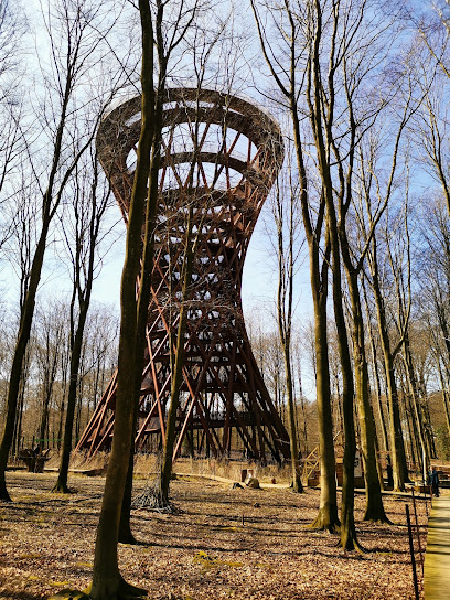
Camp Adventure
17.0 km
Spiral into the Danish canopy on a sculptural forest tower, then trade the view for ziplines, rope bridges and hours of treetop adventure in South Zealand’s woods.
Sankt Mogens Kilde
17.9 km
A sacred spring rooted in Viking heritage, where centuries of spiritual tradition flow through Denmark's countryside.
Hotel Residens Møen
18.8 km
Waterfront residence on idyllic Møn, blending historic seaside charm, modern Scandinavian apartments and thoughtfully designed shared spaces by Stege Bay.
Stensby Møllebæk (Malling's Gorge)
18.8 km
A small, hidden ravine where a lively mill stream, steep wooded slopes and traces of local history create a quiet, atmospheric pause in the South Zealand countryside.
Mølleporten
19.1 km
One of Denmark’s last medieval town gates, Mølleporten pairs evocative fortifications and intimate prison history with fine views over historic Stege.
Essential places to dine
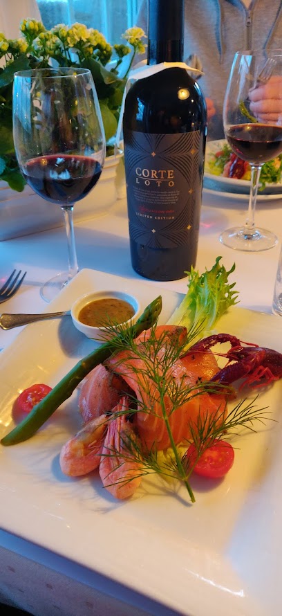
Frederiksminde hotel og restaurant
5.0 km
Romantic fjordside pavilion in Præstø where classic Danish charm meets New Nordic fine dining, intimate gardens and slow, atmospheric escapes from everyday life.
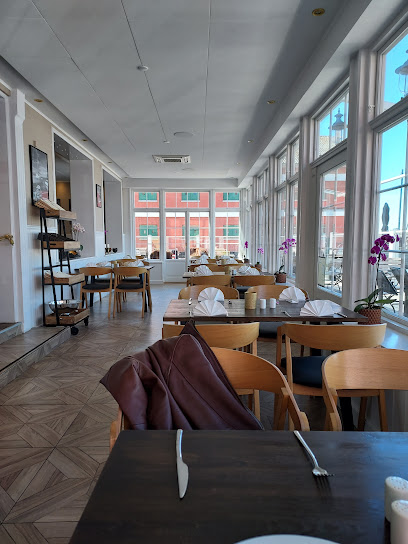
Restaurant Sommers
5.4 km
Relaxed harbourfront restaurant in Præstø serving generous Danish comfort dishes and seafood, with bright Nordic interiors and a terrace overlooking the marina.
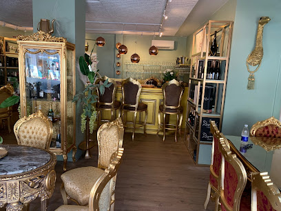
Muldiverset
5.4 km
Organic farmhouse restaurant and regenerative garden by the sea, where slow-paced Nordic cooking, wild greenery and a curated eco shop reconnect you with nature.
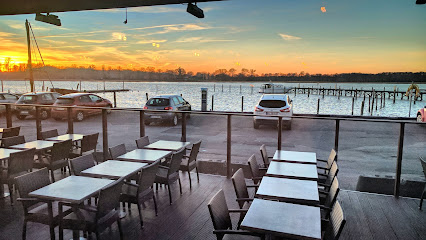
Cafe Mocca
5.5 km
Relaxed harborfront café-restaurant on Præstø Fjord, serving hearty classics, brunch and drinks with wide fjord views and an easygoing small-town atmosphere.
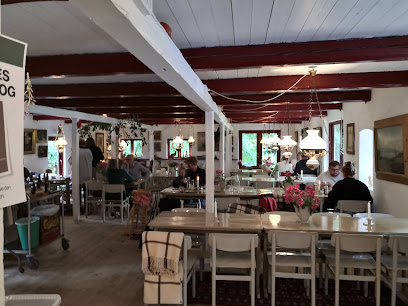
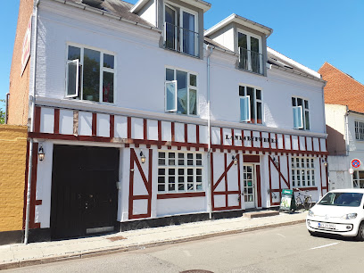
Fjordkroen
7.2 km
Cosy fjordside country inn on South Zealand, blending classic Danish kro charm, water‑view rooms and traditional cooking in a peaceful rural setting.
Gæsteriet
7.9 km
Intimate Danish brasserie in the village of Mern, serving homely seasonal cooking and drinks in a relaxed South Zealand countryside setting.
Noorbohandelen
10.9 km
Atmospheric island deli and spirits specialist in Nyord’s car‑free village, combining tastings, gourmet shelves and a cosy café stop on the edge of Møn.
Restaurant GastrÖ
10.9 km
Nordic fine dining on a quiet island, where seasonal ingredients and technical precision create unforgettable meals.
Restaurant Lolles Gaard ApS
10.9 km
Traditional Danish cuisine in an idyllic island garden where heritage and hospitality flourish.
Færgemandens Hus.
19.0 km
A former ferryman’s house turned cosy waterfront grill-restaurant on Møn, serving hearty Danish comfort food in snug rooms and by the bay.
HAVNEGRILLEN - Stege
19.1 km
Waterfront Danish grill serving generous portions of smørrebrød, hot dogs, and frikadeller in casual seaside comfort.
Slagter Stig
19.2 km
Traditional Danish butcher and eclectic brasserie in the heart of Stege, where hand‑picked cuts, candlelit dining and art-filled rooms create a distinctly Møn experience.
MØN AMI - The French Bistro 🇫🇷
19.2 km
A tiny French-inspired bistro in Stege, where intimate island charm, slow-paced dining and classic Gallic flavours meet in one cosy neighbourhood room.
Møn Isola Pizza
19.2 km
Casual, central pizzeria on Stege’s main street serving generous, no‑nonsense pizzas and takeaway boxes to fuel island adventures on Møn.
Café Frederik VII
19.2 km
Relaxed, family-friendly café on Stege’s main square, serving burgers, grill dishes, sweets and coffee with front-row views of everyday life on the island of Møn.
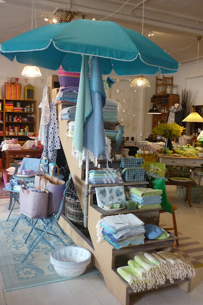
Markets, malls and hidden boutiques
Nyord Ø Handel
10.8 km
Tiny island shop with a big heart: local groceries, crafts, coffee and ice cream at the friendly center of everyday life on tranquil Nyord.
Rosengaarden antik
17.8 km
Rural Danish antique treasure trove on Møn, where barns and sheds brim with vintage furniture, glass, chinaware and curios along the road to Stege.
Wedele’s Hus
18.5 km
A cozy garden center in a traditional Danish house, Wedele’s Hus offers seasonal plants, local charm, and a peaceful green pause while exploring Stege and Møn.
Vibækgård
18.6 km
Rural farm shop on Møn blending fresh local produce, animal feed and thoughtful gifts in a laid-back courtyard setting between fields and Stege Bay.
Liza's Gallery
19.1 km
Intimate artist-run gallery in a historic Stege courtyard, blending Møn’s coastal atmosphere with contemporary Danish and international art and distinctive design pieces.
Fængselsgården Møn
19.2 km
Fængselsgården Møn - Stege’s historic prison yard reimagined as a creative brasserie, bookshop, and cultural nexus, inviting visitors to eat, browse, and experience local life.
Colourlove Møn
19.2 km
A cosy, colour-drenched design boutique in Stege, filled with upcycled silk fashion, playful interiors and unique gifts inspired by the creative spirit of Møn.
Intersport
19.2 km
Premier sporting goods retailer offering expert guidance, quality equipment, and professional services in central Stege.
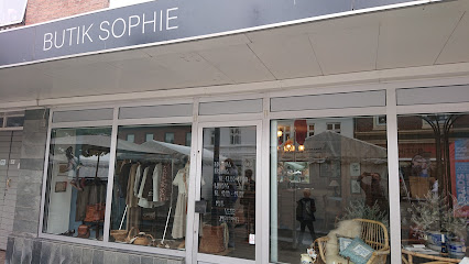
Butik Sophie
19.2 km
A cosy Scandinavian-style gift boutique on Stege’s main street, mixing hygge-filled home décor, textiles and small treasures in an intimate, relaxed setting.
Moshroom
19.2 km
A cozy, offbeat clothing boutique on Stege’s main street, blending relaxed Scandinavian style, personal service and small-town island charm on Møn.
Sy Og Strik
19.2 km
A cosy knit and sewing shop in Stege’s historic main street, brimming with yarn, fabrics and friendly advice for creative travellers on the island of Møn.
Red Cross Op Shop
19.2 km
Volunteer-run second-hand treasure trove in Stege, where sustainable finds, local life and Red Cross humanitarian work come together under one modest roof.
Tøjeksperten
19.2 km
Compact Danish menswear store on Stege’s main street, ideal for smart-casual outfits, emergency wardrobe fixes and climate-ready layers while exploring Møn.
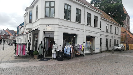
Højris Femme Clothing
19.2 km
A cosy women’s fashion boutique on Stege’s main street, blending Scandinavian style, quality fabrics and personal service in the heart of historic Møn.
Vinhuset Møn
19.2 km
Atmospheric island wine shop in the heart of Stege, combining handpicked bottles, gourmet treats and personal, expert guidance in an intimate setting.
Essential bars & hidden hideouts
Sussis Bodega ApS
5.3 km
Rural Danish bodega in an 1800s house along Stavreby Strandvej, offering simple drinks, informal company and a quietly coastal countryside atmosphere.
Mølleporten Øl- og Vinstue
19.2 km
A classic Danish “brown pub” on Stege’s main street, pairing local atmosphere, simple drinks and small-town charm just down from the town’s medieval gate.
Ba'ryhl Bar & Café
19.2 km
Cosy café by day, intimate cocktail bar by night, Ba'ryhl brings small‑town warmth, good drinks and relaxed conversation to the heart of Stege on Møn.
Rådhus Pub'en
19.3 km
Authentic Danish pub on the historic town square, where locals and travelers gather for genuine hospitality.
Bykroen
24.0 km
Cozy local bar and live music hangout on Haslev’s main street, offering simple drinks, late-weekend nights and an authentic small-town Danish atmosphere.
Pub Dyssen
24.2 km
Unpretentious neighborhood bar in Næstved where Danish hygge, cold beer, and local conversation come together in a simple, welcoming setting.
Grønvej 2 Næstved ApS
25.1 km
Unpretentious neighborhood bodega in Næstved serving cold beer, simple spirits and everyday local atmosphere on a quiet side street off the town’s commercial core.
Bodega Dueslaget
25.1 km
Traditional Danish neighborhood bodega in Næstved, serving cold beers, simple drinks and plenty of local atmosphere from morning until late on weekends.
5'eren
25.4 km
Laid-back neighborhood beer hall in Næstved, where cold beer, conversation and local charm matter more than cocktails or design.
Cafe Borre
25.4 km
Homemade pastries and genuine warmth in a charming Borre village café.
Birk´s Bar
25.4 km
Næstved's authentic neighborhood pub where community, billiards, and genuine hospitality thrive.
Champagne Riget
25.6 km
Næstved's premier champagne bar where curated bubbles meet refined gastronomy in elegant surroundings.
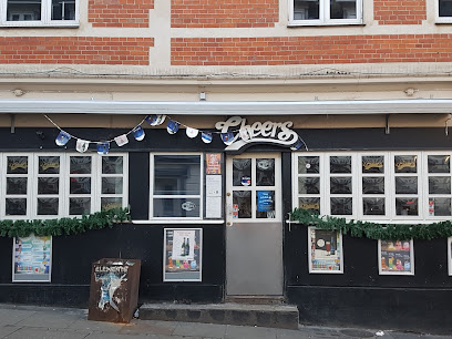
Cheers
25.7 km
Næstved's cozy social hub where genuine Danish hospitality meets lively evening atmosphere.
Step Inn I / S
25.7 km
Long‑running Irish pub in central Næstved, blending cosy wooden interiors, sociable pints and late‑night weekend vibes on historic Ramsherred.
Landsby Pubben
25.7 km
A classic Næstved "værtshus" with cold beer, billiards and a lived-in charm that turns a simple drink into a slice of local everyday life.
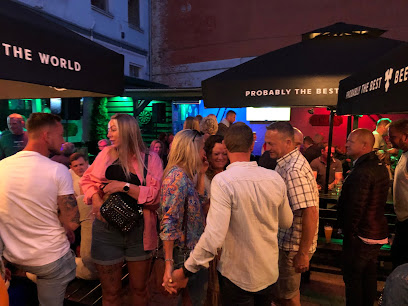
Nightclubs & after hour spots
Avenue Næstved
25.5 km
Lively nightspot and flexible event hall in central Næstved, mixing dancefloor energy, festive dinners, stand-up comedy and themed parties under one roof.
Crazy Daisy Næstved
25.7 km
High‑energy weekend nightclub in central Næstved, packing loud beats, flashing lights and a late‑night local crowd into a compact, classic Danish town‑club setting.
Loke MC - Helheim
33.4 km
Rural Danish biker clubhouse with Norse-mythology flair, offering intimate late-night gatherings, loud rock playlists and a no-frills bar far from mainstream nightlife.
Bloom Nightclub
36.1 km
Late-night harborfront beats and a compact dance floor bring big-night energy to small-city Køge every Friday and Saturday.
The Flame
36.1 km
Compact, high-energy nightclub by Køge’s harbor, serving up youthful beats, live acts and weekend dance-floor vibes in an intimate, no-frills setting.

LUSIO
36.1 km
Compact harbor-side nightclub in Køge with late Friday hours, a tight dance floor, and an intimate, no‑frills setting for Danish weekend nights out.
Første sted
43.7 km
Compact, music-driven nightclub on central Slotsgade, offering an intimate, local slice of Nykøbing Falster’s late-night dancing and drinks scene.
N.Y.K. Event
43.7 km
Compact late-night bar and nightclub in central Nykøbing Falster, mixing strong drinks, loud beats and a sociable dance floor that runs into the early morning.
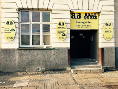
Billy Booze
43.7 km
Compact late-night disco in Nykøbing Falster with inexpensive drinks, loud hits and a casual dance floor vibe from Thursday to Saturday.
Riverside Jazz Club
43.7 km
Experience authentic Danish jazz in an intimate riverside setting where local musicians and jazz enthusiasts gather to celebrate live music in Nykøbing Falster.
Billie Jean Bar
43.7 km
Billie Jean Bar is the beating heart of Nykøbing Falster’s nightlife—friendly crowds, handcrafted drinks, DJs, and vibrant atmosphere in Falster’s central urban hub.
jazz på tværs
44.0 km
Intimate local jazz room on Østre Alle, where close-up live music, simple comforts and a relaxed Nykøbing Falster vibe create quietly memorable evenings.
Dr. Emil Laboratory, Marielyst
49.7 km
Beachfront nightclub where summer energy meets live music and dancing until dawn.
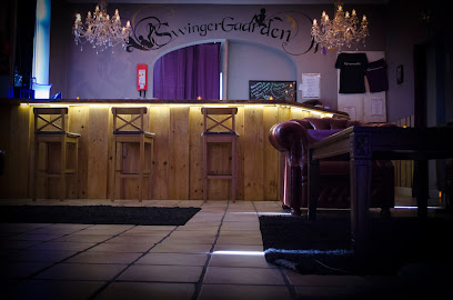
Swingergaarden
53.2 km
Discreet countryside swingers club near Slagelse, offering themed adult nights, intimate play spaces and a rules-based, consent-focused environment for open-minded guests.
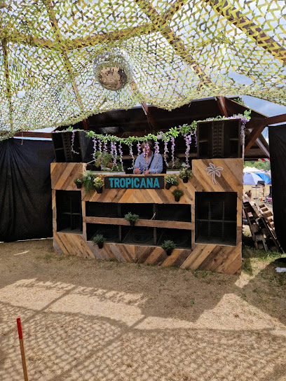
Tropicana DC
53.9 km
Compact Latin-flavoured nightclub on Roskilde’s industrial edge, delivering loud beats, simple drinks and a late-night dancefloor focused purely on partying.
For the vibe & atmosphere seeker
- Relaxing
- Tranquil
- Scenic
- Unique
- Casual
For the design and aesthetic lover
- Minimalist Designs
- Rustic Designs
For the architecture buff
- Historic
- Landmarks
- Viewpoints
- Parks & Gardens
For the view chaser and sunset hunter
- Iconic Views
- Panoramas
- Sunset Spots
- Waterfront
For the social media creator & influencer
- Photo Spots
- Selfie Spots
- Reel-Friendly
- Architectural Shots
For the eco-conscious traveler
- Low Impact
- Wildlife Habitat
- Public-Transport Accessible
- Leave-No-Trace Critical
For the kind of experience you’re after
- Nature Escape
- Photowalk
- Adventure Photo Shoot
- Day Trip
- Mindfulness
For how adventurous you want the journey to be
- Easy Access
Location Audience
- Family Friendly
- Senior Friendly
- Child Friendly
- Teen Friendly
- Solo Friendly
- Couple Friendly
- Solo Female Friendly


