Capitol Reef National Park · Travel guide · Updated 2026

The Timeless Beauty of Capitol Reef National Park

Discover the awe-inspiring landscapes and rich history of Capitol Reef National Park, a hidden gem in Utah's red rock country, perfect for hiking, photography, and wildlife viewing.

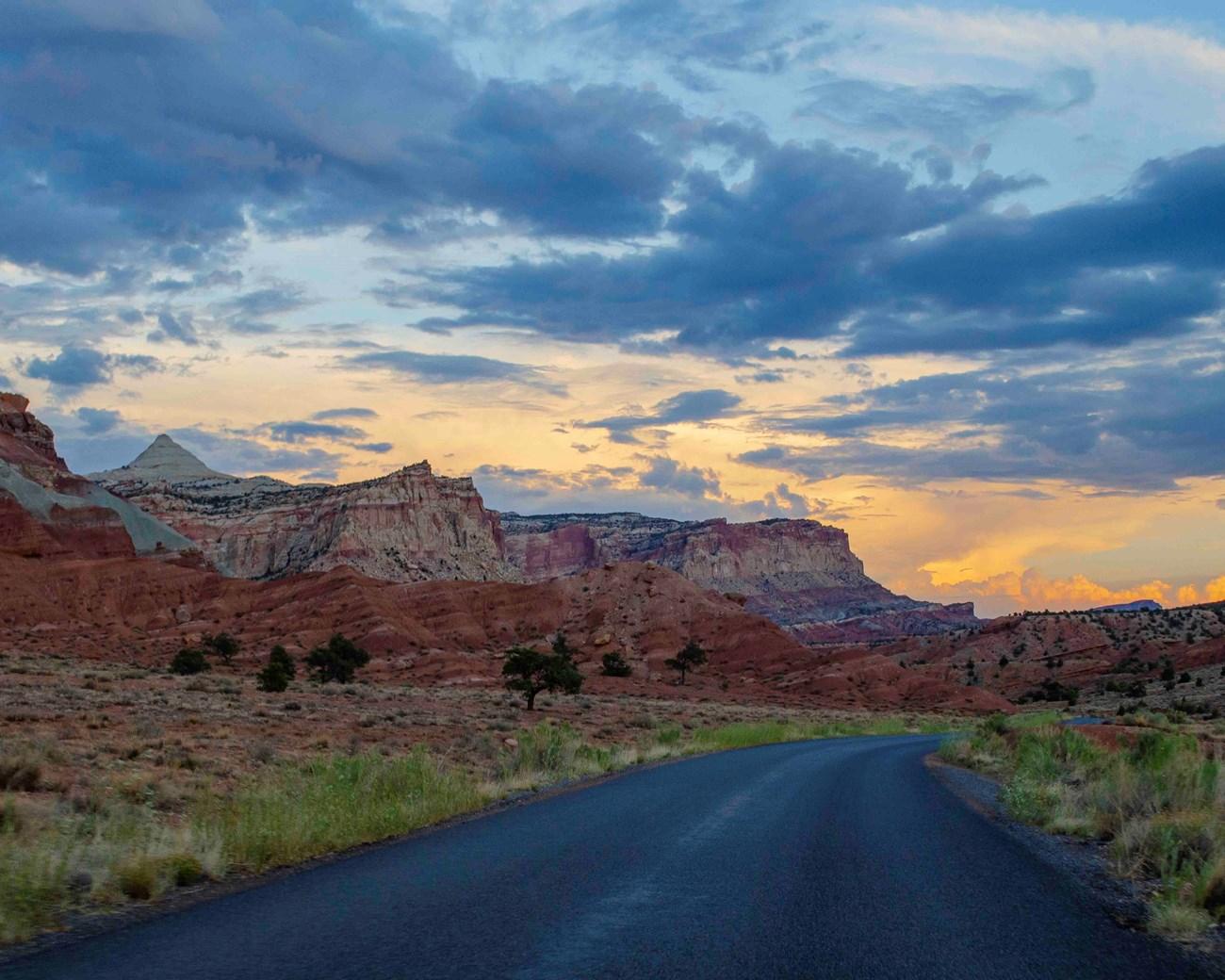
Capitol Reef National Park, located in the heart of red rock country in south-central Utah, is a hidden gem waiting to be explored. This park is known for its stunning geological formations, including the iconic Waterpocket Fold, a ripple in the Earth's crust that extends for nearly 100 miles. Visitors can marvel at towering cliffs, deep canyons, and natural arches that showcase the raw beauty of the American Southwest. The park offers a variety of activities for outdoor enthusiasts. Hikers can enjoy numerous trails that cater to all skill levels, from easy walks to challenging backcountry routes. For those interested in history, the park features the Fruita Historic District, where you can explore the remnants of an early Mormon settlement, including orchards that still bear fruit. Wildlife enthusiasts will be delighted by the diverse fauna, including mule deer, bighorn sheep, and a variety of bird species. Capitol Reef is also a paradise for photographers. The changing light throughout the day highlights the park’s vivid colors and unique rock formations, making it a fantastic destination for capturing breathtaking landscapes. Whether you are looking to immerse yourself in nature, learn about the area's rich history, or simply find a quiet spot to enjoy the scenery, Capitol Reef National Park offers something for everyone.

When is the best time to go to Capitol Reef National Park?

Weather at a glance

Use the monthly temperature and precipitation trends to compare typical conditions across the year before planning countryside walks, town visits, and heritage days.

Temperature

°C

Precipitation

mm
Warmest months
Longest daylight
Driest period

Explore places in Capitol Reef National Park

    See all →
    Free Images : landscape, nature, scenic, usa, united states of america,  landmark, national park, geology, utah, badlands, bryce canyon, tourist  destination, landform, geographical feature, majesic, land formation  4256x2832 - - 1064970 - Free stock ...
    Destination guide

    More about Utah

    Explore Utah's stunning national parks, rich cultural heritage, and year-round outdoor adventures. Discover why this diverse state is a top destination for travelers.

    Tell me more about Utah
    Mobile App
    Get the app

    Your all‑in‑one travel companion app

    Explore expert travel guides, compare and book tours, experiences, hotels, and more—all from the palm of your hand. Download now for seamless trip planning wherever your wanderlust takes you.

    Explore Capitol Reef National Park in Photos

    A quick visual route through countryside views, towns, gardens, and regional day-trip atmosphere.

    Scenic Drive Rehabilitation Project - Capitol Reef National Park (U.S. National  Park Service)
    File:2008-0914-CapitolReef-WaterpocketFold1.jpg - Wikimedia Commons
    File:Hickman Bridge Capitol Reef National Park USA.jpg - Wikimedia Commons
    File:Temple of the Sun in Cathedral Valley.jpg - Wikimedia Commons
    Scenic Drive Rehabilitation Project - Capitol Reef National Park (U.S.  National Park Service)
    File:Fruita UT.jpg - Wikimedia Commons
    Scenic Drive Rehabilitation Project - Capitol Reef National Park (U.S.  National Park Service)
    File:2013-09-23 16 12 30 View north from near Goosenecks Overlook in Capitol  Reef National Park.JPG - Wikimedia Commons
    File:Cassidy Arch is an arch in Wingate Sandstone, near the contact point  of the Kayenta Formation. Cassidy Arch Trail is considered  (2c8bfa34-737d-42da-81f0-9a4e130db2aa).jpeg - Wikimedia Commons
    Scenic Drive Rehabilitation Project - Capitol Reef National Park (U.S.  National Park Service)

    Select Currency

    Choose the currency you want prices to display in.