

Free Zion National Park Travel Guide & Mobile App
Explore Zion National Park with free travel guides. Discover regional history, expert tips, proposed trips, and audio guides on web or mobile app.


Zion National Park combines Utah's towering sandstone canyons, river trails, high desert scenery and challenging hikes in a carefully managed wilderness.
Read more about Zion National Park
Getting to and around Zion National Park
How to get there
Transportation
Destinations in Zion National Park
Resorts, valleys and scenic spots worth a trip of their own.

Swipe for more destinations
Best attractions in Zion National Park
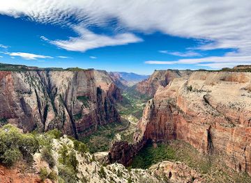
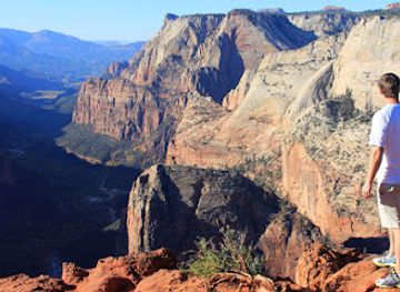
Zion's attractions are inseparable from its geology and the movement of water through the landscape. In the main canyon, Riverside Walk follows the Virgin River beneath immense sandstone walls, while the Narrows continues into a river corridor where the route itself is shaped by water level and weather. Angels Landing is a demanding, exposed hike subject to permit arrangements, and should not be treated as a casual viewpoint. The Watchman area, Pa'rus Trail and Emerald Pools routes provide different perspectives on the canyon without requiring the same kind of river travel or exposure. On the eastern side, the Zion–Mount Carmel Highway reveals slickrock formations, switchbacks and changing elevations. Kolob Canyons, in the park's north-western district, offers red cliffs, viewpoints and trails with a quieter atmosphere than the main canyon. Wildlife watching, photography, geology walks and night-sky appreciation complement hiking, while ranger programmes provide context on ecology and human history. Facilities are deliberately limited compared with a town, so the park is experienced primarily through trails, roads, viewpoints and the changing character of the land.
-
Zion National Park
Explore Zion National Park, a breathtaking natural wonder in Utah, featuring stunning landscapes, diverse wildlife, and unforgettable outdoor adventures.
-
Zion Canyon Visitor Center
Discover the Zion Canyon Visitor Center, your ultimate starting point for exploring the breathtaking beauty of Zion National Park.
-
East Zion Adventures
Discover exhilarating outdoor adventures at East Zion Adventures, your gateway to Zion National Park's breathtaking landscapes and thrilling activities.
-
Tourist attraction
Fort Zion
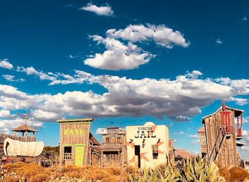
Experience the charm of Fort Zion in Virgin, Utah - a vibrant souvenir store, delightful restaurant, and mini zoo near Zion National Park.


Best landmarks in Zion National Park
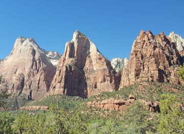
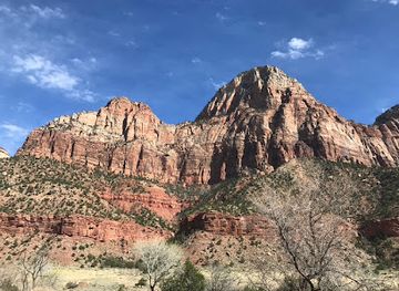
The Great White Throne is Zion's most recognisable natural landmark, a pale sandstone monolith rising above the main canyon and illustrating the scale of the park's exposed rock layers. Angels Landing forms a narrow, elevated prow above the Virgin River and is both a famous viewpoint and a serious hike with steep exposure. The Court of the Patriarchs presents a row of towering sandstone peaks named for biblical figures, while the Watchman stands near the canyon's southern entrance as a prominent red-and-cream sentinel. On the eastern approach, the Zion–Mount Carmel Tunnel is an important historic engineering landmark cut through the rock and linked to the highway completed in 1930. Checkerboard Mesa, east of the tunnel, is marked by a distinctive grid of weathered lines in the sandstone. In Kolob Canyons, the richly coloured cliffs and the Kolob Arch area express a different scale and atmosphere from the main canyon. Together these places give Zion a visual identity built on vertical walls, layered geology and the continual work of the Virgin River.
-
Visitor center
Zion Canyon Visitor Center
Explore the gateway to Zion National Park at the Zion Canyon Visitor Center, where adventure meets education amidst breathtaking landscapes.
-
Adventure sports
East Zion Adventures
Experience the breathtaking beauty of Zion National Park at East Zion Adventures, your gateway to adventure sports and outdoor fun!
-
Pizza
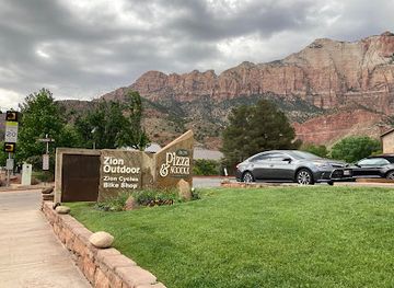
Zion Pizza & Noodle Co
Experience delicious pizzas and hearty pastas at Zion Pizza & Noodle Co, a family-friendly gem near Zion National Park's entrance in Springdale.
-
History museum
Zion Human History Museum
Explore the captivating history of Zion at the Human History Museum, where culture and nature intertwine in the heart of Utah's iconic landscape.
Explore Zion National Park on the map
Plan your trip on one map. See where the top cities, national parks and sights are, and book hotels and experiences in a few clicks.
Best hotels in Zion National Park
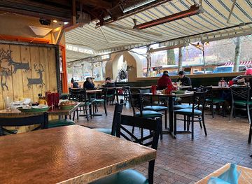
Best restaurants in Zion National Park
Dining within Zion National Park is limited, so many visitors eat in the gateway community of Springdale, which lies outside the park near the south entrance. Its restaurants, cafés, bakeries and casual dining rooms cater to hikers and road travellers, with menus commonly combining American comfort food, Southwestern influences, vegetarian options and practical meals for an active day. Picnic supplies, drinks and packed lunches are useful for longer excursions, although food must be stored responsibly because wildlife can be attracted to scraps. The wider region of southern Utah is associated with desert-grown produce, local honey, baked goods and hearty dishes suited to travel in a dry climate, but Zion itself is not a single-dish culinary destination. Visitors staying farther from the canyon should plan ahead, since services become less frequent on the east side and around Kolob Canyons. Water, coffee and early meals are particularly practical before popular trails become busy.
-
Restaurant
River Rock Roasting Company
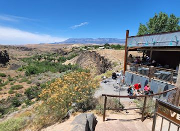
Discover La Verkin's hidden culinary gem at River Rock Roasting Company – savor exquisite coffee and hearty meals with breathtaking canyon views.
-
Steak
Stage Coach Grille
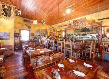
Experience delectable steaks and Southwestern flavors at Stage Coach Grille in La Verkin, perfect for travelers seeking comfort food.
-
Cafe
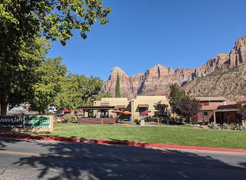
MeMe's Café
Experience delicious gourmet cuisine at MeMe's Café near Zion National Park – perfect for breakfast, brunch, and fine dining!
-
American
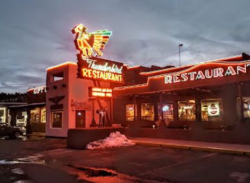
Thunderbird Restaurant
Experience delightful American cuisine at Thunderbird Restaurant in Mount Carmel - perfect for travelers exploring Utah's breathtaking landscapes.
Best bars in Zion National Park
Zion's evening culture is shaped by its national-park setting rather than by a large club scene. Springdale, outside the park's south entrance, has the broadest choice of restaurants, relaxed bars and places serving drinks after a day on the trails, while nearby gateway communities offer a more limited selection. Inside the park, evenings centre on quiet accommodation, camping, stargazing and the sounds of the canyon rather than late-night entertainment. Some establishments in the gateway area may provide live music or seasonal outdoor seating, but opening arrangements can change and should be checked locally. Alcohol is subject to United States and Utah laws, including rules that may differ between types of licensed premises. Visitors should plan a safe return after drinking, since roads are dark, winding and shared with wildlife. The park's night-time appeal is primarily its desert sky and stillness, not nightlife districts or nightclubs.
-
River Rock Roasting Company
Experience the rich flavors of River Rock Roasting Company, La Verkin’s top destination for gourmet coffee and delicious meals.
-
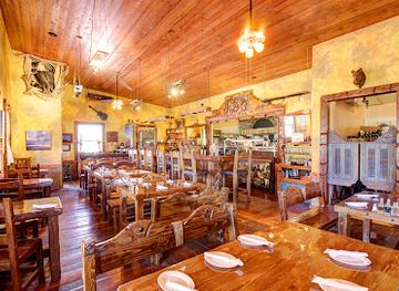
Stage Coach Grille
Experience the ultimate Wild West dining at Stage Coach Grille in La Verkin, Utah, with delicious steaks and a charming atmosphere.
-
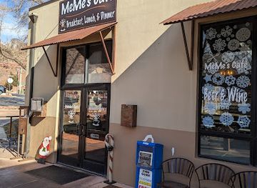
MeMe's Café
Discover the flavors of MeMe's Café, a delightful eatery near Zion National Park offering a diverse menu from breakfast to fine dining.
-
Restaurant
Oscar's Cafe
Discover Oscar's Cafe in Springdale, where fresh, local ingredients and a welcoming atmosphere create a memorable dining experience near Zion National Park.

Best shops in Zion National Park
Shopping is concentrated outside the park, particularly in Springdale near the south entrance, where galleries, independent shops, outdoor retailers and small food businesses serve visitors. Typical purchases include regional artwork, landscape photography, books about geology and Indigenous history, hiking equipment, locally produced food and practical supplies for the trail. The gateway community also offers souvenirs, but visitors should distinguish durable local craft from mass-produced items labelled broadly with a South-western theme. There are no extensive retail districts inside Zion National Park, and park facilities focus on visitor services, interpretation and essential supplies rather than general shopping. Farmers' markets and craft events may appear seasonally in nearby southern Utah communities, although their timing is not permanent. For meaningful purchases, look for work by artists and makers who clearly identify their materials, methods and regional connections, and avoid collecting rocks, plants or archaeological objects from protected land.
-
Tour operator
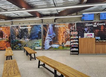
Zion Guru
Discover unforgettable adventures at Zion Guru, your trusted tour operator near Zion National Park. Experience nature like never before.
-
Shopping mall
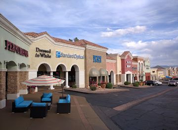
The Shoppes at Zion
Experience shopping like never before at The Shoppes at Zion, where unique stores meet delightful dining and vibrant entertainment in St. George.
-
Souvenir store
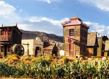
Fort Zion
Experience the unique charm of Fort Zion, where shopping, dining, and wildlife meet in the heart of Virgin, Utah.
-
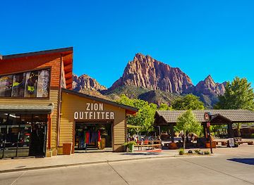
Outdoor sports store
Zion Outfitter
Explore Zion National Park with ease at Zion Outfitter, your one-stop shop for outdoor rentals, gear, and expert advice.
Get your free copy of our complete guide to Zion National Park, delivered straight to you.
Everything on this page, from attractions and restaurants to essentials and local phrases, in one PDF you can read offline, print or share.
Already have an account? Sign in
Your Zion National Park guide is ready.
We'll send it to · Not you? Sign out

Getting your guide ready…
We are putting together a fresh copy of the Zion National Park guide. This can take up to a minute.
This can take a few moments. If your browser asks, choose Allow so the download can start. You'll find the guide in your Downloads folder.
Nothing happened? Download it again
Sorry, the guide is taking longer than usual. Please try again in a minute, or get it by email instead.
Zion National Park essentials
Currency and Payment
Safety
Emergency Situations
Do's and Don'ts
Local Tips
From Eve
Local phrases worth knowing
You don't need to get them perfect. A few words go a long way, and locals appreciate the effort.
Basics
| English | Local | Say it |
|---|---|---|
| Hello | Howdy | [Ha-dee] |
| Goodbye | See ya | [See ya] |
| Yes | Yep | [Yep] |
| No | Nah | [Nah] |
| Please/You're welcome | You bet | [Yoo bet] |
| Thank you | Thanks | [Thangs] |
| Excuse me/Sorry | Pardon me | [Par-dun mee] |
| How are you? | How's it going? | [How's it goin'?] |
| Fine. And you? | Good, you? | [Good, you?] |
| Do you speak English? | Do ya speak English? | [Doo ya speek Ing-glish?] |
| I don't understand | I don’t get it | [I don’t get it] |
Eating & Drinking
| English | Local | Say it |
|---|---|---|
| I'd like to see the menu, please | Can I see the menu? | [Can I see the men-yoo?] |
| I don't eat meat | I'm a vegetarian | [I'm a vege-tair-ian] |
| Cheers! | Cheers! | [Cheers!] |
| I would like to pay, please | Can I get the check? | [Can I get the chek?] |
Emergencies
| English | Local | Say it |
|---|---|---|
| Help! | Help! | [Help!] |
| Go away! | Leave me alone! | [Leave me alone!] |
| Call the Police! | Call the cops! | [Call the cops!] |
| Call a doctor! | Get a doctor! | [Get a doctor!] |
| I'm lost | I'm turned around | [I'm turned around] |
| I'm ill | I'm not feeling well | [I'm not feelin' well] |
Shopping
| English | Local | Say it |
|---|---|---|
| I'd like to buy... | I wanna buy... | [I wanna buy...] |
| I'm just looking | Just browsing | [Just browsin'] |
| How much is it? | What’s the price? | [What’s the price?] |
| That's too expensive | That costs too much | [That costs too much] |
| Can you lower the price? | Can ya knock down the price? | [Can ya knock down the price?] |
Time & Numbers
| English | Local | Say it |
|---|---|---|
| What time is it? | What time ya got? | [What time ya got?] |
| It's one o'clock | It's one | [It's one] |
| Half past (10) | Half past ten | [Half past ten] |
| Morning | Morning | [Mornin'] |
| Afternoon | Afternoon | [Afternoon] |
| Evening | Evening | [Evenin'] |
| Yesterday | Yesterday | [Yesterdy] |
| Today | Today | [Today] |
| Tomorrow | Tomorrow | [Tomorrow] |
| 1 | One | [One] |
| 2 | Two | [Two] |
| 3 | Three | [Three] |
| 4 | Four | [Four] |
| 5 | Five | [Five] |
| 6 | Six | [Six] |
| 7 | Seven | [Seven] |
| 8 | Eight | [Eight] |
| 9 | Nine | [Nine] |
| 10 | Ten | [Ten] |
Transport & Directions
| English | Local | Say it |
|---|---|---|
| Where's a/the...? | Where's the...? | [Where's the...?] |
| What's the address? | What’s the address? | [What’s the address?] |
| Can you show me (on the map)? | Can ya point it out on the map? | [Can ya point it out on the map?] |
| When's the next (bus)? | When's the next bus? | [When's the next bus?] |
| A ticket (to ....) | One ticket to ... | [One ticket to ...] |
History of Zion National Park
Ancestral Puebloan and Southern Paiute Homelands
The landscapes now protected as Zion National Park have a long human history predating the park by thousands of years. Ancestral Puebloan communities farmed, travelled and made use of the wider Virgin River region, while Southern Paiute peoples developed enduring cultural and practical relationships with the canyon country. Rock markings, archaeological remains and place traditions reflect these earlier histories, although they should not be treated as simple relics of a vanished past. Indigenous connections with southern Utah continue, and the park's scenery is also a living cultural landscape.
Mormon Settlement and the Name Zion
In the mid-nineteenth century, Mormon settlers entered the Virgin River region and established communities in what is now south-western Utah. The canyon was known by several names before the designation Zion became established; the word reflected a biblical vocabulary used by settler communities and was applied to the landscape by Isaac Behunin, an early settler associated with the canyon. Farming in the narrow valley was difficult, but orchards, irrigation works and small settlements left traces of the period. The nearby town of Springdale developed alongside this settlement history.
Mukuntuweap National Monument, 1909
Growing national interest in the canyon's geology and scenery led President William Howard Taft to establish Mukuntuweap National Monument in 1909. The name, derived from a Southern Paiute term recorded by outsiders, appeared on early federal maps and reflected an attempt to protect the canyon before tourism infrastructure was fully developed. The monument's creation marked a shift from local use of the landscape towards formal federal conservation, although the naming history also illustrates how Indigenous terminology was interpreted and repurposed by government officials and explorers.
Zion National Monument and National Park, 1918–1919
The protected area was renamed Zion National Monument in 1918, helping promote a name that was more familiar to the public and aligned with the canyon's emerging identity. In 1919, it became Zion National Park, Utah's first national park. Federal protection preserved the canyon's geological formations and wildlife habitat while providing a framework for roads, trails and visitor facilities. The designation also connected the site to the expanding national-park movement in the United States, which sought to make remarkable landscapes accessible while retaining their scenic and scientific value.
Roads, the Zion–Mount Carmel Highway and the Tunnel
Improved access transformed Zion during the 1920s. The Zion–Mount Carmel Highway linked the park's main canyon with the eastern entrance and crossed difficult terrain through steep switchbacks and the Zion–Mount Carmel Tunnel. Completed in 1930, the tunnel was an important engineering achievement for its era and opened a scenic route towards the park's high eastern country. Roads made the landscape available to far more visitors, but they also concentrated pressure on a fragile canyon environment. The route remains one of the park's defining pieces of historic infrastructure.
Modern Conservation and Visitor Management
Zion's popularity grew rapidly during the twentieth and early twenty-first centuries, bringing economic benefits to nearby communities but also congestion, erosion and pressure on water, wildlife and trail systems. The park responded with measures including shuttle operations in Zion Canyon, trail management and permit systems for especially sensitive or demanding routes. Contemporary conservation balances public access with protection of desert and riparian habitats. The result is a landscape where planning, seasonal management and responsible behaviour are central to preserving the experience for future visitors.
Zion National Park in Photos
Browse through our photo collection highlighting the charm and character of the destination.
Neighbouring regions of Zion National Park
The closest regions to Zion National Park, if you have time for more than one.
-
 Dixie
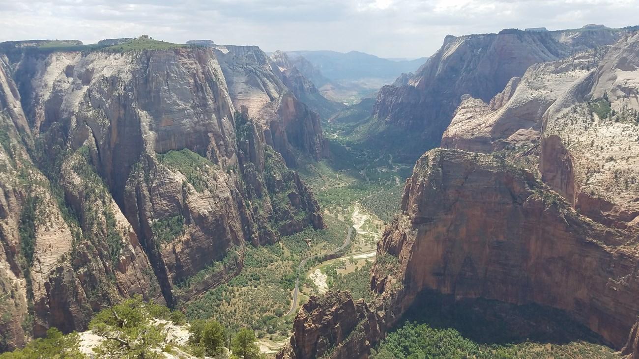
Explore Dixie Utah for red-rock canyons, desert trails, St George heritage, high plateaux and access to Zion’s dramatic landscapes.
Dixie
Explore Dixie Utah for red-rock canyons, desert trails, St George heritage, high plateaux and access to Zion’s dramatic landscapes.
-
 Escalante Desert
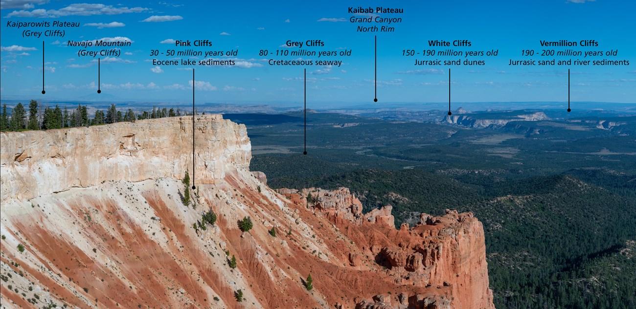
Explore Utah's Escalante Desert for sandstone canyons, river trails, dark skies, scenic drives and the wide-open landscapes of Grand Staircase country.
Escalante Desert
Explore Utah's Escalante Desert for sandstone canyons, river trails, dark skies, scenic drives and the wide-open landscapes of Grand Staircase country.
-

-

-
 Capitol Reef National Park
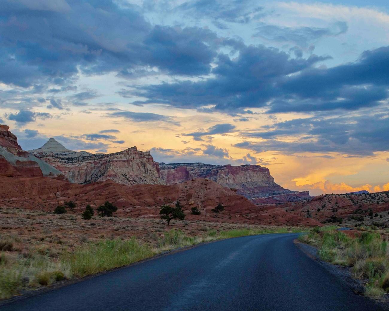
Explore Capitol Reef National Park in Utah for folded red-rock geology, historic Fruita orchards, scenic drives, canyons and remote desert trails.
Capitol Reef National Park
Explore Capitol Reef National Park in Utah for folded red-rock geology, historic Fruita orchards, scenic drives, canyons and remote desert trails.


Swipe for more regions
Explore more

Explore more of Utah
Explore Utah's stunning national parks, rich cultural heritage, and year-round outdoor adventures. Discover why this diverse state is a top destination for travelers.
Explore Utah