

Green Ridge State Forest Travel Guide - Free Web & App
Your ultimate guide to Green Ridge State Forest. Discover top landmarks, proposed trips, and local tips. Free on the web or via the Evendo companion app.


Green Ridge State Forest in Maryland offers Appalachian trails, lakes, camping, fishing, wildlife and quiet woodland escapes near Cumberland and the Potomac.
Forested Ridges and Quiet Valleys
\n\nGreen Ridge State Forest occupies a broad, rugged tract in western Maryland, stretching across the forested ridges and hollows of Allegany County near the Potomac River and the Pennsylvania and West Virginia borders. Covering roughly 46,000 acres, it is Maryland’s largest contiguous block of public land and feels substantially wilder than the state’s more urbanised eastern regions. Narrow roads wind through oak, hickory, pine and mixed hardwood woodland, while steep slopes descend towards streams, reservoirs and the long rural valleys around Flintstone, Oldtown and Green Spring.\n\nOutdoor Recreation and Natural Character
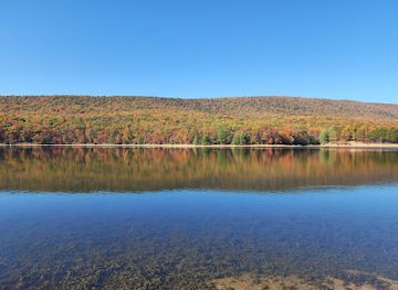
\n\nThe forest is primarily a destination for walking, camping, hunting, fishing, boating and quiet observation rather than intensive sightseeing. Its trail network includes routes through wooded ridges and remote valleys, with opportunities for both short outings and longer backcountry-style excursions. Green Ridge Lake and Piney Mountain provide focal points for water-based recreation and forest views, although conditions and permitted activities vary by location and season. Wildlife commonly associated with the surrounding Appalachian woodland includes white-tailed deer, wild turkey and a wide range of woodland birds; sightings are never guaranteed, and visitors should observe animals without approaching or feeding them.\n\nHistory and Gateway Communities
\n\nThe forest’s identity is closely linked to Maryland’s public-land and conservation history, while the surrounding countryside preserves evidence of older farming, transport and river communities. Nearby Cumberland provides the broadest range of services, museums and accommodation, while Flintstone and Oldtown are useful rural gateways. The historic National Road corridor and the C&O Canal towpath lie close to parts of the forest but are separate destinations. Green Ridge is best understood as a dispersed landscape: distances between trailheads, campsites, lakes and settlements make careful planning, adequate supplies and a reliable vehicle important.When is the best time to visit Green Ridge State Forest?
Best: May–June, September · 22–27°C| Month | High (°C) | Rainfall (mm) |
|---|---|---|
| January | 4 | 74 |
| February | 6 | 70 |
| March | 12 | 90 |
| April | 17 | 85 |
| May (best) | 22 | 95 |
| June (best) | 27 | 95 |
| July | 29 | 110 |
| August | 28 | 100 |
| September (best) | 24 | 90 |
| October | 18 | 85 |
| November | 11 | 85 |
| December | 5 | 85 |
Getting to and around Green Ridge State Forest
How to get there
Transportation
Best attractions in Green Ridge State Forest
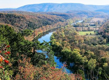
Green Ridge State Forest’s main attractions are its extensive woodland, quiet valleys and dispersed recreation areas rather than a concentration of built sights. Green Ridge Lake is a focal point for fishing, boating where permitted and relaxed waterside visits, while Piney Mountain and the surrounding ridges provide wooded scenery and access to trails. The forest’s network of hiking routes leads through mixed hardwood stands, hollows and upland terrain, with opportunities ranging from short walks to more demanding excursions. Campsites and remote clearings allow visitors to experience the forest after day visitors have left, subject to current regulations and reservations where required. The Potomac River and the small communities of Oldtown, Flintstone and Green Spring help define the surrounding landscape, although not every riverside or historic attraction is within the forest boundary. Nearby Cumberland and the C&O Canal towpath offer complementary excursions outside Green Ridge, particularly for visitors interested in regional history and transport heritage.
-
Scenic spot
Point Lookout Overlook Green Ridge State Forest
Discover the stunning vistas at Point Lookout Overlook in Green Ridge State Forest, a breathtaking destination for nature lovers and photographers.
-
Scenic spot
Town Hill Overlook
Discover the stunning panoramic views and tranquil ambiance of Town Hill Overlook, a scenic gem in Maryland perfect for nature lovers and photographers.
-
Scenic spot
Green Ridge Overlook
Experience the stunning beauty of the Appalachian Mountains at Green Ridge Overlook, a must-see scenic spot in Flintstone, Maryland.
-
Park
Zumbrun Overlook
Discover the breathtaking beauty of Zumbrun Overlook in Maryland, where stunning vistas and tranquil nature await every traveler.
Best landmarks in Green Ridge State Forest
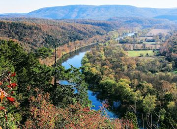
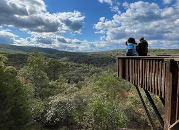
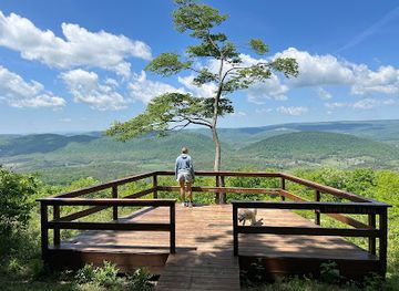
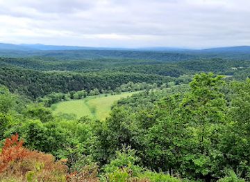
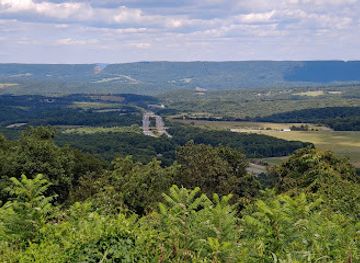
The defining landmark of Green Ridge State Forest is the long, heavily wooded Appalachian ridge system from which it takes its name, a landscape of elevated spurs, steep hollows and narrow valleys extending across western Allegany County. Green Ridge Lake is an important managed water feature and recreational reference point, while Piney Mountain contributes one of the forest’s characteristic elevated settings. Streams, forest roads and remote clearings provide intimate landmarks within a much larger woodland rather than isolated monumental sights. The forest also lies near the historic National Road corridor, whose nineteenth-century transport history helps explain the settlement pattern around its southern side, and near the Potomac River and C&O Canal landscape, although the canal and many associated structures are outside the forest boundary. Cumberland’s historic buildings and museums provide further regional context, but they should be visited as separate nearby attractions.
-
State park
Rocky Gap State Park
Discover the stunning landscapes and outdoor adventures at Rocky Gap State Park, a haven for nature lovers in Maryland.
-
Scenic spot
Point Lookout Overlook Green Ridge State Forest
Experience awe-inspiring views at Point Lookout Overlook, a hidden gem in Maryland's Green Ridge State Forest, perfect for nature lovers and photographers.
-
Scenic spot
Log Roll Overlook
Experience stunning panoramic views and natural serenity at Log Roll Overlook, a must-visit scenic spot in Maryland's Allegheny Mountains.
-
Scenic spot
Town Hill Overlook
Discover the stunning beauty of Town Hill Overlook in Maryland, offering breathtaking views and serene nature for an unforgettable experience.
Explore Green Ridge State Forest on the map
Plan your trip on one map. See where the top attractions, landmarks, restaurants and hotels are, and book hotels and experiences in a few clicks.
Best hotels in Green Ridge State Forest
Best restaurants in Green Ridge State Forest
Green Ridge State Forest has no concentrated restaurant district, and food options within the forest are limited compared with those in nearby towns. Visitors generally stock up in Cumberland or another larger settlement before travelling to remote trailheads, lakes and campsites, while Flintstone, Oldtown and other small communities may provide modest local services rather than a broad choice of dining. The surrounding Allegheny region is associated with straightforward American cooking, diner meals, sandwiches, barbecue, baked goods and farm-linked produce, reflecting its rural and working-landscape character. Cumberland offers the widest selection, including independent restaurants, cafés, pubs and takeaway food, and is the most reliable base for a meal after a day outdoors. Campers should plan self-catering carefully and carry sufficient supplies, since a forest recreation area should not be assumed to have a café, restaurant or reliable food shop nearby.
-
Restaurant
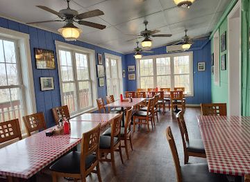
Potomac River Grill
Experience delightful American cuisine with scenic views at Potomac River Grill in Hancock, Maryland.
Best bars in Green Ridge State Forest
Evening entertainment around Green Ridge State Forest is quiet and dispersed rather than club-oriented. After dark, the principal experience is the silence of the woodland and the subdued atmosphere of a campsite, provided camping and fire regulations are followed. Traditional pubs, casual bars and restaurants are more likely to be found in Cumberland and other nearby settlements than within the forest, with Cumberland offering the region’s broadest choice of evening hospitality and occasional cultural programming. Flintstone and smaller surrounding communities have a limited rural evening scene, and opening patterns may vary. Visitors should not expect nightclubs, late-night districts or regular entertainment inside Green Ridge itself. Anyone travelling after dark should allow for poorly lit rural roads, wildlife crossings and long distances between accommodation, dining and recreation areas.
-
State park
Green Ridge State Forest
Explore the expansive Green Ridge State Forest, a Maryland gem offering stunning landscapes, diverse wildlife, and endless outdoor activities for all ages.
-
Scenic spot
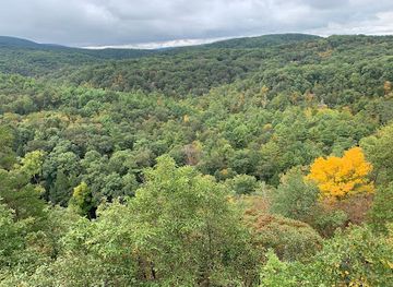
Green Ridge Overlook
Discover the stunning vistas and tranquil atmosphere at Green Ridge Overlook, a must-visit scenic spot in Flintstone, Maryland.
-
Haunted house
shady rest haunt
Experience spine-chilling thrills at Shady Rest Haunt in Flintstone, Maryland - where ghostly tales come to life!
-
Sports bar
Signatures Bar & Grill
Experience the ultimate sports bar atmosphere at Signatures Bar & Grill in Flintstone, Maryland, featuring a delectable menu and live broadcasts of your favorite games.


Best shops in Green Ridge State Forest
Shopping inside Green Ridge State Forest is minimal, with no extensive high street or permanent craft market. Visitors commonly purchase food, fuel, camping supplies and outdoor equipment in Cumberland before reaching the forest, while smaller nearby communities may offer basic provisions rather than a full retail selection. Cumberland is the most practical place to browse independent shops, cafés, galleries, local services and regional goods, and its historic setting gives shopping a stronger cultural context than a remote forest facility can provide. Around the wider Allegany County countryside, farm-linked products, baked goods, preserves and practical rural merchandise may appear through local businesses, although availability varies. Outdoor retailers are particularly useful for maps, clothing and equipment, as Green Ridge’s dispersed terrain makes last-minute supplies difficult to obtain at trailheads, lakes and campsites.
-
State park
Green Ridge State Forest
Explore the vast wilderness of Green Ridge State Forest, a natural gem in Maryland offering breathtaking trails, diverse wildlife, and endless outdoor adventures.
-
Scenic spot
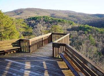
Point Lookout Overlook Green Ridge State Forest
Discover the stunning vistas of Point Lookout Overlook in Green Ridge State Forest, a tranquil escape for nature lovers in Little Orleans, Maryland.
-
Scenic spot
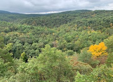
Green Ridge Overlook
Experience the stunning vistas and serene beauty of Green Ridge Overlook, a hidden gem in Flintstone, Maryland, perfect for nature lovers and photographers.
-
Campground
Green Ridge State Forest Campsite #1
Discover tranquility and adventure at Green Ridge State Forest Campsite #1 in Maryland, a perfect getaway for nature lovers and outdoor enthusiasts.

Get your free copy of our complete guide to Green Ridge State Forest, delivered straight to you.
Everything on this page, from attractions and restaurants to essentials and local phrases, in one PDF you can read offline, print or share.
Already have an account? Sign in
Your Green Ridge State Forest guide is ready.
We'll send it to · Not you? Sign out

Getting your guide ready…
We are putting together a fresh copy of the Green Ridge State Forest guide. This can take up to a minute.
This can take a few moments. If your browser asks, choose Allow so the download can start. You'll find the guide in your Downloads folder.
Nothing happened? Download it again
Sorry, the guide is taking longer than usual. Please try again in a minute, or get it by email instead.
Green Ridge State Forest essentials
Currency and Payment
Safety
Emergency Situations
Do's and Don'ts
Local Tips
From Eve
Local phrases worth knowing
You don't need to get them perfect. A few words go a long way, and locals appreciate the effort.
Basics
| English | Local | Say it |
|---|---|---|
| Hello | Howdy | [hah-dee] |
| Goodbye | See ya | [see yah] |
| Yes | Yup | [yuhp] |
| No | Nah | [nah] |
| Please/You're welcome | Please | [pleez] |
| Thank you | Thanks | [thanks] |
| Excuse me/Sorry | Pardon | [pahr-dun] |
| How are you? | Howdy | [hah-dee] |
| Fine. And you? | A-OK. How 'bout you? | [ay-oh-kay. how 'bout yuh] |
| Do you speak English? | Y'all speak English? | [yawl speak ing-lish] |
| I don't understand | I'm lost | [ahm lost] |
Eating & Drinking
| English | Local | Say it |
|---|---|---|
| I'd like to see the menu, please | Menu, please | [men-yoo, pleez] |
| I don't eat meat | No meat for me | [noh meet fohr mee] |
| Cheers! | Cheers! | [cheers] |
| I would like to pay, please | Check, please | [chek, pleez] |
Emergencies
| English | Local | Say it |
|---|---|---|
| Help! | Help! | [help] |
| Go away! | Get lost! | [get lost] |
| Call the Police! | Call the cops! | [call the cops] |
| Call a doctor! | Get a doc! | [get a doc] |
| I'm lost | I'm lost | [ahm lost] |
| I'm ill | I'm sick | [ahm sick] |
Shopping
| English | Local | Say it |
|---|---|---|
| I'd like to buy... | I wanna buy... | [ah wanna buy] |
| I'm just looking | Just browsing | [just brau-zing] |
| How much is it? | How much? | [how much] |
| That's too expensive | Too pricey | [too pry-see] |
| Can you lower the price? | Can ya do better? | [can yuh doh bet-ter] |
Time & Numbers
| English | Local | Say it |
|---|---|---|
| What time is it? | What time? | [what time] |
| It's one o'clock | It's one | [its one] |
| Half past (10) | Half past ten | [haff past ten] |
| Morning | Morning | [morn-ing] |
| Afternoon | Afternoon | [af-ter-noon] |
| Evening | Evening | [ee-ven-ing] |
| Yesterday | Yesterday | [yes-ter-day] |
| Today | Today | [toh-day] |
| Tomorrow | Tomorrow | [toh-mor-row] |
| 1 | One | [wun] |
| 2 | Two | [too] |
| 3 | Three | [three] |
| 4 | Four | [for] |
| 5 | Five | [fahyv] |
| 6 | Six | [siks] |
| 7 | Seven | [sev-uhn] |
| 8 | Eight | [ayt] |
| 9 | Nine | [nine] |
| 10 | Ten | [ten] |
Transport & Directions
| English | Local | Say it |
|---|---|---|
| Where's a/the...? | Where's the... | [wheres the] |
| What's the address? | What's yer address? | [whats yur address] |
| Can you show me (on the map)? | Show me on the map | [show mee on the map] |
| When's the next (bus)? | Next bus? | [next bus] |
| A ticket (to ....) | A ticket, please | [a ticket, pleez] |
History of Green Ridge State Forest
Appalachian Foundations
Green Ridge occupies the Allegheny Plateau, where long sandstone and shale ridges were shaped by immense geological processes and later dissected by streams flowing towards the Potomac River. The resulting terrain of narrow valleys, steep wooded slopes and elevated ridgelines influenced settlement and travel for centuries. Before the modern forest was established, the wider region was used by Indigenous peoples and later developed through farming, timbering, transport and small-scale extraction. Many of the forest’s present-day roads and clearings reflect this layered relationship between communities and the upland landscape rather than a landscape untouched by human activity.
Settlement, Farming and Transport
Historic communities around Green Ridge developed in the valleys and along routes connecting western Maryland with Pennsylvania and the Ohio country. Farming remained important on more accessible land, while the surrounding ridges supplied timber and other forest resources. The National Road, now broadly followed by U.S. Route 40, passes near the southern side of the forest and helped connect Cumberland with settlements farther east and west during the nineteenth century. The Potomac River corridor and the nearby Chesapeake and Ohio Canal also formed part of the region’s historic transport network, although the canal itself is outside Green Ridge State Forest.
Creation of a State Forest
Green Ridge State Forest emerged during the twentieth century as Maryland acquired and consolidated heavily forested land in western Allegany County. The programme reflected wider efforts to restore woodland, protect watersheds and provide public recreation after periods of intensive timber harvesting and changing rural land use. State management gradually shaped the area into a large public forest where timber production, wildlife management, hunting, fishing and recreation coexist. The forest is therefore both a natural refuge and a managed working landscape, with roads, reservoirs, campsites and trails integrated into its extensive woodland.
Modern Conservation and Recreation
Modern Green Ridge State Forest is managed by the Maryland Department of Natural Resources, which balances public access with forest management, habitat protection and regulated outdoor activities. Recreation expanded through camping areas, trail systems, water access and designated routes, while hunting and fishing remained significant uses of the land. Conservation work continues in response to changing woodland conditions, invasive species, erosion, wildfire risk and visitor pressure. Nearby historic resources, including the National Road and C&O Canal corridor, add cultural context, but Green Ridge’s defining modern character remains its scale of contiguous public forest and its relatively remote Appalachian setting.
Green Ridge State Forest in Photos
Browse through our photo collection highlighting the charm and character of the destination.
Neighbouring destination travel guides
The closest destinations to Green Ridge State Forest, if you have time for more than one.
-

-
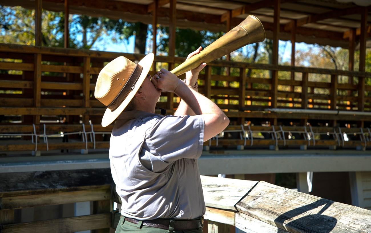 Chesapeake and Ohio Canal National Historical Park
 in Maryland follows a 184.5-mile towpath through canal history, riverside scenery, locks and Great Falls.
Chesapeake and Ohio Canal National Historical Park
Chesapeake and Ohio Canal National Historical Park in Maryland follows a 184.5-mile towpath through canal history, riverside scenery, locks and Great Falls.
-

-

-


Swipe for more destinations
Explore more

Explore more of Western Maryland
Explore Western Maryland for Appalachian scenery, Deep Creek Lake, canal towpaths, Civil War history, mountain towns and farm-to-table flavours.
Explore Western Maryland
Explore more of Maryland
Discover Maryland, where coastal charm meets rich history and outdoor adventure. Experience the best of the East Coast in this small but diverse state.
Explore Maryland