

Santa Fe National Forest Travel Guide - Free Web & App
Your ultimate guide to Santa Fe National Forest. Discover top landmarks, proposed trips, and local tips. Free on the web or via the Evendo companion app.


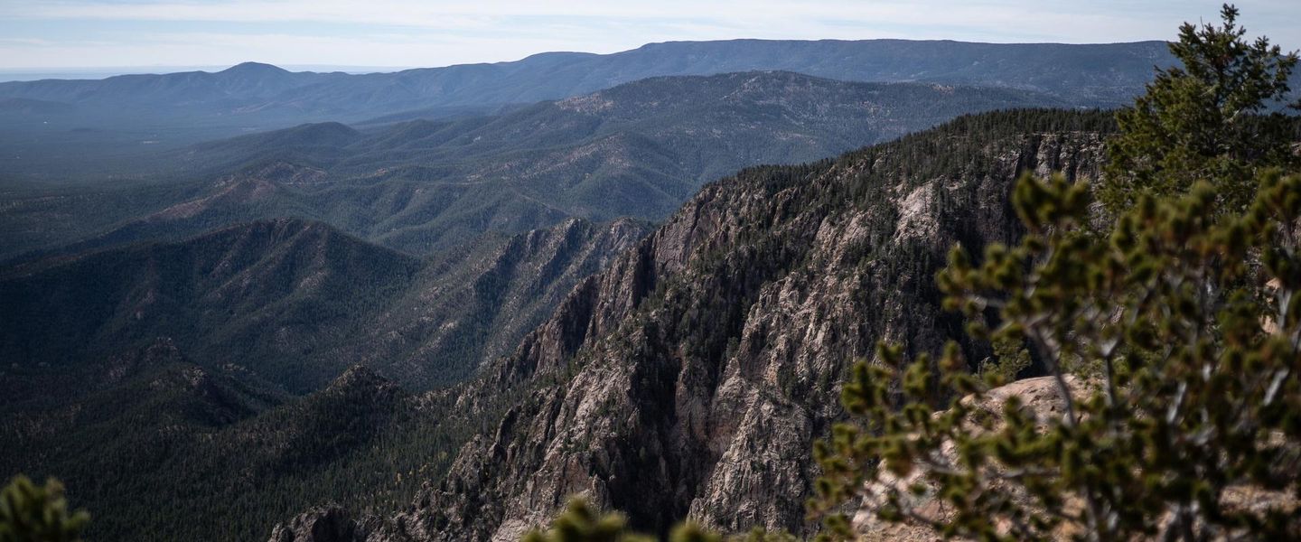


Santa Fe National Forest in New Mexico offers alpine wilderness, volcanic peaks, scenic trails, wildlife, fishing and mountain access near historic Santa Fe.
Mountains Above the High Desert
Santa Fe National Forest occupies about 1.6 million acres across north-central New Mexico, extending from the wooded Sangre de Cristo Mountains east of Santa Fe to the volcanic Jemez Mountains west of the Rio Grande. Its terrain rises sharply from piñon- and juniper-clad foothills into ponderosa pine forests, aspen groves, alpine meadows and high wilderness country. The forest is divided into several distinct landscapes, including the Pecos Wilderness, San Pedro Parks Wilderness and parts of the Chama and Jemez watersheds.Read more about Santa Fe National Forest
Wilderness, Water and Volcanic Landscapes
Culture and Gateway Communities
When is the best time to visit Santa Fe National Forest?
Best: April–May, September · 19–26°C| Month | High (°C) | Rainfall (mm) |
|---|---|---|
| January | 8 | 18 |
| February | 11 | 16 |
| March | 14 | 22 |
| April (best) | 19 | 24 |
| May (best) | 24 | 30 |
| June | 29 | 51 |
| July | 31 | 71 |
| August | 30 | 69 |
| September (best) | 26 | 45 |
| October | 19 | 29 |
| November | 12 | 24 |
| December | 7 | 21 |
Getting to and around Santa Fe National Forest
How to get there
Transportation
Best attractions in Santa Fe National Forest
Santa Fe National Forest's attractions are distributed across several mountain landscapes rather than concentrated in one visitor centre. The Pecos Wilderness offers long-distance hiking through glacial valleys, high lakes and peaks above the tree line, while the San Pedro Parks Wilderness is known for broad mountain meadows and forested uplands. Around the Jemez Mountains, visitors encounter volcanic formations, wooded canyons and the scenic route through the Jemez region; the nearby Valles Caldera National Preserve is a separate National Park Service site rather than part of the national forest. Santa Fe Ski Basin provides winter sports and summer mountain access in the Sangre de Cristo range. Lake recreation, fishing and camping occur at selected developed sites such as Nambe Lake and along forest waterways, subject to local rules and conditions. Scenic drives towards the Pecos valley, Jemez country and Chama region reveal changing vegetation, historic villages and high-desert views.
-
Historical landmark
Santa Fe Plaza
Discover the cultural essence of Santa Fe at Santa Fe Plaza, where history, art, and local traditions come alive in a vibrant setting.
-
Shrine
Santuario de Chimayo
Explore the Santuario de Chimayo, a revered shrine in New Mexico, offering a blend of healing, history, and breathtaking architecture.
-
State park
Rio Grande Nature Center State Park
Discover the natural beauty and diverse wildlife of Rio Grande Nature Center State Park, a serene escape in Albuquerque, New Mexico.
-
Museum
Tinkertown Museum
Explore the enchanting Tinkertown Museum in Sandia Park, New Mexico, where artistry and imagination come to life in whimsical miniatures and dioramas.


Best landmarks in Santa Fe National Forest
The Pecos Wilderness is Santa Fe National Forest's defining natural landmark, spread across rugged Sangre de Cristo terrain where high ridges, glacial valleys and alpine lakes shape the landscape. Truchas Peaks rise prominently above northern New Mexico, while the Pecos River and its tributaries connect mountain country with historic valley settlements. In the west, the Jemez Mountains display the region's volcanic character through red-rock canyons, forested slopes and broad high-elevation basins; Valles Caldera, although nearby, is managed separately as a National Park Service preserve. Santa Fe Ski Basin is a recognisable mountain landmark close to the capital, and the forest's wilderness areas are landmarks of conservation as well as scenery. Historic villages, acequias and Pueblo cultural landscapes around the forest provide an important human dimension, even where the built heritage lies outside the national forest boundary.
-
Historical landmark
Santa Fe Plaza
Experience the vibrant culture and rich history at Santa Fe Plaza, the heart of Santa Fe, New Mexico, where art, food, and community come together.
-
Park
Pecos National Historical Park
Discover the breathtaking landscapes and rich history of Pecos National Historical Park, where ancient ruins meet stunning natural beauty.
-
Museum
El Rancho de las Golondrinas
Experience the heart of New Mexico's history at El Rancho de las Golondrinas, a living museum showcasing the rich agricultural traditions and cultural heritage.
-
Park
Cross of the Martyrs
Experience the historical beauty and tranquility of Cross of the Martyrs in Santa Fe, where stunning views and rich heritage await travelers.


Explore Santa Fe National Forest on the map
Plan your trip on one map. See where the top attractions, landmarks, restaurants and hotels are, and book hotels and experiences in a few clicks.
Best hotels in Santa Fe National Forest
Best restaurants in Santa Fe National Forest
Santa Fe National Forest has very limited dining within its remote mountain areas, so most meals are taken in gateway communities. Santa Fe provides the broadest choice, with New Mexican cooking shaped by corn, beans, chile, historic Pueblo and Hispanic traditions, alongside contemporary restaurants and cafés. Española and smaller Rio Grande valley communities are useful for food and supplies on routes towards the northern forest, while Los Alamos and villages in the Jemez region offer more limited everyday options. Traditional dishes may include enchiladas, tamales, posole and locally characteristic red or green chile preparations, though menus vary widely. Rural cafés, family restaurants, general stores and village establishments are more relevant than a concentrated dining district. Visitors camping or entering wilderness should buy provisions before departure and should not expect food service at trailheads, campgrounds or high mountain lakes.
-
Mexican
La Choza Restaurant
Experience authentic Mexican flavors at La Choza Restaurant in Santa Fe – where vibrant cuisine meets warm hospitality.
-
American
The Ranch House
Experience authentic American cuisine at The Ranch House in Santa Fe - where local flavors meet exceptional hospitality.
-
Barbecue
Cowgirl
Experience the lively spirit of Santa Fe at Cowgirl - where American barbecue meets modern culinary creativity.
-
Mexican
Maria's New Mexican Kitchen
Savor the authentic tastes of New Mexico at Maria's New Mexican Kitchen in Santa Fe - where every dish tells a story.


Best bars in Santa Fe National Forest
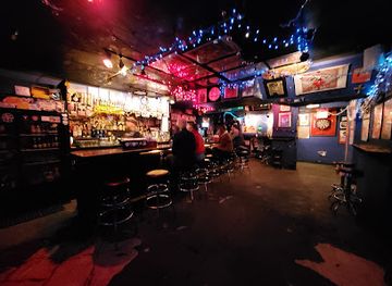
Evening entertainment is concentrated outside the forest in Santa Fe and the surrounding gateway communities rather than within the mountain landscape. Santa Fe has the region's most developed selection of bars, traditional cantinas, hotel lounges, restaurants with evening service and cultural venues, while Española, Los Alamos and smaller towns offer a quieter choice of local bars and community-oriented establishments. Mountain villages may have a pub or restaurant where visitors can eat and socialise, but opening patterns and seasonal availability vary. There are no established nightlife districts or substantial nightclub scenes in the remote forest. After dark, the characteristic experience is often the quiet of a campsite or rural lodging, with visitors expected to observe fire regulations, minimise noise and respect nearby residents and wildlife.
-
Bar
Cowgirl
Discover the vibrant flavors and lively ambiance of Cowgirl, a must-visit bar and restaurant in Santa Fe, New Mexico.
-
Bar
Coyote Cafe & Rooftop Cantina
Experience the vibrant flavors of Southwestern cuisine at Coyote Cafe & Rooftop Cantina in Santa Fe, New Mexico, where every meal is a celebration.
-
Grill
Del Charro
Experience the vibrant flavors of Del Charro in Santa Fe, offering delicious American cuisine, craft beers, and a lively atmosphere perfect for any occasion.
-
Mexican
Horseman's Haven Cafe
Discover authentic Mexican cuisine at Horseman's Haven Cafe in Santa Fe, where tradition meets flavor in a welcoming atmosphere.


Best nightclubs in Santa Fe National Forest
Evening entertainment is concentrated outside the forest in Santa Fe and the surrounding gateway communities rather than within the mountain landscape. Santa Fe has the region's most developed selection of bars, traditional cantinas, hotel lounges, restaurants with evening service and cultural venues, while Española, Los Alamos and smaller towns offer a quieter choice of local bars and community-oriented establishments. Mountain villages may have a pub or restaurant where visitors can eat and socialise, but opening patterns and seasonal availability vary. There are no established nightlife districts or substantial nightclub scenes in the remote forest. After dark, the characteristic experience is often the quiet of a campsite or rural lodging, with visitors expected to observe fire regulations, minimise noise and respect nearby residents and wildlife.
-
Bar
The Matador
Experience the spirited nightlife of Santa Fe at The Matador, a beloved bar known for its unique cocktails and vibrant atmosphere.
-
Cocktail bar
Tonic
Experience the art of mixology at Tonic, a premier cocktail bar in Santa Fe offering creative drinks and a vibrant lounge atmosphere.
-
Bar
Evangelo's
Discover Evangelo's, a vibrant bar in Santa Fe, New Mexico, known for its handcrafted cocktails and lively atmosphere. Perfect for socializing and unwinding.
-
Bar
La Reina
Discover La Reina, a vibrant bar and lounge in Santa Fe, offering craft cocktails and local flavors in an inviting atmosphere.


Best shops in Santa Fe National Forest
Shopping within Santa Fe National Forest is limited to occasional supplies and small rural businesses, with the principal retail choice in Santa Fe and other gateway communities. Santa Fe is particularly associated with Native American arts and crafts, Spanish Colonial traditions, jewellery, textiles, pottery, paintings and regional food products, although visitors should buy from reputable sellers and ask about provenance. Española and northern New Mexico villages also have shops and galleries reflecting local Hispanic and Indigenous artistic traditions, while Los Alamos is a practical stop for provisions and outdoor needs. Farmers' markets and seasonal community markets may operate in surrounding settlements, but they should not be assumed to run year-round. There are few reasons to expect extensive retail facilities near trailheads, campgrounds or wilderness access points, so food, fuel, maps and equipment should be obtained before entering remote forest country.
-
Shopping mall
Santa Fe Place Mall
Explore Santa Fe Place Mall, a vibrant shopping hub in New Mexico offering diverse stores, dining, and entertainment for an unforgettable retail experience.
-
Gift shop
Tin-Nee-Ann Trading Co
Explore authentic Native American treasures and unique gifts at Tin-Nee-Ann Trading Co in Santa Fe, NM.
-
Gift shop
Doodlet's
Discover Doodlet's, a unique gift shop in Santa Fe offering handcrafted treasures and local art that captures the spirit of New Mexico.
-
Pottery store
Jackalope Mercado at Santa Fe
Explore Jackalope Mercado in Santa Fe for unique pottery, handcrafted furniture, and a true taste of New Mexico's vibrant culture.


Get your free copy of our complete guide to Santa Fe National Forest, delivered straight to you.
Everything on this page, from attractions and restaurants to essentials and local phrases, in one PDF you can read offline, print or share.
Already have an account? Sign in
Your Santa Fe National Forest guide is ready.
We'll send it to · Not you? Sign out

Getting your guide ready…
We are putting together a fresh copy of the Santa Fe National Forest guide. This can take up to a minute.
This can take a few moments. If your browser asks, choose Allow so the download can start. You'll find the guide in your Downloads folder.
Nothing happened? Download it again
Sorry, the guide is taking longer than usual. Please try again in a minute, or get it by email instead.
Santa Fe National Forest essentials
Currency and Payment
Safety
Emergency Situations
Do's and Don'ts
Local Tips
From Eve
Local phrases worth knowing
You don't need to get them perfect. A few words go a long way, and locals appreciate the effort.
Basics
| English | Local | Say it |
|---|---|---|
| Hello | Hola | [oh-lah] |
| Goodbye | Adiós | [ah-dee-ohs] |
| Yes | Sí | [see] |
| No | No | [noh] |
| Please/You're welcome | Por favor/De nada | [por fah-vor/de nah-dah] |
| Thank you | Gracias | [grah-syahs] |
| Excuse me/Sorry | Disculpe/Perdón | [dee-skool-peh/pehr-dohn] |
| How are you? | ¿Cómo estás? | [koh-moh ehs-tahs] |
| Fine. And you? | Bien. ¿Y tú? | [byen. ee too] |
| Do you speak English? | ¿Hablas inglés? | [ah-blahs een-glays] |
| I don't understand | No entiendo | [noh ehn-tyen-doh] |
Eating & Drinking
| English | Local | Say it |
|---|---|---|
| I'd like to see the menu, please | Me gustaría ver el menú, por favor | [meh goos-tah-ree-ah behr ehl meh-noo, por fah-vor] |
| I don't eat meat | No como carne | [noh koh-moh kahr-neh] |
| Cheers! | ¡Salud! | [sah-lood] |
| I would like to pay, please | Me gustaría pagar, por favor | [meh goos-tah-ree-ah pah-gar, por fah-vor] |
Emergencies
| English | Local | Say it |
|---|---|---|
| Help! | ¡Ayuda! | [ah-yoo-dah] |
| Go away! | ¡Vete! | [veh-teh] |
| Call the Police! | ¡Llama a la policía! | [yah-mah ah lah poh-lee-see-ah] |
| Call a doctor! | ¡Llama a un médico! | [yah-mah ah oon meh-dee-koh] |
| I'm lost | Estoy perdido | [ehs-toy pehr-dee-doh] |
| I'm ill | Estoy enfermo | [ehs-toy ehn-fehr-moh] |
Shopping
| English | Local | Say it |
|---|---|---|
| I'd like to buy... | Me gustaría comprar... | [meh goos-tah-ree-ah kohm-prahr] |
| I'm just looking | Sólo estoy mirando | [soh-loh ehs-toy mee-rahn-doh] |
| How much is it? | ¿Cuánto cuesta? | [kwan-toh kwehs-tah] |
| That's too expensive | Esto es demasiado caro | [ehs-toh ehs deh-mah-syah-doh kahr-oh] |
| Can you lower the price? | ¿Puede bajar el precio? | [pweh-deh bah-har ehl pree-syoh] |
Time & Numbers
| English | Local | Say it |
|---|---|---|
| What time is it? | ¿Qué hora es? | [keh oh-rah ehs] |
| It's one o'clock | Es la una | [ehs lah oo-nah] |
| Half past (10) | Y media (10) | [ee meh-dee-ah (dies)] |
| Morning | Mañana | [mah-nyah-nah] |
| Afternoon | Tarde | [tahr-deh] |
| Evening | Noche | [noh-cheh] |
| Yesterday | Ayer | [ah-yehr] |
| Today | Hoy | [oy] |
| Tomorrow | Mañana | [mah-nyah-nah] |
| 1 | Uno | [oo-noh] |
| 2 | Dos | [dohs] |
| 3 | Tres | [trehs] |
| 4 | Cuatro | [kwah-troh] |
| 5 | Cinco | [seen-koh] |
| 6 | Seis | [says] |
| 7 | Siete | [syeh-teh] |
| 8 | Ocho | [oh-choh] |
| 9 | Nueve | [nweh-veh] |
| 10 | Diez | [dyehs] |
Transport & Directions
| English | Local | Say it |
|---|---|---|
| Where's a/the...? | ¿Dónde está...? | [dohn-deh ehs-tah] |
| What's the address? | ¿Cuál es la dirección? | [kwal ehs lah dee-rehk-syohn] |
| Can you show me (on the map)? | ¿Puedes mostrarme (en el mapa)? | [pweh-dehs mohs-trahr-meh (ehn ehl mah-pah)] |
| When's the next (bus)? | ¿Cuándo es el próximo (autobús)? | [kwan-doh ehs ehl proh-ksee-moh (ow-toh-boos)] |
| A ticket (to ....) | Un boleto (para ....) | [oon boh-leh-toh (pah-rah)] |
History of Santa Fe National Forest
A Volcanic and Mountainous Foundation
The landscapes of Santa Fe National Forest were formed over exceptionally long geological periods. The Jemez Mountains are a volcanic complex associated with major eruptions and caldera formation, while the Sangre de Cristo Mountains preserve uplifted and eroded mountain terrain. Glaciation later carved high valleys and basins in the Pecos country, leaving cirques, lakes and rugged ridges. These geological processes created the varied elevations, watersheds and habitats that now distinguish the forest, although the present national forest is a modern administrative designation laid over much older natural systems.
Indigenous Homelands and Ancestral Use
The mountains, forests, rivers and exceptionally productive valleys of the region have long been used by Indigenous peoples, including Pueblo communities whose homelands surround and intersect the wider landscape. Hunting, gathering, farming and travel connected upland areas with settled communities along the Rio Grande and its tributaries. Archaeological and cultural resources occur throughout the region, and many places retain continuing significance for Native communities. Visitors should understand that the national forest is not an empty wilderness: its landscapes form part of living cultural geographies with traditions extending well beyond the boundaries of the federal forest.
Spanish Settlement and Mountain Communities
Spanish colonisation introduced new patterns of settlement, livestock raising and irrigated agriculture to northern New Mexico from the seventeenth century onwards, while later Hispanic communities developed villages, acequias and land-use traditions around mountain valleys and waterways. The forests supplied timber, grazing and other resources to nearby settlements, and routes through the mountains linked communities on both sides of the Sangre de Cristo and Jemez ranges. These layered histories remain visible in village landscapes, religious traditions, agricultural practices and the names of rivers, peaks and valleys around the forest.
From Territorial Resource Lands to National Forest
As the United States expanded its administration of New Mexico, federal surveys and changing land policy brought many mountain areas into a system of public resource management. Santa Fe National Forest was established in 1915 through the consolidation and reorganisation of earlier forest reserves. Timber production, grazing, watershed protection and recreation became increasingly coordinated under the United States Forest Service. Roads and trails gradually improved access, but the forest's large size and rugged terrain kept many areas relatively remote, particularly within the high wilderness country of the Pecos Mountains.
Wilderness Protection and Modern Stewardship
Twentieth-century conservation movements changed the balance between extraction, recreation and ecological protection. The Pecos Wilderness, designated in 1964 under the Wilderness Act, preserves a substantial high-mountain landscape with limited road access, while the San Pedro Parks and Dome wilderness areas protect other distinctive parts of the forest. Today, management also addresses wildfire, watershed health, habitat, forest restoration, recreation pressure and the protection of archaeological and cultural resources. The surrounding communities continue to depend on the forest for water, livelihoods, seasonal recreation and longstanding cultural connections.
Santa Fe National Forest in Photos
Browse through our photo collection highlighting the charm and character of the destination.
Cities in Santa Fe National Forest
The towns and cities of Santa Fe National Forest, and the easiest places to base yourself.
-
-
-

-

-

-


Swipe for more cities
Neighbouring destination travel guides
The closest destinations to Santa Fe National Forest, if you have time for more than one.
-

-

-
-

-


Swipe for more destinations
Explore more

Explore more of Jemez Mountains
Explore New Mexico’s Jemez Mountains for volcanic calderas, pine forests, hot springs, Pueblo heritage, hiking and high-country scenery.
Explore Jemez Mountains
Explore more of New Mexico
Discover the enchanting blend of rich history, diverse cultures, and stunning landscapes in New Mexico, the Land of Enchantment, where adventure and relaxation await.
Explore New Mexico