

Cape Fear Coast Travel Guide - Free Web & App
Your ultimate guide to Cape Fear Coast. Discover top landmarks, proposed trips, and local tips. Free on the web or via the Evendo companion app.


Explore North Carolina's Cape Fear Coast for Wilmington's riverfront, Atlantic beaches, Civil War history, island wildlife, seafood and water-based adventures.
A Coast Shaped by River and Sea
Cape Fear Coast occupies the southeastern corner of North Carolina, where the Cape Fear River reaches the Atlantic through a broad estuarine landscape of marshes, tidal creeks, barrier islands and sandy beaches. Its visitor geography is centred on Wilmington and extends along a varied shoreline that includes Wrightsville Beach, Carolina Beach, Kure Beach, Fort Fisher, Southport, Bald Head Island, Oak Island, Holden Beach and Ocean Isle Beach. Distances between these places are substantial, so the coast is best understood as a collection of linked but distinct areas rather than one compact resort strip.Read more about Cape Fear Coast
Historic Ports and Barrier Islands
Coastal Life and Outdoor Exploration
When is the best time to visit Cape Fear Coast?
Best: April–May, October · 23–28°C| Month | High (°C) | Rainfall (mm) |
|---|---|---|
| January | 13 | 99 |
| February | 14 | 91 |
| March | 19 | 107 |
| April (best) | 23 | 91 |
| May (best) | 28 | 107 |
| June | 32 | 114 |
| July | 33 | 140 |
| August | 33 | 150 |
| September | 30 | 142 |
| October (best) | 25 | 102 |
| November | 19 | 89 |
| December | 14 | 97 |
Getting to and around Cape Fear Coast
How to get there
Transportation
Best attractions in Cape Fear Coast
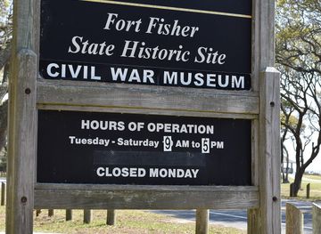
The Cape Fear Coast's attractions range from Wilmington's historic riverfront and preserved downtown buildings to an extensive chain of barrier-island beaches. Wrightsville Beach is associated with surfing, boating and an active seasonal waterfront, while Carolina Beach and Kure Beach offer boardwalk, pier and family-oriented seaside settings. At the mouth of the river, Fort Fisher State Historic Site combines Civil War interpretation with beaches, marshes and maritime habitat, and the nearby North Carolina Aquarium at Fort Fisher explores regional aquatic life. Southport provides harbour views and a walkable historic centre, while Bald Head Island offers maritime forest, dunes, tidal creeks and access to Old Baldy lighthouse. Further south, Oak Island, Holden Beach and Ocean Isle Beach present different coastal communities and beach environments. The Cape Fear River itself is a major natural attraction, best appreciated from riverfront areas, organised excursions or suitable paddling waters rather than treated as a single uniform recreational site.
-
History museum
Battleship North Carolina
Discover the legacy of the Battleship North Carolina, a WWII naval museum that brings history to life along the scenic Cape Fear River.
-
Aquarium
North Carolina Aquarium at Fort Fisher
Explore the North Carolina Aquarium at Fort Fisher, a captivating blend of marine life, gardens, and educational experiences in scenic Kure Beach.
-
Beach pavillion
Carolina Beach Boardwalk
Experience the lively Carolina Beach Boardwalk, a coastal gem filled with attractions, dining, and stunning ocean views for the perfect beach getaway.
-
Historical place museum
Fort Fisher State Historic Site
Discover the rich history and stunning coastal views at Fort Fisher State Historic Site, a key landmark of the Civil War in North Carolina.


Best landmarks in Cape Fear Coast
The Cape Fear River is the defining natural landmark of the region, forming a navigable corridor between Wilmington, the estuary and the Atlantic. At its seaward approach, Fort Fisher is both a major Civil War landmark and part of a low coastal peninsula of dunes, marsh and beach. Bald Head Island's Old Baldy lighthouse, formally known as the Bald Head Island Lighthouse, is one of the area's best-known historic structures and an enduring navigation symbol. Wilmington's preserved nineteenth-century riverfront buildings and Southport's historic townscape express the coast's port and maritime heritage. The barrier islands themselves are significant landmarks: Wrightsville, Carolina, Kure, Oak, Holden and Ocean Isle each combine beaches with inlets, tidal waters and developed coastal communities. Maritime forests, salt marshes and the Cape Fear estuary provide the ecological setting that links these natural and human landmarks.
-
History museum
Battleship North Carolina
Discover the rich naval history and stunning views at the Battleship North Carolina, a historic landmark and museum on the Cape Fear River.
-
Aquarium
North Carolina Aquarium at Fort Fisher
Discover the captivating marine life and stunning gardens at the North Carolina Aquarium at Fort Fisher, a premier attraction in Kure Beach.
-
Beach pavillion
Carolina Beach Boardwalk
Experience the vibrant atmosphere of Carolina Beach Boardwalk, where coastal charm meets fun-filled attractions and stunning ocean views.
-
State park
Carolina Beach State Park
Discover the stunning landscapes and diverse wildlife of Carolina Beach State Park, a perfect coastal retreat for nature lovers and adventure seekers alike.


Explore Cape Fear Coast on the map
Plan your trip on one map. See where the top attractions, landmarks, restaurants and hotels are, and book hotels and experiences in a few clicks.
Best hotels in Cape Fear Coast
Best restaurants in Cape Fear Coast
Dining across the Cape Fear Coast reflects its river, estuary and Atlantic setting, with seafood, oysters, shrimp, fish, crab and locally sourced coastal produce prominent in many menus. Wilmington has the region's broadest choice, from restaurants and cafés around the historic district and riverfront to contemporary establishments in surrounding neighbourhoods. Southport and the beach communities provide places associated with waterfront dining, casual seafood and seasonal holiday trade, while smaller coastal settlements may have fewer options and more limited opening patterns outside the main season. Regional Southern cooking, barbecue, sandwiches, farm produce and craft beverages also feature alongside seafood. Farmers' markets, fish markets and farm shops can offer a more direct connection with local ingredients, although exact availability varies by season, weather and location.
-
American
The Copper Penny
Discover Wilmington's culinary gem at The Copper Penny - where American flavors meet Southern charm in a vibrant riverside setting.
-
Grill
The Fork 'N' Cork
Experience the heart of Wilmington at The Fork 'N' Cork - where delicious American cuisine meets vibrant social dining.
-
Seafood
Elijah's
Experience exquisite seafood dining at Elijah's on Wilmington's beautiful Riverfront – where every meal comes with stunning views.
-
Seafood
Fish Bites Seafood Restaurant
Experience the best of Wilmington's coastal cuisine at Fish Bites Seafood Restaurant - where freshness meets flavor!



Best bars in Cape Fear Coast
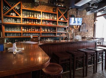
Evening entertainment is concentrated in Wilmington, where the historic downtown and riverfront support pubs, restaurants, breweries, live-music settings and other modest late-evening options, with the atmosphere generally more varied than on the quieter islands. Carolina Beach has a more seasonal seaside evening character, including its boardwalk area and established hospitality venues, while Wrightsville Beach, Kure Beach, Southport and the Brunswick County communities tend towards relaxed bars, restaurants and traditional local gathering places rather than large club districts. Outside the principal towns, nightlife can be sparse and may follow seasonal patterns. Visitors staying on Bald Head Island should expect a quieter island evening shaped by accommodation venues, marsh and ocean surroundings rather than a conventional nightlife scene. Check current arrangements locally, particularly outside summer.
-
Grill
Anne Bonny's Bar and Grill
Experience Riverside Dining at Anne Bonny's Bar and Grill in Wilmington, NC - Enjoy Southern Flavors with Scenic Views.
-
Bar
Satellite Bar and Lounge
Discover Satellite Bar and Lounge: Wilmington's vibrant bar with a dog-friendly atmosphere, diverse drinks, and a lively ambiance for unforgettable nights.
-
Grill
Reel Cafe
Experience the best of American grilling at Reel Cafe, a vibrant restaurant along Wilmington's Riverfront, where fresh seafood meets local charm.
-
Grill
Ogden Tap Room
Discover Ogden Tap Room in Wilmington, NC – a delightful grill offering diverse flavors and an extensive selection of craft beers in a lively atmosphere.


Best nightclubs in Cape Fear Coast
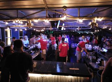
Evening entertainment is concentrated in Wilmington, where the historic downtown and riverfront support pubs, restaurants, breweries, live-music settings and other modest late-evening options, with the atmosphere generally more varied than on the quieter islands. Carolina Beach has a more seasonal seaside evening character, including its boardwalk area and established hospitality venues, while Wrightsville Beach, Kure Beach, Southport and the Brunswick County communities tend towards relaxed bars, restaurants and traditional local gathering places rather than large club districts. Outside the principal towns, nightlife can be sparse and may follow seasonal patterns. Visitors staying on Bald Head Island should expect a quieter island evening shaped by accommodation venues, marsh and ocean surroundings rather than a conventional nightlife scene. Check current arrangements locally, particularly outside summer.
-
Bar
Dirty Dan's uncw
Discover Wilmington's nightlife at Dirty Dan's, a lively bar with outdoor seating and a dance club that guarantees an unforgettable experience.
-
Bar
Level 5 at City Stage
Discover Wilmington's nightlife at Level 5, a lively cocktail bar offering great drinks, live performances, and a vibrant atmosphere for all.
-
Bar
Varnish
Experience Wilmington's nightlife at Varnish, where innovative cocktails and vibrant entertainment create unforgettable memories by the riverfront.
-
Night club
Ibiza Nightclub
Experience the vibrant nightlife of Wilmington at Ibiza Nightclub, where electrifying music and inclusive vibes create unforgettable nights.



Best shops in Cape Fear Coast
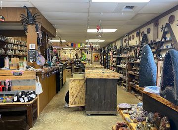
Wilmington offers the Cape Fear Coast's most substantial shopping, particularly around the historic district, where independent retailers, galleries, bookshops, clothing businesses and craft-oriented stores occupy older streets near the river. Southport is known for small-town browsing, local art and maritime-themed gifts, while beach communities provide seasonal shops, surf and outdoor equipment, beachwear and practical supplies rather than extensive retail districts. Farmers' markets, seafood markets, farm shops and regional food producers provide opportunities to buy local ingredients, although market days and seasonal stock vary. Craft beer, North Carolina food products, coastal artwork, photography, pottery and nautical goods are among the types of regional purchases available. On Bald Head Island and in smaller island communities, choice is more limited, so visitors should obtain specialist outdoor equipment and substantial provisions in larger gateway towns when appropriate.
-
Shopping mall
The Cotton Exchange
Experience the charm of The Cotton Exchange, a unique shopping mall steeped in history, located in the heart of Wilmington's Riverfront.
-
Spice store
Cape Fear Spice Merchants
Explore a world of flavors at Cape Fear Spice Merchants, Wilmington's premier destination for spices, gourmet groceries, and specialty teas.
-
Gift shop
Blue Moon Gift Shops
Explore Blue Moon Gift Shops in Wilmington, NC for unique gifts, jewelry, home goods, and more that capture the essence of local artistry.
-
Metaphysical supply store
Madame Meerkat's Cabinet of Curiosities
Explore the whimsical world of Madame Meerkat's Cabinet of Curiosities, a must-visit metaphysical supply store in Wilmington, NC, filled with unique treasures.


Get your free copy of our complete guide to Cape Fear Coast, delivered straight to you.
Everything on this page, from attractions and restaurants to essentials and local phrases, in one PDF you can read offline, print or share.
Already have an account? Sign in
Your Cape Fear Coast guide is ready.
We'll send it to · Not you? Sign out

Getting your guide ready…
We are putting together a fresh copy of the Cape Fear Coast guide. This can take up to a minute.
This can take a few moments. If your browser asks, choose Allow so the download can start. You'll find the guide in your Downloads folder.
Nothing happened? Download it again
Sorry, the guide is taking longer than usual. Please try again in a minute, or get it by email instead.
Cape Fear Coast essentials
Currency and Payment
Safety
Emergency Situations
Do's and Don'ts
Local Tips
From Eve
Local phrases worth knowing
You don't need to get them perfect. A few words go a long way, and locals appreciate the effort.
Basics
| English | Local | Say it |
|---|---|---|
| Hello | Hey y'all | [hey y'all] |
| Goodbye | See ya later | [see ya later] |
| Yes | Yeah | [yeah] |
| No | Nah | [nah] |
| Please/You're welcome | Please/No problem | [please/no problem] |
| Thank you | Thank ya | [thank ya] |
| Excuse me/Sorry | Pardon me/My bad | [pardon me/my bad] |
| How are you? | How y'all doin'? | [how y'all doin'] |
| Fine. And you? | Fine. And you? | [fine. and you?] |
| Do you speak English? | Ya speak English? | [ya speak English?] |
| I don't understand | I ain't gettin' it | [I ain't gettin' it] |
Eating & Drinking
| English | Local | Say it |
|---|---|---|
| I'd like to see the menu, please | I'd like to see the menu, please | [I'd like to see the menu, please] |
| I don't eat meat | I don't eat meat | [I don't eat meat] |
| Cheers! | Cheers! | [Cheers!] |
| I would like to pay, please | I would like to pay, please | [I would like to pay, please] |
Emergencies
| English | Local | Say it |
|---|---|---|
| Help! | Help! | [Help!] |
| Go away! | Git! | [Git!] |
| Call the Police! | Call the Law! | [Call the Law!] |
| Call a doctor! | Call a doc! | [Call a doc!] |
| I'm lost | I'm turned around | [I'm turned around] |
| I'm ill | I ain't feelin' well | [I ain't feelin' well] |
Shopping
| English | Local | Say it |
|---|---|---|
| I'd like to buy... | I'm lookin' to buy... | [I'm lookin' to buy...] |
| I'm just looking | I'm just browsin' | [I'm just browsin'] |
| How much is it? | How much does it cost? | [How much does it cost?] |
| That's too expensive | That's too pricey | [That's too pricey] |
| Can you lower the price? | Can ya do any better on the price? | [Can ya do any better on the price?] |
Time & Numbers
| English | Local | Say it |
|---|---|---|
| What time is it? | What time is it? | [What time is it?] |
| It's one o'clock | It's one o'clock | [It's one o'clock] |
| Half past (10) | Half past ten | [Half past ten] |
| Morning | Mornin' | [Mornin'] |
| Afternoon | Afternoon | [Afternoon] |
| Evening | Evenin' | [Evenin'] |
| Yesterday | Yesterday | [Yesterday] |
| Today | Today | [Today] |
| Tomorrow | Tomorrow | [Tomorrow] |
| 1 | One | [One] |
| 2 | Two | [Two] |
| 3 | Three | [Three] |
| 4 | Four | [Four] |
| 5 | Five | [Five] |
| 6 | Six | [Six] |
| 7 | Seven | [Seven] |
| 8 | Eight | [Eight] |
| 9 | Nine | [Nine] |
| 10 | Ten | [Ten] |
Transport & Directions
| English | Local | Say it |
|---|---|---|
| Where's a/the...? | Where's a/the...? | [Where's a/the...?] |
| What's the address? | What's the address? | [What's the address?] |
| Can you show me (on the map)? | Can you show me (on the map)? | [Can you show me (on the map)?] |
| When's the next (bus)? | When's the next (bus)? | [When's the next (bus)?] |
| A ticket (to ....) | A ticket (to ....) | [A ticket (to ....)] |
History of Cape Fear Coast
Coastal Formation and Indigenous Presence
The Cape Fear Coast was shaped over long geological timescales by changing sea levels, river sediment and the movement of Atlantic barrier islands. Its present landscape combines the Cape Fear River estuary with tidal marshes, sounds, dunes and offshore sand islands. Before European colonisation, Indigenous communities lived along the river, sounds and coastal plain, using maritime, wetland and woodland resources. The Cape Fear River was an important route through this environment, linking inland settlements with the coast. Many later place names and patterns of development were imposed during colonisation, while the environmental knowledge and presence of Indigenous peoples remain an essential part of the region's deeper history.
Colonial Port and Cape Fear Trade
European settlement expanded around the Cape Fear River during the eighteenth century, when the river offered access to the interior of North Carolina. Wilmington was established as a town in 1739 and became the principal port of the lower Cape Fear. Trade in naval stores, timber, agricultural goods and other products connected the coastal plain with Atlantic markets. Rice and later cotton were associated with the wider river economy, which depended heavily on enslaved labour. Smaller river and harbour communities developed around shipping, fishing and farming, creating the settlement pattern that still links Wilmington with Southport and the lower Cape Fear.
Civil War Port and Fort Fisher
During the American Civil War, Wilmington was one of the Confederacy's most important remaining Atlantic ports. Fort Fisher, built on the peninsula south of the river mouth, protected access to the Cape Fear River and helped blockade runners supply Wilmington. Union forces captured the fort on 15 January 1865 after a major land and naval assault. The fall of Fort Fisher was followed by the capture of Wilmington in February, cutting a significant Confederate supply route. Today, the fort site and associated landscapes at Fort Fisher State Historic Site interpret this military history alongside the peninsula's beaches, marshes and maritime habitats.
Railways, Shipping and Coastal Communities
After the Civil War, rail connections and expanding commercial activity strengthened Wilmington's position as a regional port. The lower Cape Fear continued to support shipping, fishing, timber and agricultural trade, while Southport developed a durable identity as a harbour and maritime community. Along the oceanfront, the barrier islands gradually became accessible to recreational visitors through improved roads, bridges and ferries. Beach communities such as Wrightsville Beach, Carolina Beach and Kure Beach grew from seasonal seaside settlements into year-round residential and tourism centres, although hurricanes, erosion and changing shorelines have remained persistent influences on coastal life.
Film, Conservation and the Modern Coast
Wilmington's riverfront streets, varied architecture and proximity to beaches helped establish a substantial film and television production industry from the late twentieth century, earning the city a long-standing association with screen production. At the same time, conservation shaped the modern identity of the wider coast. Fort Fisher State Historic Site, the North Carolina Aquarium at Fort Fisher, Bald Head Island Conservancy and other local organisations contribute to public understanding of coastal ecology, wildlife and heritage. Protection of dunes, marshes, sea-turtle nesting areas and maritime forests now sits alongside tourism, residential development, navigation and beach management as a central issue for the Cape Fear region.
Cape Fear Coast in Photos
Browse through our photo collection highlighting the charm and character of the destination.
Neighbouring destination travel guides
The closest destinations to Cape Fear Coast, if you have time for more than one.
-

-

-

-

-


Swipe for more destinations
Explore more
Explore more of Cape Fear
Cape Fear combines Wilmington's riverfront heritage with barrier-island beaches, maritime landscapes, seafood and Civil War history on North Carolina's coast.
Explore Cape Fear
Explore more of North Carolina
Discover North Carolina's blend of natural beauty, vibrant cities, and rich history. From the Outer Banks to the Blue Ridge Mountains, experience diverse landscapes and cultures.
Explore North Carolina