

Dixie National Forest Travel Guide - Free Web & App
Your ultimate guide to Dixie National Forest. Discover top landmarks, proposed trips, and local tips. Free on the web or via the Evendo companion app.


Dixie National Forest in Utah spans red canyons, alpine lakes, ponderosa forests and scenic hiking routes across southern Utah's varied landscapes.
A Forest of Contrasting Landscapes
Dixie National Forest stretches across more than two million acres of southern Utah, linking the red-rock country around St George and Cedar City with the high plateaux, mountains and lakes of the central south. Rather than forming one continuous woodland, it is a broad mosaic of public landscapes divided by towns, private land and neighbouring protected areas. Its four principal districts give the forest an exceptional range of scenery: the Pine Valley Mountains rise above the Mojave Desert, the Markagunt Plateau carries spruce and fir forests near Brian Head and Cedar Breaks, the Paunsaugunt country frames Red Canyon, and the Aquarius Plateau opens into remote high country around Boulder Mountain.Read more about Dixie National Forest
Plateaux, Canyons and Water
Gateway Communities and Outdoor Life
When is the best time to visit Dixie National Forest?
Best: June–August · 24–27°C| Month | High (°C) | Rainfall (mm) |
|---|---|---|
| January | 4 | 40 |
| February | 5 | 35 |
| March | 8 | 40 |
| April | 12 | 35 |
| May | 18 | 30 |
| June (best) | 24 | 25 |
| July (best) | 27 | 30 |
| August (best) | 26 | 30 |
| September | 22 | 30 |
| October | 15 | 35 |
| November | 8 | 40 |
| December | 4 | 40 |
Getting to and around Dixie National Forest
How to get there
Transportation
Best attractions in Dixie National Forest
Dixie National Forest's attractions range from the red pinnacles of Red Canyon near the Paunsaugunt Plateau to the alpine scenery of the Markagunt Plateau around Brian Head and the broad, remote heights of Boulder Mountain. Navajo Lake and Panguitch Lake provide contrasting settings for fishing, boating and shoreline recreation where permitted, while the Pine Valley Mountains rise above the dry country west of St George. Scenic byways and forest roads open views across high meadows, aspen groves, volcanic terrain and canyon country, although access varies with weather and season. The forest also forms an important setting for visits to nearby Cedar Breaks National Monument and Bryce Canyon National Park, which are separate protected areas rather than Forest Service attractions. Hiking trails, mountain-bike routes, equestrian paths, campgrounds and winter recreation areas allow visitors to experience different elevations, but facilities are dispersed and many sites are reached from distinct gateway communities.
-
National park
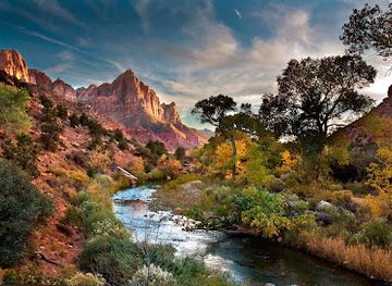
Zion National Park
Discover breathtaking landscapes and exciting outdoor adventures at Zion National Park, a must-visit destination in Utah.
-
National park
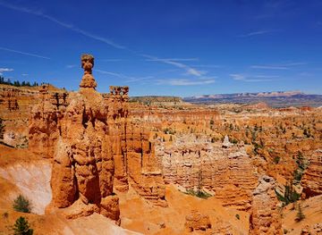
Bryce Canyon National Park
Explore the enchanting landscapes and unique hoodoos of Bryce Canyon National Park, Utah's breathtaking natural wonder.
-
Visitor center
Bryce Canyon National Park Visitor Center
Explore the stunning beauty of Bryce Canyon National Park Visitor Center, your gateway to unforgettable landscapes and rich natural history.
-
Tourist attraction
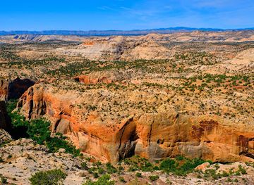
Grand Staircase-Escalante National Monument
Explore the stunning landscapes of Grand Staircase-Escalante National Monument, a natural wonder in Utah filled with canyons, plateaus, and rich wildlife.
Best landmarks in Dixie National Forest
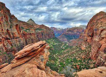
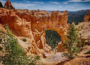
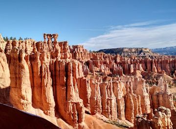
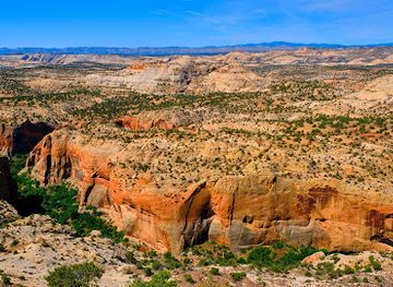
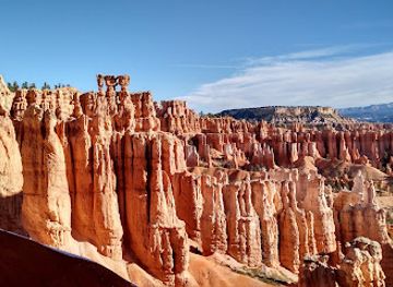
The forest's most significant landmarks are largely natural. Red Canyon's orange-red hoodoos and narrow fins form a distinctive gateway to the Paunsaugunt country, while the higher Markagunt Plateau includes the dramatic terrain around Brian Head and the separate Cedar Breaks National Monument. Boulder Mountain, part of the Aquarius Plateau, is marked by broad uplands, forested slopes and numerous lakes, while Navajo Lake and Panguitch Lake are prominent water features with long-standing recreational importance. The Pine Valley Mountains provide a powerful granite and forested backdrop above the desert around St George. Navajo Mountain and the Escalante country appear in the wider eastern landscape, though not every nearby landmark lies within the national forest. Together these features express the sharp transitions between Colorado Plateau canyons, high-elevation conifer country and the Mojave-influenced lowlands.
-
National park
Zion National Park
Explore the breathtaking beauty of Zion National Park in Utah, a paradise for hikers, nature lovers, and outdoor enthusiasts seeking adventure.
-
National park
Bryce Canyon National Park
Explore the breathtaking hoodoos and vibrant landscapes of Bryce Canyon National Park, a natural wonder in the heart of Utah, perfect for outdoor adventures.
-
Visitor center
Bryce Canyon National Park Visitor Center
Explore the breathtaking beauty of Bryce Canyon National Park Visitor Center, your gateway to stunning landscapes and unforgettable adventures in Utah.
-
Nature preserve
Grand Staircase-Escalante National Monument
Experience the breathtaking landscapes of Grand Staircase-Escalante National Monument, a natural paradise for hiking, photography, and wildlife watching in Utah.
Explore Dixie National Forest on the map
Plan your trip on one map. See where the top attractions, landmarks, restaurants and hotels are, and book hotels and experiences in a few clicks.
Best hotels in Dixie National Forest
Best restaurants in Dixie National Forest
Dixie National Forest itself has few concentrated dining areas, so most meals are found in gateway communities such as Cedar City, St George, Panguitch, Escalante, Boulder and Torrey. These towns provide the practical mix of cafés, diners, independent restaurants, bakeries and provisions shops needed before travelling into the forest. Southern Utah cooking reflects a high-desert and rural setting, with American comfort food, grilled meats, Mexican-influenced dishes, locally produced ingredients and café fare more common than a single defining regional cuisine. Farm shops and small food producers appear in some agricultural valleys, while lakeside or mountain recreation areas may have limited seasonal concessions rather than a dependable restaurant scene. Visitors planning long drives or remote camping should carry supplies from town, as distances between food outlets can be considerable and opening patterns vary outside the larger settlements.
-
Steak
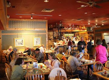
Ruby's Inn Cowboy's Buffet & Steak Room
Experience hearty cowboy cuisine at Ruby's Inn Cowboy's Buffet & Steak Room near Bryce Canyon – where flavor meets adventure!
-
Steak
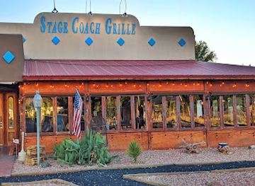
Stage Coach Grille
Experience mouthwatering steaks and delightful Southwestern dishes at Stage Coach Grille in La Verkin, Utah - a culinary gem waiting to be discovered.
-
American
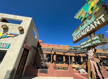
Thunderbird Restaurant
Experience authentic American cuisine at Thunderbird Restaurant in Mount Carmel - where delicious meals meet stunning Utah landscapes.
-
Southwestern American
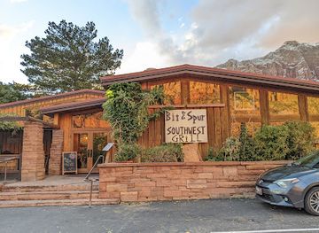
Bit & Spur Restaurant & Saloon
Experience authentic Southwestern American cuisine in a vibrant atmosphere near Zion National Park.
Best bars in Dixie National Forest
Evening entertainment is modest and concentrated in the towns around Dixie National Forest rather than within its remote landscapes. Cedar City and St George offer the broadest choice of restaurants, breweries, bars, cinemas and cultural venues, while Panguitch, Escalante, Boulder and Torrey are more likely to provide traditional pubs, hotel bars, cafés and relaxed places for an evening meal. Cedar City's arts calendar, including performances associated with the Utah Shakespeare Festival, can add a cultural dimension when events are scheduled, although the festival is seasonal and outside the forest. In smaller communities, evenings are generally quiet, with conversation, local hospitality and dark-sky viewing more characteristic than clubbing. Remote campgrounds and high-country sites should not be treated as nightlife destinations, and visitors should check current local arrangements rather than expect late-night services.
-
Barbecue
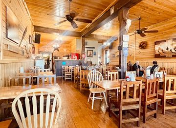
Cowboy's Smokehouse Cafe/Steakhouse
Discover Cowboy's Smokehouse Cafe/Steakhouse in Panguitch, Utah, where hearty barbecue and steak dishes await in a charming, rustic setting.
-
American
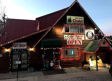
Aunt Sue's Chalet
Discover the charm of Aunt Sue's Chalet, where delicious American cuisine meets a cozy café atmosphere in the heart of Duck Creek Village.
-
Steak
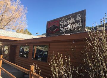
Milt's Stage Stop
Discover the flavors of Cedar City at Milt's Stage Stop, where exquisite steaks and fresh seafood await in a cozy, inviting atmosphere.
-
Restaurant
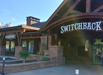
Switchback Grille
Experience exceptional dining at Switchback Grille, where exquisite flavors meet the breathtaking beauty of Zion National Park.
Best shops in Dixie National Forest
Shopping connected with Dixie National Forest is concentrated in its gateway towns rather than at isolated trailheads or scenic overlooks. Cedar City and St George provide the widest range of supermarkets, outdoor retailers, galleries and practical equipment shops, while Panguitch, Escalante, Boulder and Torrey offer smaller selections of provisions, local art, gifts and outdoor supplies. Regional products may include Utah-made foods, honey, preserves, pottery, paintings, photography, Native-inspired or locally designed artworks, and craft goods sold through independent businesses; the precise selection varies by settlement and season. Farm shops and rural producers are more relevant around agricultural valleys than in the high forest itself. Visitors heading into remote areas should buy fuel, food and specialist equipment before departure, since villages may have limited stock and there are no extensive shopping districts within the forest.
-
National forest
Dixie National Forest
Discover the breathtaking landscapes and outdoor adventures at Dixie National Forest, a natural gem in Utah, ideal for nature lovers and thrill-seekers.
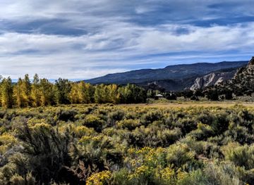
Get your free copy of our complete guide to Dixie National Forest, delivered straight to you.
Everything on this page, from attractions and restaurants to essentials and local phrases, in one PDF you can read offline, print or share.
Already have an account? Sign in
Your Dixie National Forest guide is ready.
We'll send it to · Not you? Sign out

Getting your guide ready…
We are putting together a fresh copy of the Dixie National Forest guide. This can take up to a minute.
This can take a few moments. If your browser asks, choose Allow so the download can start. You'll find the guide in your Downloads folder.
Nothing happened? Download it again
Sorry, the guide is taking longer than usual. Please try again in a minute, or get it by email instead.
Dixie National Forest essentials
Currency and Payment
Safety
Emergency Situations
Do's and Don'ts
Local Tips
From Eve
Local phrases worth knowing
You don't need to get them perfect. A few words go a long way, and locals appreciate the effort.
Basics
| English | Local | Say it |
|---|---|---|
| Hello | Howdy | [haw-dee] |
| Goodbye | Y'all come back now | [yawl kum bak now] |
| Yes | Yessir | [yes-sir] |
| No | Nah | [nah] |
| Please/You're welcome | Please/You're welcome | [pleez/yur wel-kum] |
| Thank you | Thank ya kindly | [thank ya kine-lee] |
| Excuse me/Sorry | Pardon me | [par-dn me] |
| How are you? | How y'all doin'? | [how yawl doo-in] |
| Fine. And you? | Fine. How 'bout you? | [fine. how bout yoo] |
| Do you speak English? | Ya speak English? | [ya speak ing-lish] |
| I don't understand | I ain't got a clue | [i aint got a kloo] |
Eating & Drinking
| English | Local | Say it |
|---|---|---|
| I'd like to see the menu, please | Can I take a gander at the menu, please | [kan i tayk a gan-der at the men-yoo pleez] |
| I don't eat meat | I don't touch the meat | [i dont tuch the meet] |
| Cheers! | Cheers! | [cheers] |
| I would like to pay, please | I reckon it's time to settle up | [i rek-un its tyme too set-tul up] |
Emergencies
| English | Local | Say it |
|---|---|---|
| Help! | Help! | [help] |
| Go away! | Git! | [git] |
| Call the Police! | Call the Sheriff! | [call the sher-iff] |
| Call a doctor! | Call the Doc! | [call the dok] |
| I'm lost | I'm turned around | [im turnd a-round] |
| I'm ill | I'm feelin' poorly | [im feel-in poor-lee] |
Shopping
| English | Local | Say it |
|---|---|---|
| I'd like to buy... | I'm fixin' to purchase... | [im fiks-in to pur-chus] |
| I'm just looking | Just browsin' | [just brow-zin] |
| How much is it? | What's the damage? | [wats the dam-ij] |
| That's too expensive | That's mighty pricey | [thats my-tee prye-see] |
| Can you lower the price? | Can y'all do any better on the price? | [kan yawl doo any bet-ter on the pryece] |
Time & Numbers
| English | Local | Say it |
|---|---|---|
| What time is it? | What's the time of day? | [wats the tyme of day] |
| It's one o'clock | It's one | [its wun] |
| Half past (10) | Ten-thirty | [ten-thur-tee] |
| Morning | Mornin' | [mor-nin] |
| Afternoon | Afternoon | [af-ter-noon] |
| Evening | Evenin' | [eve-nin] |
| Yesterday | Yestiddy | [yes-ti-dy] |
| Today | Today | [to-day] |
| Tomorrow | Tomorrow | [to-mor-row] |
| 1 | One | [wun] |
| 2 | Two | [too] |
| 3 | Three | [three] |
| 4 | Four | [four] |
| 5 | Five | [five] |
| 6 | Six | [six] |
| 7 | Seven | [sev-en] |
| 8 | Eight | [ate] |
| 9 | Nine | [nine] |
| 10 | Ten | [ten] |
Transport & Directions
| English | Local | Say it |
|---|---|---|
| Where's a/the...? | Where's the... | [wheres the] |
| What's the address? | What's the street? | [wats the street] |
| Can you show me (on the map)? | Can you point it out? | [kan you point it out] |
| When's the next (bus)? | When's the next one? | [whens the next one] |
| A ticket (to ....) | A ticket (to ....) | [a ticket (to)] |
History of Dixie National Forest
Plateaux Shaped by Time
The landscapes of Dixie National Forest reflect immense geological change rather than a single historical event. Uplift of the Colorado Plateau, erosion by water and ice, volcanic activity and the carving of canyons produced the high plateaux, cliffs, hoodoos and lava-rich landscapes visible today. The forest crosses several geological provinces, so its scenery changes markedly between the red sandstone country near St George, the forested Markagunt and Paunsaugunt plateaux, and the Aquarius Plateau around Boulder Mountain. These physical differences later influenced pasture, timber use, transport routes and settlement patterns.
Indigenous Homelands and Early Travel
Southern Utah has long been inhabited and travelled by Indigenous peoples, including Southern Paiute communities whose homelands extend across the region. Their knowledge of plants, water sources and seasonal movement remains an important part of the area's cultural history. Archaeological evidence across the wider Colorado Plateau records earlier human activity, although individual sites should be treated with care and protected from disturbance. Later routes followed river corridors, mountain passes and springs, connecting Native communities, explorers, traders and settlers through terrain that could be difficult to cross.
Settlement and Resource Use
Mormon settlement expanded through southern Utah during the nineteenth century, establishing communities and agricultural networks around Cedar City, Panguitch, St George and other valleys. Higher country supplied summer grazing, timber, fuel and water, while local industries included livestock raising, small-scale farming, logging and, in surrounding districts, mining. Roads and trails gradually connected the valleys with the plateaux. These activities altered forest structure and grasslands, but much of the region remained sparsely settled because of its elevation, aridity and rugged terrain.
Creation of the National Forest
The federal forest system developed in the early twentieth century as the United States sought to manage watersheds, timber and grazing resources more systematically. Dixie National Forest was established in 1905 through the consolidation and reorganisation of earlier forest reserves. Its name reflects the regional nickname traditionally associated with southern Utah rather than a single town or landscape. Forest Service management later incorporated recreation, wildlife habitat, fire planning, road access and watershed protection alongside the older uses of grazing and timber.
Tourism, Recreation and Stewardship
Improved roads and the growth of automobile travel brought wider attention to southern Utah's high plateaux and canyon country during the twentieth century. Scenic drives, campgrounds, fishing waters, ski facilities near Brian Head and access to neighbouring national parks helped establish the forest as part of the region's outdoor tourism economy. Contemporary management must balance recreation with wildfire risk, drought, habitat protection, grazing and the preservation of archaeological resources. The forest's modern identity therefore combines working public land with increasingly valued opportunities for hiking, wildlife observation and low-impact travel.
Dixie National Forest in Photos
Browse through our photo collection highlighting the charm and character of the destination.
Cities in Dixie National Forest
The towns and cities of Dixie National Forest, and the easiest places to base yourself.
-

-

-

-

-

-


Swipe for more cities
Neighbouring destination travel guides
The closest destinations to Dixie National Forest, if you have time for more than one.
-

-

-

-

-


Swipe for more destinations
Explore more
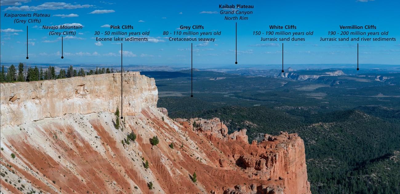
Explore more of Escalante Desert
Explore Utah's Escalante Desert for sandstone canyons, river trails, dark skies, scenic drives and the wide-open landscapes of Grand Staircase country.
Explore Escalante Desert
Explore more of Utah
Explore Utah's stunning national parks, rich cultural heritage, and year-round outdoor adventures. Discover why this diverse state is a top destination for travelers.
Explore Utah