

Bighorn National Forest Travel Guide - Free Web & App
Your ultimate guide to Bighorn National Forest. Discover top landmarks, proposed trips, and local tips. Free on the web or via the Evendo companion app.


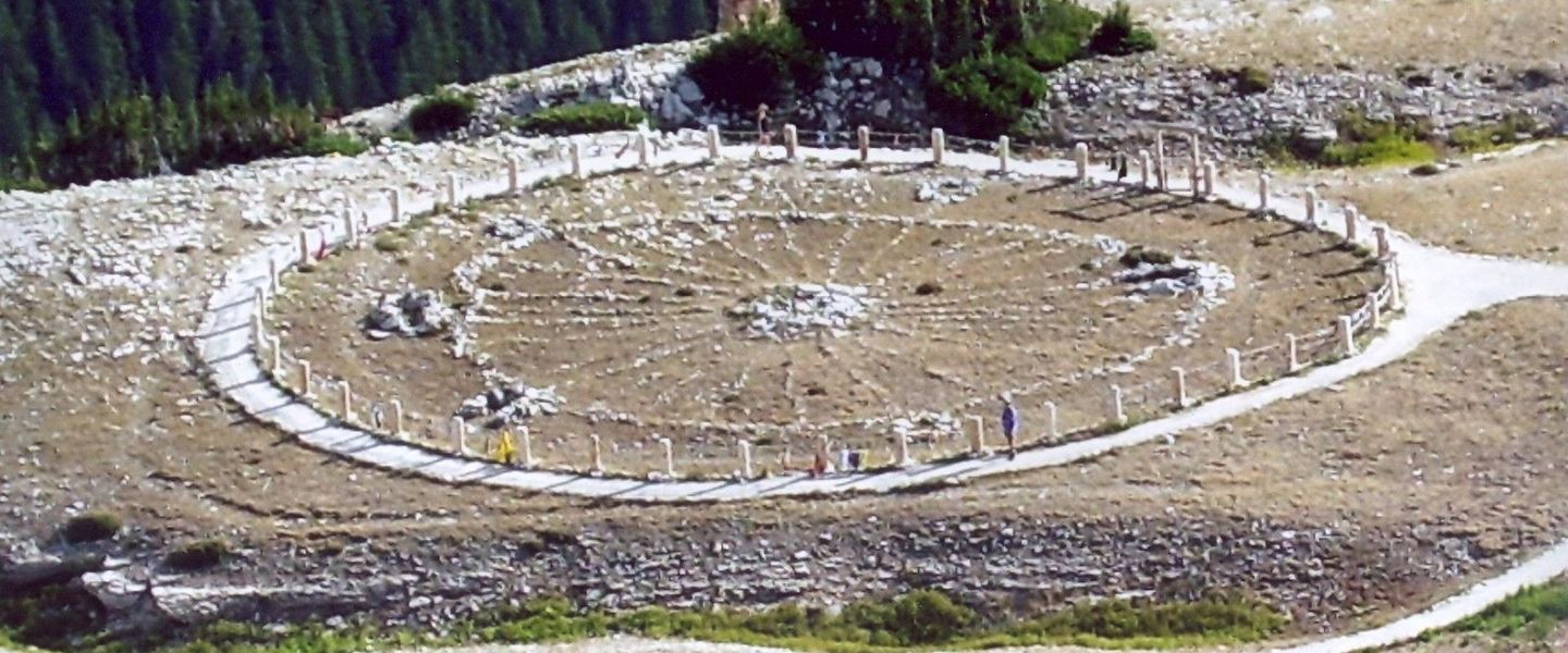


Bighorn National Forest in Wyoming offers alpine lakes, Cloud Peak Wilderness, scenic byways, wildlife, hiking, camping and the historic Medicine Wheel.
Mountain Landscapes and Wilderness
Bighorn National Forest occupies much of the Bighorn Mountains in north-central Wyoming, rising abruptly from the surrounding plains between the towns of Buffalo, Sheridan, Lovell, Ten Sleep and Worland. Its high country includes glacially shaped valleys, clear alpine lakes, forested slopes, open meadows and the Cloud Peak Wilderness, where Cloud Peak reaches 13,167 feet. Lower elevations are marked by dry foothills, ponderosa pine woodland and deep river canyons, creating a striking range of landscapes within a relatively compact mountain system.Read more about Bighorn National Forest
Scenic Roads and Natural Features
Heritage and the High Country
When is the best time to visit Bighorn National Forest?
Best: June–August · 19–22°C| Month | High (°C) | Rainfall (mm) |
|---|---|---|
| January | -1 | 25 |
| February | 1 | 23 |
| March | 5 | 31 |
| April | 9 | 36 |
| May | 14 | 46 |
| June (best) | 19 | 55 |
| July (best) | 22 | 48 |
| August (best) | 21 | 41 |
| September | 17 | 31 |
| October | 10 | 25 |
| November | 3 | 20 |
| December | -1 | 23 |
Getting to and around Bighorn National Forest
How to get there
Transportation
Best attractions in Bighorn National Forest
Bighorn National Forest’s attractions are spread across a high mountain range rather than concentrated in one park centre. Shell Falls, reached from US Highway 14, is one of the forest’s best-known roadside features, where Shell Creek drops through a deep canyon. The roads across the crest provide changing views of alpine terrain, forested slopes and the surrounding Wyoming basins, while trailheads lead towards West Tensleep Lake, high meadows and the Cloud Peak Wilderness. Medicine Wheel National Historic Landmark on Medicine Mountain combines a high-elevation setting with continuing Indigenous cultural significance. Hikers and backpackers explore routes around Cloud Peak, the range’s highest summit, although wilderness travel demands preparation and route-finding. Other attractions include quiet mountain lakes, deep valleys, wildlife habitat and dispersed camping areas, with access and facilities varying considerably by season. Gateway towns such as Buffalo, Sheridan, Ten Sleep and Lovell add museums, historic architecture and local interpretation beyond the forest boundary.
-
Visitor center
Shell Falls Interpretive Site
Explore the natural beauty and educational wonders of Shell Falls Interpretive Site in the heart of Wyoming's Big Horn National Forest.
-
Mountain cabin
Sheep Mountain Lookout
Experience the stunning vistas and serene ambiance of Sheep Mountain Lookout in Wyoming's Bighorn National Forest.
-
Visitor center
Big Horn National Forest Visitor's Center
Discover the heart of Wyoming’s wilderness at the Big Horn National Forest Visitor's Center, your gateway to adventure and natural beauty.
-
Lake
Park Reservoir
Experience the serene beauty of Park Reservoir in Wyoming, a perfect destination for outdoor adventures and peaceful retreats amidst nature.


Best landmarks in Bighorn National Forest
The defining natural landmark is the Bighorn Mountains themselves, an elevated range whose glacial valleys, exposed rock and alpine basins rise sharply above Wyoming’s surrounding plains. Cloud Peak, at 13,167 feet, is the highest summit and the focal point of the Cloud Peak Wilderness, although reaching it is a serious backcountry undertaking rather than a roadside visit. Shell Falls is a prominent water feature beside US Highway 14, while Medicine Mountain is significant for both its high setting and Medicine Wheel, a stone monument recognised as a National Historic Landmark and still important to Indigenous communities. The forest’s scenic highways are landmarks in their own right, crossing high passes and revealing the contrast between mountain forest and open basin. The importance of these places lies in their combined geological, ecological, cultural and historical meanings rather than in monumental architecture alone.
-
Government office
Tongue Ranger District and Forest Supervisor's Office
Explore the Tongue Ranger District: Your gateway to Wyoming's breathtaking wilderness and outdoor adventures await you.
-
Visitor center
Shell Falls Interpretive Site
Explore the stunning Shell Falls Interpretive Site in the Bighorn Mountains, where breathtaking views and nature education come together in perfect harmony.
-
Waterfall
Shell Falls
Experience the breathtaking beauty of Shell Falls in Wyoming, a stunning waterfall nestled in the heart of Bighorn National Forest, perfect for nature lovers.
-
Museum
Museum at the Bighorns
Explore the rich cultural heritage of Wyoming at the Museum at the Bighorns, where history comes alive through captivating exhibits and local artifacts.


Explore Bighorn National Forest on the map
Plan your trip on one map. See where the top attractions, landmarks, restaurants and hotels are, and book hotels and experiences in a few clicks.
Best hotels in Bighorn National Forest
Best restaurants in Bighorn National Forest
Bighorn National Forest has no single dining district, and food options inside the forest are generally limited to what visitors bring or prepare at campsites. The principal choice of restaurants, cafés, bakeries, supermarkets and provisions is found in gateway communities including Buffalo, Sheridan, Ten Sleep, Lovell and Worland. These towns reflect Wyoming’s ranching and mountain culture, with casual American meals, burgers, steaks, sandwiches, breakfast cooking and hearty food suited to travellers heading into the high country. Local shops and food markets are useful for assembling picnics and trail supplies, while rural cafés and traditional bars often provide informal meals rather than elaborate destination dining. Visitors staying in country inns, guesthouses or cabins may encounter kitchens or communal cooking facilities, but availability varies. Pack food and water for long excursions because roadside facilities are sparse and there may be no reliable opportunity to buy a meal between mountain crossings.
-
Restaurant
Cowboy Cafe
Experience authentic Wyoming dining at Cowboy Cafe in Sheridan – where hearty meals meet Western hospitality.
-
Pizza
Big Horn Merc Pizza
Discover delicious hand-crafted pizzas at Big Horn Merc Pizza in Wyoming's scenic town of Big Horn—where flavor meets comfort.
-
Brewery
Luminous Brewhouse
Experience the finest craft beers at Luminous Brewhouse in Sheridan, Wyoming – your ultimate destination for brewing excellence and local flavor.
-
Grill
Powder Horn Grill
Discover exceptional flavors amidst breathtaking views at Powder Horn Grill in Sheridan, Wyoming - where gourmet dining meets stunning landscapes.


Best bars in Bighorn National Forest
Evening entertainment around Bighorn National Forest is informal and concentrated in the surrounding towns rather than within the forest. Buffalo, Sheridan, Ten Sleep, Lovell and Worland offer the most dependable choices of traditional bars, historic saloons, casual pubs and restaurants where visitors can eat, meet local residents and hear occasional live music or community entertainment. The atmosphere is generally relaxed and regional rather than organised around a nightlife district, and options may be seasonal or change over time. Inside the forest, evenings are shaped by campfires where permitted, dark skies, quiet campgrounds and the sounds of mountain weather rather than by bars or clubs. Visitors should not expect late-night venues at remote trailheads or scenic byways, and should plan transport carefully if spending an evening in a gateway town before returning to rural accommodation or a campsite.
-
Government office
Tongue Ranger District and Forest Supervisor's Office
Discover the Tongue Ranger District in Wyoming - a scenic haven for hiking, camping, and wildlife enthusiasts amidst the breathtaking Bighorn National Forest.

Best nightclubs in Bighorn National Forest
Evening entertainment around Bighorn National Forest is informal and concentrated in the surrounding towns rather than within the forest. Buffalo, Sheridan, Ten Sleep, Lovell and Worland offer the most dependable choices of traditional bars, historic saloons, casual pubs and restaurants where visitors can eat, meet local residents and hear occasional live music or community entertainment. The atmosphere is generally relaxed and regional rather than organised around a nightlife district, and options may be seasonal or change over time. Inside the forest, evenings are shaped by campfires where permitted, dark skies, quiet campgrounds and the sounds of mountain weather rather than by bars or clubs. Visitors should not expect late-night venues at remote trailheads or scenic byways, and should plan transport carefully if spending an evening in a gateway town before returning to rural accommodation or a campsite.
-
Bar
Last Chance Bar
Discover Big Horn's Last Chance Bar, a cozy local hangout offering affordable drinks, live music, and a warm atmosphere in the heart of Wyoming.
Best shops in Bighorn National Forest
Shopping connected with Bighorn National Forest is concentrated in the gateway towns rather than at remote mountain attractions. Buffalo, Sheridan, Ten Sleep, Lovell and Worland provide supermarkets, fuel stops, outdoor equipment, independent shops, galleries and practical supplies for camping and hiking. Visitors may find Wyoming-themed clothing, Western art, locally made goods, books about regional history, and food suitable for picnics or self-catering. Sheridan is particularly associated with a broader range of galleries, historic-town shopping and Western cultural businesses, while smaller communities offer a more limited, local scale of retail. Forest roads and trailheads are not shopping destinations, so equipment, maps, medication and provisions should be obtained before departure. Products associated with ranching, Western life and the Bighorn landscape are more meaningful purchases than generic souvenir merchandise, but availability varies between settlements and seasons.
-
Government office
Tongue Ranger District and Forest Supervisor's Office
Discover the natural beauty of Wyoming at the Tongue Ranger District, your gateway to the Bighorn National Forest.
-
Fishing store
Fly Shop of the Bighorns
Discover the best fly fishing gear and expert advice at the Fly Shop of the Bighorns in Sheridan, Wyoming, your gateway to the Bighorn River.
-
Visitor center
Big Horn National Forest Visitor's Center
Discover the gateway to adventure at Big Horn National Forest Visitor's Center, where nature and exploration await in Wyoming's stunning landscapes.
-
Pawn shop
Big Horn Trading LLC
Explore Big Horn Trading LLC in Sheridan, WY for unique finds, from tools to collectibles, in a welcoming atmosphere that celebrates local culture.


Get your free copy of our complete guide to Bighorn National Forest, delivered straight to you.
Everything on this page, from attractions and restaurants to essentials and local phrases, in one PDF you can read offline, print or share.
Already have an account? Sign in
Your Bighorn National Forest guide is ready.
We'll send it to · Not you? Sign out

Getting your guide ready…
We are putting together a fresh copy of the Bighorn National Forest guide. This can take up to a minute.
This can take a few moments. If your browser asks, choose Allow so the download can start. You'll find the guide in your Downloads folder.
Nothing happened? Download it again
Sorry, the guide is taking longer than usual. Please try again in a minute, or get it by email instead.
Bighorn National Forest essentials
Currency and Payment
Safety
Emergency Situations
Do's and Don'ts
Local Tips
From Eve
Local phrases worth knowing
You don't need to get them perfect. A few words go a long way, and locals appreciate the effort.
Basics
| English | Local | Say it |
|---|---|---|
| Hello | Howdy | [hah-dee] |
| Goodbye | See ya | [see yah] |
| Yes | Yup | [yuhp] |
| No | Nope | [nohp] |
| Please/You're welcome | Please/No worries | [pleez/noh wur-eez] |
| Thank you | Thanks | [thanks] |
| Excuse me/Sorry | Pardon me/My bad | [par-dun mee/my bad] |
| How are you? | Howdy partner, how's it goin'? | [hah-dee pahrt-nur, howz it go-in] |
| Fine. And you? | Just dandy. How 'bout you? | [just dan-dee. how bout yuh] |
| Do you speak English? | Ya speak English? | [yah speak ing-glish] |
| I don't understand | I ain't gettin' ya | [I aint get-tin yah] |
Eating & Drinking
| English | Local | Say it |
|---|---|---|
| I'd like to see the menu, please | Lemme take a gander at the menu, if ya don't mind | [lem-me take uh gan-der at the men-yoo, if yah dont mind] |
| I don't eat meat | I ain't into meat | [I aint in-toh meet] |
| Cheers! | Bottoms up! | [bot-ums up] |
| I would like to pay, please | Mind if I settle up? | [mind if I set-tul up] |
Emergencies
| English | Local | Say it |
|---|---|---|
| Help! | Send help! | [send help] |
| Go away! | Git outta here! | [git out-tuh here] |
| Call the Police! | Get the law on the line! | [get the law on the line] |
| Call a doctor! | Fetch a doc! | [fetch uh doc] |
| I'm lost | I'm turned around | [I'm turned around] |
| I'm ill | I'm feelin' poorly | [I'm feel-in poor-lee] |
Shopping
| English | Local | Say it |
|---|---|---|
| I'd like to buy... | I reckon I'll take... | [I rek-in I'll take] |
| I'm just looking | Just browsin' | [just brow-sin] |
| How much is it? | What's the damage? | [whats the dam-ij] |
| That's too expensive | That's a bit steep | [thats uh bit steep] |
| Can you lower the price? | Can ya knock some off the price? | [can yah knock sum off the price] |
Time & Numbers
| English | Local | Say it |
|---|---|---|
| What time is it? | What's the hour? | [whats the our] |
| It's one o'clock | It's one on the dot | [its one on the dot] |
| Half past (10) | Ten-thirty | [ten-thur-tee] |
| Morning | Mornin' | [morn-in] |
| Afternoon | Afternoon | [after-noon] |
| Evening | Evenin' | [even-in] |
| Yesterday | Yest'day | [yes-t-day] |
| Today | Today | [to-day] |
| Tomorrow | Morrow | [mor-row] |
| 1 | One | [wun] |
| 2 | Two | [too] |
| 3 | Three | [three] |
| 4 | Four | [for] |
| 5 | Five | [fiv] |
| 6 | Six | [siks] |
| 7 | Seven | [sev-in] |
| 8 | Eight | [ate] |
| 9 | Nine | [nine] |
| 10 | Ten | [ten] |
Transport & Directions
| English | Local | Say it |
|---|---|---|
| Where's a/the...? | Where's the...? | [wheres the] |
| What's the address? | What's the addy? | [whats the add-ee] |
| Can you show me (on the map)? | Can ya show me (on the map)? | [can yah show me (on the map)] |
| When's the next (bus)? | When's the next (bus)? | [whens the next (bus)] |
| A ticket (to ....) | A ticket (to ....) | [uh ticket (to)] |
History of Bighorn National Forest
An Ancient Mountain Uplift
The Bighorn Mountains form an isolated north–south range rising above the Bighorn Basin and the Powder River country. Their geology records repeated changes in ancient seas, sediment deposition, uplift and erosion, with older rocks exposed in the core of the range and younger layers visible around its margins. Glacial action later carved high valleys and basins, leaving alpine lakes, cirques and broad areas of exposed mountain rock. These geological processes explain the sharp contrast between the forest’s high plateau, deep canyons and dry surrounding plains.
Indigenous Homelands and Travel Routes
The Bighorn Mountains have long been used by Indigenous peoples for travel, hunting, gathering and spiritual practice. The range lies within the wider cultural landscape of Northern Plains peoples, including the Crow, Northern Cheyenne, Lakota and other nations. Medicine Wheel, a stone arrangement on Medicine Mountain, is the best-known surviving sacred site in the forest and continues to have ceremonial importance. Its precise origins and construction history are not treated as a single settled narrative, and visitors are asked to recognise the site as a living cultural place rather than simply an archaeological curiosity.
Exploration, Ranching and Resource Use
During the nineteenth century, the surrounding valleys and mountain passes became connected with military movement, ranching, farming, prospecting and expanding transport routes. Communities such as Buffalo, Sheridan, Ten Sleep and Lovell developed around the plains and approaches to the range rather than within the high forest itself. Timber, grazing and mineral exploration influenced parts of the mountain landscape, while roads and trails followed routes that had long served as practical corridors across the Bighorns. The area’s human history therefore reflects a continuing relationship between high-country resources and the settlements below.
Forest Reserve to National Forest
Federal forest protection began during the Progressive Era, when the Bighorn Mountains were included in the national forest reserve system created to manage watersheds, timber and public lands. Bighorn National Forest became part of the developing United States national forest system in the early twentieth century. Management has since balanced recreation, grazing, timber, wildlife habitat, watershed protection and cultural-resource conservation. The forest’s modern identity is shaped not only by its roads and campgrounds but also by areas where development is deliberately limited.
Wilderness and Modern Conservation
The Cloud Peak Wilderness, designated under the 1984 Wyoming Wilderness Act, protects a large central section of the highest Bighorn Mountains from roads and motorised development. Other parts of the forest remain accessible through scenic highways, maintained roads, campgrounds and extensive trail networks. Conservation today includes safeguarding alpine watersheds, forests, wildlife corridors and culturally important places while accommodating recreation. Seasonal road closures, changing snow conditions and dispersed facilities are practical reminders that the Bighorns remain a working and protected landscape rather than a conventional resort area.
Bighorn National Forest in Photos
Browse through our photo collection highlighting the charm and character of the destination.
Cities in Bighorn National Forest
The towns and cities of Bighorn National Forest, and the easiest places to base yourself.

Swipe for more cities
Neighbouring destination travel guides
The closest destinations to Bighorn National Forest, if you have time for more than one.
-
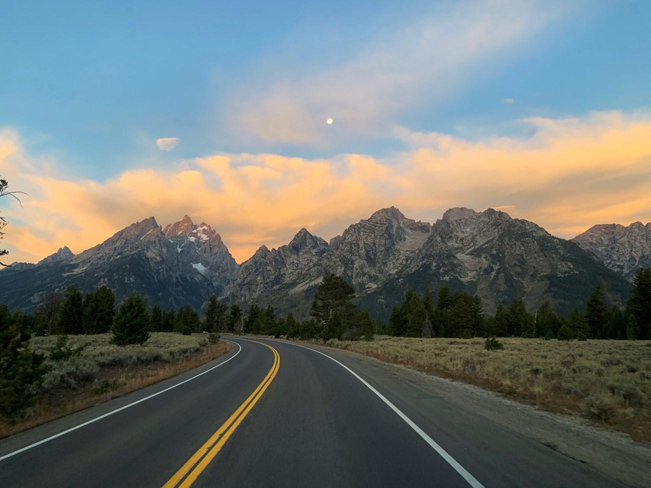 Buffalo Bill State Park
, Wyoming, pairs a mountain reservoir with boating, fishing, camping and Cody’s Old West heritage near Yellowstone’s east gateway.
-

-

-

-


Swipe for more destinations
Explore more

Explore more of Sheridan County
Explore Sheridan County for historic Sheridan, working ranches, Western arts, rodeo culture and mountain scenery in Wyoming’s Bighorn country.
Explore Sheridan County
Explore more of Wyoming
Discover Wyoming: A Land of Unspoiled Beauty, Rich History, and Boundless Outdoor Adventures in the Heart of the American West.
Explore Wyoming