

Mount Rainier National Park Travel Guide - Free Web & App
Your ultimate guide to Mount Rainier National Park. Discover top landmarks, proposed trips, and local tips. Free on the web or via the Evendo companion app.


Mount Rainier National Park in Washington offers glacier-clad peaks, wildflower meadows, old-growth forests, scenic drives, hiking and heritage.
A Glacier-Clad Landscape
Mount Rainier National Park surrounds the most heavily glaciated peak in the contiguous United States, a 4,392-metre stratovolcano rising above the forests and foothills of Washington’s Cascade Range. Known to many Indigenous peoples by names including Tahoma, the mountain dominates the park’s skyline, though cloud and weather often conceal its summit. Its broad slopes feed rivers such as the Nisqually, White, Carbon and Cowlitz, while volcanic ridges, subalpine meadows and deep valleys create markedly different environments across the park.Read more about Mount Rainier National Park
Four Distinct Visitor Areas
Life on the Mountain
When is the best time to visit Mount Rainier National Park?
Best: July–September · 16–18°C| Month | High (°C) | Rainfall (mm) |
|---|---|---|
| January | 3 | 350 |
| February | 3 | 300 |
| March | 6 | 250 |
| April | 7 | 200 |
| May | 11 | 150 |
| June | 14 | 100 |
| July (best) | 18 | 50 |
| August (best) | 18 | 50 |
| September (best) | 16 | 100 |
| October | 11 | 200 |
| November | 6 | 300 |
| December | 3 | 350 |
Getting to and around Mount Rainier National Park
How to get there
Transportation
Best attractions in Mount Rainier National Park
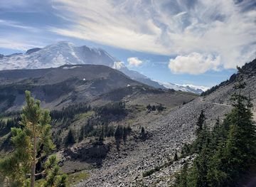
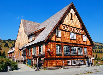
Mount Rainier National Park’s attractions are distributed among several distinct districts. Paradise is the principal south-side destination, with the Jackson Visitor Center, the historic Paradise Inn, Nisqually Vista and access to the Skyline area, where subalpine meadows and mountain views define the experience when conditions are clear. From Longmire, visitors can explore the historic district, the Trail of the Shadows and forested routes near the Nisqually River, while nearby Christine Falls and Narada Falls are prominent roadside viewpoints. Sunrise, reached by a seasonal road, offers access to high meadows, panoramic viewpoints and trails towards Sourdough Ridge, with Tipsoo Lake just beyond the Sunrise area on the eastern side of the park. Ohanapecosh is known for old-growth forest, the Grove of the Patriarchs area when access permits, and the Ohanapecosh River. The north-western Carbon River and Mowich Lake areas provide quieter forest and wilderness approaches, with facilities and road conditions requiring particular advance checking.
-
Visitor center
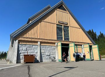
Henry M. Jackson Memorial Visitor Center
Explore the beauty of Mount Rainier National Park from the Henry M. Jackson Memorial Visitor Center, your gateway to adventure and nature's wonders.
-
Volcano
Mount Rainier
Discover the breathtaking landscapes and rich biodiversity of Mount Rainier, a stunning volcano in Washington State, perfect for outdoor adventures year-round.
-
Tourist attraction
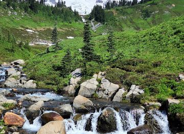
Myrtle Falls
Explore the breathtaking beauty of Myrtle Falls in Mount Rainier National Park, a stunning oasis for nature lovers and adventure seekers alike.
-
Visitor center
Sunrise Visitor Center
Discover the breathtaking beauty of Mount Rainier at the Sunrise Visitor Center, your gateway to adventure and exploration in Washington's premier national park.



Best landmarks in Mount Rainier National Park
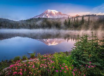
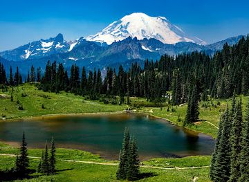
Mount Rainier itself is the park’s defining natural landmark: a glaciated stratovolcano whose summit, ridges and icefields dominate views from surrounding valleys and high meadows. The Emmons Glacier on the north-east side and Nisqually Glacier on the south-west illustrate the scale of the mountain’s remaining ice, although glaciers should be viewed from safe, established locations rather than approached casually. Paradise, Sunrise, Tipsoo Lake and Reflection Lakes are important scenic landmarks because they frame the mountain through very different subalpine settings. Narada Falls, Christine Falls and the Ohanapecosh River add dramatic water features, while the ancient trees around the Ohanapecosh area express the park’s forest heritage. Human landmarks include the rustic Paradise Inn, Longmire’s historic buildings and the former Longmire mineral-spring resort landscape, which connect modern recreation with the earliest phases of organised tourism around Rainier.
-
Visitor center
Henry M. Jackson Memorial Visitor Center
Discover the gateway to adventure at the Henry M. Jackson Memorial Visitor Center, your starting point for exploring Mount Rainier's breathtaking landscapes.
-
Visitor center
Sunrise Visitor Center
Discover the breathtaking beauty and adventure opportunities at Sunrise Visitor Center in Mount Rainier National Park.
-
Tourist attraction
Myrtle Falls
Discover the breathtaking beauty of Myrtle Falls within Mount Rainier National Park, where cascading waters meet stunning landscapes.
-
Hiking area
Mount Fremont Lookout Trail
Explore the stunning vistas of Mount Fremont Lookout Trail, a premier hiking destination in Washington offering unforgettable views and rich natural beauty.


Explore Mount Rainier National Park on the map
Plan your trip on one map. See where the top attractions, landmarks, restaurants and hotels are, and book hotels and experiences in a few clicks.
Best hotels in Mount Rainier National Park
Best restaurants in Mount Rainier National Park
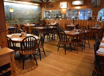
Dining inside Mount Rainier National Park is limited and seasonal rather than comparable with an urban or resort destination. The National Park Inn at Longmire and the Paradise Inn have historically provided the principal established meal services within the park, subject to opening arrangements and seasonal operation, while visitor facilities may offer only a modest selection of snacks or provisions. Many visitors therefore eat before entering, carry food for the day or use restaurants and cafés in gateway communities outside the park, particularly Ashford near the Nisqually entrance and communities serving the eastern and southern approaches. Regional menus commonly reflect the Pacific Northwest through ingredients such as salmon, berries, apples, mushrooms and locally produced beer or wine, though availability varies. Campers should plan meals carefully, follow food-storage rules and avoid relying on finding a shop or restaurant near every trailhead.
-
Restaurant
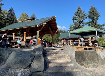
Copper Creek Inn Restaurant & Lodging
Discover Copper Creek Inn: A cozy retreat offering delicious dining and log cabin lodging near stunning Mount Rainier National Park.
-
Restaurant
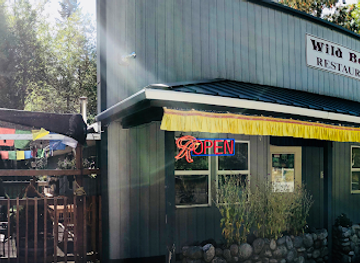
Wildberry Restaurant
Experience the fusion of Nepalese and American cuisine at Wildberry Restaurant near Mount Rainier National Park.
-
Grill
Rainier BaseCamp Bar & Grill
Discover delightful flavors at Rainier BaseCamp Bar & Grill - your perfect dining stop near Mount Rainier National Park.
-
Restaurant
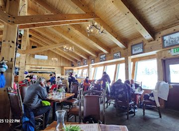
Summit House Restaurant
Experience exquisite dining at Summit House Restaurant with breathtaking views of Mount Rainier amidst Washington's stunning landscape.
Best bars in Mount Rainier National Park
Mount Rainier National Park has no conventional nightlife district or concentration of nightclubs, and evenings are generally quiet once visitors leave the trails. Lodges and inns may provide a social setting when their dining or public areas are operating, but entertainment schedules should never be assumed. The gateway community of Ashford has the most relevant hospitality infrastructure for the Nisqually and Paradise approach, while other small settlements around the park provide scattered rural bars, restaurants or taverns rather than a late-night scene. After dark, the park is better suited to listening to the forest, observing stars where conditions and regulations allow, or resting for an early start than to organised entertainment. Visitors should drive cautiously on rural roads, plan their return before services close and remember that mobile coverage and lighting are limited.
-
Restaurant
Copper Creek Inn Restaurant & Lodging
Discover rustic charm and delightful dining at Copper Creek Inn, your gateway to Mount Rainier's breathtaking beauty.
-
Restaurant
Wildberry Restaurant
Discover the perfect blend of Nepalese flavors and American classics at Wildberry Restaurant, just moments from Mount Rainier.
-
Grill
Rainier BaseCamp Bar & Grill
Experience the flavors of the Pacific Northwest at Rainier BaseCamp Bar & Grill, your go-to spot for delicious meals near Mount Rainier.
-
Bar
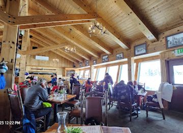
Summit House Restaurant
Discover breathtaking views and delightful Pacific Northwest cuisine at the Summit House Restaurant in Crystal Mountain, Washington.


Best nightclubs in Mount Rainier National Park
Mount Rainier National Park has no conventional nightlife district or concentration of nightclubs, and evenings are generally quiet once visitors leave the trails. Lodges and inns may provide a social setting when their dining or public areas are operating, but entertainment schedules should never be assumed. The gateway community of Ashford has the most relevant hospitality infrastructure for the Nisqually and Paradise approach, while other small settlements around the park provide scattered rural bars, restaurants or taverns rather than a late-night scene. After dark, the park is better suited to listening to the forest, observing stars where conditions and regulations allow, or resting for an early start than to organised entertainment. Visitors should drive cautiously on rural roads, plan their return before services close and remember that mobile coverage and lighting are limited.
-
Grill
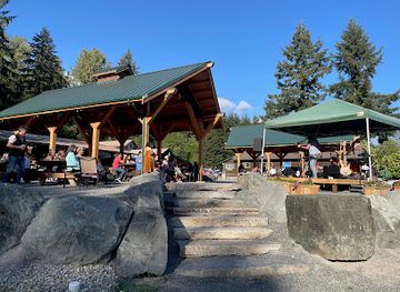
Rainier BaseCamp Bar & Grill
Experience the essence of mountain dining at Rainier BaseCamp Bar & Grill, where delicious meals meet the breathtaking views of Mount Rainier.
Best shops in Mount Rainier National Park
Shopping within Mount Rainier National Park is modest and centred on visitor necessities, interpretive materials, maps, books and souvenirs available through park facilities when they are operating. The park is not a destination for extensive retail browsing, so visitors should purchase fuel, substantial food, medication and outdoor equipment in gateway communities before entering. Ashford, near the Nisqually entrance, is the most established western base, while smaller communities around the eastern and southern approaches offer more limited supplies. Regional products found in the broader area may include Pacific Northwest foodstuffs, locally made preserves, coffee, artwork, outdoor clothing and craft items, but availability changes between businesses and seasons. Purchases connected with Indigenous cultures should be made from legitimate artists or recognised retailers, with attention to accurate representation and respect for cultural ownership.
-
National park
Mount Rainier National Park
Explore the breathtaking landscapes of Mount Rainier National Park, a gem in Washington known for its stunning views, diverse wildlife, and endless outdoor adventures.
-
Visitor center
Henry M. Jackson Memorial Visitor Center
Discover the gateway to Mount Rainier's natural beauty and rich history at the Henry M. Jackson Memorial Visitor Center.
-
Volcano
Mount Rainier
Discover the awe-inspiring beauty of Mount Rainier, an active volcano and national park offering stunning landscapes and outdoor adventures in Washington.
-
Visitor center
Sunrise Visitor Center
Explore the majestic beauty of Mount Rainier National Park at the Sunrise Visitor Center, your gateway to adventure and nature's wonders.
Get your free copy of our complete guide to Mount Rainier National Park, delivered straight to you.
Everything on this page, from attractions and restaurants to essentials and local phrases, in one PDF you can read offline, print or share.
Already have an account? Sign in
Your Mount Rainier National Park guide is ready.
We'll send it to · Not you? Sign out

Getting your guide ready…
We are putting together a fresh copy of the Mount Rainier National Park guide. This can take up to a minute.
This can take a few moments. If your browser asks, choose Allow so the download can start. You'll find the guide in your Downloads folder.
Nothing happened? Download it again
Sorry, the guide is taking longer than usual. Please try again in a minute, or get it by email instead.
Mount Rainier National Park essentials
Currency and Payment
Safety
Emergency Situations
Do's and Don'ts
Local Tips
From Eve
Local phrases worth knowing
You don't need to get them perfect. A few words go a long way, and locals appreciate the effort.
Basics
| English | Local | Say it |
|---|---|---|
| Hello | Yakama | [yah-KAH-mah] |
| Goodbye | Hózhǫ́ | [HOE-zhuhn] |
| Yes | Ahe | [ah-HAY] |
| No | Hą́ | [HAHN] |
| Please/You're welcome | Yá'át'ééh | [yah-AHT-ay] |
| Thank you | Yá'át'ééh | [yah-AHT-ay] |
| Excuse me/Sorry | T'áá hwó'ají | [TAH-hah WHO-ah-zhee] |
| How are you? | Nizhónígo | [nee-ZHOE-nee-goh] |
| Fine. And you? | Nizhónígo. Áya | [nee-ZHOE-nee-goh. AH-yah] |
| Do you speak English? | Ayóó'anííníshní | [AH-yoh-ah-NEE-neesh-nee] |
| I don't understand | Díí bááh nishłį́ | [dee bahh neesh-LIH] |
Eating & Drinking
| English | Local | Say it |
|---|---|---|
| I'd like to see the menu, please | Nááhó, menu naakai, nihikaa | [NAH-hoh, MEH-noo nah-KAH-ee, nee-hee-KAH] |
| I don't eat meat | T'áá shí bí yinaagóó níłch'i | [TAH-hah shee bee yee-NAH-goh neel-CHEE] |
| Cheers! | Shikéédéé | [shee-KAY-day] |
| I would like to pay, please | Nihikaa, díí baa shí | [nee-hee-KAA, dee bah shee] |
Emergencies
| English | Local | Say it |
|---|---|---|
| Help! | T'áá hwó'ají | [TAH-hah WHO-ah-zhee] |
| Go away! | Nihí | [NEE-hee] |
| Call the Police! | Nihikaa, t'áá hwó'ají | [nee-hee-KAA, TAH-hah WHO-ah-zhee] |
| Call a doctor! | Nihikaa, ch'ízho | [nee-hee-KAA, CHEEZ-hoh] |
| I'm lost | Nihidleeł | [nee-hee-DLAY] |
| I'm ill | Nihidleeł | [nee-hee-DLAY] |
Shopping
| English | Local | Say it |
|---|---|---|
| I'd like to buy... | Nihikaa, háálá | [nee-hee-KAA, HAH-lah] |
| I'm just looking | T'áá hóló | [TAH-hah hoh-LOH] |
| How much is it? | Hádééł'á? | [HAH-day-LAH] |
| That's too expensive | Aahóó | [ah-HOH] |
| Can you lower the price? | Béésh bee náshdla' | [BAYSH bee NAHSH-dlah] |
Time & Numbers
| English | Local | Say it |
|---|---|---|
| What time is it? | Háídéésh? | [HAH-ee-DAYSH] |
| It's one o'clock | Bíhígíí | [BEE-hee-GHEE] |
| Half past (10) | Níłch'í bikáá' dah | [neel-CHEE bee-KAH dah] |
| Morning | Ahíni | [ah-HEE-nee] |
| Afternoon | Hózhóogo | [HOE-zhoe-GOE] |
| Evening | Yiłtsoh | [yil-TSOH] |
| Yesterday | Achééh | [ah-CHEH] |
| Today | Biil | [beel] |
| Tomorrow | Bikéyah | [bee-KAY-yah] |
| 1 | Tʼááłáʼí | [TAH-lah-ee] |
| 2 | Naaki | [NAH-kee] |
| 3 | Tááʼ | [TAH-ah] |
| 4 | Dį́į́ʼ | [dee-ee] |
| 5 | Ashdlaʼ | [ahsh-LAH] |
| 6 | Hashchʼéé | [hahsh-chay] |
| 7 | Tsostsʼid | [tsoh-tseet] |
| 8 | Tseebíí | [tseh-bee] |
| 9 | Tááʼtsʼósí | [TAH-ah-tsoh-see] |
| 10 | Náhást'éí | [NAH-hahst-ay] |
Transport & Directions
| English | Local | Say it |
|---|---|---|
| Where's a/the...? | Háadii... | [HAH-dee] |
| What's the address? | Béésh aanííníshní? | [BAYSH ah-NEE-neesh-nee] |
| Can you show me (on the map)? | Béésh bee naaznilóó? | [BAYSH bee nahz-nee-LOH] |
| When's the next (bus)? | Háádéésh chʼíłkáád? | [HAH-day-sh chil-KAH-d] |
| A ticket (to ....) | Béésh bee naaznilóó? | [BAYSH bee nahz-nee-LOH] |
History of Mount Rainier National Park
A Mountain Shaped by Fire and Ice
Mount Rainier is a large andesitic stratovolcano of the Cascade Range, built by repeated eruptions over a very long geological period. Glacial erosion has cut valleys and ridges into its volcanic mass, while modern glaciers continue to shape the high slopes and feed rivers flowing towards Puget Sound and the Columbia River system. The mountain remains potentially active, although visitors generally encounter its geological legacy through lava-derived rock, ash-rich soils, unstable slopes and extensive ice rather than visible volcanic activity. Its glaciers and snowfields have also influenced the location of roads, trails and settlements around the park.
Indigenous Connections and Place Names
Mount Rainier and the surrounding river valleys have long been part of the homelands and travelling landscapes of Indigenous peoples, including communities associated with the Puyallup, Nisqually, Cowlitz, Muckleshoot, Yakama and other neighbouring nations. The mountain is known by Indigenous names, including Tahoma, and remains important in cultural memory, traditional travel and relationships with plants, animals and waterways. The English name came through European charting and colonial usage, while the wider region was transformed by settlement, treaty-making and the displacement of Indigenous communities. Visitors encounter only part of a much older cultural landscape when they follow the park’s modern roads and trails.
Exploration, Climbing and Early Settlement
European-American exploration increased during the nineteenth century as settlers, surveyors and naturalists travelled through the river valleys around the mountain. The first recorded ascent generally credited to climbers Hazard Stevens and P. B. Van Trump took place in 1870, helping establish Mount Rainier as a major mountaineering objective. James Longmire developed a mineral-spring resort near the Nisqually entrance during the 1880s, creating an early centre for visitors and giving Longmire its enduring name. Trails, pack routes and primitive roads gradually made the mountain more accessible to tourists, climbers and scientific expeditions.
National Park Protection
Mount Rainier National Park was established by Congress in 1899, making it one of the earliest national parks in the United States. Protection helped preserve the mountain’s glaciers, forests, meadows and river headwaters while guiding the growth of tourism through designated roads, trails and visitor facilities. The National Park Service, created in 1916, later assumed responsibility for managing the park within a wider national system. The park’s importance lies not only in its summit but also in the connected habitats and watersheds extending from lowland forest to alpine terrain.
Roads, Architecture and Conservation
During the early twentieth century, roads and trails opened new approaches from the Nisqually, Carbon River and Ohanapecosh sides, while the Paradise Inn and other park structures expressed the rustic architectural ideals associated with American national parks. Depression-era public works, including Civilian Conservation Corps projects, contributed to trails, campgrounds and visitor infrastructure. Later management increasingly emphasised ecological protection, wilderness values, watershed conservation and the effects of climate change on glaciers and seasonal snow. Today, historic buildings and engineered routes remain part of a landscape managed for recreation alongside habitat protection and the safety of visitors.
Mount Rainier National Park in Photos
Browse through our photo collection highlighting the charm and character of the destination.
Neighbouring destination travel guides
The closest destinations to Mount Rainier National Park, if you have time for more than one.
-

-

-

-

-


Swipe for more destinations
Explore more

Explore more of Mount Rainier Area
Explore the Mount Rainier Area for glacier views, wildflower meadows, old-growth forests, historic parklands and Washington mountain trails.
Explore Mount Rainier Area
Explore more of Washington
Explore Washington State: From the vibrant streets of Seattle to the tranquil beauty of the Olympic Peninsula, discover the diverse landscapes, culture, and adventures awaiting you.
Explore Washington